.
Before
commencing onto the various locations, there is a
road in the State of New York that while it is called a toll road,
at the current time I will not be including on the website:
Whiteface Veterans Memorial Highway or New York State Route 431.
This road allows
drivers to access the top of Whiteface Mountain from the village of Wilmington, NY. The road contains several scenic overlooks and where upon reaching the top of the mountain, the road ends. Since technically this road is not a through-way offering connection to
another road, nor is it a bridge or tunnel crossing, the only purpose
of the said "toll" is to access the top of the mountain.
Therefore it is in my judgment that this is more of an admission or access fee, much like Jones Beach or any
one of hundreds of other scenic or historical sites in the United
States that charge for access. It is precisely this nature of being
just an access and not a "thoroughfare", which precludes it from being a true and conventional toll
road and therefore inclusion here.
Privately Owned Plank Roads & Turnpikes
.
From the
late 1700's, throughout the 1800's and to the early 1900's; there were dozens if not hundreds
of privately owned plank roads and turnpikes constructed throughout the State of
New York that were built to connect and offer easy passage to various towns and villages.
A comprehensive (but not complete list) of these plank roads may be reviewed on Wikipedia: List of Plank Roads In New York
|
Delaware Plank Road
..
.
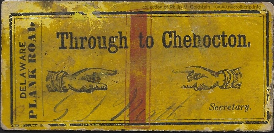
The following ticket, which I acquired in February 2021; was
issued by the Delaware Plank Road Company.
This company was chartered in March
23, 1849 and borrowed $12,000 the following year to connect Walton
with Chehocton, which by this date is now known as the Village of Hancock. The overall length of this route was about 20 miles.
The date of organization of the company, and use of the name
"Chehocton" however, opens up a small conflict in dating: if the
village was renamed Hancock in 1848 when the Erie Railroad reached
the village, and the Delaware Plank Road Company was not organized
until 1849;, yet the road carries the pre-1848 name. This little
bit needs clarification. Research reflects the correct pronunciation of
Chehocton was "she-HOCK-tin".
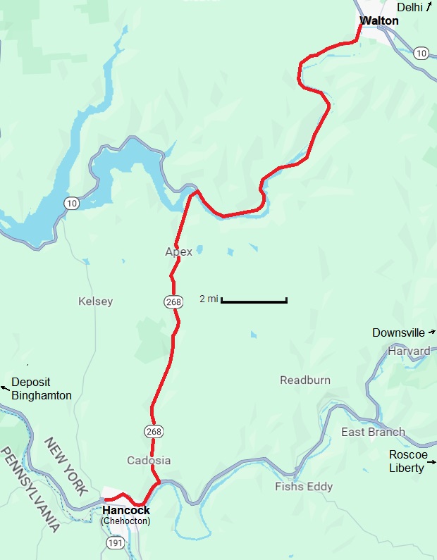
For the most part, the current South River
Road, NY State Route 10, NY State Route 268 follows
the alignment of this former plank road. As I used to live within the same
county (Delaware County, NY), I felt it a worthy expenditure to add
this ticket to my
collection when it was offered for sale.
With the arrival of the Erie Railroad in 1848, and the renaming
of Village of Chehocton to Hancock; the village became a regular and
important station stop on
the railroad, with its connections to Binghamton and cities further
to the north; as well as Port Jervis and New Jersey in the south.
The road itself was vitally important as it connected the smaller
communities with this important railroad station.
Never the less, the ticket is printed on
very heavy cardstock (chipboard?): and measures 2 15/16" by
1 3/8" and is .034 thick. It is impressive this ticket has
survived, and I am proud to have added this antiquity to my growing
collection. |
 |
|
|
|
Delaware Plank Road Ticket - ca. 1848
Through to Chehocton.
.034 thick, 2 15/16" by 1 3/8"
collection of Philip M. Goldstein
added 23 February 2021 |
.
.
.
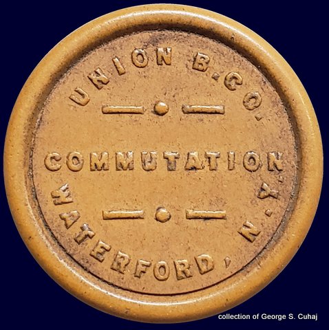
Moriah Plank Road
.
.
These tokens shown below are from the Moriah Plank Road,
first organized September 24, 1850, with opening on or about July 12,
1851.
This plank road would connect the villages of
Moriah in the south, with Moriah Center and Mineville in the north.
Construction of the plank road was undertaken to improve upon the
main road which was used to serve iron ore mine haulage, and of which
such traffic was inflicting heavy rutting & damage upon the road.
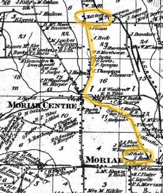
"The said plank road shall commence at some point in the Town of Moriah
near the New Bed, so–called, owned by A.J. Rosseau, George Sherman and
John A. Lee; thence by the most direct and eligible route to some point
at or near the shore of Lake Champlain in said Town of Moriah at or
near the Pine Tree in the highway, being a distance of not exceeding
six miles near the residence of James Donohue.”
It also appears, the toll was quite high for the time:
"If
the toll rate on the plank road was high or not is not stated in the
records, but it is presumed that because of the fee, trails were being
used, again, and at the meeting of directors on June 1859, the fee of
35 cents was reduced to 31 cents for a single wagon team.
Evidently the
company found that the road was not used enough and tolls were driving
some (people) to use trails again. This brought on the decision of
April 29, 1864 to abandon one of the two toll gates and to continue to
maintain that one near Hiram McKenzie‘s residence."
An in-depth history may be found here: Moriah Plank Road Company |
 |
 |
 |
 |
 |
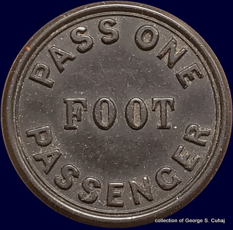
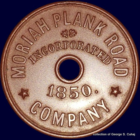
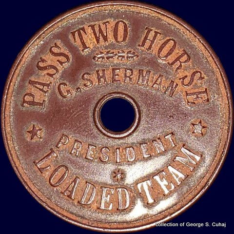
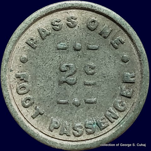
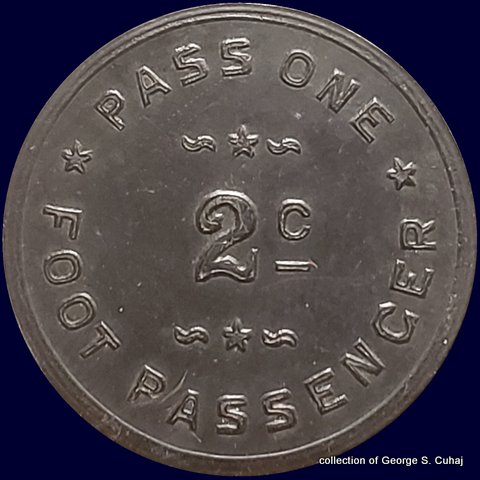
NY595A
Pass Two Horses One Foot Passenger
31mm, Vulcanite, maroon
collection of George S. Cuhaj |
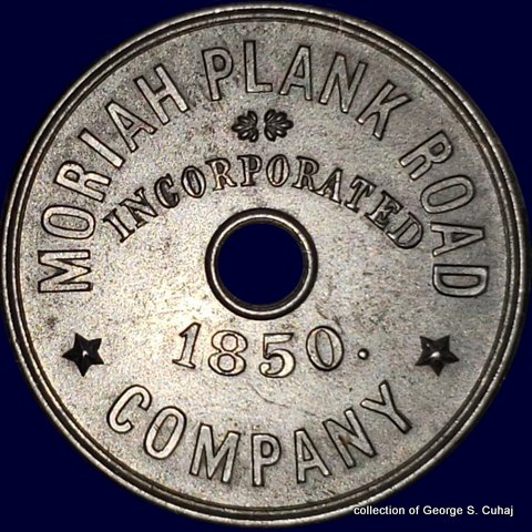
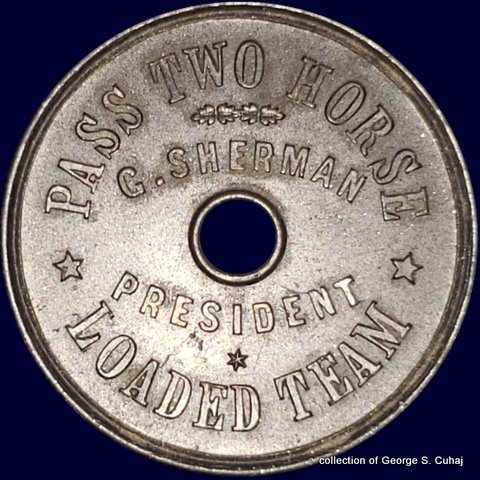
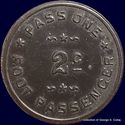
NY595B
Pass Two Horses One Foot Passenger
31mm, Vulcanite, black
collection of George S. Cuhaj |
| all tokens shown at 200% |
.
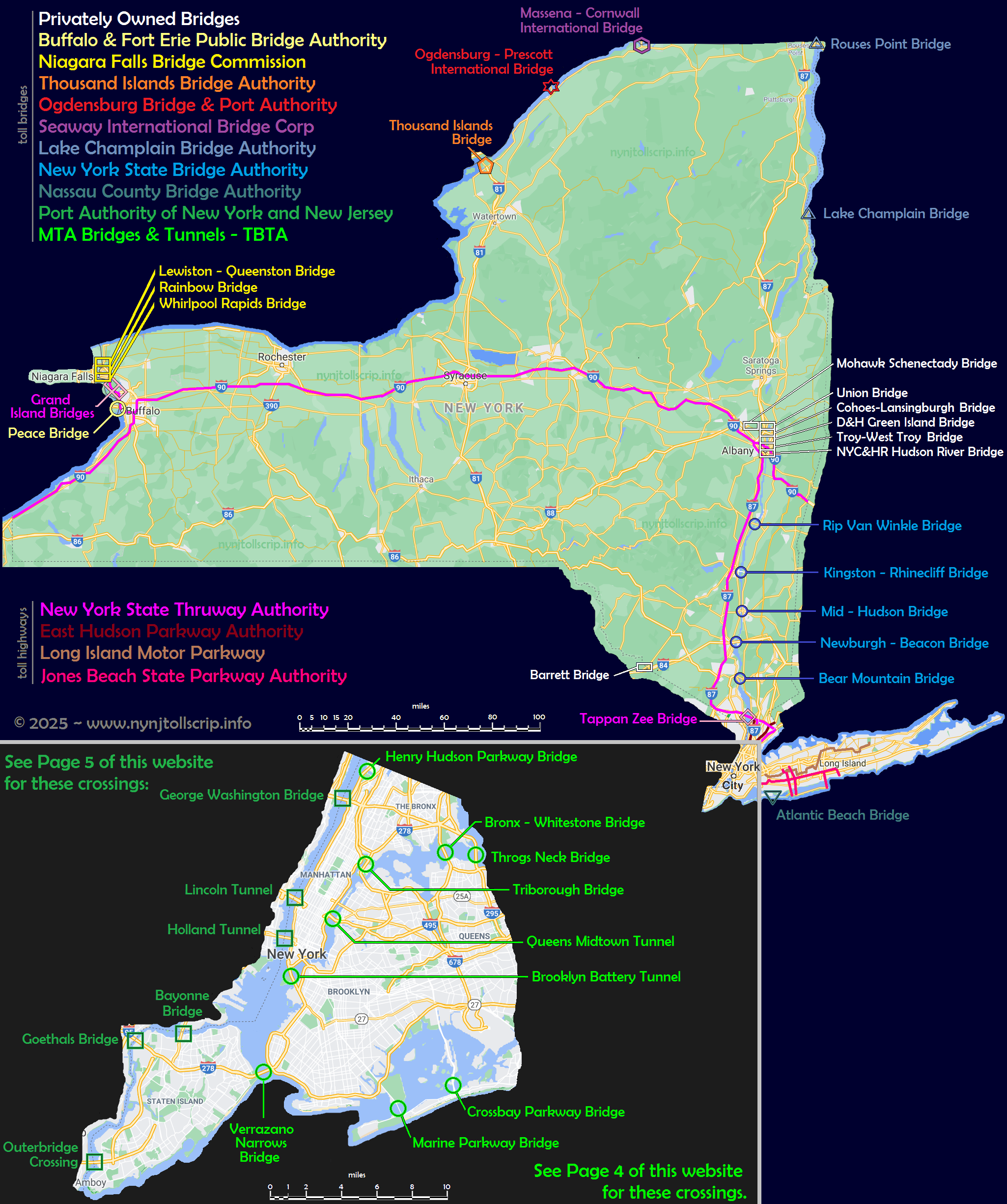
Privately Owned Bridges.
.
.
As with plank roads, there were multitudes of privately owned
bridges located in the state of New York. The principal waterways:
Genesee, Hudson, Mohawk, Delaware and the Susquehanna Rivers were but a
few that saw tolled bridges at multiple locations; and we are aware of
many others across the Black, Canisteo, Chenango, Cohocton, Raquette,
Schoharie, Saranac Rivers.
As to what toll issues
that have survived, is another matter. As issues surface to be
accounted for, whether in museums, private collections or on the
market; they will be added below.
.
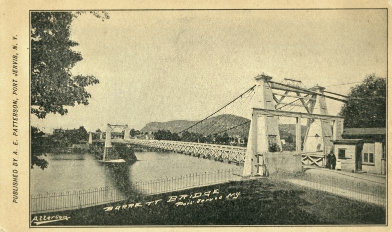
Barret Bridge Company
Port Jervis, NY / Matamoras, PA
Delaware River
.
.
This issue is from the Barret Bridge Company, (spelled either with one or two T's) and was
located over the Delaware River connecting Port Jervis, NY with
Matamoras, Pennsylvania. These tickets are from the first incarnation.
There were a total of three bridges at this location.
The first bridge, a two span suspension bridge, built 1872,
damaged by ice flows and debris which knocked the spans down stream on
March 17, 1875. The spans of the bridge were located and hauled back
upstream to their location and reassembled. The bridge reopened with a
couple of weeks. This first bridge would then be destroyed permanently
by river flooding on October 11, 1903.
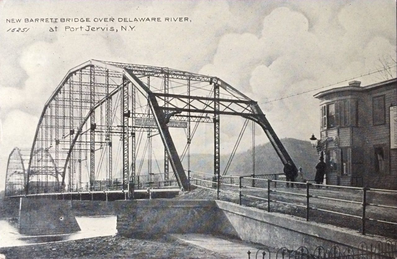
The second bridge, called the "New Barrett Bridge", and
of Pennsylvania through truss construction was finished in 1903
and remained open until October 9, 1939.
This
second bridge was replaced by a similar truss bridge constructed
parallel to the older span, and the third bridge opened to traffic on
October 9, 1939; with demolition of the second bridge starting on the
same day and continuing through to November 26.
Now, while upon originally finding these tickets on eBay; I did
not think they were associated with the Port Jervis "Barrett Bridge"
because of the single T in the name printed on the ticket. But upon
referencing the name W. L. Cuddeback, it would turn out that it was.
William L. Cuddeback was a Colonel in the War of 1812, and was a
prominent figure in this area of New York State; and of which the
village of Cuddebackville is named after.
|
|
|
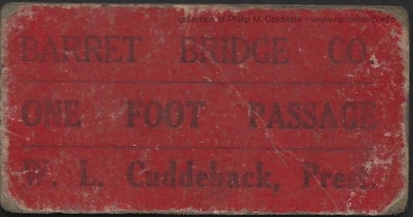
Barret Bridge Co. - One Foot Passage (3 cents)
W. L. Cuddeback, President.
(Port Jervis, NY / Matamoras, PA)
.016 thick, 31/32" by 1 29/32"
collection of Philip M. Goldstein
added 04 June 2021 |
|
|
|
| First Bridge, with toll house on right |
Second Bridge with toll house on right |
|
|
.
.
.
.
What with
Albany, New York area being both the capital of the State of New York and extremely close to the confluence of
Mohawk and Hudson Rivers just north of it; this locality saw ever growing and rapid expansion to the area.
Albany was advantageously located at a narrow
portion of the Hudson River, making fording the river much easier and
more affordable than locations south, and where the river was much wider
and deeper.
In addition to this, Albany was strategically located by being
closer latitudinally to Boston; Vermont, New Hampshire, and Maine etc.
Albany was also geographically located on the easiest and most
direct route to Buffalo along the Mohawk River; and commencing in 1825,
the Erie Canal.
This route eventually saw the
building of the railroads, in faster and direct competition via
shipping by the canal. The routing of the railroads via the "water
level route" of the New
York Central & Hudson River Railroad (which followed the banks of
the Mohawk River and Erie Canal); gave it direct access west to
Buffalo, NY, and Chicago, and points west.
And, in regard to commerce to and from Canada, Albany also enjoyed being the first major city south on the "fur trade route" from Montreal.
Naturally, before the railroads were built, many wagon ways and
roads existed connecting these industrial villages and towns. With
this expansion taking place on both the east and west shores of the Hudson River;
many bridges were constructed crossing the Hudson at various point
northward.
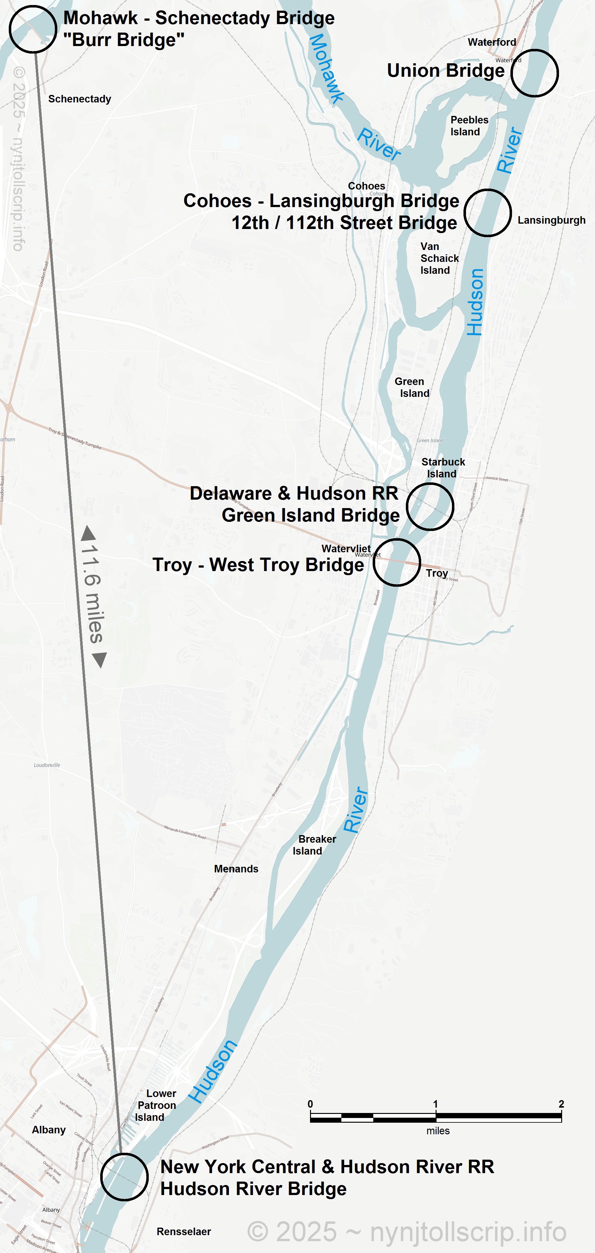
In my attempt to exercise some form of organization of the toll
bridge issues, I will catalog them from north to south. I thought about
listing them in alphabetical order, but that would have been too easy.
Furthermore I also desired to keep the Hudson River issues kept grouped
together, as I would with the Mohawk River issues, as they surfaced.
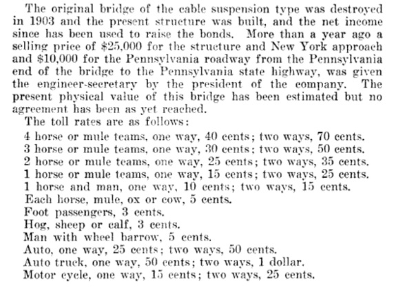
It also bears mentioning, that the three "non-railroad" owned crossings over the Hudson River, the: Union Bridge, the Cohoes - Lansingburgh Bridge, and the Troy - West Troy Bridge, were owned and operated by the same group of principals; with Thomas A. Knickerbacker (correct spelling) as president and chief financier.
Mr.
Knickerbacker was perhaps most widely and popularly known in connection
with the bridges which span the Hudson river at Troy. He was the
president of the Union Bridge Company of Waterford, whose original
charter was granted by the State in 1803; and when the old picturesque
wooden bridge was destroyed by fire in 1909, he immediately began the
work of erecting the present steel structure. The frame enclosing the
picture shown of Mr. Knickerbacker was made from a piece of the old
timber taken from the wooden bridge.
He organized and was
president of the Cohoes and Lansingburgh Bridge Company which built and
owned the bridge, opened in May, 1880, at the foot of the present 112th
street, Troy, New York.
With a number of associates he
organized the Troy and West Troy Bridge Company, April 23, 1872, to
construct a bridge across the Hudson river between the city of Troy, at
the foot of Congress street, and what is now the city of Watervliet."
Troy
and Rensselaer County, New York, Volume III, by Rutherford Hayner
(Lewis Historical Publishing Company, Inc., New York and Chicago, 1925)
|
 |
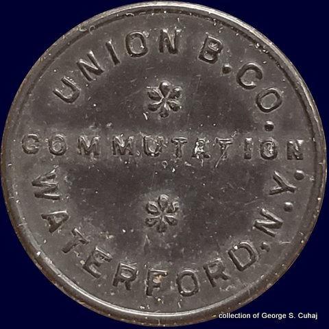
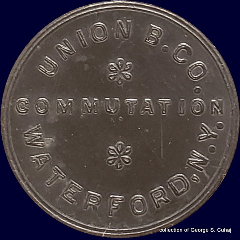
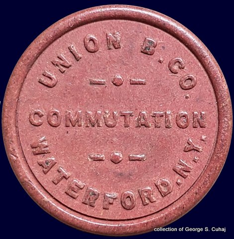
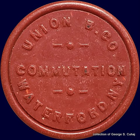
Union Bridge Company
Waterford and Lansingburgh, NY
Hudson River
.
.
The
Union Bridge, was constructed across the Hudson River to connect
Waterford and Lansingburgh, NY. This span has the distinction of being
the very first bridge to cross the Hudson River in its 154 mile course
from New York Harbor northward.
The first act of legislature that would
lead to the construction of a bridge, was passed on April 15, 1800,
when said legislature authorized building of toll bridges across the
Hudson River.
However, actual construction of the bridge would
not begin until late 1802, when a group of the prominent residents of
Waterford and Lansingburgh; chief among them being T. A. Knickerbacker; proposed the formation of the Union Bridge
Company to build a toll bridge at the site. The bridge was designed by
Theodore Cooper utilizing a truss design of his creation, which would
come to be patented.
This bridge was also
unique in the fact that is was a multi-span covered bridge, and quite
the length at 176 feet and accommodating two 11 foot wide roadways. The cost to build the bridge was only $50,000. The bridge opened on December 3, 1804 to major celebrations and was
attended by the Governor of New York among many other state and local
dignitaries.
The tolls charged for crossing the
bridge included 30 cents for every four wheel pleasure carriage, drawn by
four horses; 12½ cents for every wagon and two horses, and 2 cents for every
foot passenger.
It may seem odd to us in the present era to charge a 1/2 cent
amount; but back in the day, one must bear in mind that Half Cent coins
were minted until 1857. Even after being discontinued from minting,
they remained in circulation. Also, the use of a half cents on a single
ticket toll encouraged two way travel by rounding up to the nearest
whole cent for a round trip ticket.
Horse drawn trolley cars utilized the bridge for many years, paying a
yearly fee of $750 in the 1860s which eventually rose to $2,000 per
year. Electric trolley cars began to use the bridge in 1889, and
heavier Hudson Valley interurban trolley cars weighing over 25 tons
started to use the bridge around 1900.
According to an article in a local newspaper in 1901,
"Partly
on account of the deterioration in the structure but largely to provide
for the increased load of large interurban trolley cars. Extensive
repairs, costing $28,000, were made to the bridge. Additional 4 x
7-inch strips were bolted to the tops of the stiffener arches and
intermediate rod hangers were put in to support additional floor
beams.” Apparently 7 tiers of 4 x 8-inch strips were added to the two
center spans and four tiers of the same size added to the shorter shore
arches. The top chord bracing and roof structure was modified greatly
to provide the necessary height for the trolley cars. The rebuilding
was by Palmer C. Ricketts and Joseph Lawson of Rensselaer Polytechnic
Institute."
This
bridge lasted until July 10, 1909 when at such time it was
destroyed by fire. Motorman Walter Wright of the United Traction
Company was crossing the bridge when he "looked downward and saw a
spiteful flame leaping from possible faulty insulation in the flooring.
Within a very short span of time, Soon the long-covered bridge, acting
as an horizontal chimney, was blazing furiously." This was followed by
the separation of a gas main mounted to the bridge and, within a period
of only 35 minutes, three of the four spans had collapsed into the
river.
The Troy Budget reported the “blazing bridge was a
spectacle worth going miles to see." At this juncture, it would be
replaced with a steel bridge utilizing the original masonry piers. The
in-depth history of this bridge may be read here: structuremag.org
 |
 |
 |
 |
 |
 |
|
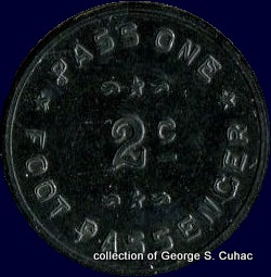
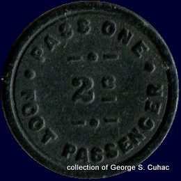
NY935A
Pass One Foot Passenger - 2¢
22mm, fiber, white
collection of George S. Cuhaj
|
NY935Ba
Pass One Foot Passenger - 2¢
22mm, Vulcanite, black
collection of George S. Cuhaj
|
NY935Bb
Pass One Foot Passenger - 2¢
22mm, Vulcanite, black
collection of George S. Cuhaj |
.
. |
|
|
|
|
|
 |
 |
 |
 |
 |
 |
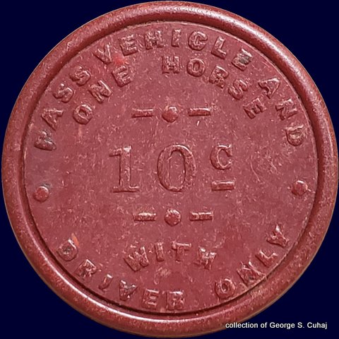
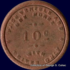
NY935Ca
Pass Vehicle and One Horse with Driver Only - 10¢
25mm, Vulcanite, red-brown
collection of George S. Cuhaj |
NY935Cb
Pass Vehicle and One Horse with Driver Only - 10¢
25mm, Vulcanite, red-brown
collection of George S. Cuhaj |
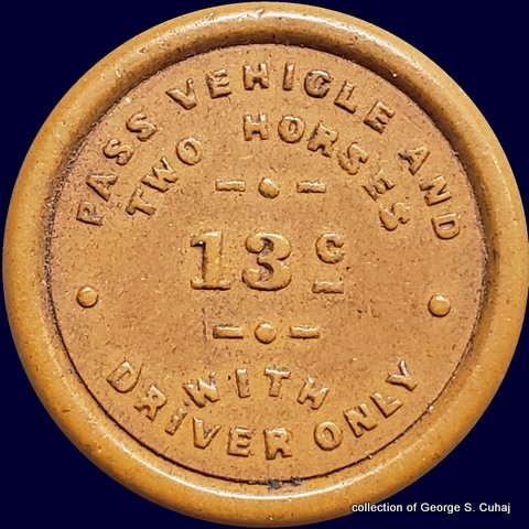
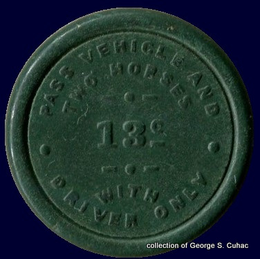
NY935Cb
Pass Vehicle and Two Horses with Driver Only - 13¢
31mm, Vulcanite, yellow
collection of George S. Cuhaj |
| all tokens shown at 200% |
..
.
..
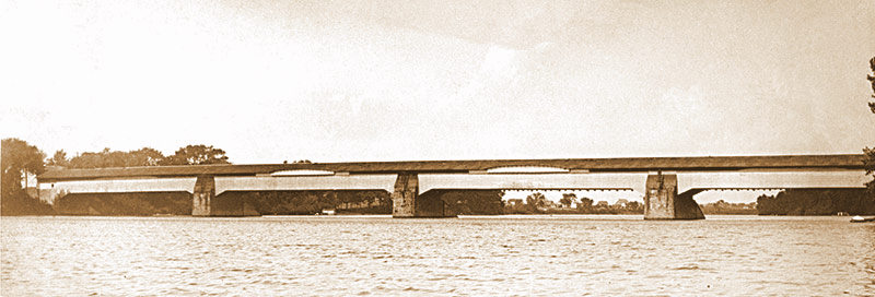
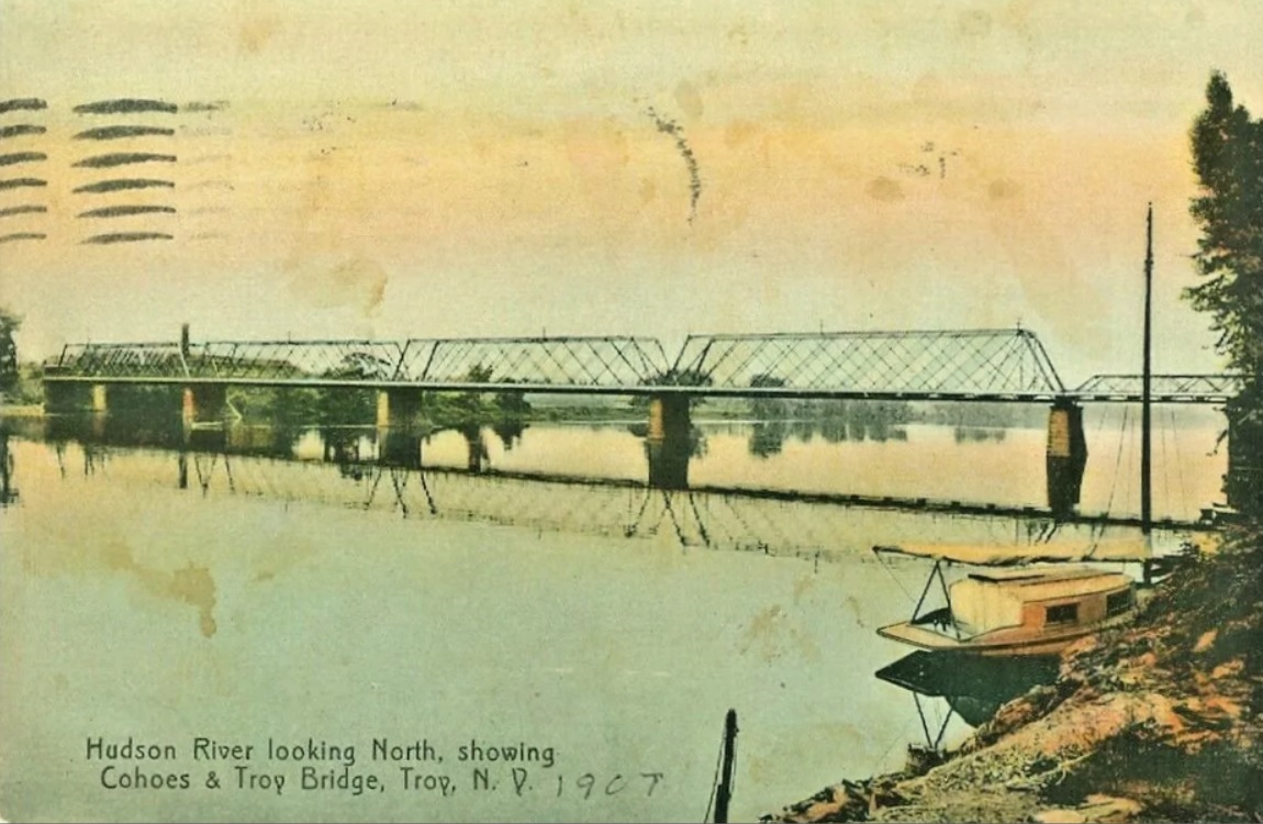
Cohoes & Lansingburgh Bridge Company
12th Street Bridge / 112th Street Bridge
Hudson River
.
.
We know the Cohoes & Lansingburgh Bridge opened in May 18 or
19, 1880 by Thomas A. Knickerbacker as there is even a monument
installed at the western end of the present bridge.
Different references reflect that this bridge was also called the
12th Street Bridge, the 112th Street Bridge and the Cohoes & Troy
Bridge.
A colorized postcard on eBay shows the bridge to be a steel lattice truss.
 |
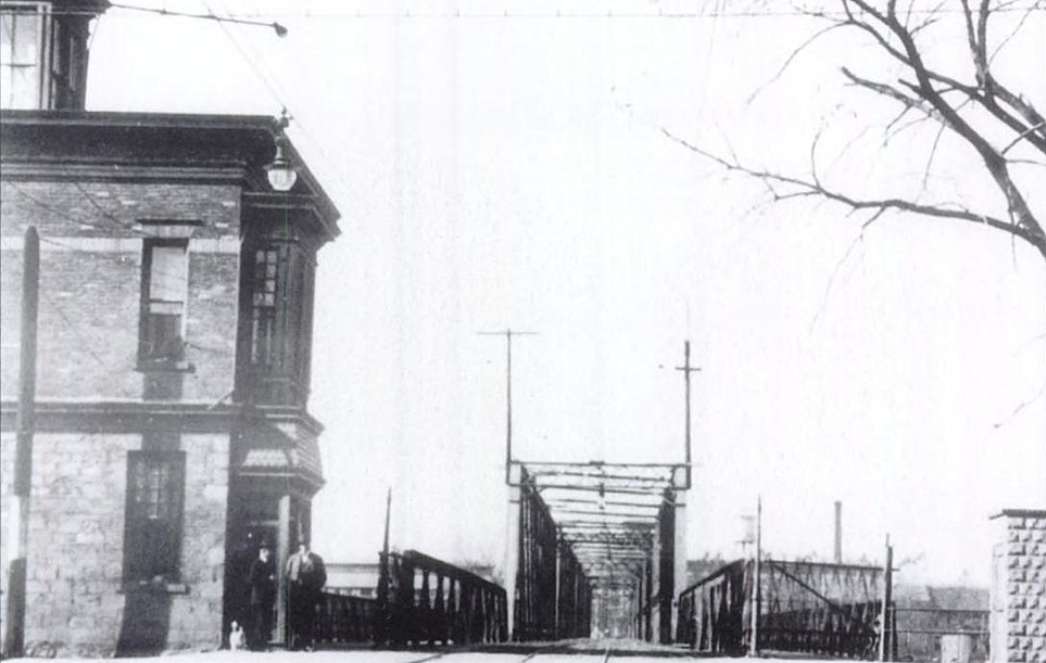 |
Cohoes & Lansingburgh Bridge, dated 1907
|
Cohoes & Lansingburgh Bridge, believed to be looking west.
Unknown date, unknown provenance (Google Images) |
.
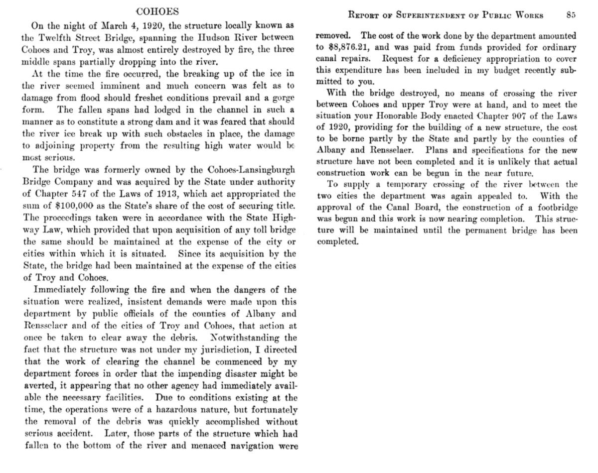
From
this point the bridgehunter.com website begins with the history of the
second span opening in 1922 as the first bridge for this location, but
obviously this information needs to be amended / corrected; (and now
appears to be removed from the web entirely, due to the untimely demise
of the
sites creator and owner, James Baughn.)
Referencing Google Books however, shows this bridge was acquired
by the State
of New York in 1913. On March 4, 1920; the wood deck bridge burned,
with fire being of such intensity, the steel frame and trusses warped
from the heat and collapsed into the river.
.
Following the fire and collapse, a temporary
foot crossing was erected utilizing a cable suspended walkway until a
new bridge could be constructed. From historical accounts, this
suspended walkway swayed with the winds and pedestrians were hesitant
to use it.
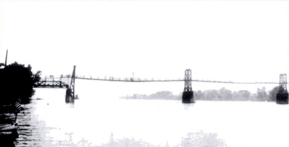
Cohoes & Lansingburgh temporary foot bridge - ca. 1920-1923
.
.
According to the book "Lansingburgh", by Don Rittner, (Arcadia,
1999) an ornamental concrete
bridge was constructed and which opened to traffic in 1923. This span
replaced the temporary
foot bridge and once again provided vehicular access between each side
of the river. This bridge opened as a toll free crossing.
This concrete bridge was demolished in 1995, and replaced with
the current steel girder frame and concrete deck which opened to
traffic in 1996.
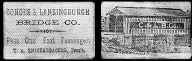
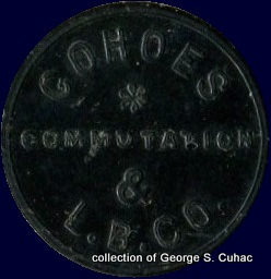
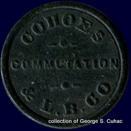
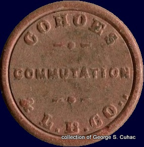
Cohoes & Lansingburgh Bridge
Pass One Foot Passenger
T. A. Knickerbacker, Pres't
 |
 |
|
 |
 |
Cohoes & Lansingburgh Bridge - NY140A
(flower commutation ampersand)
Pass Vehicle and One Horse - 2 c - with Driver Only
25mm, Vulcanite, black
collection of George S. Cuhaj |
|
Cohoes & Lansingburgh Bridge - NY140B
(line dot line commutation line dot line)
Pass Vehicle and One Horse - @ c - with Driver Only
25mm, Vulcanite, black
collection of George S. Cuhaj |
|
|
|
|
|
 |
 |
|
 |
 |
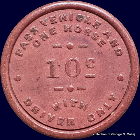
Cohoes & Lansingburgh Bridge - NY140C
Pass Vehicle and One Horse - 10 c - with Driver Only
25mm, Vulcanite, brown
collection of George S. Cuhaj |
|
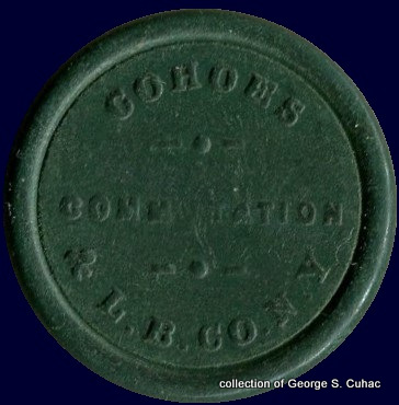
Cohoes & Lansingburgh Bridge - NY140D
Pass Vehicle and Two Horses - 13 c - with Driver Only
31mm, Vulcanite, green
collection of George S. Cuhaj |
.
.
..
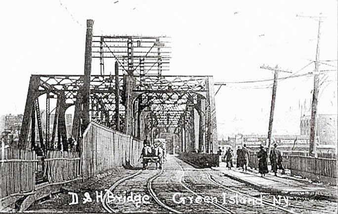
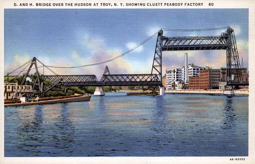
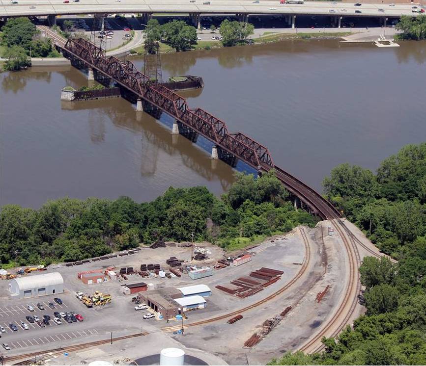
Delaware & Hudson Railroad Company
Green Island - Troy Bridge (Railroad and Auto / Pedestrian / Trolley)
Hudson River
.
.
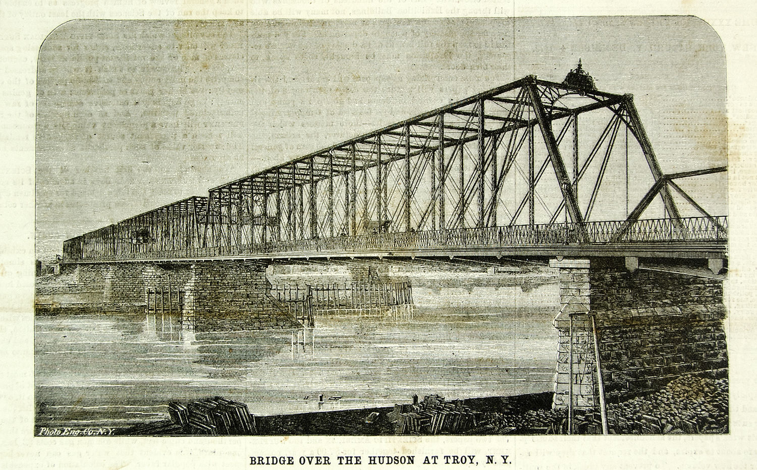
The
Rensselaer & Saratoga Railroad constructed the first bridge at this
location in 1832, and that was a covered wood truss bridge. Trains would be pulled across the bridge by teams of horses.
The original tolls, according to "Corporate
History of the Delaware and Hudson Company, Volume 4 were as follows:
SEC.
10. If no corporation shall, previous to the first day of July next,
propose to the said directors to enter into such contract; or in the
event of a disagreement between the two companies, as to the terms, and
the chancellor of this State shall, upon an application to him, in
behalf of either company, after reasonable notice to the other, have
decided upon what would be equitable terms, and such other corporation
shall, for ten days after notice of such decision, refuse to enter into
such contract, upon the terms as fixed by the chancellor, then, or in
either of those cases, it shall be lawful for the directors of this
company to construct a bridge across the southerly sprout of the Mohawk
river, and a turnpike road upon Green Island, between that bridge and
the bridge erected by said corporation across the Hudson River, and
erect upon either end of each of said bridges a toll gate, and to exact
at each of said gates, during the whole year, from all persons crossing
from the main shore, to and upon Green Island, the following tolls:
| for every wagon and two horses, |
twelve and a half cents |
| for every sleigh and two horses, |
twelve and a half cents |
| for every horse and wagon or cart with one horse, |
nine cents |
| for a horse and chair, gig or tilbury or stanhope, |
twelve and a half cents |
| for every man and horse, |
six cents |
| for every horse without a rider, |
six cents |
| for every stage or carriage with four horses, |
twenty-five cents |
| for every stage or carriage, with two horses, |
nineteen cents |
| for every person on foot, |
three cents |
| for every hog or sheep, |
one-half cent |
| for every ox team with two oxen, |
twelve and half cents |
| for every ox team with four oxen, |
twenty-five cents |
all cattle or horses without riders, if under twenty in number,
in the same drove, |
three cents each |
all cattle and horses without riders, if over twenty in number,
in the same drove, and crossing the bridge at the same time, |
four cents each |
 |
 |
|
 |
 |
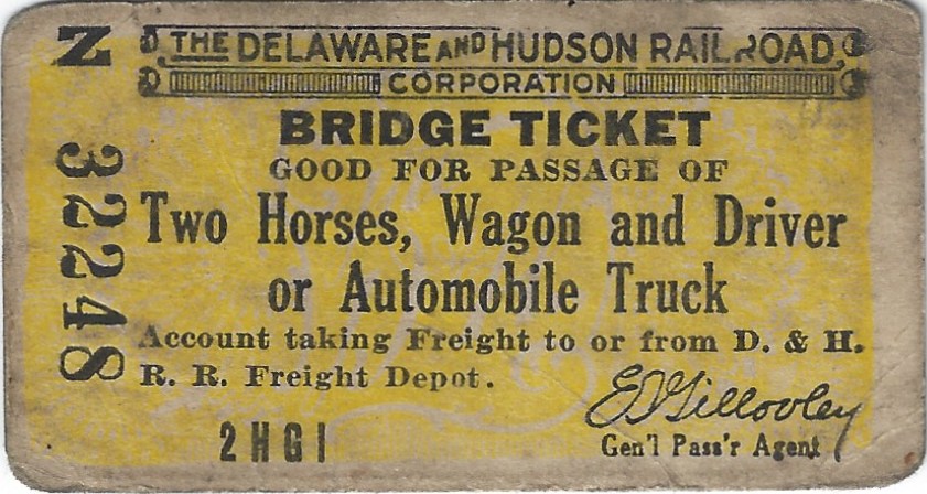
Toll Ticket for Delaware & Hudson Green Island / Troy Bridge - ca. 1931
for Two Horse, Wagon & Driver
Automobile holding more than two persons or Automobile Truck
E. T Gilooley - General Passenger Agent (post 1931)
2 3/4" x 1 1/2"
collection of Philip M. Goldstein |
|
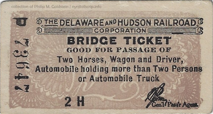
Toll Ticket for Delaware & Hudson Green Island / Troy Bridge - date unknown
for Two Horse, Wagon & Driver
Automobile holding more than two persons or Automobile Truck
(indecipherable signature) - General Passenger Agent
(It is believed due to font style and subsequent prefix letter "P" this issue is later than the one seen to left.
2 3/4" x 1 1/2"
collection of Philip M. Goldstein |
but
no toll shall be exacted at either of the said gates for crossing from
Green Island to the main or opposite shore, upon or over either of the
said bridges, except from persons who shall have crossed from the main
shore to or upon Green Island in any other manner than through one of
the said toll-gates; and such persons shall pay the same toll as they
would be liable to pay under this act, if crossing either of said
bridges in an opposite direction.
On May 10, 1862, sparks from a passing locomotive set the Green
Island span alight, and it soon fell into the river. Parts of the
burning structure after falling into the river, floating with the
current and endangered steamboats and the smaller craft tied up along
the wharves. Brisk winds spread the flames into a devastating
conflagration that also consumed more than 500 buildings covering 75
acres of downtown Troy.
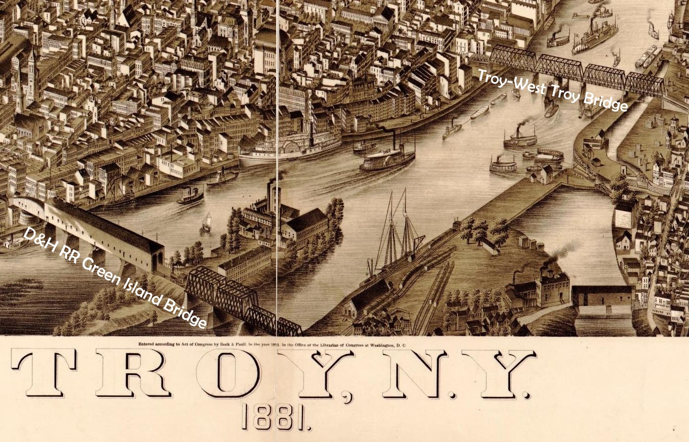
Troy - 1881
drawn by Beck & Pauli
Library of Congress |
That bridge was
replaced by a second wooden bridge
and can be seen in an drawing of the Beck & Pauli 1881 drawing of
Troy, NY. This is only an excerpt of the main drawing, which is looking
south-southeast.
This second bridge lasted 22 years, before it too
caught fire and was destroyed.
In 1884 a steel
truss and plate girder railroad bridge was constructed. Actually, it
was a siamesed pair of parallel steel bridges built by the
Delaware
and Hudson Railroad (which was the successor to the Rensselaer &
Saratoga).
The northern span was the dedicated railroad bridge, while the
southern span was a toll bridge for cars, trolleys, and pedestrians.
In
1925 (some sources state 1923, the swing bridge was replaced with a
significantly longer vertical lift bridge, granting greater channel
clearance for river traffic.
This bridge was comprised of fixed spans over the narrow west channel over the
Hudson River between Green Island and Starbuck Island (now known as Center Island); and a multiple fixed span truss bridge from Starbuck
Island to Troy, with a swingbridge on the Troy side of the Hudson River. A short plate girder span comprised the east approach from Troy.
For reference, the Troy - West Troy Bridge can be seen at the top right corner of the excerpt at left.
|
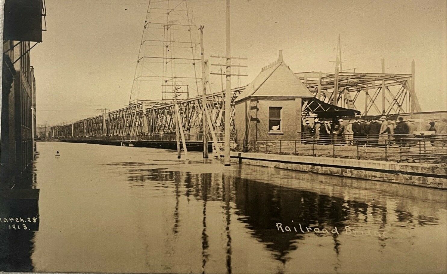 |
 |
March 28, 1913 flooding (looking west towards Green Island)
Showing toll house for the road / pedestrian side of the bridge.
Note building extreme left of image with water up to second story windows.
Donald Garner collection |
unknown date (looking east at Troy)
looking east railroad span on left; auto, pedestrian and trolley on right |
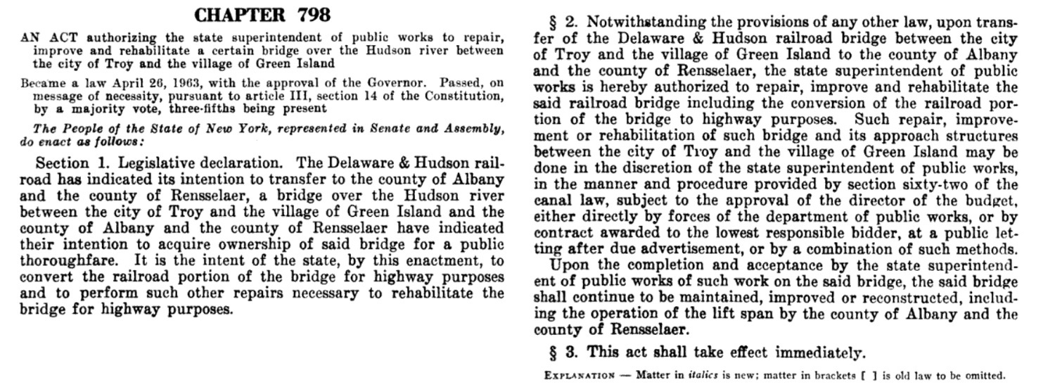
When Delaware &
Hudson Railroad service to Troy ended on July 27, 1963; the railroad
portion of the bridge was decked and converted for automobile traffic.
It is also understood from the following document, "Laws of the State of New York, Passed at the One Hundred Eighty Sixth Session, 1963 - Volume II"; ownership of the bridge was conveyed to corresponding local
governments:
Albany County for the western portion and
Rensselaer County for east
portion, including the vertical lift bridge.
The toll is believed to have been abolished at this time, but
I can find no documents to confirm this at this time. |
 |
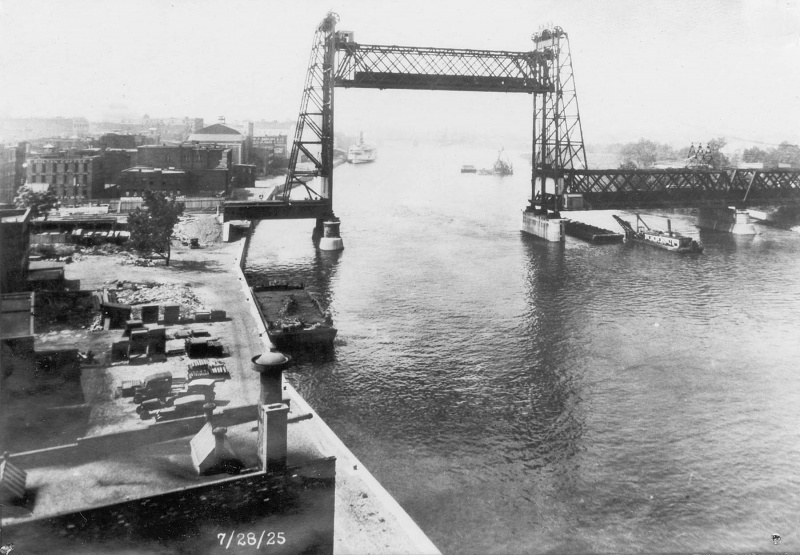
looking south - July 28, 1925 |
looking north
|
.
.
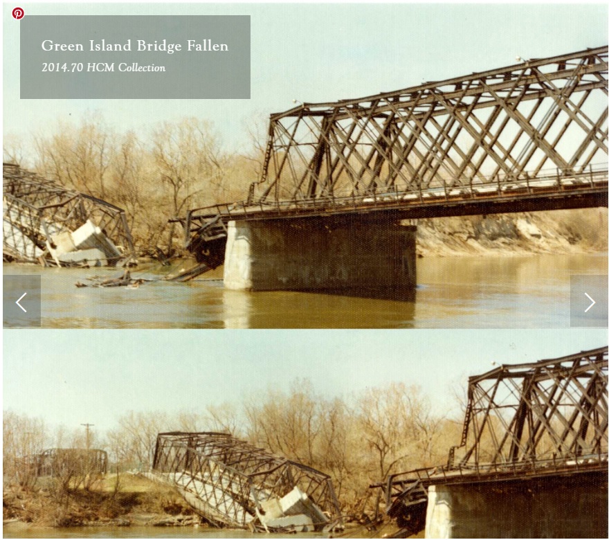
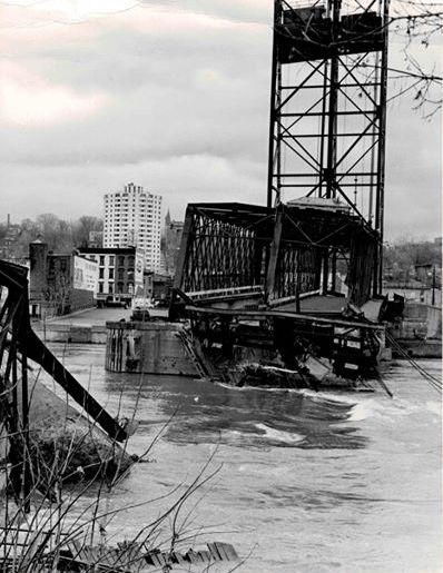
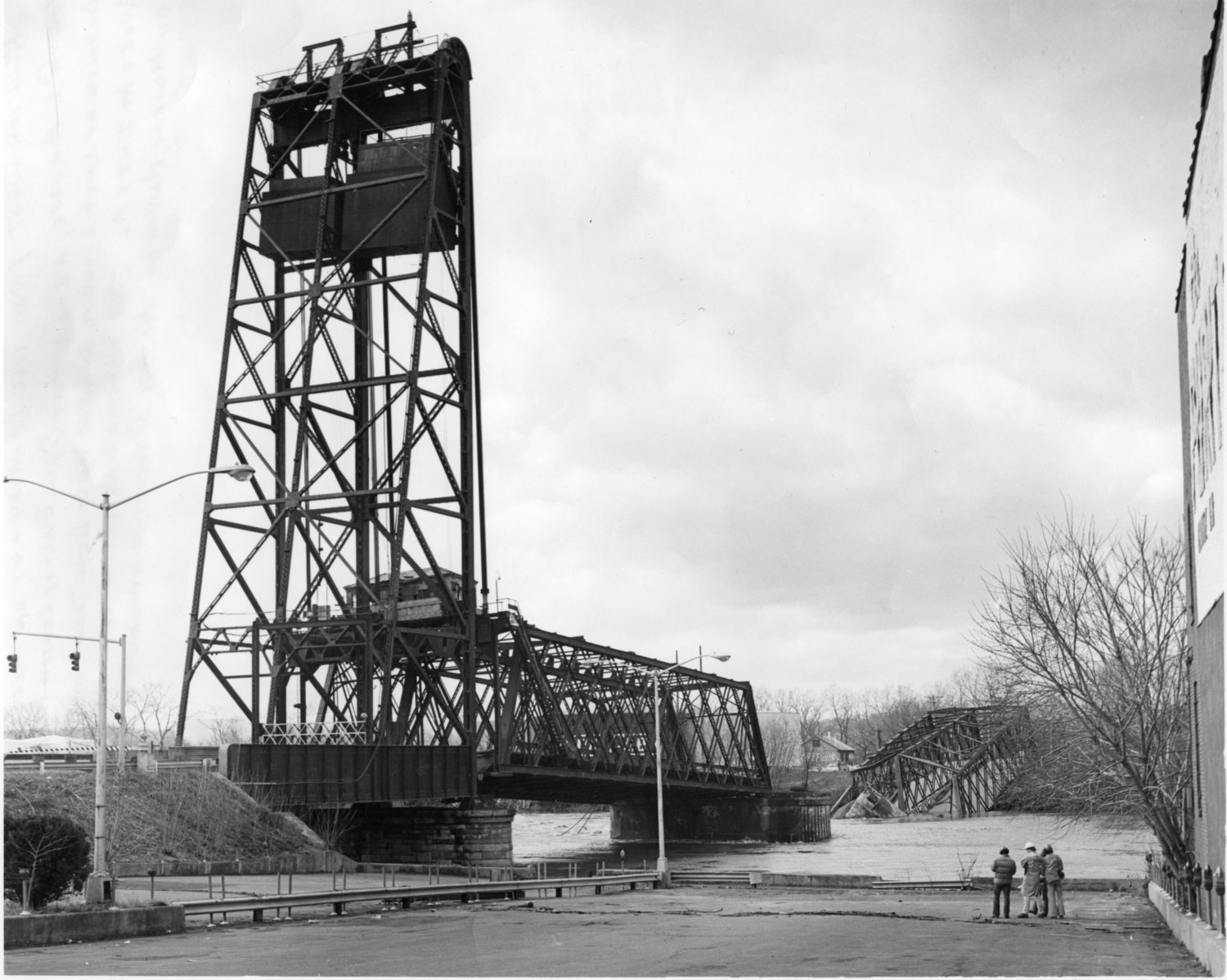
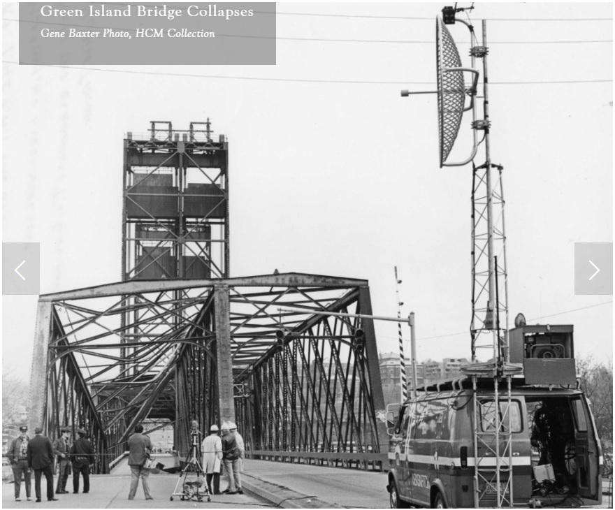
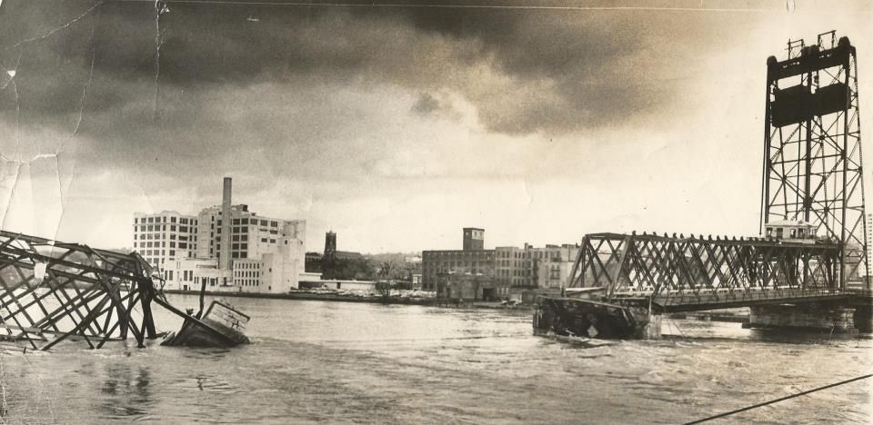
. Due to flooding caused by 2.7 inches of heavy weekend rains, coupled with melting snows and heavy runoff, flood water induced scour undermined the one of span support piers closest to Starbuck Island.
Luckily, two New York Telephone personnel: Bill McLaughlin and Larry Marinucci were working in that immediate area and
along with as well as local resident Rob Bouchey noted that things were not normal, with the bridge groaning and making
popping sounds. They managing to stop traffic so that people were not
on the bridge when it fell.
The collapse of the fixed span compromised the structural
integrity of the western vertical lift bridge tower. At approximately 7
p.m. that evening, it too collapsed into the waters.
|
March 16, 1977 - looking east at Troy
|
March 16, 1977 - looking northeast |
..
. |
|
March 16, 1977 - looking east
Gene Baxter photo
Hart Cluett Museum |
March 16, 1977 - looking northeast
Gene Baxter photo
Hart Cluett Museum |
..
. |
|
|
March 16, 1977 - looking west
Hart Cluett Museum
|
.
.
After razing the remains of the bridge; a modern vertical lift
bridge was constructed, and opened to traffic in 1981, of which this
bridge remains in service.
.
.
.
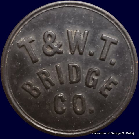
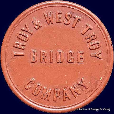
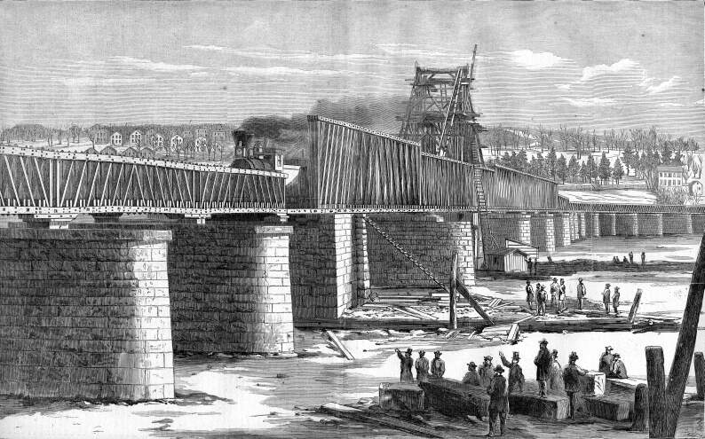
Troy and West Troy Bridge Company
Hudson River
..
.
The Troy & West Troy Bridge Company, was founded 1872 and
constructed a multi-span Whipple through truss bridge with center swing
span to allow maritime traffic to navigate the Hudson River.
This
bridge was better known as the Congress Street Bridge and would see use
through 1913, at which time it was replaced.
|
|
 |
 |
 |
|
|
|
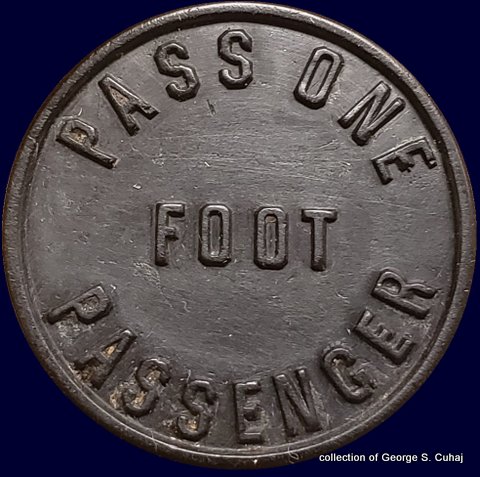
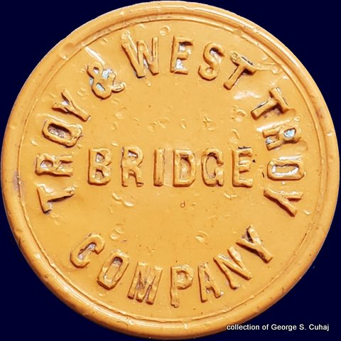
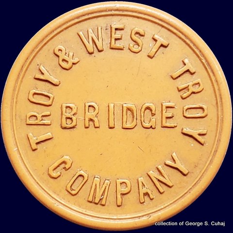
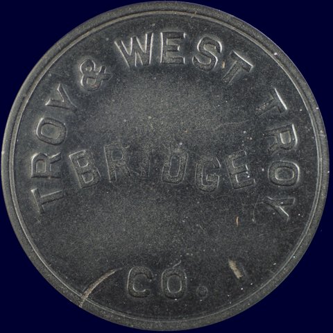
Troy & West Troy Bridge - NY890Aa
One Foot Passenger
23mm, Vulcanite, black
sans-serif "FOOT" reverse
collection of George S. Cuhaj |
Troy & West Troy Bridge - NY890Ab
One Foot Passenger
23mm, Vulcanite, black
serif "FOOT" reverse
collection of George S. Cuhaj |
|
.
. |
|
|
|
|
|
 |
 |
 |
 |
 |
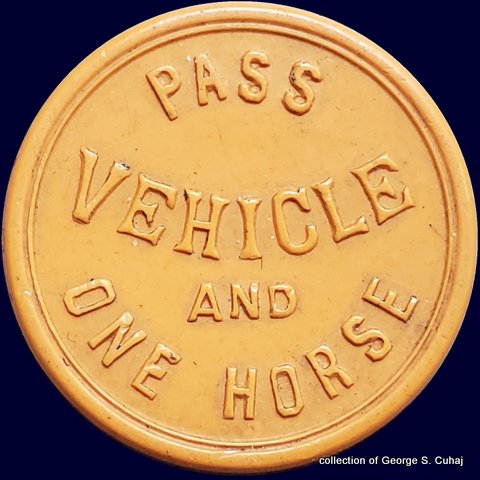 |
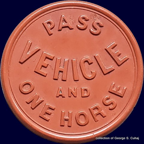
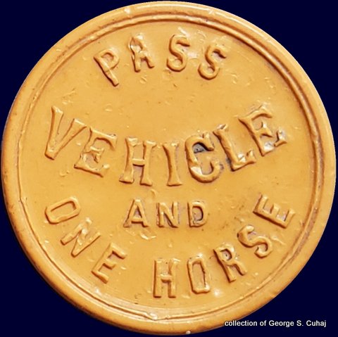
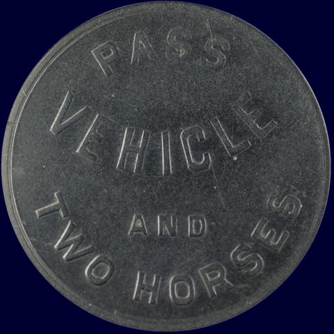
Troy & West Troy Bridge - NY890B
Vehicle and One Horse
25mm, Vulcanite, brown
collection of George S. Cuhaj |
Troy & West Troy Bridge - NY890Ja (unlisted)
Vehicle and One Horse
25mm, Vulcanite, yellow
apex of 'A" in AND points to center of "H" in VEHICLE
collection of George S. Cuhaj |
Troy & West Troy Bridge - NY890Jb (unlisted)
Vehicle and One Horse
25mm, Vulcanite, yellow
apex of 'A" in AND points to leg of "H" in VEHICLE
collection of George S. Cuhaj |
.
. |
|
|
|
|
|
|
|
 |
 |
|
|
|
|
Troy & West Troy Bridge - NY890Ca
Pass Vehicle and Two Horses
32mm, Vulcanite, black
internet image |
|
|
| all tokens shown at 200% |
.
.
.
.
Hudson River Bridge Co. / Livingston Avenue Bridge
Albany / Rensselaer, NY
owned by New York Central & Hudson River Railroad
Hudson River
.
.
 |
 |
original bridge: wood Howe truss swingbridge over Hudson River - 1866 to 1901
looking east |
replacement bridge: steel Baltimore through truss - 1901 to present
looking west-northwest |
The Hudson
River Bridge Company was incorporated April 9, 1856 for the intent of
constructing a bridge to carry the railroad over the Hudson River
between Albany and Rensselaer, and work on the bridge began in April
1864.
The Green Island Bridge seven miles to the north, and owned by
the Albany & Schenectady RR (to become the Delaware & Hudson
RR) which had
opened in 1835; required the railroad to use a longer route via
the Schenectady and Troy
Railroad.
The bridge constructed at this location, called the "Hudson River Bridge"; was to connect
the New York Central Railroad on the west (Albany) side of
the bridge directly to the Hudson River Railroad, as well as the Troy & Greenbush
Railroad and the Boston & Albany Railroad on the east (Rensselaer) shore.
The bridge was constructed of wood as a swing bridge of Howe Truss design. It incorporated pedestrian footways and a carriage
path, as well as railroad tracks.
With approaches, the bridge totaled 4,825 feet long, encompassed a swing
span of 1,953 feet, and provided shipping traffic with a closed clearance of 30 feet from high
water. It cost $1,100,000 to construct.
The bridge was placed into
service February 22, 1866; and both freight and passenger trains
utilized this bridge at first until the Maiden Lane bridge was completed 10 months later several blocks to the
south.
After this, the Hudson River Bridge was referred to as the "North
Bridge", with the Maiden Lane Bridge as the "South Bridge".
Due
to its convenient location, foot passengers and carriages began to
use the Hudson River Bridge as a means to commute between Albany and Rensselaer. A
nominal toll was charged: three cents for foot passengers, or 50
tickets for $1.00.
In 1901, a new bridge was constructed upon the original 1866 pilings; however this structure being a Baltimore through steel truss.
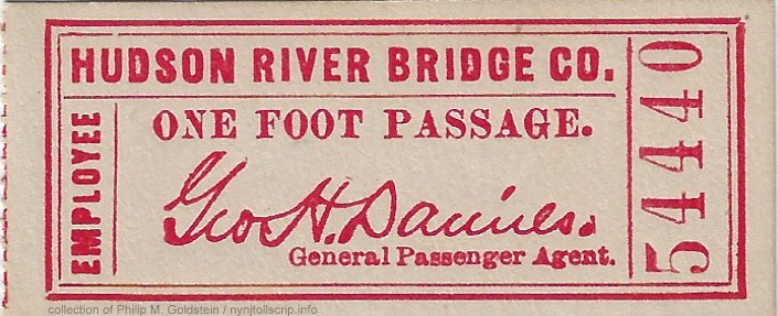 Employee One Foot Passage Ticket:
facsimile signature of George H. Daniels, general passenger agent
(1889 - 1905)
2 5/16" x 1"
collection of Philip M. Goldstein
Employee One Foot Passage Ticket:
facsimile signature of George H. Daniels, general passenger agent
(1889 - 1905)
2 5/16" x 1"
collection of Philip M. Goldstein
This new structure was renamed the Livingston Avenue Bridge; and when
originally built was freight service only, with passenger trains using
the Maiden Lane bridge to the south.
However, when that bridge was closed in the early 1960's, passenger
service was rerouted over the Livingston Avenue span.
The
Livingston Avenue Bridge is still in service to this day, albeit only
for railroad service; with the pedestrian walkways closed. It is
currently owned by CSX Transportation, and leased to Amtrak.
This
bridge carries Amtrak's regional "Empire Service" (between Buffalo and
New York City), as well as the long
distance "Lake Shore Limited" (New York City to Chicago) and "Maple
Leaf" (New York City to Toronto, Canada). It also sees use by CSX in
local
freight service.
Due to its advanced age; it has
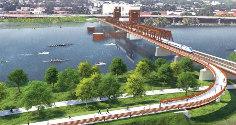
been in discussion for the last ten years whether to rebuild, or replace the Livingston Avenue Bridge
entirely. The approval process for this is ongoing.
The rendering of the
replacement span seen below, shows a vertical lift bridge (instead of a swingbridge), with an adjoining
shared use (bicycle and foot paths) for crossing the river:
|
 |
 |
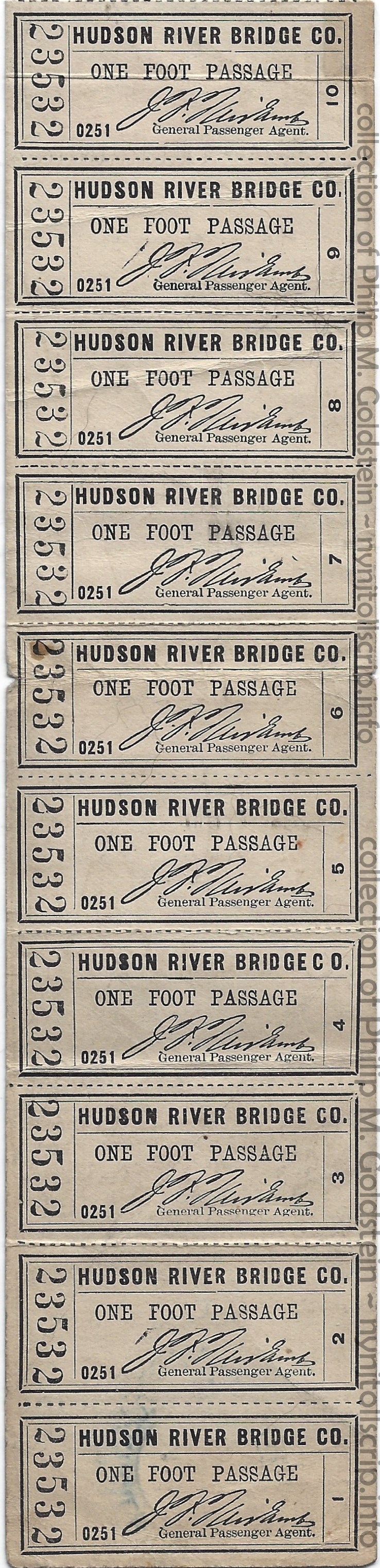
One Foot Passage Tickets
tickets: 2 1/4" x 1", strip of 10 - August 24, 1907
facsimile signature of John F. Fairlamb, general passenger agent
collection of Philip M. Goldstein |
courtesy of New York State Department of Transportation / Empire State Passenger Association
looking west
..
.
.
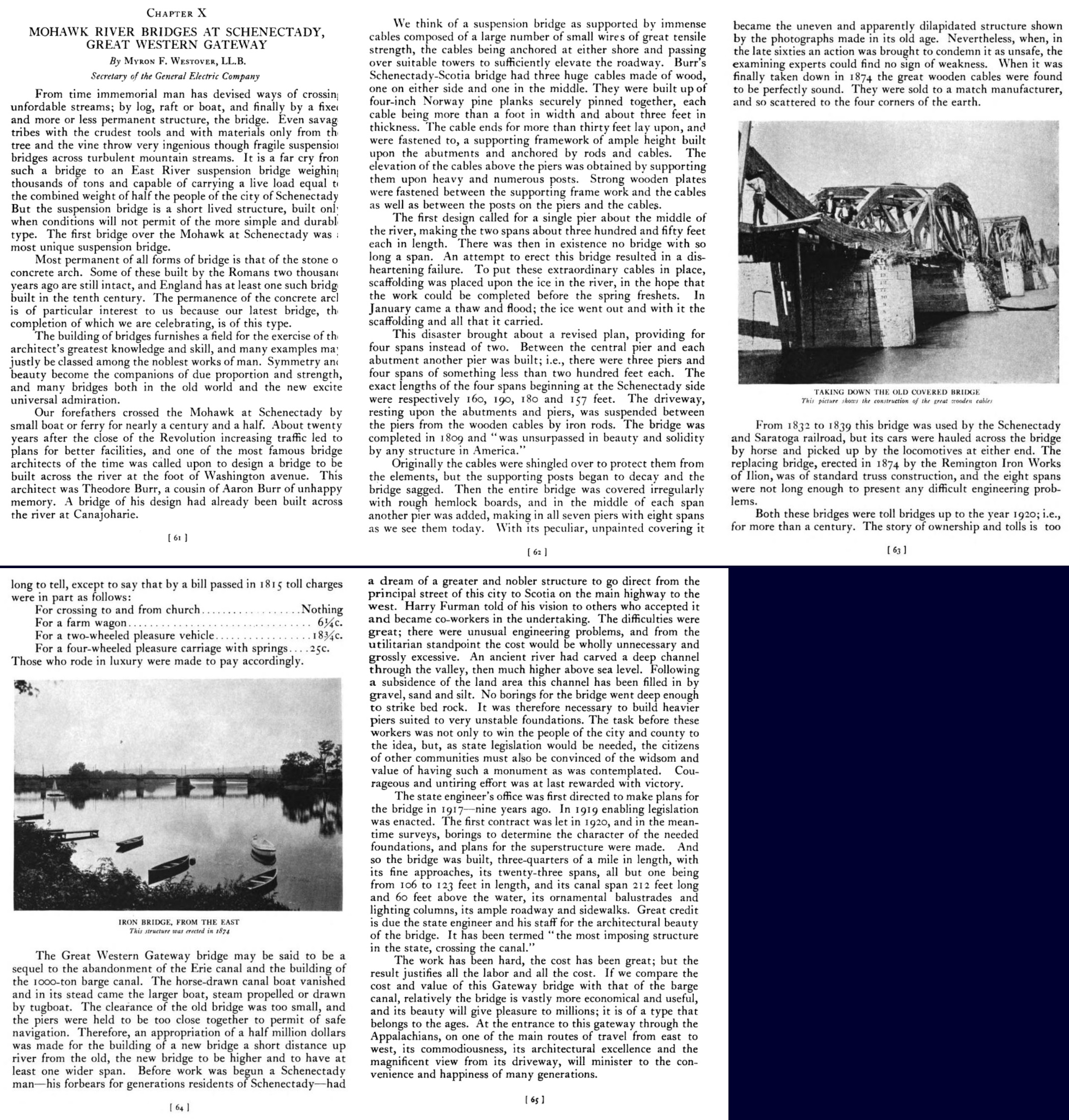
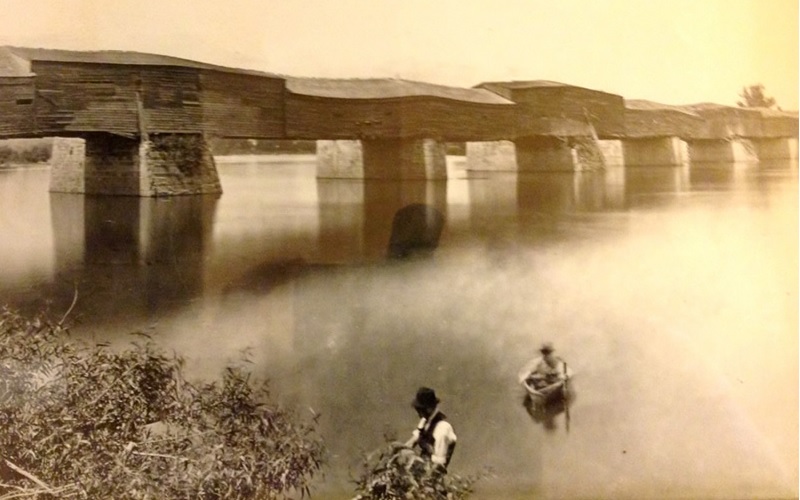
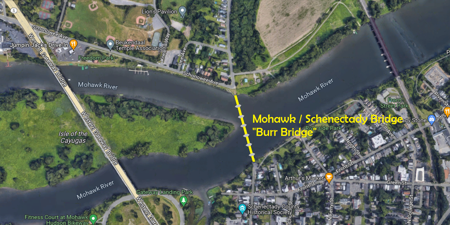
Mohawk / Schenectady Bridge a/k/a Burr Bridge
Mohawk River
.
.
If my research is correct, this was the multi-span located
between Schenectady & Scotia. The Mohawk / Schenectady Bridge also
was known as the Burr Bridge, as it was designed by Theodore Burr, a
cousin of Aaron Burr (yes, that Aaron Burr of whom was Vice President
of the United States 1801-1805, under President Thomas Jefferson;
and of whom shot Alexander Hamilton in the duel.)
In its 1915 report, the Great Western Gateway Commission gave a little
bit of history of the various bridges that had connected Schenectady to
Scotia across the Mohawk River. Despite having been settled in 1661,
the first permanent bridge to be built didn’t come about until 1808. It
was authorized in 1800 in the formation of the Mohawk and Schenectady
Bridge and Turnpike Company, which was to build a bridge across the
Mohawk at Schenectady and a turnpike from Schenectady to Little Falls.
It went from the foot of Washington Avenue in Schenectady to the end of
the dike in Scotia, now known as Schonowe Avenue.
This bridge is particularly unique in the fact that it utilized wood
"cables". That is, one foot wide planks of lumber were staggered and
overlapped each other in a three very long continuous assemblages were
used for the main cable. From these, the vertical roadbed suspender
cables are strung from. This layered assembly design is quite similar
to the modern day "LVL" (laminated veneer lumber) where multiple layers
of veneer is glued and pressed together. (Plywood uses layers with the
grains running perpendicular to each layer, where LVL the grain runs in
the same direction for all layers).
The
bridge as well has a long and storied history behind it, of which is
well covered in the book Schenectady and the Great Western Gateway,
1926:
There are several excellent views of the bridge on the following website: Burr Bridge
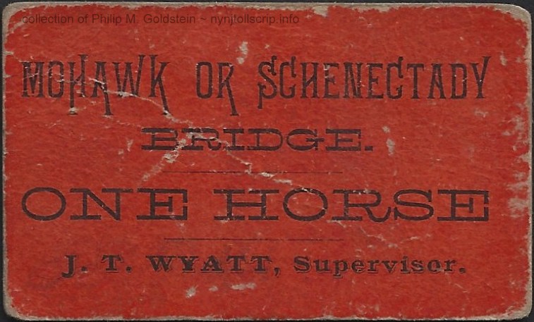
Further
research by this author reflects that J. T. Wyatt was one of the County
Supervisors for Schenectady County, ca. 1886; which make this ticket
from the era of the iron bridge, which was constructed in 1874.
When first opened, the toll schedule was as follows:
| Twenty sheep or hogs: |
8 cents |
| Twenty cattle, horses or mules: |
18 cents |
| Each horse and rider or led horse: |
5 cents |
| Each horse sulky, chair or chaise: |
12 ½ cents |
| Each one-horse cart: |
6 cents |
| each chariot, coach, coaches or phaeton: |
25 cents |
Each wagon or other four-wheel carriage drawn by two horses mules or oxen:
each additional animal: |
12 ½ cents
3 cents |
Each cart drawn by two oxen:
Each additional horse or ox: |
6 cents
2 cents |
| For each sleigh or sled drawn by two animals: |
6 cents |
No toll to be charged persons going to or coming from church, or his
common business or his farm, or to and from any mill,
nor from any
persons passing in a sleigh or sled between January 1 and March 1 of
each year. |
 |
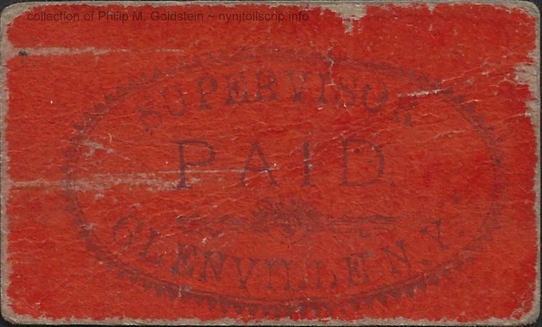 |
Mohawk or Schenectady Bridge - One Horse
J. T. Wyatt, Supervisor
with paid stamp Glenville, NY
2 7/16" x 1 15/32"
collection of Philip M. Goldstein
|
.
.
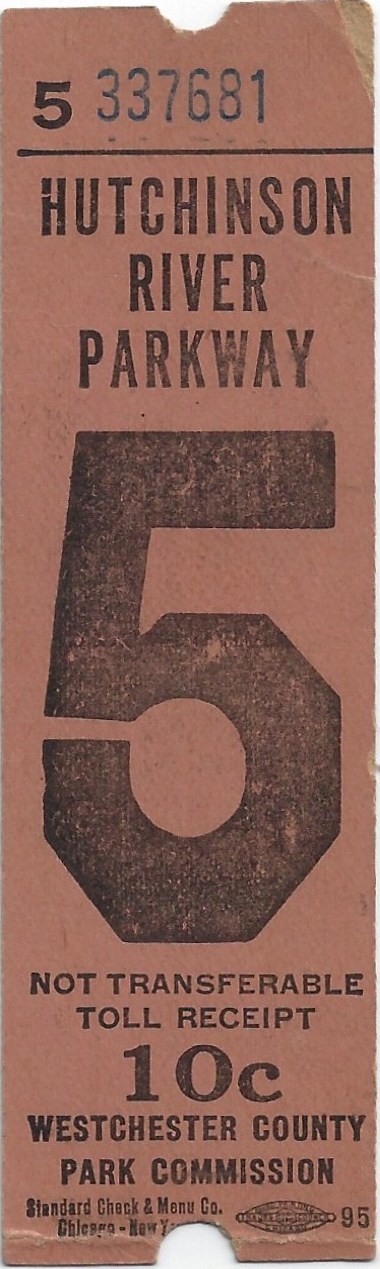
Westchester County Parks Commission: 1929 - 1960
East
Hudson Parkway Authority: 1960 - 1979
New York State Department of Transportation - Parkways: 1979 - present
.
.
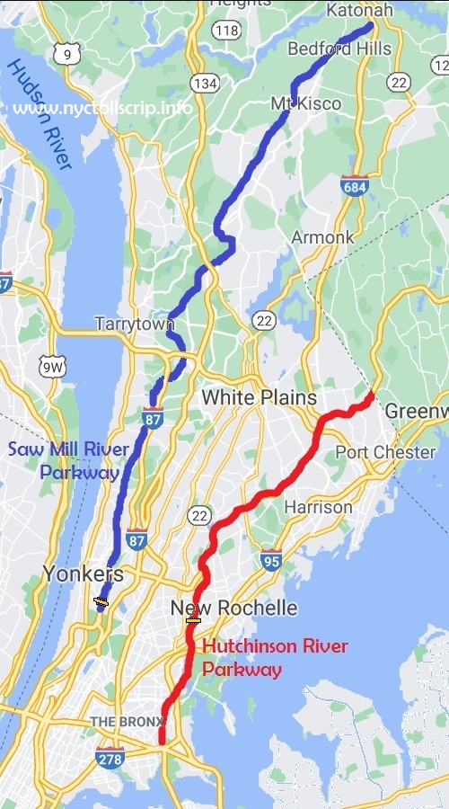
As with Long Island, a network of parkways were
constructed throughout Westchester County. These parkways comprised of
the Sprain
Brook, Bronx River, Saw Mill River & Hutchinson River Parkways, and the Cross
Cross County Parkway and the Cross Westchester Expressway.
As far as is known, only the Saw Mill River
Parkway and Hutchinson River Parkway implemented toll collection and it is these two parkway that will be addressed here.
 |
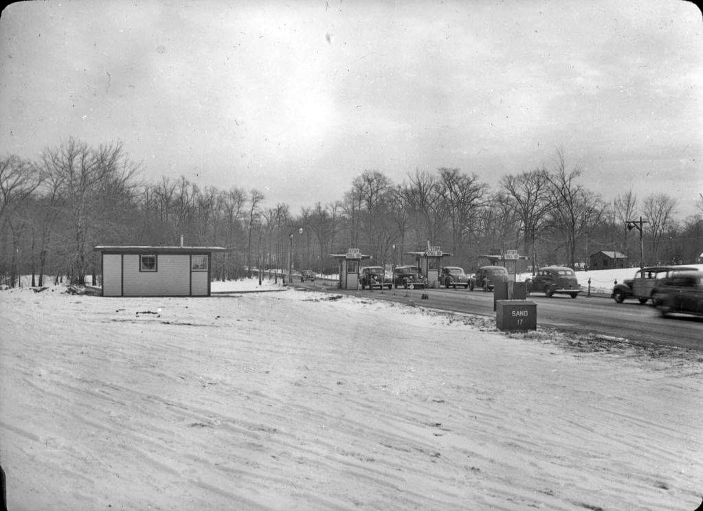
|
Hutchinson River Parkway Toll Booths
Westchester County Parks Commission
Lantern Slide Collection of the Parks Commission |
.
The Saw Mill River Parkway
First proposed in 1924 by the Westchester County Parks
Commission, the Saw Mill River Parkway was to have aesthetic design
features similar to that of the nearby Bronx River Parkway. The first
segment of the parkway, a bypass in Yonkers was opened to traffic in
1926. The next section of Saw Mill River Parkway that was to open, was
from from Tuckahoe Road in Yonkers to Ashford Avenue in Dobbs Ferry,
and was completed in September 1929, with a further four mile segment
between Dobbs Ferry and Tarrytown Road opening in 1930.
There is conflicting information as to when the toll booths were
erected and toll collection implemented on the Saw Mill River Parkway. The New York Times article below
states 1947, but the NYC Road website (www.nycroads.com) states 1936.
But it is known the toll booths were located between Exits 3 (McLean Avenue) and Exit 4
(Cross County Parkway).
.
The Hutchinson River Parkway - "The Hutch"
Construction of the Hutchinson River Parkway begin in 1924 with the first
portion opening to traffic being a two mile segment completed in 1927. By
October 1928, eleven more miles were completed, from Boston Post Road in
Pelham Manor to Westchester Avenue in White Plains.
The original rustic design of the parkway began to change when in 1936 when Robert Moses decided to build
additional parkways in the region, with a northward extension of the Hutchinson River Parkway from White Plains
to King Street in Rye Brook (on the Connecticut state
line) was completed in 1937 and a southward extension from Pelham Manor
to Pelham Bay Park opened in December 1937.
In 1941, another extension connecting the southern end of the
Hutchinson River Parkway to the Whitestone Bridge was opened to
traffic. It is here that toll booths were placed across all lanes
between Exits 7 (Boston Post Road / US Route 1) and Exit 8 (Sandford
Boulevard / Colonial Avenue) in Pelham Manor.
Initially, the toll collected at the Pelham Manor Toll
Booths was 10 cents (as was the Saw Mill River Parkways toll), but
drivers learned they could circumvent the toll on the Hutch by driving
through the Town of Pelham. At first, this was not an immediate
issue;, but in 1958 the toll was raised to 25 cents.
Now with
ever increasing amounts of privately owned automobiles and those
automobiles being used for commuting, the traffic circumventing the tolls had become a serious enough
issue to be addressed by the town of Pelham Manor.
Following the toll increase, more cars than ever began leaving the Parkway
before reaching the tolls and made their way onto
the streets of the town of Pelham Manor to avoid paying the toll. This problem was especially severe during rush hour periods.
With
increasing amounts of parkway vehicles now clogging the town streets
and thereby increasing the hazard to pedestrians and school children, not to mention the increased wear and tear of the road surface; the
town changed its traffic patterns by making one way streets and
prohibiting turns at key intersections to discourage parkway traffic
from using town streets. Naturally, local residents and businesses
did not like having their routines altered and this was not very
popular solution. But this is the way it stayed and traffic for the
most part migrated back to the parkway.
In 1979, an agreement was reached to transfer operational
and maintenance jurisdiction of the Saw Mill River and Hutchinson
Parkways (as well as the other non-tolled parkways in Westchester
County) from the East Hudson Parkway Authority to the New York State
Transportation Authority beginning on November 1. Following this date,
the East Hudson Parkway Authority was disbanded. Also as part of this
agreement, the toll booths were slated for removal. But not so fast!
The State had
become addicted to the revenue generated by the toll booths, as they
had with so many other roads. Toll collection when implemented for
these roads, was only supposed to last as long as necessary to pay off
the investment bonds issued to finance the parkways' initial
construction, but tolls were a cash cow.
According to a New York Times article, these two toll plazas on
the Hutchinson and Saw Mill River Parkways generated $11 million
annually. This money was used for road maintenance, the salaries for
those administration officials and toll collectors, as well as a
special detachment of law enforcement who patrolled the Parkways. New
York State officials objected at the cost of paying for maintenance and
police without the revenue stream from the tolls. The battle over
whether to close the toll booths waged for decades, and the motorists
kept paying.
Finally, on June 8, 1994, the New York State Legislature reached an agreement to end the
tolls on both the Hutchinson River and Saw Mill River Parkways. By this
time, they were the last remaining state roads outside the New York State Thruway
that were not free to motorists.
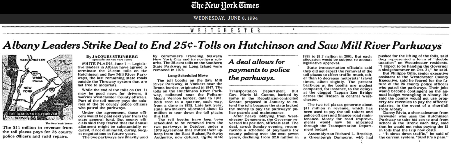
New York Times digital archives
The last toll to be collected on the Hutchinson River Parkway
was received just before midnight on October 31, 1994. The toll booths were removed a month later:
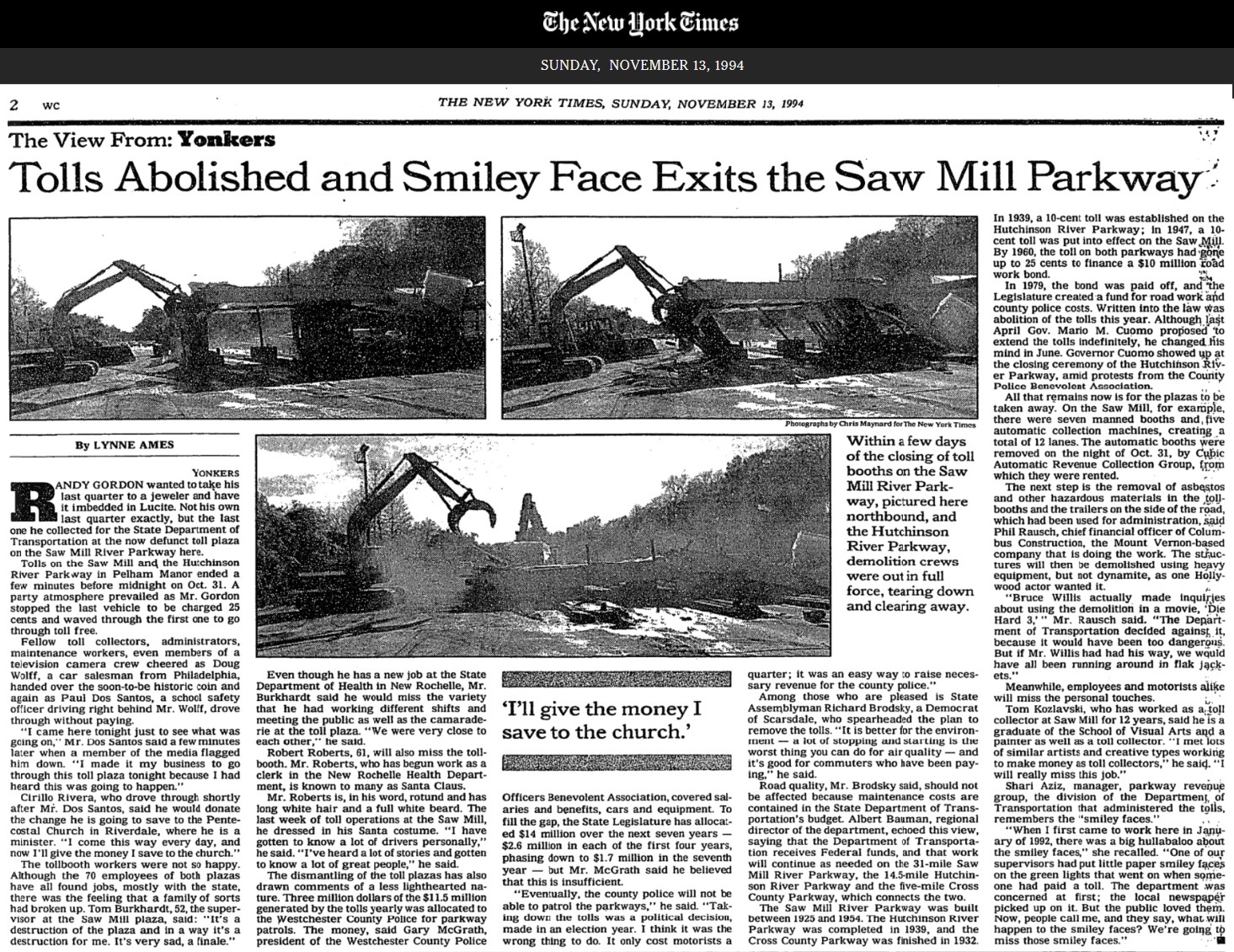
New York Times digital archives
It is not currently known if the East Hudson Parkway Authority
issued either tokens or scrip. No records of such have been located nor
any examples known to exist. But receipts from paying the tolls are
known to have survived as evidenced below.
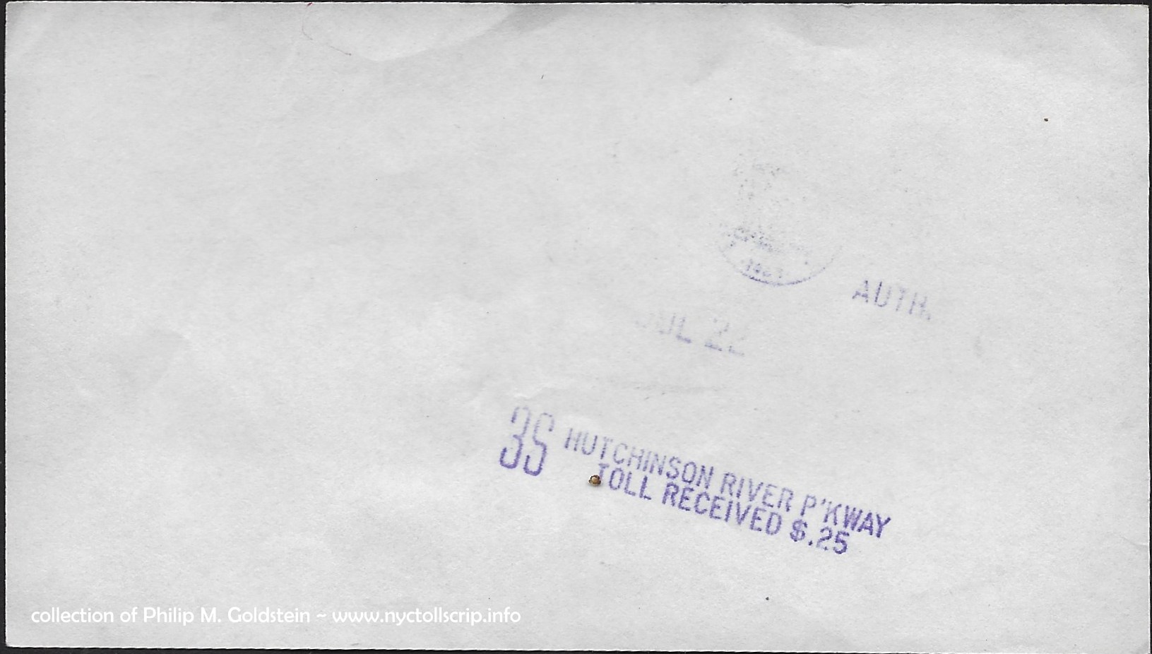
The Hutchinson River Parkway receipt seen below is dated July 22, 1974 is
printed on slips of plain white paper measuring 2 13/16" x 4 7/8". These carry the very faded
insignia of a government agency at top, but I can only discern "AUTH."
and the year 1960. This is the year the East Hudson Parkway Authority was organized, so it believed that is their insignia.
The second receipt is unusual as the slip of paper is
punched with the toll information. Usually this type of perforation is
seen as a VOID or SPECIMEN cancellation for stamps, currency or stock
and bond certificates.
 |
Westchester County Park Commission - 1939-1960
Hutchinson River Parkway toll receipt - 10 cents
collection of Philip M.
Goldstein |
| . |
 |
East Hudson Parkway Authority
Hutchinson River Parkway toll receipt 25 cents - July 22, 1974
collection of Philip M.
Goldstein
|
| . |
 |
East Hudson Parkway Authority
Hutchinson River Parkway toll receipt 25 cents - June 21, 1979
collection of Philip M.
Goldstein |
As stated above, on November 1, 1979, the East Hudson Parkway Authority was
dissolved after the New York State Department of Transportation took jurisdiction of the Parkway's.
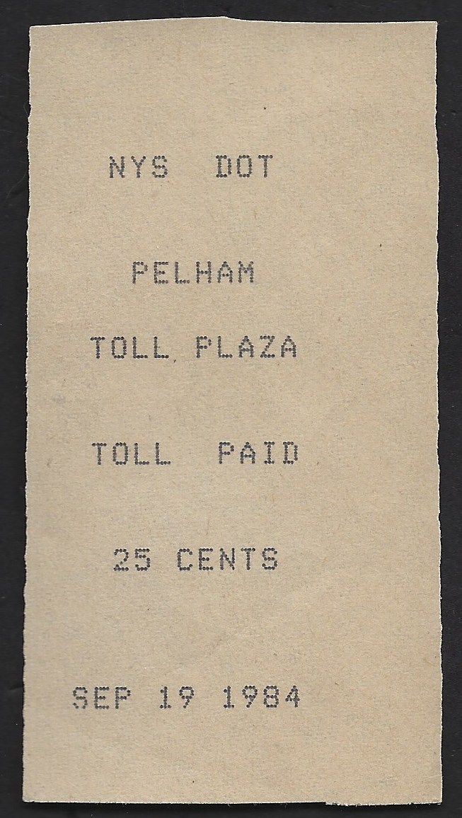
Following are several of the NYSDOT-Parkways era (1979-1994) receipts for
the Hutchinson Parkway. One of the unique things about these Pelham Parkway
receipts is the fact that some of the issues I have were printed on cut
up scraps of continuous feed dot matrix printer paper. Without a doubt,
it is definitely a useful and commendable form of up-cycling!
 |
 |
 |
 |
 |
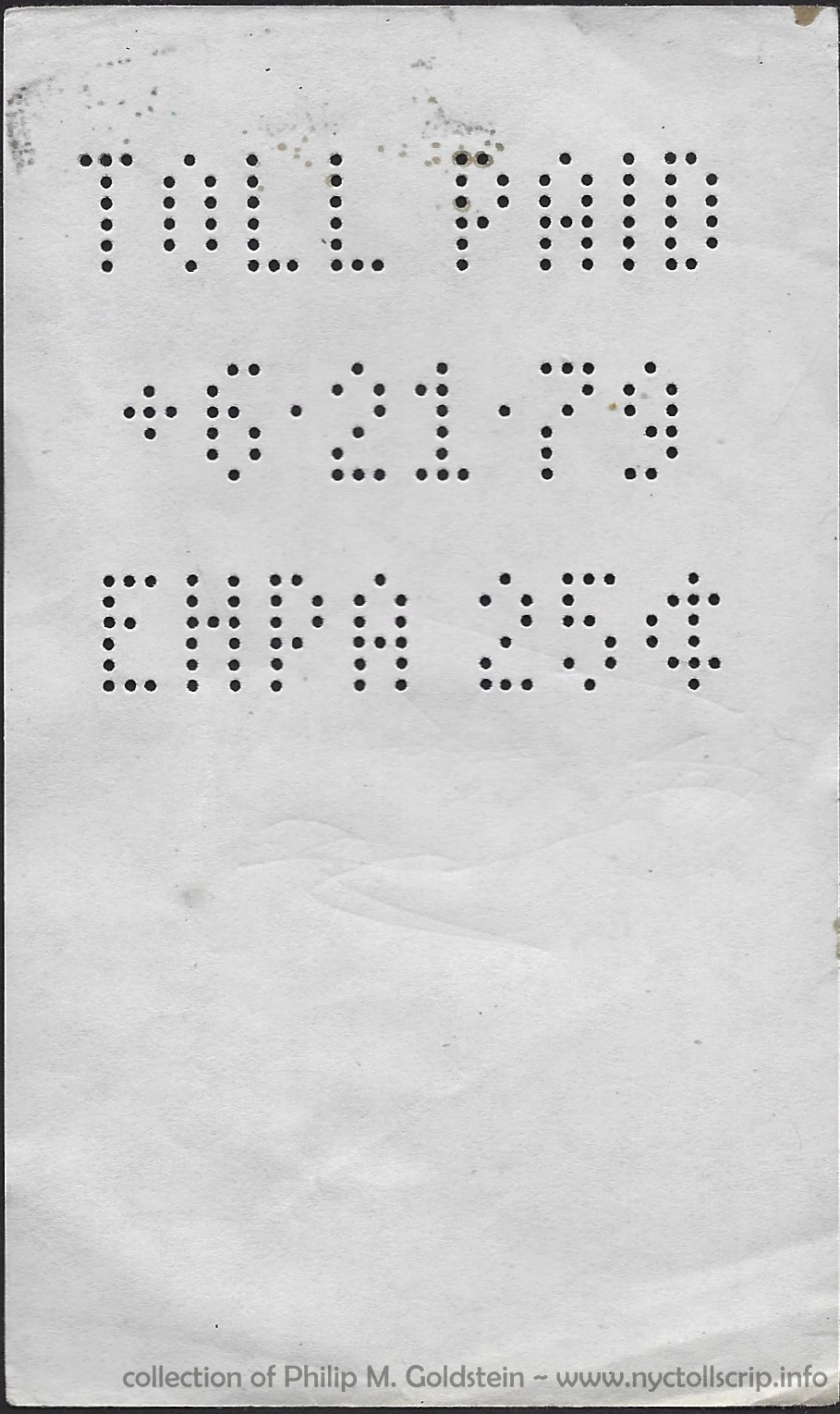
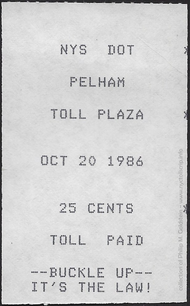
receipt - Pelham Toll Plaza
collection of
Philip M. Goldstein
|
receipt - Pelham Toll Plaza
collection of
Philip M. Goldstein
|
receipt - Pelham Toll Plaza
collection of
Philip M. Goldstein
|
receipt
- Pelham Toll Plaza
"Buckle Up" safety slogan added
collection of
Philip M. Goldstein
|
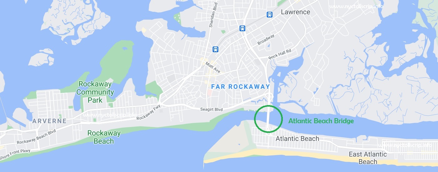
Atlantic Beach Bridge Authority / Nassau
County Bridge Authority - Atlantic Beach Bridge
The
Atlantic Beach Bridge is a bascule drawbridge and approaches, carrying
NY Route 878 and connects the Town of Lawrence and Atlantic Beach (both
Nassau County), New York. The span passes over the west end of
Reynolds Channel. This bridge also provides access to the Rockaway
Peninsula via Seagirt Boulevard.
The original span opened to traffic on June 29, 1927, and only had a vertical
clearance of only 13 feet. The Atlantic Beach Bridge reduced travel time to
Atlantic Beach by 30 minutes.
The original corporation that undertook the construction and
operation of the Atlantic Beach Bridge was aptly named the Atlantic
Beach Bridge Corporation.
In 1945, the New York State Legislature created the Nassau County
Bridge Authority to operate and maintain the span. This essentially
enabled to state to control the operation; and by proxy, allowed Robert
Moses to make "suggestions" for improvements.
On October 14, 1950, Governor
Thomas E. Dewey drove the first pile for the new Atlantic Beach
Bridge. To accommodate the new six-lane span, Nassau County and New
York City spent $2,500,000 dollars to purchase the property for the rights of way for the approach roads.
The new
Atlantic Beach Bridge was designed by Hardesty & Hanover and opened
to
traffic on May 10, 1952, at a cost of $9,500,000 dollars. Soon after
the new
span opened, the old bridge was razed. The new span is 1,173
feet long with a 33 foot vertical clearance for marine
traffic.
Typically, the toll is $2.00 for vehicles under 5 tons and
collected in each direction as of January 1, 2007. Vehicles over 5 tons
are $2.00 per axle. The Atlantic Beach Bridge is one of the few
crossings in the state of New York that does not accept E-ZPass. For
commutation rates for Nassau County residents is $130.00 and a decal is
affixed to the vehicle.
Due to the COVID-19 pandemic spread in New York State, toll collection
was temporarily suspended in mid-March 2020. Toll collection was
reinstated at the beginning of June 2020.
Nassau County Bridge Authority - Current Toll Schedule
in effect as of January 1, 2007
|
| vehicle description |
axles |
toll |
| Passenger Car or Motorcycles |
2 |
$2.00 |
| with 1 or 2 axle trailer |
1 or 2 |
$4.00 |
| each additional axle |
|
$2.00 |
| 20 Trip Pass Card (NON-COMMERCIAL USE ONLY) |
|
$15.00 |
| Resident Decals (VEHICLES REGISTERED IN NASSAU COUNTY) |
|
130.00 |
| Resident Decals (VEHICLES REGISTERED OUTSIDE NASSAU COUNTY) |
|
175.00 |
| Commercial Vehicles - Under 10,000 lbs |
|
$2.00 |
| with 1 or 2 axle trailer |
1 or 2 |
$4.00 |
| each additional axle |
|
$2.00 |
| Commercial Vehicles over 10,000 lbs |
2 |
$4.00 |
|
3 |
$6.00 |
|
4 |
$8.00 |
|
5 |
$10.00 |
|
6 |
$12.00 |
.
.
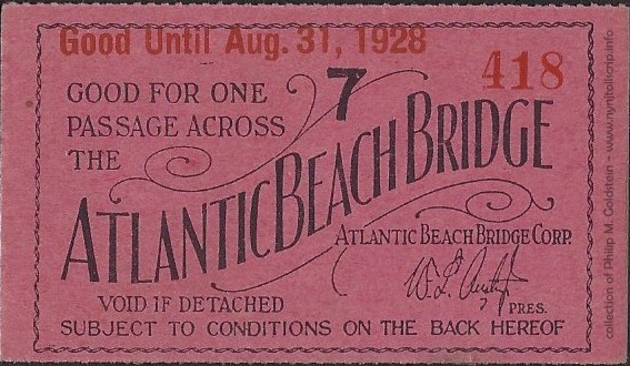
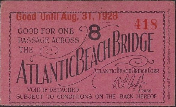
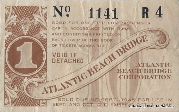
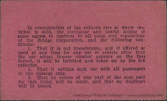
| Atlantic Beach Bridge Corporation (1927 - 1945) |
|
 |
|
 |
 |
|
September / October 1945 |
|
|
monthly prepaid scrip - August 31, 1928
collection of
Philip M. Goldstein |
|
|
.
. |
|
|
|
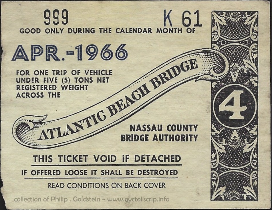
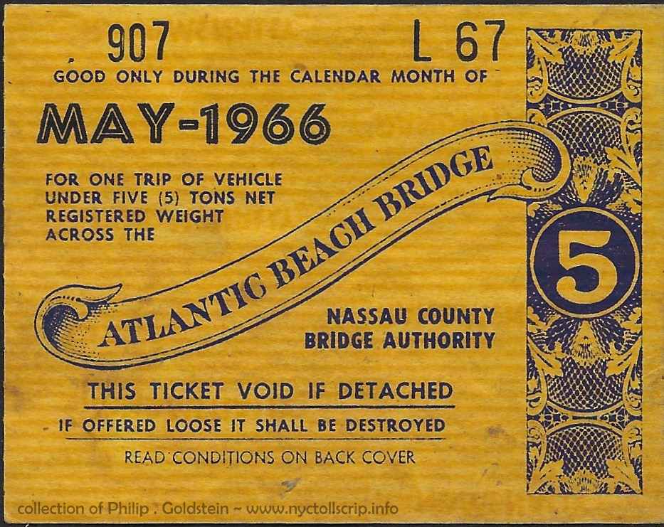
| Nassau County Bridge Authority (1945 - present) |
|
 |
 |
|
|
monthly prepaid scrip
(under 5 tons)
April 1966
collection of
Philip M. Goldstein |
monthly prepaid scrip
(under 5 tons)
May
1966
collection of
Philip M. Goldstein |
|
.
. |
|
|
|
|
 |
 |
|
|
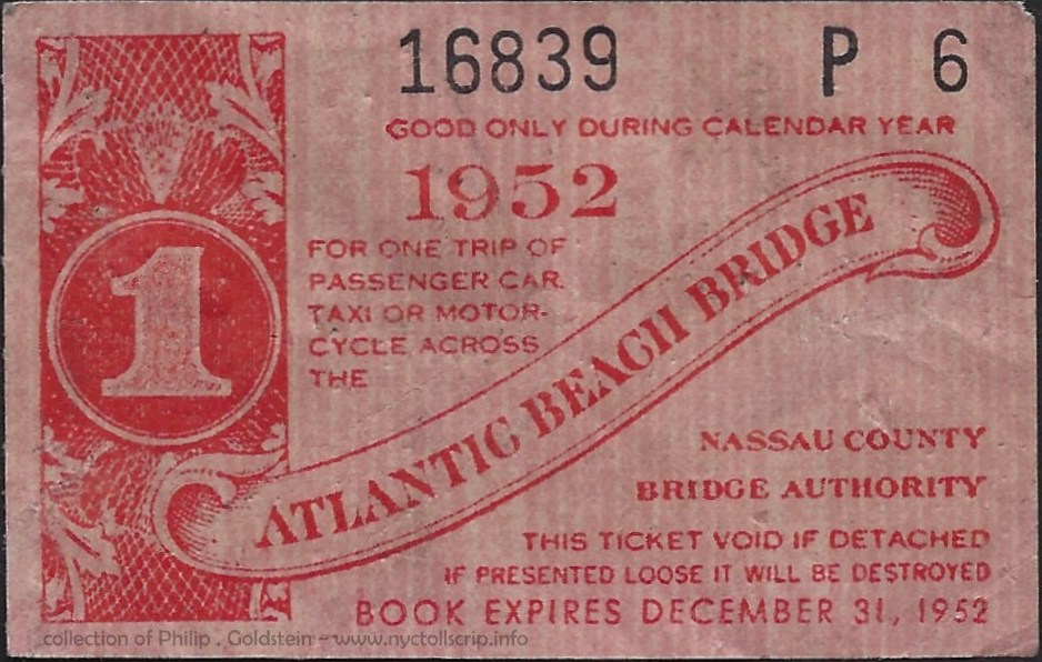
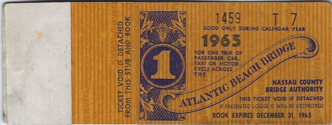
yearly prepaid scrip - 1952
Passenger Car, Taxi or Motorcycle
Rand McNally
collection of
Philip M. Goldstein |
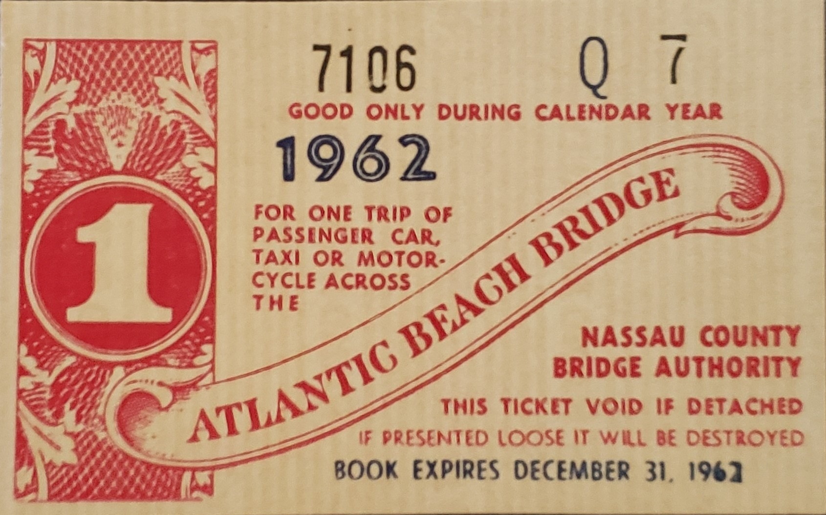
yearly prepaid scrip - 1962
Passenger Car, Taxi or Motorcycle
Rand McNally
Worthpoint |
|
.
. |
|
|
|
|
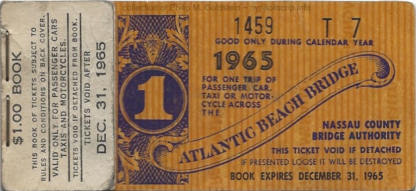
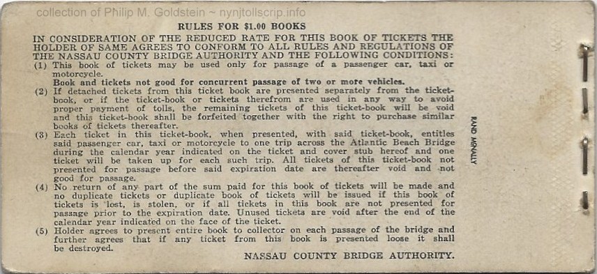
This next example is both revealing as it shows the booklet
covers (which until now had not been seen before) and the rules for the
"$1.00 Books" for the Atlantic Beach Bridge. But the unusualness of
this book is that it contains only 7 tickets. This is odd, because this
works out to a unusual amount: 14.2857 cents per ticket. (Eight
tickets would have worked out to 12.5 cents per ticket). There is no
evidence of an eighth ticket - no stub, and binding staples are tight,
so nothing appears to be missing, and the last ticket is numbered 7. |
 |
 |
yearly prepaid scrip - 1965
Passenger Car, Taxi or Motorcycle
front, with stub cover
(6 stubs, and 1 ticket remaining)
Rand McNally
collection of
Philip M. Goldstein |
yearly prepaid scrip - 1965
Passenger Car, Taxi or Motorcycle
back cover
(6 stubs, and 1 ticket remaining)
Rand McNally
collection of
Philip M. Goldstein |
| . |
|
|
|
|
 |
|
|
yearly prepaid scrip - 1965
Passenger Car, Taxi or Motorcycle
front, showing ticket stub
(6 stubs, and 1 ticket remaining)
Rand McNally
collection of
Philip M. Goldstein |
|
.
. |
|
|
|
|
 |
|
.
. |
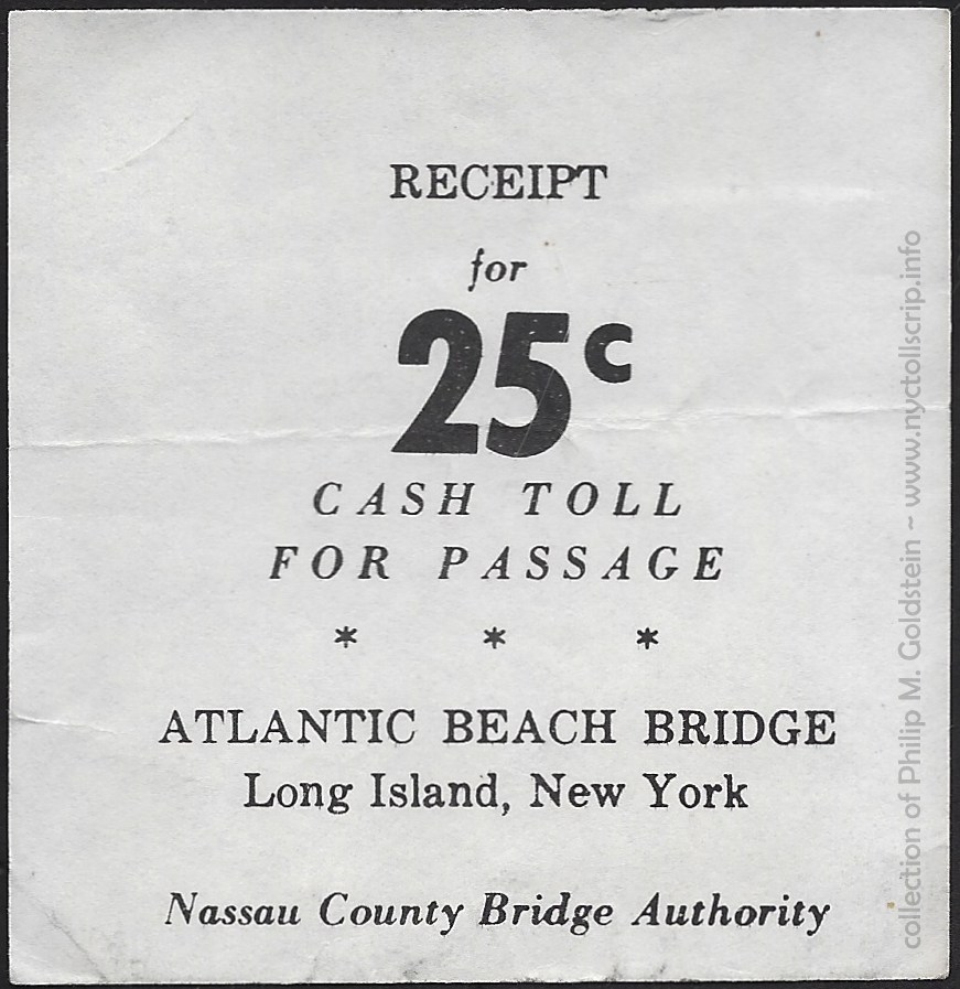
toll receipt
May 13, 1974
collection of
Philip M. Goldstein |
|
.
. |
|
|
|
 |
 |
|
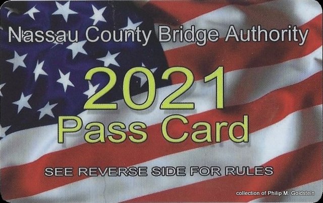
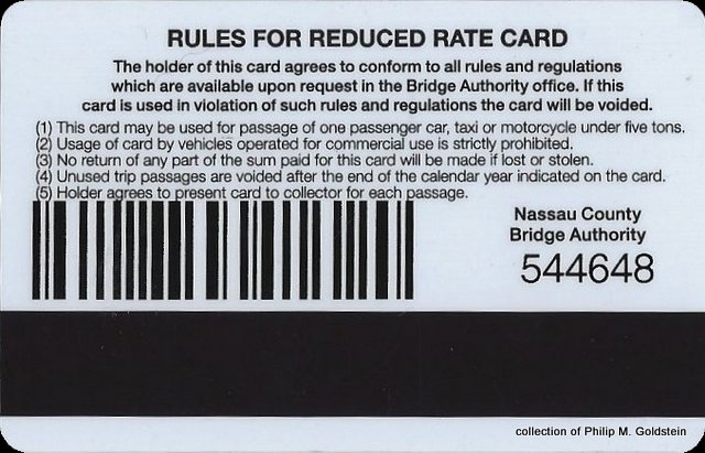
20 trip prepaid pass card
Passenger Car, Taxi or Motorcycle
2021
collection of
Philip M. Goldstein |
|
|
|
|
|
The use of this next issue is somewhat unclear. Not in who issued it, but where it was used. To the best of my research, there is only one bus
route in Nassau County that went over a toll bridge: The present "N33"
route over the Atlantic Beach Bridge.
The Atwood Coffee
catalog attributes the issue to Hewlett, NY (in Long Island) and research shows this was
the location of the corporate office of Nassau Bus Company, Inc.
Nassau Bus Lines was a private surface transit (bus) company that
operated in Nassau County, Long Island. Unlike New York City which has
consolidated all of the separate transit operators: subway / elevated
routes (rapid transit) streetcar and bus (surface transit) under one
operating entity in 1940; transit providers operating in Nassau and
Suffolk County, operated under their individual corporate identities
right up until 1980's with some into the 2000's.
Information from "BusTalk" (an online forum for transit
aficionados); Nassau Bus Lines Inc., was a small operator based in
Hewlett, Long Island. This company had the little known distinction of
being one of the first motorized passenger carriers in the New York
Metropolitan area.
Their buses plied Nassau County's first bus routes on
the south shore, and were the only two routes the company ever had.
Service began in 1912 with service between Lynbrook and Far Rockaway
via the 'Five Towns' and; upon the opening of the first Atlantic Beach
Bridge in 1927, the company obtained permits to operate a bus line
between Long Beach and Far Rockaway via Atlantic Beach.
There were several attempts by competitor bus lines
that were looking to expand throughout the following
decades by acquiring the two franchises of Nassau Bus; but they remained in operation until Schenck
Transportation "made them an offer they couldn't refuse" in the early
sixties.
Eventually, most if not all of the private
bus companies operating in Nassau County eventually became part of the
quasi-governmental transit agency Metropolitan Suburban Bus Authority
(which was an operating division owned by the parent organization
Metropolitan Transportation Authority; of which operates the subway &
bus lines of New York City as well as Long island Railroads and
Metro-North Commuter Railway).
The MTA ceased using the MSBA name
in 1995 and at that time took the name "Nassau Inter-County Express". While
it remains operating under this name, operations were contracted to
private operators beginning December 2011 and the current operator is
Transdev - a multi-national transit operating company.
Returning to the token issue, it is my belief this token was used
by buses of the Nassau Bus Company to cross the Atlantic Beach Bridge.
The question remains as to why the Nassau County Bridge Authority did
not commission or issue the tokens. Until further
information is located disproving my postulation, the issue will
remain in this chapter.
 |
 |
Nassau Bus Lines Inc. - Bridge Toll - 1940
NY365A - 23mm - bronze
mintage quantity: 7000
(shown larger than actual size for detail)
collection of
Philip M. Goldstein |
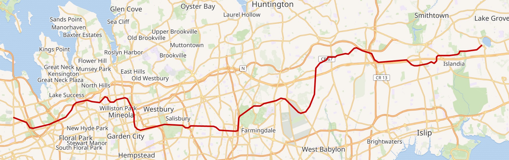
Long Island Motor
Parkway
a/k/a Vanderbilt Parkway
The
Long Island Motor Parkway, also known as the Vanderbilt Parkway,
Vanderbilt Motor Parkway, or Motor Parkway, was a roadway on Long
Island, NY. It was the first roadway designed for automobile use only.
This parkway was privately built by William Kissam Vanderbilt II
(grandson of Cornelius Vanderbilt - of steamboat & New York
Central Railroad fame) with grade separated overpasses and bridges to remove most
intersections.
Construction began in June 1908. With its banked turns, guard rails,
reinforced concrete roadbed, and controlled access, was the first limited-access
roadway in the world, much less the United States. By October 10, 1908;
the first portion, 10 miles long; had opened as far as modern Bethpage.
The road was originally planned to stretch for 70 miles in and out of
New York City to as far as Riverhead,
in Suffolk County. Only 45 miles of highway: from Queens in New York City to Lake
Ronkonkoma, were actually constructed however, and at a cost of $6
million.
The roads intent was twofold: everyday auto traffic but to also host auto racing (William Vanderbilt was an avid motor
racing enthusiast). Races were held in 1908 and on the full road in 1909 and 1910. Unfortunately
however, an accident during the 1910 Vanderbilt Cup, which killed two riding
mechanics with additional injured persons. This caused the New York Legislature
to ban auto racing except on race tracks, ending the Motor
Highway's career as a racing road.
By 1911, the road had been extended as far east to Lake
Ronkonkoma. Its western stretch
was also extended from Great Neck to what is now Fresh Meadows. Despite
it's wealthy backing by a Vanderbilt, the Long Island Motor Parkway faced closure due to unpaid back taxes.
William Vanderbilt appealed to Robert Moses to incorporate the
Long Island Motor Parkway into Moses' new parkway system
being built on Long Island. Moses rejected the request. The Long Island
Motor Parkway could not compete with the public roads, even after the
toll was reduced to 40 cents, just before it closed. Ironically, Moses
gained control of Vanderbilt’s pioneering road for the sum of back
taxes of about $80,000 which the State of New York paid, so in short
Moses could build his system.
Parts of the parkway survive today, used as
sections of other roadways, a utility line corridor or as a bicycle
trail. But for the most part it has been obliterated by development.
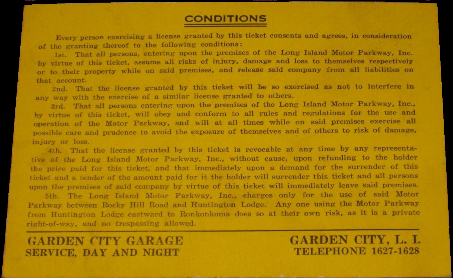
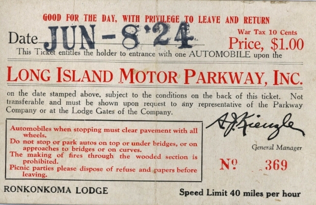
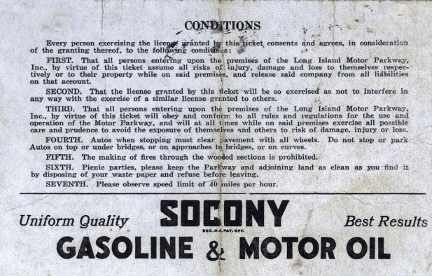
Tolls
When the Long Island Motor Parkway first opened in 1908, the toll
was set at $2. In 1912, it was reduced to $1.50. The toll was further
reduced to $1 in 1917, and in 1937 lowered to .50 cents and finally to
.40 cents in 1938 Just before closure.
While I do not own the following pieces, I felt them interesting and
pertinent enough to include here. There appear to be three types: a one
way, a roundtrip ticket and a day license, which included the privilege to
exit and re-enter.
The right edge appears to have perforated, so either
a stub was attached or these licenses were printed in book form and
detached when sold. It
was seen for sale on eBay in September 2020.
|
One Way
or Round Trip Pass
|
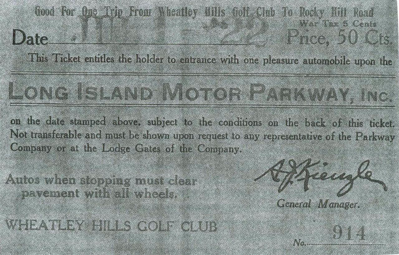 |
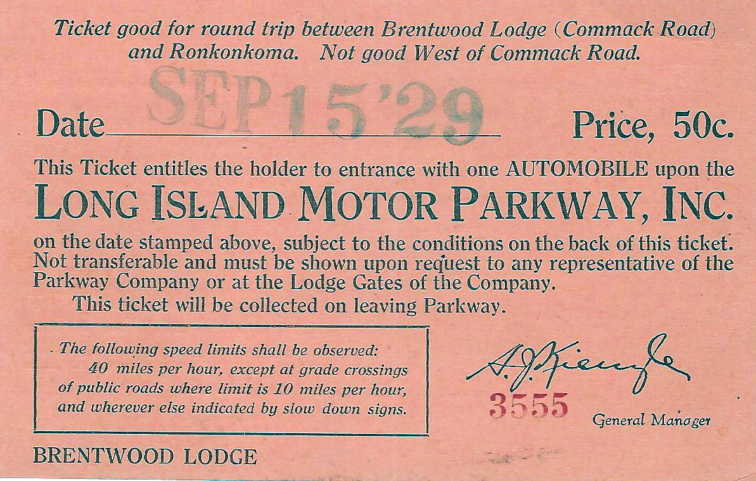 |
Good
for one trip (one way) from Wheatley Hills Golf Club to Rocky Hill Road - 50 cents
Issued by Wheatly Hills Golf Club
image courtesy of
Howard
Kroplick / Vanderbilt
Cup Races website |
Good
for round trip between Brentwood Lodge (Commack Road)
and Ronkonkoma. Not good west of Commack Road - 50 cents
Issued by Brentwood Lodge
image courtesy of
Howard
Kroplick / Vanderbilt
Cup Races website
|
|
|
|
|
 |
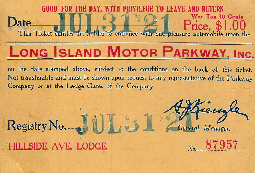
Good
for one way trip to New York or
on round trip Ronkonkoma to Huntington
July 4, 1929
Issued by Ronkonkoma Lodge
image courtesy of
Howard
Kroplick / Vanderbilt
Cup Races website |
Good for one way trip to
Ronkonkoma or
one round trip New York to Huntington
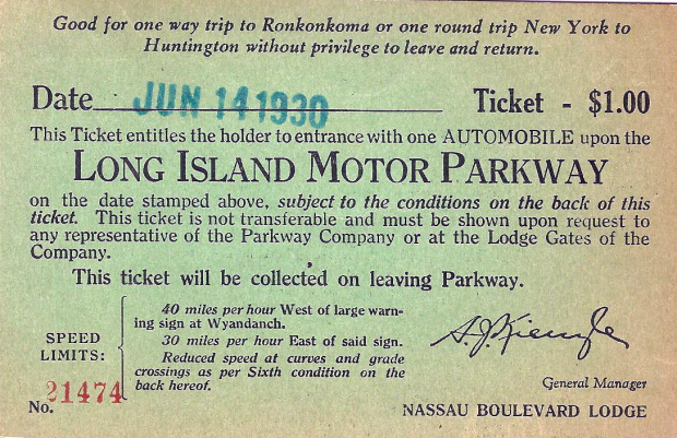
June 14, 1930
Issued by Nassau Boulevard Lodge
image
courtesy of Howard Kroplick / Vanderbilt
Cup Races website
|
| Day
Pass |
 |
 |
July 4, 1929
Good for the day, with privilege to leave & return - $1.00
Issued by Hillside Avenue Lodge
image courtesy of
Howard
Kroplick / Vanderbilt
Cup Races website |
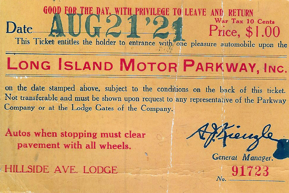
August 21, 1924
Good for the day, with privilege to leave & return - $1.00
Issued by Hillside Avenue Lodge
image courtesy of
Howard
Kroplick / Vanderbilt
Cup Races website |
|
|
 |
 |
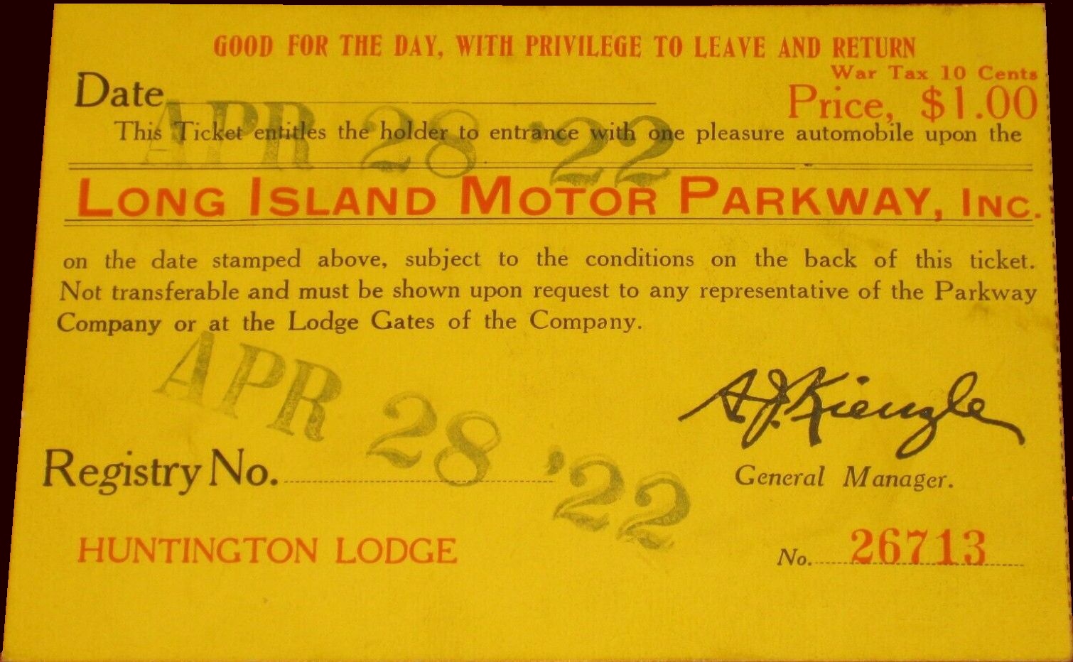
April
28, 1922
Good for the day, with privilege to leave & return - $1.00
Issued by Huntington Lodge
image courtesy of
eBay
auctions |
|
|
 |
 |
June
8, 1924
Good for the day, with privilege to leave & return - $1.00
Issued by Ronkonkoma Lodge
image courtesy of
Howard
Kroplick / Vanderbilt
Cup Races website |
Jones Beach State Parkway Authority
Long Island State Parkway Commission
- Southern State Parkway
- Meadowbrook Parkway
- Wantagh State Parkway
- Lido Beach Loop Causeway "Loop Parkway"
.
.
The Long Island State Parkway network began in 1927 with the
construction of the Southern State and Wantagh Parkways.
Not all
of Long Island's parkways had tolls, and in keeping with the topic of this website, I
will only address those parkways that tolls were collected upon.
And frankly, the tolls to access Jones Beach could in fact be
considered a park / beach access fee as opposed to a conventional road
toll.
As described in the Patterson v. Carey decision of the Court of Appeals 41 N.Y.2d 714 (1977):
"The Jones Beach State Parkway Authority was created in 1933 for the
purpose of financing and constructing the Jones Beach State Parkway and
other approaches to Jones Beach State Park. The necessary capital was
obtained by the authority through the sale of revenue bonds to the
Federal Reconstruction Finance Corporation. The authority is a public
benefit corporation (see General Construction Law, § 66, subd 4) with a
membership identical to that of the Long Island State Park Commission."
|
|
In March 1933, the Jones Beach State Parkway Authority was issued
a $5,050,000 loan by the Reconstruction Finance Corporation.
A toll was planned for both the Meadowbrook Causeway and the Lido Beach
Loop Causeway to assist in repaying this loan.
Tollbooths
were constructed, and a 25 cent toll was instituted on both
highways on January 2, 1935. It is reported that 300 people used
these highways on this day.
A 50 cent parking fee on Jones Beach was
reduced to 25 cents in order to keep the total charged to motorists at
50 cents. It was anticipated that the loan would be repaid in 25 years.
As we all know, Robert Moses' plan for Long Island was to build
an interconnecting network of parkways to access both north and south
shores, and allow city residents to access various parks and the
beaches along the south shore.
Year after year, from 1927 through the
1960's, another parkway was built or extended.
All
of the parkways built under the Moses Plan were limited access, and
intentionally designed for passenger automobiles only; with grades,
curves and to the point that almost all constructed overpasses was
intentionally built with low clearance as to prevent truck traffic from
ever using the parkways without major reconstruction.
The
Southern
State Parkway, which runs relatively close to the south shore of Long Island; was at
that time of opening in 1927; the main east-west limited access parkway
(passenger automobiles only) from the Queens border to West Islip where
it becomes the Heckscher State Parkway.
Since its first opening, a 10 cent toll
was instituted, with the the toll barrier at Valley Stream between Exits 13 and 14.
|
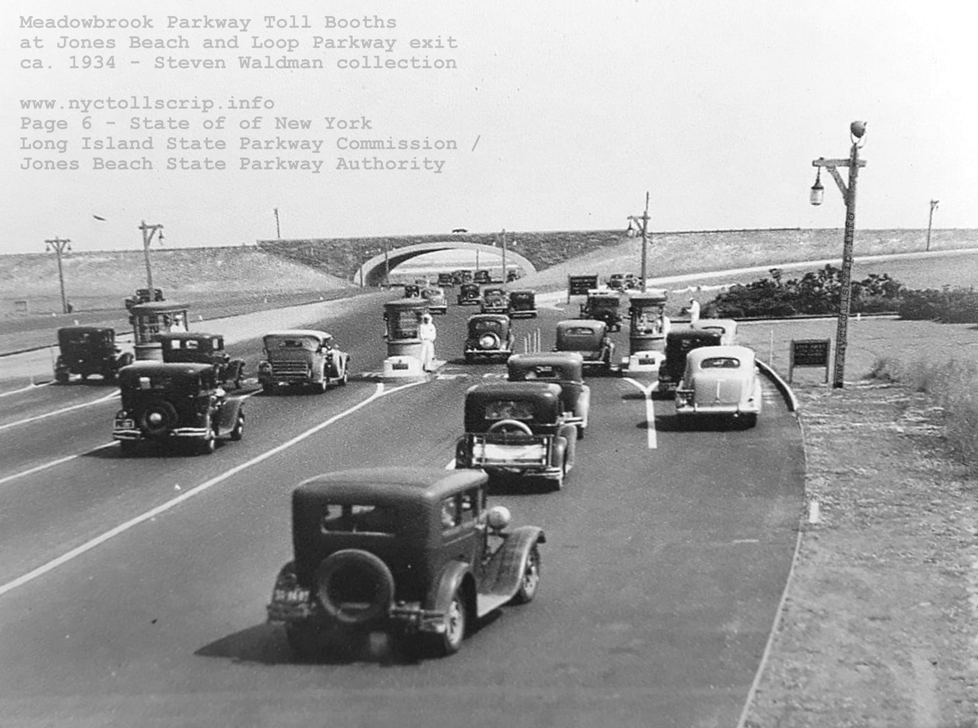
Meadowbrook State Parkway Toll Booths - ca. 1934
at Jones Beach / Loop Parkway exit
collection of Steven Waldman
|
In 1953, the
JBSPA expanded its provenance and undertook reconstruction of the
Southern State Parkway.
While the Meadowbrook and Wantagh State Parkways led to Jones
Beach, you could drive almost the entire stretch from the north
shore of Long Island to the south shore without paying a toll, until
actually arriving at Jones Beach. To access Jones Beach, south of the
toll barriers, you paid a toll. Whether we wish to consider this toll a
state park / beach access fee or an actual road toll remains to be
hashed out. The Loop Parkway was actually a short connector causeway
connecting Long Beach with Jones Beach and history has recorded this
was a one lane toll booth to continue to Jones Beach. If you chose to
go north on the Meadowlands, it was free..
But, being that you can drive the remainder of the parkways,
without actually visiting the beach is why is they are included here. Only the Southern State
Parkway collected a toll to use the parkway, in either direction,
and in consideration for the privilege of using said parkway for
entering or exiting the New York City borough of Queens with Nassau
County.
Forty years later, the tolls were still in place and on January 1, 1975, and with only two weeks notice; the
JBSPA raised the toll on the Southern State Parkway from 10 cents to
25 cents, while the Loop Parkway retained its 25 cent toll.
This change faced immediate criticism from the New York State
Legislature as well as vociferous protests from residents; and the
Democratic members of the Legislature tried to rescind the toll hike.
Robert Moses still retained a great deal of influence however; as
in an agreement he had entered with the State of New York, he ensured
that only his authority could choose when to raise and rollback tolls.
However, this agreement never prohibited the State of New York
from buying out the bonds the JBSPA had issued, and thus the State took
over the roads maintained by the Jones Beach Parkway Authority by purchasing those bonds.
Governor Hugh Carey
had yet to craft the $12 billion state budget for 1978, and he proposed
a deal to forgo the $24 million debt that the JBSPA had
accumulated as well as eliminate the toll on the Loop Parkway and Southern State Parkway by taking over
the parkways.
After the governor and his departments decided that the state
could do without the annual $3.8 million dollars that the 25 cent
toll would produce, (much as they had with the East Hudson Parkway Authority) a bill permitting the State of New York to take
over the Jone Beach State Parkway Authority roads was passed in legislature on March 31, 1978.
Naturally this ignited a back and forth of legal filings and
appearance before the court. But in the end, the State of New York
prevailed and so; with the goal for the abolishment of the tolls, purchased the Jones Beach State Parkway
Authority, and operation of the parkways was assigned to the New York
State Department of Transportation.
Finally, on
July 1, 1978 and just one year after the NYSDOT took over, the tollbooths
were removed and the abolition of tolls collected on the Southern State
Parkway came after a twenty year battle by locals for their removal.
The toll barrier stood for only a little while in Valley Stream
before it was razed. A New York State Police barracks as a rest area
were built to the sides of the parkway.
Ironically,
the ticket booths on the Meadowbrook and Wantagh State Parkways for
Jones Beach remained unused, but were not razed until April 2019.
 |
 |
 |
 |
 |
 |
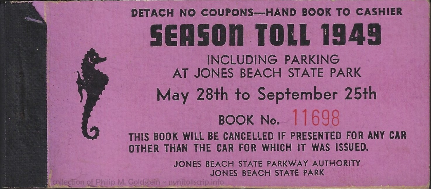
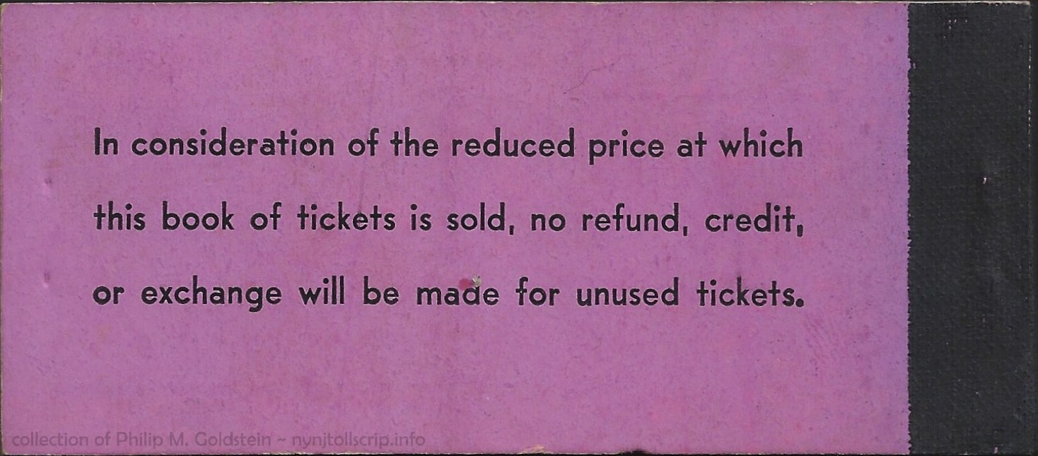
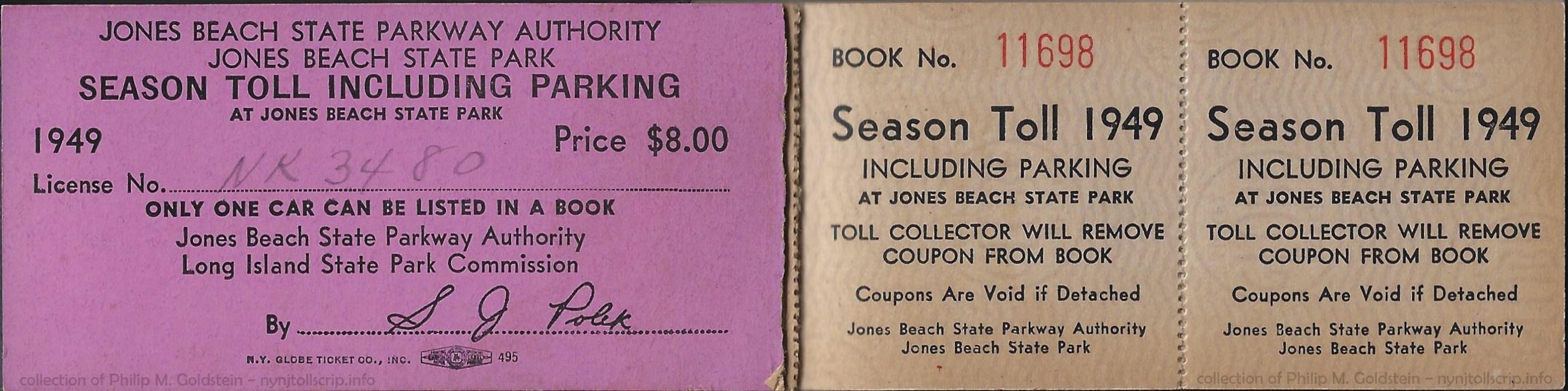
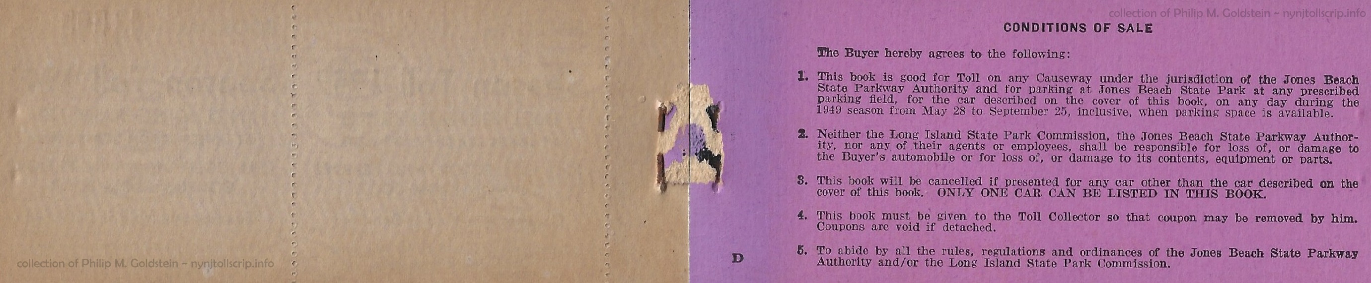
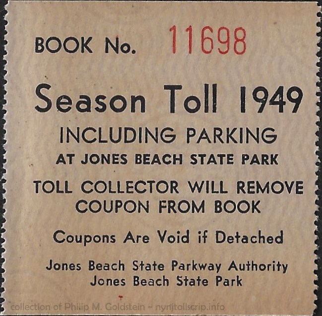
JBSPA Season Toll Book - 1949
May 28th to September 25th
book size: 2" x 4 1/2"
collection of Philip M. Goldstein
12 February 2024 |
.
. |
|
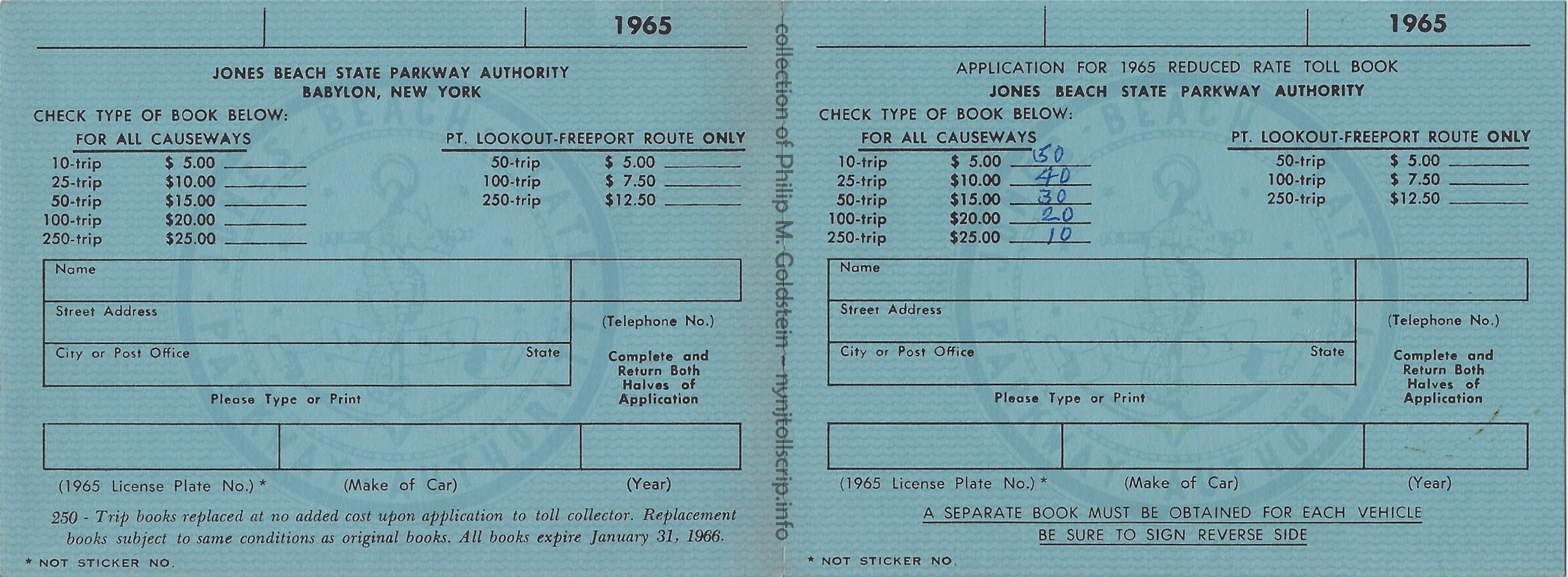
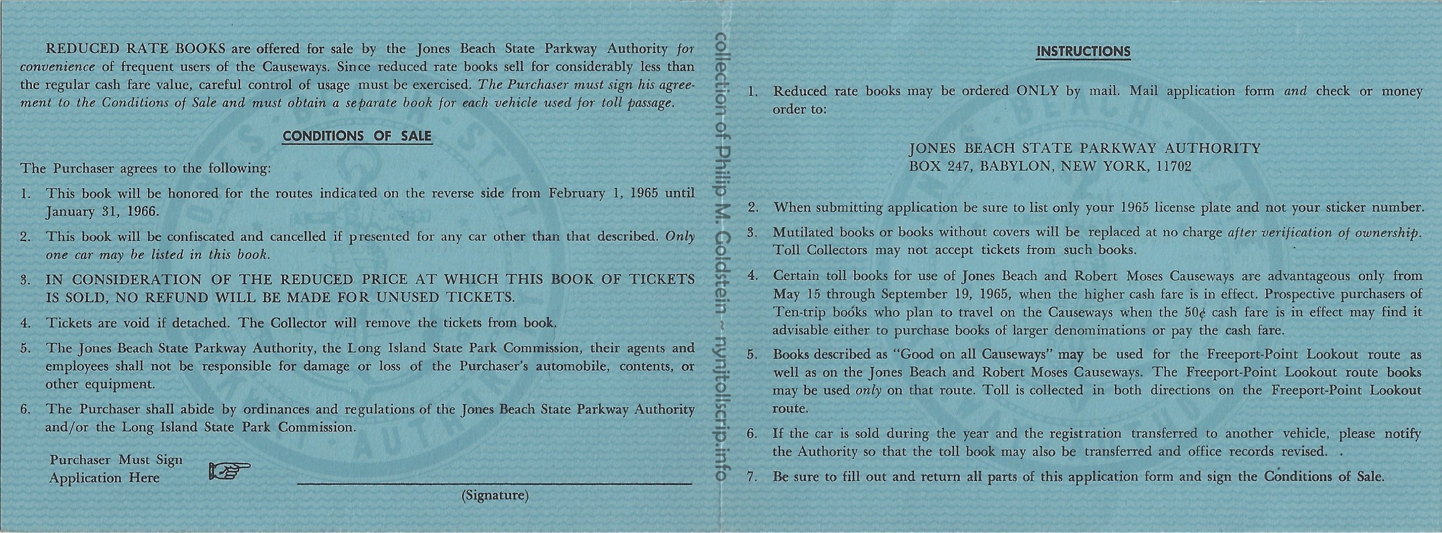
JBSPA Application for 1965 Reduced Rate Toll Books - outside above
book size: 4 11/16" x 3 7/16" folded
collection of Philip M. Goldstein
15 December 2023
JBSPA Application for 1965 Reduced Rate Toll Books - inside below
|
|
.
. |
|
 ........ ........ |
 |
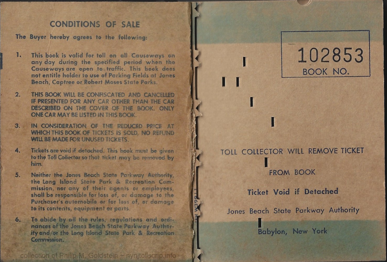 |
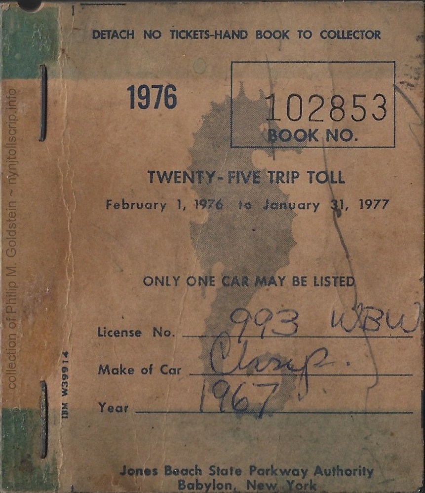
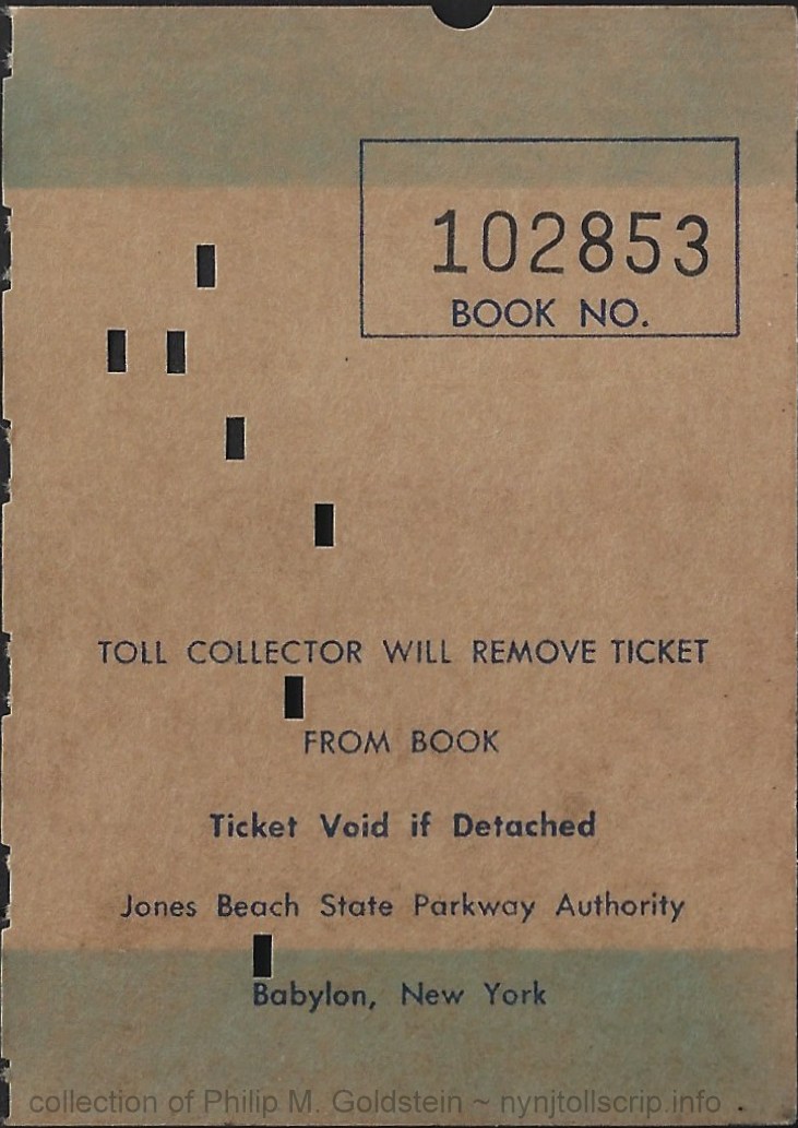
JBSPA 25 trip toll book (value not known) - February 1, 1976 - January 31, 1977 (1 year)
book size: 7 3/8" w/ 1/2" selvage x 3 1/4",
cover: IBM W39914 - tickets: IBM W39911
collection of Philip M. Goldstein
13 May 2023
|
.
. |
|
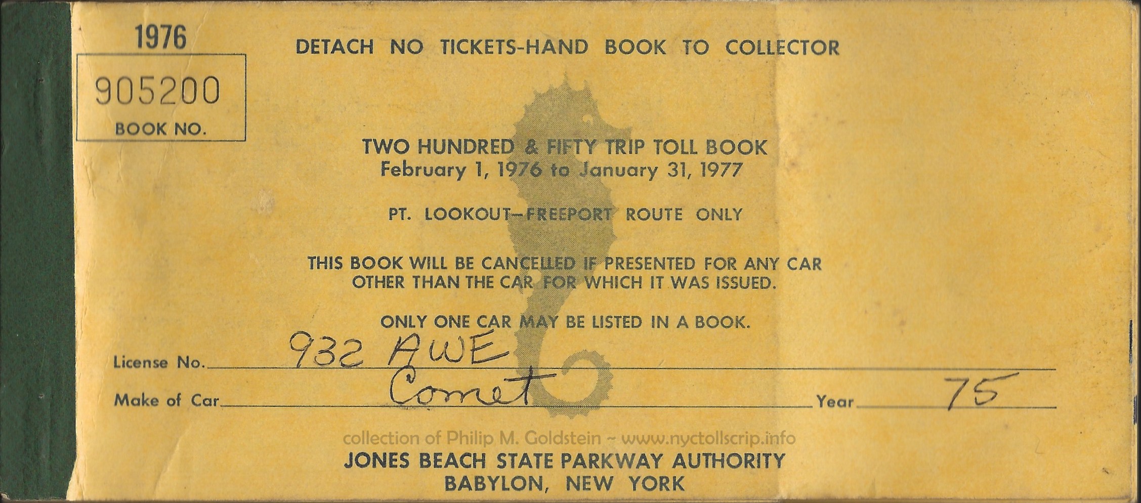 |
JBSPA 250 trip toll book (value not known) - February 1, 1976 - January 31, 1977 (1 year)
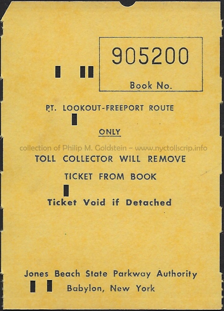
Point Lookout - Freeport Route Only (Loop Parkway & Meadowbrook Parkways Only)
front cover
book size: 7 3/8" x 3 1/4"
collection of Philip M. Goldstein
05 February 2021 |
| . |
|
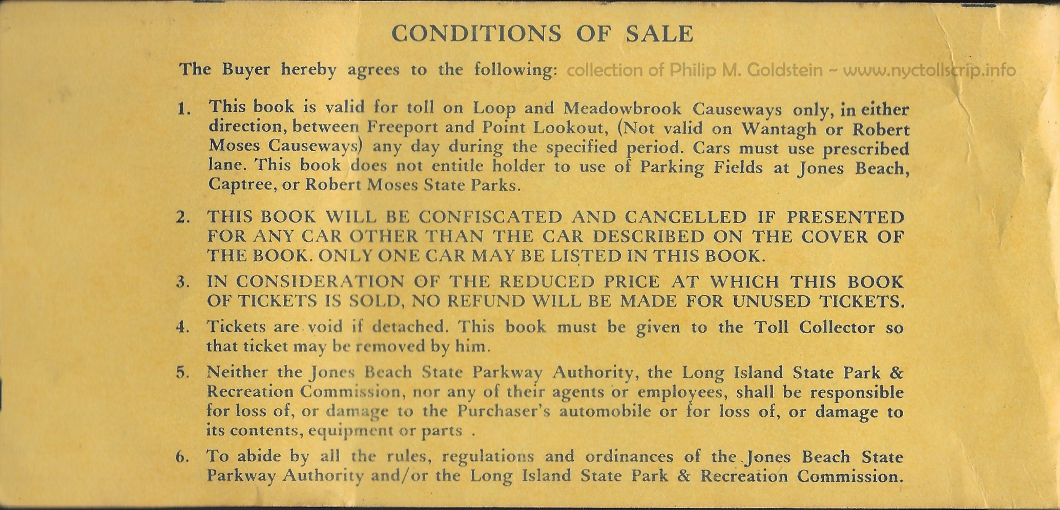 |
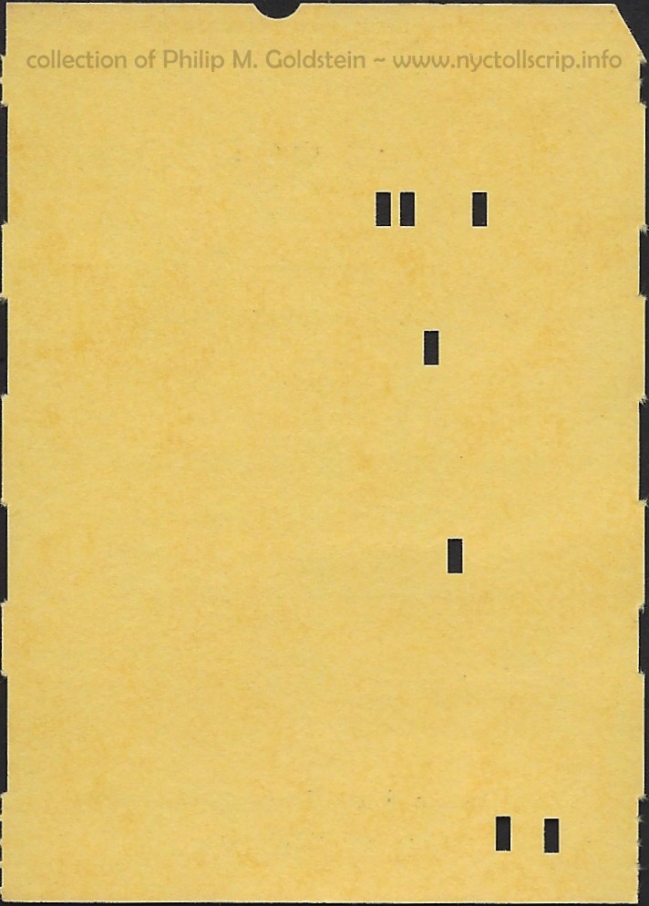
JBSPA 250 trip toll book (value not known) - February 1, 1976 - January 31, 1977 (1 year)
Point Lookout - Freeport Route Only (Loop Parkway & Meadowbrook Parkways Only)
inside front cover
collection of Philip M. Goldstein
05 February 2021 |
| . |
|
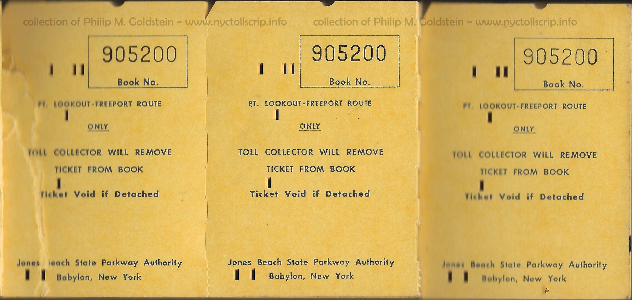 |
JBSPA 250 trip toll book (value not known) - February 1, 1976 - January 31, 1977 (1 year)
Point Lookout - Freeport Route Only (Loop Parkway & Meadowbrook Parkways Only)
ticket pages (three per page, perfed on sides)
collection of Philip M. Goldstein
05 February 2021 |
| . |
|
 |
JBSPA 250 trip toll book (value not known) - February 1, 1976 - January 31, 1977 (1 year)
Point Lookout - Freeport Route Only (Loop Parkway & Meadowbrook Parkways Only)
back cover
collection of Philip M. Goldstein
05 February 2021 |
| . |
|
  |
JBSPA 250 trip toll book ticket front & back - February 1, 1976 - January 31, 1977 (1 year)
Point Lookout - Freeport Route Only (Loop Parkway & Meadowbrook Parkways Only)
2 5/16" W x 3 1/4" H - IBM format
collection of Philip M. Goldstein
05 February 2021 |
.
. |
|
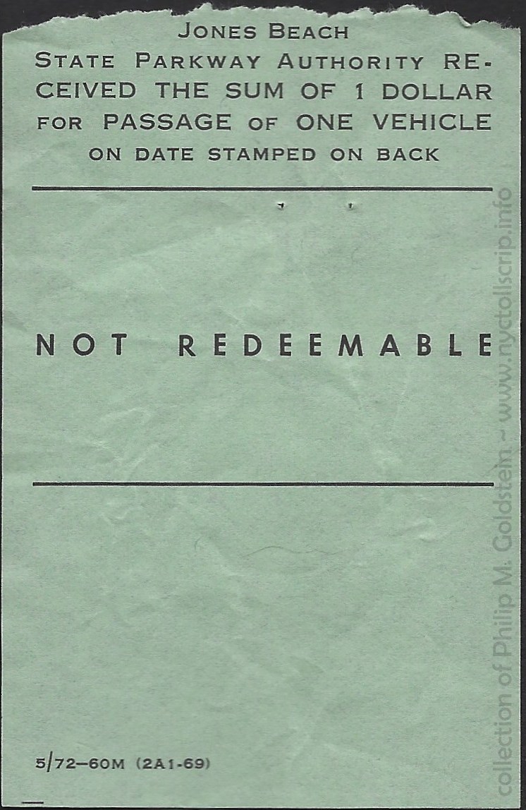 |
JBSPA toll receipt - $1.00 - not dated - ca. 1972
collection of Philip M. Goldstein |
| . |
|
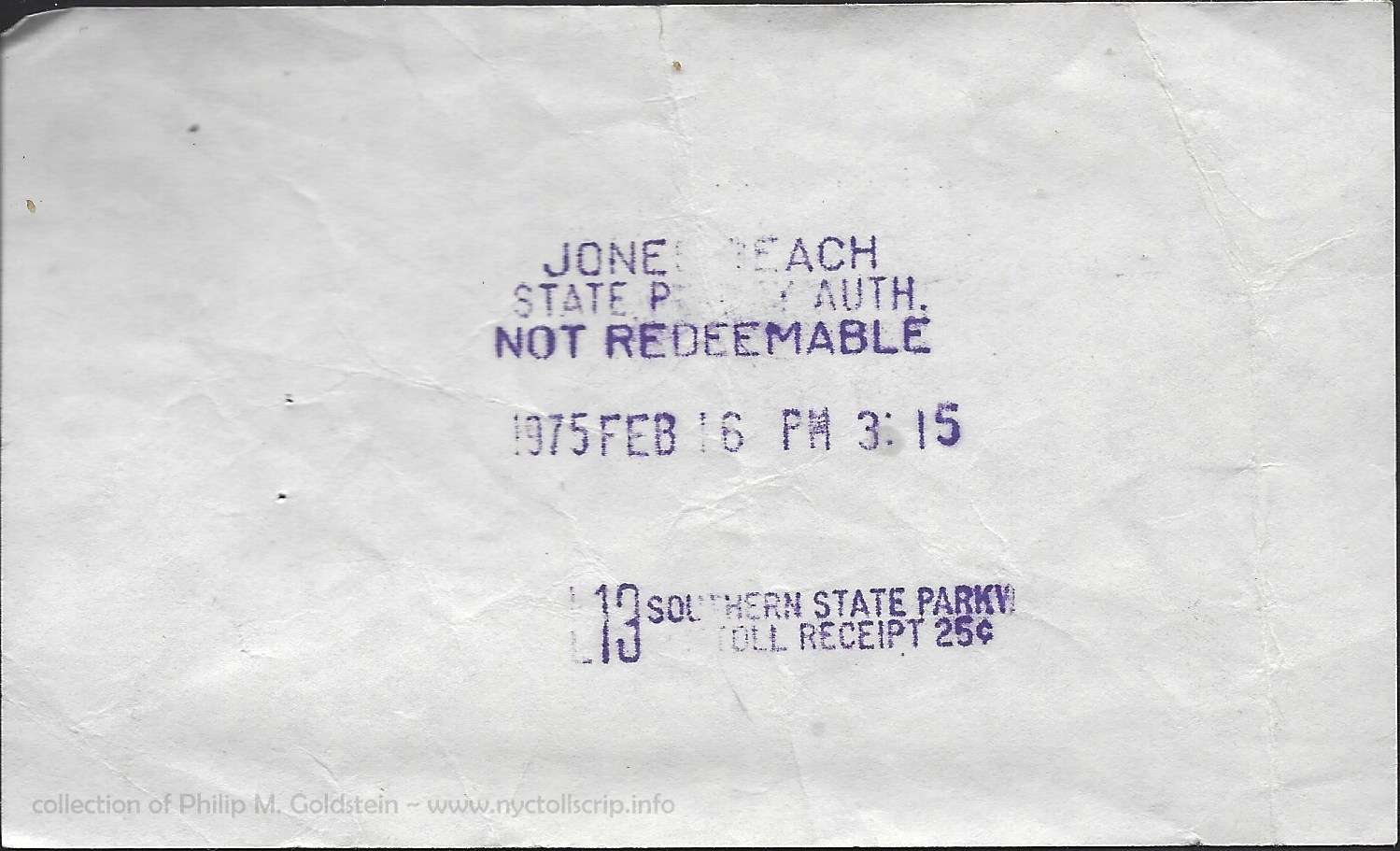 |
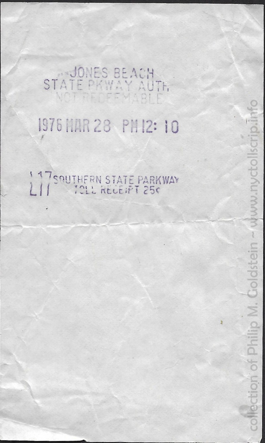
JBSPA - Southern State Parkway toll receipt - .25 - 2/16/1975
horizontal
collection of Philip M. Goldstein |
| . |
|
 |
JBSPA - Southern State Parkway toll receipt - .25 - 3/28/1976
vertical
collection of Philip M. Goldstein |
| . |
|
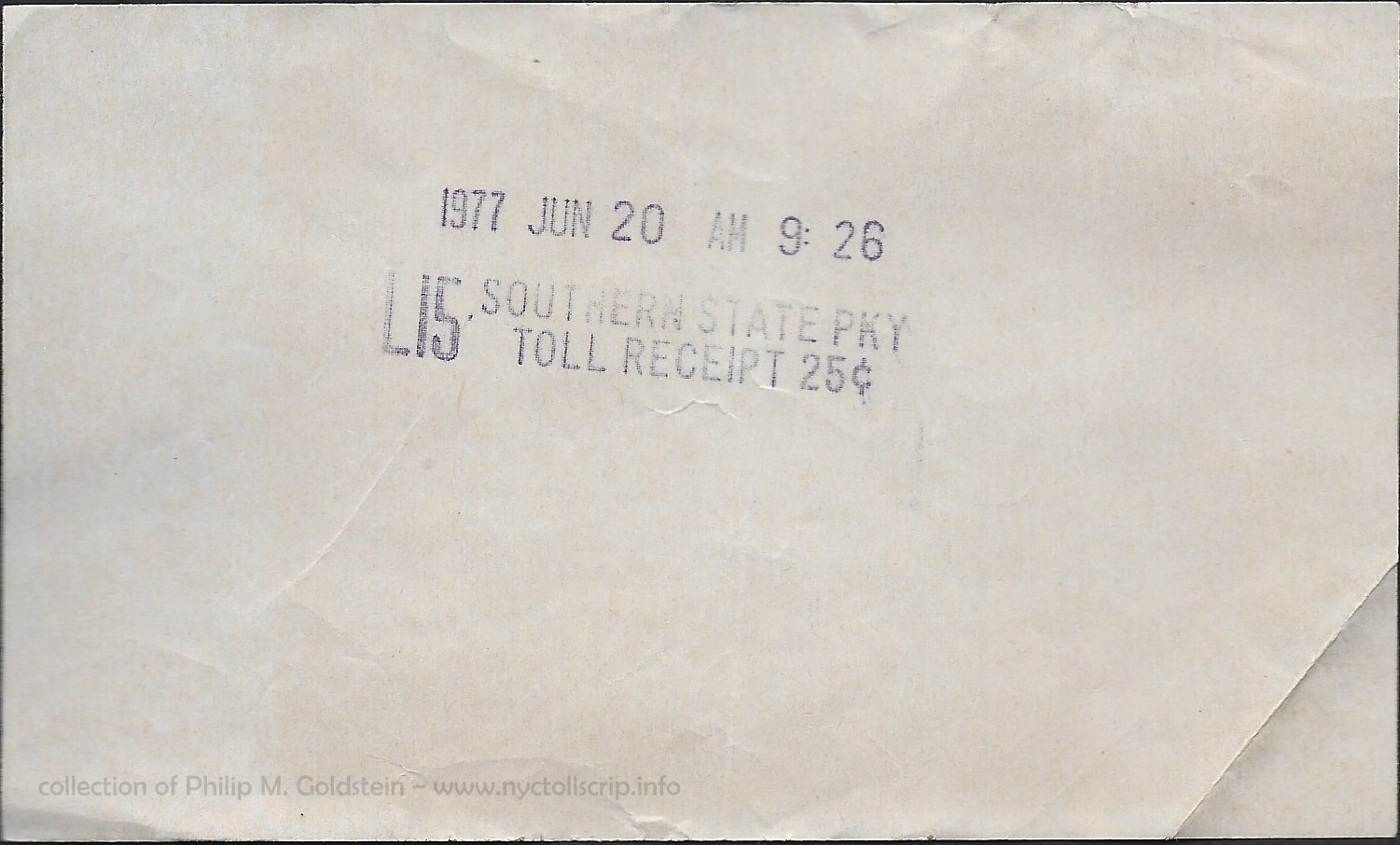 |
NYSDOT - Southern State Parkway toll receipt - .25 - 6/20/1977
(note Jones Beach State Parkway Authority title removed)
horizontal
collection of Philip M. Goldstein |

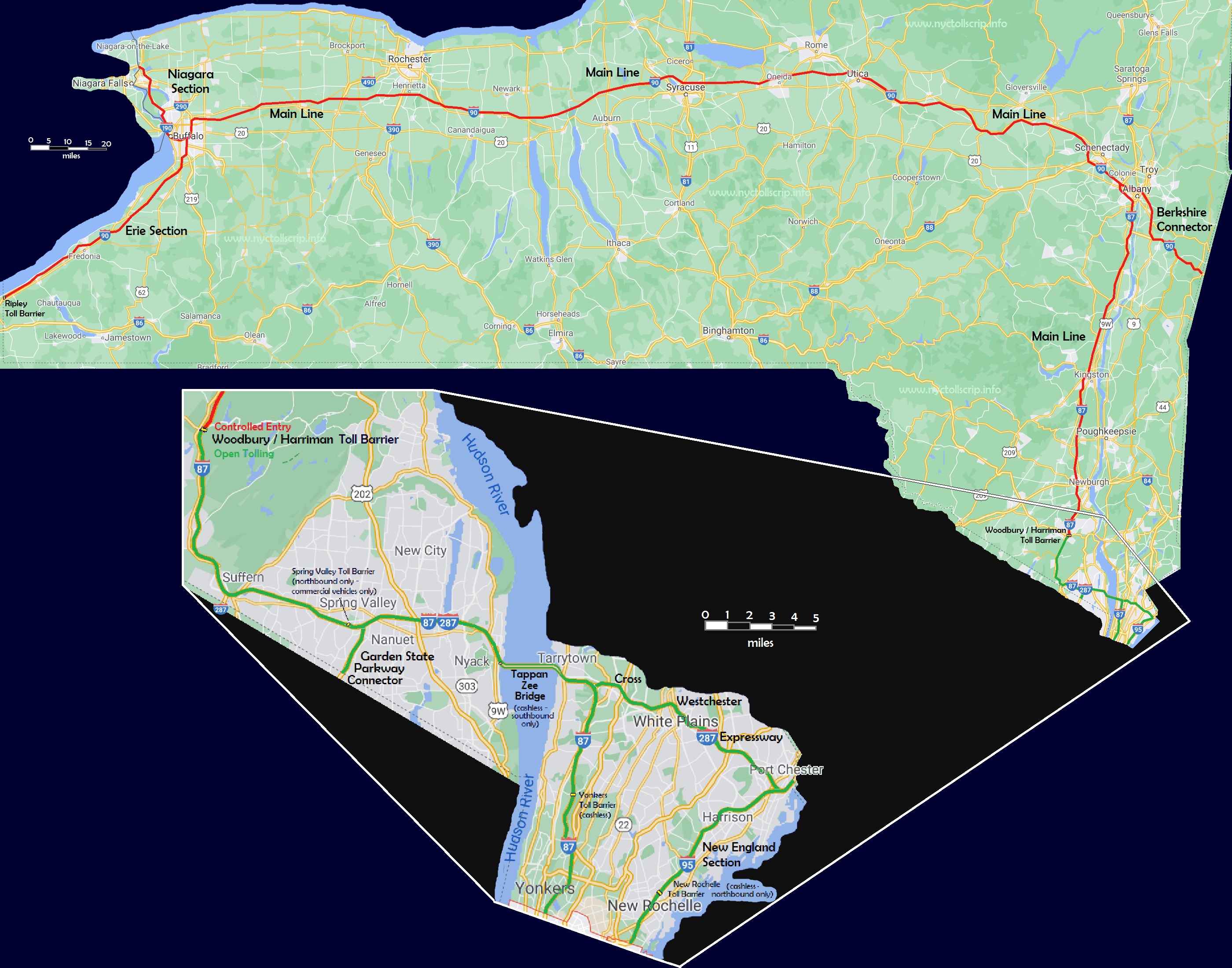
The map below reflects the dual tolling structure of the New York State Thruway prior to November 13, 2020; on which date the entire Thruway transitioned to the open tolling method.
The
"main drag" of New York State is undoubtedly the New York State
Thruway, also known as Interstate 87 from Yonkers to Albany and
Interstate 90
from Albany to Buffalo. This well maintained thoroughfare connects most
of New York's major cities: New
York City, Newburgh, Kingston, Albany, Schenectady, Utica, Syracuse,
Rochester and Buffalo. This section is known as the "Main Line".
The first section of the Thruway to open to traffic was a 115
mile segment from Lowell (a little south of Rome and west of Utica) to
Rochester which opened on June 24, 1954. By December 23, 1960, all 559
miles of the original Thruway system were open.
Spurs also connect the Thruway to
- the "Berkshire Section" / I-90 from Albany to the Massachusetts state line;
- the "New England Section" / I-95 from New York City to the Connecticut state line;
- the "Niagara Section" / I-190 from Buffalo to Niagara Falls;
- the "Erie Section" / I-90 Buffalo to the Pennsylvania state line at Ripley, NY;
- a connection to New Jersey's Garden State Parkway at Spring Valley,
and
- the
Cross Westchester Expressway (I-287) which connects Tarrytown and
the Tappan Zee Bridge to Connecticut state line and I-95 at Port
Chester.
The Cross Westchester Expressway and a portion of Interstate 84 were added to the Thruway system in 1991. All told, the New York State Thruway now encompasses 570
miles. It also carries the name Governor Thomas E. Dewey Thruway; after
the renowned prosecutor, Manhattan District Attorney, and Forty-seventh
Governor of New York State.
.
.
Open and Closed Tolling Structure
A unique facet of the New York State Thruway, is that it once utilized both open and closed tolling methods:
Open tolling is defined as the usage of fixed barriers at
strategically placed locations, but a motorist may enter and leave the
road through ungated entries and exits. This allows some motorists to
use the road without actually paying a toll, if they enter after and
exit before the fixed barriers.
Closed tolling
requires the issuance of a entry ticket upon accessing
the highway; and upon exiting, a predetermined fare based on
mileage is collected. In the era of E-ZPass usage, the E-ZPass logged
your entry and exit, and deducted the appropriate amount from the
existing balance on your account.
However, as of
November 13, 2020; The New York State Thruway transitioned to a
completely open tolling structure with cash payment replaced entirely
by electronic tolling, (that being both E-ZPass and
Tolls-By-Mail).
.
.
Open Tolling Portion
The southern
portion of the Thruway which begins / ends at the county line
separating the Bronx (City of New York) / and Yonkers (Westchester
County) and
Woodbury - Harriman Toll Barrier (Orange County) is limited access, but
this section is "open tolling" with fixed rate
toll barriers at Yonkers and Spring
Valley on the "main line", and New Rochelle on the New England Section,
therefore it is possible to use portions of the Thruway without paying
any tolls on this segment and in an freeway fashion.
Continuing north after the Yonkers toll, you encounter the
Tappan Zee Bridge crossing over the Hudson River. While originally there was
a toll for northbound / westbound traffic, this was abolished in
1970 and the toll doubled for southbound / eastbound traffic.
After
crossing the Hudson River, the next toll barrier encountered was Spring
Valley, at around Exit 14. In 1974, exact change
lanes for passenger cars only were added to the barrier at Spring Valley to speed up
toll payment process. In 1997, passenger cars were no longer require to
pay the toll at the Spring Valley Barrier, however all other vehicle
classes still have to pay their respective tolls.
.
.
Closed Tolling Portion - (abolished November 13, 2020)
Continuing north to Harriman, you encounter the
Woodbury - Harriman Toll
Barrier. It is here you enter the "closed" ticketed portion of the
Thruway. No toll is collected northbound at this point, but a
toll collector issued you an entry ticket based on your vehicle class.
Later, passenger cars could use "car only - no trailer" lanes and a
machine spat out your ticket. However, all commercial vehicles regardless of
axle or height needed to stop at one of several manned lanes and receive an entry
ticket based on their vehicle class
From this point at Woodbury - Harriman / Exit 16, (or traveling
east from Ripley, NY) your toll is calculated
for the type of vehicle you were driving and the exit in which you left
the Thruway at. To this day, long after I have moved out of New York
State and long after the tolls have been raised; I remember the toll
amount from Woodbury to Kingston - Exit 19: $1.90. Two singles to the
collectors at Kingston and a dime change returned to me. That was until
I enrolled in E-ZPass!
As announced on April 17, 1954; the toll schedule adopted for use
on the closed tolling (entry ticket) portion of the Thruway (Woodbury /
Harriman,
NY to Ripley, NY - PA border) was as follows. Subsequent raises in the
toll schedule as mentioned in New York Times digital archives follow.
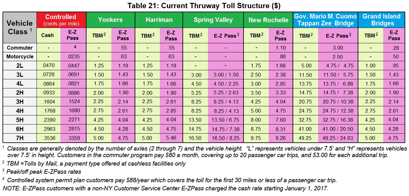
New York State Thruway Authority - Historical Toll Schedule
April 17, 1954 |
| Passenger Cars, Taxis, Ambulances or Hearse |
.0125 cents per mile |
| Buses, 2 or 3 axle |
.0350 cents per mile |
| Passenger Car with Trailer; Light Truck with Trailer; 3 Axle Truck, |
.0175 |
| Light Trucks; Two Axle Tractors without Trailer |
.0125 cents per mile |
| Single Unit Trucks - 2 axles, 6 tires |
.02 cents per mile |
| Single Unit Trucks - 3 axles |
.035 cents per miles |
| 2 axle Trucks with 1 axle Trailer |
.045 cents per mile |
| Tractor Trailer, 4 or more axles |
.05 cents per miles |
| . |
|
| January 1, 1959 |
25% increase in passenger cars toll,
Yonkers Section
rose .10 cents to .25 cents for passenger cars.
Spring Valley toll from .30 cents to .50 cents, commercial vehicles: from .20 & .40 cents rose to .30 & .60 cents.
per mile for passenger car rose from .0125 to .0156 cents per mile.
Tappan Zee Bridge to Albany $1.50 to $1.95.
Tappan Zee Bridge to Buffalo $5.00 to $6.40.
Tappan Zee Bridge to Ripley rose $1.60 from $5.85 to $$7.45.
Annual Permit rose from $20 to $40. |
| . |
|
| June 27, 1959 |
Empty truck cut rate was abolished. This was a discounted .035 toll per
mile as opposed to
.045 and .05 cent charged for loaded trucks. |
| . |
|
| January 1, 1970 |
18.5% increase for commercial vehicles, which had not changed since 1954 inception.
.035 cents per mile to .10 cents per mile
Annual permit remains at $40. |
| . |
|
| March 22, 1980 |
Passenger tolls raised 25% - per mile rose .019 to .024 cents per mile
Bus tolls raised 15%
Commercial tolls raised 30%
Albany to Buffalo was $5.30, now $6.55
Albany to Suffern was $2.30, now $2.85 |
| . |
|
| April 17, 1988 |
Passenger Car tolls raised 30%, passenger cars from .024 to .031 per mile
Buffalo to NYC now $10.05 to 12.55
Commercial Vehicle tolls raised 40%
|
|
|
|
| May 16, 2005 |
Passenger Cars raised 25%
Commercial Vehicles raised 35% |
|
Entry
tickets are stamped for entry, lane, time and date, number of axles or
vehicle class, the collector number / i.d. and an individual card number. Normally,
when you arrived at your destination exit, you must turn in your entry
card and the appropriate toll amount. If you actually lost the ticket
(by it blowing out the window or falling down into the the scuzzy worm hole under
everyones seat to magically reappear years later) or whether you
actually kept the ticket as a momento and claiming you "lost it", the motorist is
charged the highest toll shown, which can amount to hefty price
nowadays. As
such, the entry cards are more difficult to acquire and collect.
Another variety of ticket is the breakdown ticket which is
actually more of an exit ticket. As the entry tickets are stamped with
the time you entered the Thruway; you were alloted so much time to
exit. If your vehicle broke down while on the Thruway, your entry card
time "expired". Research reveals the Thruway had a regulation which
established a maximum time frame that a person could be within the
Thruway System upon receiving a toll ticket. If you exceeded that time,
you were then assessed an additional fee or fine. The 'breakdown
ticket' was used to waive this additional fee or fine in situations
where, due to mechanical problems, you ended up exceeding that time
limit. But you still had to turn in your entry ticket. I received mine
upon request from a friendly toll collector.
In my collection, I have the following booklet: New York State
Thruway - Toll Schedules and Traffic Rules and Regulations. While
undated, it is believed to be circa 1954. In it, we learn that
commutation tickets were indeed issued for the "Hudson River Bridge"
which we came to call the Tappan Zee Bridge; as well as the Grand
Island Bridges.
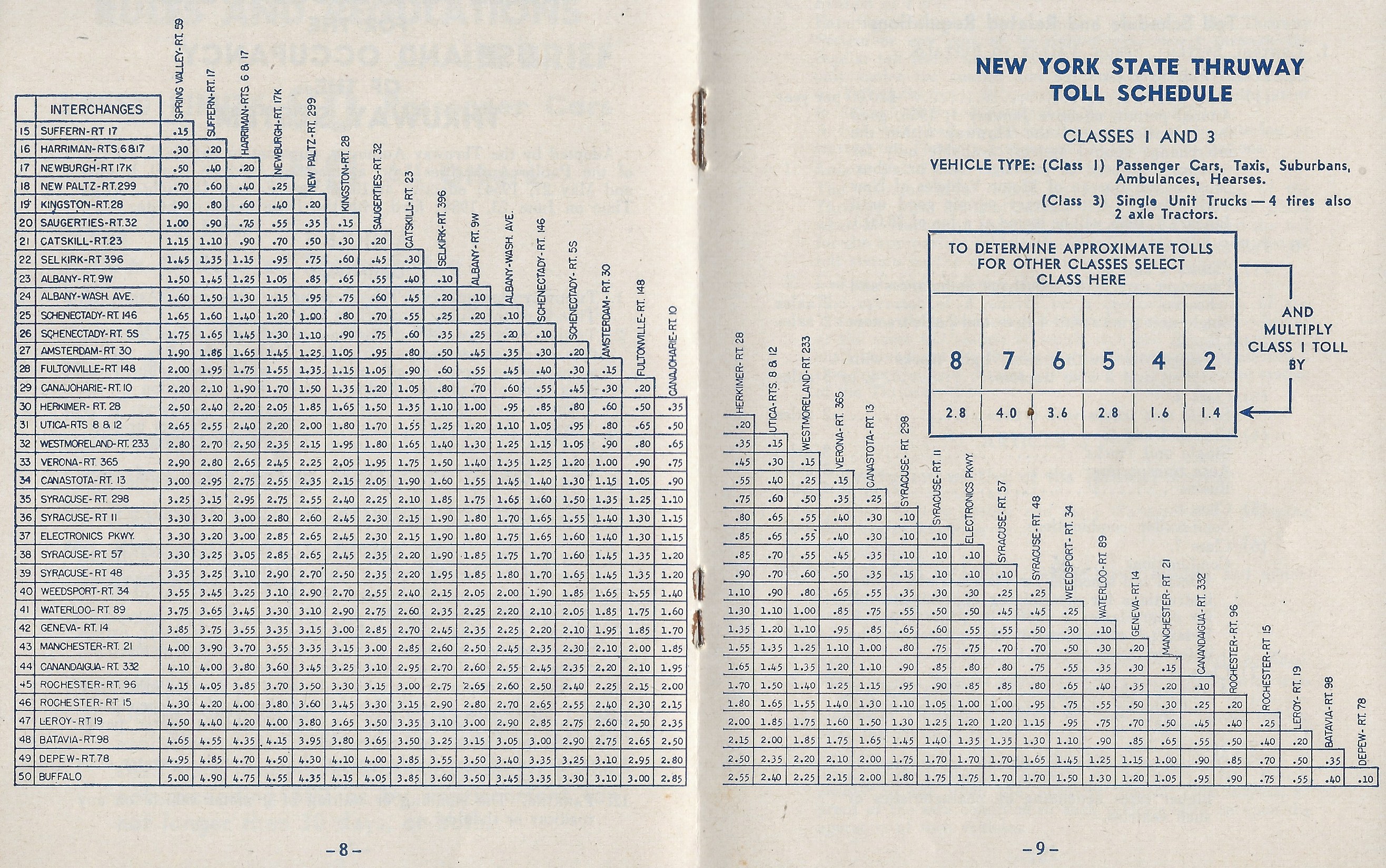
collection of Philip M. Goldstein
.
The New York State Thruway changed their method of toll structure
in 2009 (?) from a basic vehicle class structure to a structure that further
defined low (under 7' 6") or high (over 7' 6") vehicles. Meaning, a
passenger car of 2 axles (2L) pays a lower rate than say an extended
height delivery van of two axles (2H). A passenger car towing a low
open trailer (Class 4L) while a 2 axle box truck towing a box trailer
(Class 4H). Compounded with the height classification is the
number of axles.
This new toll schedule also
incorporated Peak and Off Peak tolls, of which the Off Peak tolls were
significantly discounted. This was to encourage travel during off peak
times.
As a result of the Coronavirus (SARS-CoVid 19) epidemic of 2020, toll
collection ceased beginning March 22 until June 3 to create appropriate
social distancing for cash collection. While cash transactions were
suspended, collectors were on duty at some locations to record license
plate numbers for billing purposes. Cash toll collection resumed at
11:59pm on June 3.
The current (as of 10/19/2020) toll structure is as follows:
.
. Currently,
proposals are under review for toll increases for the Gov. Mario M.
Cuomo - Tappan Zee Bridge as well at the reminder of the Thruway; of
which they may be reviewed here:
.
.
New York State
Thruway Authority Entry Tickets
|
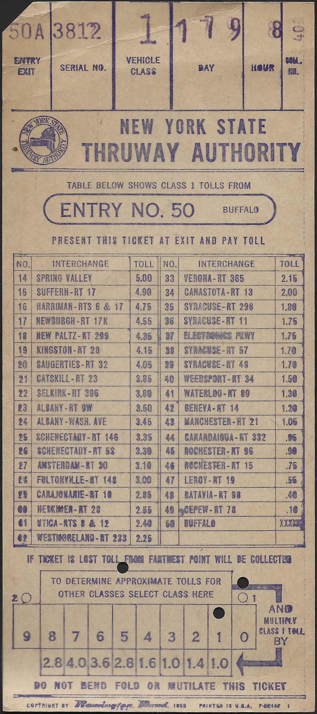 |
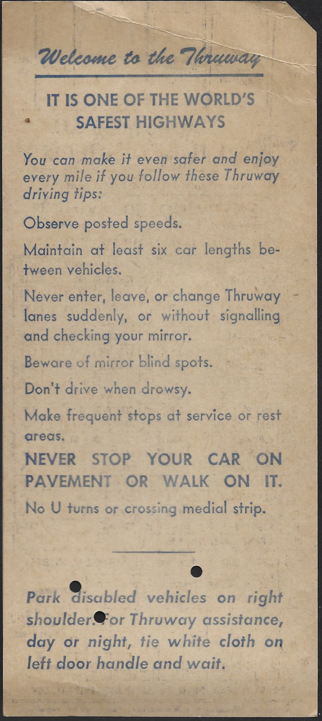 |
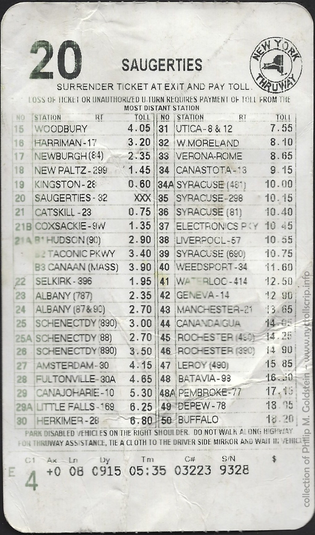 |
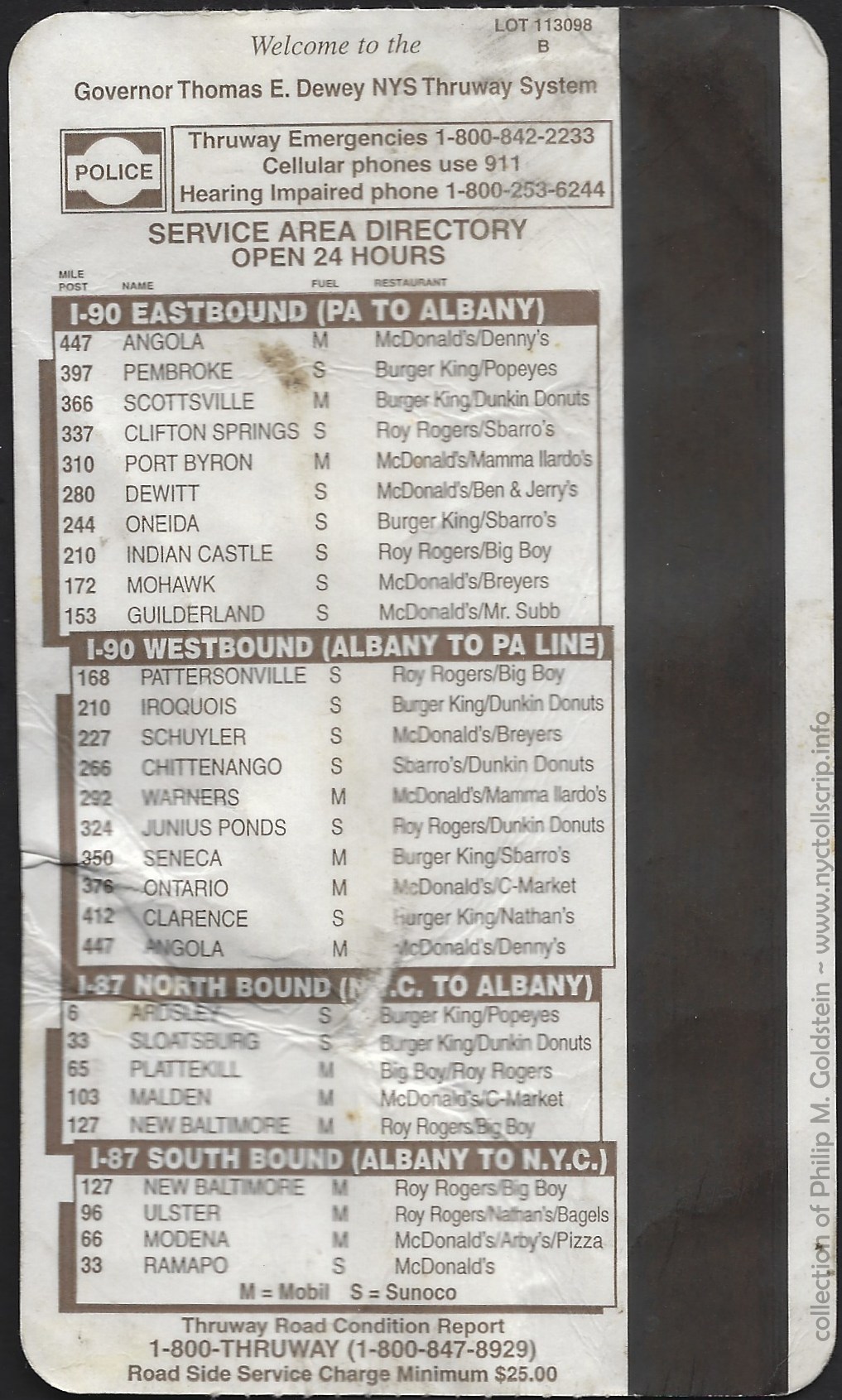 |
Entry
Ticket - circa 1953
Exit 50 Buffalo NY - Class 1 (passenger car)
Remington Rand - P22468 - 1?
collection of
Philip M. Goldstein
|
Entry
Ticket - introduced 1993, circa 1998 -
Exit 20 - Saugerties, NY - Class 4
collection of
Philip M. Goldstein
|
.
. |
|
|
|
|
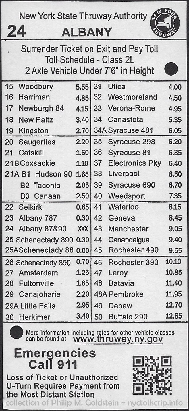 |
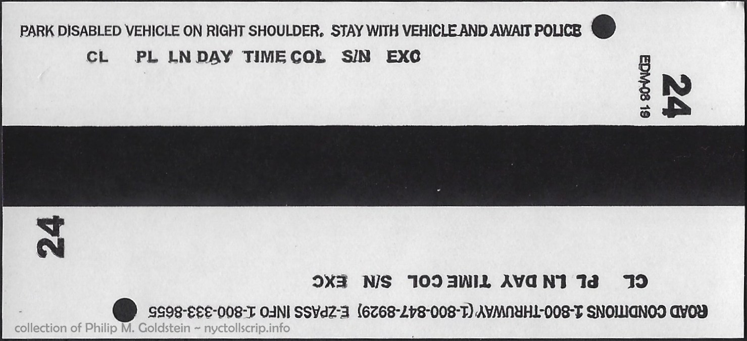 |
|
Entry
Ticket - 2019-2021 (final issue)
Exit 24 Albany - I87 and I90 - Class 2L (passenger car)
EDM-08 19
collection of
Philip M. Goldstein
with special thanks to Kristen Sammarco, Director of Toll Administration, NYSTA. |
|
.
. |
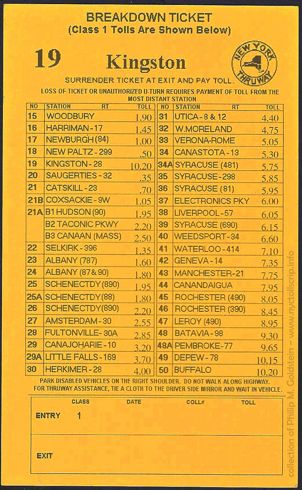 |
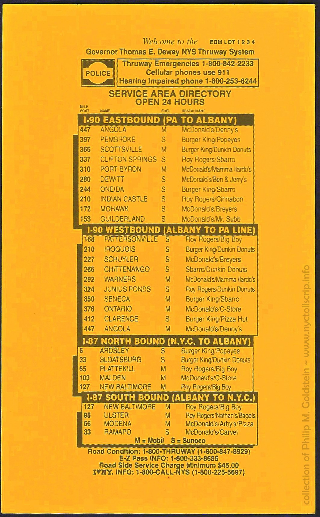 |
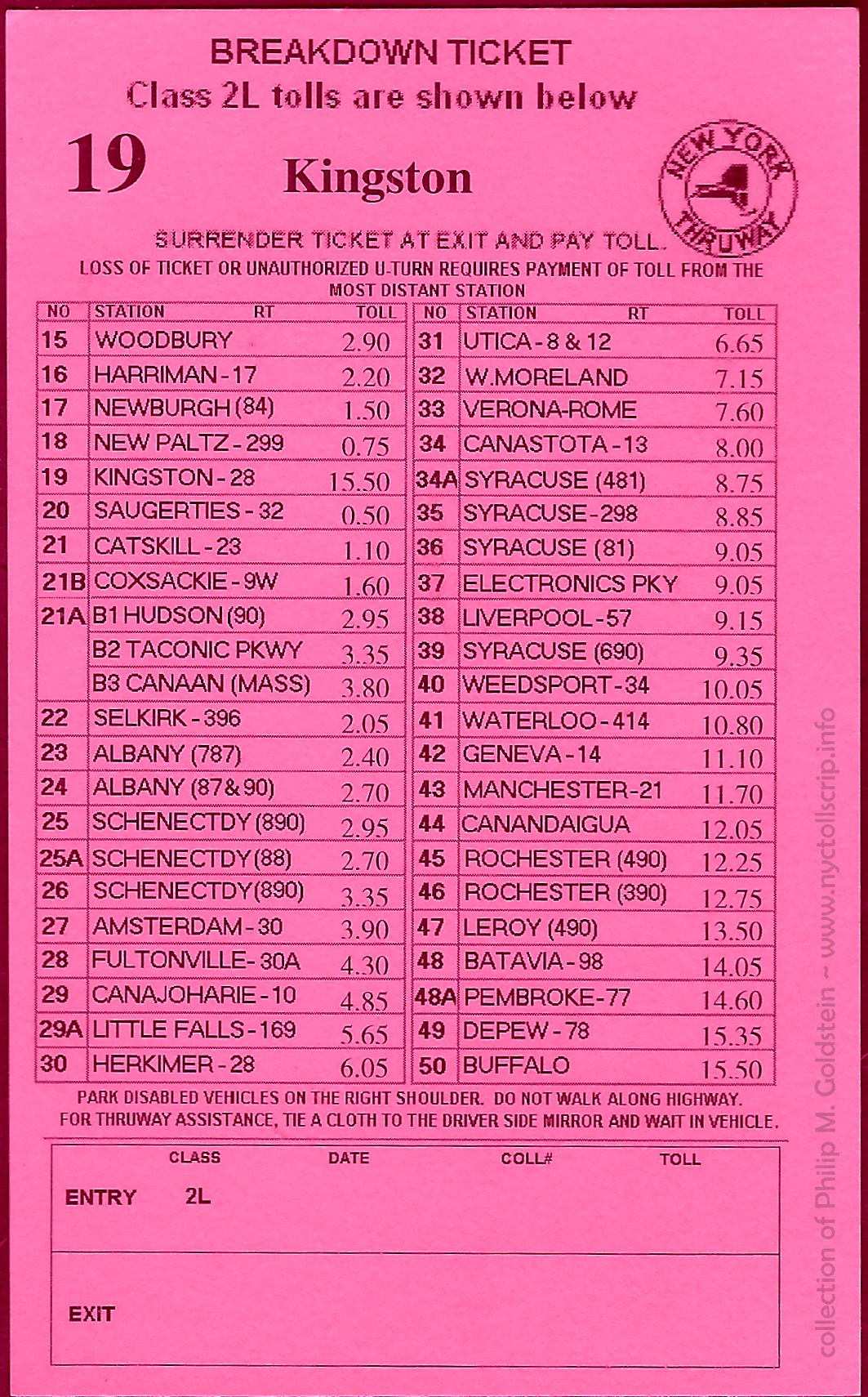 |
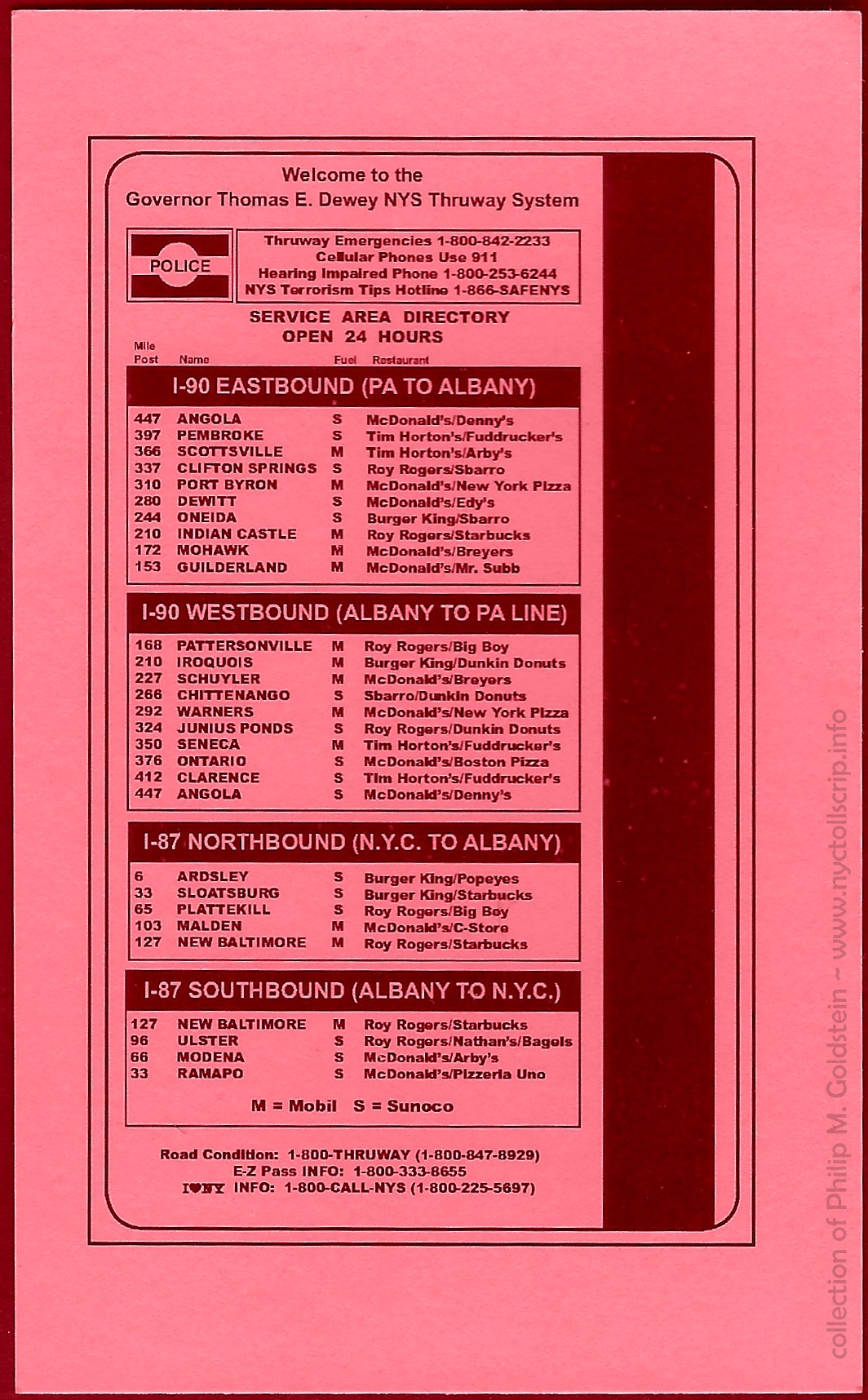 |
Breakdown
Ticket - 2008?
Exit 19 Kingston - Class 1 (passenger car - abolished, now class 2L)
collection of
Philip M. Goldstein
|
Breakdown
Ticket - 2018
Exit 19 Kingston - Class 2L (2 axle - low height [car or passenger pickup, van])
collection of
Philip M. Goldstein
|
Through this booklet above as well as continued research, we also know the Thruway offered
an annual
permit for unlimited use. These permits were in the form of embossed
tin
plates that were affixed below the regular state issued license plate.
The
purchase of this plate shown below, cost $20 in 1958; and allowed passenger cars, suburbans
and motorcycles unlimited use of the Thruway for one year.
In 1959, the cost of the annual pass was raised to $40. As the years marched on,
and with each subsequent toll hike, this unlimited rate increased. The last year
of this unlimited permit is understood to have been issued in 1988.
.
.
Tolls By Mail
A further advance
in toll collection began with the institution of Tolls By Mail. This system, which
uses pairs of high speed digital cameras mounted on a pair of overhead
gantries. Your vehicle, which trips a sensor,
activates the cameras (one frontwards facing for the back license plate
and one rearward facing for the front license plate);
which takes an image of the license plates of the vehicle going though
the barrier at highway speed. As some states only require a rear plate
to
be affixed to a vehicle, the rearward facing camera is deemed necessary
to ensure fairness for all highway users and to prohibit toll evaders.
The license plate is then cross
referenced with Department of Motor Vehicles records and a bill
generated and mailed to the vehicles' registration address. After the
system was developed and bugs worked out, it is obvious that the cost of a stamp is significantly lower than
the annual salary, cost of medical benefits and retirement plan of the toll
collectors.
No toll booths, no reduced speed, no congestion and no fumbling for change.
.
Two Toll Bridges
In addition to the tolling system, the New York Thruway operates
two bridges with tolls collected to pass over them, over and
above those tolls collected of the closed tolling system. Meaning,
there is an
additional toll to be paid for crossing these two spans, while all
other bridges within the New York State Thruway system are included in
the rate between entry and exit of the Thruway.
.
.
The first Tappan Zee Bridge
The first and the possibly most recognizable bridge on the New York State Thruway was/is the Tappan Zee Bridge.
The bridge with its approaches, is the longest bridge in New York State. The total length of the
bridge approached 16,013 feet or 3.0328 miles. The main span was a steel cantilever truss with truss support towers. The cantilever span
was 1,212 feet in length, and provided a maximum clearance of 138 feet over the water. To
each side of the main span was the approach ramps which were deck truss
bridges. The causeway leading up to the bridge was concrete &
steel.
Construction of the original Tappan Zee Bridge, commenced in 1952 and ran through 1955,
and opened to traffic December 14, 1955. Design and construction was
started during the Korean Conflict, and several engineering reports
stated that the span was built to the bare minimum with little to no
safety redundancies and with the original span having a 50 year service
life. Also
as a result of the war, construction incurred some delays due to
material shortages. Adding to this, was the increasing weight of
commercial vehicles over the decades the bridge was in service.
From 1955 through August 11, 1970, tolls were collected from both
directions to cross the Tappan Zee Bridge, with the toll barrier on the
Tarrytown side. The northbound / westbound toll was eliminated on
August 12, 1970, on the same date all the Port Authority of New York
and New Jersey crossings eliminated their westbound tolls as well. As
result, the toll was doubled from .50 cents to $1.00 for the southbound
/ eastbound traffic across the Tappan Zee Bridge.
As
constructed it had 3 lanes
northbound and 3 lanes southbound with a center island and steel
grating. This island was removed in 1986 and a
seventh "middle" lane was built and opened in July 1987. In 1993, a
vehicle called a Barrier Transfer Machine was purchased, which moves a
segmented concrete barrier from one side of the lane to the other.
Garages were constructed in the median on either side of the bridge to
house the BTM during non-use.
This
movable divider, also called a "zipper"; allowed the middle lane to be opened depending on the rush hour traffic
direction. For the Tappan Zee Bridge this means in the morning: four lanes southbound, and in the afternoon,
the barrier was slid to the other side of the lane allowing the evening
rush hour to utilize the fourth lane. By the next morning, the
barrier would be moved back to the other side of the lane for the
morning rush hour and with the process repeating itself for the Monday - Friday
commute.
A very interesting article with a video of this machine in operation can be read here: Tappan Zee Bridge Barrier Machine - LoHud / USA Today
In 1994, the Tappan Zee Bridge was accorded the honor of being named the "Malcolm Wilson Bridge", to honor
the 20th anniversary of his leaving the governor's office in
December 1974. In all my years of being a resident until moving
out of New York State in 2017, I do not recall this name ever being
used either in the news, in literature on the digital thruway signage
or even on the CB!
.
.
The second Tappan Zee Bridges
With the first Tappan Zee Bridge approaching the end of its
service life, discussion of the replacement commenced in the late
1990's. No matter how you looked at it, the bridge was way past its service life by 2005. After
the typical feasibility studies and
cost analyses, community feedback and wrangling; and sticker shock over the
cost of construction; a pair of cable stayed
concrete & steel spans were
designed and approved just to the north of the old span.
With construction commencing in 2013, and completion 4 years
later, the new Tappan Zee Bridges became one of the widest cable-stayed
bridges in the world, having a combined width across both decks of 183
feet. Some components of the bridge were pre-assembled on barges at
several work yards along the Hudson River and then floated
to the construction location, where they were then hoisted into place.
The design and construction
methods used are said to allow the bridge to last at least 100 years.
The bridge is actually comprised of two spans and two approach
causeways: each carrying four lanes and two full width breakdown lanes
on each side of the roadway (for a total of six 12 foot wide lanes),
and in each direction.
The first span to open to traffic was the northern span (the
present westbound/northbound flow of traffic) and opened on August 26,
2017. This span would be used bi-directionally (four lanes in each
direction - no breakdown or shoulder lanes) until the second span
was ready for service. This took place on September 11, 2018, and this
was designated for eastbound / southbound traffic flow, and is the
southerly of the two spans.
Following the opening of the "new"
twin span Tappan Zee Bridge in 2017, the new bridge(s) were
named the "Mario M. Cuomo Bridge", after a former Democratic governor
of New York who held office from 1983 through 1994. His
son, Andrew Cuomo, followed in his fathers footsteps and of whom is presently
the Governor of New York, and has held that office since 2011. During this time that the
bridge was constructed, he put forth his fathers name for the bridge. This
ignited
controversy by both the opposing Republican political members who
opposed
Mario Cuomo's governorship, as well as traditionalists who wished
Malcolm
Wilson's name be retained. After much back and forth, in the end a
compromise was reached: the bridge would be called the Mario M. Cuomo -
Tappan Zee Bridge.
Also taking place as a result of the new construction, is the
relocation of the collection toll point for the bridge. While the toll booths had been
located at the east end of the bridge in Tarrytown, the E-ZPass
scanners and the "Tolls By Mail" camera gantry have been located at the
west end of the bridge in Nyack, and the toll booths razed. Tolls are still collected for southbound / eastbound traffic flow only.
The following charts show the tolls for the Tappan Zee
Bridge from opening to the present, but historical scheduling is still being compiled. Please bear in mind, these tolls for the bridge are in addition to the toll collected for use of the Thruway.
.
| Tappan Zee Bridge - Historic Toll Schedules |
|
cars |
commutation rate |
large trucks |
class 8 bus |
| opening December 14, 1955 to August 11, 1970 |
.50 |
$10 monthly (.33 cents) |
$2.00 |
|
August 12, 1970
tolls were doubled but now collected southbound only (towards New York City) |
$1.00 |
|
$4.00? |
|
| May 5, 1975 |
$1.50 |
20 trip / $10.00 = .50 per trip |
|
$3.30 |
July 29, 1980
(commutation ticket rates raised only - regular toll remained same) |
$1.50 |
20 trip / $15.00 = .75 per trip |
|
|
| unknown date |
$2.00 |
|
|
|
| date? (11/13/1988, 11/10/1993) |
$2.50 |
$1.00 per trip |
$15.00 |
|
| July 1997 |
$3.00 |
|
$20.00 |
|
|
|
Motorcycle |
Class 2L |
Class 3L |
Class 4L |
Class 2H |
Class 3H |
Class 4H |
Class 5H |
Class 6H |
Class 7H |
| Cash - 1/3/2009 & prior 2009 |
|
4.50 |
10.50 |
12.50 |
13.50 |
18.75 |
22.50 |
29.75 |
37.25 |
44.75 |
| Cash - 1/4/2009 |
|
5.00 |
11.25 |
13.25 |
14.25 |
19.75 |
23.75 |
31.25 |
39.25 |
47.00 |
.
Tappan Zee - Gov. Mario M. Cuomo Bridge - Current Toll Schedule
January 3, 2010 - present |
|
Motorcycle |
Class 2L |
Class 3L |
Class 4L |
Class 2H |
Class 3H |
Class 4H |
Class 5H |
Class 6H |
Class 7H |
| Commuter (E-ZPass) |
n/a |
3.00 1 |
n/a |
n/a |
n/a |
n/a |
n/a |
n/a |
n/a |
n/a |
| Tolls By Mail |
n/a |
5.00 |
11.50 |
13.75 |
14.75 |
20.75 |
24.75 |
32.75 |
41.00 |
49.25 |
| E-ZPass - Peak |
2.50 |
4.75 |
11.50 |
13.75 |
14.75 |
20.75 |
24.75 |
32.75 |
41.00 |
49.25 |
| E-ZPass - Off peak 2 |
2.50 |
4.75 |
5.75 |
6.88 |
7.38 |
10.38 |
12.38 |
16.38 |
20.50 |
24.63 |
1 E-ZPass Commuters receive a $2.00 discount per trip ($3.00 versus
$5.00 cash rate) on the Gov. Mario M. Cuomo Bridge. A minimum of 20
trips per month is required. If fewer than 20 trips are taken per month,
you will be charged $3.00 for each trip not taken. NYSTA E-ZPass Plan Code: (MCC) - Required Prepayment ($60.00)
2 Current tolls for vehicles other that Class 2L passenger automobiles is based on time of day "congestion pricing" a/k/a incentive pricing.
By offering a lower toll rate during off peak hours, allows
vehicle traffic to be balanced throughout the day - or so as its touted. |
In the above pamphlet, it mentions commutation tickets for the
"Hudson River Bridge" (better known as the Tappan Zee Bridge).
According to an article in the New Times digital archives,
Commutation Ticket Books were only handled by mail after July 1, 1970,
but you could drop off an order form with the toll collector.
With
kudos to George Cuhaj, we now know what those later commutation issue looks like,
or least one third of it! With the receipt, we know the it was a $20.00 - 20
trip or $1.00 per trip. This should correspond with the $2.00 or 2.50
regular toll, and it was good for 35 days.
| NYSTA Tappan Zee Commutation Tickets |
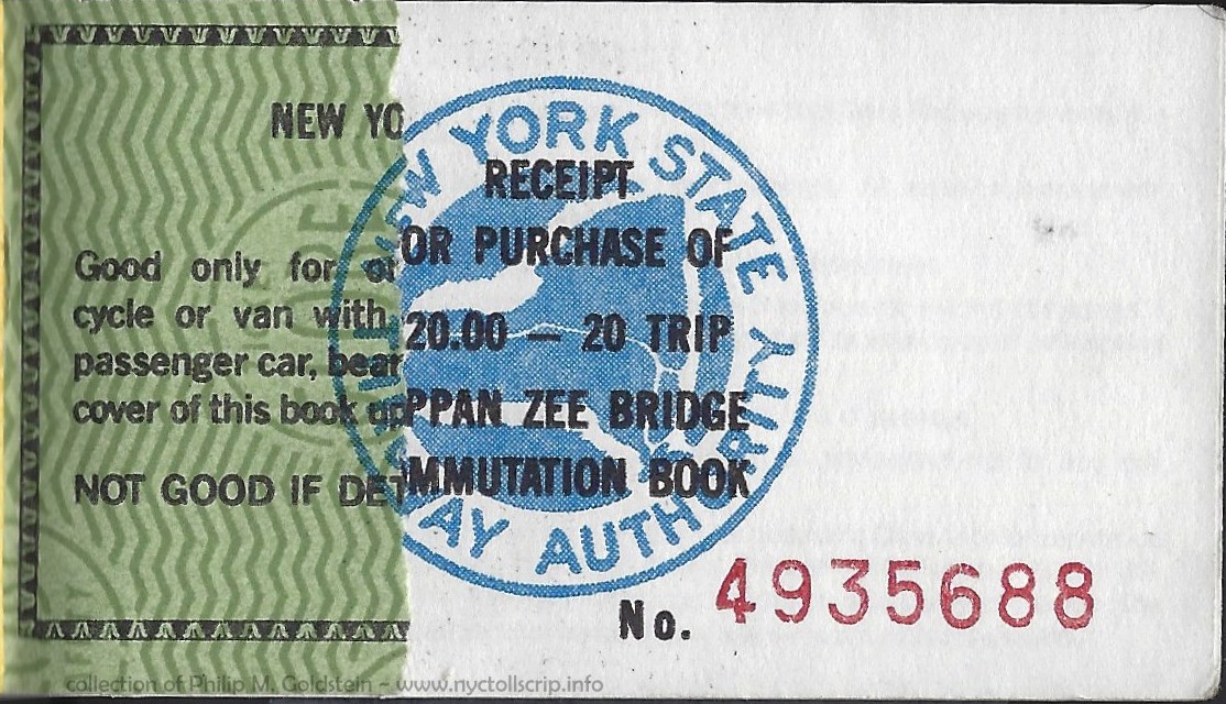 |
Tappan Zee Bridge Commutation Ticket - 10/11/1993
(partial ticket in booklet, with receipt)
collection of Philip M. Goldstein |
| . |
|
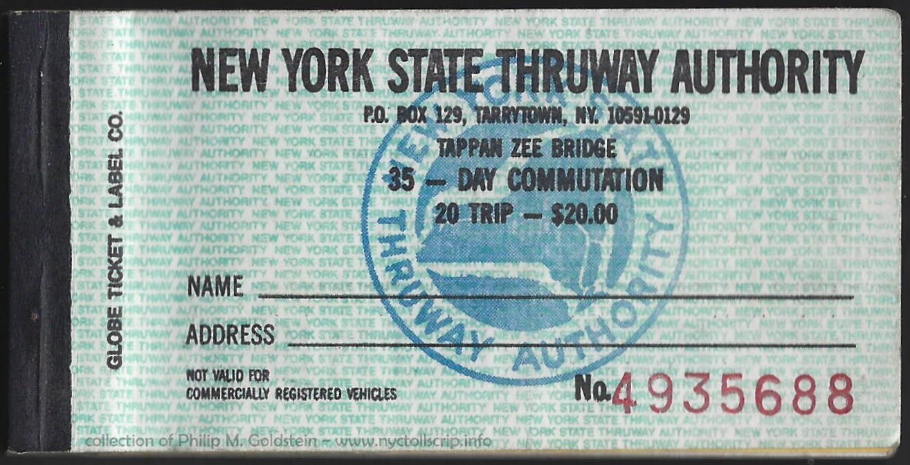 |
 |
Tappan Zee Bridge Commutation Book - 10/11/1993
(booklet front & back cover)
collection of Philip M. Goldstein
|
| . |
|
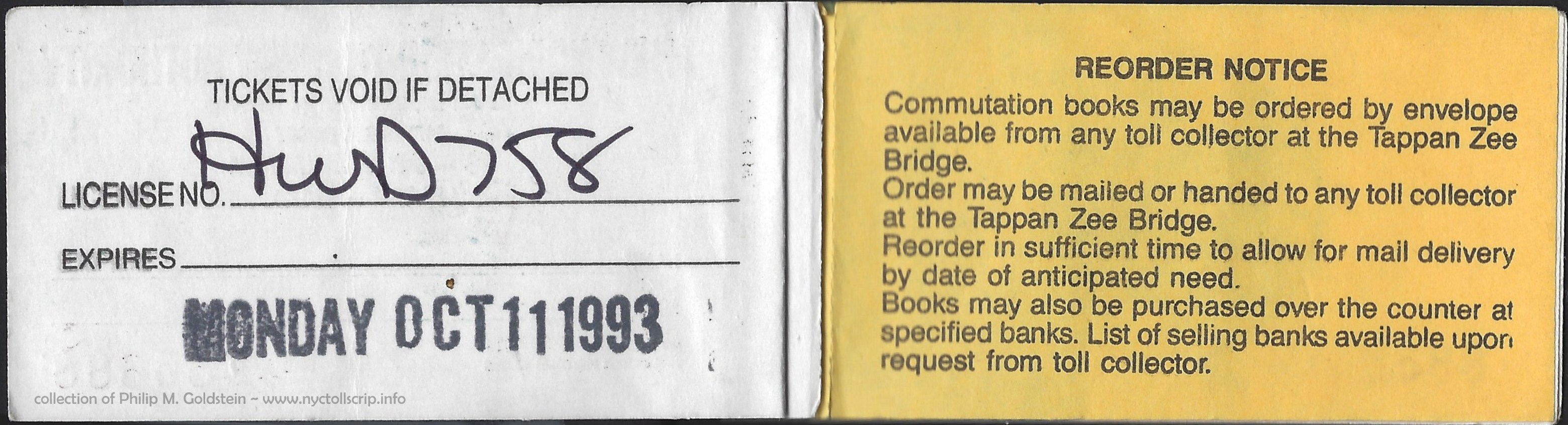 |
Tappan Zee Bridge Commutation Book - 10/11/1993
(inside front cover)
|
| . |
|
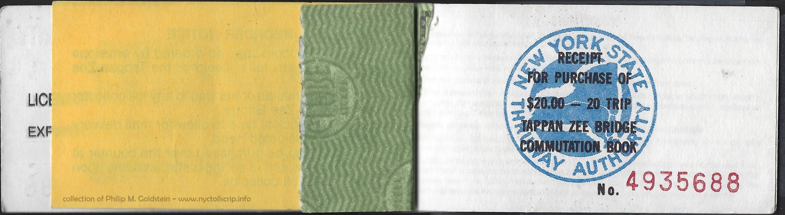 |
Tappan Zee Bridge Commutation Book - 10/11/1993
(back of partial script and face of receipt)
|
| . |
|
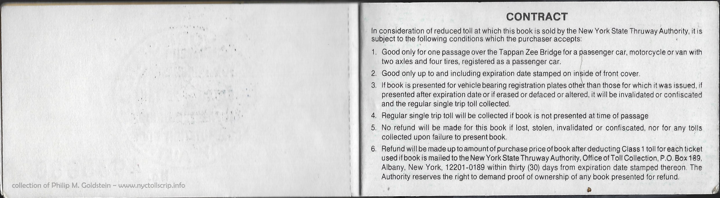 |
Tappan Zee Bridge Commutation Book - 10/11/1993
(back of receipt and inside of back cover)
collection of Philip M. Goldstein
|
.
.
The second of these "extra toll" bridges (actually two pairs of
bridges) on the New York State Thruway are the Grand Island Bridges,
connecting Tonawanda (north of Buffalo) with Grand Island and with
Niagara Falls via I-190.
Each direction encounters a South Grand Island Bridge and a North Grand Island Bridge.
The
(present) southbound bridge was completed in 1935 and built by the
Niagara Frontier Bridge Commission. As originally opened, the bridge was
bi-directional carrying carrying one lane in each direction of Route 324, and the original toll was 25 cents
for passenger automobiles. The South Grand Island Bridge is a truss
through arch, and the North Grand Island Bridge is a deck truss bridge.
In
1950, the State of New York assumed ownership of this bridge to incorporate the route into
the Niagara Thruway / I-190 construction.
In 1963, a matching pair of twin bridges were
erected to the northeast of the original structures. Upon opening of these
spans, two lanes of northbound traffic was moved onto the new crossing and the
original 1935 span became two lanes of southbound traffic only.
Despite being constructed almost 30 years apart, the spans are almost
identical, save for some very minor differences.
Tolls
are collected in each direction. The southbound toll barrier is located
on north shore of Grand Island, and the northbound toll barrier
is located in Tonawanda.
|
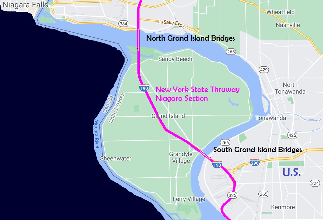 |
| NYSTA Grand Island Bridges Commutation Tickets |
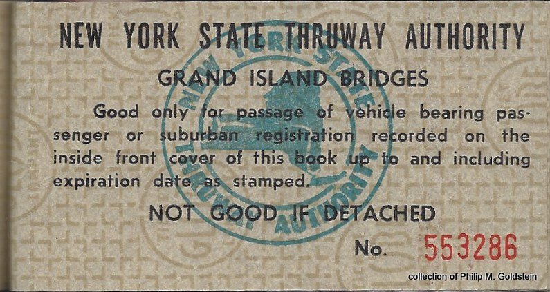 |
Grand Island Bridges Commutation Ticket - 8/8/1967
collection of Philip M. Goldstein |
| . |
|
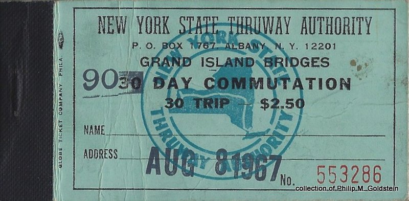 |
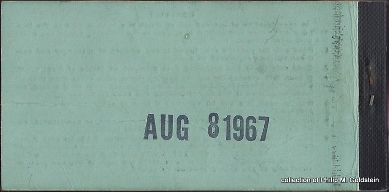 |
Grand Island Bridges Commutation Book - 8/8/1967
(booklet front & back cover)
collection of Philip M. Goldstein
|
| . |
|
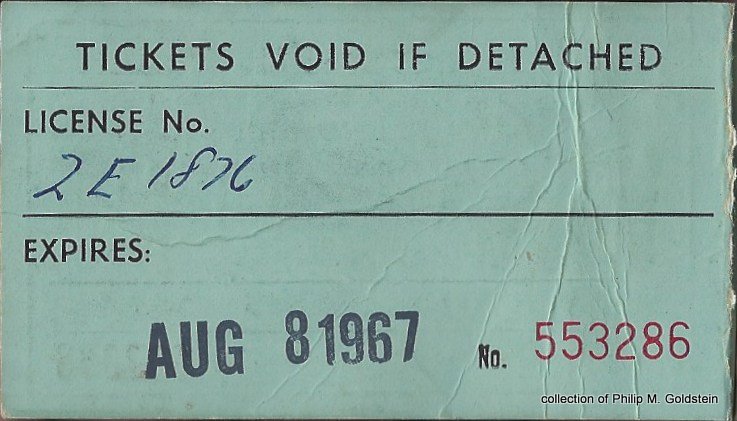 |
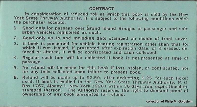 |
Grand Island Bridges Commutation Book - 8/8/1967
(inside front & back covers)
|
| . |
|
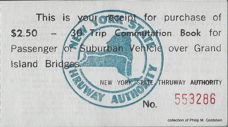 |
Grand Island Bridges Commutation Book Receipt - 8/8/1967
(back of partial script and face of receipt)
collection of Philip M. Goldstein
|
| Grand Island Bridge - Historical Toll Schedules |
|
1935 |
2003? |
5/2005 |
1/6/2008 |
| automobiles |
.25 |
.50 |
.75 |
1.00 |
Commutation Tickets:
$2.50 for 30 tickets good for 90 days only |
.0833 |
? |
|
|
Resident Tickets:
$5 for 55 trips - no expiry |
|
.09 |
.09 |
|
| automobiles with E-Z Pass |
n/a |
n/a |
|
.95 |
| Commuters with E-ZPass and GIC plan |
|
|
|
.28 |
| . |
| Grand Island Bridges - Current Toll Schedule |
|
Motorcycle |
Class 2L |
Class 3L |
Class 4L |
Class 2H |
Class 3H |
Class 4H |
Class 5H |
Class 6H |
Class 7H |
| Commuters with E-ZPass and GIC plan 1 |
n/a |
.28 |
n/a |
n/a |
n/a |
n/a |
n/a |
n/a |
n/a |
n/a |
| Tolls By Mail |
n/a |
1.00 |
1.50 |
1.75 |
2.00 |
2.25 |
2.75 |
4.25 |
4.50 |
5.00 |
| E-ZPass |
.50 |
.95 |
1.43 |
1.66 |
1.90 |
2.14 |
2.61 |
4.04 |
4.28 |
4.75 |
1 - Receive a $0.72
discount per trip ($0.28 versus $1.00 cash rate) on the Grand Island
Bridges. Minimum of 20 trips per month is required.
If fewer than 20 trips are taken per month, you will be charged $0.28
for each trip not taken. If this plan is selected, the $25
required prepayment in Box B of application is waived.
Plan Code: (GIC) - Required Prepayment ($5.00). |
This bridge, as of March 30, 2018; has
implemented cashless tolling. Those drivers without E-ZPass receive a
bill by mail via photo identity of their license plate.
New
                    York State Thruway Authority Receipts
|
| Yonkers
Toll Station |
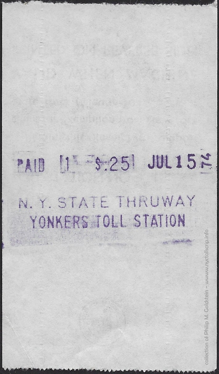 |
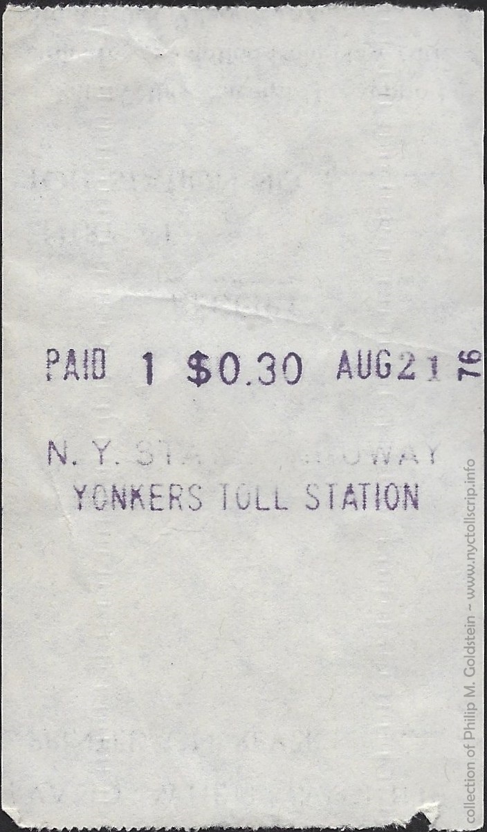 |
|
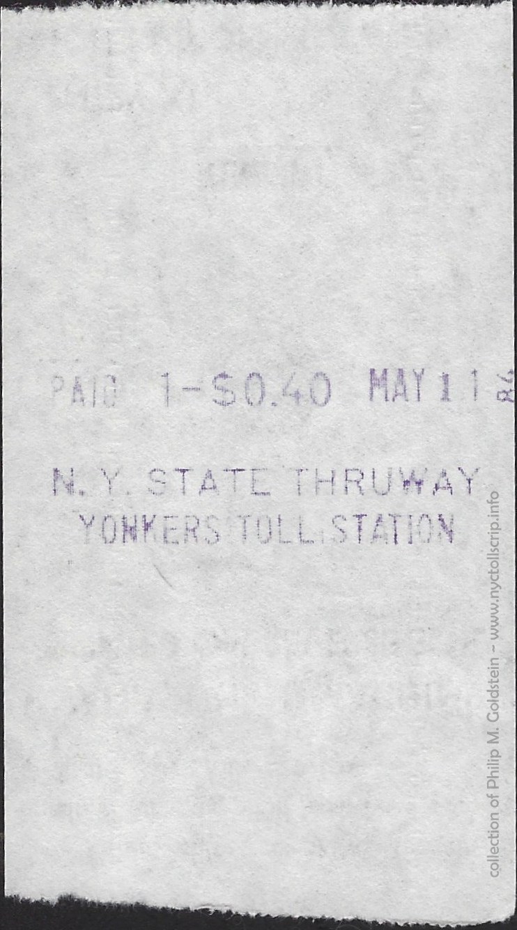 |
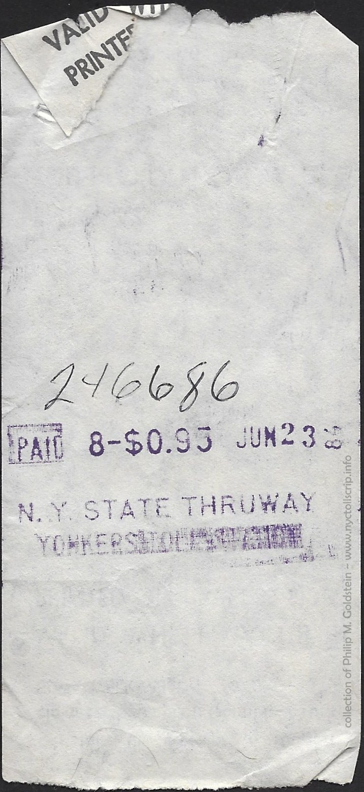
|
|
toll receipt - Class 1 - .25
7/15/1974
collection of
Philip M. Goldstein
|
toll receipt - Class 1 - .30
8/21/1976
collection of
Philip M. Goldstein
|
|
toll receipt - Class 1 - .40
5/11/1984
collection of
Philip M. Goldstein
|
toll receipt - Class 8 - .95 - 6/23/1984
collection of
Philip M. Goldstein
|
..
|
|
| Spring
Valley Toll Station |
|
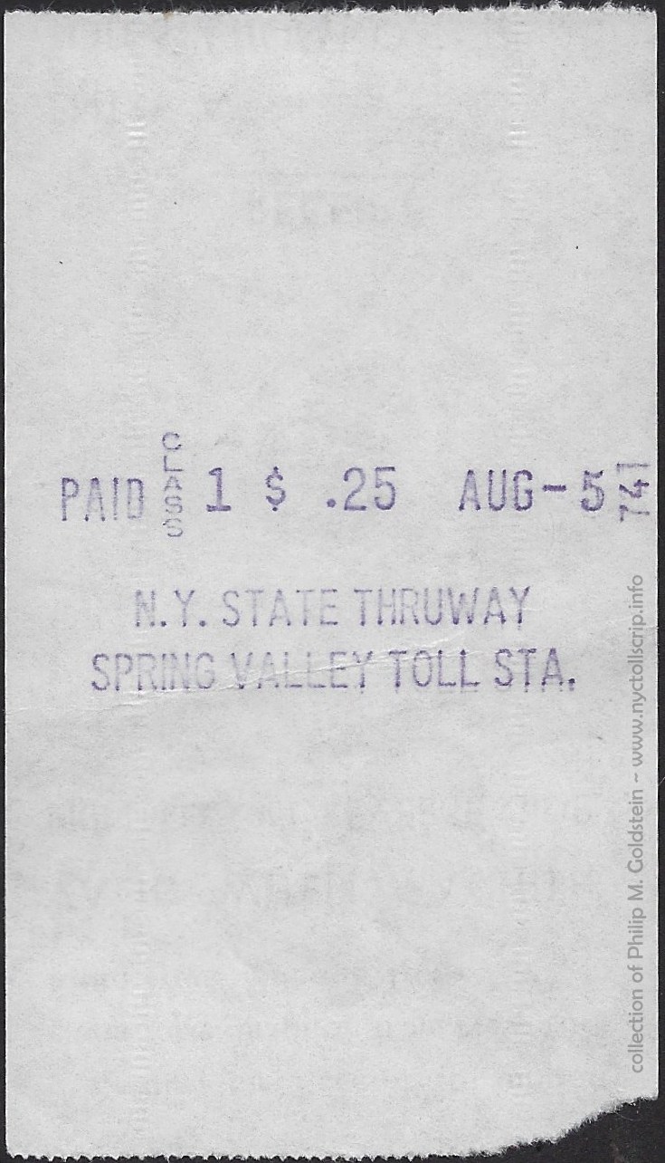 |
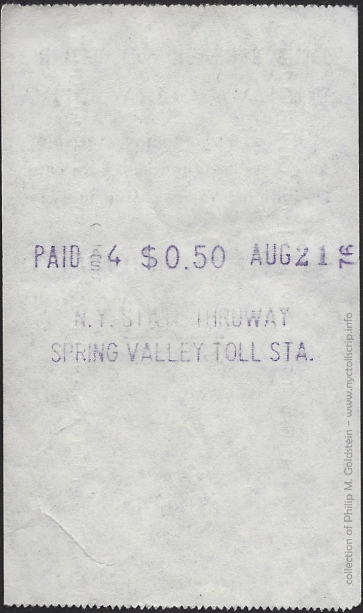 |
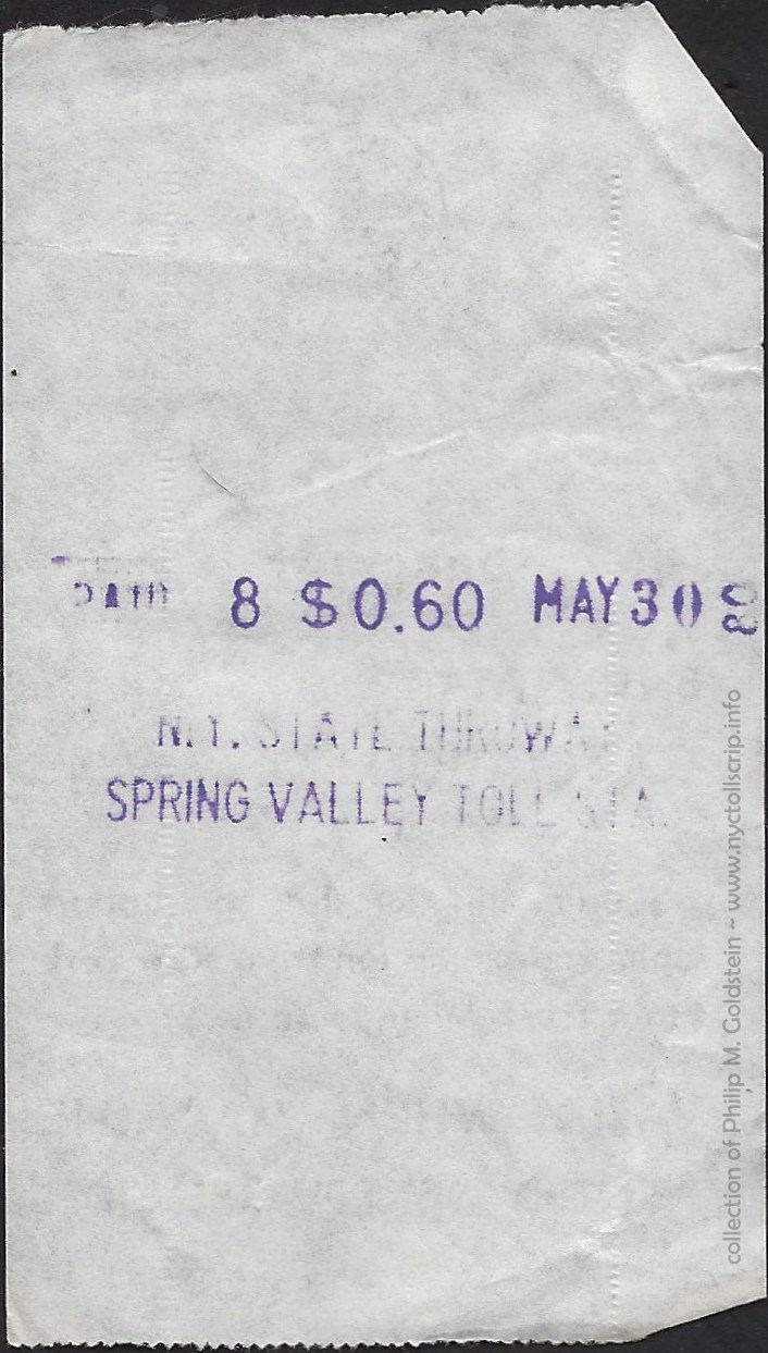 |
|
|
toll receipt - Class 1 - .25
8/5/1974
collection
of Philip M. Goldstein
|
toll receipt - Class 1 - .50
8/21/1976
collection
of Philip M. Goldstein
|
toll receipt - Class 1 - .60
5/30/1980
collection
of Philip M. Goldstein
|
|
..
. |
|
| Tappan
Zee Bridge |
|
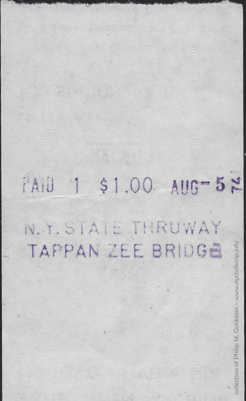 |
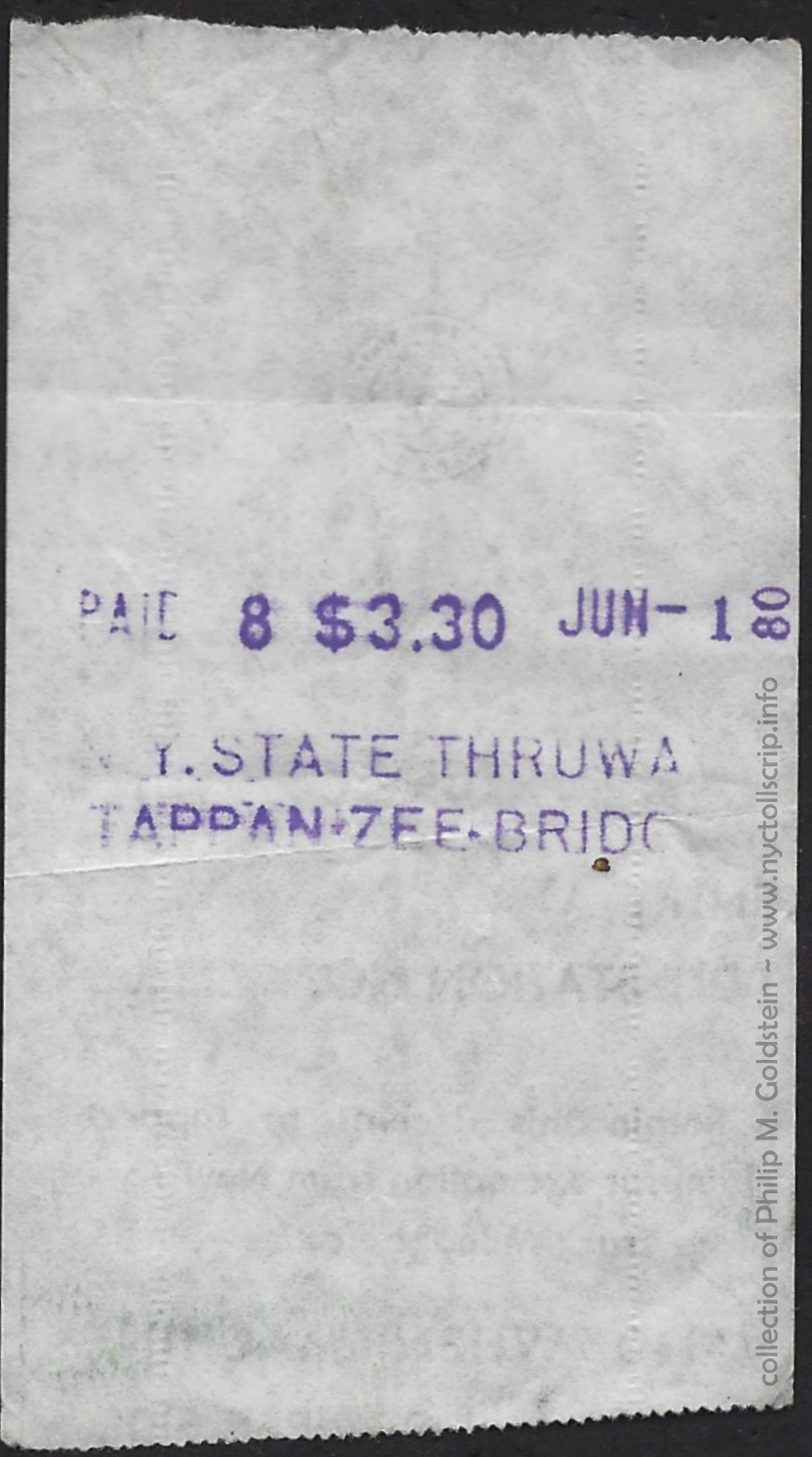 |
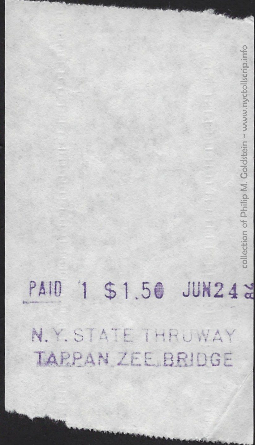 |
|
|
toll receipt - Class 1 - 1.00
8/5/1974
collection
of Philip M. Goldstein
|
toll receipt - Class 8 - 3.30
8/5/1974
collection
of Philip M. Goldstein
|
toll receipt - Class 1 - 1.50
6/24/1984
collection
of Philip M. Goldstein
|
|
..
. |
|
| Harriman
Toll Station |
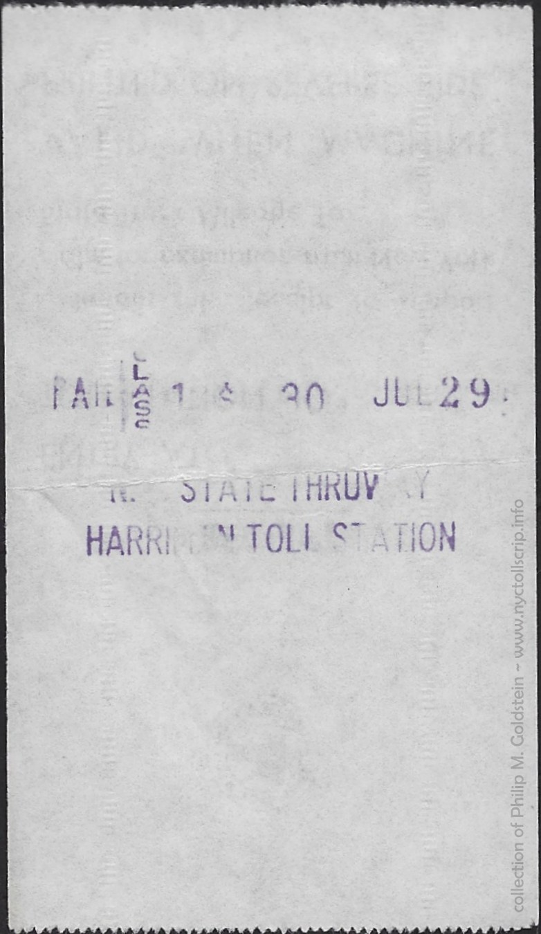 |
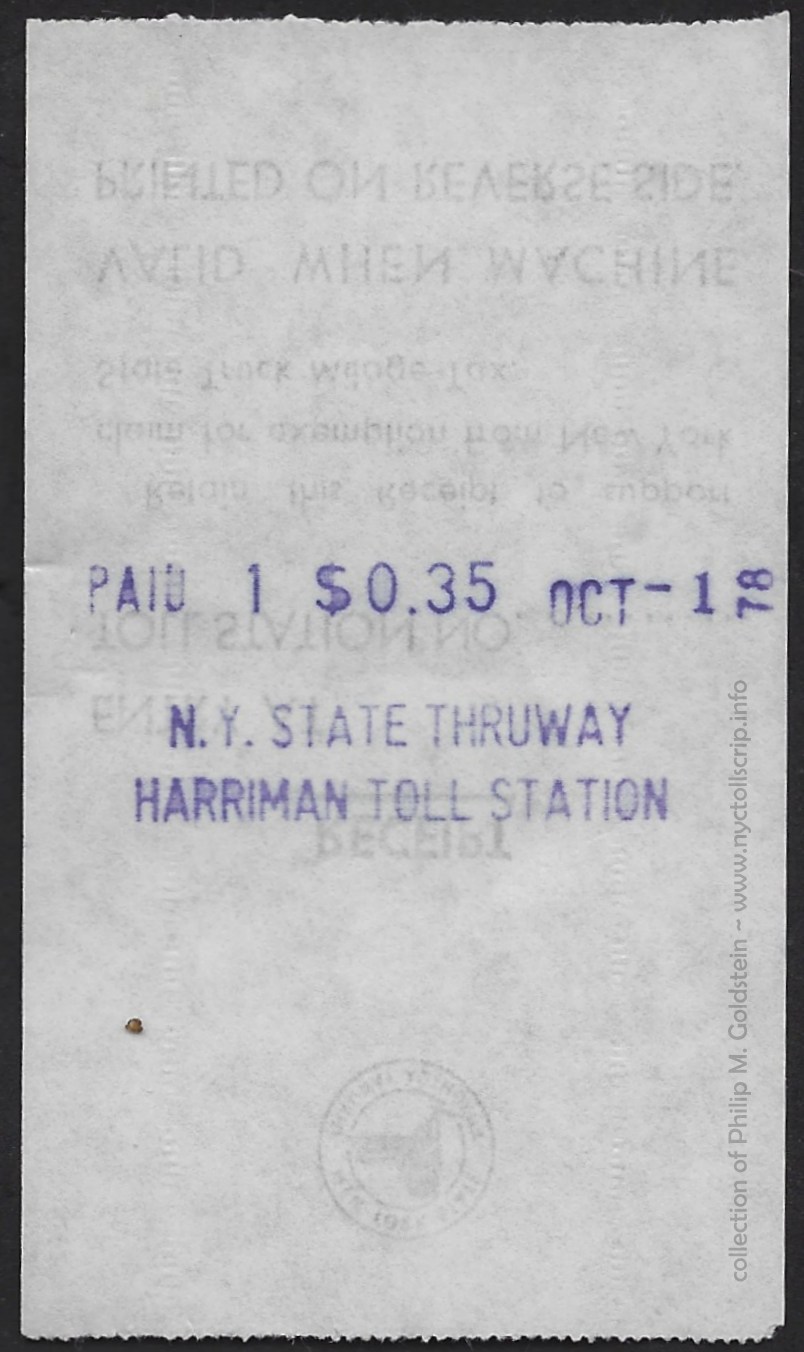 |
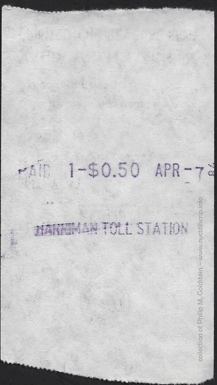 |
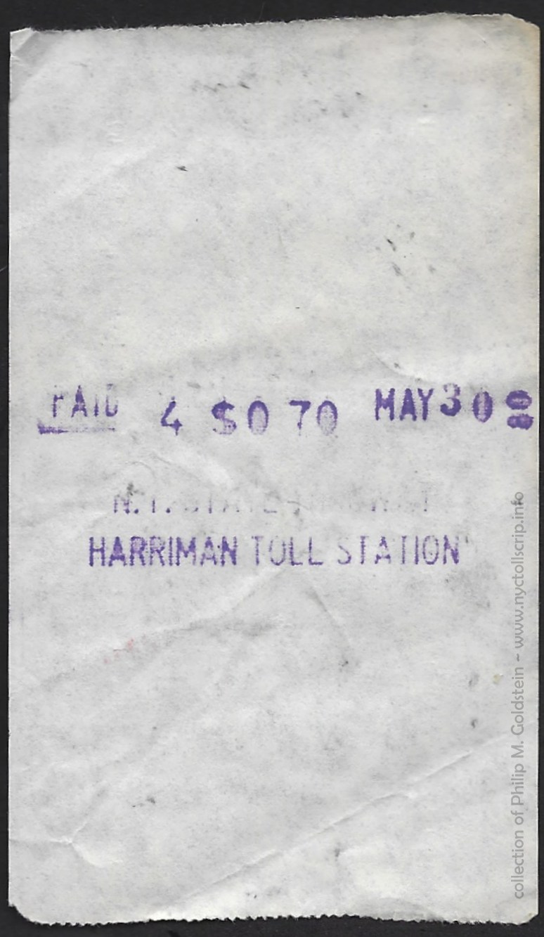 |
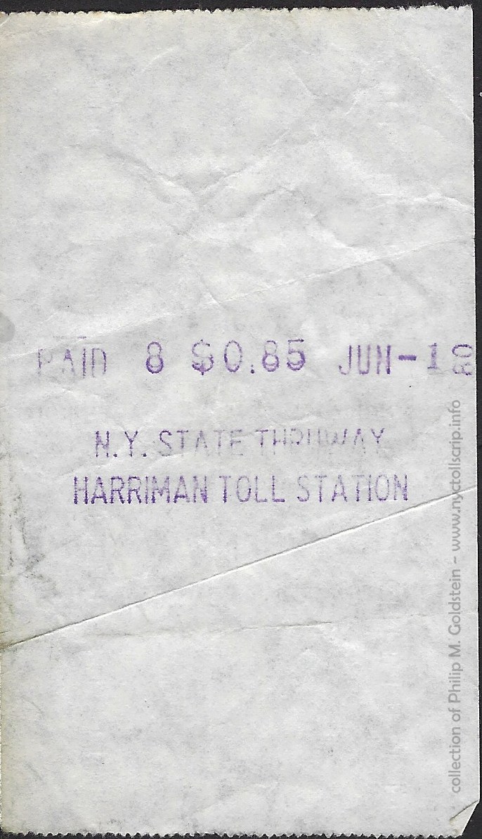 |
|
toll receipt - Class 1 - .30
7/29/197?
collection
of Philip M. Goldstein
|
toll receipt - Class 1 - .35
10/1/1978
collection
of Philip M. Goldstein
|
toll receipt - Class 1 - .50
4/7/1984
collection
of Philip M. Goldstein
|
toll receipt - Class 1 - .70
5/30/ 1980
collection
of Philip M. Goldstein
|
toll receipt - Class 1 - .85
6/1/1980
collection
of Philip M. Goldstein
|
..
. |
|
| New
England Toll Station |
|
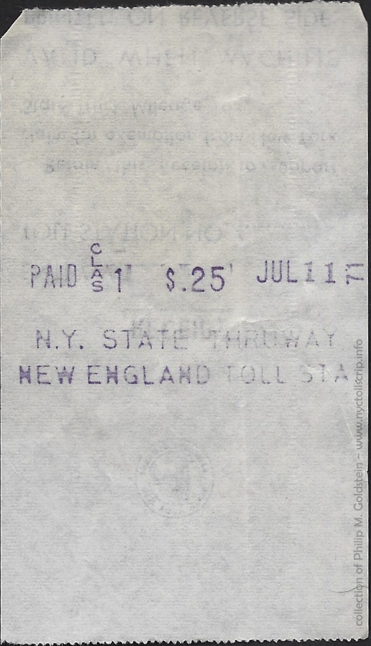 |
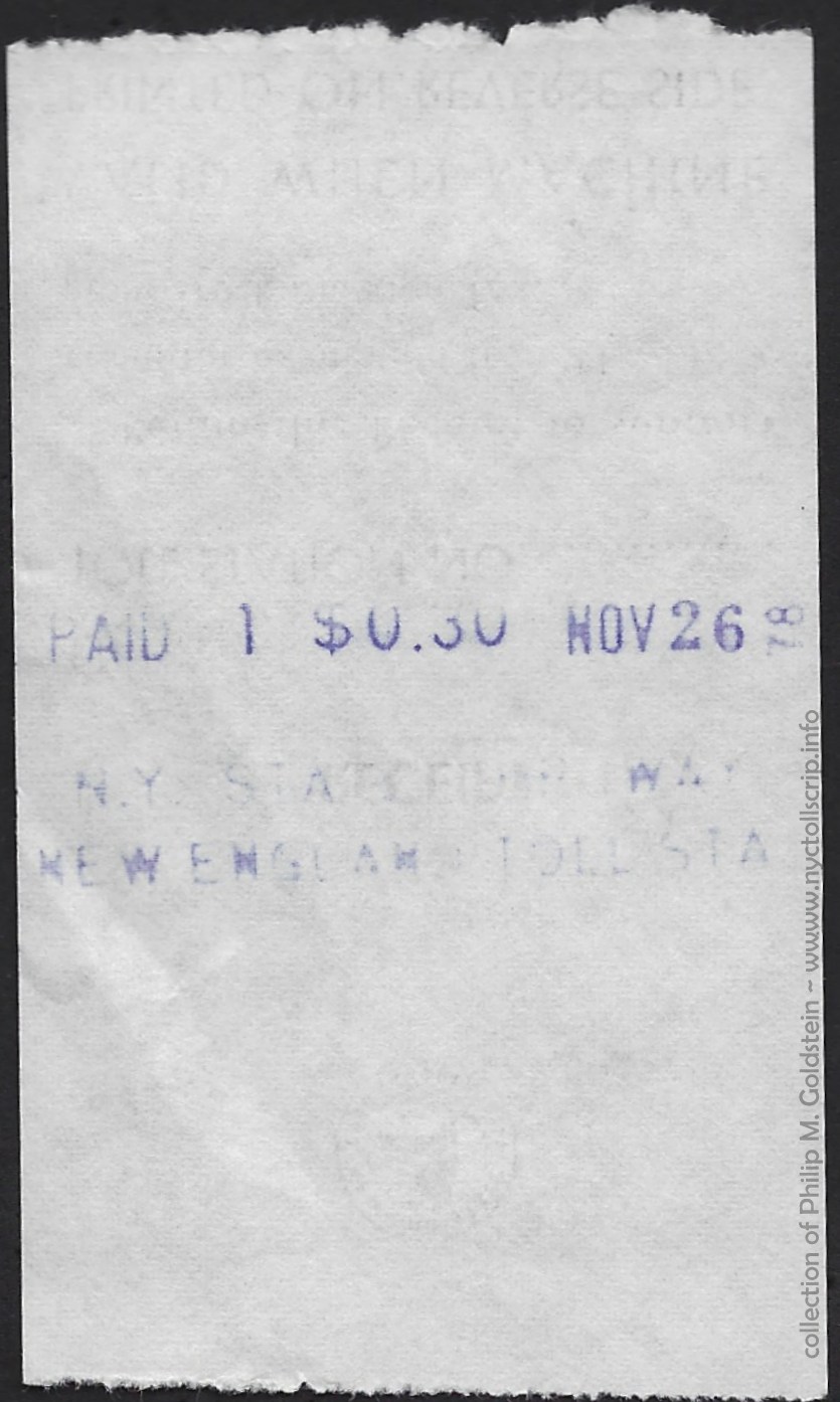 |
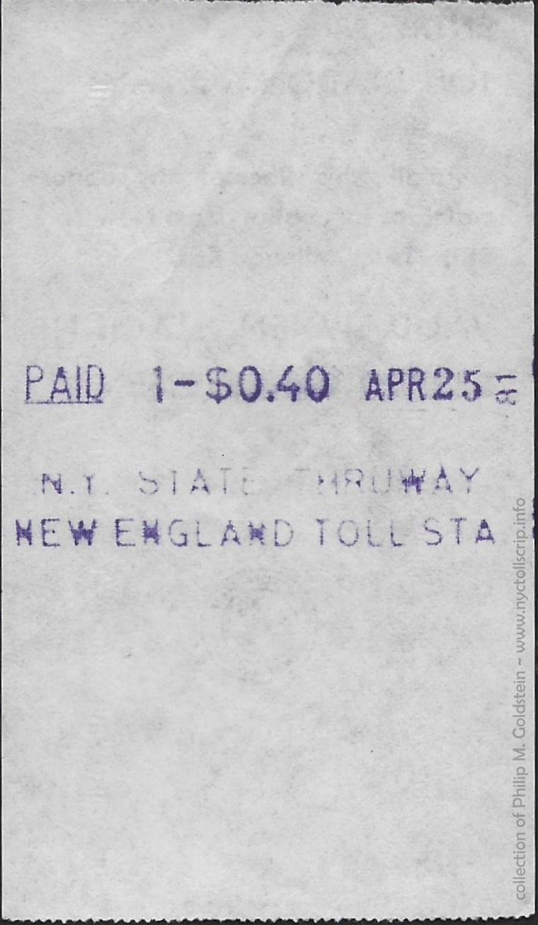 |
|
|
toll receipt - Class 1 - .25
7/11/1971
collection
of Philip M. Goldstein
|
toll receipt - Class 1 - .30
11/26/1978
collection
of Philip M. Goldstein
|
toll receipt - Class 1 - .40
4/25/1981
collection
of Philip M. Goldstein
|
|
..
|
|
| Various
Exit Toll Receipts |
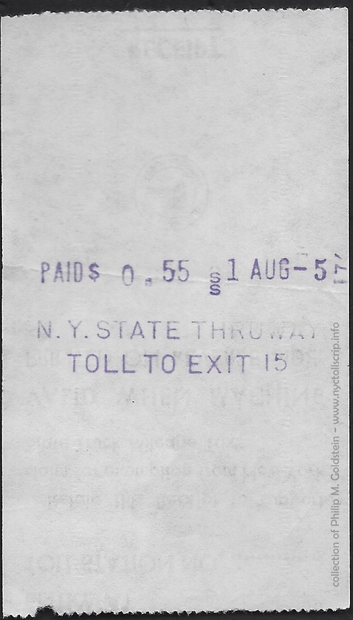 |
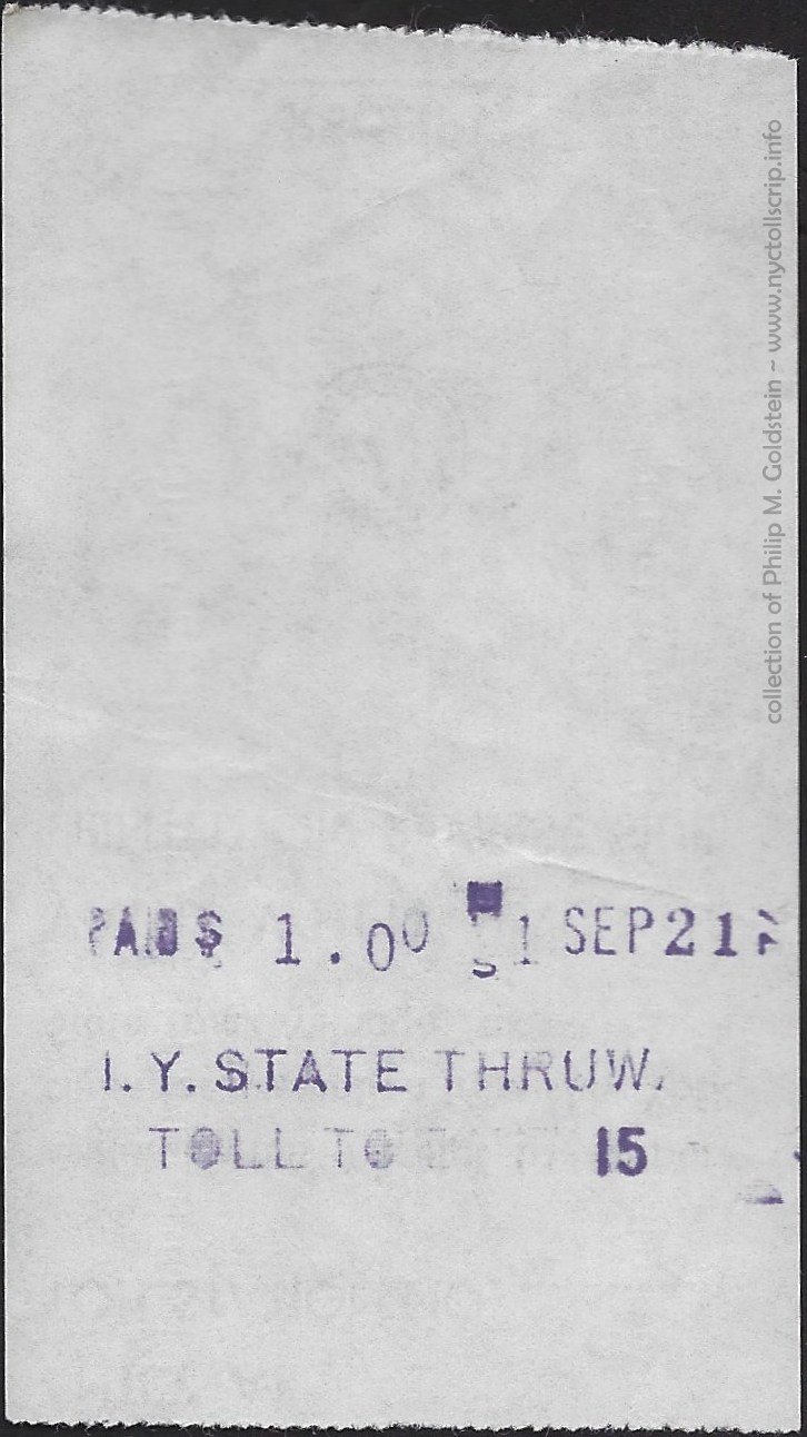 |
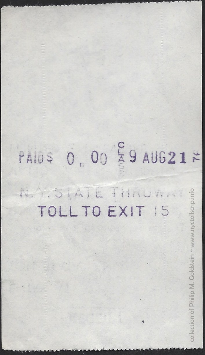 |
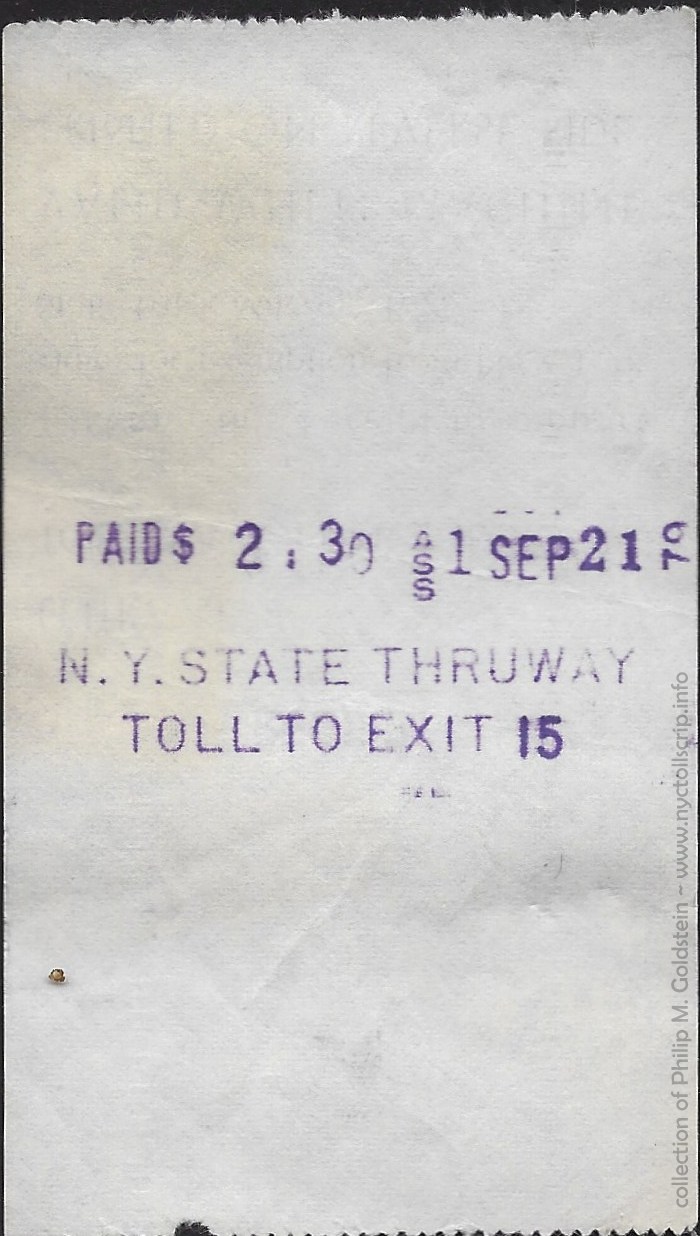 |
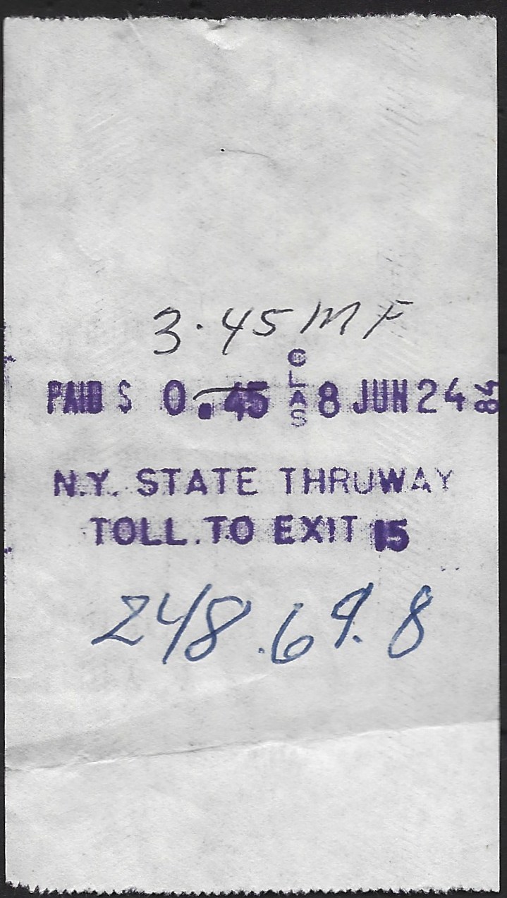 |
toll receipt - Toll to Exit 15
class 1 - .55 - 8/5/1974
collection of
Philip M. Goldstein
|
toll receipt - Toll to Exit 15
class 1 - 1.00 - 9/21/1974
collection of
Philip M. Goldstein
|
toll receipt - Toll to Exit 15
class 9 - 0.00 - 8/21/1976
collection of
Philip M. Goldstein
|
toll receipt - Toll to Exit 15
class 1 - 2.30 - 9/21/1979
collection of
Philip M. Goldstein
|
toll receipt - Toll to Exit 15
class 8 - 3.45 - 6/24/1984
collection of
Philip M. Goldstein
|
| . |
|
|
|
|
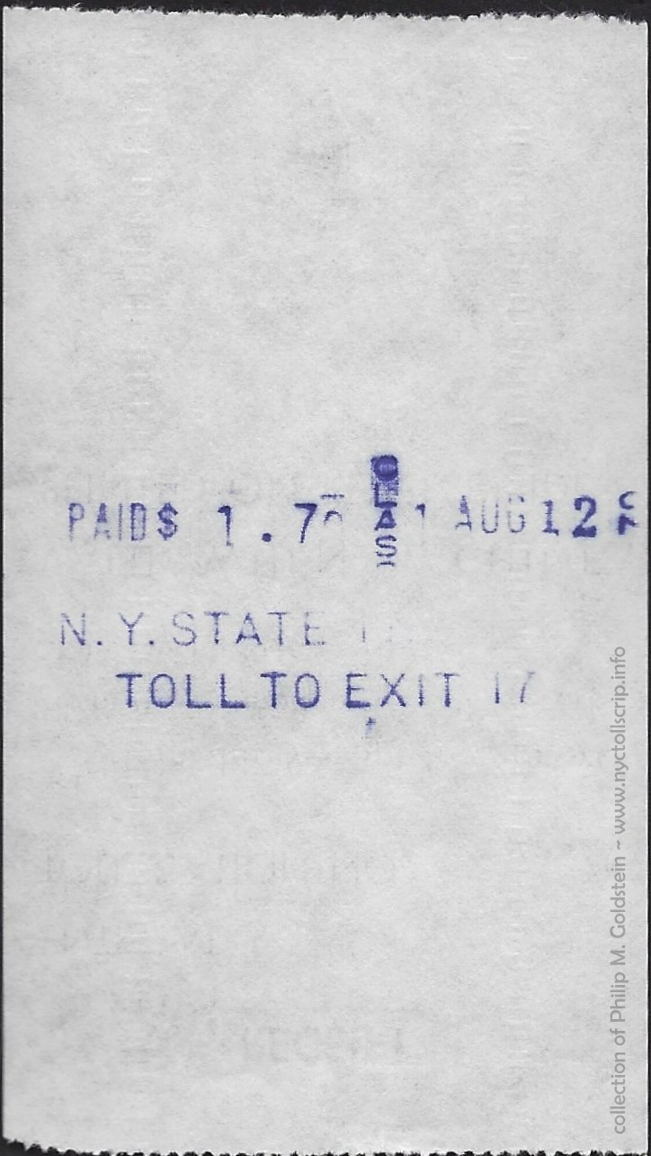 |
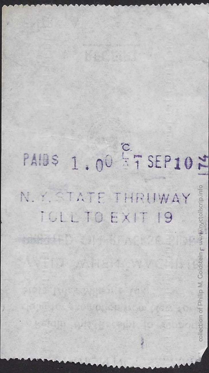 |
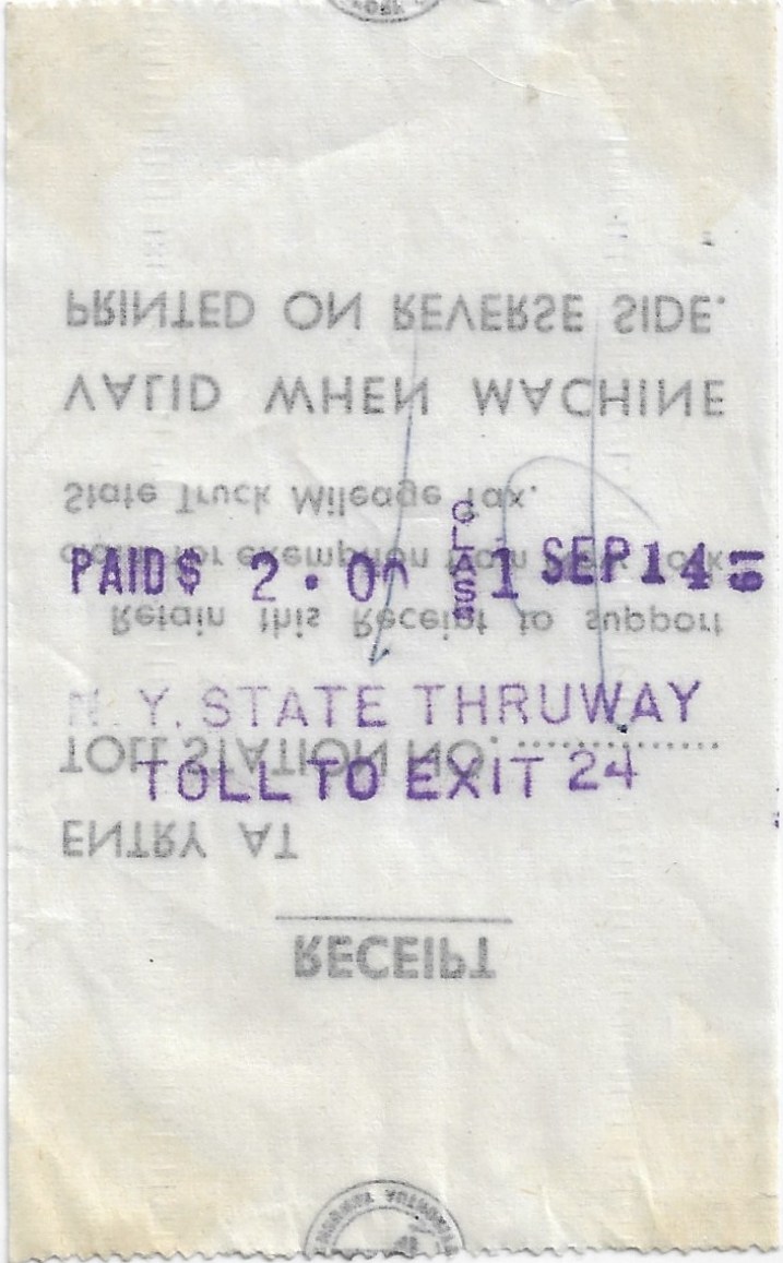 |
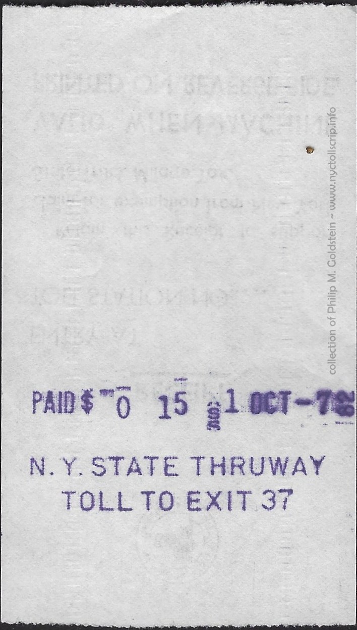 |
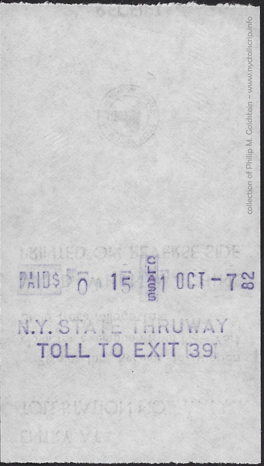 |
toll receipt - Toll to Exit 17
class 1 - 1.70 - 8/12/1979
collection of
Philip M. Goldstein
|
toll receipt - Toll to Exit 19
class 1 - 1.00 - 9/10/1974
collection of
Philip M. Goldstein
|
toll receipt - Toll to Exit 24
class 1 - 2.00 - 9/14/1961
collection of
Philip M. Goldstein |
toll receipt - Toll to Exit 37
class 1 - .15 - 10/7/1982
collection of
Philip M. Goldstein
|
toll receipt - Toll to Exit 39
class 1 - .15 - 10/7/1982
collection of
Philip M. Goldstein
|
| . |
|
|
|
|
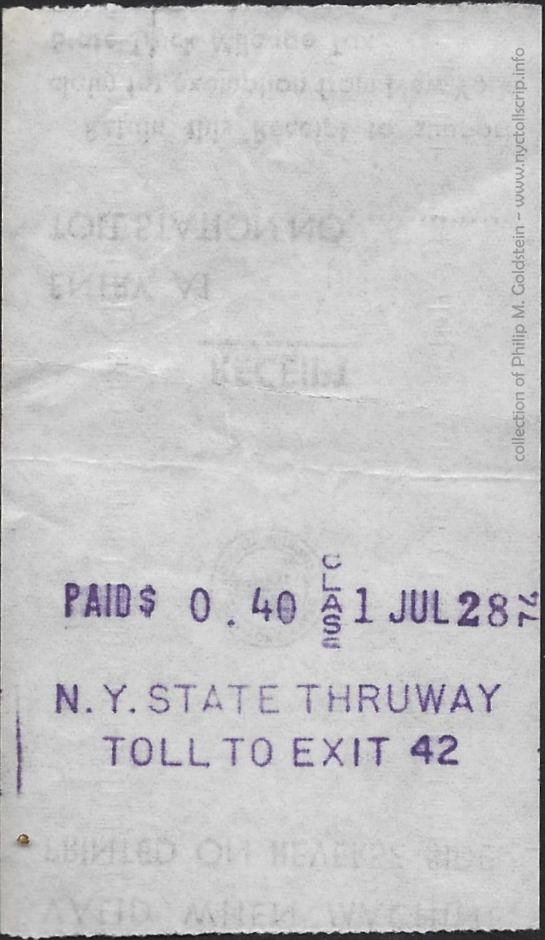 |
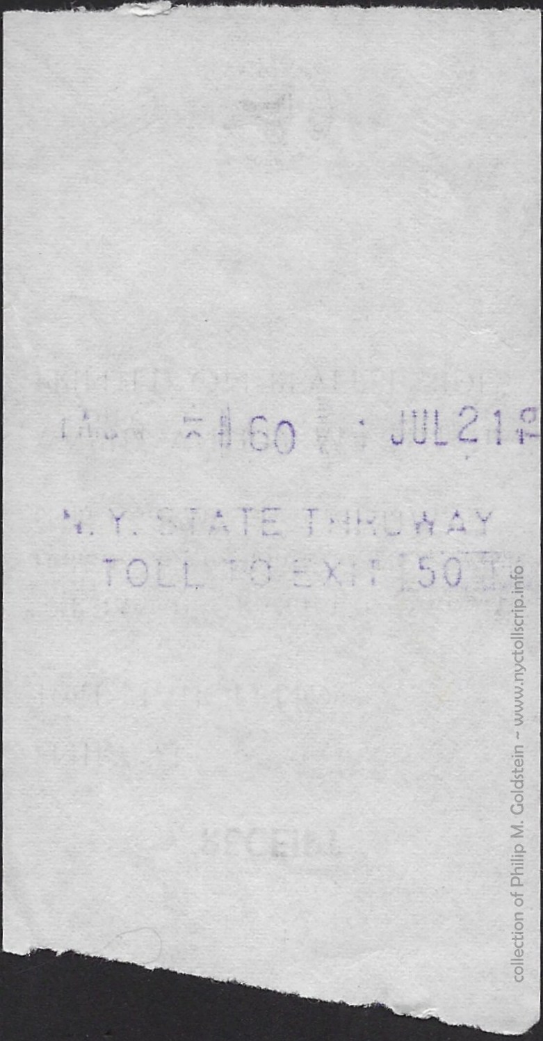
|
intentionally left blank
|
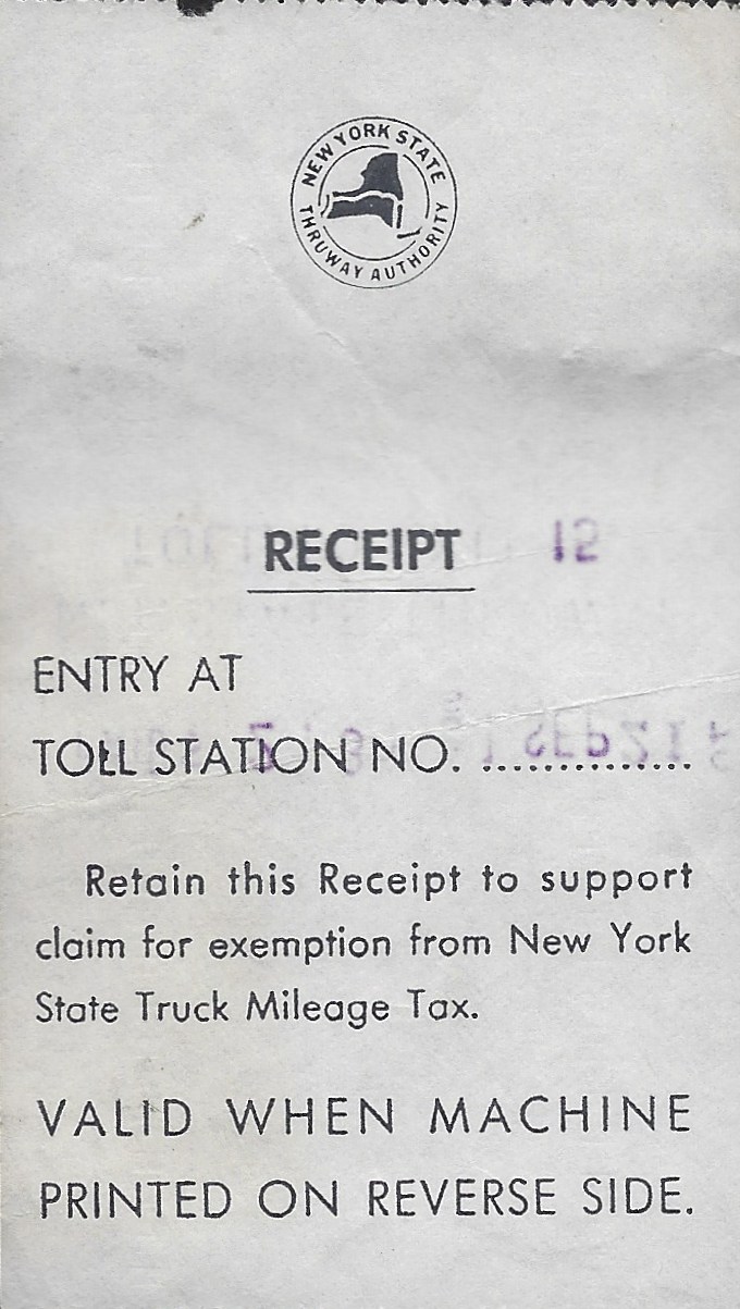 |
 |
toll receipt - Toll to Exit 42
class 1 - .40 - 7/28/1974
collection of
Philip M. Goldstein
|
toll receipt - Toll to Exit 50
class 1 - .60 - 7/21/1979
collection of
Philip M. Goldstein
|
|
preprinted back of toll
receipts
(light style)
collection of
Philip M. Goldstein
|
preprinted back of toll
receipts
(bold style)
collection of
Philip M. Goldstein
|
New York
State Bridge Authority
and its predecessors.
Crossing
the Hudson River in conveniently placed locations are various bridges,
and usually connecting two cities where ferries once plied their cross
river transportation service. These ferries and bridges fall under the scope of the
present New York State Bridge Authority.
The first bridge to open across the Hudson River would be the Bear Mountain Bridge on November
27, 1924 and located just north of Peeksill. It should be noted, that
this bridge predates the opening of the Holland Tunnel (1927) and
George Washington Bridge (1931). This was the only way to cross the the
Hudson River by automobile, without having to travel all the way north
to Albany or by ferry.
This location was not not chossen without merit. There had been
plans for a railroad crossing at this location, the "Hudson Highland
Suspension Bridge" as early as 1868. Following several decades of
finanicing and reorganizaion; only the foundations were constructed,
with the company folding in Panic of 1893.
By this time, the only physical crossings the spanned the Hudson
River were either the railroad bridge at Poughkeepsie, or or the
automobile and railroad bridges at Albany. The only other method to
cross the Hudson River was by ferry. The opening of the Bear Mountain
Bridge, constructed and operated by the Bear Mountain Hudson River
Bridge Company which was organized in 1922, would offer a direct
alternative.
The location of the Bear Mountain Bridge was part of a direct highway route between Middletown, NY and Danbury, CT.
The opening of the Mid-Hudson Bridge between Poughkeepsie and
Newburgh; followed six years later in 1930. But unlike the Bear
Mountain Bridge, this span was not underwritten by private venture and
investment; and the Mid-Hudson Bridge was to funded by the State of New
York, and built and operated by the State of New York - Department of
Public Works.
With the Great Depression of 1929;
almost all private companies as well as state funded projects
regardless of their commodity or purpose, found themselves in
precarious financial positions. This was especially so of the Bear
Mountain Hudson River Bridge Co. The Depression meant less money for
the everyman to travel; less money for travel meant less toll receipts,
which meant less money for upkeep of the bridge. But the span became an integral part of transportation in the area.
Enter the New York State Bridge Authority. This state agency was formed in 1933 when New York State finances were in short supply due to the Depression, and out of an originally proposed plan for
the state to build the Rip Van Winkle Bridge which had been vetoed by then
Governor Franklin D. Roosevelt.
As a possible precursor to his ‘New Deal’,
Roosevelt supported the creation of an Authority, separate from state
finance; to let bonds for funding construction and repaying debt
though the collection of tolls. Hence the creation of the New York State Bridge Authority. And with it the two existing bridges were absorbed into the Bridge Authority.
The five bridges now under the auspices of the New York State Bridge
Authority and are shown in the map to the right, from north to south.
| crossing |
span type |
date opened |
original operating entity |
| Rip Van
Winkle Bridge |
cantilever truss |
July 2,
1935 |
New York State Bridge Authority |
Kingston-Rhinecliff
Bridge
George Clinton / Kingston-Rhinecliff Bridge (2000) |
continuous under-deck truss |
February 2,
1957
"official" May 11, 1957 |
New York State Bridge Authority |
Mid Hudson
Bridge
Franklin Delano Roosevelt / Mid Hudson Bridge (1994) |
suspension |
August 25,
1930 |
New York State Department of Public Works |
Newburgh-Beacon
Hamilton Fish / Newburgh-Beacon Bridge (1997) |
cantilever truss |
first
span: November 2, 1963
second span: November 1, 1980
(now eastbound lanes only) |
New York State Bridge Authority |
Bear
Mountain Bridge
Purple Heart Veterans Memorial Bridge (2018) |
suspension |
November
27, 1924 |
Bear Mountain Hudson River Bridge Co.
acquired by NYSBA in September 26, 1940 |
It should be noted, that the Tappan
Zee Bridge (both the older span and present dual spans) located at Tarrytown are not and were not part of this agency,
despite its crossing the Hudson River. That bridge is administered to and
is maintained by the Thruway Authority.
|
Of particular note is the complicated toll schedule originally
implemented on the two crossings that were opened in the 1930's. With utmost appreciation, the New York State Bridge
Authority has very thoughtfully put together a partial chronological history
of their tolls as well significant dates in bridge toll history. This
undoubtedly made my job tremendously easier.
This current information as well as
historical information including tolls, traffic figures by class and
crossing and more, is conveniently posted on the NYSBA website. |
|
 |
 |
Newburgh - Beacon Ferry
Good For One Passage
estimated dates of usage: 1938-1963
Atwood Coffee NY615I
bronze, 18mm
with 9mm hub, 5mm hole
(shown larger than actual size for detail)
collection of Philip M. Goldstein |
New York State Bridge Authority (and predecessors) - Historic Toll Schedules
. |
| March 29, 1933 |
New York State
Bridge Authority takes jurisdiction of the Mid-Hudson Bridge and adopts
the toll schedule then in effect under the Department of Public Works.
Thirty-six often complex separate tolls included the following:
|
|
. |
|
|
Toll Rates for Rip Van Winkle and Mid Hudson Bridges - 1930's |
each direction |
|
Pedestrians |
.10 |
|
One-horse wagons (up to 16 feet) |
.50 |
|
Horses, oxen, cows, yearlings |
.20 |
|
Saddle horse and rider |
.30 |
|
|
|
|
Automobile or Motor Bus including driver |
.80 |
|
each passenger in vehicle |
.10 |
|
Bicycle or Motorcycle |
.20 |
|
Motorcycle with side car |
.35 |
|
passenger car trailer |
.35 |
|
TRUCKS: |
|
|
Under 1 ton, rated capacity |
$1.00 |
|
From 1 and under 2 tons, rated capacity |
$1.25 |
|
From 2 and under 3 tons, rated capacity |
$1.50 |
|
From 3 to 5 tons, rated capacity |
$1.75 |
|
For each ton above 5 tons rated capacity |
.50 |
|
Two-wheel truck-trailer |
$1.00 |
|
Vehicles exceeding 20 feet in length, for each additional foot above 20 |
.10 |
|
A SPECIAL PERMIT AND SURVEY IS REQUIRED FOR ANY LOAD EXCEEDING 15 TONS
|
|
|
. |
|
|
COMMUTATION BOOKS
(For use only by the individual vehicle to which issued)
PASSENGER CARS:
Good for calendar month for which issued
|
|
|
25 Trip Book |
$7.50 |
| . |
62 Trip Book |
$12.00 |
|
TRUCKS:
50 Trip Books. Good for one year from date of sale. |
|
|
Rated capacity under 2 tons |
$30.00 |
|
Rated capacity, 2 and under 3 tons |
$40.00 |
|
Rated capacity, 3 tons and over |
$50.00 |
|
.
|
|
| . |
|
|
| September 15, 1937 |
Tolls were
reduced overall although 18 separate categories were maintained.
Passengers in vehicles were no longer tolled and livestock was now
banned except as cargo in or as motive power for vehicles.
|
|
|
each direction |
|
Pedestrians |
.10 |
|
Passenger Automobiles |
.50 |
|
Wagon or Horse and Rider |
.20 |
| . |
|
|
..
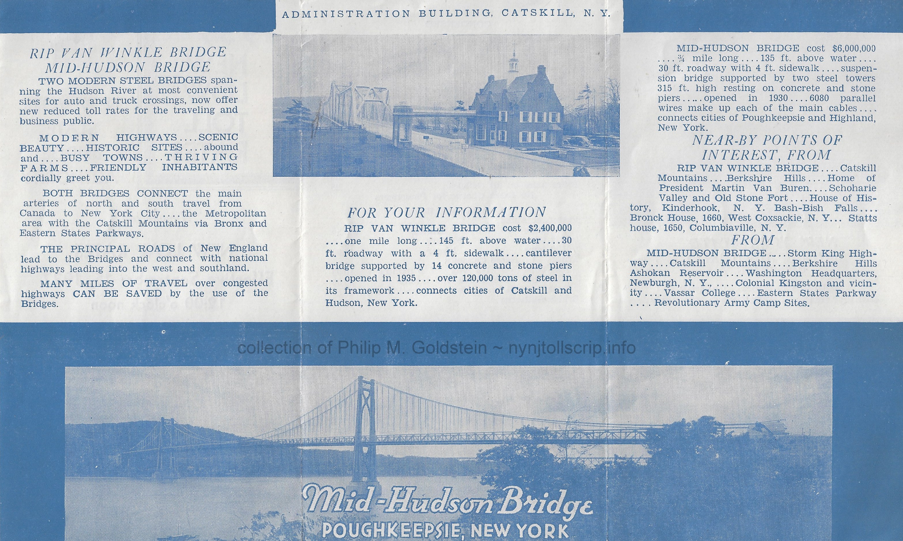 |
| . |
|
|
| July 15, 1945 |
With the
Second World War nearing its end and the Army replacing commuters as a
major source of revenue, vehicle tolls were again reduced and
pedestrians finally received a break.
|
|
|
each direction |
|
Pedestrians |
.05 |
|
Passenger Automobiles |
.25 |
|
Horse and Wagon |
.15 |
|
Extra axles on all vehicles |
.25 |
| . |
|
|
 |
| .. |
|
|
| June 1, 1963 |
Axle tolls
replaced weight related tolls for most trucks resulting in a slight
increase for mid-size trucks and a slight toll reduction for most heavy
trucks. Meanwhile, a separate higher toll schedule was enacted for
the about to be opened Newburgh-Beacon Bridge.
Passenger cars and
small trucks were required to pay .25¢ more in each direction and
larger trucks were charged .50¢ more. |
| . |
|
|
|
. |
|
| October 15, 1966 |
Tolls at all Authority bridges were again made uniform at the following rates: |
| |
|
each direction |
| Pedestrians |
.05 |
| Passenger Automobiles |
.25 |
| . |
|
|
| . |
|
|
| August 12, 1970 |
Eastbound tolls were doubled to .50¢ and all westbound toll collections ceased.
|
| .. |
|
|
| . |
|
|
| November 2, 1980 |
Pedestrian tolls were abandoned.
|
| . |
|
|
| . |
|
|
| July 2, 1989 |
Tolls increase to .75¢ round trip for passenger cars. All other vehicles $1.00 per axle for commercial vehicles.
|
| . |
|
|
| . |
|
|
| February 5, 2000 |
Tolls increase to $1.00 round trip for passenger cars and $1.50 per axle for commercial vehicles.
|
| . |
|
|
| . |
|
|
| January 30, 2012 |
Tolls increase to $1.50 for passenger cars paying cash, $1.25 for passenger cars using E-ZPass.
|
| . |
|
|
| . |
|
|
| May, 1, 2020 |
Toll increase - see current schedule below. |
|
|
. |
|
New York State Bridge Authority - Current Toll Fare Schedule
effective May 1, 2020
. |
| class |
vehicle description |
E-ZPass |
Cash |
| 1 |
Cars, Pick-ups & Motorcycles - 2 axles, less than 7' 6" in height |
$1.35 |
$1.75 |
|
Commuter Plan for passenger vehicles only, minimum of 17 trips each month |
$1.10 |
n/a |
| 2 |
2 axles, more than 7' 6" in height |
$4.90 |
$6.00 |
|
Commercial vehicles |
|
2 axles |
$4.90 |
$6.00 |
|
3 axles |
$7.35 |
$9.00 |
|
4 axles |
$9.80 |
$12.00 |
|
5 axles |
$12.25 |
$15.00 |
|
6 axles |
$14.70 |
$18.00 |
|
Other |
|
extra axle with class 1 |
$1.00 |
$1.25 |
|
extra axle with classes 2 through 6 |
$2.45 |
$3.00 |
I had long since known that scrip was issued by the New
York State Bridge Authority, as I had acquired the following piece
about 15 years ago.
Until now, I did not have an approximation of its age. Upon
creating this particular chapter of the website, I was at least able to
determine it was issued before 1963, when the Newburgh Beacon Bridge
opened, and as it is not listed on the scrip. However the Kingston
Rhinecliff Bridge is listed and that opened in 1957. Upon review of
the historical toll tariff tables as published on the NYSBA website, I
believe this toll scrip denomination of $1.00 was issued to vehicles larger than passenger automobiles, as their toll rate for the period after 1945 for passenger cars was 50 cents.
Scrip, tickets and receipts in my collection reflect the following
tolls: .25, .50, $1.00, $1.25, $1.50. The cash toll is now $1.75, with
E-ZPass accepted and discounted.
 |
 |
NYSBA Toll Scrip - .25 - post 1963
(Newburgh Beacon Bridge listed)
collection of
Philip M. Goldstein |
| . |
|
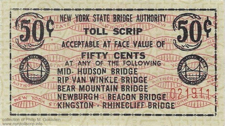 |
 |
NYSBA Toll Scrip - .50 - post 1963
(Newburgh Beacon Bridge listed)
collection of
Philip M. Goldstein |
| . |
|
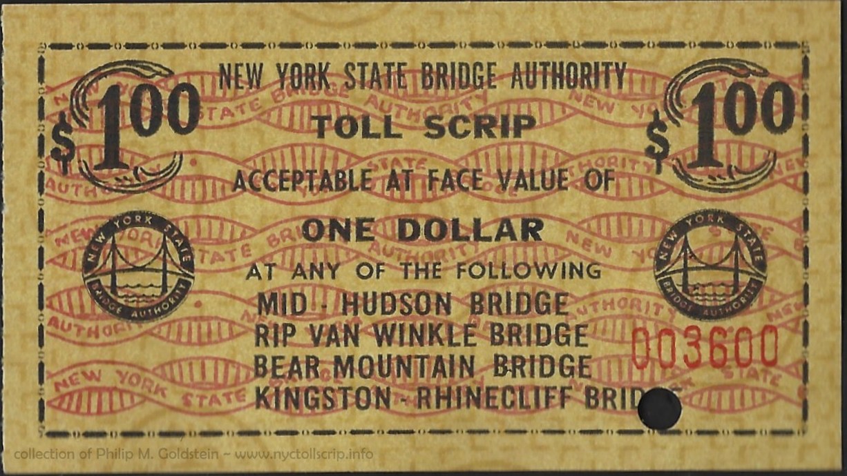 |
 |
NYSBA Toll Scrip - $1.00 - 1957 through 1963
(Newburgh Beacon Bridge not listed)
collection of
Philip M. Goldstein
|
In
1970, all the bridges were converted to one way tolling (collected
eastbound only) and the toll doubled (as they had been for all
Hudson River Bridges, even those in New York City and under the
jurisdiction of the Port
of New York Authority / Port of New York and New Jersey).
Another gem re-homed from the George Cuhaj collection (thanks
George!) is this scrip ticket and booklet cover from May 31, 1979:
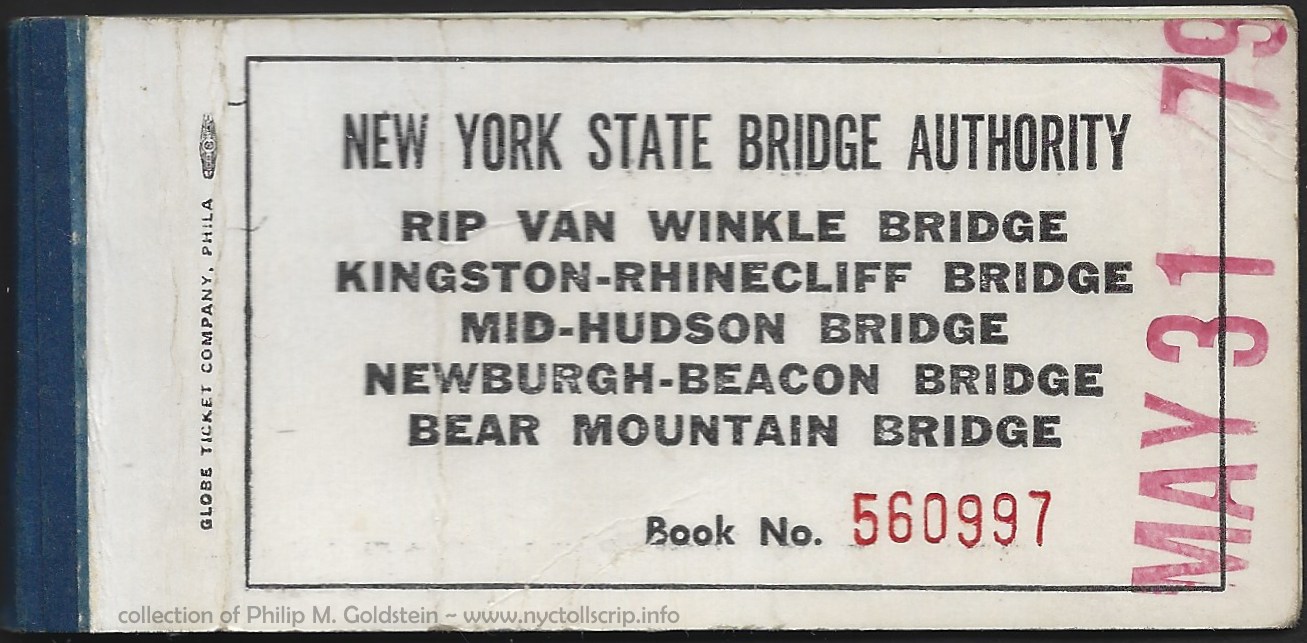 |
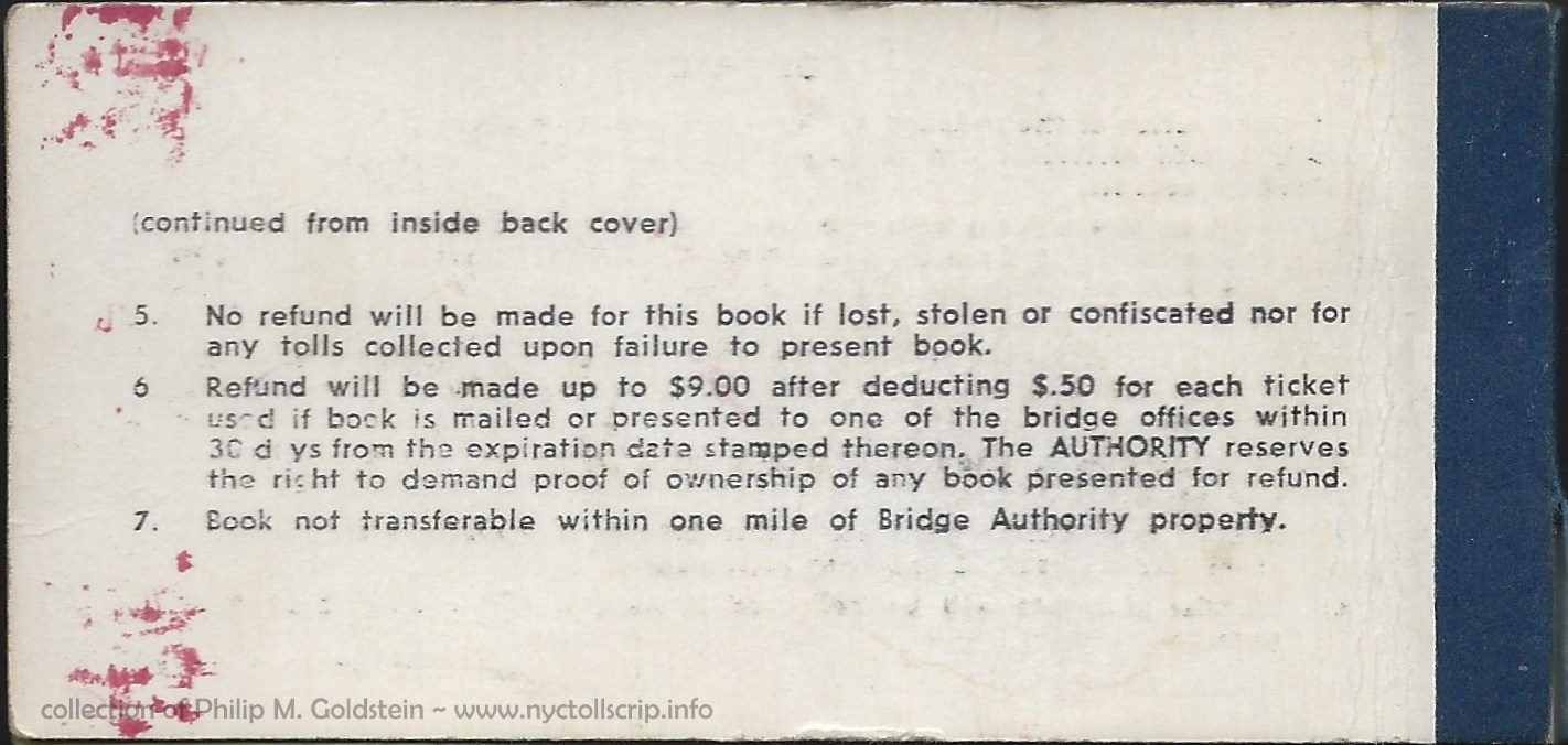 |
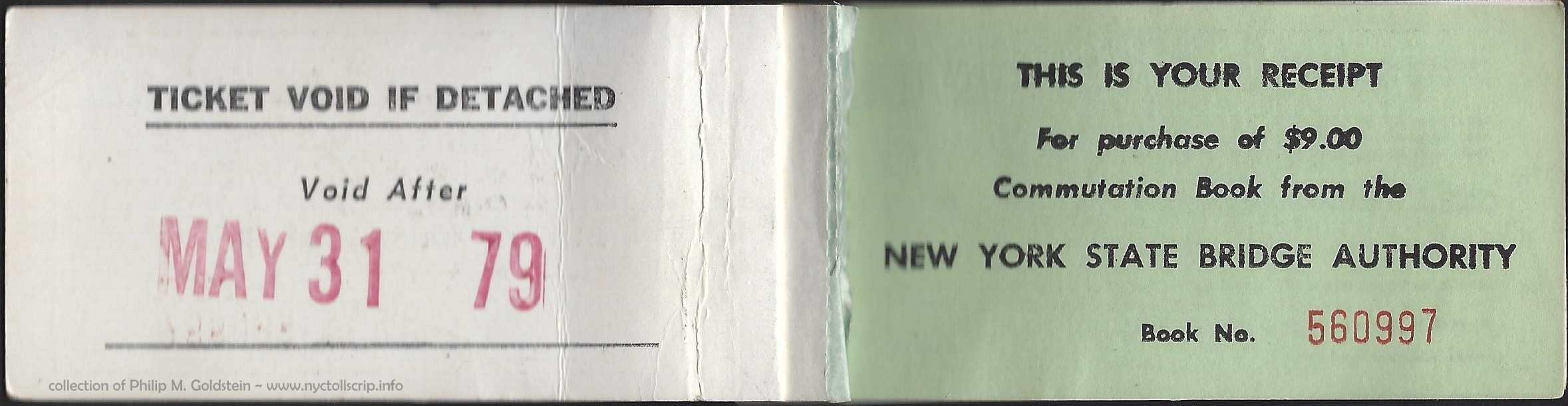 |
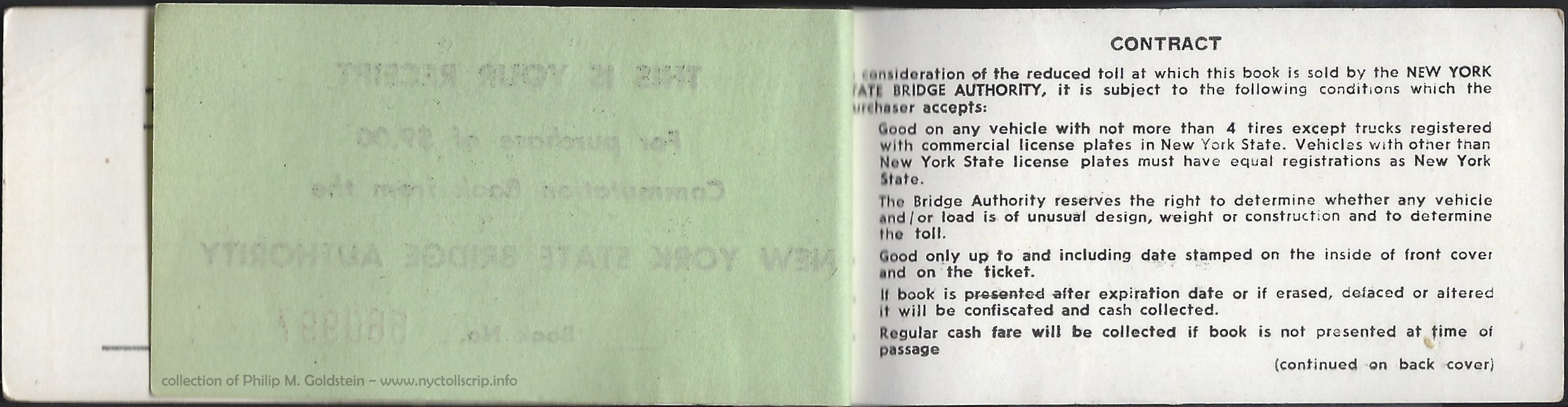 |
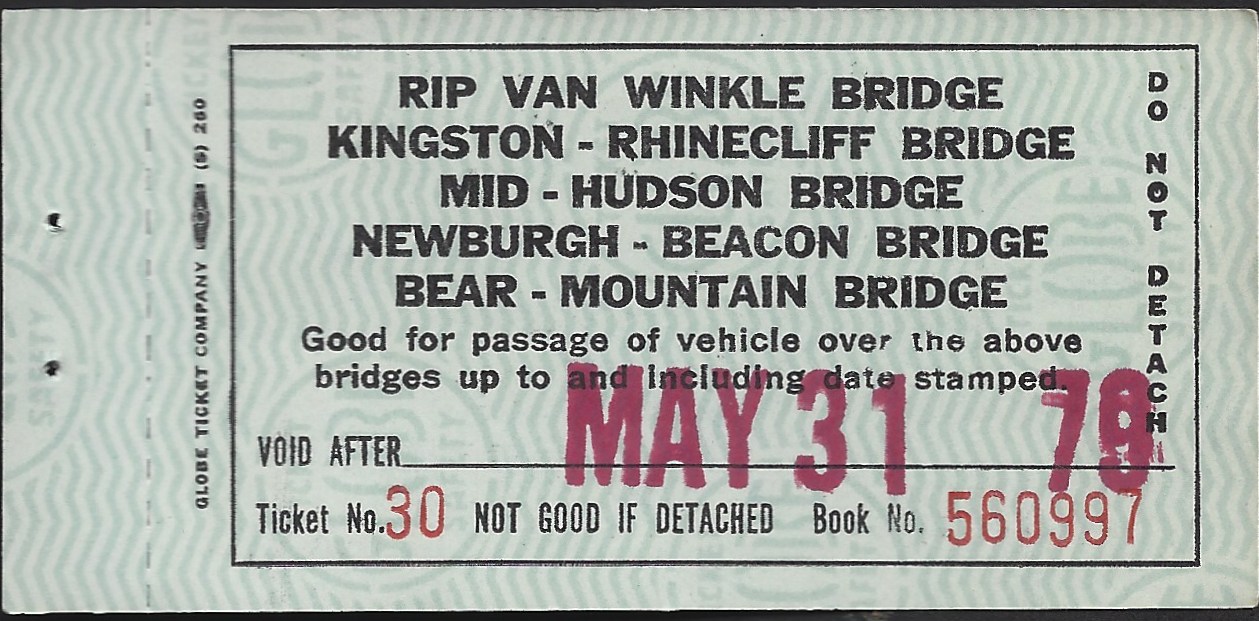 |
 |
New York State Bridge Authority toll scrip and booklet - 5/31/1979
Globe Ticket Company
collection of Philip M. Goldstein |
.
. |
|
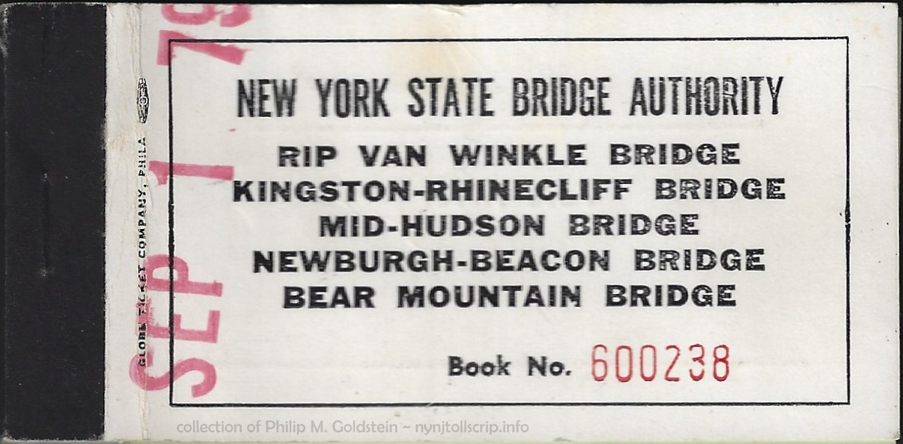 |
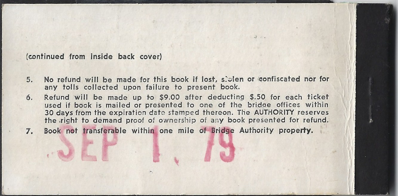 |
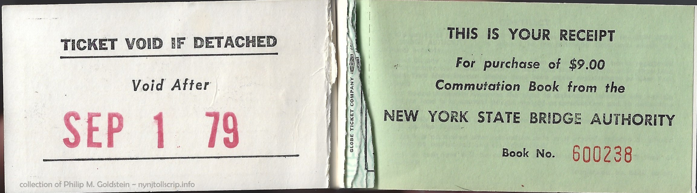 |
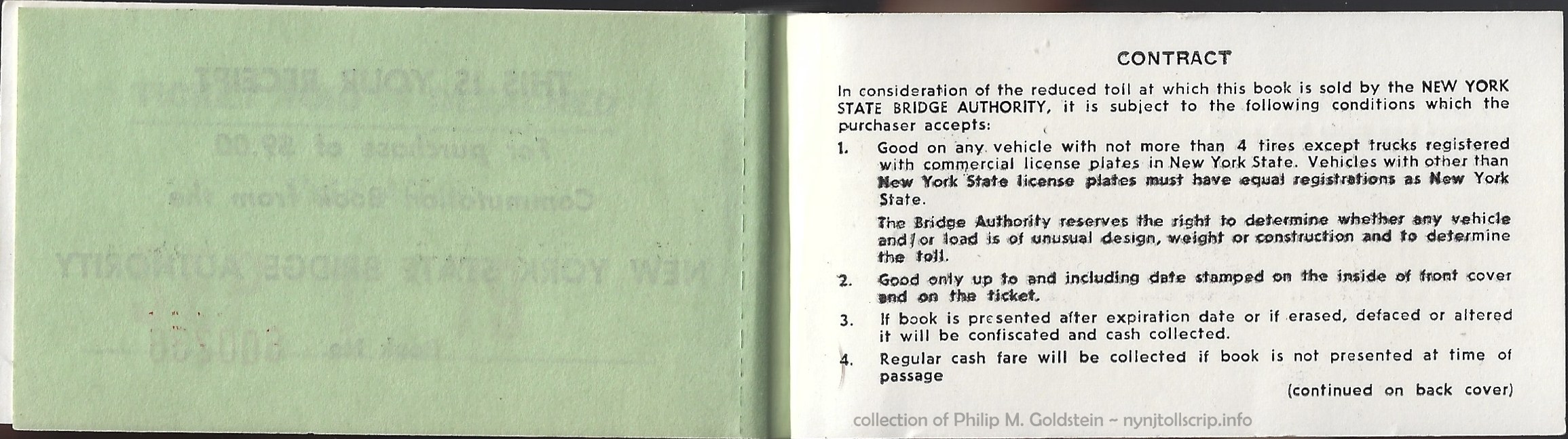 |
New York State Bridge Authority toll scrip and booklet - 9/1/1979
Globe Ticket Company
collection of Philip M. Goldstein
|
 |
 |
New York State Bridge Authority Employees Certificate of Passage - unknown date
3 1/4" x 2"
collection of Philip M. Goldstein
|
| New York
State Bridge Authority Receipts |
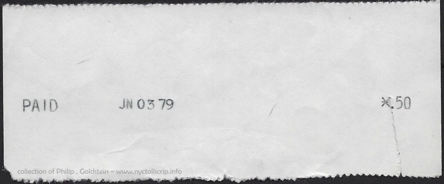 |
 |
|
Bear Mountain Bridge toll receipt - .50
- June 3, 1979
collection
of Philip M. Goldstein
|
..
. |
|
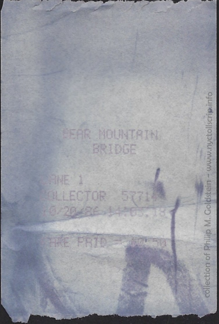 |
|
Bear Mountain Bridge toll receipt -
October 20, 1986 - .50
collection
of Philip M. Goldstein
|
..
. |
|
 |
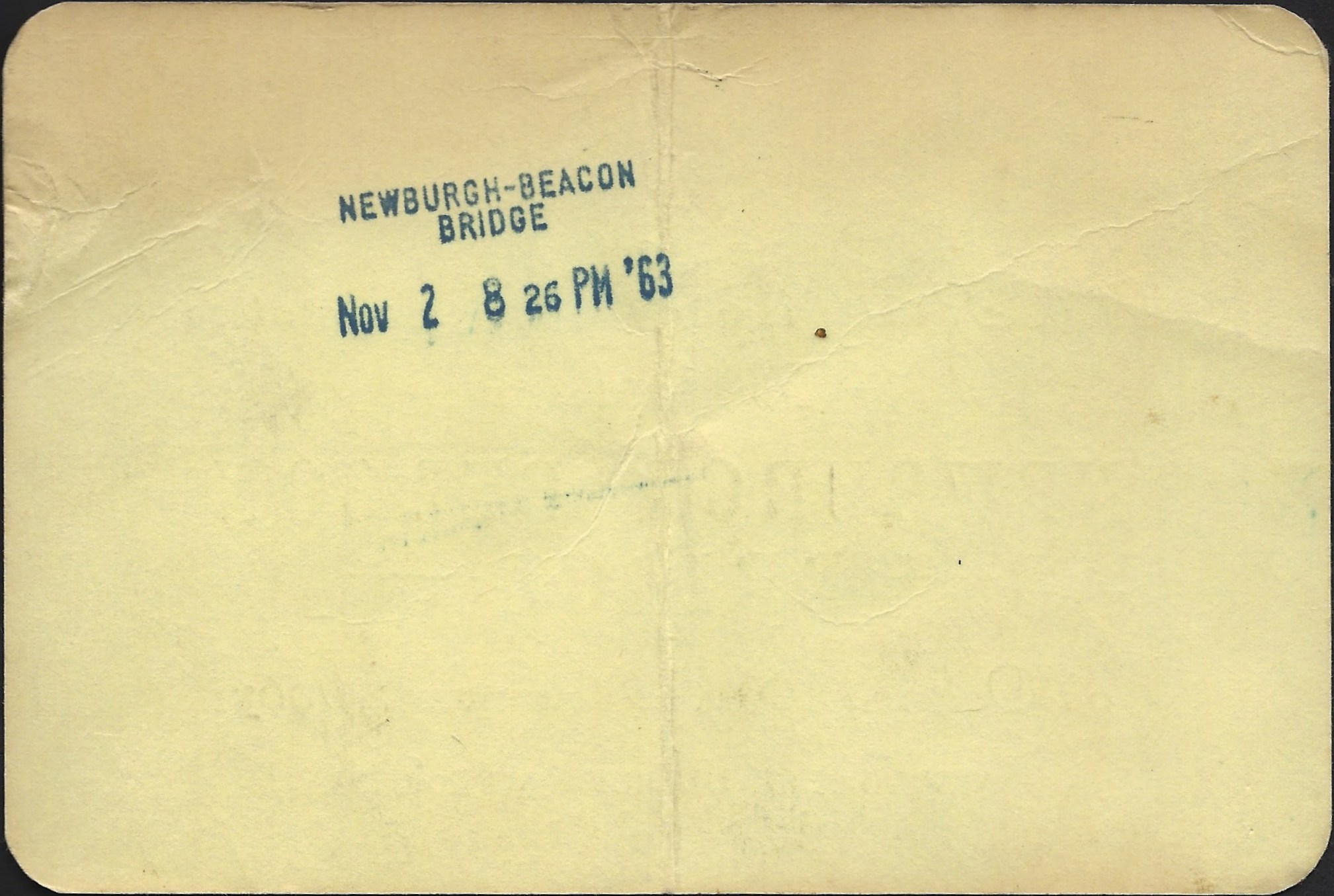 |
NYSBA commemorative receipt for Newburgh Beacon
Bridge Opening Day - November 2, 1963 - 8:26 PM
(cardstock)
collection of
Philip M. Goldstein
|
..
. |
 |
 |
Newburgh Beacon Bridge toll receipt -
May 12, 1979 - .50
collection of
Philip M. Goldstein
|
..
. |
|
 |
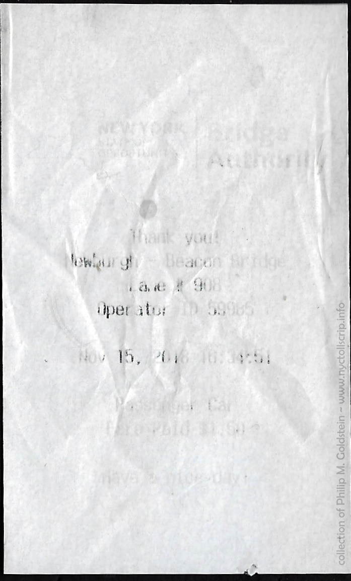 |
Newburgh Beacon Bridge toll
receipt - April 7, 1984 - 5:38 PM - $.50
(dot matrix)
collection of
Philip M. Goldstein
|
Newburgh Beacon Bridge toll
receipt - November 15, 2018 - 16:34 PM - $1.50
(thermal ink paper)
collection of
Philip M. Goldstein
|
..
. |
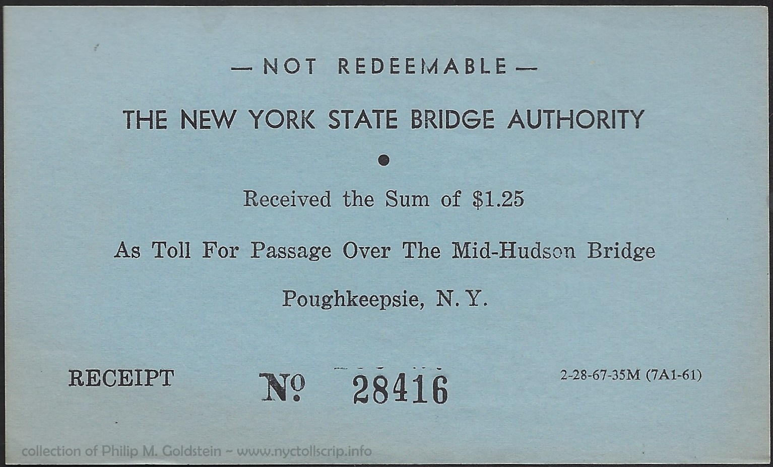 |
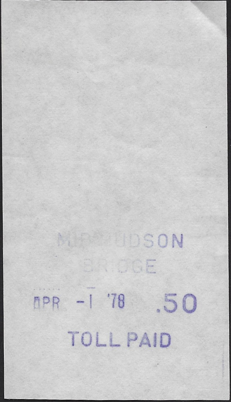 |
Mid Hudson Bridge toll receipt - 1.50 - ca.
1967
collection of
Philip M. Goldstein
|
Mid Hudson Bridge toll receipt - .50 -
April 1, 1978
collection of
Philip M. Goldstein
|
.
. |
|
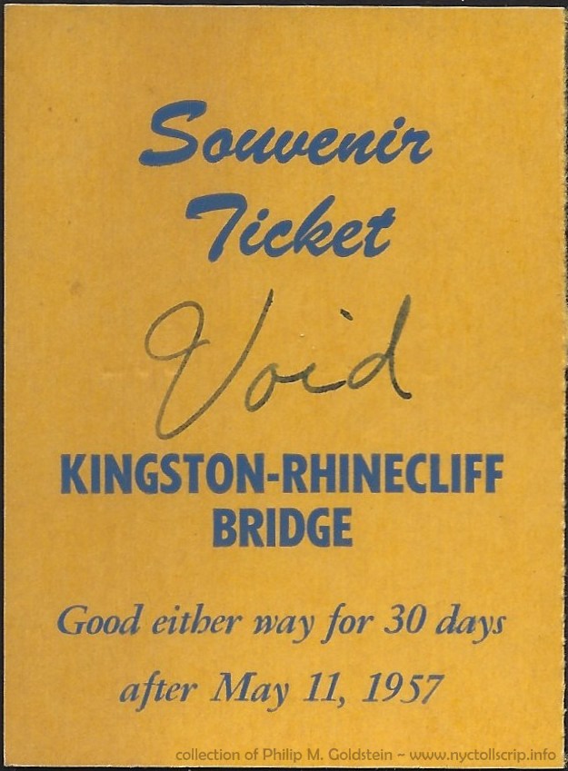 |
Kingston Rhinecliff Bridge Souvenir Ticket - $1.50 - May 11, 1957
collection of
Philip M. Goldstein
|
.
. |
|
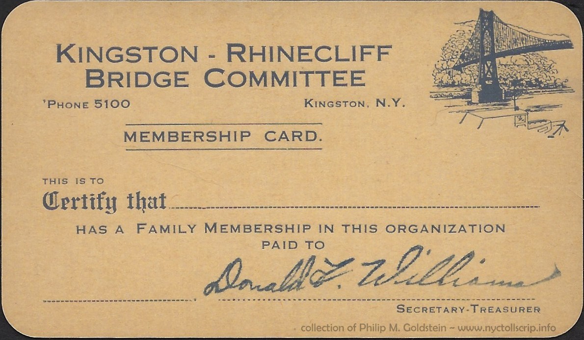 |
 |
Kingston Rhinecliff Bridge Committee Membership Card #935 - unknown date, but came with Souvenir Ticket above
collection of
Philip M. Goldstein |
.
. |
|
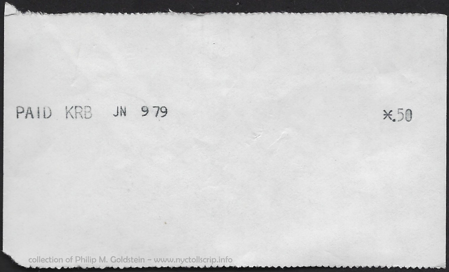 |
 |
Kingston Rhinecliff Bridge toll receipt - .50
- June 9, 1979
collection of
Philip M. Goldstein
|
..
. |
|
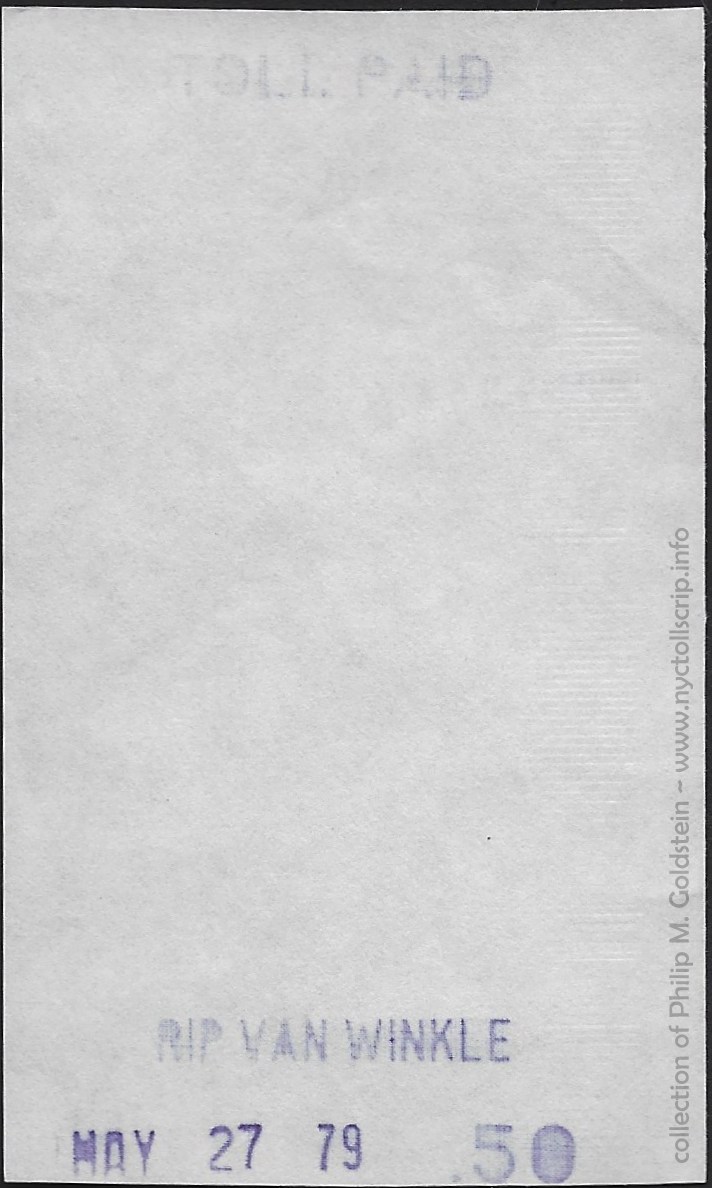
|
Rip
Van Winkle Bridge toll receipt - .50 - May 27, 1979
collection of
Philip M. Goldstein
|
Lake Champlain Bridge Commission
The Lake Champlain Bridge Commission had jurisdiction of two
bridges in the Lake Champlain vicinity: one at the north end of
the lake at the Canadian border, Rouses Point; the other towards
the south end, being Lake Champlain Bridge.
Lake Champlain Bridge
The first Lake Champlain Bridge was a vehicular bridge traversing
Lake Champlain between Crown Point, New York and Chimney Point /
Addison, Vermont via NY State Route 185.
The first Champlain Bridge (also known as the Crown Point Bridge) opened to traffic in 1929 as a toll bridge; and was
a 2,184-foot-long continuous truss bridge bridge that traversed Lake
Champlain between Crown Point, New York and Chimney Point, Vermont.
The bridge connected NY 185 in New York to VT 17 in Vermont.
The half-mile, two-lane, bridge was jointly owned and maintained by the
New York State Department of Transportation and the Vermont Agency of
Transportation.
This bridge was closed due to safety concerns on October 16, 2009, and was taken down by explosive demolition on December 28, 2009. It was replaced by a new bridge which opened on November 7, 2011.
The new bridge was designed and constructed
during an aggressive two-year schedule to minimize the social and
economic impact of the original bridge's demolition.
Tolls upon opening were noted as:
Lake Champlain Bridge Commission - Lake Champlain Bridge - Historical Toll Schedules
1929
. |
| Pleasure Cars |
single trip |
$1.00 |
|
round trip |
$1.50 |
| no charge for passengers or drivers |
Rouses Point Bridge
The Rouses Point Bridge opened in 1937 (its opening is announced
on a 1936 brochure published by the Lake Champlain Bridge Commission).
It connects Rouses Point, New York with Alburg, Vermont via US 2.
The first Rouses Point Bridge was a Parker through truss structure, with a swing bridge
center section for lake traffic transiting from the St. Lawrence River.
It was built by the Lake Champlain Bridge Commission starting in 1937,
with the opening to vehicular traffic on July 16, 1937.
The
original Rouses Point Bridge was replaced by the current, multi-span
concrete deck on concrete girder span and is over a mile in length.
This bridge opened in May 1987 and tolls at this crossing as well as at the Lake Champlain Bridge were abolished in 1987.
According to a 1937 brochure, the tolls upon opening of the
Rouses Point Bridge as well as the Lake Champlain Bridge were as follows:
Lake Champlain Bridge Commission - Lake Champlain & Rouses Point Bridges
Historical Toll Schedules - 1937
Single Trip Rates |
| Automobiles including passengers |
$1.00 |
| automobile trailers |
.50 |
| Small Buses |
$2.00 |
| Large Buses |
$3.00 |
| Trucks, up to 1 ton capacity |
$1.00 |
| Trucks, 1 ton to 2 ½ ton capacity |
$1.25 |
| Trucks, 2 ½ ton to 5 ton capacity |
$1.50 |
| Trucks over 5 ton capacity |
$2.00 |
| Trucks over 5 ton capacity with trailer |
$2.50 |
| Pedestrians |
.50 |
Round Trip Rates |
| Passenger automobiles |
$1.50 |
| Trucks - quote upon request |
A 1949 Brochure published by the Lake Champlain Bridge authority state
toll have been reduced to .25 cents for passenger cars including
drivers and passengers.
The 1959 receipt below lists the following toll schedule:
| pedestrians, bicycles, motorcycles |
.10 |
| passenger cars, trailer 2 axles |
.25 |
| trucks 2 axle |
.50 |
| single(?) units |
.15 |
|
|
| trucks 3 axles |
$1.00 |
| trucks 4 axles |
$1.15 |
| trucks 5 axles |
$1.30 |
| busses 2 axles |
$1.00 |
| busses 3 axles |
$1.15 |
|
|
|
Commutation Books (Trucks) available at regular rates
Commuters Books (Cars) available at regular rates
|
.
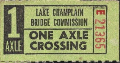 |
Lake Champlain Bridge 1 Axle Prepaid Ticket
unknown date
A ticket for one axle is most unusual. On retrospect it could only be applicable for a 1 axle trailer.
It
is theorized this was a supplemental ticket to two axle vehicles now
hauling a trailer, i.e.: If a purchaser bought a three axle ticket,
they would wind up overpaying for their crossing if they did not have a
trailer at that moment of crossing. Naturally, a one axle ticket was
useless by itself. So, a two axle vehicle operator could also purchase
one axle tickets and use in conjunction with a two axle ticket when
towing a trailer.
eBay |
.
. |
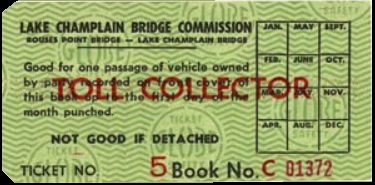 |
Lake Champlain Bridge Monthly Commutation Ticket
unknown date
Bridge commuters could buy a book of toll tickets
to cross the lake at discount rates.
William G. LaFrance, Jr. collection |
.
. |
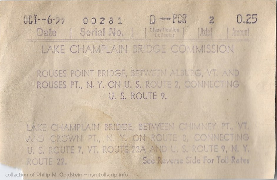  |
Lake Champlain Bridge toll receipt - 25 cents - October 6, 1959
collection of Philip M. Goldstein
added 26 January 2023 |
.
. |
  |
Lake Champlain Bridge toll receipt - 25 cents - July 12, 1965
collection of Philip M. Goldstein
added 06 January 2021 |
.
. |
 |
Lake Champlain Bridge toll receipt - 50 cents - September 21, 1979
collection of Philip M. Goldstein |
 The International Crossings The International Crossings 
The State of New York also carries with it the fortunate
distinction of being located on an international border, that being
with Canada. These crossings have a special importance as not only
are they river crossings, but they are also gateways for international
commerce.
Four international crossings exist between New York in the United
States and Canada, and fortunately they are known to have issued tokens and
/ or scrip for toll payment.
.
.
Cornwall - Northern New York International Bridge Corp. (1935 - 1957)
Cornwall - Massena International Bridge (1957 - present)
The original bridge, when opened was known as the "Roosevelt
International Bridge" as it connected Cornwall, Ontario with
Rooseveltown, NY. The corporation operating it was the Cornwall -
Northern New York International Bridge Corp. and provided a connection
between Ontario Route 2 and New York Route 37. On May 24, 1934 it was
authorized to reconstruct and utilize an existing span of the New
York Central Railroad (Ottawa and New York Railway) that was
reconstructed to carry rail, automobile and pedestrian traffic.
Prior to this it was a railway only crossing. Railroad service
across the span was reduced to one passenger train in each direction
per day in 1939. In 1951 this was further reduced to seasonal
traffic only (November tthrough April), with rail service ceasing
entirely on July 15, 1954.
A Rand McNally Map and Guide in my collection reflects the
following tolls for February 15, 1938 as agreed by the War Department
of the United States and the board of Railway Commissioners for Canada:
Roosevelt International Bridge - Historic Toll Schedule
. |
|
|
(US $) |
| Auto including driver |
|
$1.00 |
| Additional passengers, each: |
|
.10 |
| Auto with trailer and including driver |
|
$1.50 |
| Auto with trailer and including driver, return trip |
|
$2.00 |
| Special Trip: Auto and driver including 5 passengers making return trip |
|
$1.25 |
| Trucks: capacity 1/2 ton and up, round trip |
|
$1.50 - $5.00 |
| Busses & Miscellaneous |
|
|
| capacity 8 persons - round trip |
|
$3.00 |
| capacity 9 to 25 persons - round trip |
|
$5.00 |
| capacity exceeding 25 persons - round trip |
|
$6.50 |
| Motorcycle and driver |
|
.25 |
| Bicycle |
|
.10 |
| Foot Passengers |
|
.10 |
| all round trips good for return trip within 24 hours |
| In 1957, two new entities were created with equal interest: the St.
Lawrence Seaway Development Corporation, which in itself was comprised
of two companies: the Cornwall International Bridge Co. Ltd (the
Canadian owned portion) and the Cornwall- Massena International Bridge
sytem which was the United States owned portion). These corporations
acquired all outstanding shares of the former operator (above).
An entirely new crossing was proposed, to replace the antiquated span.
The new span would be slightly relocated from the existing route to
allow the old span to remain in use during construction.
The new crossing now
consisted of three spans: the Raquette River Bridge (also known as Rooseveltown Bridge) which is entirely in the
state of New York, the South Channel Bridge which connects New York
(United States) with Cornwall Island (Canada) and the North Channel
Bridge which connects Cornwall Island with Cornwall, Ontario, and is completely within Canada.
Designed by Hugh and Philip Louis Pratley, the South Channel Bridge was opened in 1958, and spans the St. Lawrence Seaway. The North Channel Bridge, which was scheduled to open in 1961; connects the City of Cornwall to Cornwall Island.
Automatic toll collection machines were installed to augment manual collection in 1960.
The bridges are now jointly owned by the Federal Bridge Corporation (a Crown corporation
of the Canadian Government) and the Saint Lawrence Seaway Development
Corporation, which is an agency of the United States Department of
Transportation. It is operated by the Seaway International Bridge
Corporation, which became under the control of the Federal Bridge
Corporation from the Saint Lawrence Seaway Authority in 1998.
The crossing is also now known as the Seaway International Bridge, and of the numerous
crossings between New York and Canada, this is one of the busiest, and
averages approximately two million crossings a year. The current toll, as of April 2019 is as follows.
|
|
In 2000, the North Channel Bridge was re-named the Three Nations Crossing in
recognition of the three Native American Nations it connects: Canada, Akwasasne, and the
U.S.A.
It is known that this crossing employed the use of tokens
for use at the toll booths. Research is pending on issues of Toll Scrip.
Seaway International Bridge - Current Toll Schedule
. |
| Gross Vehicle Weight Rating |
Toll Fares |
| pounds (SAE) |
kilograms (metric) |
# axles |
US $ |
CAN $ |
| under 9,000 pounds |
under 4,080 kilograms |
2 |
$3.00 |
$3.75 |
| 3 |
$4.50 |
$5.50 |
| 4 |
$5.75 |
$7.25 |
|
| over 9,000 pounds |
over 4,080 kilograms |
2 |
$9.50 |
$7.50 |
| 3 |
$11.75 |
$9.25 |
| 4 |
$14.00 |
$11.00 |
| 5 |
$16.25 |
$13.00 |
| 6 |
$18.50 |
$14.75 |
| 7 |
$20.75 |
$16.50 |
| 8 |
$23.00 |
$18.25 |
| 9 |
$25.25 |
$20.00 |
| 10 |
$27.50 |
$21.75 |
| Recreational Vehicles |
|
$9.50 |
$7.50 |
| All unused idler axles in the retracted position must be placed into lowered position and counted in tariff. |
|
| 10% Discount when you use Seaway Transit Card |
| Cornwall - Massena International Bridge Tokens |
 |
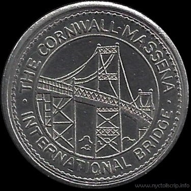 |
Cornwall International Bridge Company - ca. 1979
NY560A (no serifs) - 27mm - white metal
(shown larger than actual size for detail)
collection of
Philip M. Goldstein |
.
. |
|
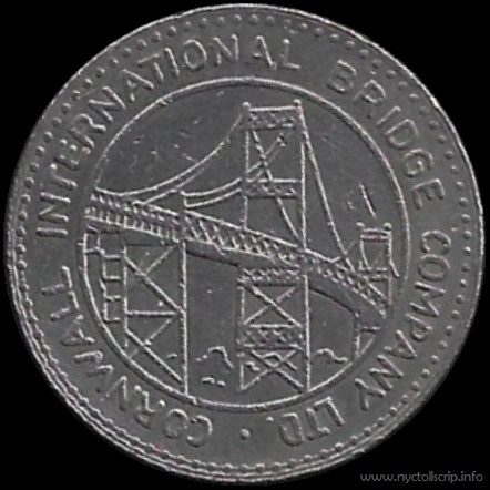 |
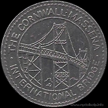 |
Cornwall International Bridge Company - ca. 1979
NY560B (no serifs) - 25mm - white metal
(shown larger than actual size for detail)
collection of
Philip M. Goldstein |
.
. |
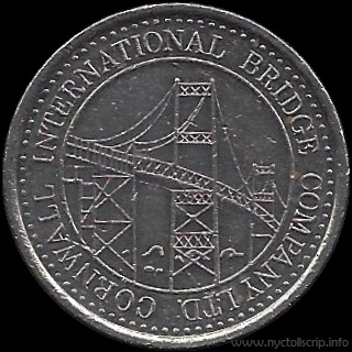 |
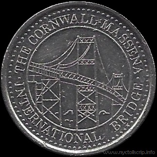 |
Cornwall International Bridge Company - ca. 1979
NY560C (with serifs) - 25mm - white metal
(shown larger than actual size for detail)
collection of
Philip M. Goldstein |
Ogdensburg - Prescott International Bridge
The
Ogdensburg–Prescott International Bridge crosses the St. Lawrence
Seaway and connects Ogdensburg, New York, USA with Johnstown, Ontario
in Canada. The bridge is also known as the St. Lawrence Bridge and the
Seaway Skyway.
It is a suspension bridge designed by Modjeski & Masters and of which was completed in 1960. It is comprised of 6
spans with a main span 1,150.8 feet, and with approaches it totals 1.5 miles in length.
The Ogdensburg–Prescott International Bridge allows for both
passenger and commercial vehicles to cross the Canada - United States
border; however neither bicyclists or nor pedestrians are permitted to cross this
bridge. The bridge is a very popular border crossing for passenger
vehicles due to its proximity to Ottawa, the capital of the Ontario Province.
As the bridge was designed for heavy loads and has a weight
capacity of 105,000 pounds, the weight limit easily accommodates
semi-trailer trucks of multiple axles, but as the bridge is not
directly connected to to any American interstate highway, it does not
see as much commercial traffic as the neighboring Thousand Islands
Bridge to the southwest.
On the Canadian side, the bridge connects to Highway 16 and on the American side the bridge connects to New York State Route 812.
The bridge is owned and operated by the Ogdensburg Bridge and
Port Authority, which is a New York State public-benefit corporation.
A printed brochure located online and issued by the Ogdensburg
Bridge and
Port Authority mentions truck scrip, but it is not dated and does not
conform to the present toll schedule. However it does match the toll rates as filed in accordance with Codes
Rules Regulations of New York, 21-5704.1, for the
Ogdensburg International Bridge were as follows, effective July 12, 2006.
It is now understood that there was scrip issued for this bridge,
but at the current time, its appearance is not known.
|
|
Ogdensburg Bridge & Port Authority - Historical Toll Schedule
July 12, 2006
.
|
| vehicle |
toll rate US $ |
| Automobile (one way) |
2.75 |
| 2 axle truck |
5.00 |
| 3 axle truck |
6.00 |
| 4 axle truck |
6.50 |
| 5 axle truck |
8.50 |
| 6 axle truck |
10.00 |
| 7 axle truck |
11.50 |
| 8 axle truck |
13.00 |
| 9 axle truck |
14.50 |
| 10 axle truck |
16.00 |
| additional axles (each) |
1.00 |
| School Buses |
2.00 |
| Commercial Buses |
5.00 |
Special Fares |
The authority's special toll rates, effective July 12, 2006, are as follows:
(a) Truck toll scrip.
120 fifty-cent tickets for $60, less 10 percent discount for payment in advance.
(b) Passenger discount program.
75 trips for $90, valid for a two-month period from the date of issuance.
60 trips for $100, valid for six-month period from the date of issuance.
20 trips for $37, valid for six-month period from the date of issuance.
(c) Special toll promotions are specifically authorized by the authority as follows:
(1)
Retail organizations shall receive a 25 percent discount from the
normal $2 fare by purchasing a book containing 50 crossings for $75.
(2)
School, community and/or not-for-profit organizations shall receive a
50 percent discount from the normal $2 fare by purchasing a book
containing 50 crossings at $75.
|
It is known that the printed scrip has been replaced with RFID "Commuter Cards", as seen below. Current tolls as per the Ogdensport Bridge & Port Authority website are as follows.
|
Ogdensburg Bridge & Port Authority - Current Toll Schedule
effective April 15, 2019
.
|
|
|
| vehicle type |
US $ |
| Automobile |
$3.25 |
| 2 Axle Truck |
$6.75 |
| 3 Axle Truck |
$8.50 |
| 4 Axle Truck |
$10.25 |
| 5 Axle Truck |
$12.00 |
| 6 Axle Truck |
$13.75 |
| 7 Axle Truck |
$15.50 |
| 8 Axle Truck |
$17.25 |
| 9 Axle Truck |
$19.00 |
| 10 Axle Truck |
$20.75 |
| Over 10 Axles |
$1.75 per axle |
| Bus (Commercial) |
$6.75 |
| Commercial Truck Permit |
$65.00 |
| Commercial Oversized Escort Fee |
$140.00 |
| Commercial Overweight Escort Fee |
$1,000.00 |
.
Truck Toll Card: |
|
| 6 Crossings (6 month expiration) |
$66.00 |
.
Commuter Card (passenger vehicles) |
|
| 20 Crossings - 6 month expiration |
$52.00 |
| 60 Crossings - 6 month expiration |
$156.00 |
| 75 Crossings - 2 month expiration |
$195.00 |
.
Thousand Islands Bridge Authority
The Thousand Islands International Bridge (French: Pont des
Mille-îles) is an American-maintained international bridge system over
the Saint Lawrence River connecting northern New York in the United
States with southeastern Ontario in Canada.
The suspension bridge was designed by Robinson and Steinman and constructed in 1937, with
additions in 1959. The bridges span the Canada– United States border in the middle
of the Thousand Islands region. All bridges in the system carry two
lanes of traffic, one in each direction, with pedestrian sidewalks.
The Thousand Islands International
Bridge system is a series of five bridges that span parts of the St.
Lawrence River, ultimately connecting both banks. From south (US) to
north (Canada):
- Collins Landing (American mainland) to Wellesley Island (main span) and US Customs Inspection Point (for southbound traffic).
- Wellesley Island to Hill Island (international crossing) - and Canadian Border Services Inspection Point (for northbound traffic).
- Hill Island (Canada) to Constance Island (Canada)
- Constance Island (Canada) to Georgina Island (Canada)
- Georgina Island (Canada) to Canadian mainland
The southern end of the bridge connects
with Interstate 81 and the northern end of the bridge connects to
Ontario Highway 401 via Highway 137. There is also an interchange with
the Thousand Islands Parkway on the Ontario side.
The actual international border bridge crossing is a set of two
parallel 90 foot long bridges between Wellesley Island in the
United States and Hill Island in Canada.
The bridge system is administered by the Thousand Islands Bridge Authority, a New York State public benefit corporation,
whose seven board members are appointed by the Jefferson County Board
of Legislators. Four board members are US citizens and three are
Canadian citizens.
Current tolls are paid by cash, by E-ZPass,
or with a Commuter Discount Fare Trip Tag, which is good for either 16
trips for $20.00 or 72 trips for $32.00. The Bridge Authority has joined
the multi-state E-ZPass consortium and introduced electronic toll collection in June 2019.
|
Thousand Islands Bridge Authority - Current Toll Schedule
.
|
vehicle
class |
description |
# axles |
US $
|
CAN $
|
| 1 |
Automobiles, Pick Up Trucks, Motorcycles |
2 |
$3.00 |
$4.00 |
| 2 |
Automobiles, Pick Up Trucks with single axle trailer |
3 |
$4.75 |
$6.50 |
| 3 |
Recreational Vehicles, School Buses, Island Delivery |
2 |
$4.50 |
$5.75 |
| 4 |
Trucks and Buses |
2 |
$6.75 |
$8.50 |
| 5 |
Tractor Trailer Trucks |
3 |
$8.50 |
$11.00 |
| 6 |
Tractor Trailer Trucks |
4 |
$10.25 |
$13.50 |
| 7 |
Tractor Trailer Trucks |
5 |
$12.00 |
$16.00 |
| 8 |
Tractor Trailer Trucks |
6 |
$13.75 |
$18.50 |
| 9 |
Tractor Trailer Trucks |
7 |
$15.50 |
$21.00 |
| 10 |
Tractor Trailer Trucks |
8 |
$17.25 |
$23.50 |
|
Additional Axles Any One Vehicle Class |
1 |
$1.75 |
$2.50 |
|
Commercial Escort Fee |
|
$140.00 |
$185.00 |
|
Commuter Discount Fare Card (16 Trip) |
|
$23.00 |
$30.00 |
|
Commuter Discount Fare Card (72 Trip) |
|
$35.00 |
$48.00 |
The Commutation Tickets seen below was for commuters on the
United States side, commuting from Collins Landing, New York (US
mainland) and Wellesley Island.
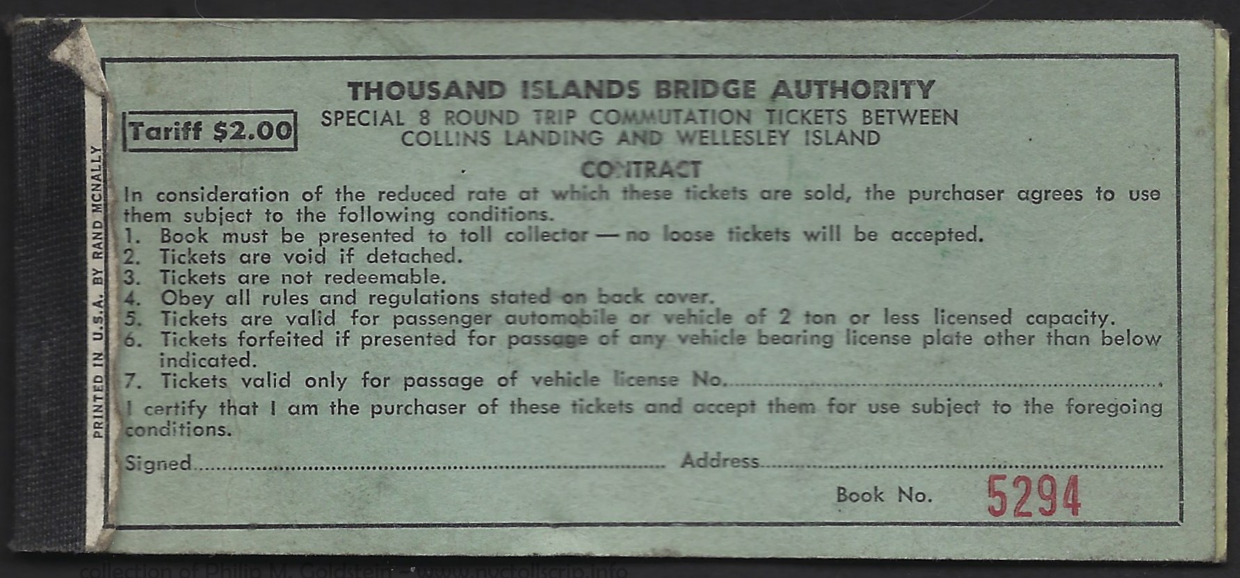 |
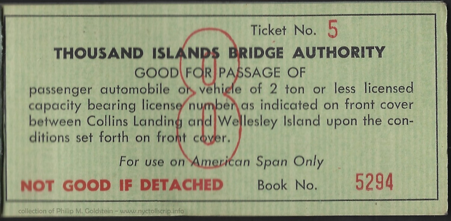 |
Thousand Islands Bridge Authority prepaid toll scrip
- Special Class 8 - date unknown
Round Trip Commutation Tickets between Collins Landing & Wellesley
Island, American Span Only
collection of
Philip M. Goldstein
|
.
.
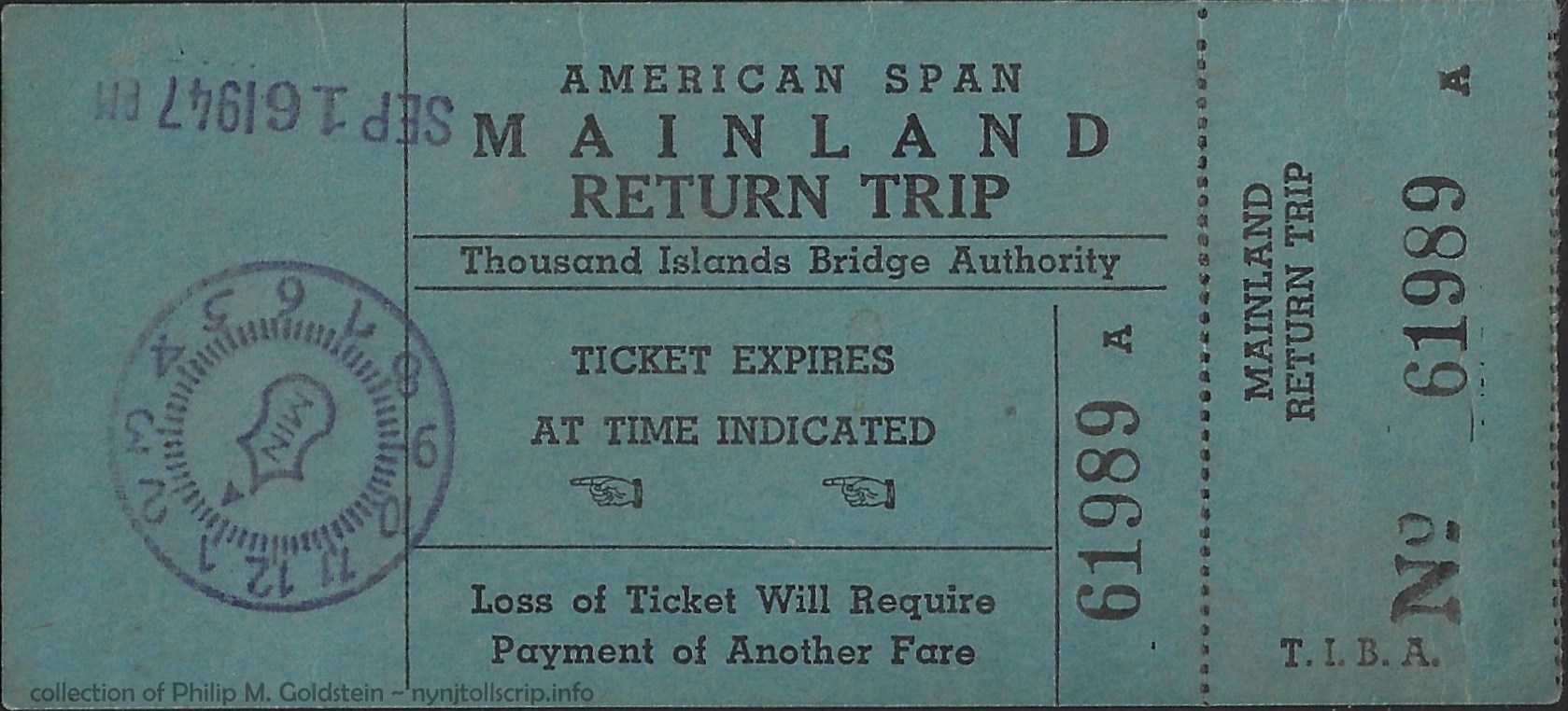 |
Thousand Islands Bridge Authority - American Span, Mainland Return Trip Ticket - September 16, 1947
4 7/16" x 2"
collection of
Philip M. Goldstein
|
.
Niagara Falls Bridge Commission
| crossing |
span type |
opening date |
| Lewiston-Queenston Bridge |
suspension
suspension
steel arch |
1851-1854 (or 1864)
July 21, 1899 - November 2, 1962
November 1, 1962 |
| Whirlpool Rapids Bridge |
double deck steel arch (upper deck railway / lower deck automobile) |
August 27, 1897 |
| Rainbow Bridge |
steel arch |
November 1, 1941 |
The Niagara Falls Bridge Commission (NFBC) was
established by Joint Resolution of the 1938 U.S. Congressional Third
Session. This resolution created the outline for the Niagara Falls
Bridge Commission as it currently is constituted.
The Extra Provincial Corporations Act by the Province of
Ontario, Canada; issues the operational license for the NFBC. As such, both Canada and the United States are equally
represented on the NFBC by the bi-national appointment of an
eight-member Board of Commissioners.
The NFBC was established to finance,
construct and operate the three international bridges across the Niagara
River connecting the Province of Ontario, Canada and the State of New
York, United States. These bridges being (from north to south), the: Lewiston-Queenston Bridge, Whirlpool Rapids Bridge and the Rainbow Bridge.
The NFBC was initially established to finance, construct and
operate the Rainbow Bridge. However following completion of that bridge
and its subsequent operation, and considering the effectiveness and efficiency at which
the Commission operated, its role was subsequently expanded.
Therefore, through
amendments to the Joint Resolution in the U.S., and by the Rainbow
Bridge Amendment Act of 1959 and the Queenston Bridge Act of 1959 in
Canada; the NFBC’s powers and authority expanded. These enactments empowered the NFBC to assume
responsibilities for the Whirlpool Rapids (Lower) and Lewiston-Queenston
Bridges as well.
In the present day, in addition to owning and operating three
international bridges, the Niagara Falls Bridge Commission constructs and maintains facilities for
Customs and Immigration functions on both the Canadian and United States sides of the international
border. The NFBC is self-supportive, largely through user fees (tolls)
and private-sector tenant leases; and the NFBC conducts international commercial
financial transactions and issues federal (U.S.) tax-exempt bonds.
The
Rainbow Bridge was designed by architect Richard (Su Min) Lee to
replace the ice damaged Honeymoon Bridge. His design was used again for
the Lewiston-Queenston Bridge, approximately 6 miles downriver.
The Whirlpool Rapids Bridge was designed by civil engineer
Leffert L. Buck, who had been hired to maintain the pre-existing
Roebling Suspension Bridge across the Niagara Gorge. Buck settled
for a bridge of the arch design. At that time of design, arch bridges
had become the favored design railway bridges and were more
cost-efficient than suspension type bridges. Beginning on April 9,
1896, the new bridge was built around and below the Suspension Bridge,
replacing it a piece at a time. His plan allowed bridge traffic -
railroad and pedestrian, to continue without disruption. By August
27, 1897, the last pieces of the Suspension Bridge were dismantled,
leaving the Lower Steel Arch Bridge, later renamed the Whirlpool Rapids
Bridge;in its stead.
.
.
Tolling
Historical tolls for the three bridges are under research.
Brochures seen for the Whirlpool Rapids
Bridge
and dated 1939 and 1942; list a .25 cent toll for car & driver and
.05 cents for
each additional passenger. A toll receipt seen on eBay (and now
part of my collection) which is dated July 30, 1952, lists .40 cents
for automobile.
The following schedule was located in WestLaw, but unfortunately
no date is given. Extrapolating the automobile rate, it should be the
toll schedule effective June 17, 1991.
|
OFFICIAL COMPILATION OF CODES, RULES AND REGULATIONS OF THE STATE OF NEW YORK
TITLE 21. MISCELLANEOUS
CHAPTER XX. NIAGARA FALLS BRIDGE COMMISSION
PART 950. RULES AND REGULATIONS
21 CRR-NY 950.2 Toll rates: Rainbow, Whirlpool Rapids and Lewiston-Queenston bridges.
(a) Cash toll - one way - toll collected in both directions
|
|
|
US $ |
CAN $ |
| 1 |
Children under 5 years |
Free |
Free |
| 2 |
Pedestrians |
25¢ |
25¢ |
| 3 |
Automobile |
75¢ |
1.00 |
| 4 |
Trailers (passenger cars) |
75¢ |
1.00 |
| 5 |
Taxi cab |
75¢ |
1.00 |
| 6 |
Motorcycle |
75¢ |
1.00 |
| 7 |
Commercial vehicles (trucks) |
20¢ p.t. |
20¢ p.t. |
Note: Truck rates based on gross weight per ton of vehicle and load - Motor trucks and driver - per ton
*The right is reserved to examine the bill of lading to determine weight of cargo carried. |
|
Minimum charge |
75¢ |
1.00 |
| 8 |
Wagon |
75¢ |
1.00 |
| 9 |
Bicycle |
25¢ |
25¢ |
| 10 |
Fire apparatus and drive |
Free |
Free |
| 11 |
Motor bus (engaged in daily scheduled operation over bridge) |
2.00 |
2.50 |
| 12 |
Motor bus and operator (not engaged in daily scheduled operation over bridge) - 2 axle |
2.00 |
2.50 |
|
Motor bus and operator (not engaged in daily scheduled operation over bridge) - 3 or more axles |
2.50 |
3.00 |
| 13 |
Tractors (farm or commercial) and driver (no lugs permitted) |
75¢ |
1.00 |
| 14 |
Baby carriages |
Free |
Free |
| 15 |
Ambulance |
Free |
Free |
| 16 |
Funerals – each automobile & hearse |
75¢ |
1.00 |
| 17 |
Commercial Float - same as commercial vehicles (truck) |
|
|
|
|
|
|
| * Operators
of trucks and tractor–trailer trucks, whether light or loaded, shall
upon request of a bridge employee, permit examination of such papers
and/or documents as may be deemed necessary to determine weight of the
load being carried over the facility. |
|
|
|
|
.
(b) Commutation tolls - one way - collected in both directions
|
40 tokens per roll
Tokens honored on the Rainbow, Whirlpool Rapids and the Lewiston-Queenston bridges. |
20.00
(.50) |
26.00
(.65) |
|
Automobiles, taxis and trailers
|
1 token |
|
|
|
|
| (1)
|
Book containing 80 tickets good for three months after date of sale
honored on the
Rainbow, Whirlpool Rapids, and Lewiston-Queenston bridges |
6.50
(.08) |
|
|
Automobile and driver |
3 tickets |
|
each additional occupant |
1 ticket |
|
Pedestrian |
1 ticket or 1 token |
| (2) |
Pedestrian toll token, no expiry date, - 16 tokens -
(for pedestrian use only - not good for passengers in vehicles) |
1.30
(.08) |
|
.
Niagara Falls Bridge Commission - Historical Toll Schedules
. |
|
1939
Rainbow
|
|
1981 |
|
4/20/1990
each direction |
|
6/17/1991
each direction 1 |
|
7/1/1995
each direction |
|
1/1/1996 5
each direction |
|
Date?
|
|
3/30/1998 7
one way to Canada |
|
11/2002? |
|
2/1/2007 |
|
11/15/2007 6 |
|
US $ |
|
US $ |
CAN $ |
|
US $ |
CAN $ |
|
US $ |
CAN $ |
|
US $ |
CAN $ |
|
US $ |
CAN $ |
|
US $ |
CAN $ |
|
US $ |
CAN $ |
|
US $ |
CAN $ |
|
US $ |
CAN $ |
|
US $ |
CAN $ |
| cash - car & driver |
.25 |
|
.50 |
.50 |
|
.50 |
.50 |
|
.75 |
1.00 |
|
1.00 |
1.25 |
|
n/c |
n/c |
|
2.00 |
2.50 |
|
2.50 |
3.50 |
|
3.00 |
|
|
3.00 |
3.50 |
|
3.25 |
3.25 |
| each passenger 1 |
.5 |
|
.10 |
.10 |
|
.10 |
.10 |
|
rate abolished |
|
|
|
|
|
|
|
|
|
|
|
|
|
|
|
|
|
|
|
|
|
commuter token
(rolls of 40) |
|
|
|
|
|
|
|
|
.50
20.00 |
.65
26.00
|
|
.66 |
.86 |
|
.70
28.00 |
.90
36.00 |
|
|
|
|
.90
36.00 |
1.275
$51.00 |
|
|
|
|
|
|
|
|
|
| ExpressPass 2 |
|
|
|
|
|
|
|
|
|
|
|
|
|
|
|
|
|
|
|
|
|
|
|
|
|
|
|
|
|
2.75 |
|
| Nexus card 3 |
|
|
|
|
|
|
|
|
|
|
|
|
|
|
|
|
|
|
|
|
|
|
|
|
|
|
|
|
|
|
2.35 |
| truck per ton 4 |
|
|
|
|
|
|
|
|
|
|
|
n/c |
up 25% |
|
n/c |
|
|
|
|
|
|
|
|
|
|
|
|
|
|
|
| buses 2 axle 1 |
|
|
.50 for driver
.10 each passenger |
|
.50 for driver
.10 each passenger |
|
2.00 |
2.50 |
|
3.00 |
3.50 |
|
n/c |
|
|
|
|
|
|
|
|
|
|
|
|
|
10.25 |
|
| buses 3 axle 1 |
|
|
|
|
2.50 |
3.00 |
|
4.00 |
4.50 |
|
n/c |
|
|
|
|
|
|
|
|
|
|
|
|
|
13.50 |
|
| pedestrian / bicycle |
|
|
|
|
|
.10 |
|
|
.25 |
|
|
|
|
|
|
|
|
|
|
|
|
|
|
|
|
|
|
|
|
|
|
| recreational vehicles |
|
|
|
|
|
|
|
|
|
|
|
|
|
|
|
|
|
|
|
|
|
|
|
|
|
|
|
|
|
3.25 |
|
| trucks 5 axles |
|
|
|
|
|
|
|
|
|
|
|
|
|
|
|
|
|
|
|
|
13.00 |
20.00 |
|
13.00 |
20.00 |
|
17.00 |
20.00 |
|
|
|
1 - driver / passenger rate abolished - flat rate per vehicle instituted 6/17/1991
2 - ExpressPass @ 15% discount introduced 10/18/2007 to supplement tokens
3 - Nexus Card (Canada) introduced
4 - per ton rates abolished in favor of per axle rates on unknown date
5 - commutation rate change only - all other rates remained unchanged
6 - due to currency parity; tolls became equal for US and CAN dollar
7 - Rainbow Bridge became dedicated commuter crossing.
Whirlpool Rapids Bridge became token only 4/21/2003, Nexus only 10/2/2003
E-ZPass accepted at all crossings Late Summer 2014 |
.
Current tolls are collected westbound (towards Canada) only and are as follows:
Niagara Falls Bridge Commission - Current Toll Schedule
. |
|
US $ |
CAN $
|
.
Automobiles (Cash, E-ZPass, ExpressPass) |
| Cash |
4.00 |
5.50 |
| E-ZPass |
4.00 |
N/A |
| ExpressPass |
4.00 |
5.50 |
| Nexus/Toll |
4.00 |
5.50 |
| In Tow per Axle |
4.00 |
5.50 |
|
. |
| Commercial (Cash, E-ZPass, ExpressPass) |
| 2 Axles |
6.00 |
8.25 |
| 3 Axles |
11.00 |
15.25 |
| 4 Axles |
19.00 |
26.25 |
| 5 Axles |
28.50 |
39.50 |
| 6 Axles |
41.00 |
57.00 |
| 7 Axles |
54.00 |
75.00 |
| 8 Axles |
66.00 |
91.25 |
| 9 Axles |
79.00 |
109.50 |
| 10 Axles |
92.00 |
127.50 |
| 11 Axles |
105.00 |
145.50 |
| 12 Axles |
118.00 |
163.50 |
.
Buses: (Cash, E-ZPass, ExpressPass)
|
| 2 Axle |
10.50 |
14.50 |
| 3 Axle |
14.50 |
20.00 |
| Recreational Vehicle / Limousine per Axle |
4.00 |
5.50 |
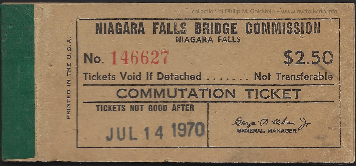
|
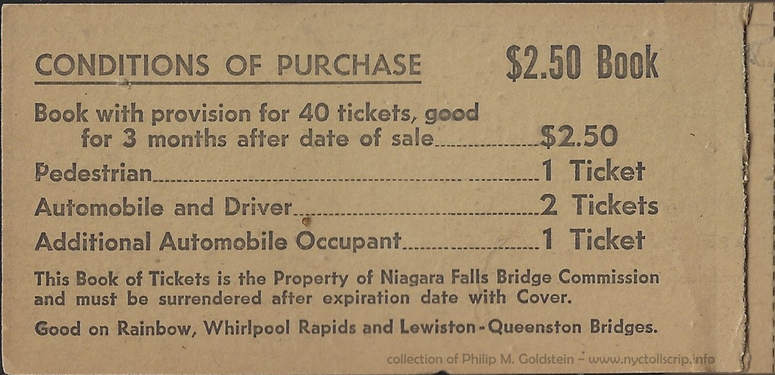
|
| front outer cover |
inner front cover |
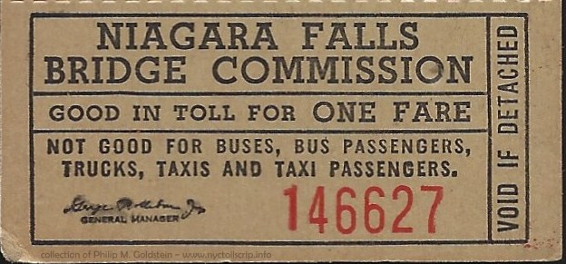
|
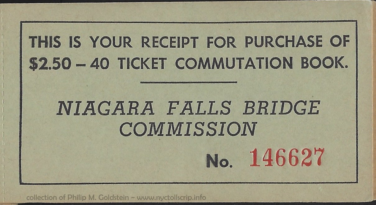 |
| individual ticket (strips of four per sheet) |
rear inner flyleaf (receipt) |
Niagara Falls Bridge Commission - July 14, 1970
$2.50 - 40 trip Commutation Ticket Book
collection of
Philip M. Goldstein
added 13 December 2020 |
.
. |
|
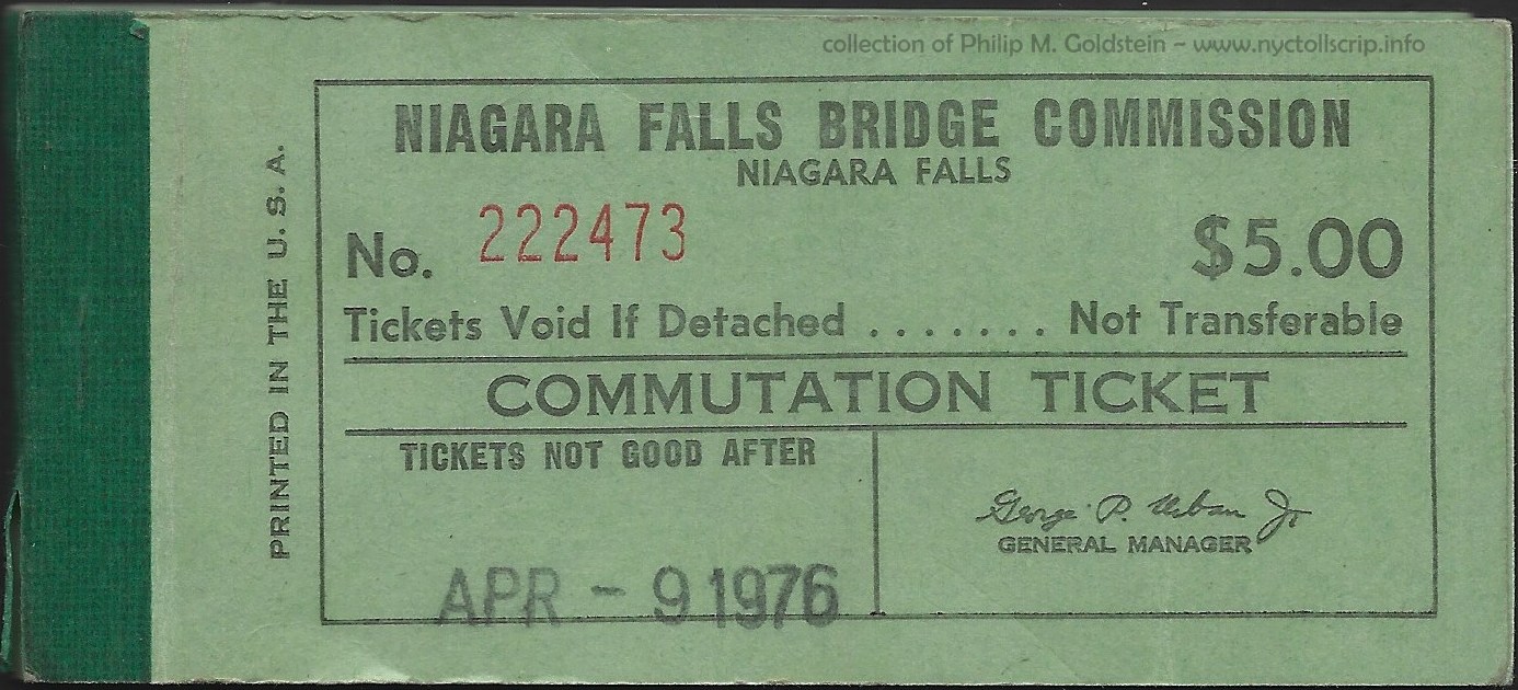 |
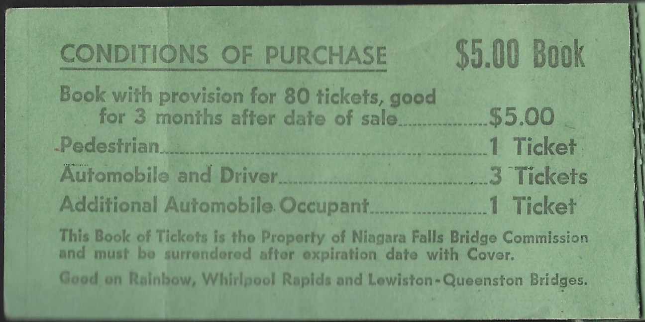 |
| front outer cover |
inner front cover |
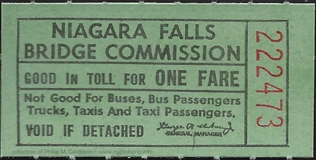 |
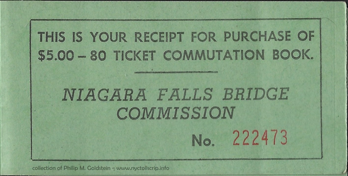 |
| individual ticket (strips of four per sheet) |
rear inner flyleaf (receipt) |
Niagara Falls Bridge Commission - April 9, 1976
$5.00 - 80 trip Commutation Ticket Book
collection of
Philip M. Goldstein
added 13 December 2020
|
.
. |
|
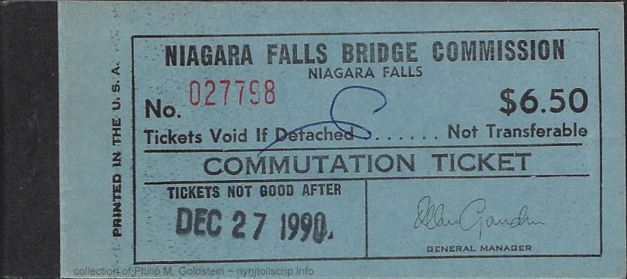 |
 |
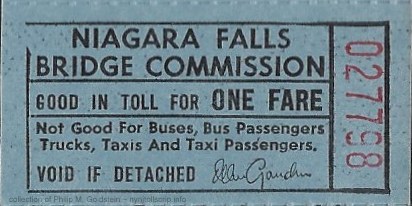 |
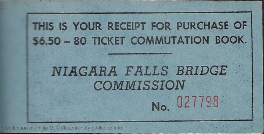 |
Niagara Falls Bridge Commission - December 27, 1990
$6.50 - 80 trip Commutation Ticket Book
(black cloth binding)
collection of
Philip M. Goldstein
added 12 September 2022 |
.
. |
|
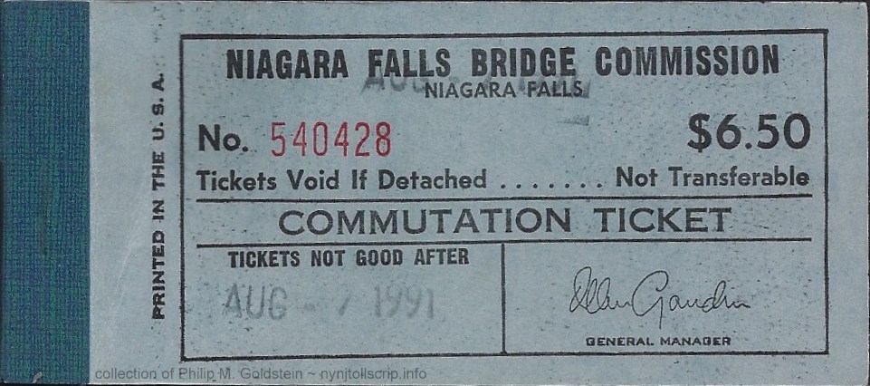 |
 |
|
|
Niagara Falls Bridge Commission - August 7, 1991
$6.50 - 80 trip Commutation Ticket Book
(blue cloth binding; also include several attached coupons for duty free shop and area motor inns inside back cover)
collection of
Philip M. Goldstein
added 12 September 2022 |
.
. |
|
 |
 |
Niagara Falls Bridge Commission - 1968
NY640G - 16mm - brass
(shown larger than actual size for detail)
collection of
Philip M. Goldstein |
.
. |
|
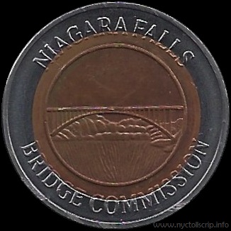 |
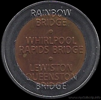 |
Niagara Falls Bridge Commission - 6/16/1991
NY640H - 25mm - white metal w/ 19mm copper center
(shown larger than actual size for detail)
collection of
Philip M. Goldstein |
.
. |
|
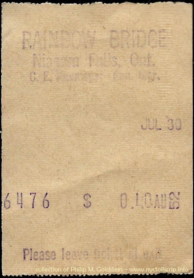 |
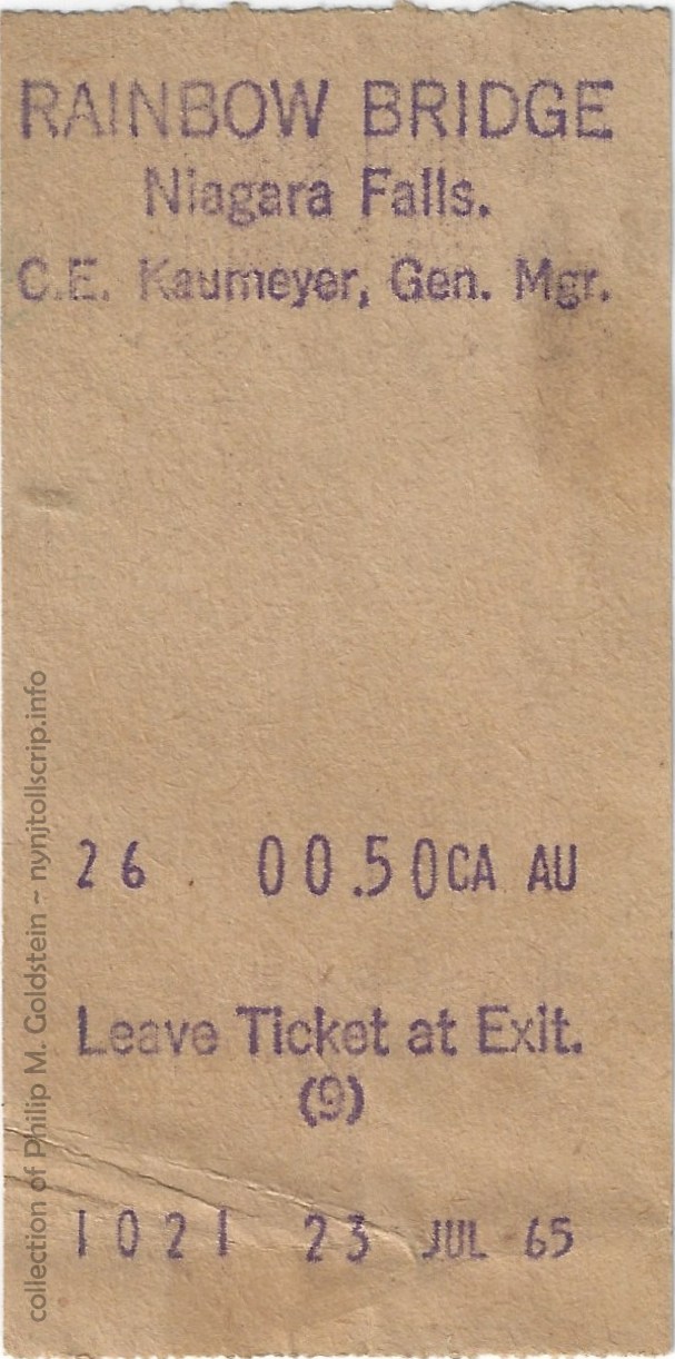 |
Rainbow Bridge Receipt - July 30, 1952
.40 - Automobile
collection of Philip M. Goldstein |
Rainbow Bridge Receipt - July 23, 1965
.50 Canadian - Automobile
collection of Philip M. Goldstein |
|
|
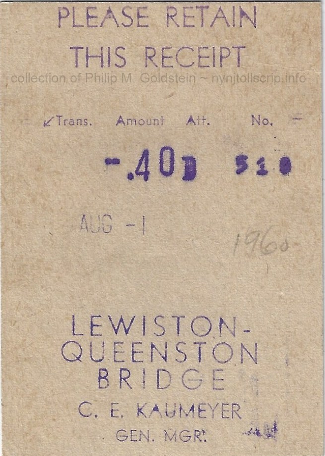 |
|
Lewiston - Queenston Bridge Receipt - August 1, 1960
.40 - Automobile
collection of Philip M. Goldstein |
|
Buffalo and Fort Erie Public Bridge Authority
The Peace Bridge
The Peace Bridge is an international bridge between Canada and
the United States at the east end of Lake Erie at the source of the
Niagara River, about 12 ½ miles upriver of Niagara Falls. It
connects Buffalo, New York; in the United States to Fort Erie, Ontario;
in Canada. It is operated and maintained by the bi-national Buffalo and
Fort Erie Public Bridge Authority.
The building of the Peace Bridge was approved by the
International Joint Commission on August 6, 1925 with Edward Lupfer
serving as chief engineer. The bridge is a multi-span deck type truss and arch bridge totalling 5,800 feet in length.
Construction began in 1925 and was by spring of 1927 the bridge was
completed. On March 13, 1927, Chief Engineer Lupfer drove the first
automobile across the bridge; however the opening to the public took
place on June 1, 1927.
The official opening ceremony was held two months later, on
August 7, 1927; with about 100,000 people in attendance. The festivities were
transmitted to the public via radio in the first international coast-to-coast broadcast.
The dignitaries who took part in the dedication ceremonies
representing Canada and the Crown, were: HRH Prince of Wales (the
future Edward VIII), HRH Prince George, Canadian Prime Minister William
Lyon Mackenzie King, British Prime Minister Stanley Baldwin and
Province of Ontario Premier Howard Ferguson.
Representing the United States and the State of New York were Vice President Charles Dawes, Secretary of State Frank Kellogg and New York Governor Alfred Smith.
When the bridge opened, Buffalo and Fort Erie each became the
chief port of entry to their respective countries from the other. At
the time, this was the only vehicular bridge on the Great Lakes from
Niagara Falls to New York. The bridge remains one of North
America's most important commercial ports, with four thousand
trucks crossing it daily.
Tolling
Historical Toll Rates are noted below. Information comes from a wide
variety of sources, including but not limited to articles in the
Buffalo Times, Democrat & Chronicle, Trucknews.com, as well as
Buffalo & Fort Erie Public Bridge Authority fiscal doucuments
located on the the internet.
The following article was located in the June 30th, 1993 issue of the Buffalo Times via their digital archives. We can take away several important facts from this article, and of which
I have highlighted. I have also included several other articles which
follow.
|
As of midnight tonight, Peace Bridge travelers will experience major changes
when they cross back and forth between Buffalo and Fort Erie.
The greatest difference will be one-way tolls. Money will be collected on the
outbound Buffalo side of the bridge only, with passenger vehicles coming into
the United States from Canada driving straight through to U.S. Customs booths
with no toll stop.
Commercial trucks will continue to pay tolls for each trip across the
bridge.
The other big change will be felt in the wallet, with the travelers forking
over $1.25 as they head over to Fort Erie. Even though they'll pay nothing on
their return trip, that price represents a 25 percent increase from the current
50-cent-per-crossing toll.
Bridge Authority Vice Chairman Peter B. Sullivan said despite the scope of
toll changes, he expects a smooth transition.
"Most of the regular bridge users are probably aware of the impending
changes. It's been in the paper, there are signs posted near the toll booths. I
don't think they'll be caught off guard," Sullivan said. "And as for novice bridge crossers, they'll just follow the signs and pay in
the appropriate way," Sullivan said. "The biggest problem will be with local people who don't cross the
bridge very often. They may pull up and be surprised about the $1.25. There'll
be a period of adjustment, but it shouldn't lead to delays," he said.
Despite the price hike, Peace Bridge officials are quick to point out they are
still the best buy when it comes to bridges between the U.S. and Canada. They
also note the price of crossing the bridge has remained at $1 for a round-trip
since 1984.
With the switch, the Peace Bridge is the only local bridge collecting tolls
on a one-way basis.
The Niagara Falls Bridge Commission, which oversees the international spans
in Niagara County, does, however, have long-range plans to change to one-way
collections as part of an extensive capital project list.
Peace Bridge regulars will also bid adieu to the familiar Peace Bridge
coupon book. The bulk discount passes are being replaced by silver- and
copper-striped tokens.
Like their paper predecessors, they can be purchased in batches of 25 and
will substantially reduce the bridge crossing cost for frequent travelers.
Token users will be able to make the round trip for 80 cents, saving 45
cents off the new toll price. Unused paper passes can be redeemed at the bridge
for a face value of 28 cents per pass. Going hand-in-hand with the introduction
of tokens are two new automatic collection lanes for Canada-bound traffic. The
sophisticated Australian-made collection machines will accept tokens, as well
as U.S. and Canadian change.
Tokens will not be accepted at the manned toll booths, only in the machine
lanes. Under the new toll structure, passenger cars, trailers, motorcycles, ambulances
and hearses, will all pay $1.25 heading into Canada.
The toll for buses will
increase from a current $2.50 each way to $6.50 one way.
Commercial trucks will continue to pay tolls both going into Canada and
crossing into the United States. Those fees, however, will increase from 20
cents per ton of gross weight to 25 cents per ton.
Bridge officials estimate 1993 toll revenues will top $2.2 million with
initiation of the higher tolls in June. In 1994, with a full 12 months of tolls
and a minimum traffic increase of 4.5 percent, the revised tolls are expected
to bring in $4.5 million. The increased revenue will help fund a slate of
recently announced capital improvements on both the Fort Erie and Buffalo
bridge plazas.
|
Fort Erie & Buffalo Public Bridge Authority Peace Bridge release - November 16, 2007
Car tolls will be $3.00 in either currency for a round trip
and all commercial tolls will also be at parity, effective December 1, 2007.
Buffalo Democrat & Chronicle - October, 8 2016
BUFFALO - Drivers crossing the Peace Bridge to get into
Canada will soon have to cough up a little more cash.
Starting on Jan. 1, 2018, the toll for passenger vehicles will
rise 75 cents to $3.75. If that wasn't enough, E-Z pass drivers will also lose
their 10 percent discount.
The Peace Bridge Authority unanimously OK'd the toll hike
Friday.
The additional revenue will go to help pay for the span's
$185-million rehabilitation project over the next few years.
The last toll increase for the Peace Bridge was in 2007.
Buffalo Times - October 12, 2018
FORT ERIE, Ont. – The Peace Bridge
Authority is examining how it will eventually raise tolls on its international
span over the Niagara River.
No toll hike is imminent, but
members of the binational authority meeting Friday asked Peace Bridge staff to
recommend ways to avoid substantial increases after a long period of price
stability. Car tolls rose from $3 to $3.75 on Jan. 1 after no hike since 2007,
while commercial vehicles have experienced no increase since the same year.
“Instead of a 10, 15 or 20 percent
increase every decade, we’re looking at something based more on the cost of
living as a strategy,” said General Manager Ron Rienas, adding no commercial
toll hikes will be considered until 2020 at the earliest.
“It’s important to note that tolls
are paying for our current $100 million rehab project,” he added. “There are no
tax dollars involved.”
The authority also voted to
eliminate EZPass discounts for commercial traffic beginning July 1. Rienas
noted that the 10 percent break on tolls was implemented years ago to encourage
use, but incentives are no longer needed because 85 percent of truck traffic
now uses the automatic toll payment system. He noted the Niagara Falls Bridge
Commission has also eliminated the discounts.
“There is no need for the EZPass
discount to get people to sign up,” he said.
Rienas also reported that the last
phase of the three-year, $100 million deck replacement program will begin Monday,
with work proceeding at night when traffic is lightest. Traffic will be reduced
from three lanes to two until May as crews concentrate on the center lane,
which he said will present the most challenges as traffic proceeds on both
sides of the work area.
The authority approved a $135
million capital budget for the next five years and a $31 million operating
budget for 2019. Major projects still slated at the bridge include the last
phase of deck replacement, a painting program last addressed more than 20 years
ago, a $3.8 million rehabilitation of the authority’s R.F. Willson
Administration Building on the Buffalo plaza, a $3.4 million toll collection
system upgrade, and new LED signs at toll booths.
Buffalo Times - October 2, 2020
Coping with a 94% drop in passenger traffic during the Covid-19 pandemic,
Peace Bridge officials have announced a toll increase along with new efforts to
promote significant savings through use of E-ZPass.
Cars crossing the international span between Buffalo and Fort Erie, Ont.,
will be charged $4 (U.S.) beginning Dec. 1, up from $3.75, but only for those
with E-ZPass transponders affixed to their windshields. Motorists still using
cash will be charged $6 (U.S.) beginning Dec. 1, and $8 on March 1, 2021.
Ron Rienas, general manager of the Peace Bridge Authority, said the
increasingly widespread use of cashless tolling – especially in New York State
– is nudging the change at the international crossing.
"If you pay by cash, you'll be paying a lot more," he said.
"The whole point is that you don't have to pay $6 or $8. With E-ZPass
you'll get the lowest rate on the northern border."
The last toll increase was instituted in January of 2018. But Rienas noted
that car traffic, especially, has been "decimated" by the pandemic
and the border shutdown imposed by the Canadian government back on
March 21. As a result, truck traffic has also dropped 13%, while revenues have
fallen from the closed Canadian Duty Free Store and U.S. Duty Free operating at
reduced hours.
|
.
.
With the various documents I now had at my disposal, I was able
to tabulate a rather comprehesive history of the toll
schedule for the Buffalo & Fort Erie Public Bridge Authority.
Unfortunately, gaps remain in the history that need to be filled
in:
Buffalo and Fort Erie Public Bridge Authority - Historical Toll Schedules
. |
|
prior to
June 30, 1993
|
|
July 1, 1993 1, 2 |
|
May 1, 1995 |
|
November 1, 1996 |
|
June 1, 1997 |
|
January 1, 1998 |
|
2000 4 |
|
cash |
|
cash |
|
cash |
|
cash |
charge |
|
cash |
charge |
|
cash |
charge |
|
cash |
charge |
|
US $ |
CAN $ |
|
US $ |
CAN $ |
|
US $ |
CAN $ |
|
US $ |
CAN $ |
US $ |
CAN $ |
|
US $ |
CAN $ |
US $ |
CAN $ |
|
US $ |
CAN $ |
US $ |
CAN $ |
|
US $ |
CAN $ |
US $ |
CAN $ |
| Automobile |
.50 |
|
|
1.25 |
1.25 |
|
1.25 |
1.50 |
|
1.50 |
2.00 |
|
|
|
2.00 |
2.50 |
|
|
|
2.00 |
2.50 |
|
|
|
2.25 |
2.75 |
|
|
| Auto token 3, 5 |
|
|
|
.80 |
|
|
.80 |
1.00 |
|
1.00 |
1.28 |
|
|
|
1.32 |
1.72 |
|
|
|
1.32 |
1.72 |
|
|
|
1.52 |
1.92 |
|
|
| Buses |
2.50 |
|
|
6.50 |
|
|
|
|
|
6.50 |
8.00 |
|
|
|
6.50 |
8.00 |
|
|
|
7.50 |
9.00 |
|
|
|
10.00 |
11.50 |
|
|
| Trucks (per ton) |
.20 |
|
.25 2 |
|
|
|
|
.30 |
.375 |
.30 |
.30 |
|
.30 |
.375 |
.30 |
.30 |
|
.35 |
.44 |
.35 |
.35 |
|
.41 |
.51 |
.41 |
.51 |
1 - One way tolling for westbound (towards Canada) cars & buses instituted
2 - Two way tolling remained for trucks, rates charged are per US gross ton
3 - Tokens sold in rolls of 25
4 - beginning in 2002, the Authority instituted an
axle-based methodology for toll rate setting for trucks (set forth in
the table below) that was not comparible to the weight based methodology
used in the table above.
5 -Tokens sales ceased January 2002 |
|
1/20/2002 |
|
4/1/2007 |
|
7/1/2007 |
|
1/18/2018 2 |
|
E-ZPass (US $) |
Cash US $ |
Cash CAN $ |
|
E-ZPass (US $) |
Cash US $ |
Cash CAN $ |
|
E-ZPass (US $) |
Cash US $ |
Cash CAN $ |
|
E-ZPass (US $) |
Cash US $ |
Cash CAN $ 1 |
.
Passenger Vehicles |
|
|
|
|
|
|
|
|
|
|
|
|
|
|
|
| Auto |
1.75 |
2.50 |
3.50 |
|
2.70 |
3.00 |
3.50 |
|
n/c |
n/c |
n/c |
|
3.75 |
3.75 |
5.00 |
| Auto & Trailer |
3.50 |
5.00 |
7.00 |
|
5.40 |
6.00 |
7.00 |
|
n/c |
n/c |
n/c |
|
7.50 |
7.50 |
10.00 |
.
Commerical Vehicles |
|
|
|
|
|
|
|
|
|
|
|
|
|
|
|
| 2 axle truck |
4.50 |
5.00 |
7.00 |
|
n/c |
n/c |
n/c |
|
5.40 |
6.00 |
7.00 |
|
n/c |
n/c |
n/c |
| 3 axle truck |
7.20 |
8.00 |
12.00 |
|
n/c |
n/c |
n/c |
|
9.00 |
10.00 |
12.00 |
|
n/c |
n/c |
n/c |
| 4 axle truck |
13.50 |
15.00 |
22.00 |
|
n/c |
n/c |
n/c |
|
16.20 |
18.00 |
22.00 |
|
n/c |
n/c |
n/c |
| 5 axle truck |
19.80 |
22.00 |
33.00 |
|
n/c |
n/c |
n/c |
|
25.20 |
28.00 |
33.00 |
|
n/c |
n/c |
n/c |
| 6 axle truck |
28.80 |
32.00 |
48.00 |
|
n/c |
n/c |
n/c |
|
36.00 |
40.00 |
48.00 |
|
n/c |
n/c |
n/c |
| 7 axle truck |
37.80 |
42.00 |
63.00 |
|
n/c |
n/c |
n/c |
|
47.70 |
53.00 |
63.00 |
|
n/c |
n/c |
n/c |
| Bus |
9.45 |
10.50 |
15.50 |
|
n/c |
n/c |
n/c |
|
11.70 |
13.00 |
15.50 |
|
n/c |
n/c |
n/c |
.
Also effective July 1, 2007,
new fees were implemented for any special loads that required any
bridge lanes to be closed or traffic patterns to be altered on the
bridge to accomodate such load. The new fees were: |
| Special Loads arriving 12 am - 12 pm |
100.00 |
120.00 |
|
|
|
|
| Special Loads arriving 12 pm - 12 am |
200.00 |
240.00 |
|
|
|
|
1 - assumes an exchange rate of $1.33 US $ to $1.00 CAN
2 - discount for E-ZPass eliminated
Due to the strengthening of the Canadian dollar in 2007, the Board adopted a toll equity policy on November 17, 2007. |
.
.
Once vehicles leave the customs plaza in Canada, they approach a
smaller toll plaza to pay the toll for using the Peace Bridge. Payment for
tolls are collected in either cash (US or Canadian),
as well as Peace Bridge tokens. There are no toll booths on the US
side and no tolls are collected from US bound vehicles, nor are
tolls collected for pedestrians or cyclists.
After new toll facilities were installed on the Canadian side in
2005, the Peace Bridge became the first E-ZPass facility outside the
United States. However, as witnessed by the historic and current toll schedules, the discount
for using E-ZPass was discontinued in 2018; but E-ZPass was still
accepted. The current toll is $3.75 USD or $5.00 CAD, paid
westbound (to Canada) only.
However, if I understand correctly, with the announcement on October 2, 2020 of toll hikes scheduled
to take place in December 2020 and March 2021, it appears a discount
will once again be offered for E-ZPass users:
"Cars crossing the international span between Buffalo and Fort Erie, Ont.,
will be charged $4 (U.S.) beginning Dec. 1, 2020, up from $3.75, but only for those
with E-ZPass transponders affixed to their windshields. Motorists still using
cash will be charged $6 (U.S.) beginning Dec. 1, and $8 on March 1, 2021.
|
Buffalo and Fort Erie Public Bridge Authority - Current Toll Schedules
.
|
| vehicle |
E-ZPass |
Cash USD |
Cash CAD |
| Automobiles |
3.75 |
3.75 |
5.25 |
| Automobiles with trailer |
7.50 |
7.50 |
10.50 |
| Commercial Vehicles, 2 axles |
7.00 |
7.00 |
10.00 |
| Commercial Vehicles, 3 axles |
11.00 |
11.00 |
15.00 |
| Commercial Vehicles, 4 axles |
20.00 |
20.00 |
28.00 |
| Commercial Vehicles, 5 axles |
30.00 |
30.00 |
42.00 |
| Commercial Vehicles, 6 axles |
43.00 |
43.00 |
60.00 |
| Commercial Vehicles, 7+ axles |
57.00 |
57.00 |
79.00 |
| Buses |
14.00 |
14.00 |
19.00 |
| Pedestrians & Bicycles |
no toll |
 |
 |
Buffalo & Fort Erie Public
Bridge Authority - fare receipt
collection of
Philip M. Goldstein |
.
. |
|
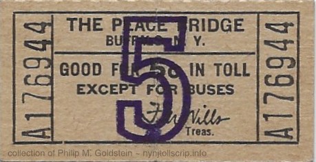 |
Buffalo & Fort Erie Public
Bridge Authority 5 cent ticket - date? use?
collection of
Philip M. Goldstein |
.
. |
|
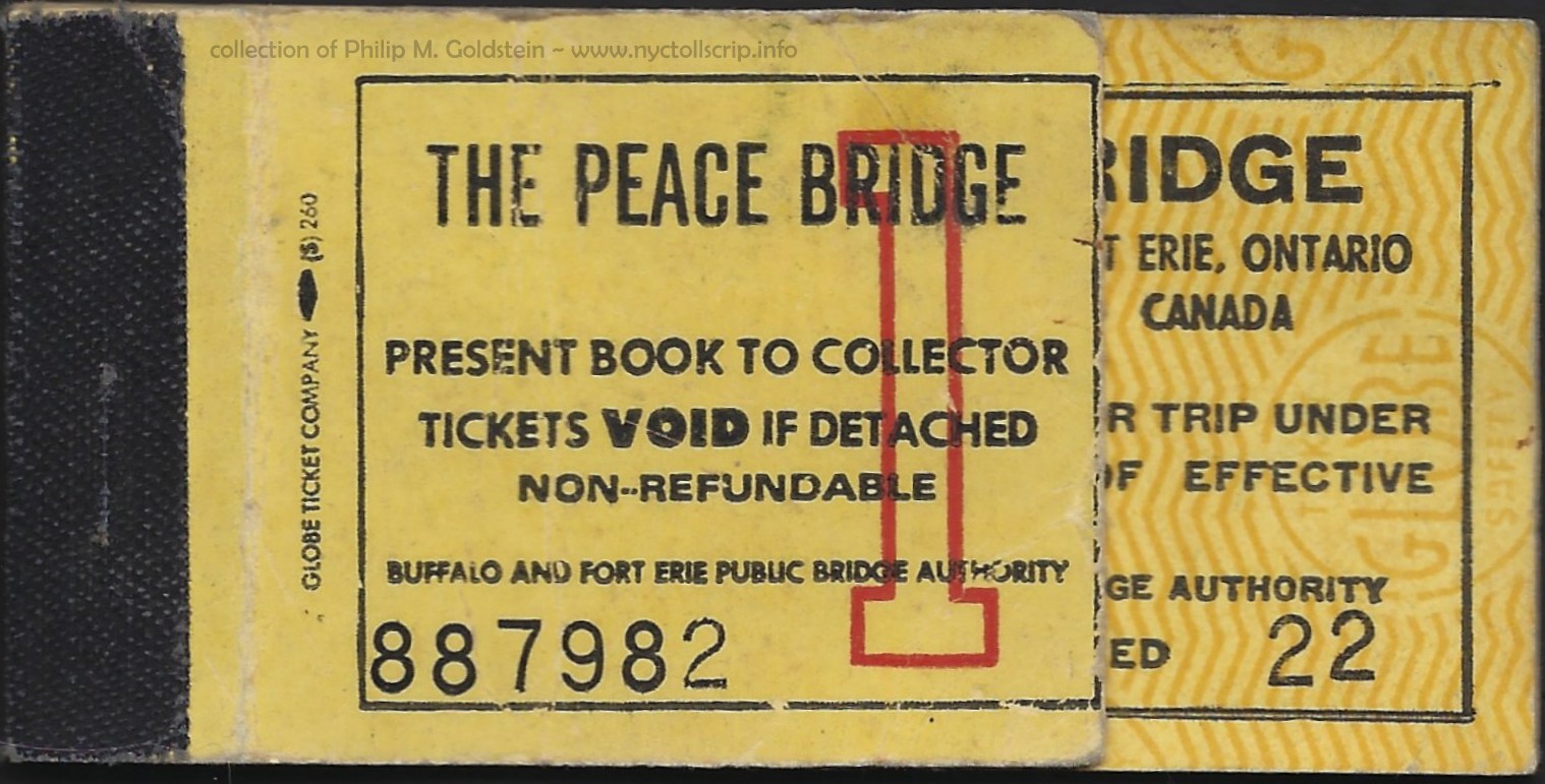 |
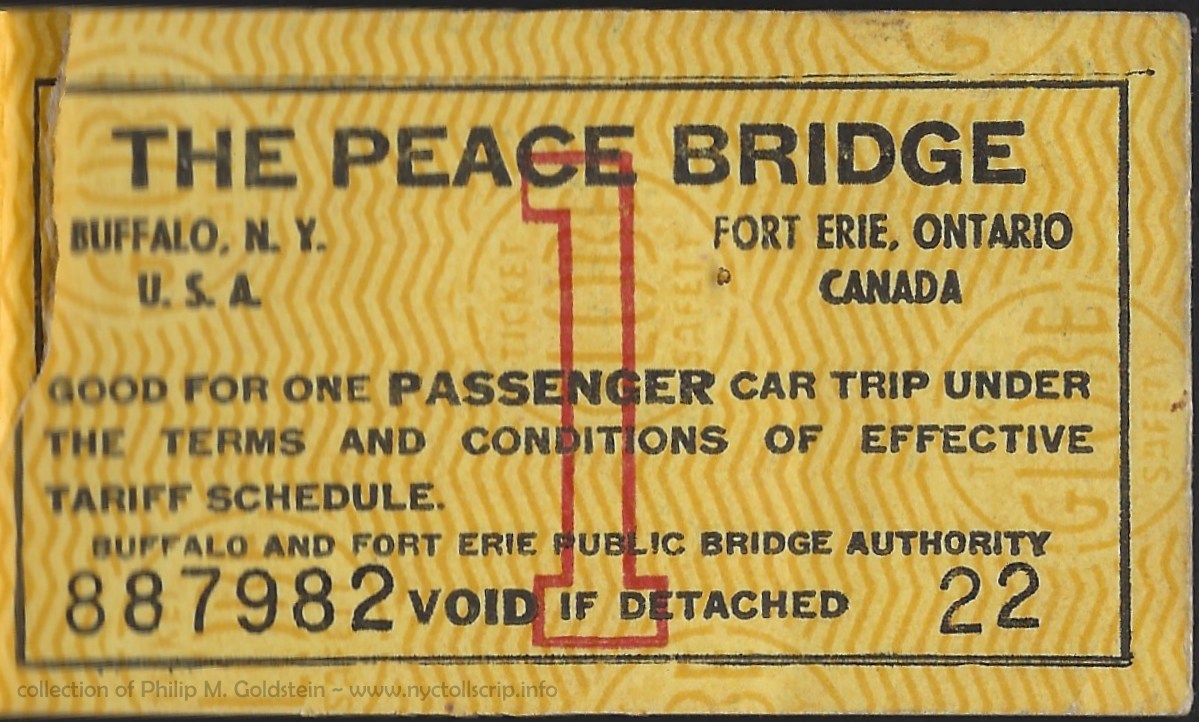 |
Buffalo & Fort Erie Public
Bridge Authority prepaid toll scrip - Class 1 - ca. 1960 through ?
early design - Variant 1
Globe Ticket
collection of
Philip M. Goldstein |
.
. |
|
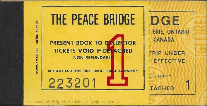 |
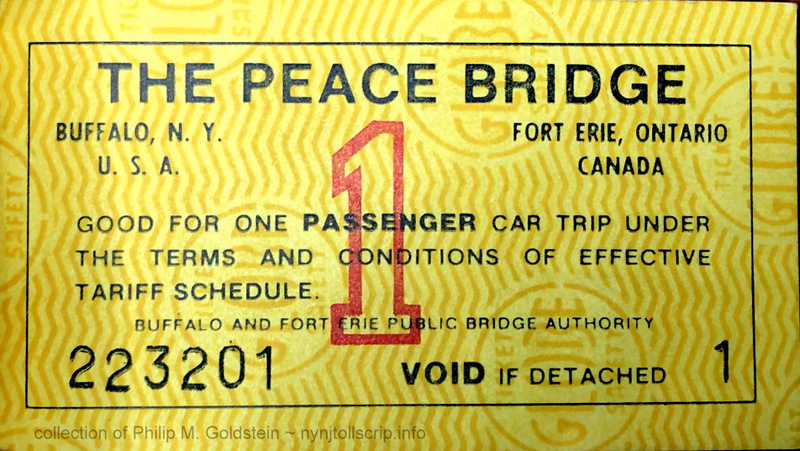 |
Buffalo & Fort Erie Public
Bridge Authority prepaid toll scrip - Class 1 - ? through 7/1/1993
later design (?) - Variant 2
Globe Ticket
collection of
Philip M. Goldstein |
|
|
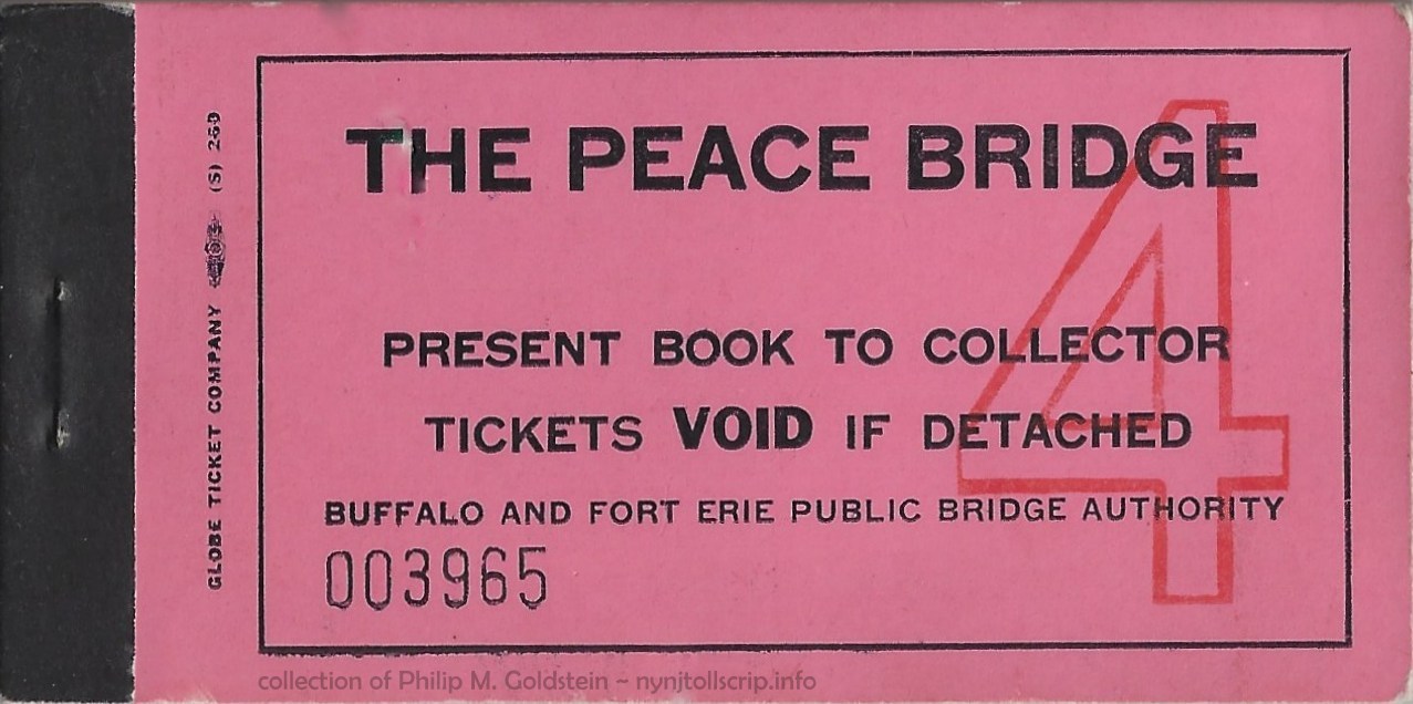 |
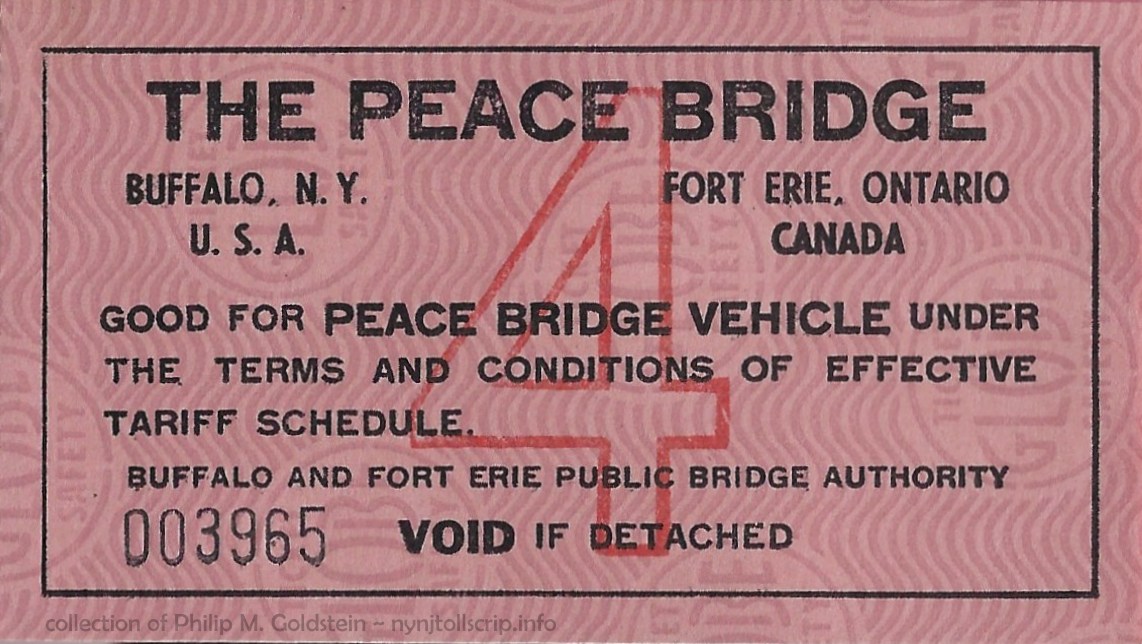 |
Buffalo & Fort Erie Public
Bridge Authority prepaid toll scrip - Class 4 - ca. 1960 through ?
Globe Ticket
collection of
Philip M. Goldstein |
|
|
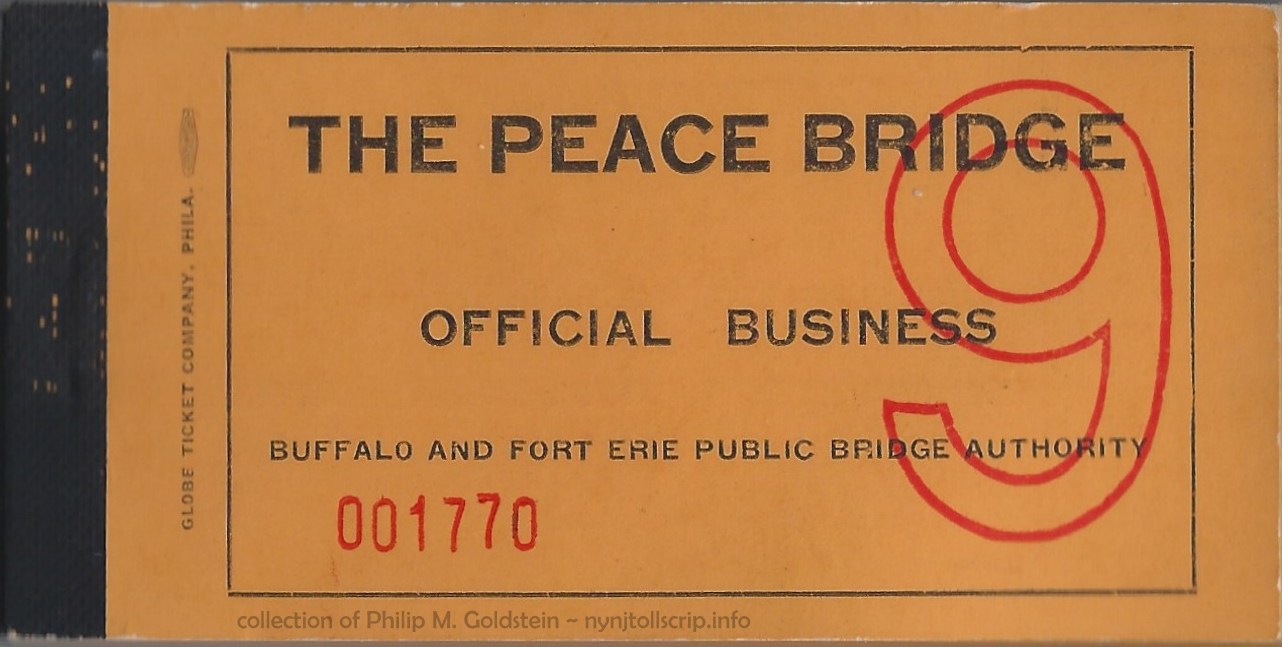 |
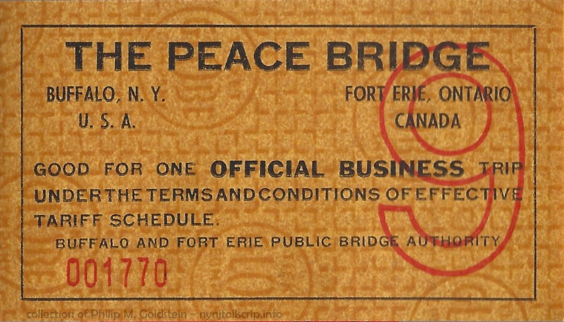 |
Buffalo & Fort Erie Public
Bridge Authority toll scrip - Official Business - Class 9 - ca. 1960 through ?
Globe Ticket
collection of
Philip M. Goldstein |
|
|
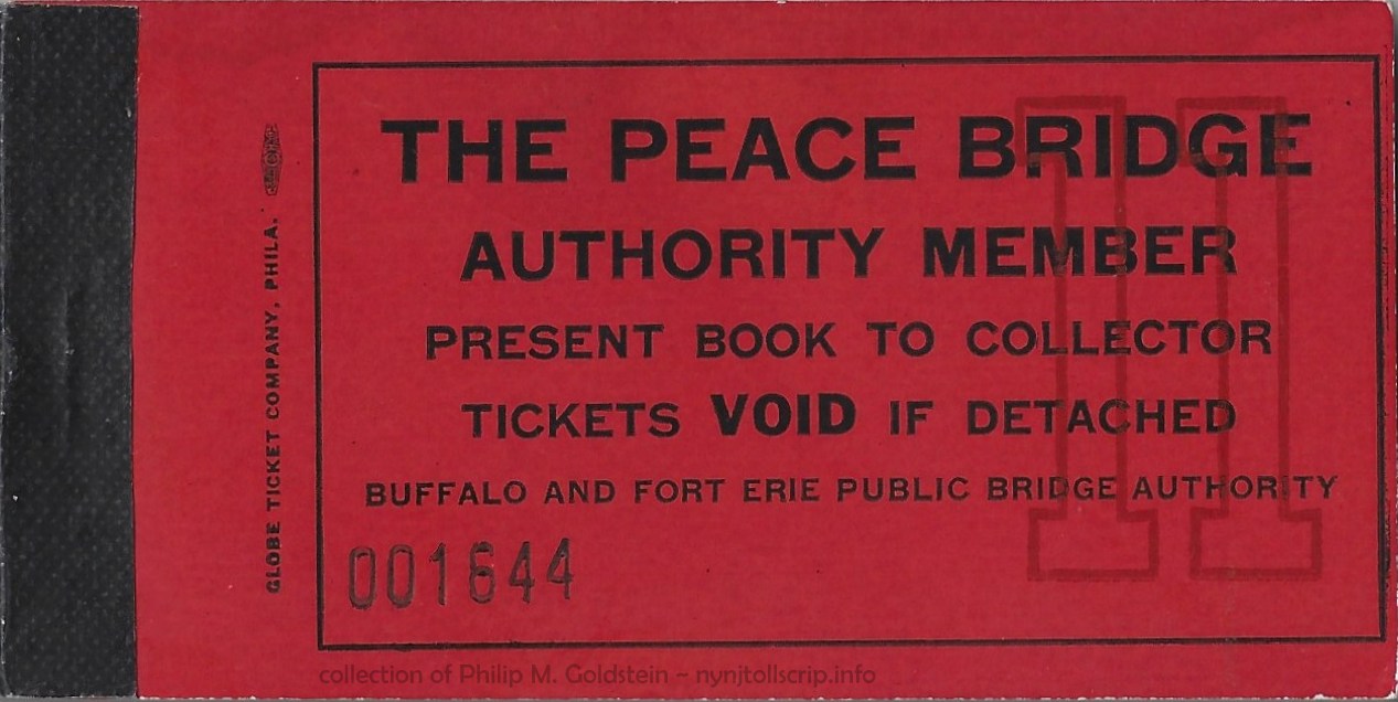 |
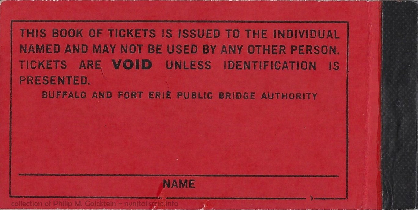 |
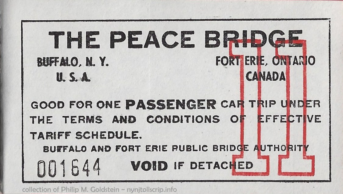 |
Buffalo & Fort Erie Public
Bridge Authority toll scrip - Authority Member - Class 11 - ca. 1960 through ?
Globe Ticket
collection of
Philip M. Goldstein |
.
. |
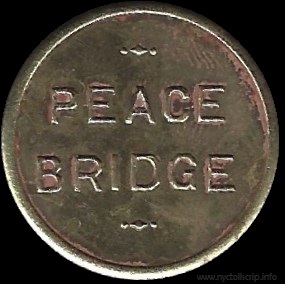 |
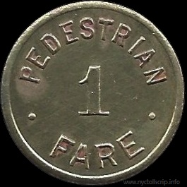 |
Buffalo & Fort Erie Public
Bridge Authority - 1927
Pedestrian 1 Fare
NY105B - 21mm - brass
(shown larger than actual size for detail)
collection of
Philip M. Goldstein |
.
. |
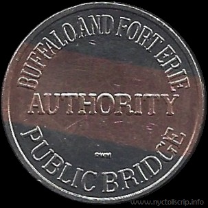 |
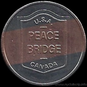 |
Buffalo & Fort Erie Public
Bridge Authority - 7/1/1993
NY105L - 23mm - white metal with copper stripe inlay
Roger Williams Mint
(shown larger than actual size for detail)
collection of
Philip M. Goldstein |
.
. |
|
.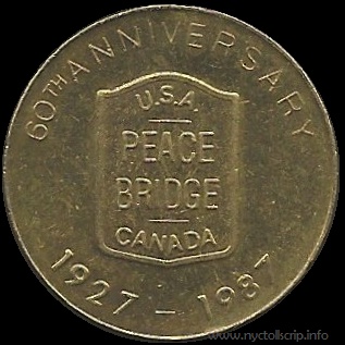
|
 |
Buffalo & Fort Erie Public
Bridge Authority - 8/9/1987
NY200A (Tranportation Related - not actual fiscal issue) - 26mm - brass
(shown larger than actual size for detail)
collection of
Philip M. Goldstein |
.
.
|