MILITARY RAILROADS
OF THE NEW YORK METROPOLITAN
AREA:
FORT TOTTEN
Bay Terrace / Whitestone, Queens, NY
.
.
updated: |
|
|
|
|
| page created | 14 May 2019 |
.
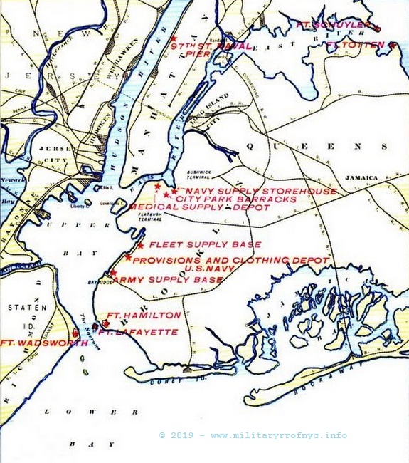
...

.
| Before we progress any further,
it bears mentioning that this websites intent is to primarily focus upon the
railroad aspect and history of the location. This will undoubtedly have the unfortunate side
effect of not discussing a significant amount of historical detail
pertaining to the overall location; so I strongly urge those
interested readers to visit the: .
That website covers the coastal defense locations throughout the
United States with a detailed history, along with hundreds of plans, blueprints,
specifications for both general construction and armaments at those locations,
|
.
.
History
Part of the authors reasoning behind this, is that the naval entrance to Long Island Sound was primarily protected by forts with artillery batteries much further east on Long Island Sound, by Block Island Sound and the Atlantic Ocean. These would include Forts Terry, Michie, H. G. Wright, Mansfield & Tyler. As Fort Schuyler and Fort Totten were pretty much the last line of defense for western Long Island Sound, and as naval invasion via Long Island Sound and through to the northeastern entrance to New York Harbor via the East River was unlikely.
Furthermore, it is very
unlikely that any attempt of naval invasion via Long Island Sound could
come as a surprise attack, being that the shorelines of Rhode Island,
Connecticut and Long Island were pretty much to some degree in sight of
each other. Any surface fleet attempting to enter and transit the Sound
would almost certainly be sighted, day or night. Even if said fleet had
managed to slip by the primary line of defenses at the east end of Long
Island Sound, a vessel would have to travel approximately 100 miles
before approaching New York City; and they most likely would be
detected by the time the progressed through the sound. Even the fastest
warships of that time averaged 24 knots. It would take approximately
four hours at top speed before getting to Forts Schuyler and Totten.
Therefore in light of all this, it seems only logical to reason
Forts Totten and Schuyler was partially stripped of their heaviest
coastal artillery guns to be shipped to Europe during World War I which
had become a land war.
And so, Fort Totten's 5 inch, 8 inch, 10 inch, and 12 inch batteries were dismounted from 1917 through 1918, for use as potential railway artillery; or as in the case of the 5 inch batteries, as field artillery. Battery Mahan's two 12 inch guns and Battery Sumner's pair of 8 inch guns were transferred to the railway artillery program. Battery Graham's pair of 10 inch guns were transferred to Fort Hamilton in Brooklyn in 1919, possibly as replacement guns for that location there. Battery Stuart's 5 inch guns were mounted on field carriages and sent to France.
It is about this point in time that it is believed the railway at Fort Totten inactivated as well. Referencing the 1921 series of Fort Maps (seen below) fails to show any recognizable notations regarding the use of a railway at this location.
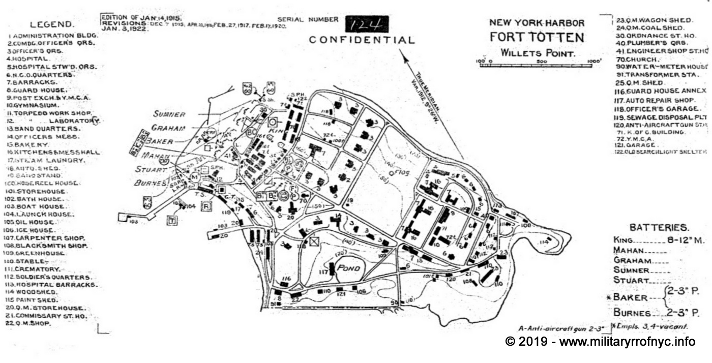
maps from the website of the
Coastal Defense Study Group
originals reside in the National Archives.
The legend for symbols used on the above map be viewed here: 1920 Series Confidential Maps Symbols & Abbreviations.
added 14 May 2019
.
In 1920, the two 3 inch guns of Battery Baker was removed, as part of this weapons general removal from service. Around this time a 3 gun anti-aircraft battery was built. In 1935 Fort Totten's last heavy armament, the mortars of Battery King, were removed and the Harbor Defenses of Eastern New York effectively inactivated, although a minefield possibly remained in reserve and the command remained in service until mid-1942. This left Fort Totten with just four 3 inch guns that served through World War II, most probably to guard the potential minefield.
By December 1941, Fort Totten had become the regional headquarters for the anti-aircraft portion of the Eastern Defense Command, organizing anti-aircraft defenses for the entire East Coast of the United States. On 9 May 1942 the Harbor Defenses of Eastern New York was inactivated and consolidated into the Harbor Defenses of New York. Ultimately Harbor Defenses of Eastern New York disbanded on 22 May 1944.
In 1954, the location was home to regional headquarters for New York Air Defense - Nike Missile sites; but no Nike missiles were actually based at this location.
Currently, the location is home to several departments of the emergency services for the City of New York, namely "TARU". Pronounced tah-ROO, it is the acronym for the Technical Assistance Research Unit of the New York Police Department which is involved with investigating computer crimes, electronic forensics, surveillance, and the sort.
Also currently located in Fort Totten is the Fire Department of New York Emergency Medical Service (ambulances & paramedics) & CFRD (SCBA) Training Centers, FDNY EMS Station 53; Bay Community Volunteer Ambulance as well as an US Army Recruiting Center.
Fort Totten is also home to Fort Totten Lake, Fort Totten Park and the aforementioned embattlements are a historic site under the New York City Parks Department.
While most of Fort Totten is not a closed facility, there is a checkpoint to enter the grounds on Totten Avenue. Unfortunately, as the railroad remnants are on the property of the NYPD TARU grounds, they are not open to the general public.
Railroad Operations & Trackage
There are no entries for any locomotives noted for Fort Totten, in any of the builders records or documents regarding this installation. Research up to 2019 failed to reveal any mention of trackage or a railway, and likewise had been omitted from this website.
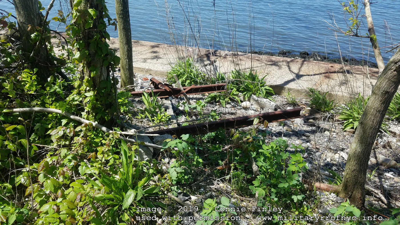
However, as we so often learn in this field, that is not to be taken conclusively. On May 14, 2019, I received an email from Connie Finley, that in fact remnants of trackage still remained in place at Fort Totten. With correspondence now being exchanged between us, another email arrived containing the images below showing the remnants of the railway.
However, the nature of the site is that it's restricted access due to it being on NYPD property and near USCG property.
Okay,
so the section of track jutting from the building is around 24 inches
however that may or may not be connected to the section the remainder
of these images are from.
In addition, according to an
environmental report, another railway ran to the now buried Battery
King; Track and/or stock from that may still exist, buried under the
dirt.
On May 15, I received another email from Connie who continued to research the facility, and came up with a gem: facility maps on file with the Army Corp of Engineers dating back to 1875 - and showing the railroad! Not only that, but how the railroad was reconfigured over time between 1875, 1904 and 1928. I am a little disappointed and a tad envious I did not find these, but hey; that is what contributors are for! Annotated maps highlighting the railway follow.
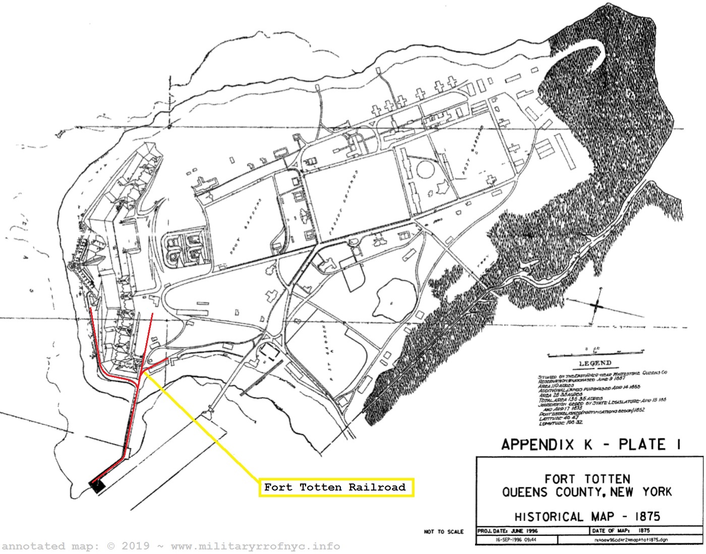
United States Department of Defense - Archives Search Report - September 1996
Report Plates - Fort Totten, NY - 1875
located & contributed by Connie Finley
added 15 May 2019
.
.
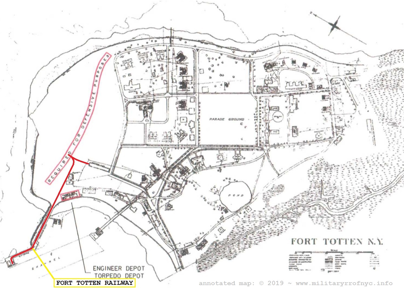
United States Department of Defense - Archives Search Report - September 1996
Report Plates - Fort Totten, NY - 1904
located & contributed by Connie Finley
added 15 May 2019
As Connie pointed out in the 1928 map, the Ordnance Storehouse is now disconnected from the the track plan and "orphaned".
.
.
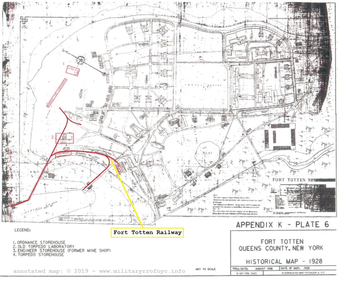
United States Department of Defense - Archives Search Report - September 1996
Report Plates - Fort Totten, NY - 1928
located & contributed by Connie Finley
added 15 May 2019
.
So, with the discovery of these plates, we can now conclude the railroad was in fact in operation as late as 1928. And while some of the trackage is no longer following its original path from 1875, the railway was at its largest in the end.
The unabridged study with all plates throughout Fort Totten's history may be viewed here (not all plates show the railway):
The following are the images Connie contributed of the
remnants of the Fort Totten Railway, as included in the first email.
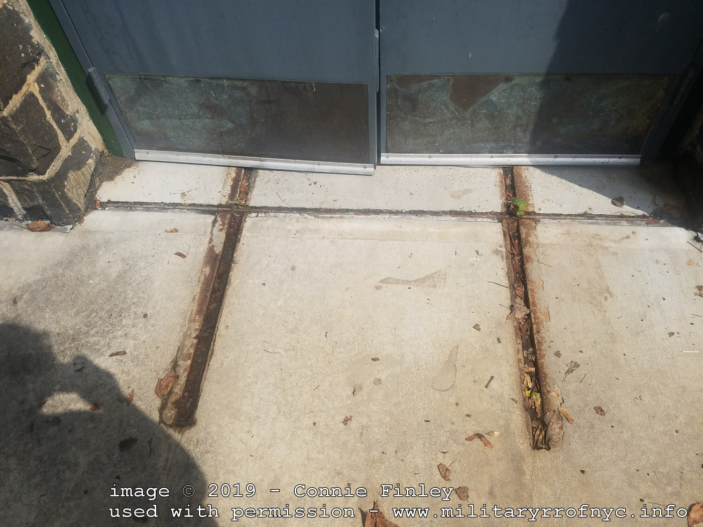 Outside of the Ordnance Building (Number 1 in the 1928 Map above) |
| . . |
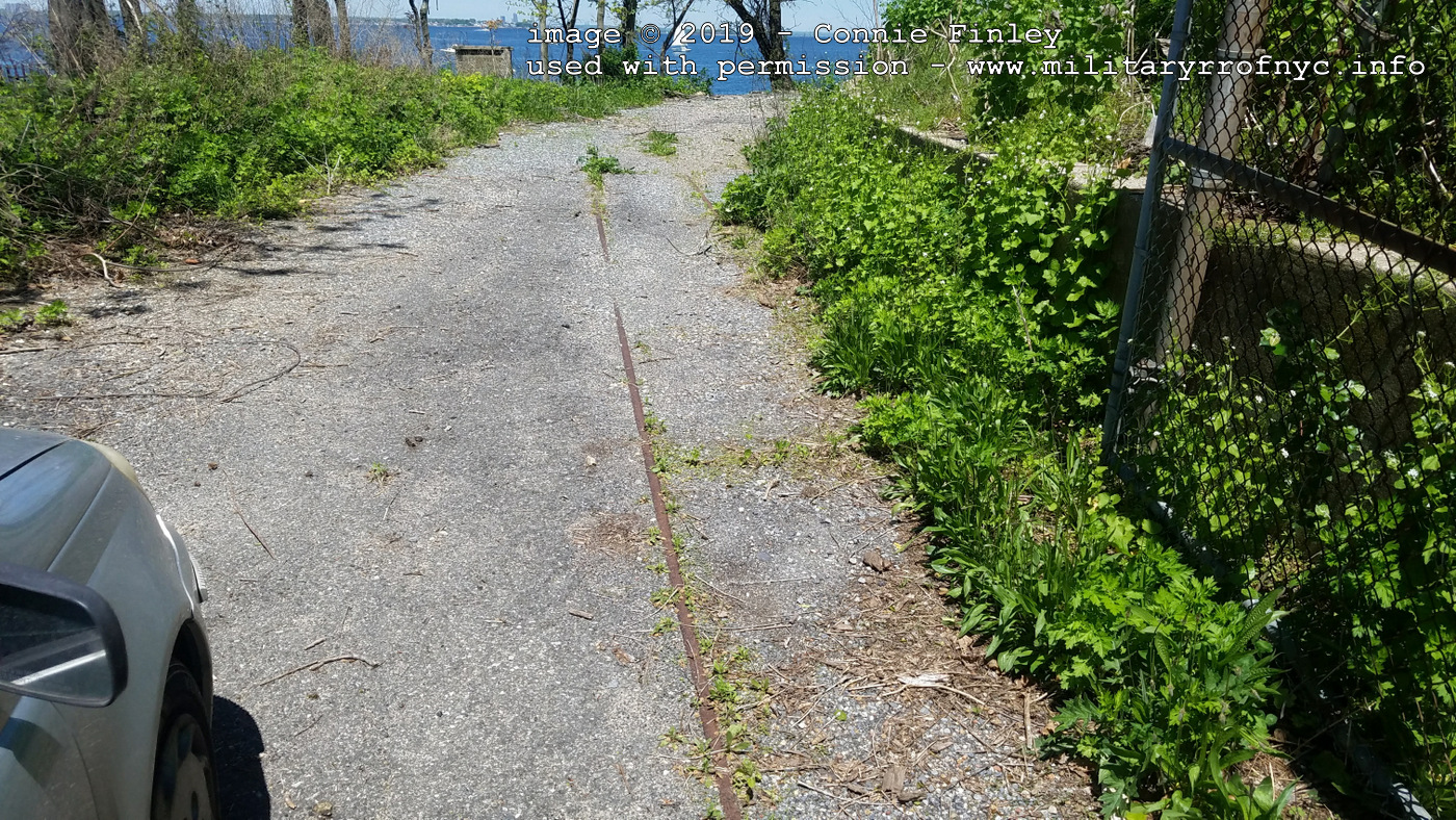 looking north added 14 May 2019 |
| . . |
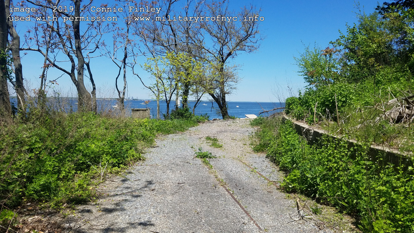 looking north added 14 May 2019 |
| . . |
 |
| . . |
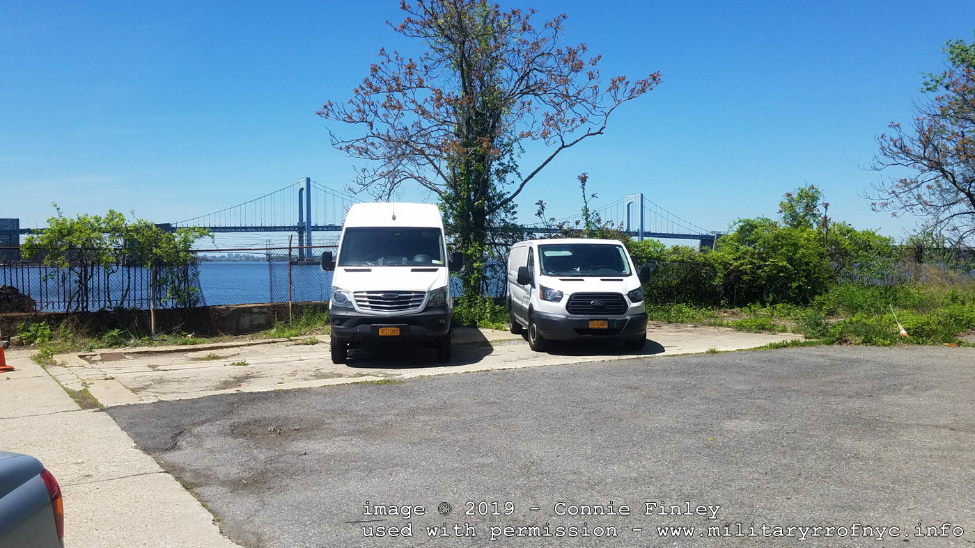 all images above: © 2019 - Connie Finley Throgs Neck Bridge in background., looking west used with permission added 14 May 2019 |
.
.
If there is any similarities to be drawn from the torpedo / mine operation at Fort Wadsworth at the southern entrance to Upper New York Harbor; it is estimated the the railway at Fort Totten was not long and only sufficient to haul the cable and mines from the torpedo shed to the shoreline. For reference, the distance across the mouth of the East River between Fort Schuyler and Fort Totten is approximately 4,100 feet.
As previously stated, there are no locomotives "earmarked" for
Fort Totten in any of the builders records this author has at his
disposal. But it is a fairly safe guess at least one operated here.
Most
likely an 0-4-0T of narrow gauge.
.
..
Fort Totten Locomotive
Roster
builder |
c/n |
build date |
gauge |
wheel arrangement |
wheel dia |
cylinders |
acquired |
number / name |
disposition |
notes |
ref |
| unknown at this time. |
|||||||||||
.
Connie Finley
for the information and images that were the inspiration to create this page!
Index:
Military
Railroads of the New York Metropolitan AreA | ||||
| EARLE N.A.D. N.W.S. EARLE | ||||
| FORT TOTTEN | Fort Terry | Fort Hancock / SANDY HOOK PROVING GROUNDS | ||
| . SIGN THE GUESTBOOK | ||||
.