


.
INDUSTRIAL
& TERMINAL RAILROADS
&
RAIL-MARINE OPERATIONS OF BROOKLYN, QUEENS,
STATEN
ISLAND, BRONX &
MANHATTAN:
No
A.I. nonsense and conjecture. Just good old fashioned research by
actually reading, analyzing, interpreting and collating information
through books, industry and trade journals, newspaper articles,
official documents and publicity releases, legal precedence and more.
Real facts, not rail
fiction.
High
Line West Side Line West Side Improvement Project Meatpacking District
National Biscuit
Nabisco Uneeda cold
storage Merchants Refrigerating Manhattan Refrigerating Hells Kitchen
Chelsea Village Tribeca upper horse escort
manhattan cowboy Death Avenue Eleventh Avenue 11th Avenue Tenth Avenue
10th Avenue
Washington
Street
St. John's Park Freight Terminal street running trackage steam dummy
Baldwin American Locomotive ALCO Schenectady 0-4-0 0-6-0 B-B C+C tripower
tri-power Lima Shay
geared 30th Street Branch Q R2 DES-2 DES-3 Diesel-electric battery
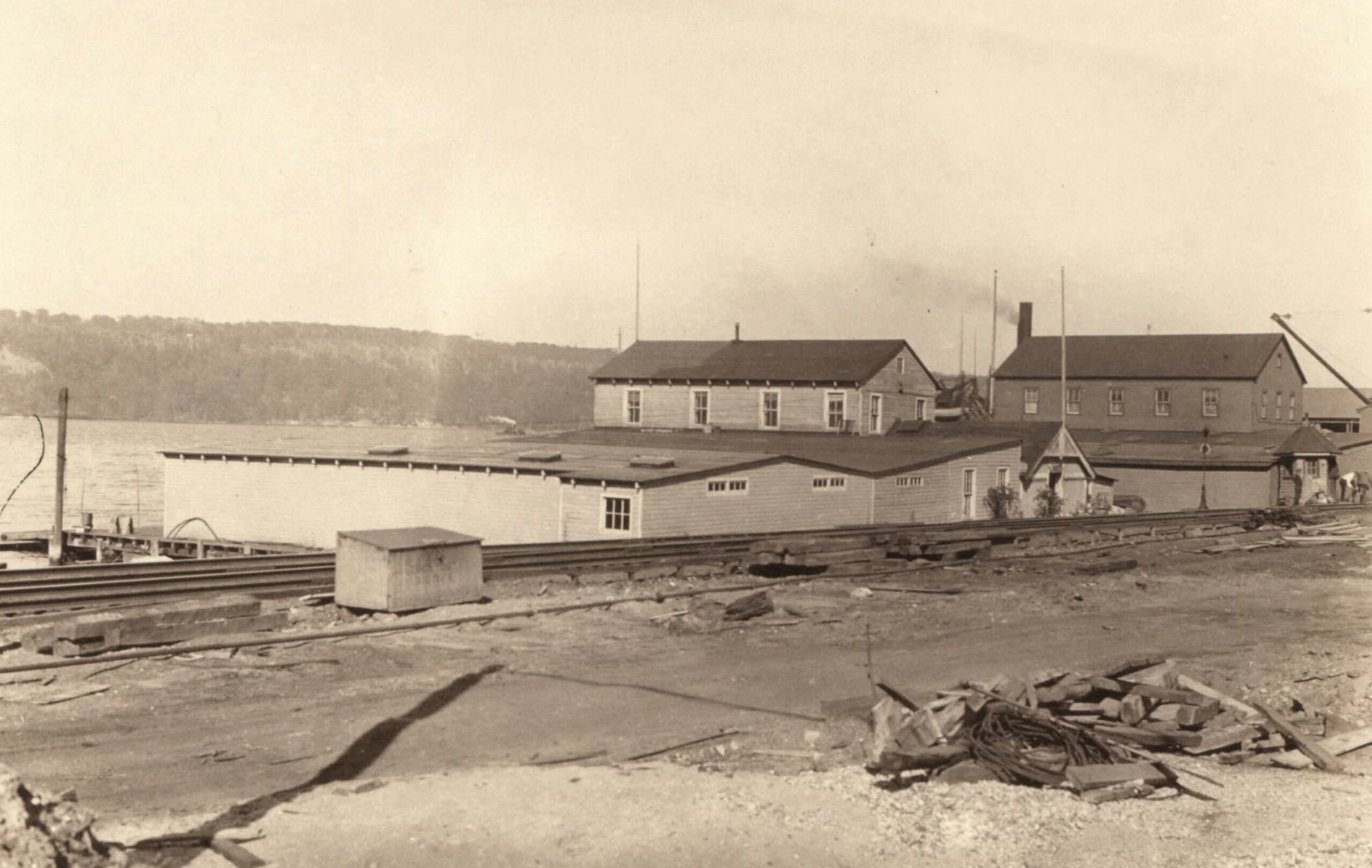
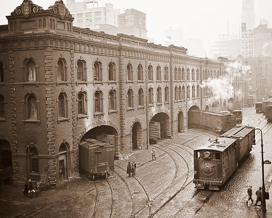 St. John's Park Freight Station (first) Hudson & Laight Streets - ca.1928 |
HUDSON
RIVER RAILROAD
NEW YORK CENTRAL & HUDSON RIVER RAILROAD NEW YORK CENTRAL RAILROAD West Side, Manhattan - Freight Operations 30th Street Branch - New York Terminal District, Hudson Division |
 |
Page 1: |
 |
|
|
.
|
|||||||||||||
.
.
.


Hudson River Railroad -
1846 to 1869
New York Central & Hudson River Railroad - 1869 to 1914
New York Central Railroad - 1914
to 1968
.
Street Running - 1846 through 1941
.
.
"Revisionist history is the re-interpretation of established historical narratives, often challenging orthodox views by introducing new evidence or different perspectives to correct misconceptions or highlight overlooked aspects. While it can be a legitimate scholarly practice to provide a more nuanced understanding of the past, the term can also be used negatively to describe the deliberate distortion of historical facts for political or social agendas.".
Philip M. Goldstein
The Hudson River Railroad comes to
Manhattan
Freight operations on the West Side in Manhattan began with the Hudson River Railroad, which was owned by Erastus Corning. The Hudson River Railroad was granted a charter from the city of New York to operate freight and passenger trains south to Chambers Street to Peekskill, NY; about 45 miles to the north.
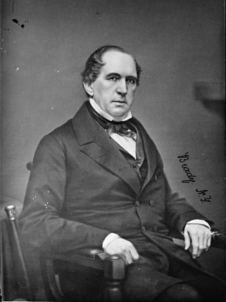 Erastus
Corning
December 14, 1794 – April 9, 1872 |
Corning was a
businessman and politician born in Norwich,
Connecticut and of whom relocated to Albany, New York; where he was a
prominent politician: mayor of Albany 1834 to 1837; New York State
Senate from 1842 to 1845, and the US House of
Representatives 1857 to
1859, and from 1861 to 1863. When the Utica and Schenectady Railroad was first chartered in 1833, Corning was a major investor and served as president and as a member on the board of directors. Corning was also a shareholder in, and president of the smaller Mohawk and Hudson Railroad. In 1851, the two railroads were reorganized as the Mohawk Valley Railroad, of which Corning served as president. Corning began planning the New York Central Railroad, to what eventually became the largest corporation in America; until US Steel. ("Michael. We're bigger than US Steel." Hyman Roth.) In 1853, Corning succeeded in persuading shareholders and executives of six functioning railroads and two that had been planned but had not yet been constructed; to agree to a plan for consolidating their companies. As the largest shareholder in the new company, Corning served as its first president and he held that office for twelve years, during which the Hudson River Railroad's expansion and connections with other railways gave it access to cities from New York City to Chicago, which made it one of the country's most important railroads. |
Corning entered into a charter
with the City of New York in 1846, to route and operate trains from
Peekskill, NY, to Chambers Street for
for the purpose of transporting freight and
passengers.
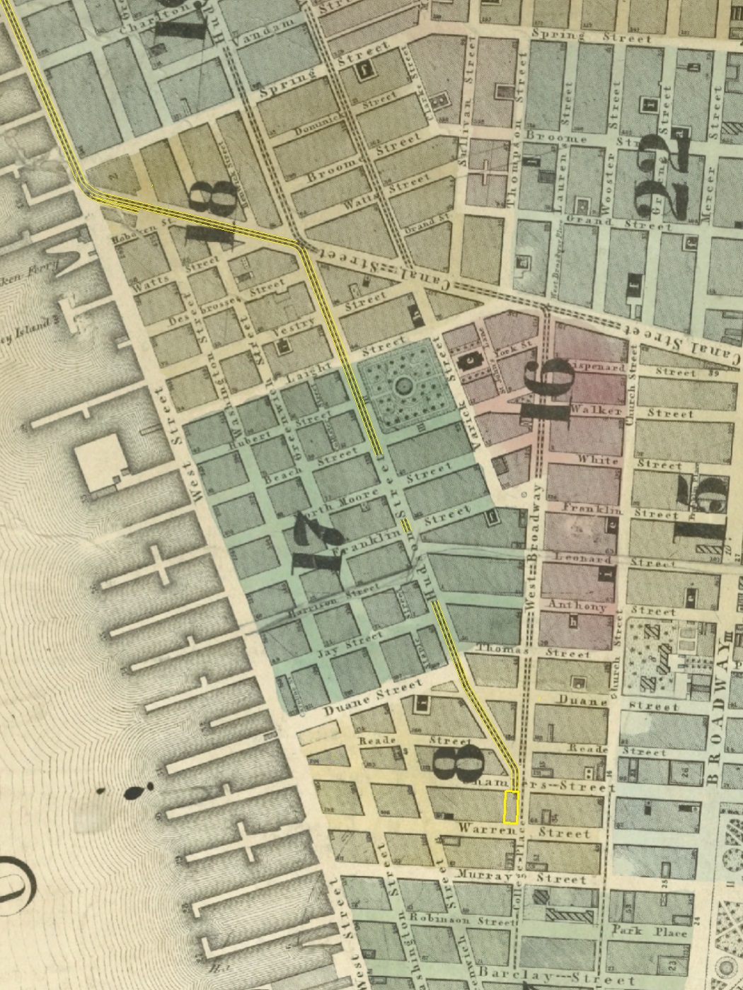
The route as laid out followed the east shore of
the Hudson River to
Spuyten Duyvil, across the Harlem River and into Manhattan. A depot was
located at Tubby Hook; at the foot of through the
then undeveloped lands of Hamilton Heights,
Carmansville (around 152nd Street), Manhattanville, Morningside Heights
and the through upper West Side.
Another depot was located at 132nd Street. It was
at this
point that the area started to become a little more developed. Here at
132nd Street was a hotel, a boarding house, stage company stables, a
convent and a chemical works, but make no mistake, it was not developed
to any degree more than a rural hamlet or small village.
The railroad line continued down the shore line,
until
reaching West 31st Street where it curved east into the Eleventh Avenue
and West 30th Street where another depot was located. Here, the line
continued Tenth Avenues, to and along West Street to Canal Street,
where it turned east on Canal for
a couple of blocks to Hudson Street. At Hudson, the line south again
until ending at the depot at Chambers Street.
The
charter was approved the following year and tracks laid, with the line
opening on September 29, 1949. In the years
shortly after, the railroad was gradually extended north from
Peekskill to Albany.
Held in the Digital Collection of the New York Public Library
are
several gems pertaining to maps. This first one is dated 1848,
and issued by the Hudson River Railroad. It
was engraved by Robert Haering and published by George Snyder of 138
William Street.
This map is huge. It measures 17 by 150 inches as
it contained to scale 1 mile = 1 inch, the
entire route from Manhattan to Albany. What you see below is only a
crop of
the Manhattan vicinity! The full map, in maximum resolution .tif format
may be viewed in the New York Public Library website here.
1848
- G. Snyder
Uncropped,
uncompressed map here.
Lionel Pincus and Princess Firyal Map
Division
New York Public Library Digital Collection
added 03 July 2026
While the
above map shows the overall scale of the railroad; these
next maps appear to be part of an survey atlas, as the remnants of
binding can be seen on some
of the edges. These maps were
published by Matthew Dripps in 1851 through 1854 (inferred).
These maps contain quite a bit more informationin
regard to detail as it lists the purposes and owners of properties
along the remote parts of the line, as well as shows topography and
depths of the river and the original coastline prior to being
landfilled, the property boundries of the original farms among other
details
M. Dripps - ca.
1851-1854
The Battery to
Horatio Street
Uncropped,
uncompressed map here.
Lionel Pincus and Princess Firyal Map
Division
New York Public Library Digital Collection
.
.
M. Dripps - ca.
1851-1854
The Battery to West 119th Street
This particular plate has been written on, in regards to the layout of
the Hudson River Railroad.
While omitted from the original plate, the railroad was penned in
through the West 30th Street area,
then again south of West 14th Street.
Uncropped,
uncompressed map here.
Lionel Pincus and Princess Firyal Map
Division
New York Public Library Digital Collection
added 03 July 2026added 03 July 2026
.
.
M. Dripps - ca.
1851-1854
West 142nd Street to Spuyten Duyvil
Uncropped
uncompressed map here.
Lionel Pincus and Princess Firyal Map
Division
New York Public Library Digital Collection
added 03 July 2026
.
.
.
.
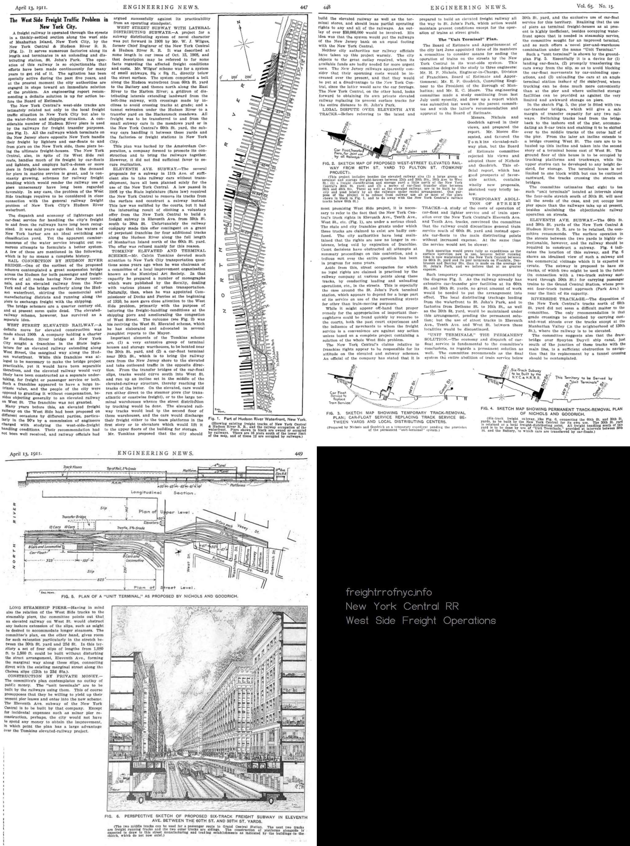
The following is quoted directly from the 1920 Joint Report with Recommendations:
"The charter of 1846 granted the right, subject to permission from the City of New York, to build a line down the West Side of Manhattan. That permission was given the next year, and the West Side tracks were laid as part of the Hudson River Railroad.
The line handled passenger as well as freight business, inasmuch as the Park Avenue line to what is now Grand Central Station belonged to an entirely different company, the New York & Harlem Railroad Company.
The Hudson River Railroad Company established a passenger station at Chambers Street, but drew its passenger cars by horses between that point and Thirtieth Street.The company's freight traffic grew to such an extent that the company was forced to find a site inland from the waterfront for a downtown terminal. On this site, at Beach and Varick Streets, was built the St. Johns Park Terminal, after which, in 1868, the tracks south to Chambers Street were removed.
In 1871, the same year the first Grand Central Station was completed at Fourth Avenue and Forty-Second Street, the Spuyten Duyvil & Port Morris Railroad, connecting what had then become the New York Central & Hudson River Railroad with the New York & Harlem Railroad, was opened, and the Central transferred its passenger trains to the new route.
Since that time the West Side line has been used almost exclusively for freight, express and milk business."
As originally laid out, the trains were brought as far south to a station located on the corner of Chambers Street and College Place / West Broadway beginning on October 8,1851.
| Cornelius
Vanderbilt was born in Staten Island, NY; on May 27, 1794, to
Cornelius van der Bilt and Phebe Hand. (van
der Bilt being the original spelling which was anglicized to
Vanderbilt.) He began working on his father's ferry in New York Harbor as a boy, quitting school at the age of 11. At the age of 16, Vanderbilt decided to start his own ferry service. Vanderbilt was nothing less than a mover and a shaker. He made a name for himself in commercial shipping and earned the nickname "the Commodore". After coming to dominate the shipping business; he further built his wealth in railroads, and through his guidance shaped the railroad industry of the Northeast. It has been said Vanderbilt lacked finesse or couth, and was prone to be vulgar (what was considered vulgar in the 1800's I don't know, but it might be tame for the 21st Century): "Contemporaries, too, often hated or feared Vanderbilt or at least considered him an unmannered brute. While Vanderbilt could be a rascal, combative and cunning, he was much more a builder than a wrecker... being honorable, shrewd, and hard-working." H. Roger Grant, historian |
Cornelius Vanderbilt
May 27, 1794 – January 4, 1877 |
This direct route via the Spuyten Duyvil swingbridge gave the New York Central access to the "Water Level Route" which ran north along the Hudson River to Rensselaer, NY; where it could go east to Boston, Massachusetts or cross the Hudson River into Albany and go west to Chicago, Illinois; and through connections even farther to the West Coast; north to Canada; or back south to New Jersey and other points south along the Eastern Seaboard.
Ironically, this physical connection still exists to this very day, albeit slightly rerouted to get the trains off the streets (which we will address in a later chapter on this page), and is now under Amtrak usage for passenger service.
In 1881, the New York, West Shore & Buffalo Railroad had been planned as one link in a chain of a new transcontinental railroad from New York to San Francisco. This chain was to be comprised of the West Shore; the New York, Chicago and St. Louis Railroad or "Nickel Plate Road"; the Chicago, Milwaukee and St. Paul Railway, the Northern Pacific Railroad; and the Oregon Navigation Company.
 William H. Vanderbilt May 8, 1821 – December 8, 1885 |
However, William Henry
Vanderbilt (son of Cornelius Vanderbilt and known as "Billy", and of
whom now owned the New York Central Railroad); purchased the
Nickel Plate Road in 1882, in effect breaking the chain and that plan. From childhood though mid life; William was looked down upon by his father, with Cornelius frequently berated and criticized him, calling his eldest son a "blockhead" and a "blatherskite". Billy longed to demonstrate to his father that he was not, but William never dared stand up to the Commodore, who had a very imposing presence. A case in point and even in adulthood: William once stated to his father, "If you tell me not to smoke, I'll obey you." Cornelius grunted, and William threw away the cigar, and gave up smoking forever. Cornelius was that powerful of a patriarch. A major turning point in their relationship occurred on the family trip to Europe on the steamship "Vanderbilt" in 1860, after which the two became very close and Billy was given a greater role in business matters. His father carefully oversaw Williams' education in the business world, starting him at age 19 as a clerk in a New York banking house. After joining as an executive of the Staten Island Railway and increasing the revenue, William was elected to the office of president in 1862. In 1869, he was made vice-president of the New York and Harlem River Railroad, further becoming its president in 1877. He took over for his father as president of the Lake Shore and Michigan Southern (LS&MS) Railway, the Canada Southern Railway, and the Michigan Central Railroad (MCRR) at the time of the Commodore's death in 1877. As crude as his father Cornelius was considered amongst his peers, it was William that drew the ire of the everyman. In 1883, reporter John D. Sherman questioned him about why he ran the limited express train, "Do your limited express trains pay, or do you run them for the accommodation of the public?" Vanderbilt responded with, "Accommodation of the public? The public be damned! We run them because we have to. They do not pay. We have tried again and again to get the different roads to give them up; but they will run them and, of course, as long as they run them we must do the same." |
.
This
interview was then published in the Chicago Daily News, but
Vanderbilt's words and the context were modified, with particularly
heavy emphasis on "The public be damned." Several different
accounts of the incident were then disseminated; the accounts vary in
terms of who conducted the interview, under what circumstance and what
was actually said.
Vanderbilt received a great deal of negative publicity from
the
"The public be damned" portion, and so much so that he even went as
far to clarify his response with a subsequent interview by the Chicago
Times. In that interview he was quoted saying: "Railroads
are not run
for the public benefit, but to pay. Incidentally, we may benefit
humanity, but the aim is to earn a dividend." As you can imagine, these
words did not sit well with the public or the media.
Paying no heed to how the public viewed him, Vanderbilt's
railroad
holdings included no less than the Chicago, Burlington and Quincy
Railroad (CB&Q); the Chicago and Canada Southern Railway; the
Detroit and Bay City Railroad; the Hudson River Railroad (not to be
confused with the New York Central and Hudson River RR), the
Hudson
River Bridge, the Joliet and Northern Indiana Railroad, the Michigan
Midland and Canada Railroad, the New York Central Sleeping Car Company,
the New York and Harlem Rail Road, the Spuyten Duyvil and Port Morris
Railroad, and the Staten Island Railroad.
During this same time frame, the New York Central
began constructing the
South
Pennsylvania Railroad across southern Pennsylvania, of which was deep
in the
Pennsylvania Railroad's territory. At
the same time, the New York Central Railroad then proceeded to
drive the New York, West Shore and Buffalo Railroad into bankruptcy via
a
brutal
rate-war, of which the West Shore could not withstand financially.
The
Pennsylvania Railroad (PRR), which was and remained the New York
Central's greatest rival right up until 1968; recognized that
the West Shore Railroad would make a
great
addition to its network, and also allowing it to penetrate deep into
New York Central
territory. So it began to make overtures to acquire it.
And now a second, but more destructive
rate-war between the Pennsylvania and the New York Central commenced;
to wit each railroad kept lowering its freight haulage prices to the
point they were actually losing money in an effort to undercut the
other.
| This loss of revenue
was an anathema to J. Pierpont Morgan; of
whom sat on the board of directors of both the New
York Central and the
Pennsylvania. Morgan was well respected throughout the business world,
and
of whom was the top railroad
financier in the United States, much less among many other industries.
This rate
war, which
drove down stock and bond prices;
was essentially killing Morgan's dividends. So, he decided to
personally
intervene. In July 1884, Morgan and Vanderbilt agreed to try to negotiate a peace treaty between the Pennsylvania and New York Central Railroads. Morgan invited George B. Roberts and Frank Thompson (president and vice-president of the Pennsylvania Railroad) to meet with the New York Central’s president, Chauncey Depew, on board Morgan’s yacht, Corsair. Morgan picked the executives up at a Jersey City pier, near the Pennsylvania Railroad’s terminal, on a hot July morning. They proceeded north up the Hudson River 50 miles to Garrison, NY; and then turned back south to Sandy Hook, New Jersey; located at the entrance to New York Harbor. Depew beseeched the Pennsylvania men to end what he called the “ruinous” competition of building parallel lines and endless rate wars. These tactics added nothing to the bottom line of either railroad. A luncheon was served as the Corsair sailed up and down the river. Morgan argued that this sort of competition was not only bad for business; it was adversely affecting the flow of European (especially British) financial capital into American railroads as they continued their expansion across the continent. No agreement, Morgan implied, equated to no further European investment. While Thompson came around to Morgan’s way of reasoning, Roberts remained adamant against it. Only when Corsair tied back up to the Jersey City pier at 7:00 pm; did Roberts, finally relent and shook hands with Morgan on the dock, stating, “I will agree to your plan and do my part.” While it took almost two more decades for the final agreement to be signed; the West Shore Railroad, would now be owned by the New York Central as a subsidiary, and the construction of the South Pennsylvania Railroad ceased (sections of which were repurposed much later (1940) for use in constructing the Pennsylvania Turnpike.) |
 John Pierpont Morgan
April 17, 1837 – March 31, 1913 |
The stock prices of the two railroads rose
immediately; and naturally, the principals and the shareholders were
pleased.
The New York Central, having purchased the New
York, West Shore and Buffalo Railway on November 24, 1885; reorganized
its new acquisition as the West Shore Railroad on December
5, and leased it for 475 years from January 1, 1886.
(So, in effect the West Shore Railroad West 36th Street Yard
was originally the competition; wound up becoming a subsidiary and by
proxy an expansion to the West 33rd Street Yards.)
In
1914, all of Cornelius Vanderbilt's eleven other
railroad operating interests: particularly the New York, West Shore
& Buffalo with its carfloat terminals in Weehawken, New Jersey;
were
merged into the New York Central and Hudson River Railroad to form the
New York Central Lines.
With this basic but very convoluted and necessary history of
the railroads
in New York City now outlined, we can now get down
to the specifics of the West Side of Manhattan Freight Operations.
.
.
Early Service - Passenger and Freight
As we can see by the City of New York
Ordinances, resolution
dated December 4, 1850 (seen at right);
|
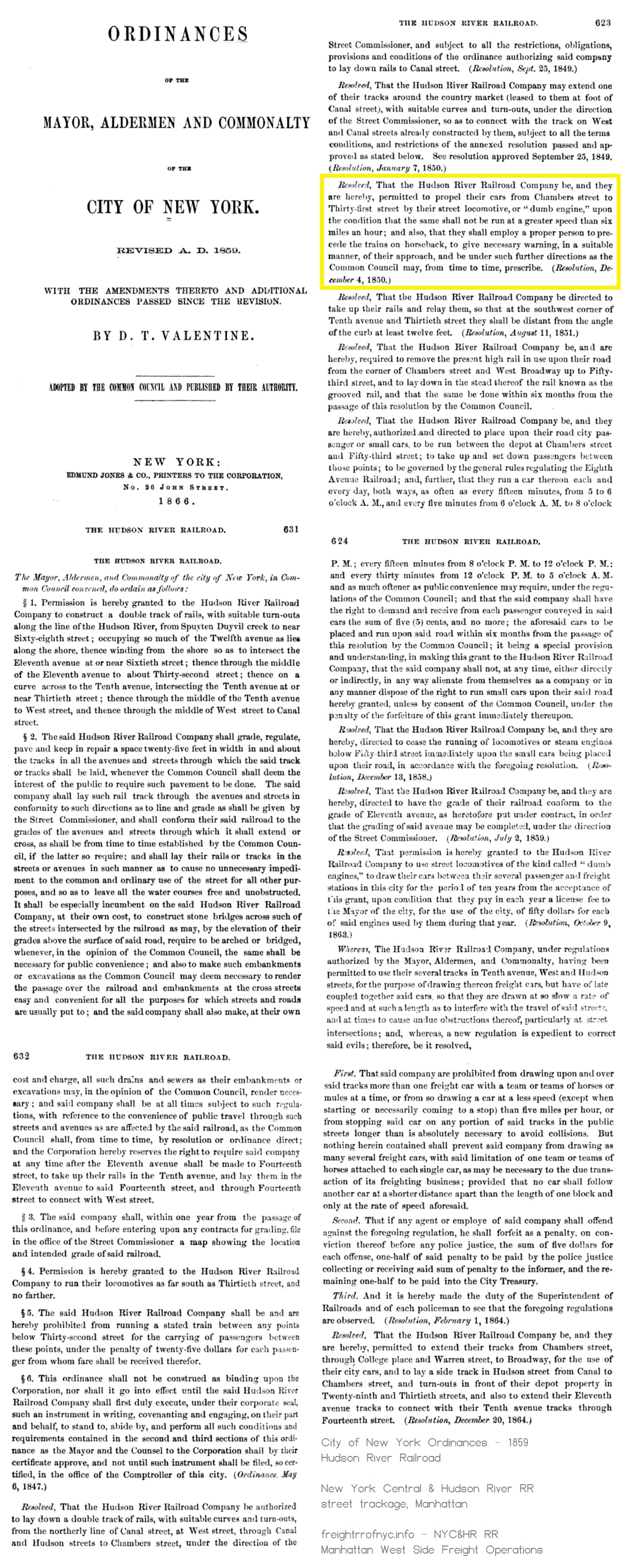 |
|
So,
the Hudson River Railroad
was permitted to use a "dumb engine" (steam dummy or covered
locomotive) from West 31st Street to Chambers Street, but the New York
and Harlem Railroad along Fourth Avenue, was not. So, not only was the Hudson River RR now permitted to use steam locomotives, but it was in fact using them in joint freight and passenger handling to and from the Chambers Street Station until 1868. 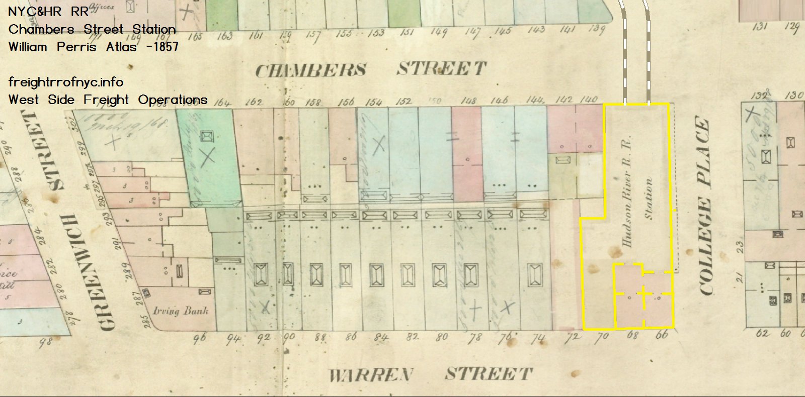 Atlases of New York City - Manhattan - 1857 Plate 8 - William Perris Civil Engineer and Surveyor Third Edition Publisher: Perris & Browne Lionel Pincus and Princess Firyal Map Division New York Public Library Digital Collection annotated version © 2024~ freightrrofnyc.info added 20 May 2024 |
 Atlases of New York City - Manhattan - 1857 Index Map William Perris Civil Engineer and Surveyor Third Edition Publisher: Perris & Browne Lionel Pincus and Princess Firyal Map Division New York Public Library Digital Collection annotated version © 2024~ freightrrofnyc.info added 20 May 2024 |
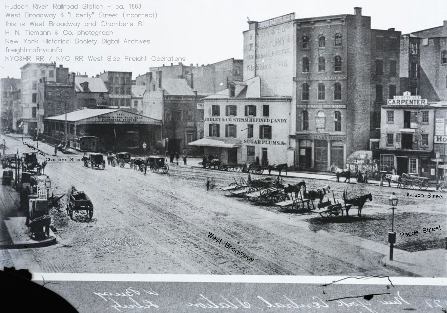
Hudson River Railroad
Station Passenger Station - 1863
H. N. Tiemann photoLooking south-southwest. This image is misattributed as West Broadway & "Liberty Street" (West Broadway and Liberty Street do not intersect.)
Furthermore, the buildings and geography shown in the image perfectly align with the Perris Street Atlas above at the intersection of Chambers Street and West Broadway.
The triangle where the horsedrawn drayage carts are lined up is present day Bogardus Plaza.
Nevertheless, the presence of numerous open two wheel horsedrawn carts queued after the hacks and carriages exemplifies freight transport at this station.
Why was the Hudson River Railroad permitted to operate locomotives in the streets and not the New York & Harlem along Fourth Avenue? While this is a question that needs a definitive answer, I suspect that answer may be read between the lines of the Joint Report with Comprehensive Plan and Recommendations of 1920: New York, New Jersey Port and Harbor Development Commission:
The line handled passenger as well as freight business, inasmuch as the Park Avenue line to what is now Grand Central Station belonged to an entirely different company, the New York & Harlem Railroad Company.
The Hudson River Railroad Company established a passenger station at Chambers Street, but drew its passenger cars by horses between that point and Thirtieth Street.
The company's freight traffic grew to such an extent that the company was forced to find a site inland from the waterfront for a downtown terminal. On this site, at Beach and Varick Streets, was built the St. Johns Park Terminal, after which, in 1868 , the tracks south to Chambers Street were removed.
Also, one must keep in mind, during this early era of operations, the New York & Harlem RR was operating in and through residential and light commercial zones south of West 14th Street. When first organized, the NY&H was a commuter railroad between Downtown and Midtown Manhattan.
The
Hudson River RR on the other hand was routed along the undeveloped land
of the shoreline (in the north), and wharfs and piers (in the south)
which were home to heavy commercial and industry.
And
so it appears with increasing clarity, while the Hudson River Railroad
engaged in both freight and
passenger service, freight became its bread and butter (figuratively
and
literally!) Otherwise, why would it give up its passenger depot at
Chambers and build an exclusive freight terminal?
It is imperative to keep in mind at this point in time; the
New York & Harlem River Railroad, was
still a competitor
to the Hudson River RR. It would not be until Cornelius Vanderbilt
purchased the HRRR, that he brought them under the same umbrella a few
years after in 1869.
|
As the city population grew, freight
traffic grew to keep up with it. And as the city reached "full
occupancy" south of 14th Street, the population expanded
northward; there arose a
conflict. Trains were now impeding the people and the people were getting run over by trains. This can be somewhat equated to building an airport on the outskirts of the city; and the city grew, it encroached upon the airport, and now its presence has become a nuisance to those closest to it. In most cases, that does not have a fatal outcome - unless of course the plane crashes into some houses, then there is an uproar; and that has happened on several occasions - but no amount of public uproar ever forced an airport to relocate!
When the Hudson River RR railroad was first laid out in
the mid-1840's, pretty
much everything north of 42nd Street was undeveloped farmland or
forest. It was
unfathomable at the time that the city would grow north of the
demarcation line at 42nd Street. This misconception would come back to
haunt the City
fathers time and time again - when City Hall was constructed at
Chambers Street, it employed
cheap brownstone for its north face, as it was expected most residents
would not venture north of Chambers Street and not see it
often. ("Grand Central",
Marshal,1946) So, as the city population grew in the late 1800's, even the slow moving (no more than 6 miles per hour per the city regulation, and escorted) freight trains running down the center of the thoroughfare were found to be involved in a rather growing frequency of serious accidents and fatalities involving pedestrians. |
year | population (Manhattan) |
| 1840 | 313,000 | |
| 1850 | 516,000 | |
| 1860 | 814,000 | |
| 1870 | 942,000 | |
| 1880 | 1,165,000 | |
| 1890 | 1,441,000 | |
| 1900 | 1,850,000 | |
| 1910 | 2,332,000 | |
| 1920 | 2,284,000 | |
| 1930 | 1,867,000 | |
| 1940 | 1,890,000 |
One of my pet peeves, is that I particularly despise the moniker "Death Avenue" - of which Eleventh Avenue and Tenth Avenue have became to be called as a result of the pedestrian vs. railroad accidents. Not because I'm squeamish, (nor am I offended) but rather because I am well read.
Also, the general population, then as now; has a macabre
obsession with death
(but only when it doesn't involve them directly) whether it be a
convict given the electric
chair at Sing-Sing, or accidents in the streets. It's often said, "if
it bleeds, it leads."
This is not personal opinion on my part, but well
established through academic and psychological studies:
The journalism adage "if it bleeds, it leads" reflects a long-standing reality that sensationalism, crime, and tragedy consistently capture more public attention and engagement than positive news.
K. MacRae, Concordia UniversityThe phrase is widely considered a staple of "yellow journalism"—a strategy dating back to the 1890s circulation wars between publishers like William Randolph Hearst and Joseph Pulitzer. These editors realized that printing exaggerated stories about violence and gore was an easy way to mass-produce sales and advertising revenue.
International Council on Media Literacy
Ergo, this "Death Avenue" moniker is a quite a bit of hyperbole and quite sensationalist, when one actually does the arithmetic. Unfortunately, it has become so ingrained throughout the historical accountings of the West Side Freight Operations, that referral to simply "Eleventh Avenue" or "Tenth Avenue" does not carry the same effect.
The 1800's and early 1900's - and with it the coming of the Second Industrial Age - were an inherently dangerous period of time of and in itself. People were maimed and killed by a great of things in daily life; pedestrians were also run over by horsedrawn wagons on a daily basis or trampled by horses. Riders were thrown. The subways were being constructed and temporary sidewalks and bridges collapsed under pedestrians on more than one occasion. With the expansion of electricity into the home and indoor plumbing, a lot of people thought it convenient and relaxing to place a radio near the bathtub. That is, until it fell into the bath water.
Industry was drastically dangerous: coal mines, steel mills, lumber mills, steam boilers, bridge building, tunnel boring and land work with explosives, mechanized farm equipment, etc. Everyday life then was more of a hazard.
In short, injuries and fatalities came from all sorts of machinery and industrial accidents, and not just this particular train or its routing. A "big deal" has been made about the 540 people were known to have been fatally injured by train movements through 1905 by the operations of street running freight trains in Manhattan.
But as you will see, trolley cars caused deaths on the streets as well. More so than the freight trains on the streets of Manhattan. These trolleys, so essential to the movement of people to and from work and school; were no different in the hazard they presented. They ran people over too. The Brooklyn Daily Eagle ran a full page feature page on December 30, 1894 blasting the deaths of so many from trolleys. "Frightfully mangled". "Beheaded". "Legs cut off". But no one individual or any holder of city office ever enacted or tried to enact legislation, that forbade the use of trolleys or made them move to another street or part of the city. The trolleys were a public service, you see. And different in terms that lines were owned by different companies. One couldn't possibly get rid of them all.
Yet, only a few people and politicians actually advocated banning the automobile from streets. What was actually done to counter this issue? Speed limits, perhaps; the hiring of policemen as traffic control officers, the installation of traffic lights, institution of one way streets; but not an outright all encompassing ban on th automobile..
But as for the Eleventh and Tenth Avenue issues, it was the "big, bad freight railroad" that bore the brunt of the blame, and was an easy target. And while people needed the trolleys to go to and from work and school, go about their daily lives and what have you; they were an essential public service. Most transit companies of the era were considered "locally" owned. The perception was (and remains) the freight trains weren't. At best, they might have been incorporated in the State of New York, but their corporate offices may have been out of state.| Acetylene, Argon, Carbon Dioxide, Oxygen: | welding and cutting of metals for construction and demolition. |
| Ammonia: | refrigerant, cleaning agent. |
| Anhydrous Ammonia: | a fertilizer used in agriculture. |
| Ammonium nitrate: | an excellent fertilizer, that can be explosive when not stored properly. Also used in instant cold packs for injuries and pain relief. |
| Chlorine: | used for purifying water and producing other chemicals like household bleach. |
| Vinyl chloride: | a gas used to make plastics, including PVC pipes and conduits (that is used to replace more toxic lead pipes in older homes!), wire insulation, packaging materials and medical devices, automotive parts. |
| Hydrochloric Acid: | used in electroplating and etching metals. When combined with other chemicals, becomes innocuous, as in the manufacture in pharmaceuticals. |
| Sulfuric Acid: | used in petroleum refining and fertilizer production. Also combined with other chemicals which becomes innocuous, in the manufacture in pharmaceuticals. |
| Sodium Hydroxide (Lye): | used in paper manufacturing and manufacture of soap and detergents. |
| Crude oil: | refined into hundreds of products from bitumen used in asphalt for roofing and paving, to motor fuels to, cleaners, and plastics. |
| Liquified Petroleum Gas (Propane): | heating, cooking, clothes drying. |
| Acetone: | combined with other chemicals becomes innocuous, in the manufacture in pharmaceuticals; solvents for paints and paint removal. |
| Alcohol (var. forms) & Ethanol (Vinyl Alcohol): | used for antiseptics and disinfectants, cosmetics & perfumes, a renewable fuel and a fuel additive for reducing pollutants. |
| Charcoal: | Quick
light charcoal that one uses in your bar-b-que grill? You guessed it. A
dangerous good. Not toxic, but very flammable. You don't use quick lite? Charcoal lighter fluid is comprised of petroleum based (mineral spirits) or alcohol (ethanol or methanol). |
| ®Common aerosol cans: | of
disinfectants (Lysol®), spray paints
(Rustoleum®
& Krylon®),
protective coatings and lubricants (WD40®),
shaving cream, hair spray, insect spray, et al. A single can by itself on your shelf - not that much of a hazard. But hundreds / thousands of of cases in shipment to a warehouse or distributor? |
| ®Butane: | If you are now or were a smoker - the Bic® butane lighter. Either gas or liquid form: Highly flammable. |
| Naptha: | Preferred
a Zippo lighter to light your cigarette or cigar? Also highly
flammable.
Both Butane and Naptha are transported by railroad in bulk before, and in the finished products themselves. |
Diesel fuel. Gasoline. Pesticides. Herbicides.
Agricultural chemicals. Pharmaceuticals. Wood treatments and
preservatives.
Let us take something found in almost every
kitchen and hardly thought of: Cling wrap or Saran® wrap. It is manufactured from
Low-Density Polyethylene (LDPE) combined with polybutylene.
Ethylene and Butylene are both highly flammable, and transported in
bulk via railroad tankcar. Can be explosive when subjected to
uncontrolled heating without emergency venting. Polyethylene is also used in the
manufacture of ZipLoc®
bags another kitchen staple for storing leftovers. Plastics
are used in food sales and storage: meats are sold
wrapped in plastic for hygienic and sanitary reasons. The medicines you
take to treat illness and disease.
Other plastics are
utilized in contact lenses and eyeglasses. Plastics require chemicals,
that require refineries to process, and through chemicals that require
transportation by rail or truck or pipeline.
The very computer or smart device you read this on, the products
you
purchase and consume, use various chemicals which are
needed to make plastics; as well as acids, and heavy metals in its
construction. Acids are used to etch metals for electrical
contacts.
The
list of
hazardous chemicals transported by rail, and that by subsequent
processing become
inert and used throughout our daily lives, is endless.
Point being, injury
and
death goes hand
in hand with living. The more advanced the civilization, the more
hazards there are that come about as a result of those advancements.
Trains derail, trucks run off the road, planes crash, ships sink. All
transportation methods collide with other objects.
Despite the best maintenance, items such as
wheels, rails, pipes and storage tanks will fail. This
bothers you? What
are the options? Going back to
living in a
cave,
hunting for your food daily with a stone or a spear? Hell,
even archaeologists have even found
primitive man injured by those basic hunting implements!
The point being, it is
one thing to call out negligence
and seek justice and remediation when it is truly a factor in an
accident; but it's another matter
entirely to steadfastly condemn something because it simply scares a
portion of the population.
It take great composure and education not to knee jerk react: to stop
knee-jerk reactions, you need to create a deliberate pause between a
trigger and your behavior / reaction. By interrupting the brain's
rapid-fire "fight or flight" response, you shift control from your
emotional center (the amygdala) to your rational mind (the neocortex).
;)
Even the author is guilty of this: every time I
read an AI
generated misstatement regarding the West Side Freight Operations - I
go into fight mode. LOL!
</rant>
Anyhow, returning to the 1800's; and
in the case of the New York Central Railroad; when
that
railroad was owned by a very
outspoken ultra-millionaire, like it was by William H. Vanderbilt
living in a mansion of Fifth Avenue; well, these persons made for an
easy target
by the media. The railroads were, and
remain to this day; to be perceived as a big faceless uncaring
corporations. Not much has changed,
has
it?
Despite this, that is not to say solutions and remedies were
not
attempted back then. One of the solutions to the hazard of
operating trains through the city streets, was to have a
man
on
horseback escort the trains during transit on public thoroughfares.
Which brings us to our next chapter.
.
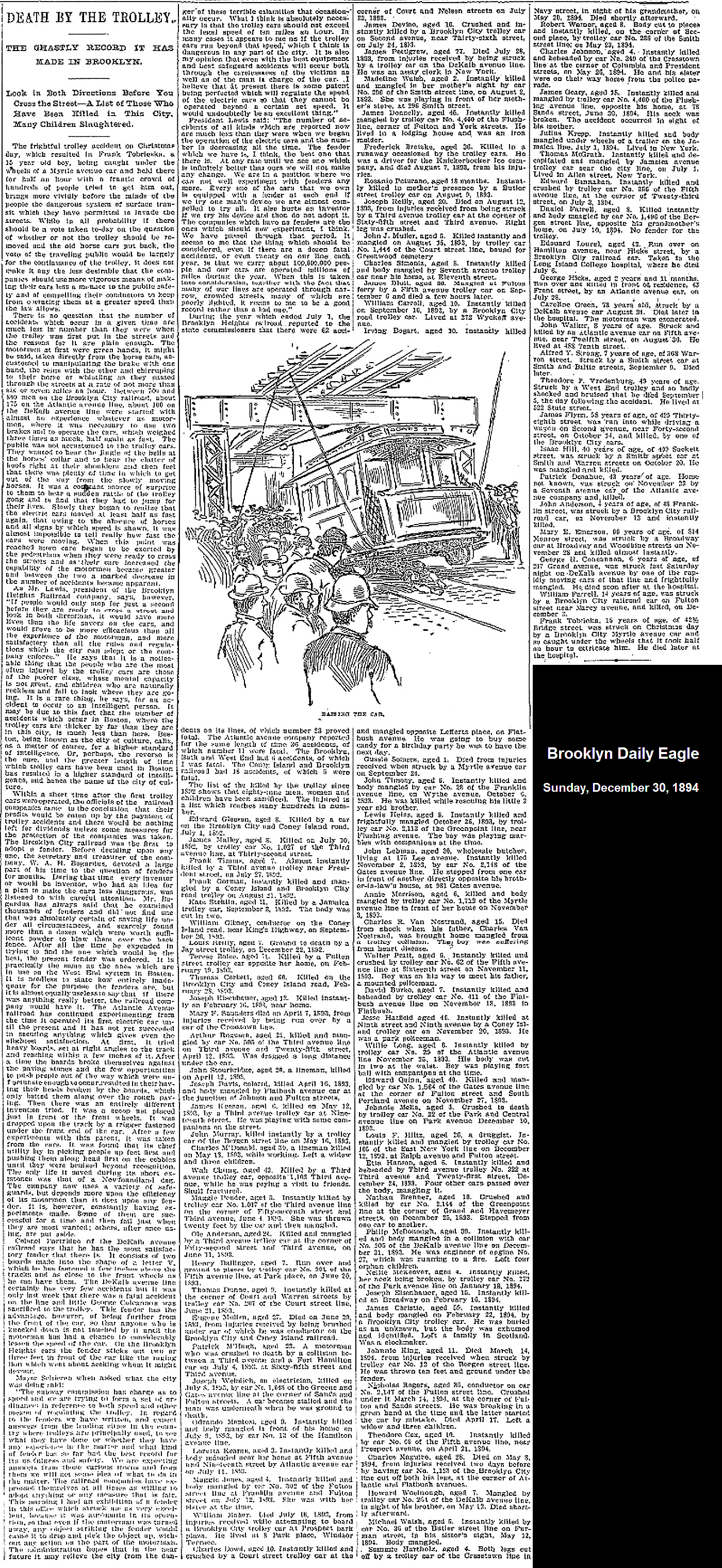
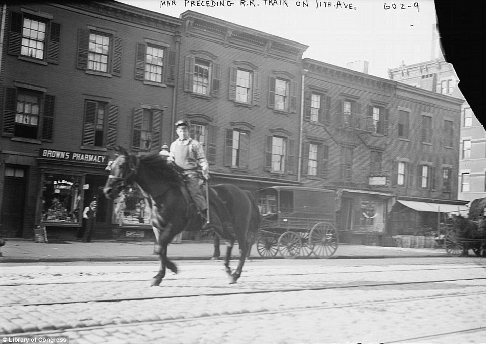
The West Side Cowboys
a/k/a
"Dummy
Boy" - "Tenth Avenue Cowboy" - "Eleventh Avenue Cowboy" - "Paul Revere"
"that the Hudson River Railroad Company . . . are permitted to propel their cars from Chambers Street to Thirty-first Street, by their locomotive, or 'Dumb Engines,' upon the condition that the same shall not be run at a greater speed than six miles an hour; and also, that they shall employ a proper person to precede the trains on horse back, to give the necessary warning in a suitable manner of their approach, and be under such further direction as the Common Council may from time to time prescribe."
Mind you, this is just one paragraph of a multiple page agreement regarding the rights of the Hudson River Railroad to use streets and avenues in Manhattan to convey freight AND passenger trains to Chambers Street Depot. The unabridged text may be read by clicking on the excerpt of legislation above. It contains some very interesting information to say the least regarding which route the railroad had to follow, distances between cars, and other details lost over time.
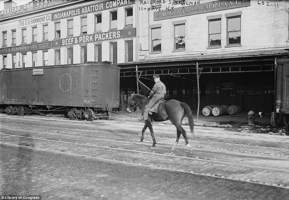
This horse rider was to lead the locomotive movement and warn pedestrians to yield to the oncoming train. An escort if you will. These horse riders became known as a "West Side Cowboy", or a "Dummy Boy" (after the steam dummy). They were also known as the Tenth Avenue (or Eleventh Avenue) Cowboy. And when first established, this rider escorted both passenger trains to Chambers Street AND freight trains.
You will note in a lot of images; these riders appear quite young. They were - back in those days when a lad was old enough to ride a horse, he was old enough to work. It was not until 1938 that the Fair Labor Standards Act was passed, prohibiting most children under age 16 from working (with exception to agriculture and domestic labor). So a lot of young men, no older than their early teens; were seen at work and this position was no exception.
 |
 |
 |
|
| two image above and one below Bain News Service / George Grantham Bain collection Library of Congress added 05 April 2024 |
unknown provenance |
The following film, converted to digital format, shows several of the West Side Cowboys at work escorting the trains. The following digital video from the blog "LivinTheHighLine" article titled "The West Side Cowboy and the High Line", (www.livinthehighline.com/the-original-urban-cowboy/).
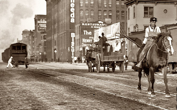
This image below, coincidentally visually exemplifies how pedestrians got injured or killed on the streets on their own accord. In this image we clearly see an escort to the train with red flag warning the public about the oncoming train (moving at no more that 6 miles an hours per City ordinance); yet in that brief span of time between that escorts passing and the train following behind, a Department of Street Cleaning (predecessor to the Department of Sanitation) street sweeper and a pedestrian are crossing in front of the train. This was a decision - sometimes a fatal decision - made by the individual to take that risk. This is an exhibition of free will. And it was not the railroads fault.
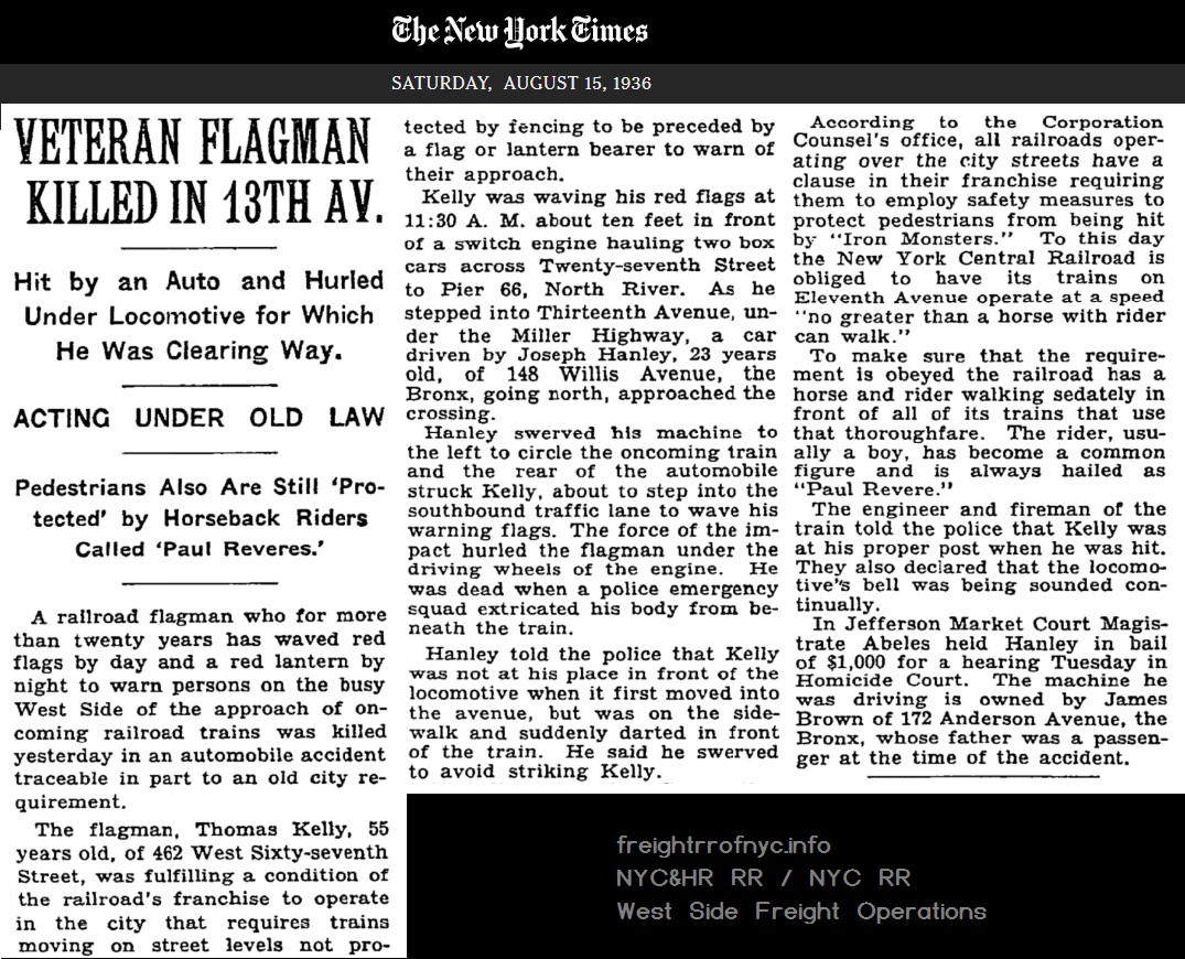 |
A railroad flagman who for
more than twenty years has waved red flags by day and a red lantern by
night to warn persons on the busy West Side of the approach of
on-coming railroad trains was killed yesterday in an automobile
accident traceable in part to an old city requirement. The flagman, Thomas Kelly, 55 years old, of 462 West Sixty-seventh Street, was fulfilling a condition of the railroad's franchise to operate in the city that requires trains moving on street levels not protected by fencing to be preceded by a flag or lantern bearer to warn of their approach. Kelly was waving his red flags at 11:30 A. M. about ten feet in front of a switch engine hauling two box cars across Twenty-seventh Street to Pier 66, North River. As he stepped into Thirteenth Avenue, under the Miller Highway, a car driven by Joseph Hanley, 23 years old, of 148 Willis Avenue, the Bronx, going north, approached the crossing. Hanley swerved his machine to the left to circle the oncoming train and the rear of the automobile struck Kelly, about to step into the southbound traffic lane to wave his warning flags. The force of the impact hurled the flagman under the driving wheels of the engine. He was dead when a police emergency squad extricated his body from beneath the train. Hanley told the police that Kelly was not at his place in front of the locomotive when it first moved into the avenue, but was on the sidewalk and suddenly darted in front of the train. He said he swerved to avoid striking Kelly. According to the Corporation Counsel's office, all railroads operating over the city streets have a clause in their franchise requiring them to employ safety measures to protect pedestrians from being hit by "Iron Monsters." To this day the New York Central Railroad is obliged to have its trains on Eleventh Avenue operate at a speed “no greater than a horse with rider can walk.” To make sure that the requirement is obeyed the railroad has a horse and rider walking sedately in front of all of its trains that use that thoroughfare. The rider, usually a boy, has become a common figure and is always hailed as "Paul Revere.” The engineer and fireman of the train told the police that Kelly was at his proper post when he was hit. They also declared that the locomotive's bell was being sounded continually. In Jefferson Market Court Magistrate Abeles held Hanley in bail of $1,000 for a hearing Tuesday in Homicide Court. The machine he was driving is owned by James Brown of 172 Anderson Avenue, the Bronx, whose father was a passenger at the time of the accident. |
|
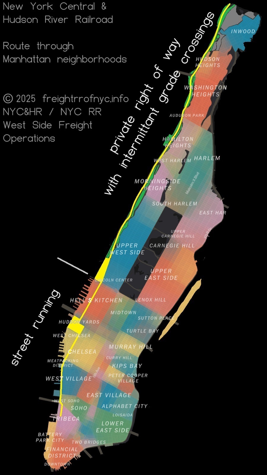
While the New York Central & Hudson River operated
north of
West 72nd Street on mostly privately owned land, the New York Central
& Hudson River RR had been
operating
the trackage in the streets south of West 60th Street under a perpetual
franchise, renewed every
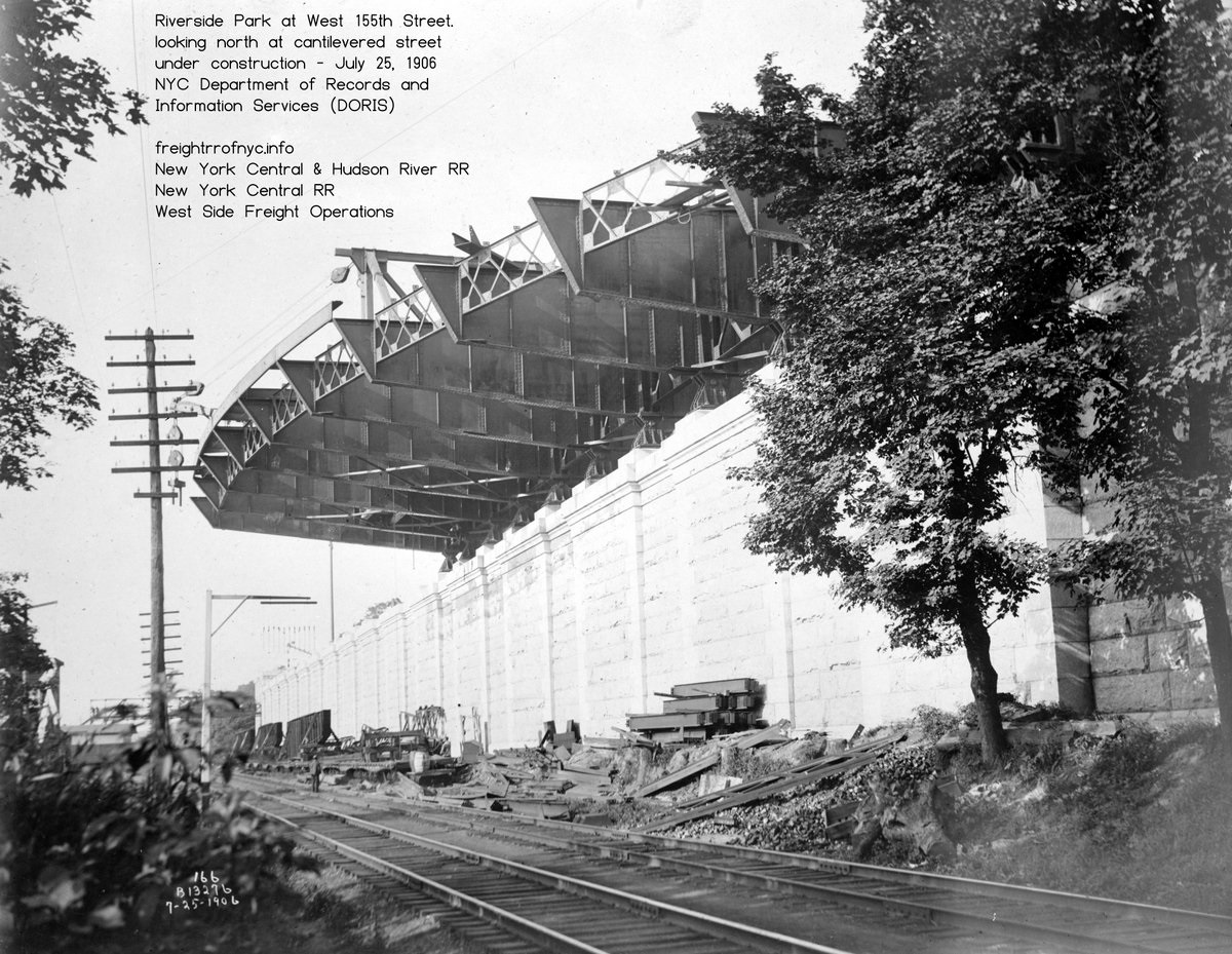
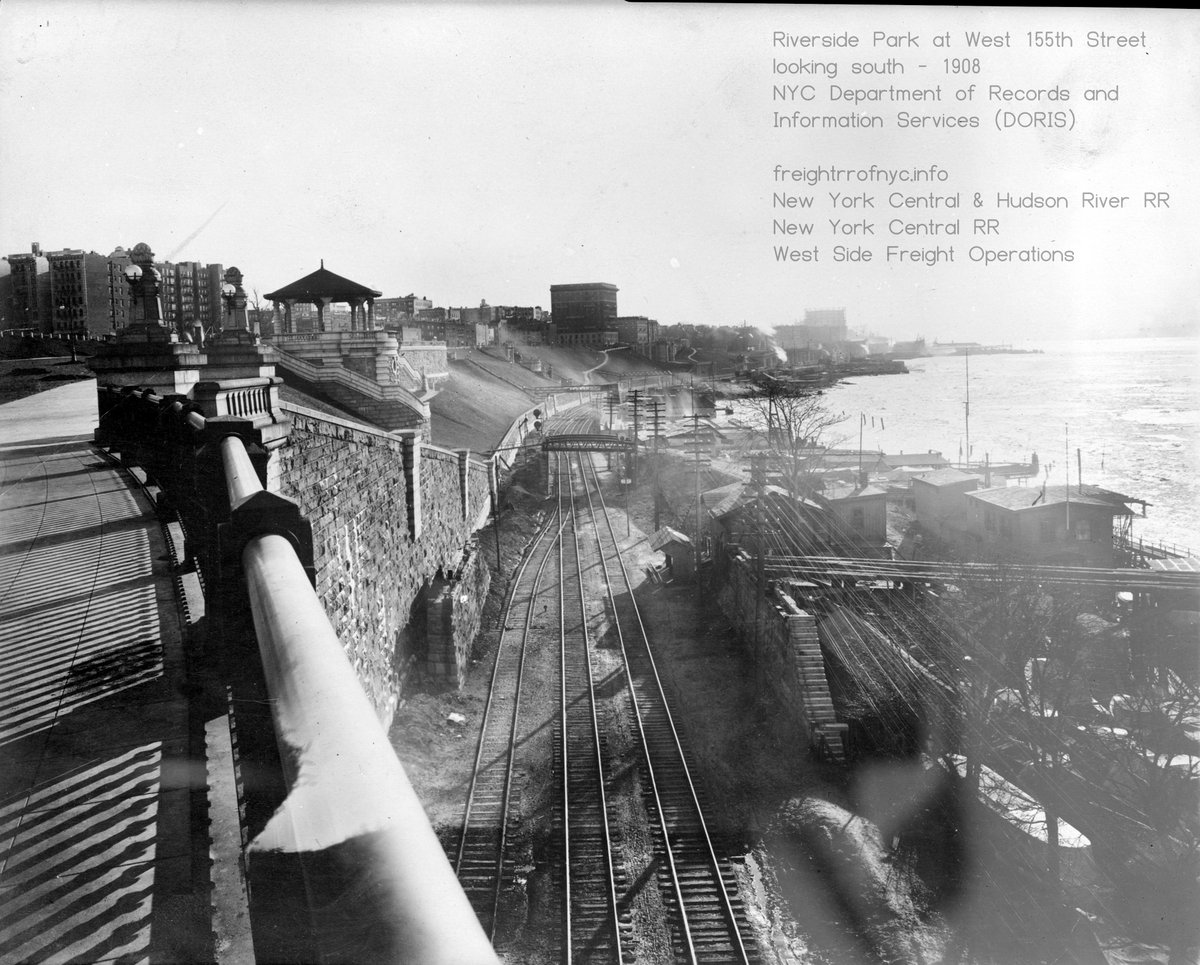
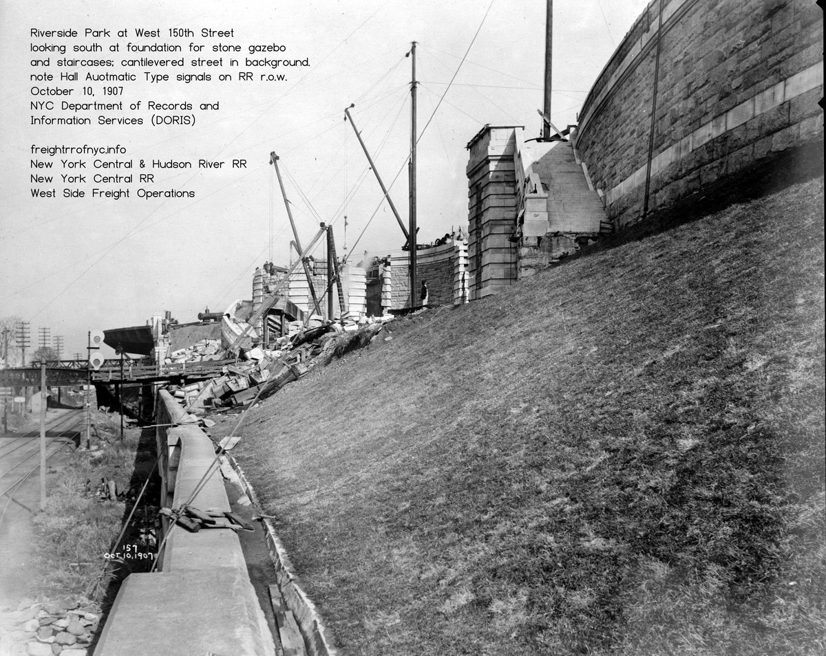
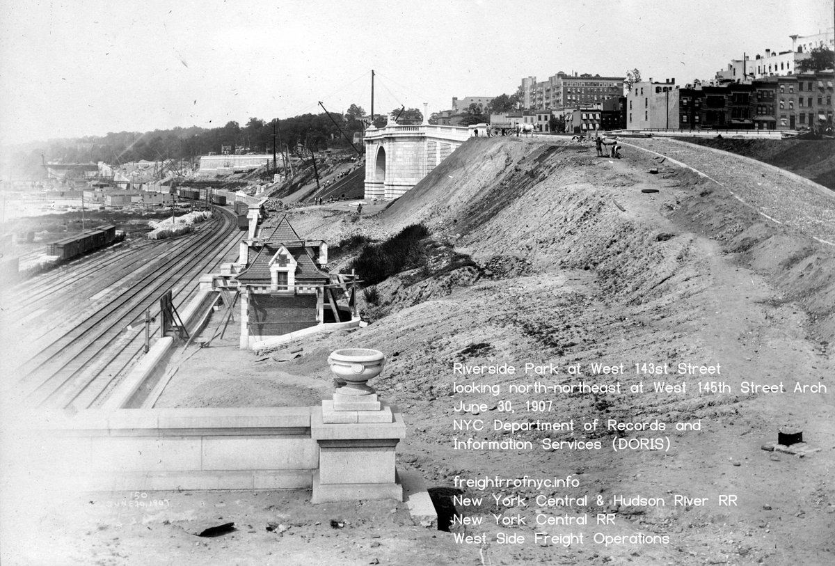
25 years. In 1905 it was proposed, and in 1906, the New York State Legislature passed a bill introduced by Senator Martin Saxe which gave the New York Central and Hudson River Railroad Company a year in which to negotiate a settlement with the old Board of Rapid Transit Commissioners; and in default of which; the City was to begin condemnation proceedings. But nothing came of it. Later, the City brought proceedings against the railroad, with the result that in 1910 the Court of Appeals rendered a decision holding that the City of New York had no right to interfere with the company, but that, as it had succeeded in showing that the presence of the New York Central operations on Eleventh Avenue were a danger to the citizens and a detriment to the neighborhood. Therefore, the State could, under its general police power; take steps to force the railroad company to find a new site for its tracks at its own expense. This included the railroad placing its tracks in a six track tunnel and which the railroad would retain its franchise on two of the six tracks, with the city renting the other four tracks to the railroad. Not to mention, the engineering issues in constructing a six track wide tunnel under active city streets! A two track subway tunnel, maybe... But six tracks? Surprisingly, the railroad was in favor of this very costly project of approximately $50,000,000 dollars - which equates to $1,775,000,000 (that's 1.775 billion) in 2024 dollars and allowing for inflation. Nothing came of it, and this did nothing to solve the increasing problem. In 1908, Calvin Tompkins (the Commissioner of Docks for the City of New York) proposed the following: an elevated freight line from West 72nd street to St. John's Park, and a "union" freight terminal with transfer bridges at 30th Street; union meaning to be operated by all the railroads seeking presence, and paid for by rental charges. This proposal too, went nowhere. . Riverside
Park
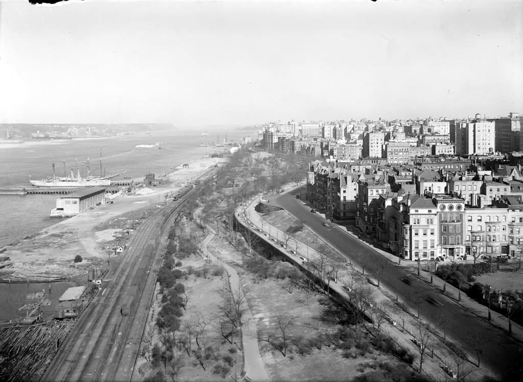
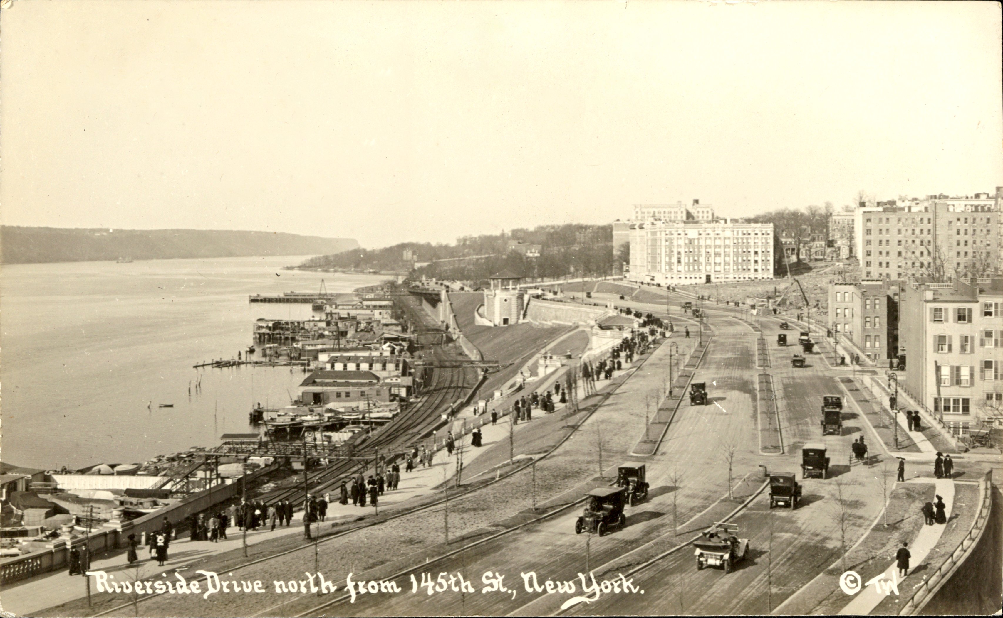
North of West 72nd Street, as businessmen (and women) earned (or inherited) the financial wherewithal to leave the congested urban center; the increasing population of Upper West Side, more specifically Riverside Park area was developing as well and increasing in population. What was once rural, transgressed rapidly into a suburban, high income enclave. The surrounding area had not quite been built up yet, so it offered refuge from the urban congestion; but not too far away from the commerce areas of lower Manhattan to be an inconvenience. With Riverside Park to the west and Central Park to the east, the locale was not overdeveloped or crammed. It was without a doubt, a better quality of life. Beginning around 1890 the residents of Riverside Park began organizing civic groups and began to rail (pun intended) against the railroad operations. Even though the railroad operated on its own private right of way (unlike further south in Manhattan where the train ran in the streets) the wealthy residents were abhorred by the smoke, cinders and clamor. Genuine railroad grade crossings were far and few between, so the railroad was not the imminent hazard it presented to pedestrian or vehicle as in lower Manhattan. Here in Riverside, the railroad was purely a nuisance, and not a safety hazard. |
 |
.
.
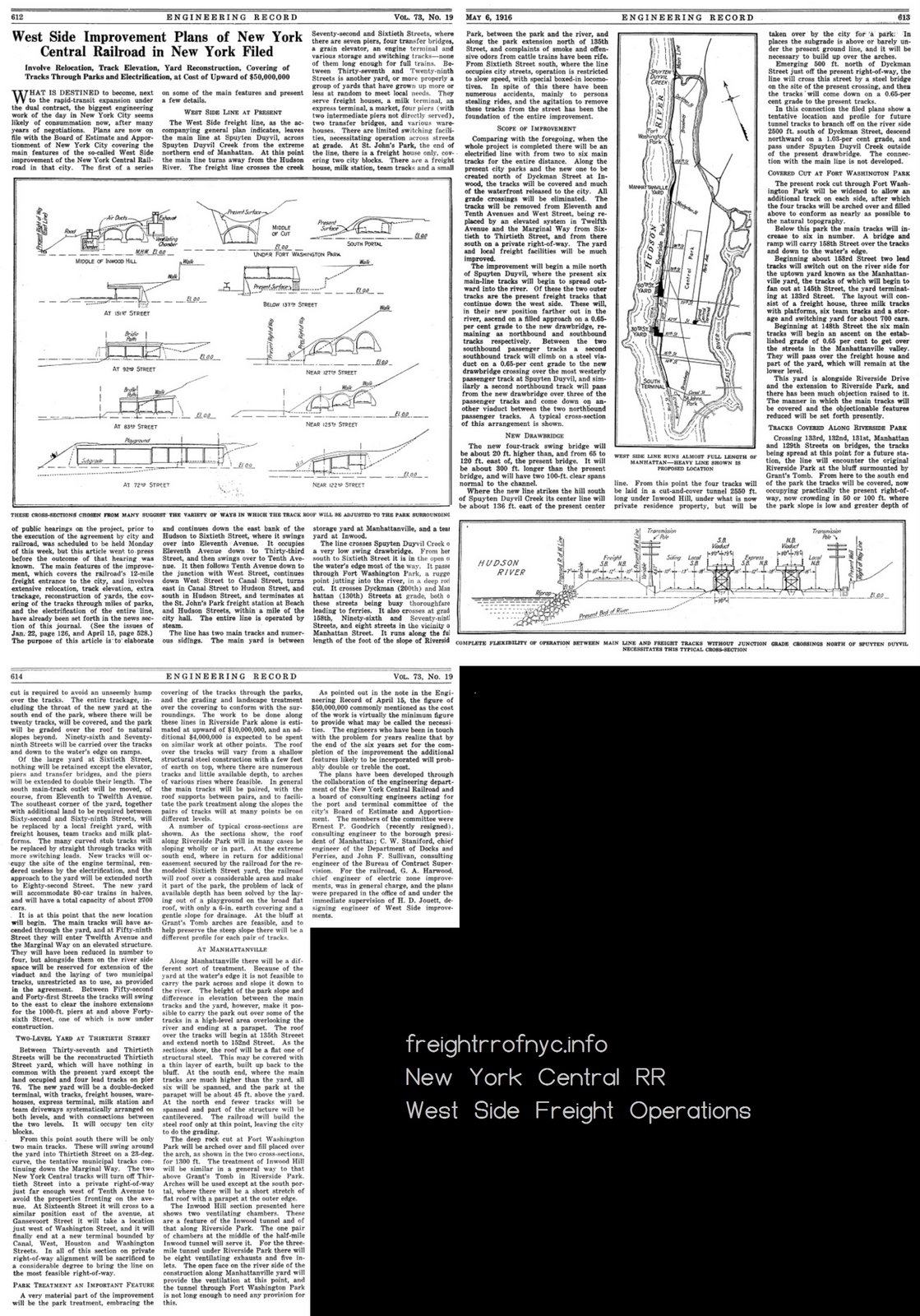
Thereupon
the Legislature of 1911, by chapter 777, directed the New York Central
& Hudson River Railroad
Company to file before October 1 of that year; plans to show how it
would remove its tracks, and authorized the Board of Estimate and
Apportionment to enter into negotiations with the railroad to effect
this. The situation then, in short was this: the City is trying to get
the railroad off of its public streets; and the railroad company is
trying to improve its freight terminal facilities. The question was,
how can
these two ends be attained and the interests of each conserved in
fairness to those of the other?
So, the new plan was thus: tracks to be placed in a roofed
cut,
designed to carry a motor parkway above, from Spuyten Duyvil to West
72nd Street, and then an elevated steel girder structure from 72nd to
St. John's Park. But it was also stipulated that the trains be drawn
only by electric locomotive after 1915, which the entire project was to
be completed by 1917.
The railroad and the
city were getting close, but no cigar. Back to the table they went in
1916. Now it was proposed (from north to south): a tunnel
under
Spuyten Duyvil Creek (Harlem River) to a six track roofed cut to West
60th Street, then a four track elevated from West 60th Street to a
point just south of St. John's Park, and an extension to Cortlandt
Street carried on a viaduct above West Street and the bulkhead line.
The railroad also took the moment to suggest enlarging their existing
freight yards, and while they were at it; a provision for passenger
service to the West Side to help alleviate the load from Grand Central
Terminal. Total estimated cost? $65,000,000 dollars ($2,010,000,000
in 2024 dollars). Both parties agreed.
.
.
1916
 |
 |
.
.
Documents of the Assembly of the State of New York - 1917 (commencing on page 252)
Report of the Commission to Investigate the Surface Railroad Situation in the City of New York - 1918
The Port of New York, Volume 1 and Volume 2, by Carl W. Condit - 1981
1920
In April 1920, Alfred H. Smith put the case quite succinctly in an address at the Merchants Association of New York City:"Manhattan Island lives on a hand to mouth existence. Because of the dearth of warehouses and storage facilities and of modern equipment for handling freight. The unnecessary costs and losses yearly are prodigious; [and] none but a rich and growing city could have borne the burden."
 |
It was suggested that a
two to four standard gauge railroad loop system be constructed,
approximately 18 miles in circumference;
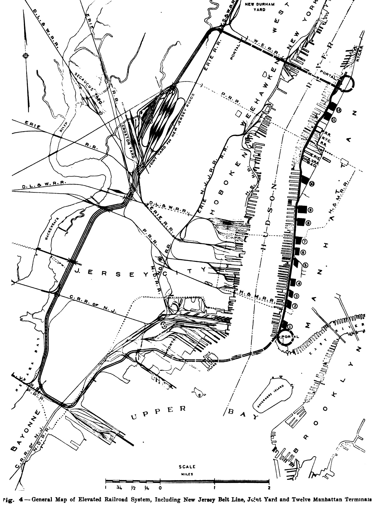
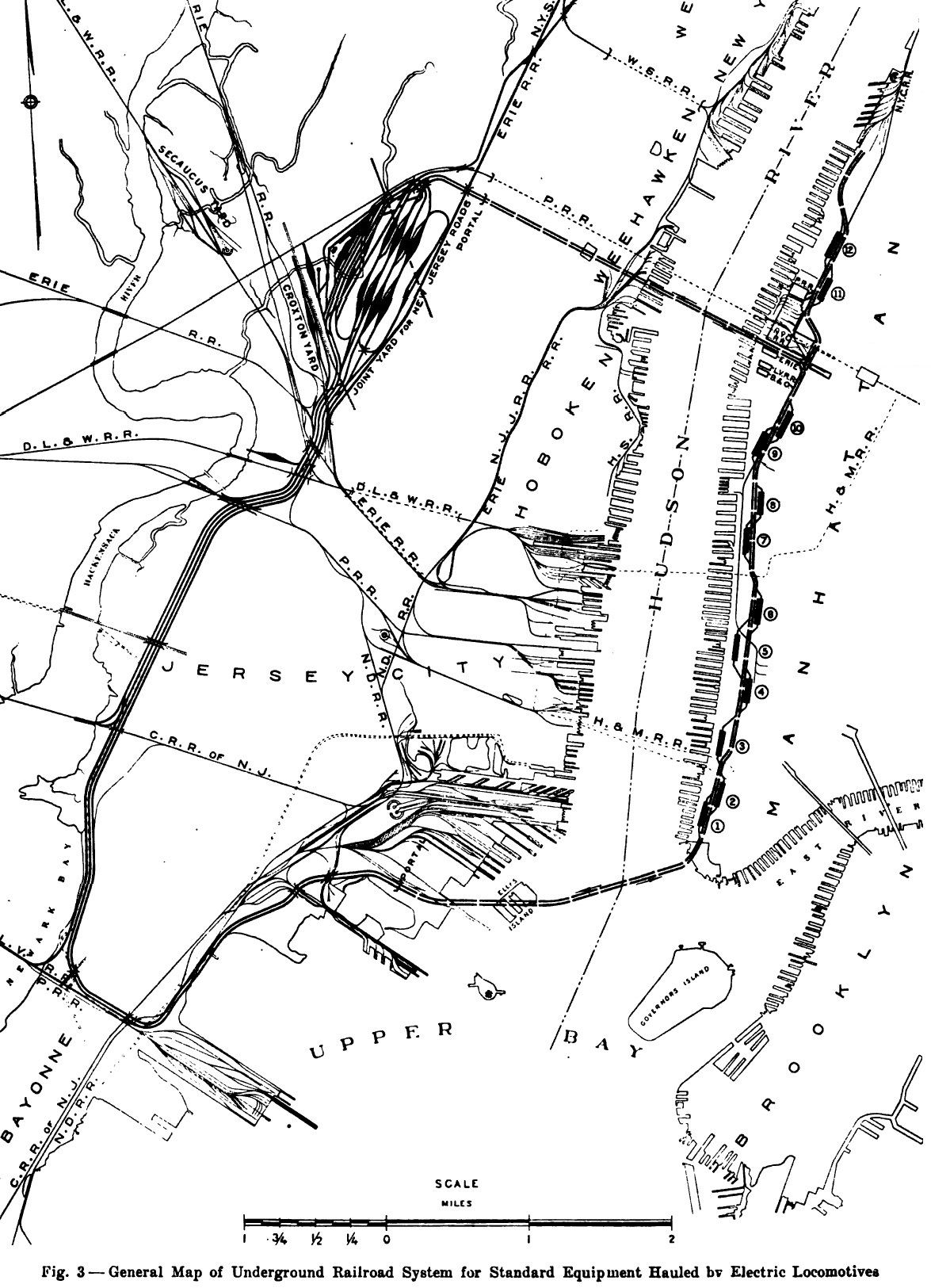
utilizing electric locomotives. One of these plans (the diagram at right) would operate through an extensive underground tunnel network to and from Manhattan, with no less than 10 small yards along the West Side of Manhattan, from the Battery north to about West 40th Street, where the tunnel returned back west to New Jersey and that connected with a new "Joint Yard" standard gauge freight yards in New Jersey. There would be a spur north to West 60th Street, but the New York Central would have to give up their yards at West 30-36th Streets (east west oriented), for two yards a little further north that were oriented north- south (numbers 11 and 12) in diagram at right. The other plan (seen at left) substituted the tunnel system for an elevated railway beginning with a helix at the Battery to transition the tunnel to an elevated line. (Think Lincoln Tunnel helix). This elevated built to four track width, and sometimes even six tracks; would proceed up the West Side of Manhattan; where "union terminals" would be constructed about every 5 to 10 blocks. These terminals would have second story railroad yards (think Morgan Parcel Post Building only much larger), with trucks and motor freight at ground level, and the freight storage and industrial occupants from the third story and above. Diagrams show both truck elevators as well as freight car elevators to bring either to the appropriate floor above for loading or unloading. At approximately West 40th Street, another helix would bring the elevated tracks down to the tunnel to cross the Hudson River and back to New Jersey. |
 |
"In 1911 (chapter 777 of laws of 1911) the West side Improvement was made the subject of special legislation, and the carrying out of the improvement was left generally for direct action between the City authorities and the railroad company. Under the Mitchel Administration plans for carrying out the West Side Improvement were developed in great detail, but at the last the proposed arrangement failed of approval. In 1917, the special legislation of 1911 was amended to confer certain jurisdiction of the (state) Public Service Commission for First District (chapter 719, laws of 1917).
The statutory authority now is so confused that little can be down until that confusion is eliminated.
Following the failure of accomplishment under the Acts of 1911 and 1917, the City Administration began litigation to test the title of the railroad company to the property occupied by its tracks. This litigation resulted unfavorably to the City (City of New York vs. New York Central R. R. Co., 234 N. Y. 113).
Toward the close of 1923 the New York Central Railroad Company made application to the Transit Commission for the elimination of all the crossings on the West Side under the provisions of the Railroad Law. The Commission found that the confused legal situation, coupled with the lack of adequate State appropriations, prevented effective action.
On December 19, 1924, the Transit Commission adopted an order denying in general the application of the Company except in so far as it related to grade crossings in the Manhattanville district, which includes the approaches to the ferry terminals at 125th Street (Fort Lee Ferry) Ferry) and at Dyckman Street. The Commission, subject to the appropriation by the State of the necessary funds, ordered the elimination of 10 grade crossings in the neighborhood of 125th and Dyckman Streets which, it estimates, will cost approximately $4,000,000.
"A new practice arose. At the steam terminal, at Fourth Avenue and Fourteenth street, incoming trains were broken up and one by one the cars were drawn by horses the rest of the day down to Chatham street terminal at Broadway, opposite Saint Paul's. And the horse-drawn cars, northbound, were made up into trains on reaching the steam terminal and thence drawn by locomotives..."
("Grand Central" No Place For A Railroad, by David Marshall, Whittlesley House - McGraw Hill; 1946)
Put into the simplest terms; the Kaufman
Electrification Act of 1923,
ratified by the New York State Assembly; was the act that mandated that
all railroads
located
in the City of New York City be electrified by January 1,
1926, and by proxy tried to eliminate steam locomotives.
All legislations prior
to the Kaufman Act, were restrictions specific to
a certain location and / or a particular operation
in Manhattan, but not the entire
borough or the city.
A great deal of misinformation exists about the Kaufman Electrification
Act, or simply "the Kaufman Act". This misinformation circulates
both in general discussion of New York City history, as well as within
railroad historical
contexts. All too often, it's simply stated
"steam locomotives were banned in Manhattan in 1908, blah blah blah". This
is simply not true.
So,
like most things on this website; the page concerning the Kaufman Act
and the previous acts became quite lengthy and detailed; and
in discussing that history, it was necessary to move it to its own
page:
Steam
Locomotive Legislation and Regulations in and around the City of New
York
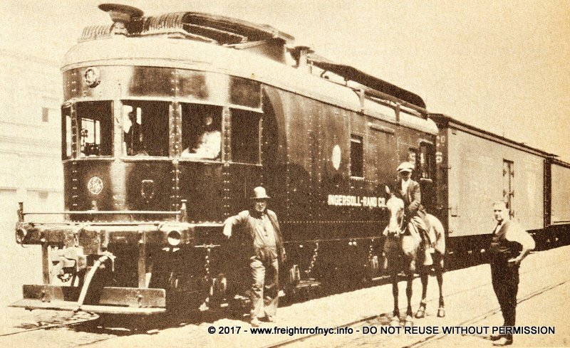
Ingersoll-Rand
/ General
Electric
Demonstrator #8835 - sometime between
June 9 and August 23, 1924
Tenth Avenue, Manhattan, NY
from Diesel Spotters Guide, Jerry Pinkepank / Kalmbach Publishing
| hours of service | dates of service | remarks |
| 833 | 6/9/1924
to 8/23/1924 |
Placed
in yard switching
service (New York
City West Side Yards) on July 19th for a daily recording of performance
data. In one test phase, this unit was operated for 24
hours per day (almost continuously), handling 3 shifts daily from 7/24
to 8/7. Inspection of the locomotive
could only occur during crew changes. On 8/14 a "Tonnage Test" was conducted: #8835 pulled "93 loaded freight cars on level track" for 36 minutes. 1, 2 Note: The Ingersoll-Rand record does not indicate what these loads consisted of or total tonnage pulled. |
"The Diesel-electric locomotive... has none of the objectionable features of the steam locomotive; it is substantially noiseless and its movement are virtually the same as those of the electric locomotive of the same capacity. It has one other feature... which has an advantage over the overhead system of contact or the third rail. in the case of the latter, there are frequent momentary discontinuances which draw arcs causing vivid flashes. These are a source of annoyance and would be objectionable to those living along Riverside Drive. The results where the contact shoe jumps from one conductor to another and such intervals would be frequent in the third rail system."
"the railroads had nearly a year to demonstrate they were attempting to comply with the provisions."
"that the task imposed upon the railroads is a difficult one because it involves not only the question of electrification but also that of the grade crossing removal."
.
.
 NO!
9/12/1928 New York Central System Historical Society - Image ID: WR110377 |
 YES.
9/12/1928 New York Central System Historical Society - Image ID: WR110375 |
|
| . . |
||
 DON'T LET THIS HAPPEN TO YOU! 9/12/1928 New York Central System Historical Society - Image ID: WR110374 added 05 May 2026 |
||
| . . Any manual labor as shown in these images carries with it the potential for injury. But with at least a dozen newspapers that once covered New York City (New York Herald, New York Daily News, New York Times, New York Post, The New York World, to name but a few); the handling of rolls of newsprint for the papers was especially fraught with the potential of serious injury or even death. These rolls weighed from 1000 to 1225 pounds EACH; and once they got rolling, you either got out of the way or you got rolled over. |
||
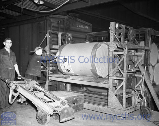
 Unloading roll of newsprint from boxcar. Two men are required for each roll. Note the use of a short piece of round wood pole in the core of the roll tied to the top of the dolly. New York Central System Historical Society - Image ID: WR290418 added 05 May 2026 |
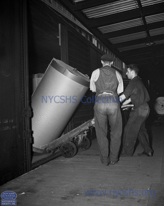 Unloading roll of newsprint from boxcar. New York Central System Historical Society - Image ID: WR290420 added 05 May 2026 |
|
| . . 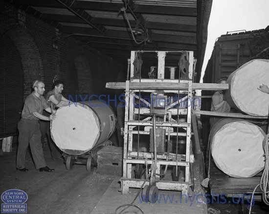 Loading rolls of newsprint onto truck via electrically powered newsprint lifting table. New York Central System Historical Society - Image ID: WR290419 added 05 May 2026 . |
||
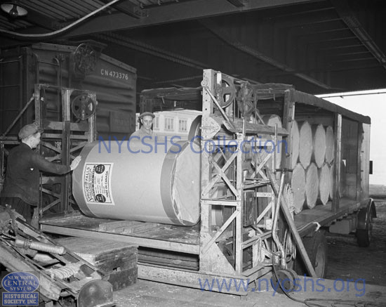 Electrically powered newsprint lifting table. Note the tied off wood pole laying on the dolly. New York Central System Historical Society - Image ID: WR290416 added 05 May 2026 |
 Electricaly powered newsprint lifting table. New York Central System Historical Society - Image ID: WR290417 added 05 May 2026 |
|
| . . |
||
 A powered pallet jack loading freight into a boxcar on a carfloat moored to a pier shed - 6/1/1929 New York Central System Historical Society - Image ID: WR130239 added 05 May 2026 |
 Unloading boxcars on a station carfloat, directly to shore and a waiting truck - 1930 New York Central System Historical Society - Image ID: WR44162 added 05 May 2026 |
|
| . . |
||
 Loading a crate from a pier house into a covered barge - 9/12/1928 New York Central System Historical Society - Image ID: WR110376 added 05 May 2026 |
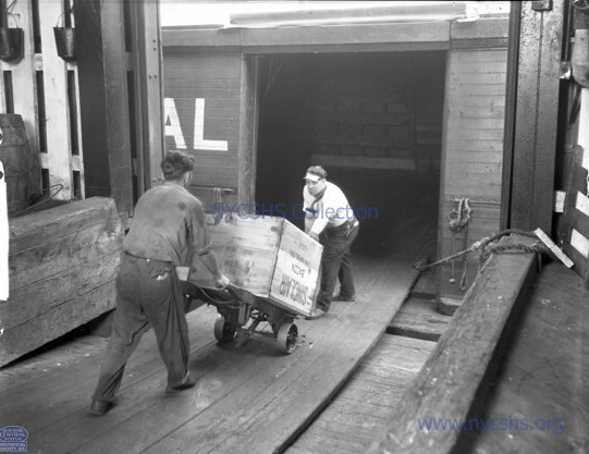
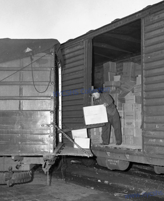
 Unloading cartons from a boxcar into a freighthouse with a cart - 1/30/1940 New York Central System Historical Society - Image ID: WR260500 added 05 May 2026 |
|
| . . |
||
| Here is a particularly wet and smelly job: the transfer and weighing of live fish from tanks on board a specially outfitted baggage car (tanks and aeration system), to a "live fish transport tank truck" (sometimes called a "fish hatchery truck"). This live fish could be used as a supply for the fresh fish market, for transport to a hatchery for further breeding and or restocking, or directly to a man made lake or reservoir for stocking. The photos are a tad blurry, so I cannot identify the species of fish. | ||
unloading live fish from tanks in a baggage car to "live haul fish tank truck" - 1/7/1950 New York Central System Historical Society - Image ID: WR45040 added 05 May 2026 |
unloading live fish from tanks in a baggage car to "live haul fish tank truck" - 1/7/1950 New York Central System Historical Society - Image ID: WR45039 added 05 May 2026 |
|
| . . |
||
unloading live fish from tanks in a baggage car to "live haul fish tank truck" - 1/7/1950 New York Central System Historical Society - Image ID: PC532172 added 05 May 2026 |
unloading live fish from tanks in a baggage car to "live haul fish tank truck" - 1/7/1950 New York Central System Historical Society - Image ID: PC532173 added 05 May 2026 |
|
. |
||
 |
 |
|
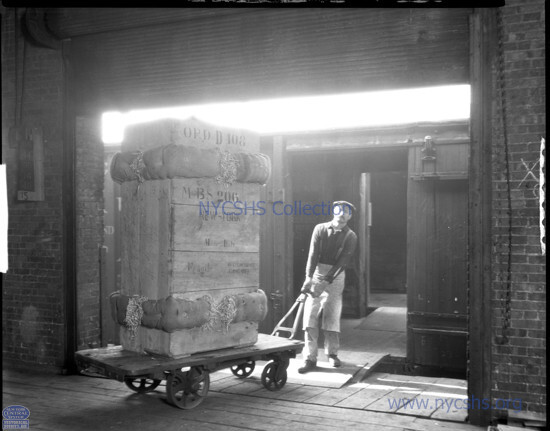
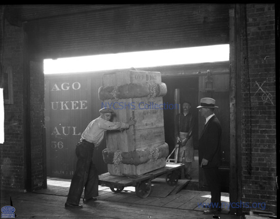
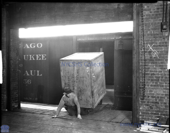
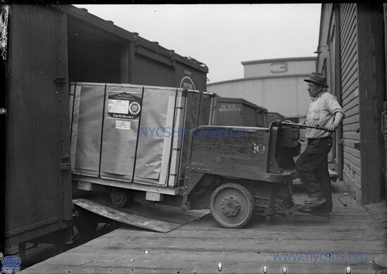
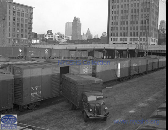
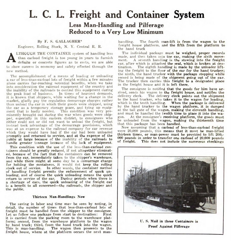
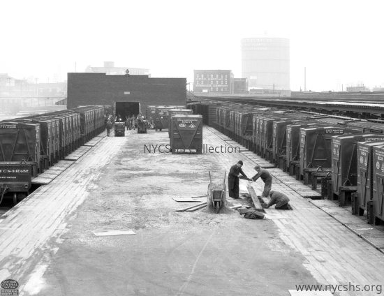
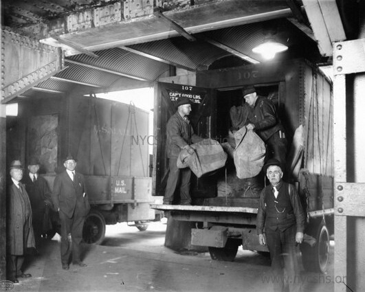
| Freight
transfer direct from boxcar to truck at team tracks in West 34th Street
Yard, Manhattan, NY New York Central System Historical Society - Image ID: added 05 May 2026 |
||
 |
 |
 |
 |
| . | |
 |
|
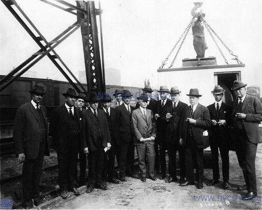
| Port & Terminal - July 1922 | |
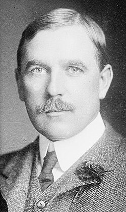 Alfred Holland Smith
b: April 26, 1863 d: March 8, 1924 |
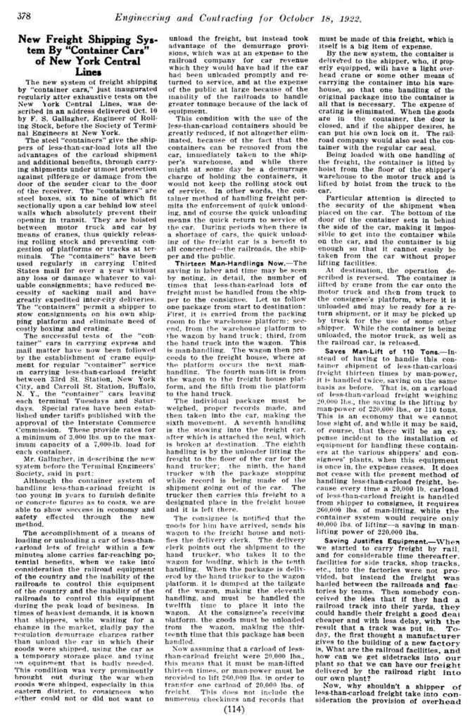
The initial idea of this compartmentalized shipping is credited (and
patented) to Alfred H. Smith. Yes, THAT Alfred H.
Smith: of whom became president of the New York
Central Railroad, and the one that the huge bridge at Castleton over
the
Hudson is named after. He invented and patented the concept of a "plurality container" system. The system was comprised of containers of a modular sizing that all would fit on a railroad car with compartments of adaptability for size. On the top of any of the containers, was four lifting loops or shackles, one each at the four corners. Here, with a container at a railroad yard; a traveling gantry or even a mobile derrick (wheel or tracked for road types or railway mounted and of which were a common fixture on smaller railroads) could lift and set down the container where ever. The gantry or derrick could set the container down on the railroad car, transfer it from one railroad car to another, place it on a platform truck, or place it directly on the ground. The system worked well, and over the years gradually expanded for the containerized transport of many different commodities not just dry goods. Unfortunately, Mr. Smith did not live long enough to see his development come to fruition. Sadly, on the afternoon of March 8, 1924; Smith and his freight manager Edward Hoopes mounted their horses for a regular ride through Central Park. Both were expert riders and regular companions. They started off from Smith's residence at the Plaza Hotel and rode together for more than two hours; Smith had already changed his mount. The two were riding near the 67th Street intersection when a woman on a horse crossed suddenly into their paths. According to Hoopes' testimony Smith pulled up sharply on the reins to stop his horse, but in the process lost his balance, grabbed for the horses's neck and fell onto the ground head first. Mr. Hoopes dismounted and ran over to Smith immediately and yelled for help, but Smith was limp. He was determined to have been killed instantly from a broken neck. The woman and horse that ventured into his path, left the scene and her identity remains unknown. |
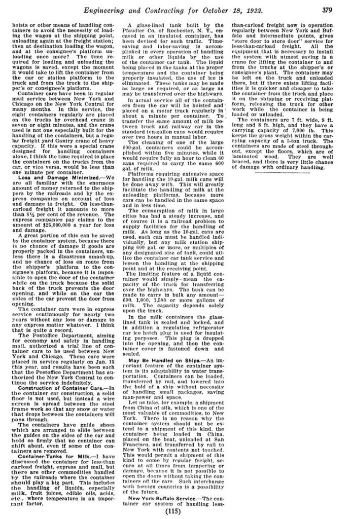
For dry goods transport:
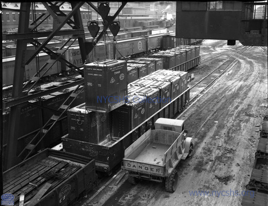
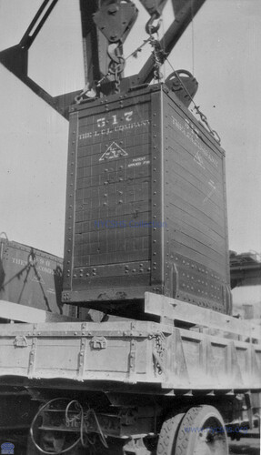
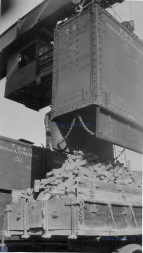
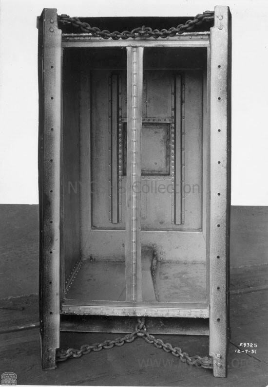
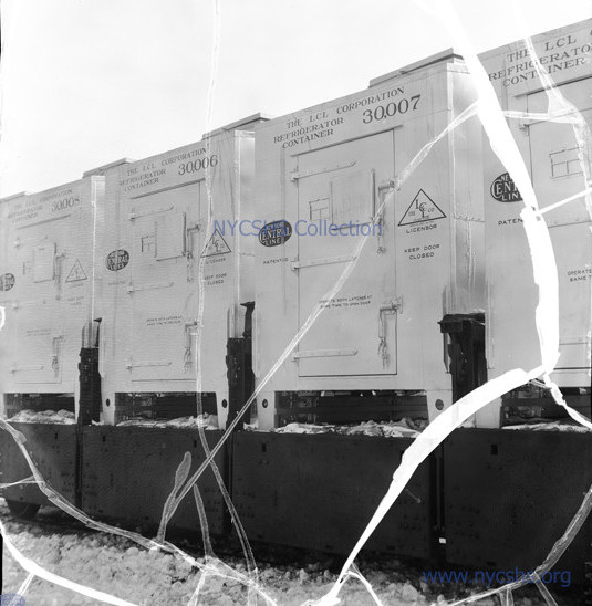
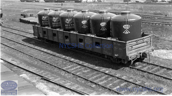
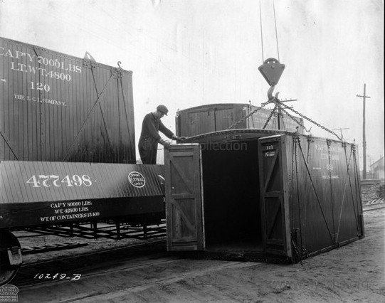 Showing a "large" 7' x 16' x 8' LCL Container (no feet) timber framed interior; steel bottom frame, with a tapered fixed side LCL gondola New York Central System Historical Society - Image ID WR110252 added 11 May 2026 |
 Showing a "small" 7' x 9' x 8' LCL Container (no feet) timber framed interior New York Central System Historical Society - Image ID WR110143 added 08 June 2026 |
|
| . | ||
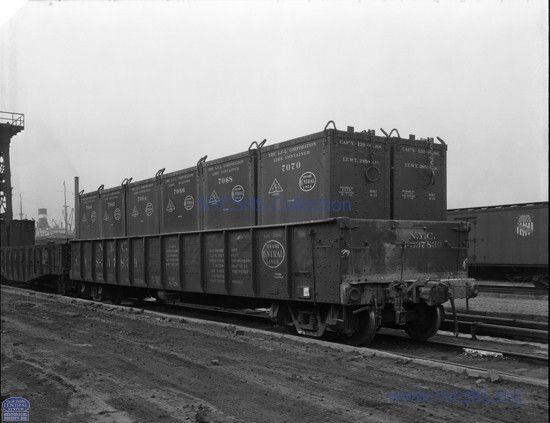
 Modularity: two 7' x 16' x 8' and two 7' x 9' x 8' LCL Containers on older tapered style fixed side gondola. New York Central System Historical Society - Image ID WR110278 added 11 May 2026 |
||
 . |
||
 Modularity: two 7' x 9' x 8' "medium" and two 7' x 18' x 8' "large" LCL Containers on older style fixed side gondola. New York Central System Historical Society - Image ID WR110272 added 11 May 2026 |
 Note how the fixed sides / ends blocks the container doors from opening. New York Central System Historical Society - Image ID WR110274 added 11 May 2026 |
|
| . | ||
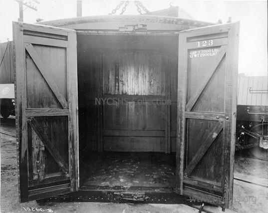
 Note the slots on inside walls and moveability of the divider boards to accommodate any combination of container sizes. This car is shows for set up of four 16' containers. This image also shows the slide channels (receptacles) for the container's tapered slide shoes. New York Central System Historical Society - Image ID WR110267 added 11 May 2026 |
||
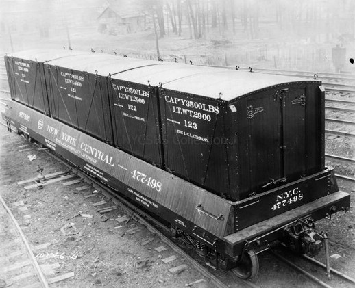
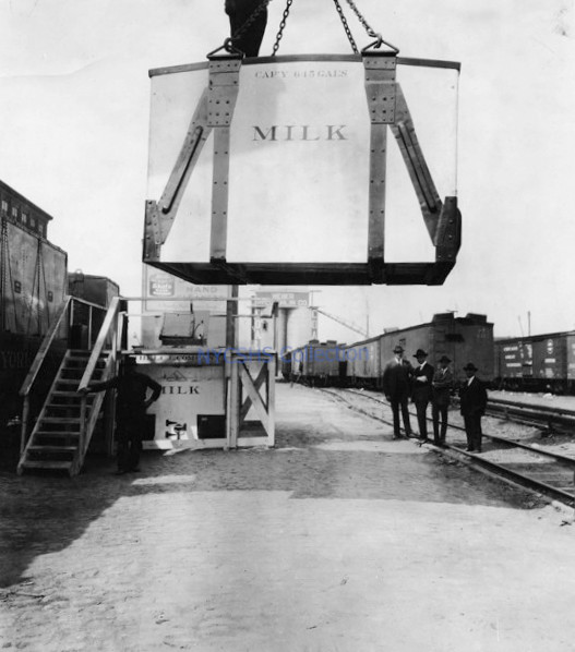
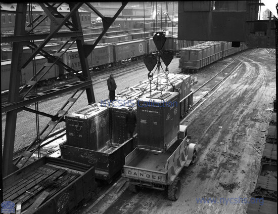
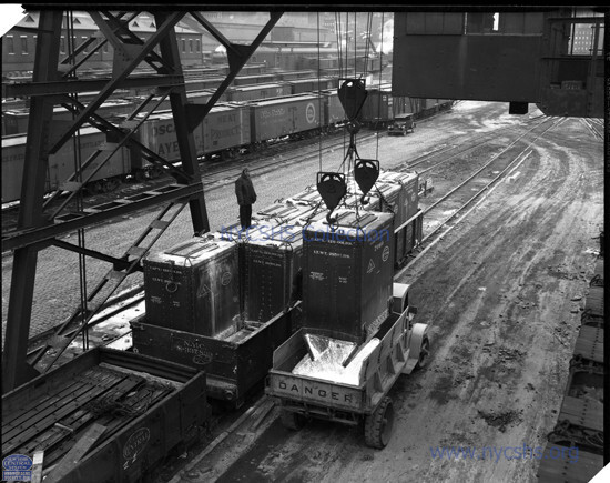
 West 30th Street Yard, Manhattan, NY - 1922 New York Central System Historical Society - Image ID: WR110193 added 05 May 2026 |
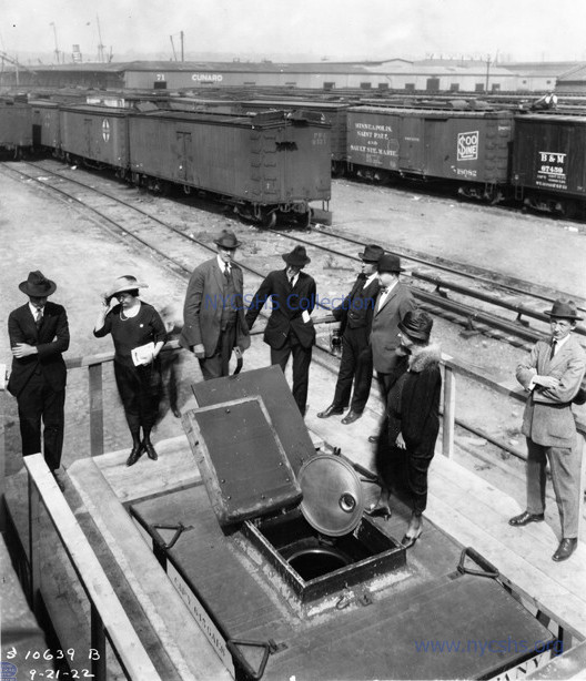
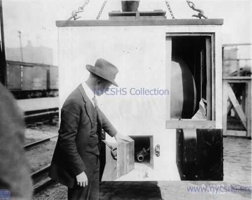 Showing hose connection - 1922 West 30th Street Yard, Manhattan, NY The opening at top right is for display purposes of the interior and tank, and not on production units. New York Central System Historical Society - Image ID: WR110195 added 05 May 2026 |
|
| . | ||
 1922 West 30th Street Yard, Manhattan, NY New York Central System Historical Society - Image ID: WR110195 added 05 May 2026 |
 |
|
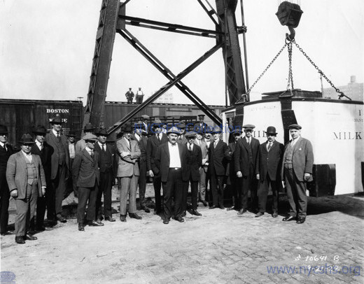 Showing the MilkTainer to respected members of of the New York Dairy Association, dealers and the City of New York Health Department - 1922 West 30th Street Yard, Manhattan, NY New York Central System Historical Society - Image ID: WR110191 added 05 May 2026 |
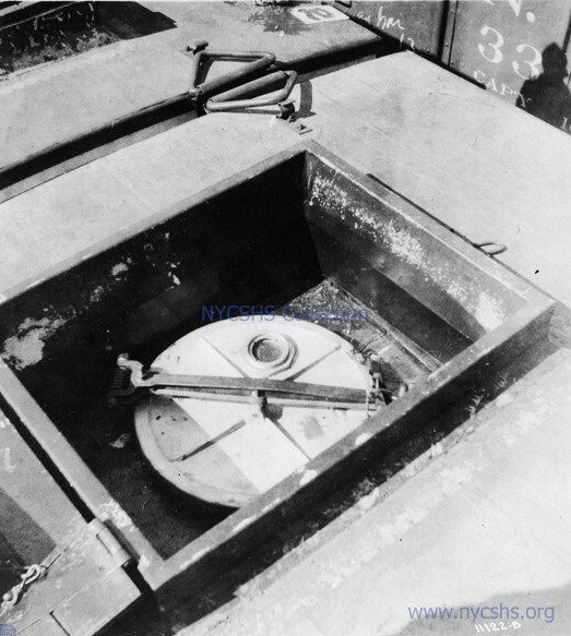 Showing hatch on top - 1922 West 30th Street Yard, Manhattan, NY New York Central System Historical Society - Image ID: WR110190 added 05 May 2026 |
|
| . | ||
 Showing the MilkTainer to respected parties of the New York Dairy Association, Deputy Commissioner of Markets, Mrs. Welzmiller; and Health Department officials Note the insulated plug door laying on the main top hatch -1922 West 30th Street Yard, Manhattan, NY New York Central System Historical Society - Image ID: WR110186 added 05 May 2026 |
Boonville, NY New York Central System Historical Society - Image ID: WR110204 added 05 May 2026 |
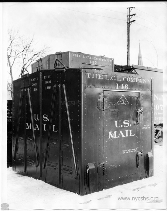
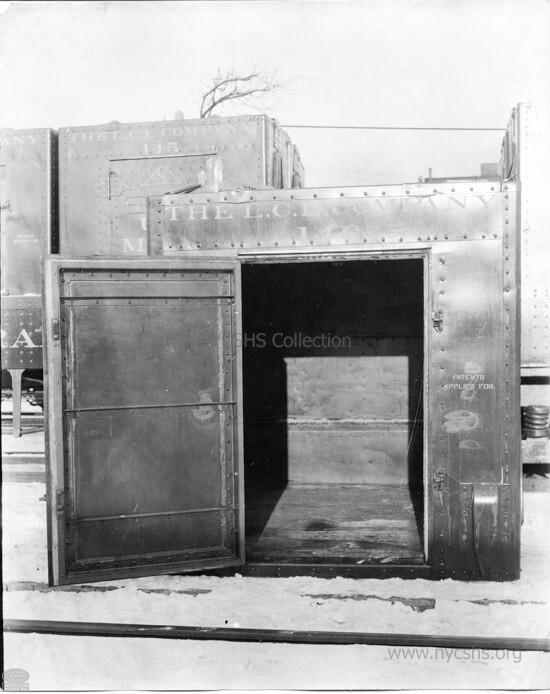
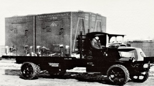
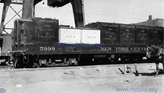 Two kinds of expedited LCL: Milk and Mail. Both were time sensitive. Note bulkhead fixed side gondola. New York Central System Historical Society - Image ID: WR110202 added 05 May 2026 |
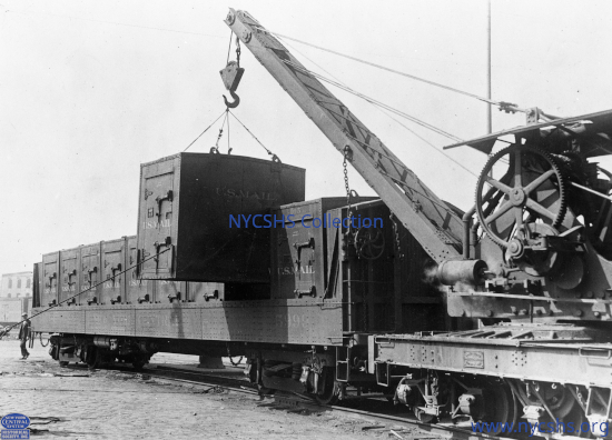 A small railroad yard derrick lifting a US Mail LCL container - ca. 1930 Note bulkhead fixed side gondola. New York Central System Historical Society - Image ID: WR110202 added 05 May 2026 |
|
| . | ||
 Flat bottomed. The
tapered slide shoes
on the bottom front corners, slid into matching channels /
slots on the inside wall of the fixed side LCL gondolas; preventing front to back shifting. All containers had these. New York Central System Historical Society - Image ID: WR110202 added 05 May 2026 |
 Interior of all steel
mail container
New York Central System Historical Society - Image ID: WR110147 added 08 June 2026 |
|
| . | ||
 Two 7' x 9' x 8' LCL Mail Containers (no feet) on straight truck - no date added 08 June 2026 |
 Loading a mail container
while still on truck. Undated
New York Central System Historical Society - Image ID: WR110221 added 08 June 2026 |
|
|
|
||
 Loading a US Mail Container situated on tow dolly New York Central System Historical Society - Image ID: WR110218 added 08 June 2026 |
 electric (battery) "mule" towing US Mail Container on dolly to truck platform for further transport to mail sorting center. New York Central System Historical Society - Image ID: WR110220 added 08 June 2026 |
Unloading a Merchandise LCL Container (with feet) in freight house. Note smooth face panels and the flat roof over door. These conform to LCL drawing 10222 and measured at 7'L x 9' 3½'W x 8' 2"H' New York Central System Historical Society - Image ID: WR110195 added 05 May 2026 |
 Unloading an Merchandise LCL Container - November 18, 1930 Note the external reinforcing ribs on front and peak of roof over the door. Is is believed these also measured at 7'L x 9' 3½'W x 8' 2"H' New York Central System Historical Society - Image ID: WR150129 added 05 May 2026 |
|
| . | ||
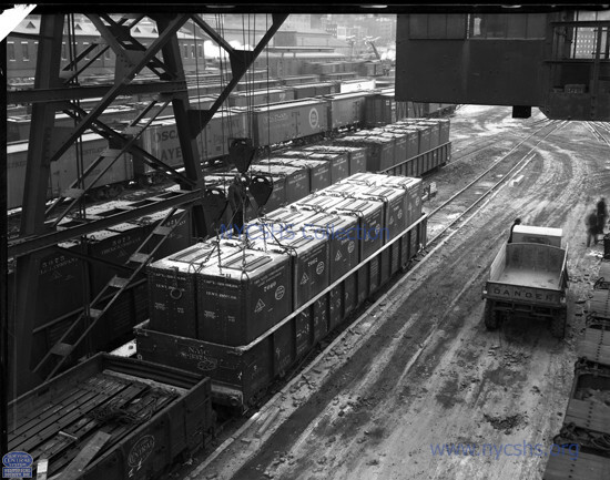
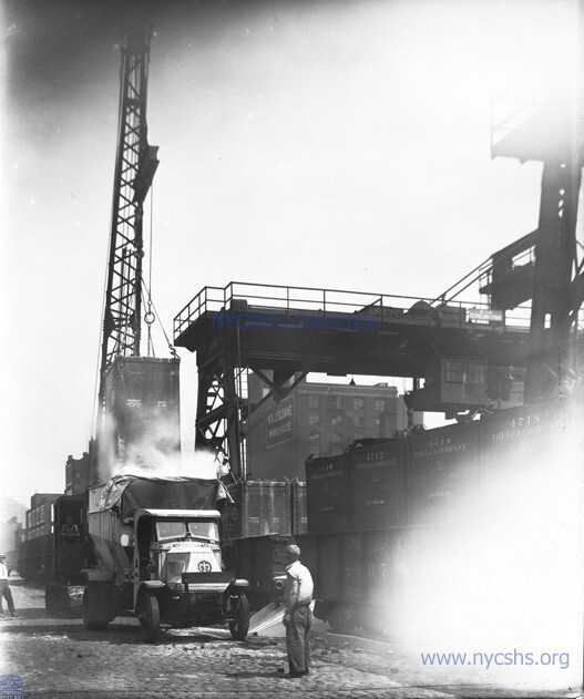
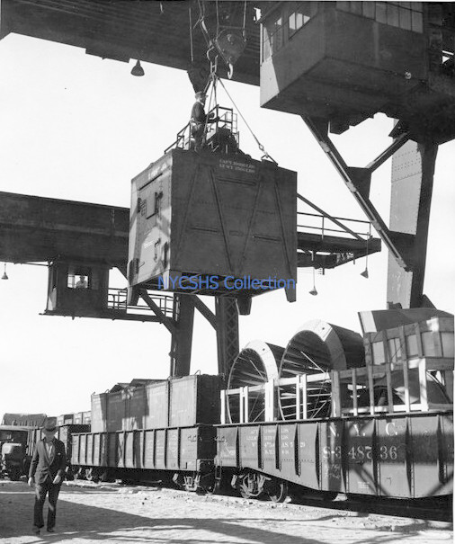 Lifting an 7' x 9' x 8' Merchandise LCL container with feet out of standard (non-LCL) gondola by traveling gantry crane - 11/1/1931 West 30th Street Yard, Manhattan, NY New York Central System Historical Society - Image ID: WR160269 added 05 May 2026 |
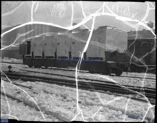
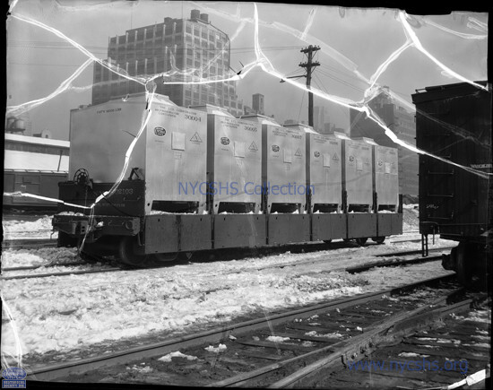
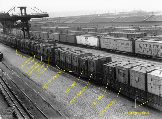 various 7' x 9' x 8' containers in LCL (drop side) gondolas at West 33rd Street Yard; Manhattan - no date Note that some of the containers are shorter than others. The shorter units are flush bottom, no legs and are US Mail containers. The taller units have 12" legs on the bottom of each corner. The containers with square dome on top are refrigerated containers. New York Central System Historical Society - Image ID: PC532194 added 05 May 2026 |
|
| . | ||
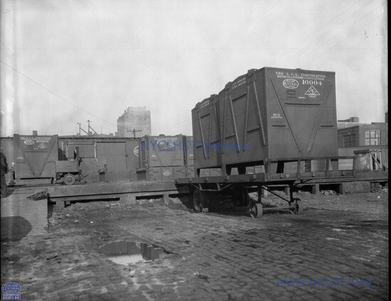 Two 7' x 16' x 8' LCL Merchanise Containers (with legs) on tractor trailer truck, Manhattan, NY - 2/5/1930 Note the forklift type mover for LCL Containers on platform. New York Central System Historical Society - Image ID: WR140052 added 05 May 2026 |
||
 all steel "Drop Bottom" 4' x 8' x 8', twelve units fit in standard 50' gondola. West 30th Street Yard, Manhattan, NY New York Central System Historical Society - Image ID: WR1120540 added 05 May 2026 |
 lifting all steel "Drop Bottom" container. West 30th Street Yard, Manhattan, NY New York Central System Historical Society - Image ID: WR1120541 added 05 May 2026 |
|
| . | ||
 "Drop Bottom" container positioned over truck. West 30th Street Yard, Manhattan, NY New York Central System Historical Society - Image ID: WR1120542 added 05 May 2026 |
 doors opened, "Drop Bottom" container dumping lime West 30th Street Yard, Manhattan, NY New York Central System Historical Society - Image ID: WR1120543 added 05 May 2026 |
|
| . | ||
 composite wood & steel "Drop Bottom" container with bottom trap doors sealed February 1, 1929 West 30th Street Yard, Manhattan, NY New York Central System Historical Society - Image ID: WR120574 added 1 May 2026 |
 composite wood & steel "Drop Bottom" container bottom trap doors opened February 1, 1929 West 30th Street Yard, Manhattan, NY New York Central System Historical Society - Image ID: WR120575 added 11 May 2026 |
|
| . | ||
 Looking through the bottom (its laying on its side)of an all steel "Drop Bottom" December 7, 1931 Heavy chain keeps bottom doors closed until released. New York Central System Historical Society - Image ID: |
 LCL Bulk Containers in LCL gondola carrier - January 24, 1929 Note trap door release rings hanging off top. West 30th Street Yard, Manhattan, NY New York Central System Historical Society - Image ID: WR120539 added 05 May 2026 |
|
| . | ||
 6/26/1930 New York Central System Historical Society - Image ID: WR150034 added 05 May 2026 |
Showing a close-up of a brick container being unloaded on a truck. - 10/23/1930 West 30th Street Yard, Manhattan, NY New York Central System Historical Society - Image ID: WR150113 added 05 May 2026 |
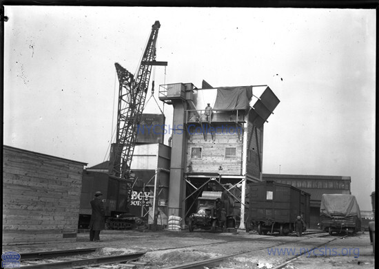 Showing LCL cars handling cement by crane with the cars in mid-air-being emptied into the cement silo and the awaiting trucks at West 33rd St Yard - 2/19/1932 New York Central System Historical Society - Image ID: WR170110 added 05 May 2026 |
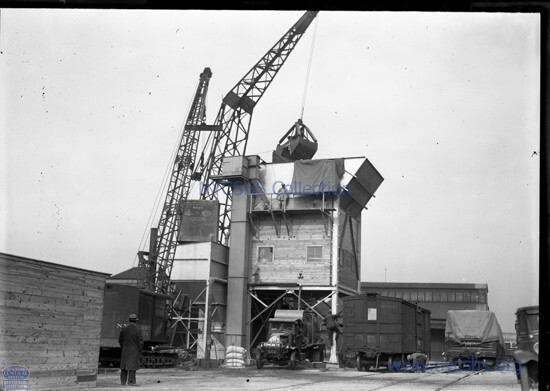 Showing LCL cars handling cement by crane with the cars in mid-air-being emptied into the cement silo and the awaiting trucks at West 33rd St Yard - 2/19/1932 New York Central System Historical Society - Image ID: WR170109 added 05 May 2026 |
Picking up a stack of brick at West 30th Street Yard - September 1, 1941 New York Central System Historical Society - Image ID: WR290452 added 08 June 2026 |
Lifting apparatus showing tines inserted to carrier at West 30th Street Yard - September 1, 1941 New York Central System Historical Society - Image ID: WR290451 added 08 June 2026 |
| . | |
Picking up a stack of brick at West 30th Street Yard - September 1, 1941 New York Central System Historical Society - Image ID: WR290449 added 08 June 2026 |
Positioning brick stack over truck at West 30th Street Yard - September 1, 1941 New York Central System Historical Society - Image ID: added 08 June 2026 |
| . | |
Dumping stack of brick at West 30th Street Yard - September 1, 1941 New York Central System Historical Society - Image ID: WR290448 added 08 June 2026 |
Empty brick handling apparatus at West 30th Street Yard - September 1, 1941 New York Central System Historical Society - Image ID: WR290447 added 08 June 2026 |
 NYC RR publicity image showing a new LCL refrigerator car in West Side yards - 3/1/1934 New York Central System Historical Society - Image ID: WR180099 added 05 May 2026 |
 NYC RR publicity image showing a new LCL refrigerator car in West Side yards - 3/1/1934 Note side panels in down position for unloading. New York Central System Historical Society - Image ID: WR180098 added 05 May 2026 |
|
| . | ||
 NYC RR publicity image showing close up of new LCL refrigerator containers in West Side yards - 3/1/1934 New York Central System Historical Society - Image ID: WR180100 added 05 May 2026 |
||
 cement carboys
/ canisters / bottles
New York Central System Historical Society - Image ID: |
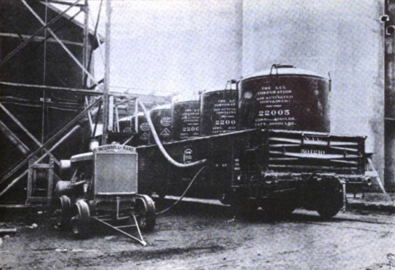 Ingersoll Rand air
compressor cart with hoses to cement
carboys / canisters / bottles
The air supply or pressure hose is the smaller black hose. The material hose is the larger lighter colored hose. |
|
 cement carboys / canisters / bottles |
||
 New York Central System Historical Society - Image ID: WR 350309 added 05 May 2026 |
 New York Central System Historical Society - Image ID: WR350308 added 05 May 2026 |
| . | |
 New York Central System Historical Society - Image ID: WR350307 added 05 May 2026 |

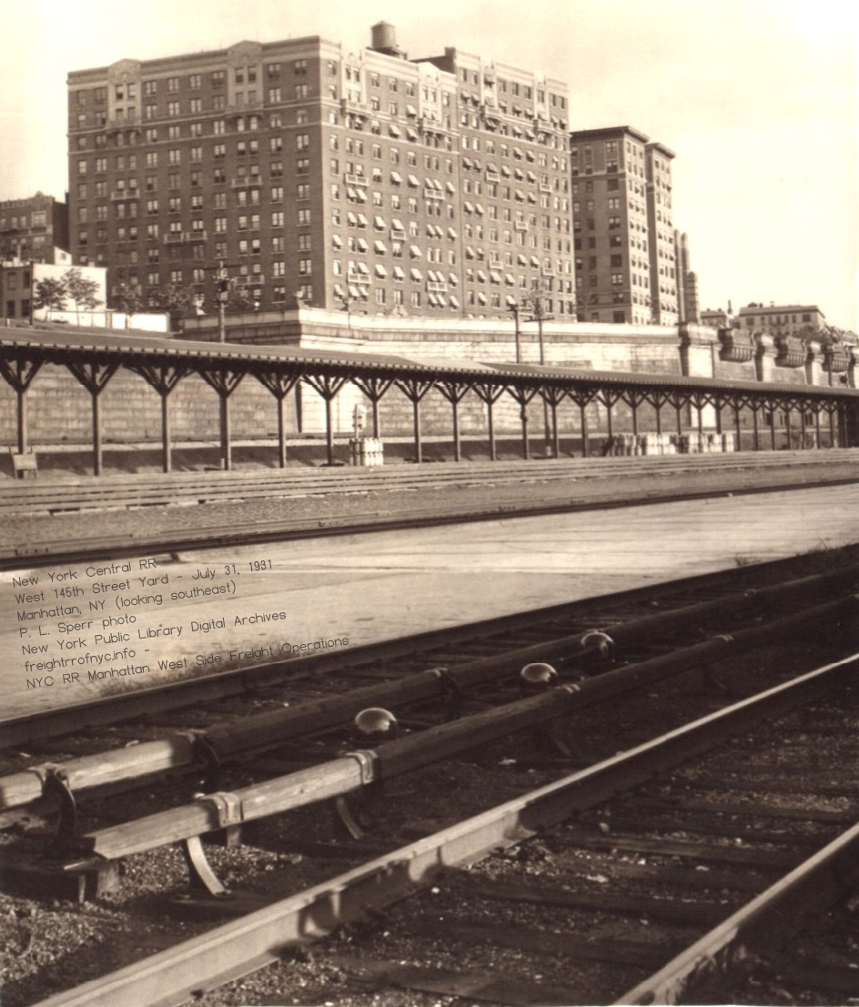
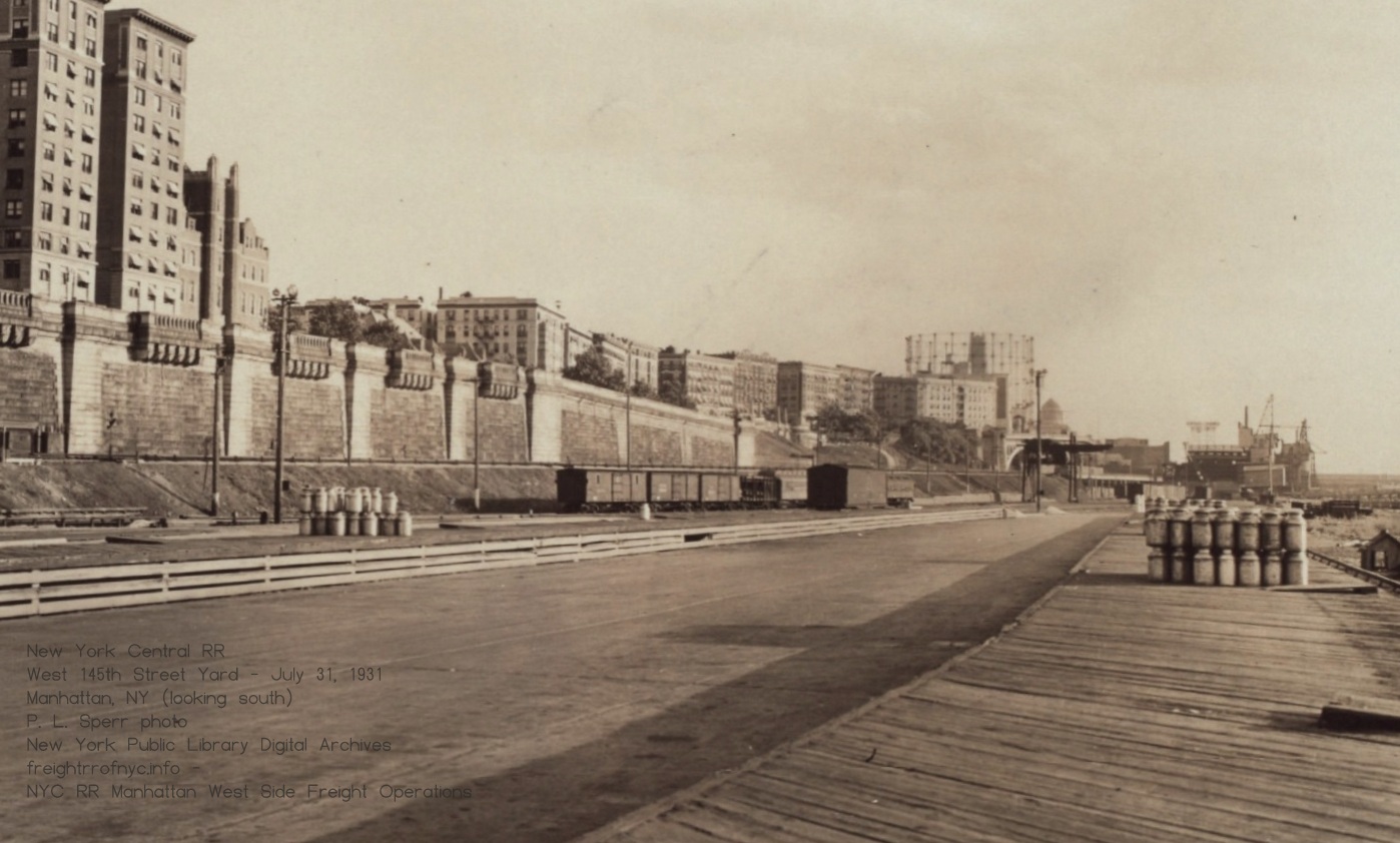
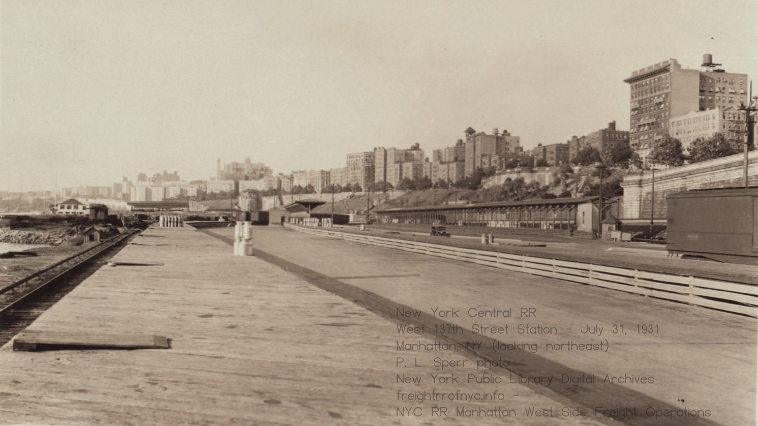
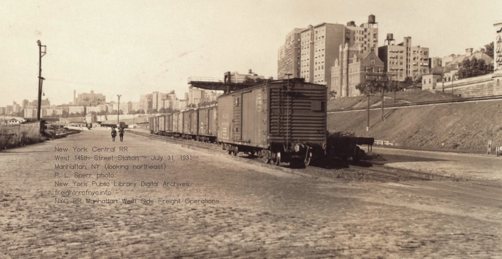
| location | milepost* | facilities | |||||||||
| Inwood (Dyckman Street) | .98 | Freight Station | Passenger | ||||||||
| Fort Washington | 2.58 | Depot | Passenger | ||||||||
| West 152nd Street | 3.75 | Yard | Foundry Yard | Passenger | |||||||
| West 148th - 143 Streets | 4.00 | Freight Station | Yard | Milk | LCL | ||||||
| West 130th Street - "Manhattanville" | 4.82 | Meat Packer | Passenger | ||||||||
| West 72nd - 60th Streets | 8.40 | Freight Station | Yard | Stock Yard | Milk | Grain Elevators | Transfer Bridges (4) | Poultry | Auto | ||
| West 59st Street | 8.50 | Freight Station | |||||||||
| West 41st Street | 9.45 | Stock
Yard & Slaughterhouses |
|||||||||
| West 36th Street | 9.70 | Freight Station | Yard | ||||||||
| West 33rd Street | 9.79 | Freight Station | Yard | Transfer Bridges (2) | Express Svc | ||||||
| West 30th Street | 10.06 | Yard | Milk | LCL | Passenger | ||||||
| West 17th Street | 10.62 | Fresh Produce Yard | |||||||||
| St. Johns Park Terminal | 12.39 | Freight Station | |||||||||
| * from Spuyten Duyvil | |||||||||||

 |
 |
| Google Street View- looking northeast | Google Aerial View |
"The Value of the Railroad Y. M. C. A."The first Railroad YMCA was established following a revival meeting among workers led by a reformed former railway employee in 1872 at the Cleveland Union Depot, in Ohio, as a partnership between the YMCA and various railroad companies to provide wholesome, affordable lodging and meals, as well as recreation for railroad workers. These "home away from home" facilities grew rapidly, offering baths, healthy meals, reading rooms, and above all, rest for railroad employees away from home.
Men should be cared for at terminals to improve their mental as well as social standing. We believe that good, clean rest rooms should be provided at terminals and encourage cleanliness with our men. We also believe that they should have access to reading rooms or libraries where they can keep themselves posted on the leading topics of the day, mechanical and otherwise. Your chairman is fortunate enough to be employed on a road that has a Railroad Y. M. C. A. at each terminal. At one of the associations there is a large library, and members of any of the other associations can draw books from this library, the books being handled back and forth by the railroad free of cost.
Railroad Age Gazette, 1906
"Where's Hendricks? Anyone seen Hendricks? Hey! Lawson! You seen Hendricks? He has the express freight to Buffalo pullin' out in 10 minutes.."
"I don't know boss, I last saw him last night tying one on at McGillicuddy's, with an empty-headed bottle blonde in one hand and a half empty bottle of Old Fitz in the other."
"Damn that lush, that's the third time this month. Stanton! You got the express freight to Buffalo! Get a hustle on, will you!?!
"Aw, boss; not Stanton.. He runs the engine like granny in her Model T on her way to Sunday services."
"Stanton's here, and he's reliable. Just get the train outta town on time, will ya!?!"
By 1875 Cornelius Vanderbilt II, the favorite grandson of Commodore Vanderbilt, had risen from a clerk in the treasury department of the New York Central Railroad to a position of major importance. He was also active in St. Bartholomew's Episcopal Church and sat on the board of directors of the Young Men's Christian Association of New York. That year he received a visit from General John H. Devereaux, the president of the C. C. C. & I. Railroad, who lived in Cleveland.
Three years earlier the first Young Men's Christian Association for railroad workers had been formed in Cleveland. Now Devereaux explained the organization to Vanderbilt, who quickly embraced the idea. The concept of a Y.M.C.A. expressly for railroad workers had advantages to both the men and to the system. The employees would have a comfortable place to relax while in New York City, one which offered a variety of pastimes. On the positive side for the railroads, the men were not tempted to get drunk or jailed and therefore unable to return to work, and morale would be greatly uplifted, as well.
Vanderbilt began with a basement space in Grand Central Depot. In 1900 Railroad Men magazine, would recall, "the first Railroad Branch at the Grand Central Station, New York, began with a single room, a canary bird, a few volumes of U. S. Reports, and a secretary."
The detractors who warned that "The men won't have it" were soon proved wrong. The Railroad Branch of the Y.M.C.A. was a success and in 1886 Vanderbilt acquired land at the northeast corner of Madison Avenue and 45th Street as the site for a permanent building. Ground was broken on September 20, 1886 and construction was completed exactly a year later, in September 1887. The building rose three stories at the corner, with a two-story extension that ran 45 feet along the avenue. Vanderbilt personally paid for the construction, which cost him $100,000--about $2.95 million today.
Daytonian in Manhattan
The stories behind the buildings, statues and other points of interest that make Manhattan fascinating.
Monday, September 12, 2022
The Lost Railroad Branch YMCA - Madison Avenue and 45th Street
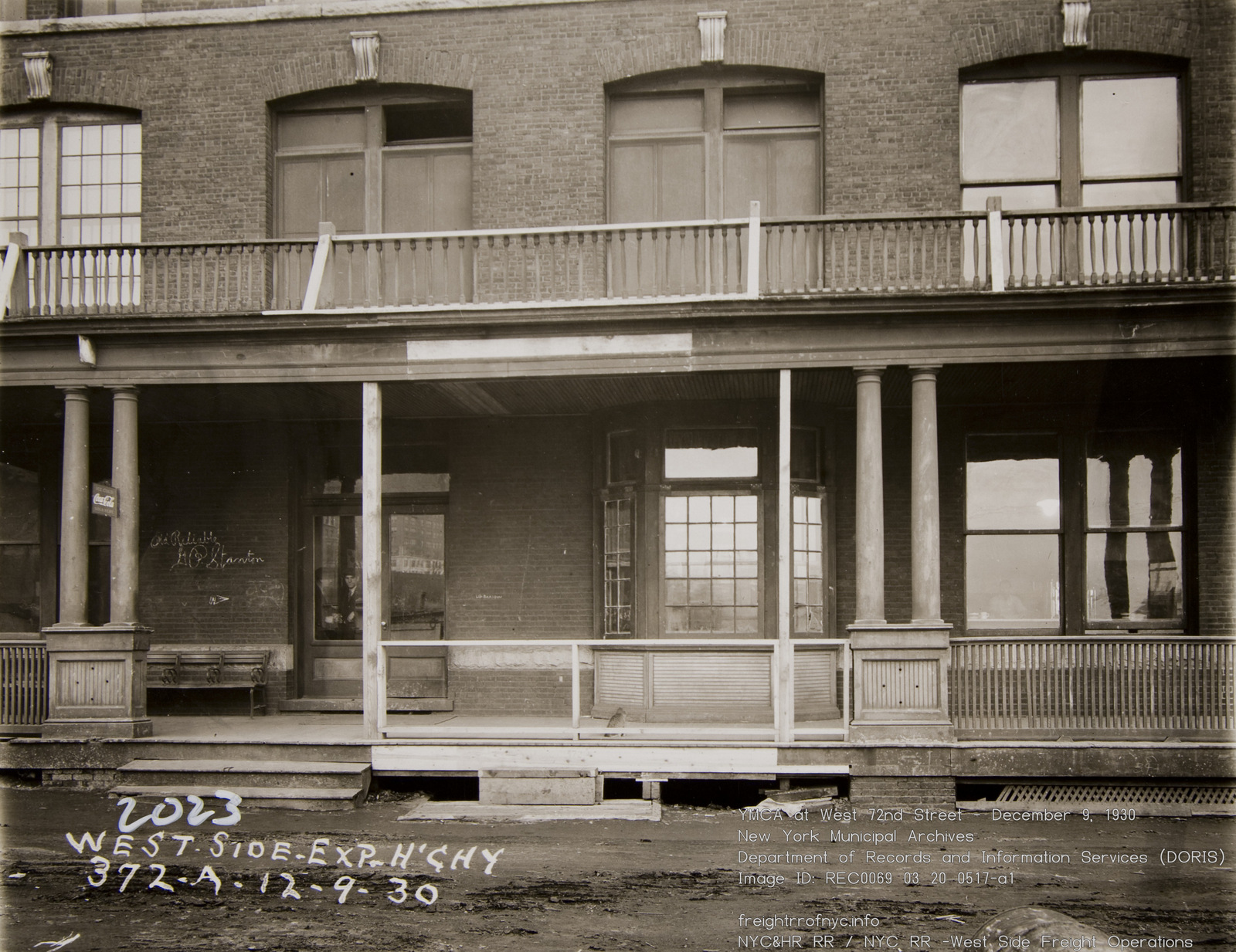
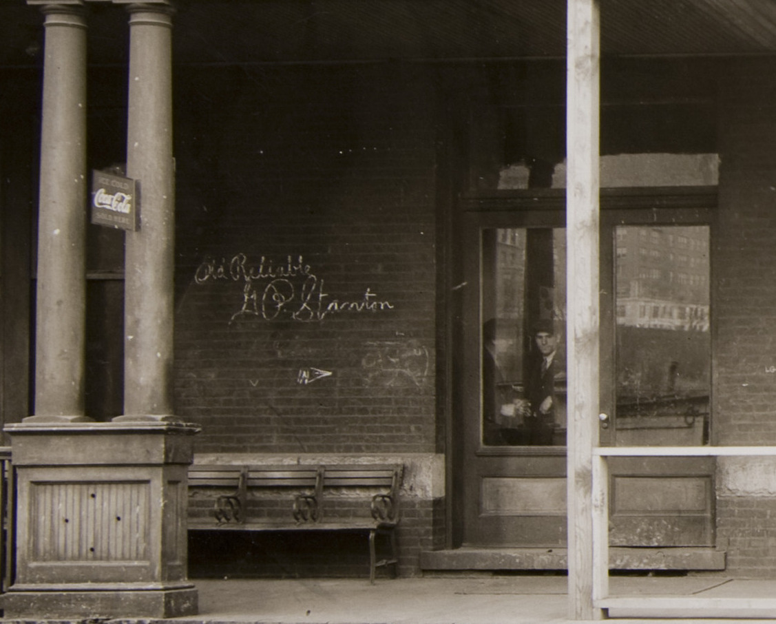
West 72nd Street Railroad YMCA - April 25, 1931
New York Municipal Archives - Department of Records and Information Services (DORIS)
.
.
"The Vanderbilt Branch of the YMCA of Greater New York was established in 1875 as the Railroad Branch of the YMCA of the City of New York. Also known as the Grand Central Branch, it was started with the support and encouragement of New York Central Railroad chairman Cornelius Vanderbilt II. First located in the basement of Grand Central Depot, the Railroad Branch existed to improve and elevate the rapidly growing number of men working on the nation's railways who passed through New York City. Although the Grand Central branch was initially intended to be used by the employees of the New York Central Railroad, it became a place where in-transit railroad men from around the country would go. At first, the branch offered Sunday services, a library and reading room, and occasional programs and entertainment. Cornelius Vanderbilt, who was the initial branch chairman, personally led Sunday Bible classes for the railroad workers and their families. The name of the branch changed to Vanderbilt YMCA in 1972 in recognition of the role played by the Vanderbilt family throughout the branch's history.
The first secretary, Orlin R. Stockwell, visited the sick and talked with men in engine houses and cabooses. The personal touch offered by Stockwell was one of the many reasons for the popularity of the YMCA among railroad men, and additional railroad Y locations were established in short order: the 30th Street Depot, 72nd Street Roundhouse, Weehawken, New Durham and Mott Haven. All of these locations were collectively known as the Railroad Branch.
In 1886, Mr. Vanderbilt engineered the purchase of land and the construction of a building at the corner of Madison Avenue and 45th Street. Growth in membership and use resulted in a project to double the building's capacity in 1893. By 1912, the railroads had other uses for the site, and plans began for a new building, this one on the east side of Park Avenue between 49th and 50th Street. The old site is the current location of the Roosevelt Hotel, which replaced the YMCA building on that block. The new building, dedicated in 1914, was quickly outgrown, and once again commercial interests, this time in the form of the Waldorf Astoria Hotel, made their interest in the land known. The new building was demolished 15 years after it opened.
A third building, still in use, was constructed in 1931, opening on January 1, 1932. The building, on East 47th Street, was ten stories high and included a swimming pool, eight bowling alleys, a billiard room, a barber shop, tailor shop and laundry. It also boasted a pipe organ, a chapel, a roof garden and a 24-hour dining room to cater to the needs of traveling men. Guest rooms occupied eight stories.
Today, the Vanderbilt Y operates as a hotel, a fitness center with two pools and a very popular child care center. Its proximity to Grand Central Terminal is the only reminder of the branch's history as the Railroad YMCA."
(The YMCA at 150: A History of the YMCA of Greater New York, 1852-2002 by Pamela Bayless, and from the Vanderbilt YMCA records).
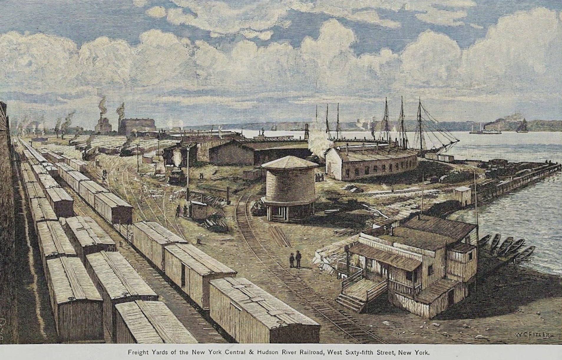
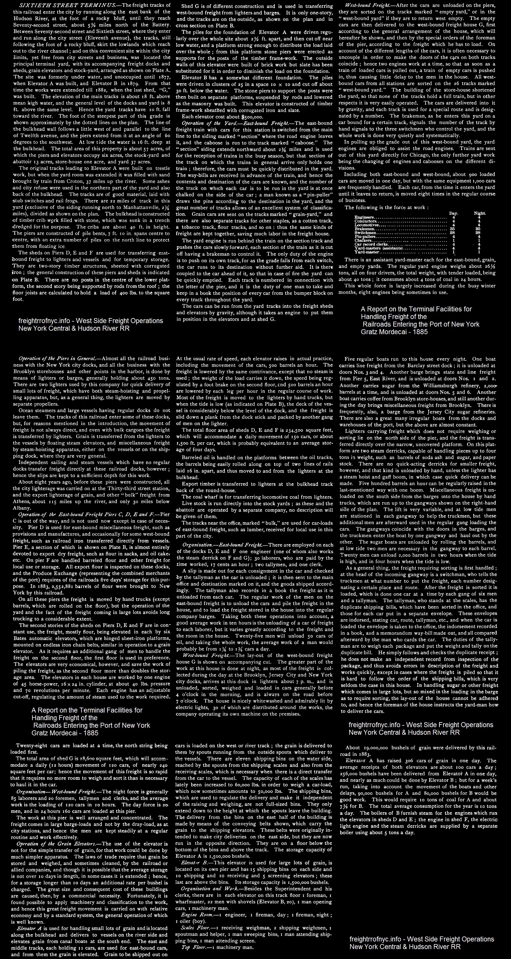
.
This was the main railroad facility in Manhattan. This facility's main features was comprised of the following, beginning at the northwest corner of the property at where West 72nd Street would meet the water: a rather large roundhouse and engine servicing facilities for locomotives and the aforementioned Railroad YMCA and other building containing offices for railroad departments.
Working south along the bulkhead was Pier I (an open pier for direct lighterage); the three transfer bridges #4 (steel overhead suspended French contained apron type), #3 (steel truss bridge on pontoon), #2 (electrically operated, overhead suspended separate apron Bensel type), then enclosed pier houses G, F, E, D and B; the West 62nd Street transfer bridge #1B (electrically operated, overhead suspended, separate apron Bensel type); then Grain Elevator A between West 62nd and West 60th Streets.
Just south of the grain elevator was the West 59th Street Freight Station on Pier 99. Working counterclockwise (east) along West 60th Street were a warehouse and stock pens for cattle, a repair in place track for expedient repairs of rolling stock, poultry platforms. At West End Avenue and West 60th Street were the yard offices and comfort station and rooms for railroad car men. In the center of all this were the stock yards, surrounded by the various classification tracks for inbound and outbound freight, and storage sidings.
Over the ensuing decades, additional property was acquired (triangle at northeast corner of 1955 map below), and the yard facilities were reconfigured to accommodate the changes in freight haulage. From the 1800's to around 1930, the stock pens at the south end of the yard were done away with and warehouses constructed, along with auto unloading platforms and Live Poultry Market. The freight station at West 59th Street was closed and property usage ceded to the City of New York Department of Sanitation (which, ironically still occupies the site.)
By the 1940's, the bulk storage of grain was no longer necessary in the New York City area. The original Grain Elevator A, which had been built in 1876, and had a capacity of 1.5 million bushels of grain and was one of the largest single structures in New York City; burnt down in April 1889 in a huge conflagration, along with Elevator B which was located on the pier. After the fire, Elevator A was built back slightly larger somewhat combining the capacities of the two previous elevators. For those of you who are interested, a bushel of grain weighs 60 pounds. A new grain elevator built in 1941 and of 13.5 million bushel capacity was constructed at Albany, NY (130 miles north), which pretty much supplanted those in the New York City proper. The grain elevator site in Manhattan now was home to a small concrete loading plant built in its footprint.
The advent of mechanical refrigeration led to a decline of the local slaughterhouses, what with meat now being able to be processed closer to the stockyards of the Midwest. As such, the stock yard at West 60th Street was closed, with any remaining inbound livestock destined for West 41st Street. This space developed into the poultry area. Trackage and poultry platforms were constructed, arranged as such with a track on one side and a wide driveway on the other. Poultry cars would be spotted at these platforms, and poultry buyers would back up their trucks to the platforms to load.
Additional platforms were built to the east of the poultry area for automobile unloading, which by the 1940's was really becoming a major shipping commodity. A chicken in every pot and an automobile in every garage finally became reality!
Strangely, new milk platforms were built in the in acquired triangle bordered by West 65 and West 62 along West End Avenue. These replaced the milk platforms that were located at West 30th Street between Ninth and Tenth Avenues and that were razed for construction of the Morgan Parcel Post Facility. But, with the advent of the mechanically refrigerated express milk car (tanks) these platforms would not last long.
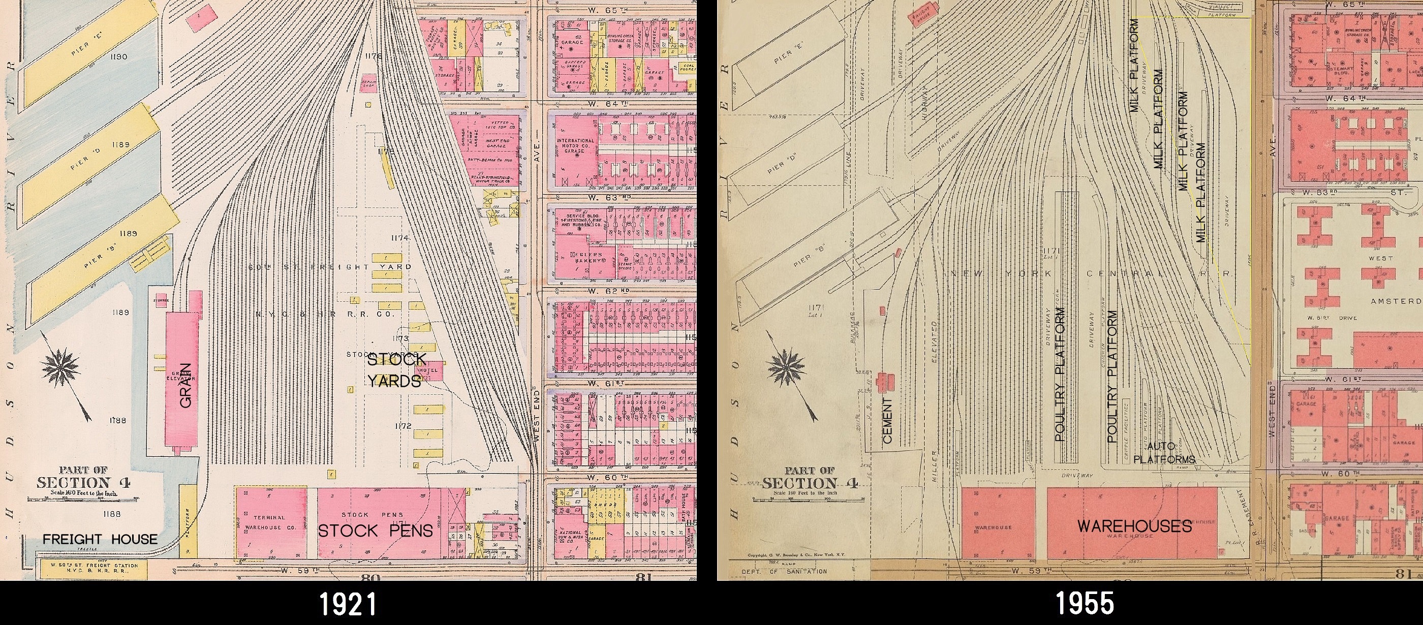
.
Just about the time that 1955 Bromley Property Atlas was published, New York Central sold that triangle of land where the milk sheds were located to the New York Times, for an anticipated printing plant as referenced in the October 1955 issue of New York Central Headlight. This printing plant became operational in July 1959, and ceased operations in 1976 with the opening of the Carlstadt, NJ plant. This is important as we know Conrail was handling carloads of paper in 1982 at West 60th-72nd Street Yard for the New York Times, and where it has been stated trucks were transporting the rolls of newsprint from the yard in Manhattan to New Jersey.
.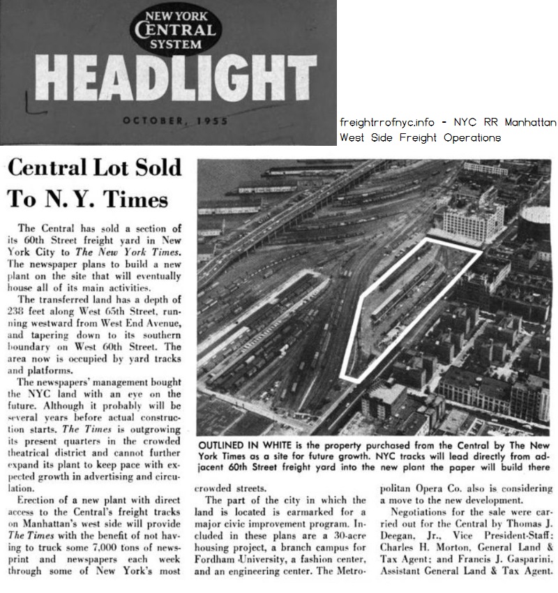
.
.
1924 - Fairchild Aerial Survey Image
8B - N.Y.C. (Aerial Set)
New York Public Library Digital Archives
annotated by author © 2025
click on map for un-annotated version
added 02 September 2025
.
. For that
direct freight
that was to be transfered to New Jersey and the terminals in Brooklyn
and Queens, those cars were blocked and placed into the
transfer bridge assemblage yards, for eventual loading upon carfloat.
Carfloats (waiting to be unloaded, or those that were loaded and
waiting for pick up were moored to piling in the carfloat holding area.
Pier I: this was an open pier and was for oversize and heavy freight, such as structural beams, boilers, engines, machinery, trucks, etc; and that of which required transfer for lighterage by open barge or stick lighter for further travel to its destination.
Pier G was designated for westbound / outbound freight (to New Jersey). Cars that needed to be combined were placed in sub-yard G, until dock workers could get to them.
Pier F was designated to handle eastbound / inbound (to Manhattan) barreled flour. Cars that needed to be loaded with this barreled flour were stored in sub-yard F.
Pier E was designated for dry export.
Pier D was designated for miscellaneous freight.
"Pier C" is mentioned in Gratz Mordechai's "Report on Terminal Facilities for Handling Freight of the Railroads Entering the Port of New York" as being held in reserve and not used frequently. This is odd, because there is no Pier C shown on any of the maps, property or railroad. It may have burned in the April 1889 conflagration, discussed below.Elevator B is also mentioned in Mordechai's "Report on Terminal Facilities"; but it too is not shown on any maps. It is believed at this time, it occupied "Pier B" as Elevator B had direct waterside transfer. Located in an 1889 Report of the Fire Department of the City of New York; a lard factory located at West 59th Street and Twelfth Avenue caught fire on April 19 at 3:40 pm. The building was fully engulfed within minutes; and the heat thereof communicated to surrounding structures which included Elevator A, and Elevator B, even pierhouse Pier D. The New York Times coverage "Millions Swept Away" and of this conflagration gives explicit details. When an urban area like New York (or Chicago or San Francisco) had a fire, it really knew how to have a fire! As Elevator B was built on a pier so fire apparatus could not access it despite fireboats being on scene. So it appears Elevator B was not rebuilt following this fire, and the pier reconstructed as a pier house instead. Elevator A however, was rebuilt. This also explains the construction date of 1889 for Elevator A.
Elevator A was used for the storage of grains with 2,300,000 bushel capacity. Carloads of grain and corn both for human consumption as well as those used for livestock needs. Cars went to Elevator A yard to be brought into one of three tracks underneath the elevator for transfer by conveyor into the appropriate silo bin. If I understand what I read correctly, it was supposedly regulated that a 10 days worth supply of grains needed to be kept on hand. As it was dispensed into either covered barges or floating grain elevators for further distribution.
West 60th Street Stock Yard: for livestock that was not destined for West 41st Street Livestock Yard and Abbatoirs (slaughterhouses); these were placed into the West 60th Street Stock Yard unloading tracks. The stock house (building) that was located on West 60th Street, was known as the "sheep house."
Team tracks: Team tracks at this facility were an unusual departure from the standard arrangement. The more common arrangement was to have one or two tracks with wide driveways on either side paralleling the trackage; then another track or two, a wide driveway, another track or two; and so on. This allowed a horsedrawn wagon or cart, or truck, that could either back up directly to the boxcar door or park alongside it for loading and unloading. However, here at West 60th Street Yard, a single team track came out from each of the pier house leads (or the transfer bridge lead) and curved to run parallel along the bulkhead and alongside a raised platform which was located between the track and the bulkhead; and parallel to the long driveway; but this track now ran perpendicular to the sub-yards trackage themselves. Freight could be directly unloaded from a barge or lighter moored to the bulkhead and directly into a freight car, or the freight car could be unloaded to the platform or onto a barge or lighter. After unloading, the car went to the empties yard. Freight could be anything from one or two crates, to crated appliances, furniture. Team tracks are highlighted below in yellow (north is to the right):
Empties Yard: empty cars went to the "empties yard" where they would be cleaned and swept out, if required. This task was usually relegated to male pre-teen and teen aged youth. These were the days where there were no under age employment laws. After cleaning, empty cars would be brought to whatever pier shed that needed cars for loading on an as need basis. This freight would arrive by covered barge or lighter; and whereas these loaded cars were then made up into outbound (northbound) trains.
Car repair tracks: adjacent to the empties yard. Here carpenters, metal workers, and any other skill craft that was necessary for the repair of freight cars was located here. These repairs could be as simple as replacing a broken or bent hinge on a door; to an entire wood body or floor; or later metal patches to steel cars.
The train assembly yard was for putting together the various groups of cars for the terminal yards and freight houses further south. Those long distance trains that arrived, were broken up (or broken down, depending on your preferred railroad lingo) by switch engines. Cars for the same general locations were grouped together (or "blocked" in railroad parlance). For those cars to be forwarded to the West 36-30th Street Yards and Freight Houses, and New Washington Square Market and St. John's Terminal, were made up in smaller blocks of cars, usually no more than 8 to 10 cars which was the norm for street running in Manhattan.This could include, but are not limited to:
- the New York Stock Company's Stock Yard and the Abbatoirs (slaughterhouses) at West 41st Street;
- carload and less than carload freight to West 36th-33rd Street Yards;
- Milk trains were "unit trains" meaning the entire train was comprised of milk cars. These milk cars went to the milk platforms at West 29th Street, or after 1930; to the platforms built at West 62nd Street and Eleventh Avenue to replace the West 29th Street milk platforms which were razed for the Morgan Parcel Post Building. Most milk cars had white roofs to reflect heat from the sun.
- the Fresh Produce Yard at West 17th Street;
- the New West Washington Market, at West Street at the foot of Gansevoort Street;
- spurs into the pierhouses of South Pacific Steamship Company occupying Piers 48, 49 and 50; located at the foot of West 11th Street, Bank and Bethune Streets respectively.
- the St John's Park Freight Terminal.
Running tracks were kept clear for the passage of trains.
In
short, the West 60th-72nd Street Yards were the "heart" of the New York
Central Railroad's Manhattan
freight operation. From here, it went out to peripheral routes; the
"arms
and legs" of commerce.
Excerpts of physical characteristics of New York Central
terminals are
included
below; but perhaps most importantly, the procedures on how the freight
was handled at each of the terminals is defined in great detail.
Therefore, I have simply reproduced the text here verbatim. Keep in
mind, this is how the freight was handled and the terminals operated in
1885 - and such procedures likely changed over the decades.
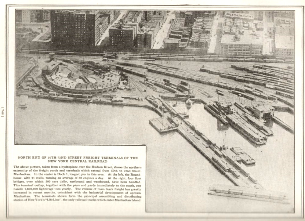
1921 New York Central Railroad Industrial Directory and Shippers Guide
- Page 748
image courtesy of Terry Link - canadiansouthern.com
the unabridged directory is available on Google
Books and the section pertaining to New York City are pages
746 through 762
added 15 August 2025
Some of the
following images were taken as part of a series
for surveying the route and subsequent construction of the Miller
Elevated Highway a/k/a West Side Highway.
Because of the vastness of this facility, I have
made an
attempt to separate images into geographical groupings. This set of
images view the structures and yards from the west side.
.
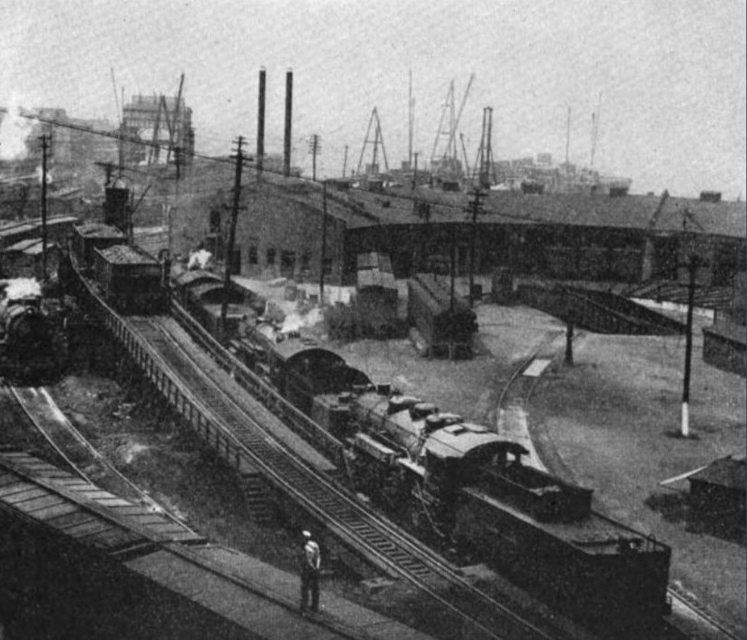
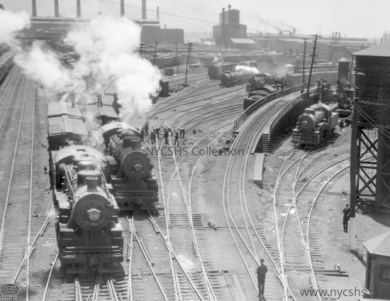
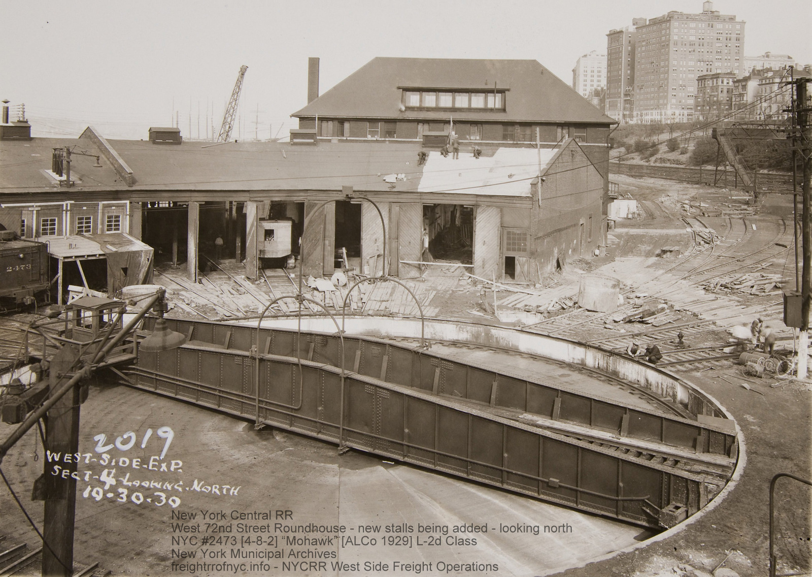
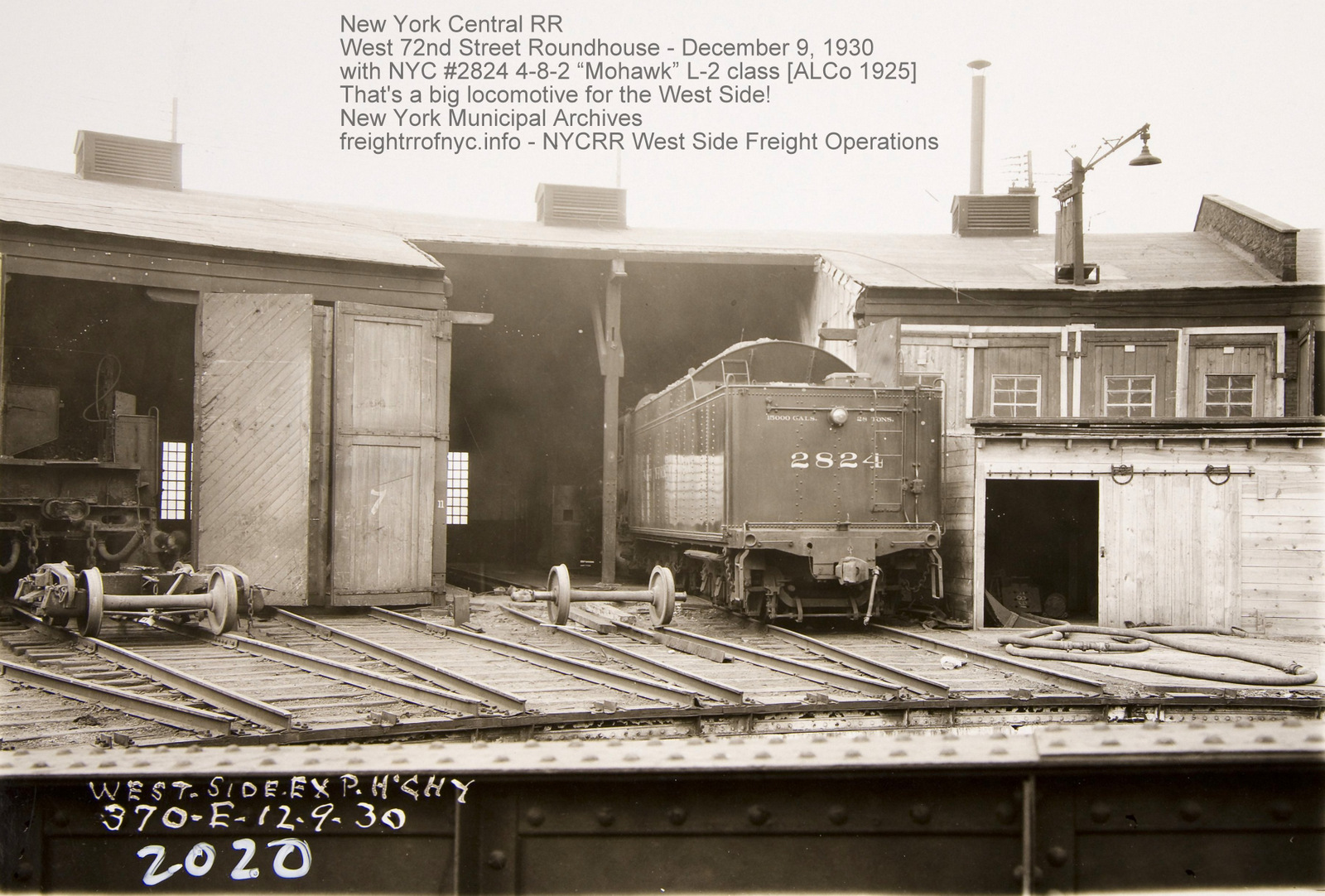
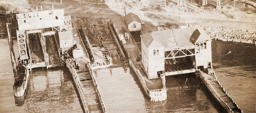
left: #4 - electrically operated, overhead suspension; steel, contained apron bridge "J. B. French patent" with steel gantry
center: #3- pontoon float / steel, pony truss
right: #2 - electrically operated, overhead suspension, wood, Howe truss bridge / separate Apron "J. A. Bensel patent" with wood enclosed gantry house
T. Flagg photo
added 04 January 2012
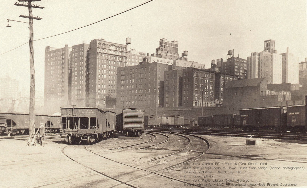
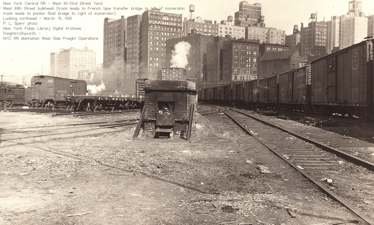
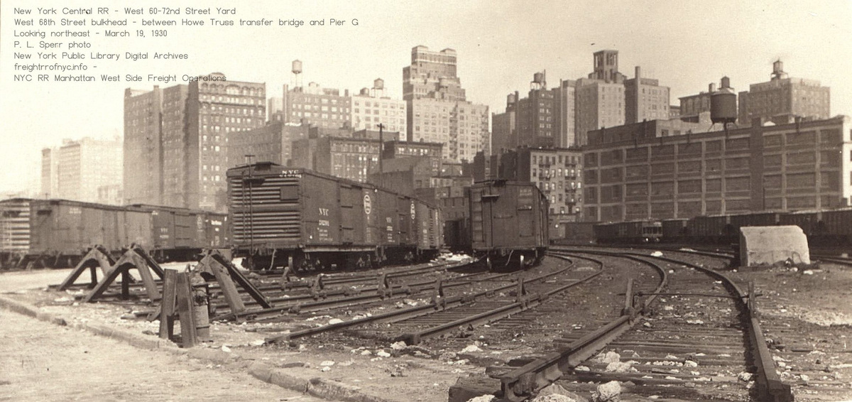
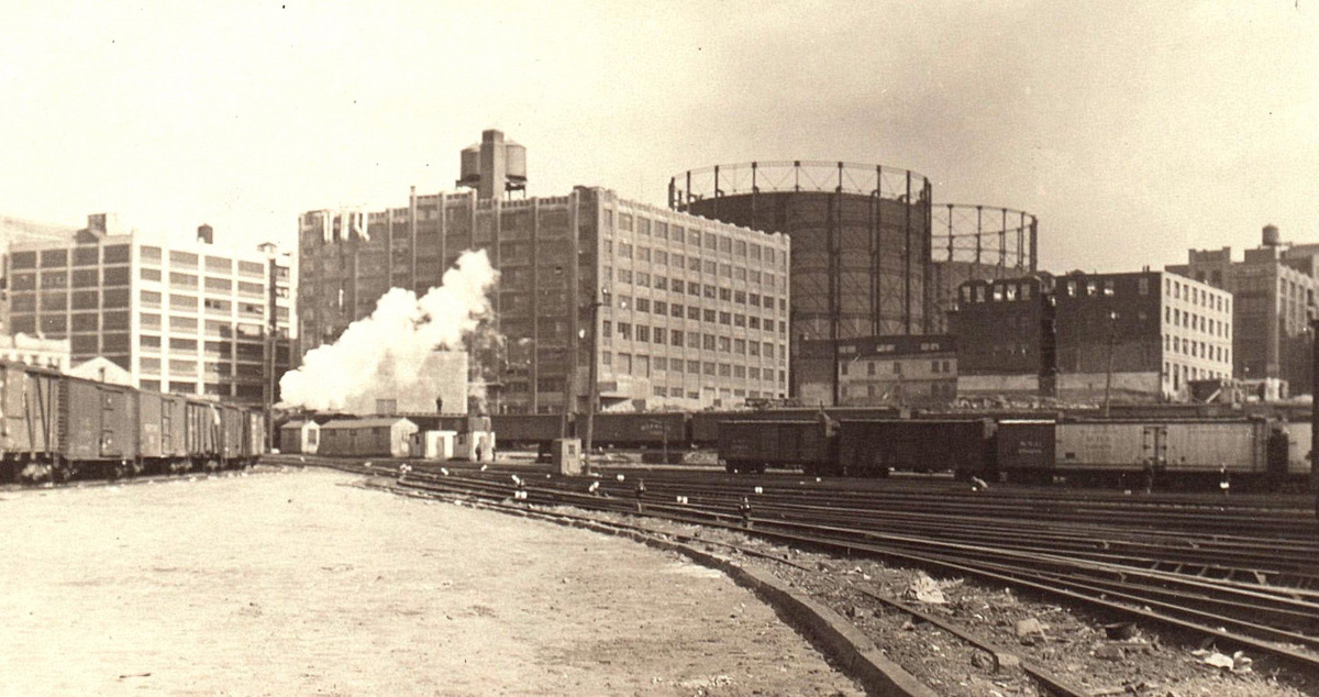
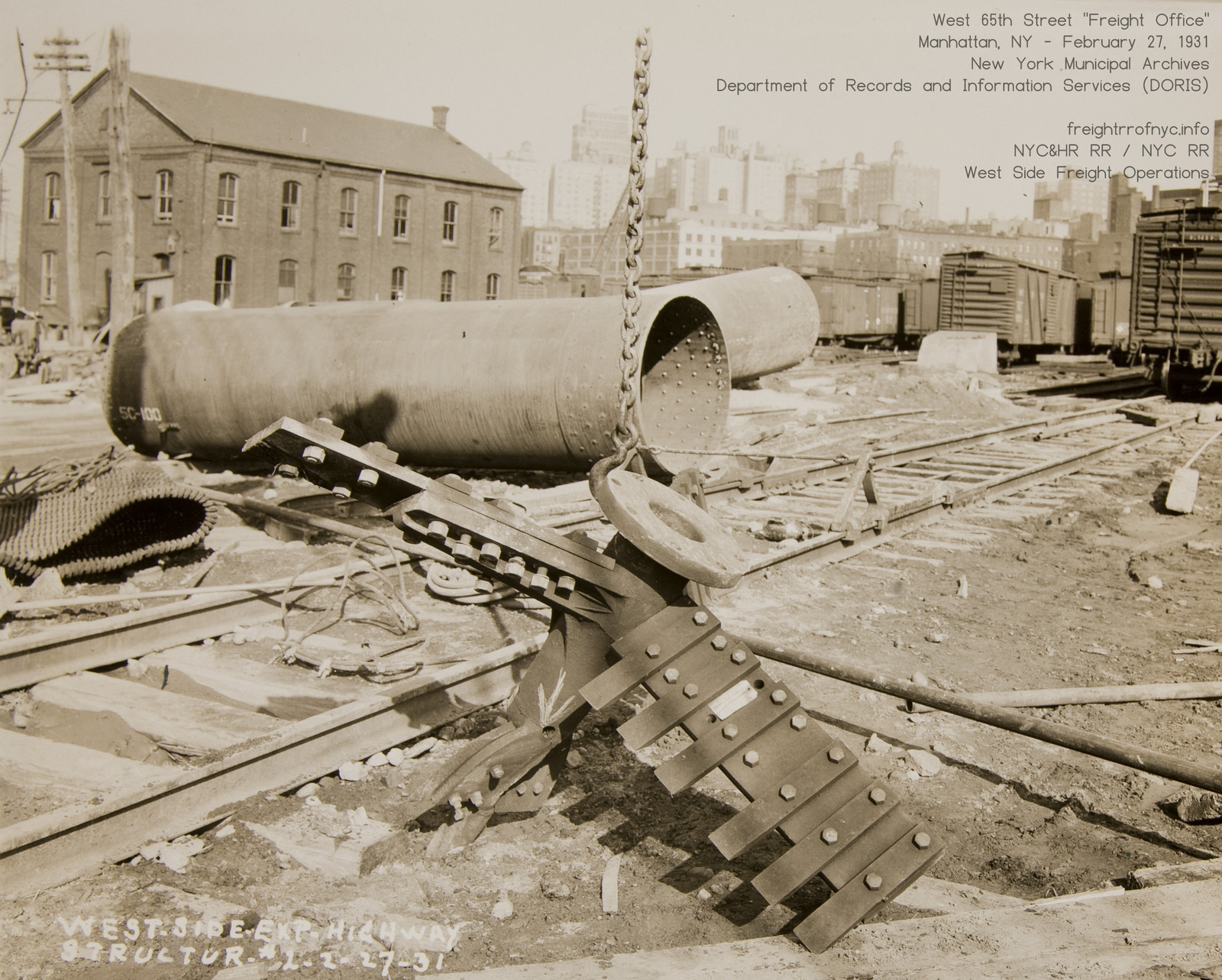 West 65th Street Freight House (with peaked roof) - February 27, 1931 The paddle like object in foreground is actually a boring bit for caisson drilling. The "pipes" laying horizontal are the caisson. New York Municipal Archives / Department of Records and Information Services Image ID: REC0069 03 20 0517-b26 added 26 June 2026 |
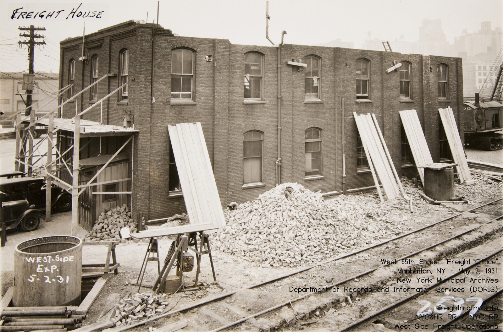 West 65th Street Freight House (roof removed) - May 2, 1931 Note the use of wall support tie rods to hold the walls (first, third and fifth windows) Note the caisson installed. New York Municipal Archives / Department of Records and Information Services Image ID: REC0069 03 26 0566-a.jpg added 26 June 2026 |
| . | |
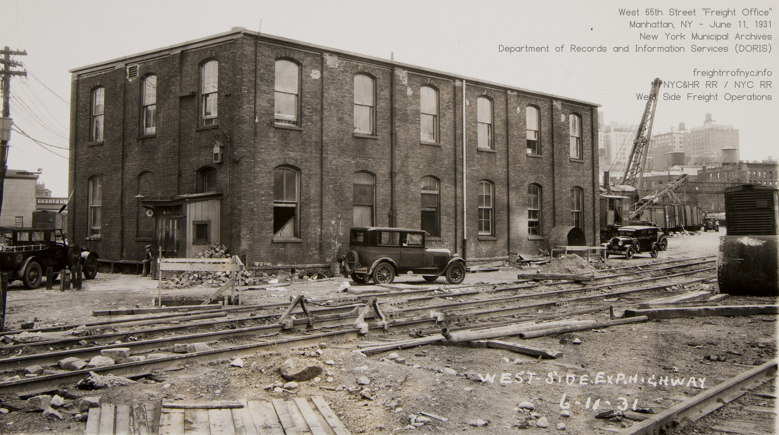 West 65th Street Freight House (new roof installed) - June 11, 1931 New York Municipal Archives / Department of Records and Information Services Image ID: REC0069 03 20 0517-b28 added 26 June 2026 |
|
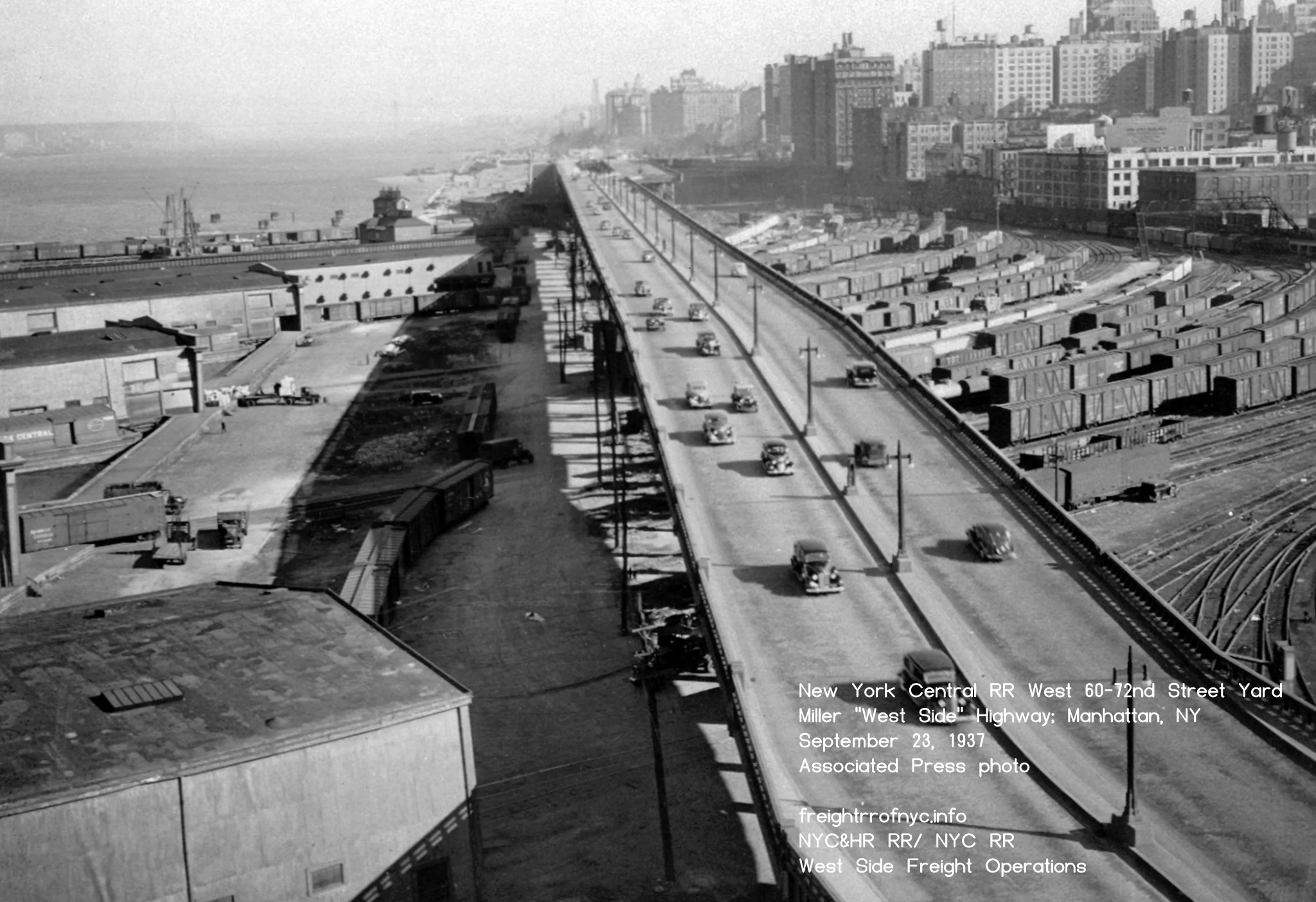
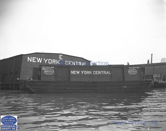
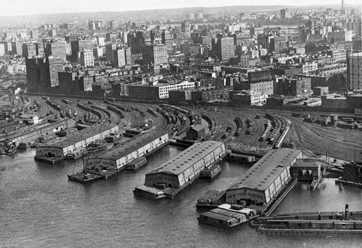
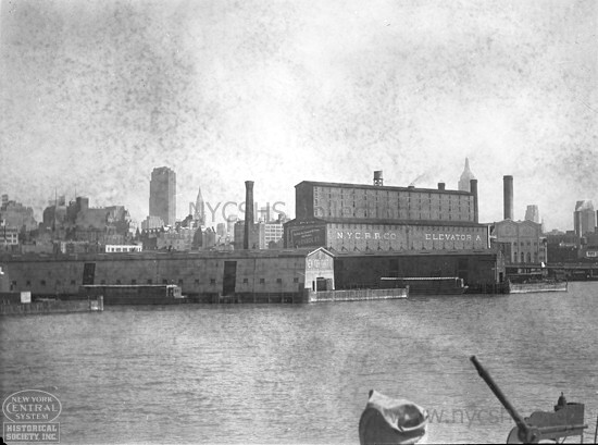
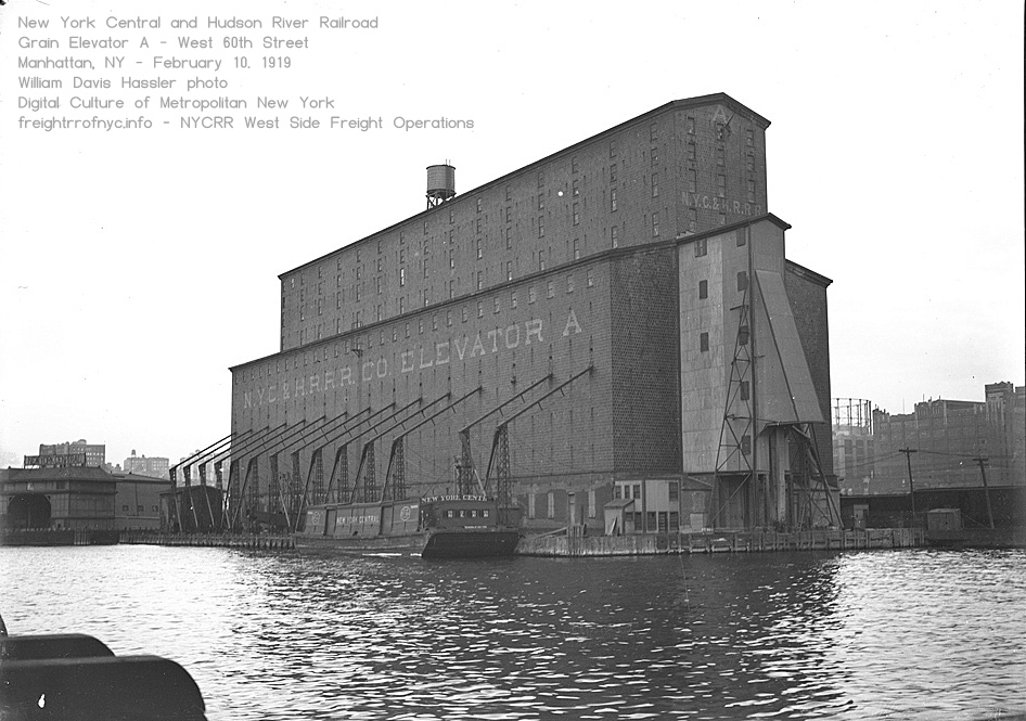
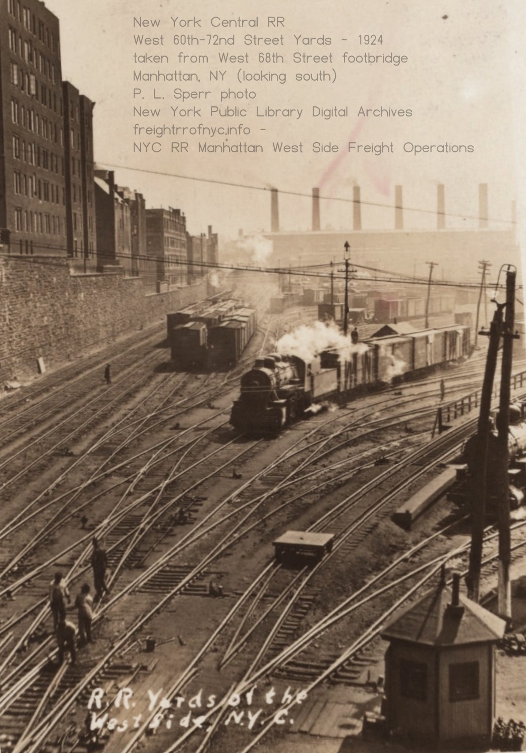
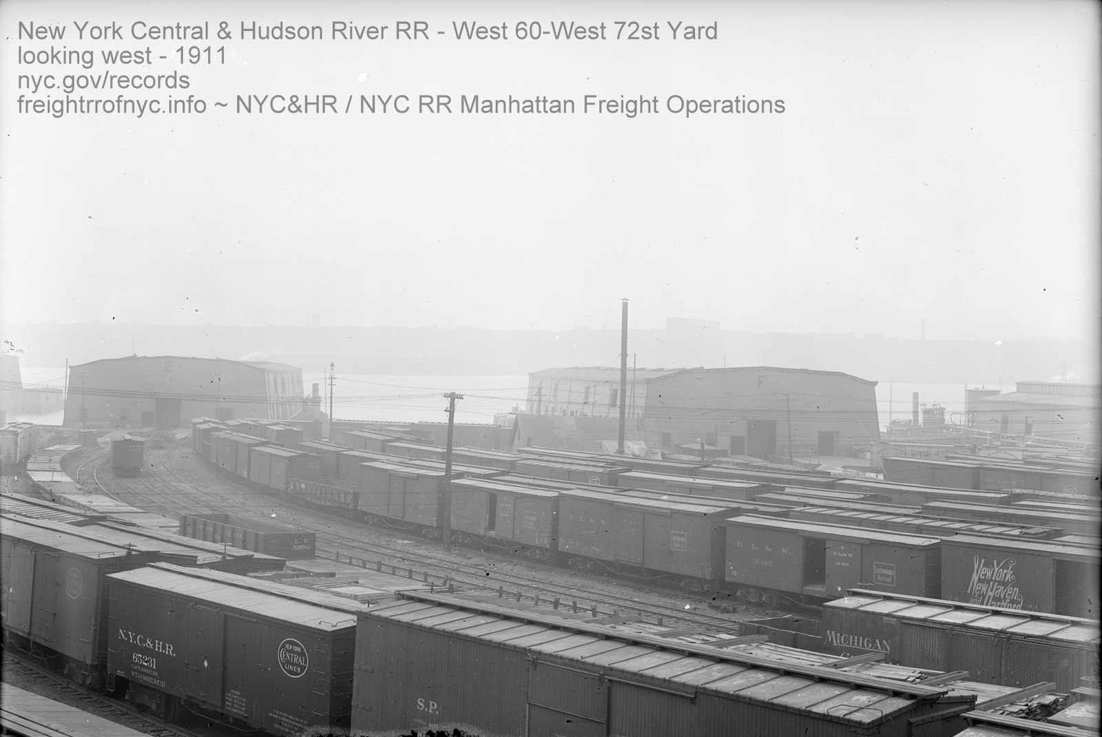
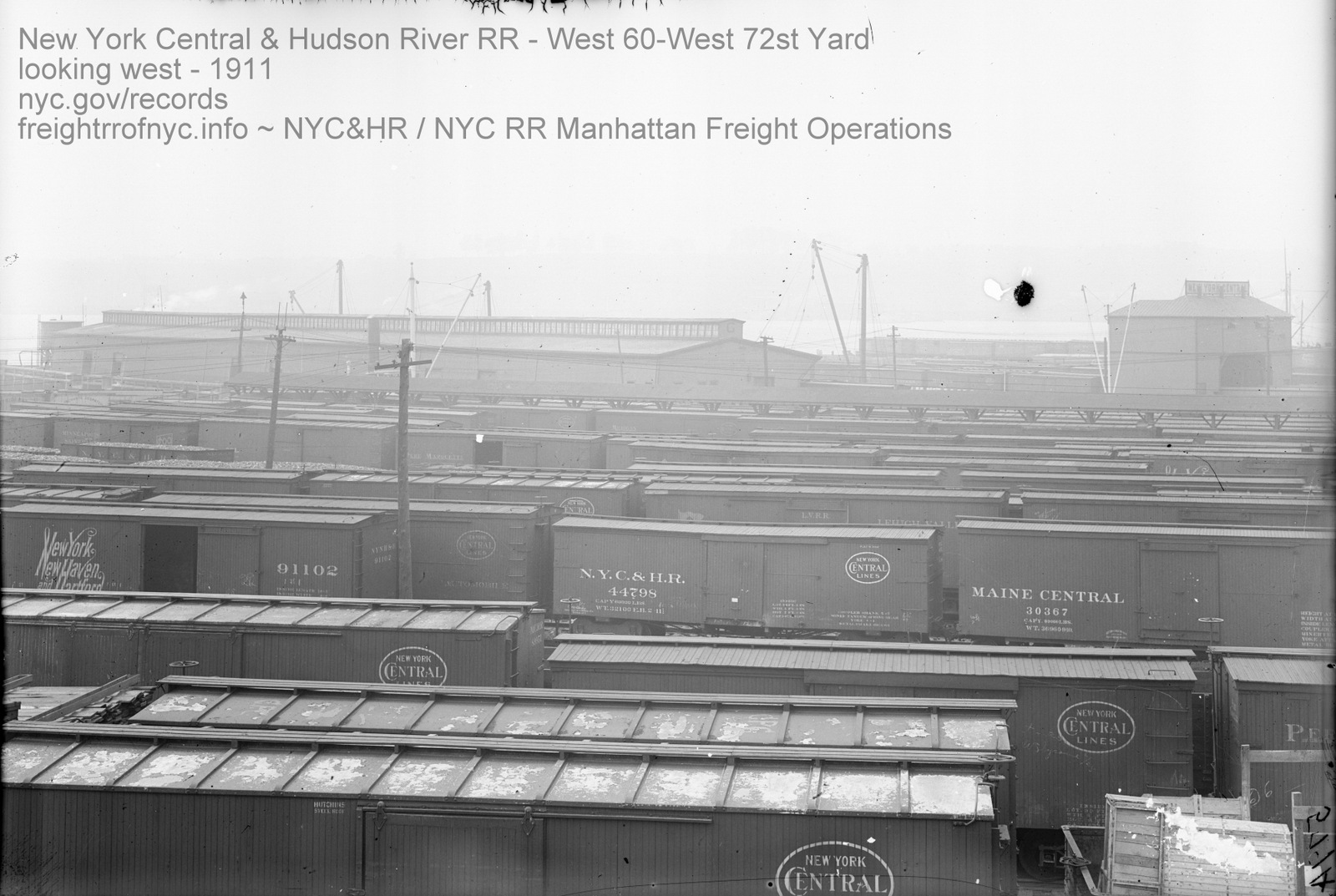
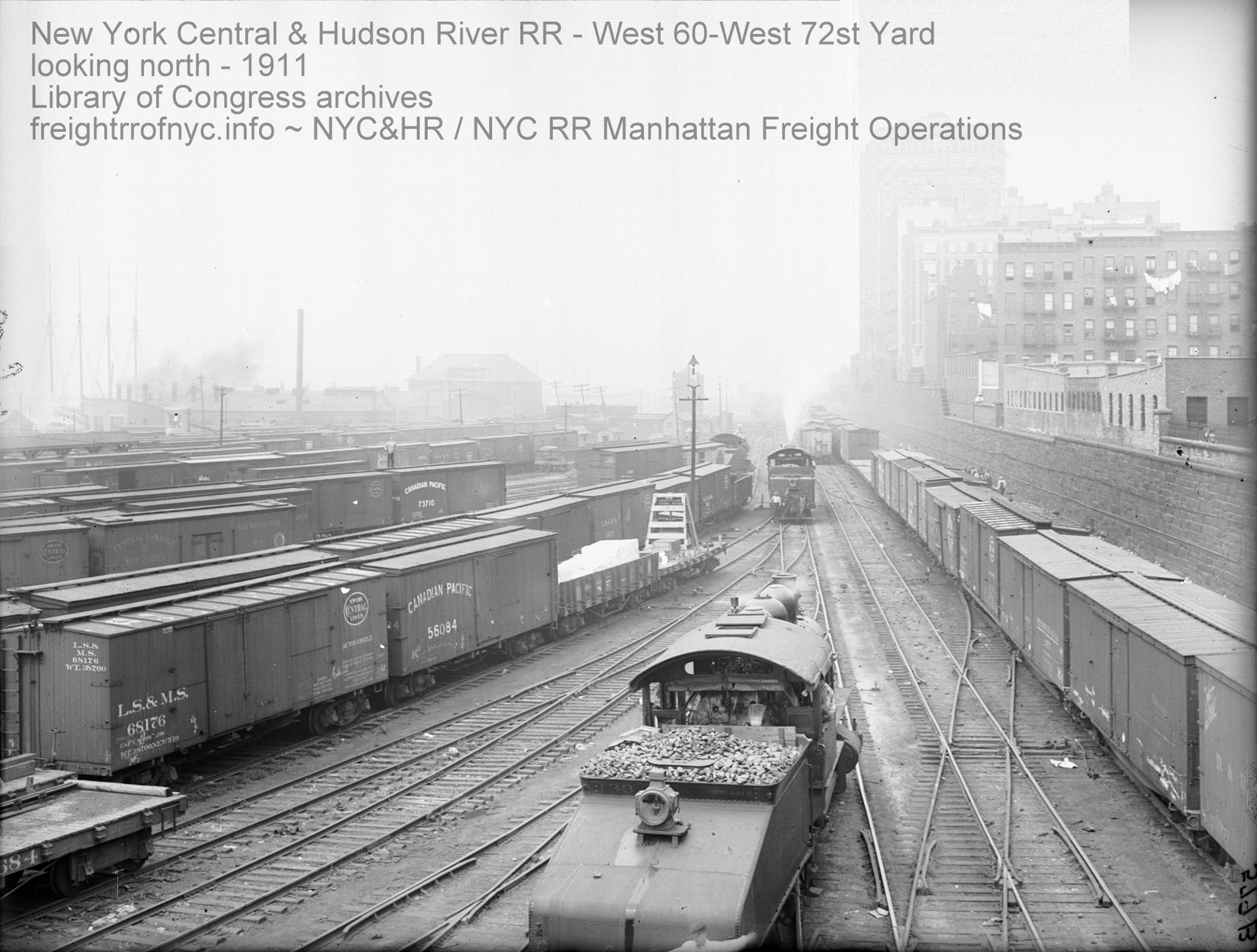
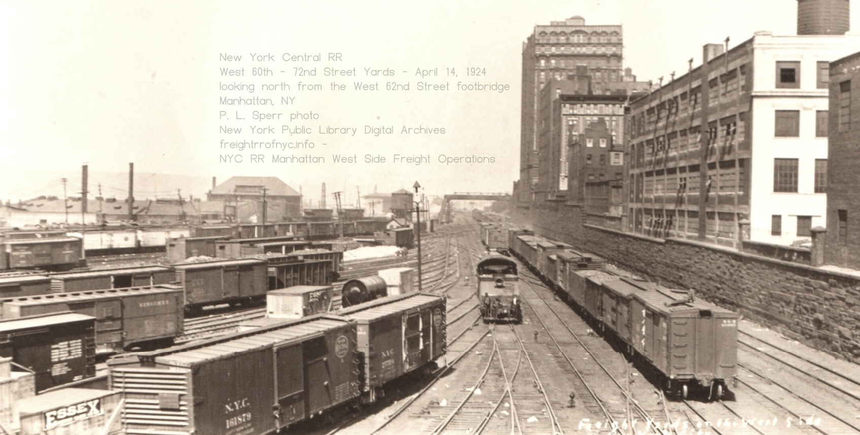
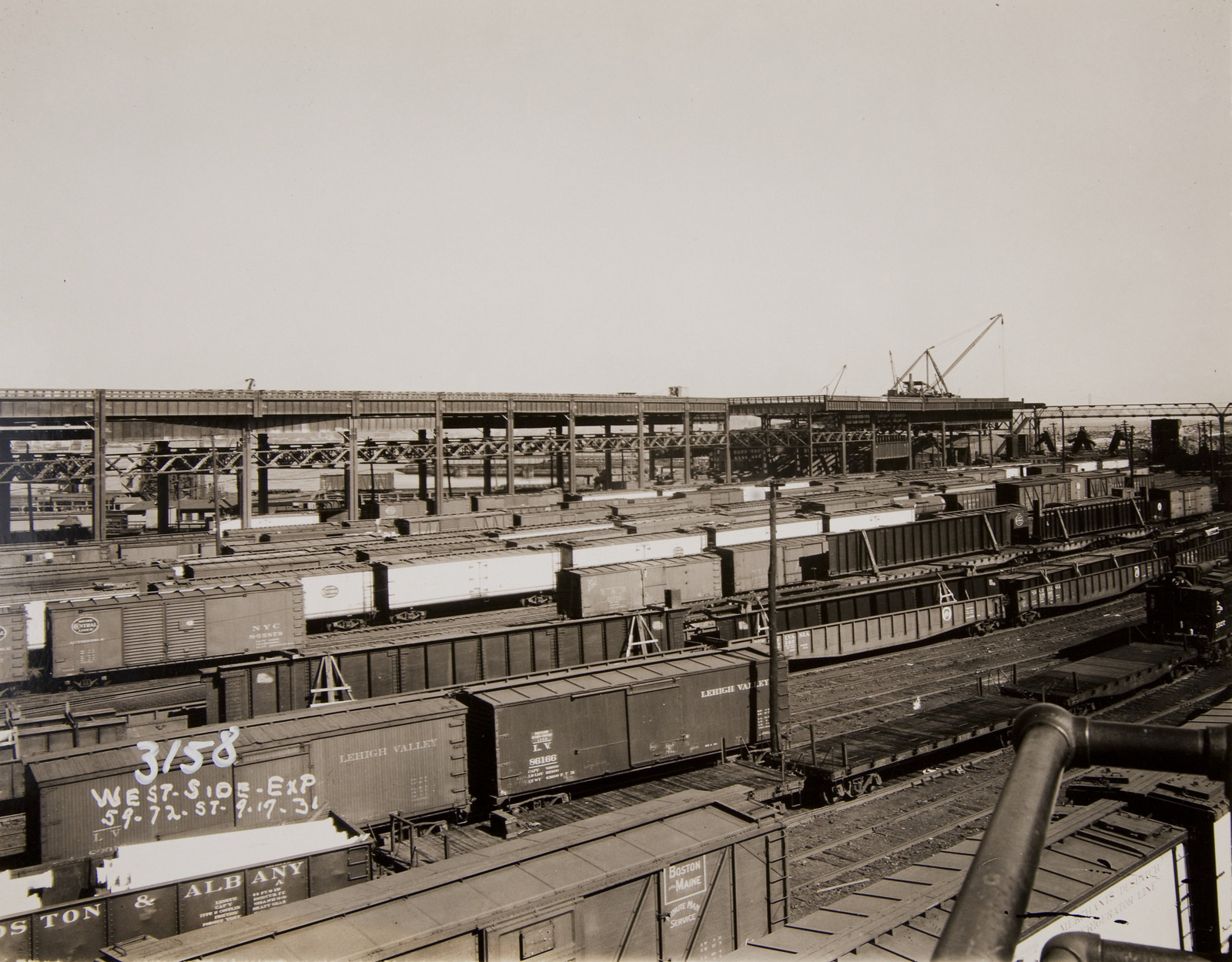
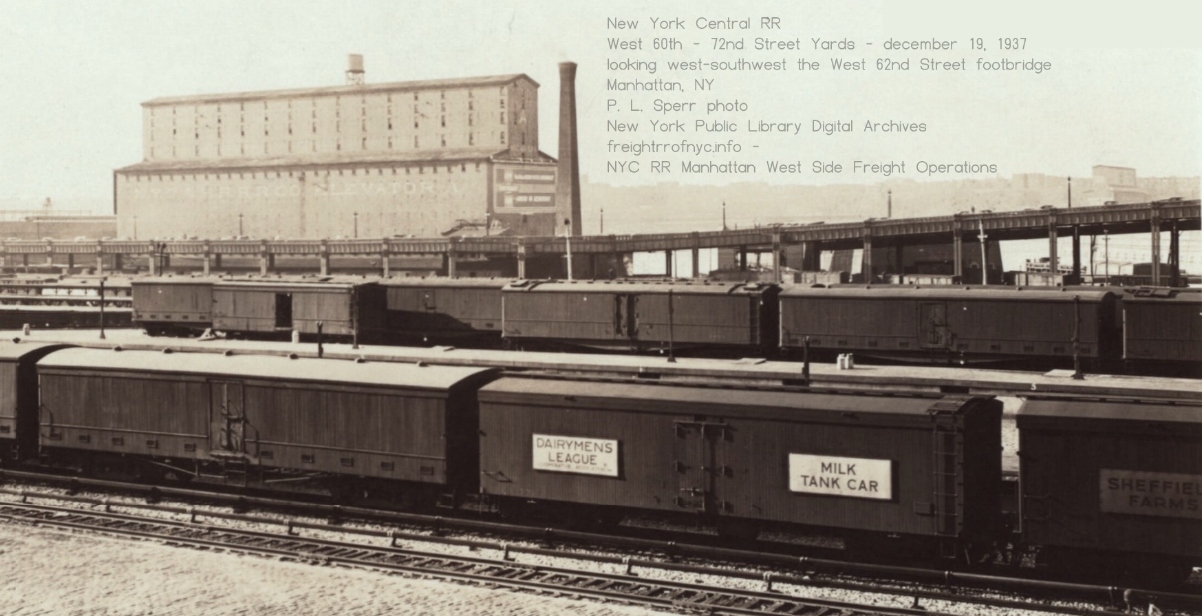
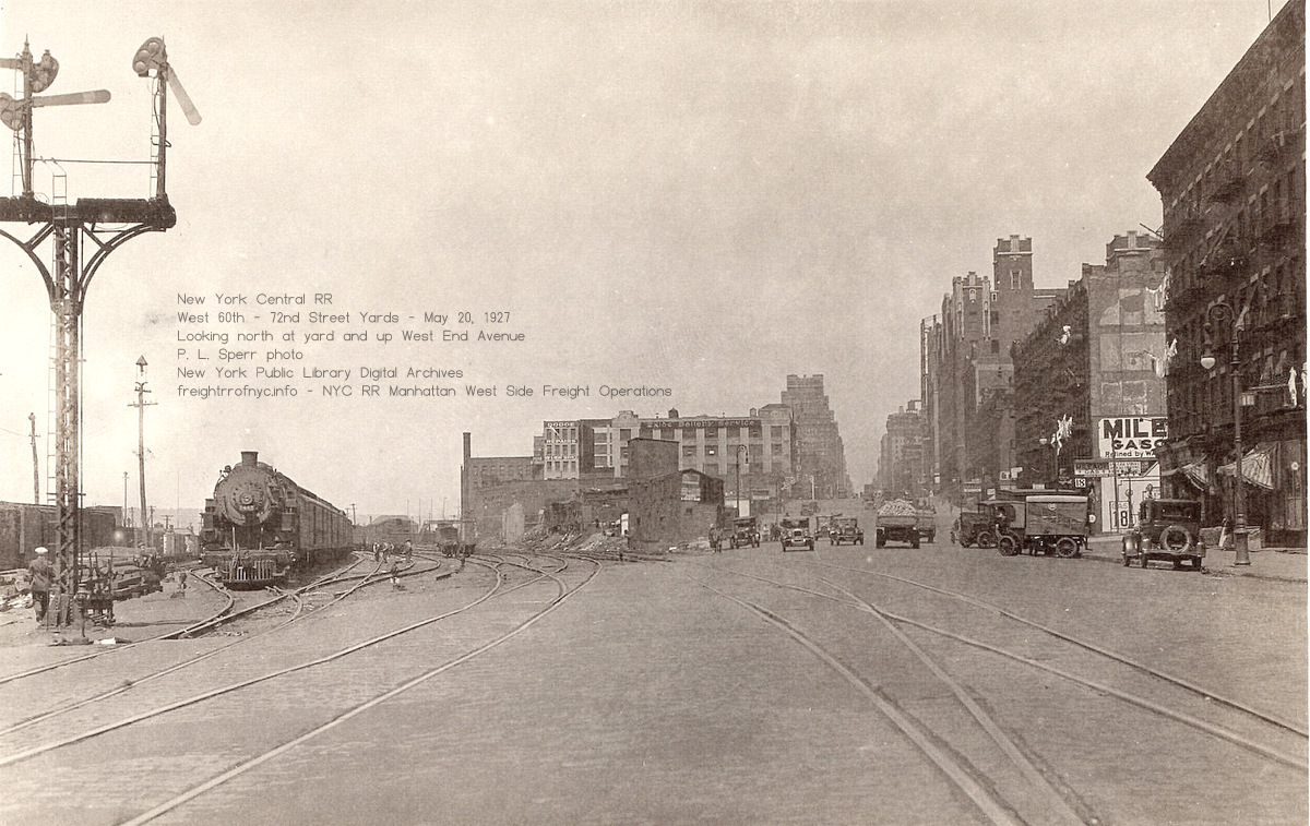
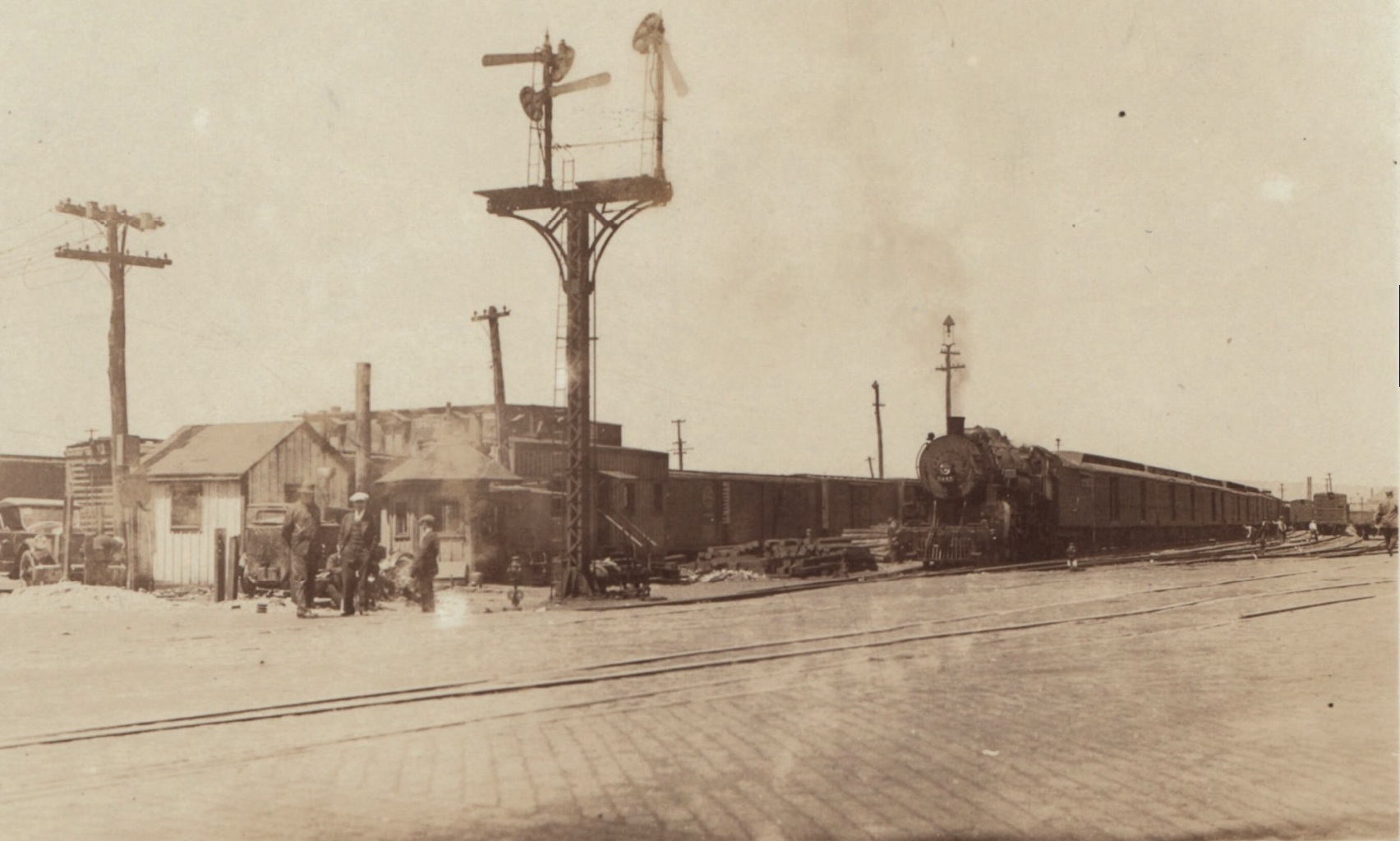
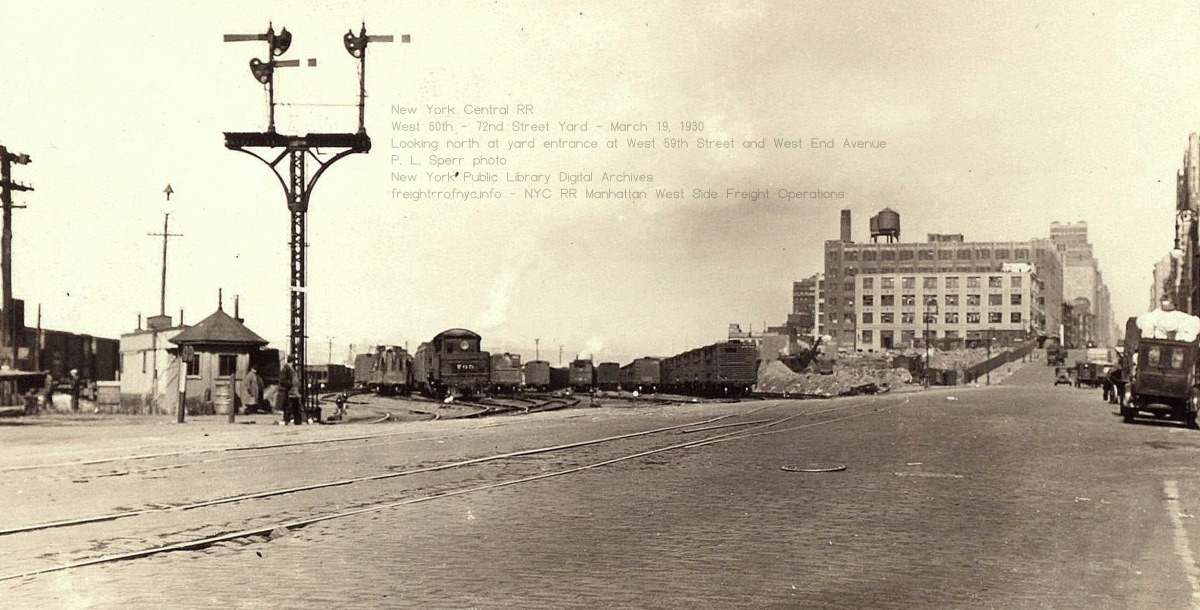
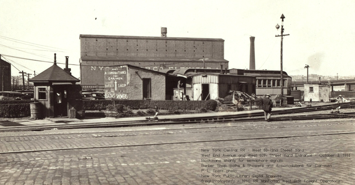
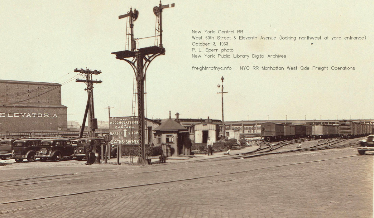
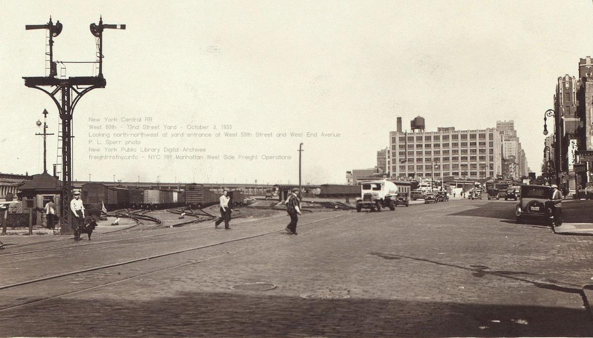
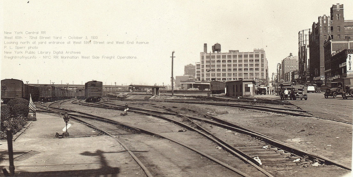
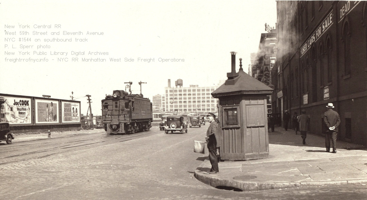
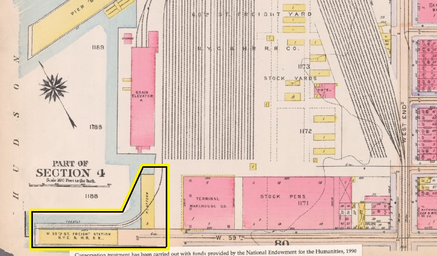
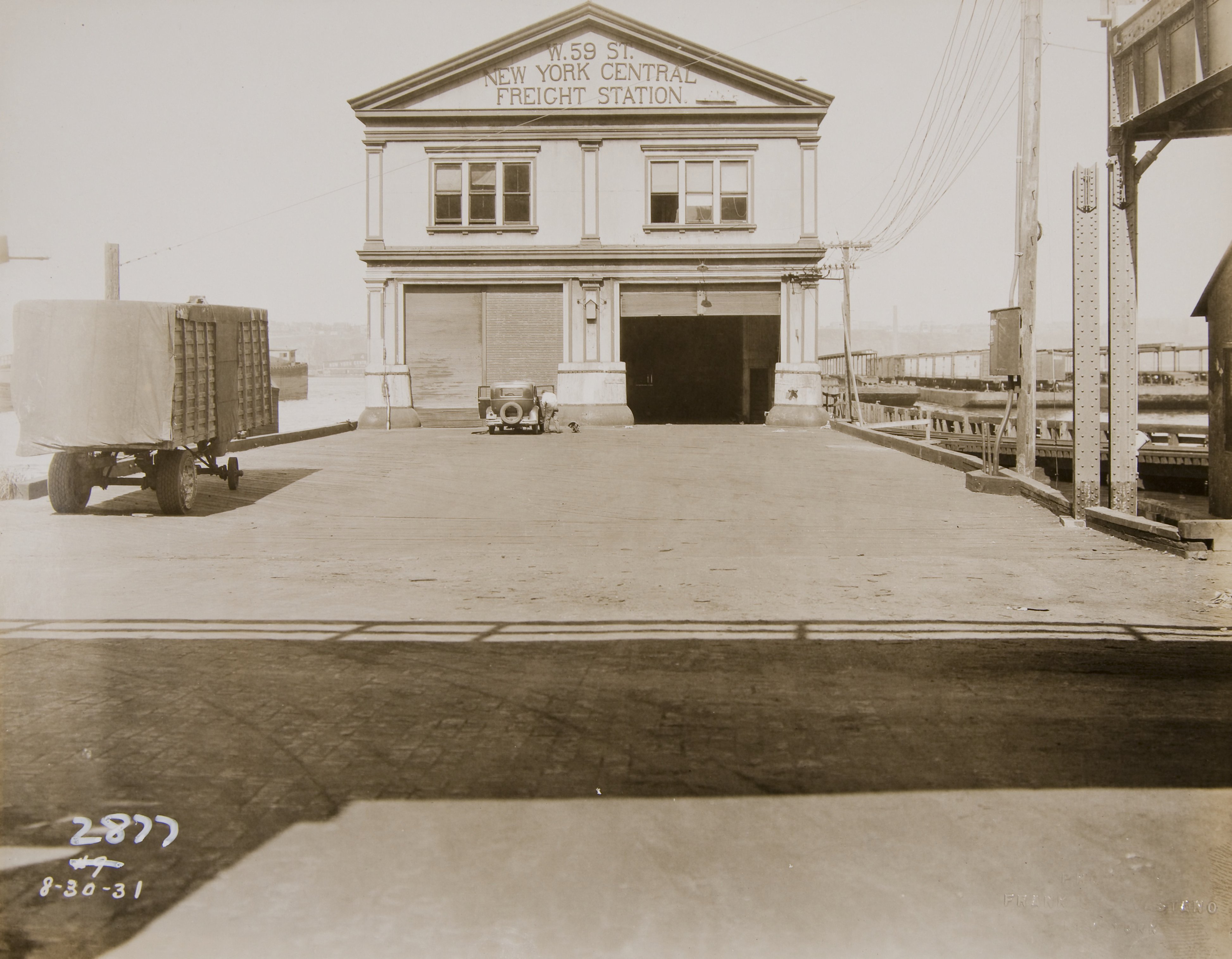 |
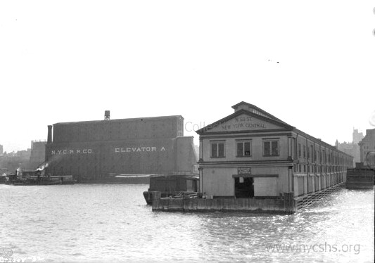 |
|
| West
59th Street Freight Station - Twelfth Avenue & West 59th Street
- August 30, 1931 Looking west. Note the wood trestle and track to right of the pier. In observation, it appears that this pier appears lightly used. Also note the steel elevated structure of the West Side (Miller) Elevated Highway. New York City Municipal Archives image |
West
59th Street Freight Station - no date Outshore end, looking east from Hudson River. New York Central System Historical Society - Image ID WR050483 |
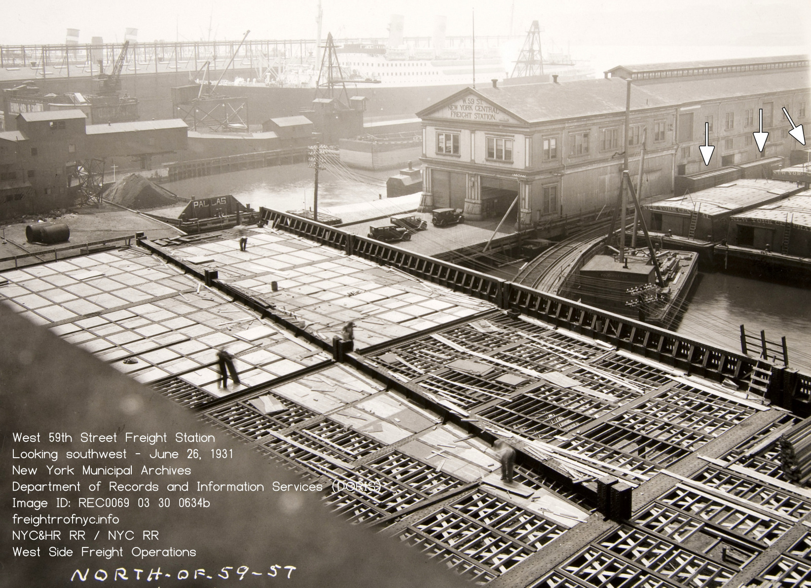
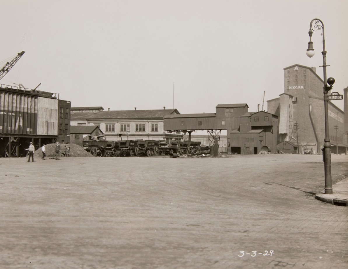
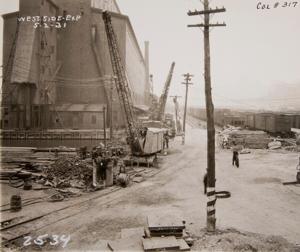
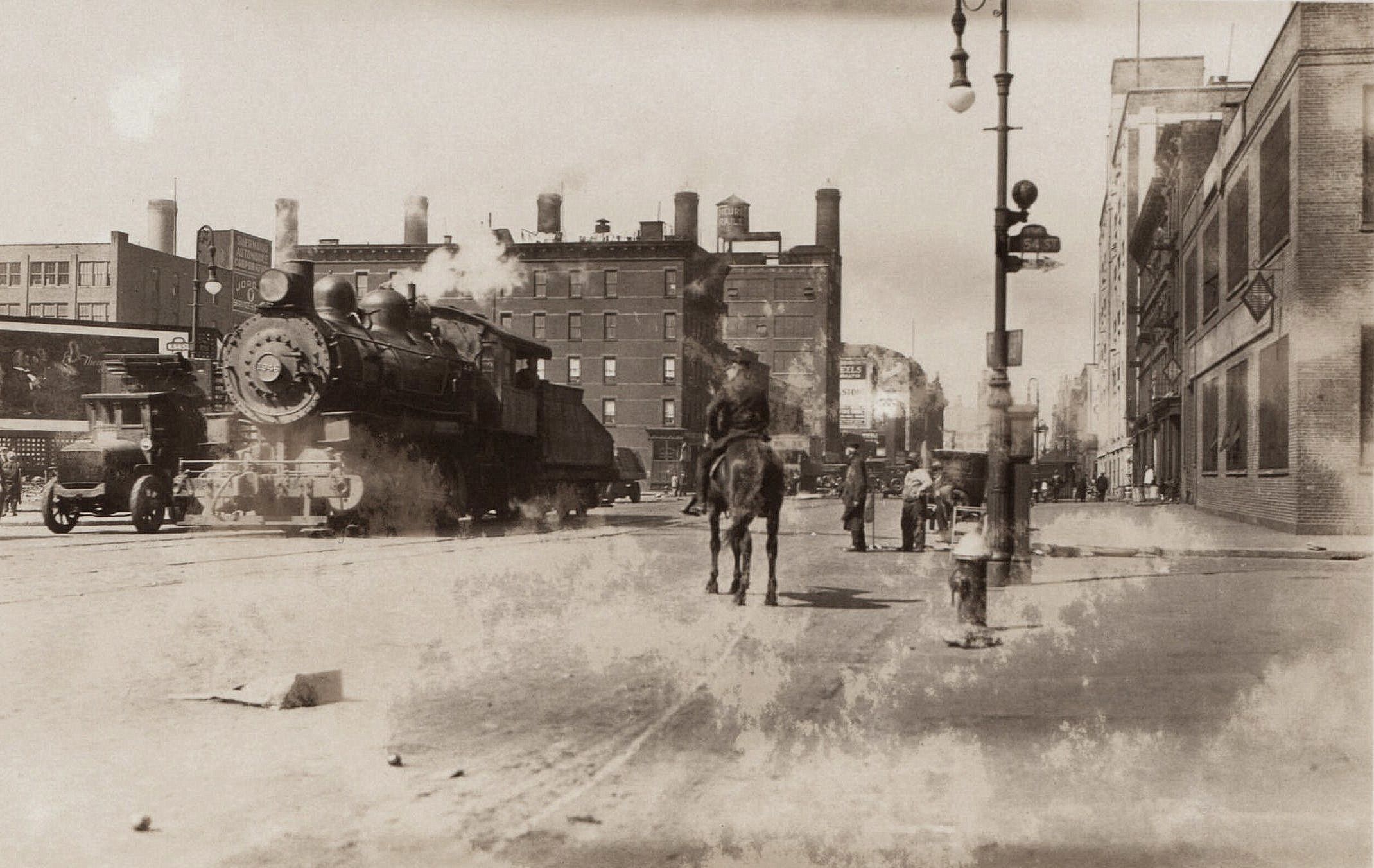
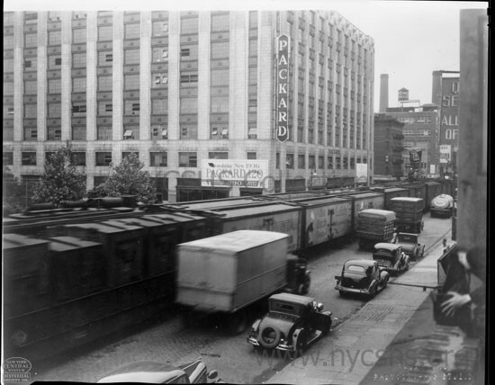
|
|
|
.
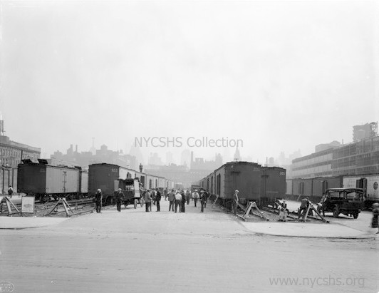
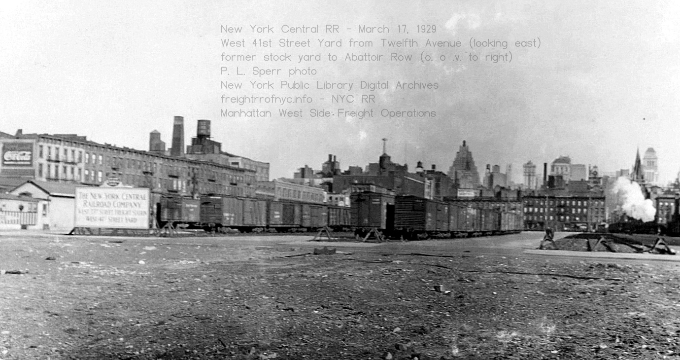
West
41st
Street Yard looking east-northeast from Twelfth Avenue - March 17, 1929
It appears most of the freight
traffic in this yard is now standard uninsulated boxcars.
P. L. Sperr photo
New York Public Library Digital Archives
added 28 August 2025
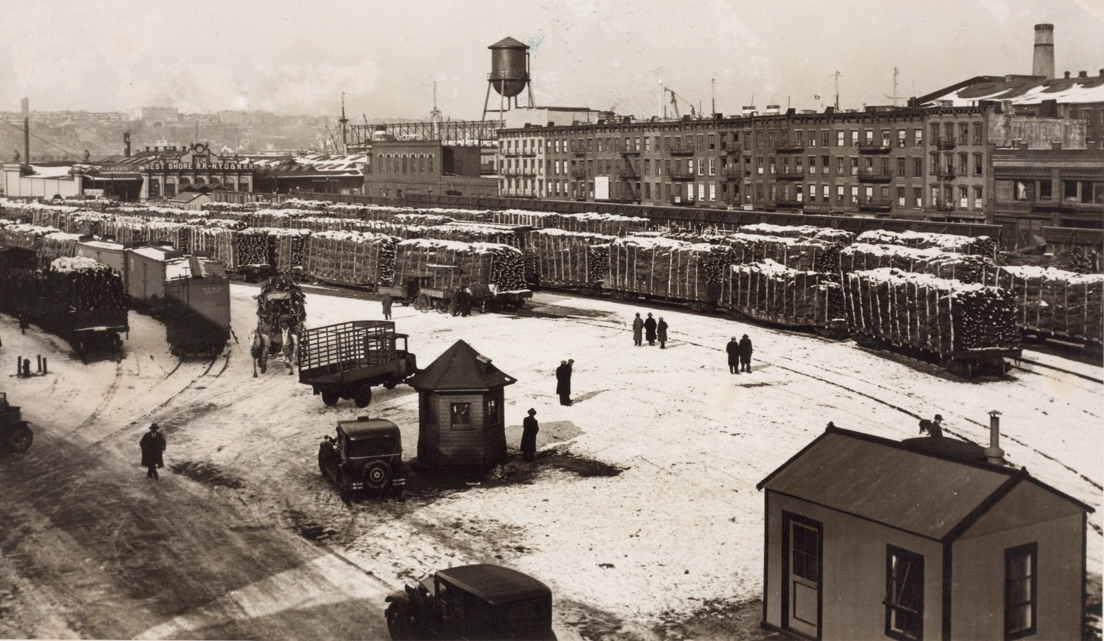
Looking west-northwest at West 41st and West 42nd Street between
Eleventh and Twelfth Avenues -
December 1932
Christmas trees!
New
York Public Library
P.L. Sperr photo
added 19 August 2025
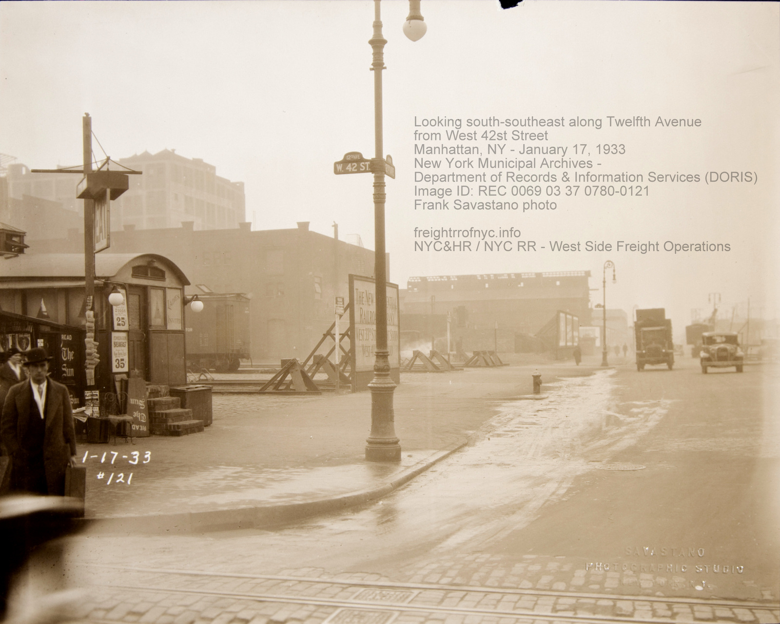
.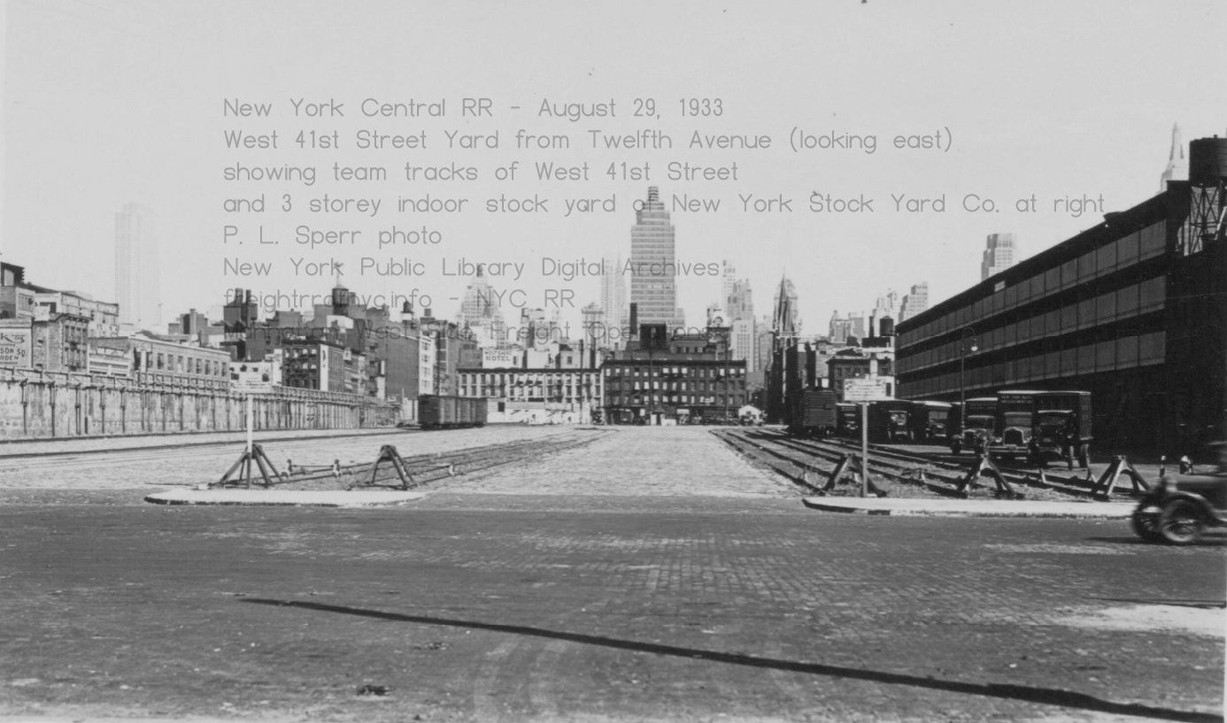
West
41st Street Yard looking east from Twelfth Avenue with new three storey
livestock building of New York Stock Yards Co. - August 29,
1933
P. L. Sperr photo
New York Public Library Digital Archives
added 28 August 2025
.
.
West
41st Street / West 40th Street / West 39th Street - Stock boats, Stock
tunnels, Stock pens and "Abbatoir Row"
Cattle and sheep and goats and pigs and chickens - Oh my!
|
The stock pens were on the north half of the block bounded by West 41st Street and West 40th Street, Eleventh and Twelfth Avenues. There was no "stockyard" per se; that served the stock house. A single spur track (highlighted in yellow) came off the southbound track of the Eleventh Avenue running track. This track turned west onto West 41st Street and was aligned just inside of the southern curb line, and ran along the north wall of the stock house along the sidewalk, and cattle were unloaded directly from livestock car into the building. It is understood this original stock house was two storeys. By the late 1920's, the miscellaneous structures of the New York Consolidated Gas Co. located on the block between West 42nd and West 41st Streets were razed, and the block directly north of the stock building was graded, several pair of team tracks installed connected with switches to the running track along Eleventh Avenue. This team yard driveways were paved with Belgian block. This team yard allowed dressed beef to be loaded into refrigerated cars for transport to the meat packers further south at Gansevoort Market, or shipped directly out of Manhattan. Around this time, the stock house was rebuilt and expanded to three storeys, and following that renovation; in 1940, sub-grade stub tracks was routed from the subgrade-cut built in 1937 (to replace Eleventh Avenue street running.) The tracks entered through the east wall of the stock building approximately 15 feet below the surface of the street. The junction of this stub track with the running tracks in the sub-grade cut could still be seen out of the right side windows of a southbound Amtrak train running the Hudson Line and heading to Penn Station. |
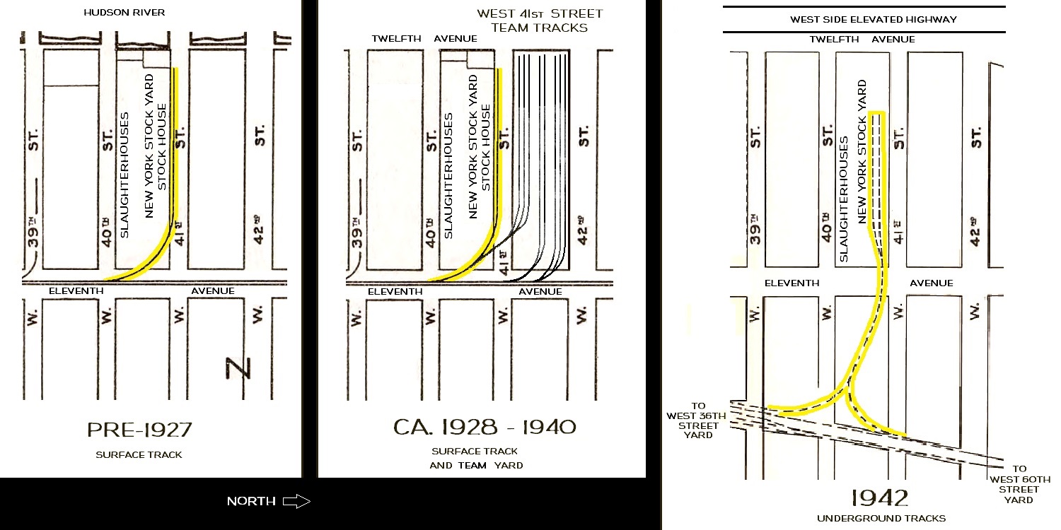 |
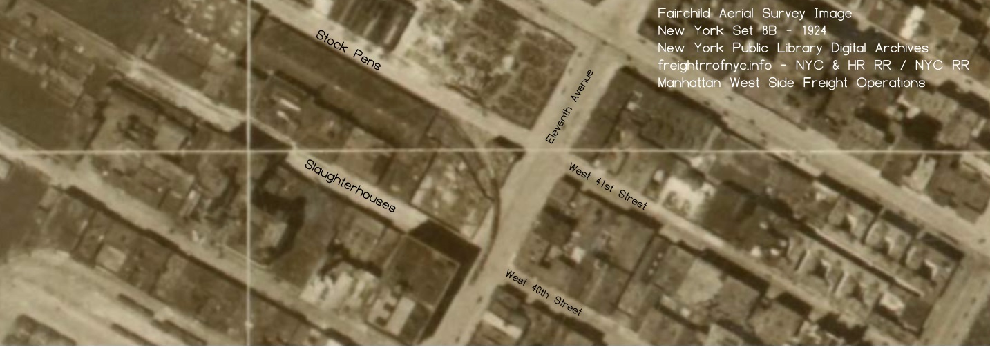
Fairchild
Aerial Survey Images - 1924
New York Public Library Digital Archives
added 19 August 2025
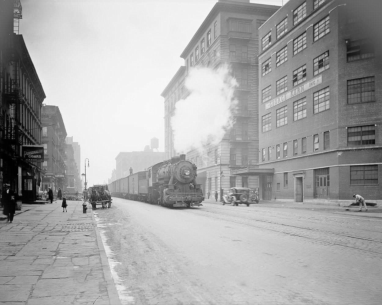
West 41st Street - New York Stock Yards - February 15, 1941 Looking west from Eleventh Avenue. The area to right was the former open stockyard. New York Central System Historical Society - Image ID WR280375 |
West 41st Street - New York Stock Yards - February 15, 1941 Looking southwest at east entrance door. The area to right was the former open stockyard. New York Central System Historical Society - Image ID WR280381 |
|
| . | ||
West 41st Street - New York Stock Yards - February 15, 1941 Looking southeast at east entrance door, eleventh Avenue in background. The remnant of the open stockyard track lead can be seen in the mismatch pavement center left of image. New York Central System Historical Society - Image ID WR280382 |
||
| . | ||
West 41st Street - New York Stock Yards - February 15, 1941 Looking south at west entrance door. (The open stockyard was behind photographer.) New York Central System Historical Society - Image ID WR280378 |
West 41st Street - New York Stock Yards - February 15, 1941 Looking east-southeast along West 41st Street mid-block at west entrance door / driveway. (Former open stockyard to left. Twelfth Avenue behind photographer) New York Central System Historical Society - Image ID WR280379 |
|
| . | ||
West 41st Street - New York Stock Yards - February 15, 1941 Looking east along West 41st Street at southwest corner of building. Former open stockyard to left. Twelfth Avenue behind photographer New York Central System Historical Society - Image ID WR280376 |
||
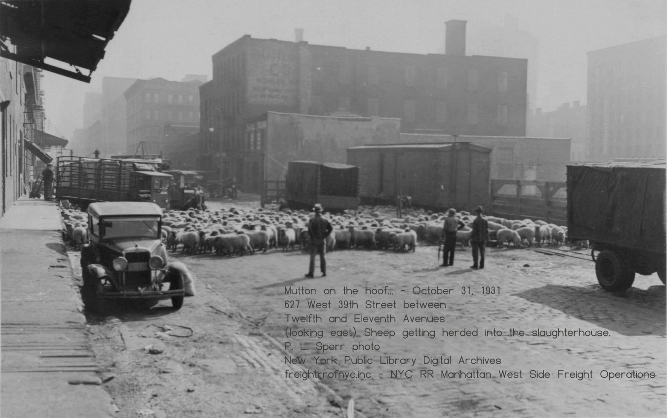
Looking east along West
39th Street from Twelfth Avenue. A flock of sheep being
herded into the slaughterhouse at 627 West 39th Street. - October 31,
1931
"Well Clarice, have the lambs stopped screaming?
P. L. Sperr photo
New York Public Library Digital Archives
added 28 August 2025
.
.
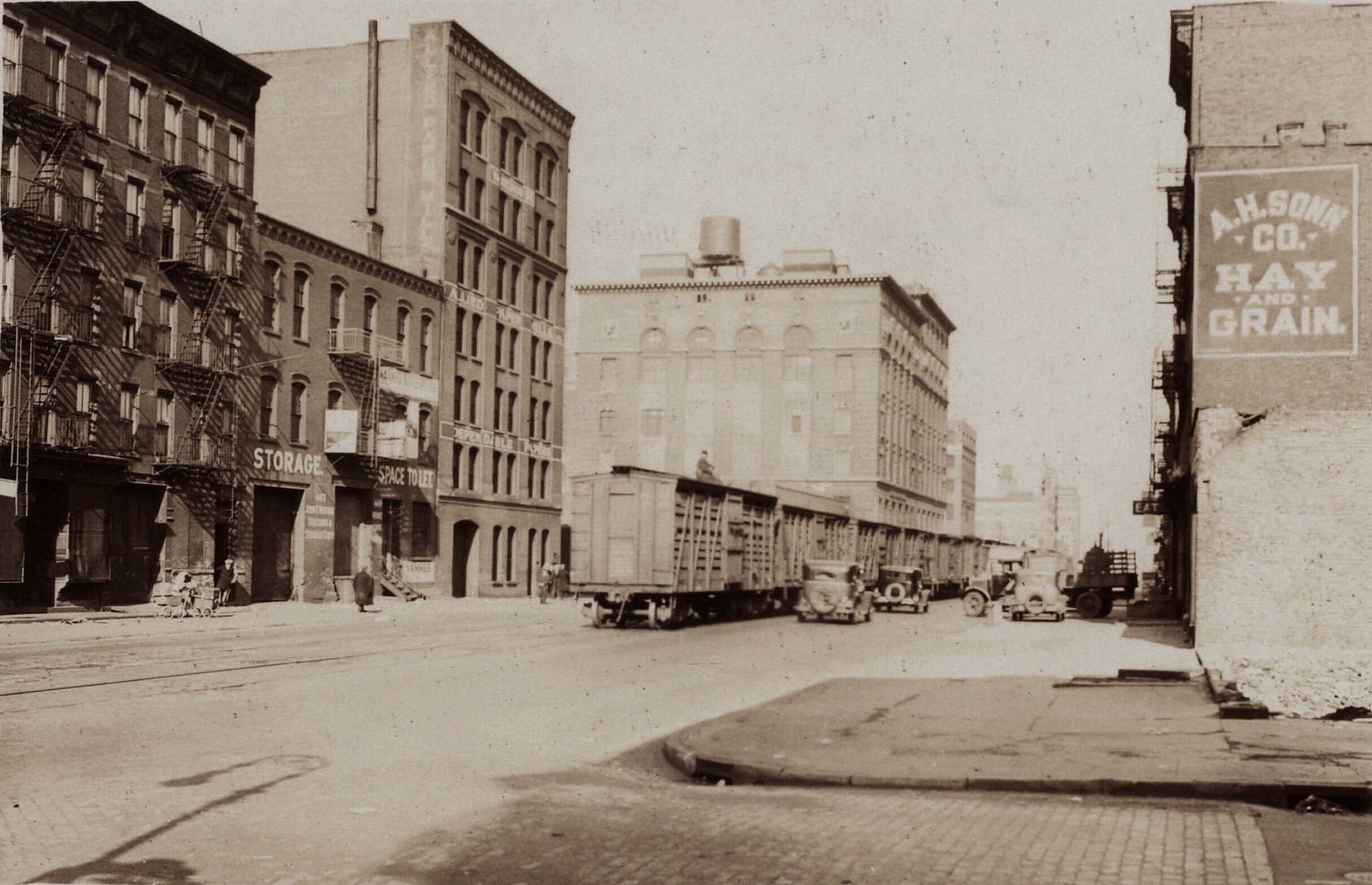
.
.
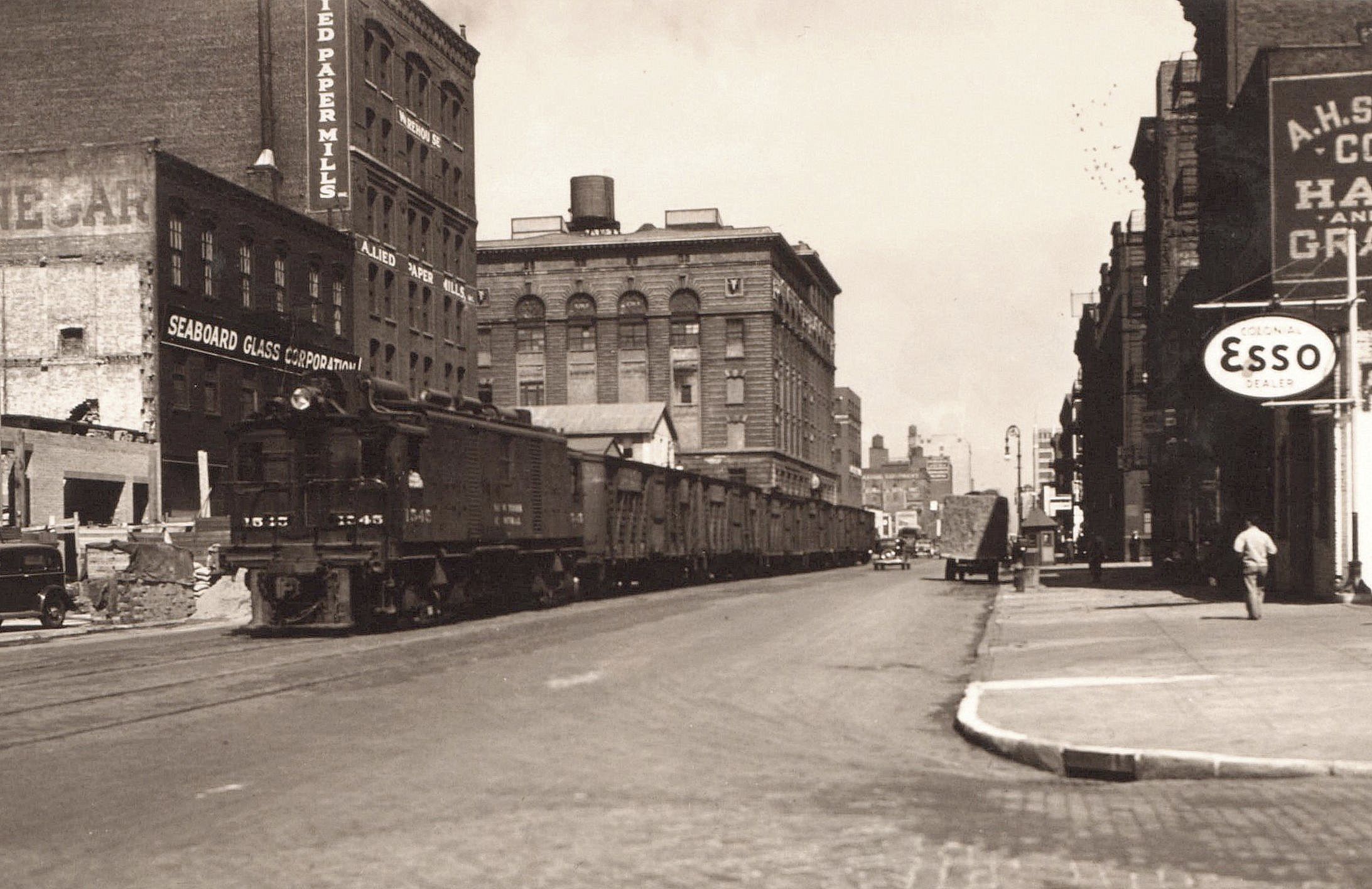
Looking
south at loaded
stock cars on Eleventh Avenue at West 37th Street - March 20, 1935
Heading to Abbatoir Row from the West 30-36th Street Yards.
New York Public Library
P. L. Sperr photo
added 16 August 2025
.
.
Abbatoirs / Slaughterhouses
Located between West 39th, West 40th and West 41st Streets and Eleventh and Twelfth Avenues were the stock pens of the New York Stockyards Company, as well as the adjoining abbatoirs (slaugherhouses). West 39th Street between Eleventh and Twelfth Avenues was known as "Abbatoir Row".
Various types of livestock (cattle, sheep, hogs) arrived by train into the various New Jersey terminals. At the New Jersey terminals, the animals were transferred to stock boats which were nothing more than ferries for livestock, which were also known as cattle boats (even though they carried sheep and pigs as well). Once loaded, these livestock boats were then ferried across the Hudson River by tugboat to the Manhattan piers. Here, the livestock was unloaded and marched across Twelfth Avenue and up the side streets to the respective pens.
As far as can be discerned, only the Pennsylvania and the New York Central Railroads operated stock yards / cattle pens in Manhattan, with the Pennsylvania having a cattle pen at the northwest corner of West 39th Street and Twelfth Avenue; and the New York Central having at least three: one at West 34th Street, one at West 40th Street and another at West 60th Street, and with the New York Central also having poultry yards.
In the P. L. Sperr image below, one of these cattle boats, the "G. W. Lewis"; can be seen moored to the north side of Pier 78 of the Pennsylvania RR, which was part of their West 37th Street Freight Station.

"G.
W. Lewis" cattle boat at Pier 78, Manhattan, NY
New York Public Library
P. L. Sperr photo
added 20 April 2026
.
.
At least one newspaper anecdotal from 1896 relates the cattle broke out of the pens and stampeded at waterfront terminals. Even in normalcy; more and more street traffic became ensnarled due to the animals being herded through the street.
Cattle Tunnels
Due to the growing congestion of vehicular traffic due to movement of livestock through city streets, tunnels are known to have been constructed under West Street leading from the pier heads to the pens. Upon the cessation of slaughtering and meatpacking on the West Side of Manhattan, these tunnels was sealed off and subsequently forgotten. There were two tunnels: one located at West 34th Street and Twelfth Avenue and another at West 38th Street and Twelfth Avenue.
|
Fortunately, there is evidence of both of these
tunnels.
A drawing in 1877 Harpers Weekly for the featurette "The Manhattan Abbatoir" shows the tunnel, highlighted at right: By
the 1890 Sanborn Fire Insurance Map however the location is reflected
as a Hay & Produce Exchange. I
cannot associate any further evidence of the West 34th Street tunnel in
use during
post-1900 railroad operations - whether by image or map; as
there are However in the interest of thoroughness, a "meat market" is reflected on the south side of West 35th Street between Eleventh and Twelfth Avenues in the 1917 New York Central Railroad Track Map. It is understood that it this tunnel that was unearthed during construction of the West 34th Street / Hudson Yards project. The
tunnel located at West
38th Street, was built and used by the Pennsylvania Railroad. We have
proof of its existence
in a map Pennsylvania Railroad West 37th Street Freight Station - Pier 77 & 78
Over the ensuing few decades, livestock boats and the
associated
extra handling of said livestock (unloading from railroad car in
Once in Manhattan, the livestock cars were switched into or
directly adjacent to the pens, which in the case of West 39th through |
|
After slaughtering; the sides of beef, hogs and such; were transported to the Meatpacking District at Gansevoort Street for butchering, packing and shipping, as well as direct wholesale and retail sales.
|
Transporting livestock by rail was effected by the use of "stock cars", and use of these cars was laborious. Cattle cars were single floor level, but hogs and sheep could be loaded into two or even three level cars for increased capacity. Obviously, they needed men to load and unload the livestock. But there was also the Twenty-Eight Hour Law. This law dictated that if livestock are being transported for longer than 28 consecutive hours, they must be offloaded for at least 5 consecutive hours to get feed, water, and rest. This law was originally passed on March 3, 1873. The law was then repealed and reenacted in 1906; and again in 1994 to set humane standards for the transportation of livestock, and the U.S. Department of Agriculture has jurisdiction and enforces this regulation. If weather or any other type of incident caused blockage of the route and as a result delayed the train carrying livestock; special arrangements had to be made. Therefore, this added considerably to transportation costs, as well as time involved. |
|
Meat Packers |
|
|
For already butchered and dressed beef,
veal and pork that was
coming
into the New York Metropolitan area from Midwest processors, these were
shipped in refrigerator cars or
"reefers." These cars were constructed of wood with double walls, and these walls were filled with and insulated by, sawdust. "Refrigeration" was provided by blocks of ice loaded through hatches on the roof at the end of the cars and covered in salt. As the ice melted, it dripped out the bottom. These were, essentially; big oversized iceboxes on wheels. Despite the insulation, for those "reefers" traveling long distances required stopping and inspection at icing platforms at selected locations to be re-iced if necessary. Almost every major railroad yard had icing facilities. Before mechanical ice making plants, natural ice was cut from frozen ponds and lakes during the winter months, and stored in icehouses. The rest of the year, ice was drawn, from the ice house, brought to the icing platform for use. Most of the railroads in the Northeast had them. A rather quick but concise webpage has the details. Naturally, hot summer time transport required more stops for icing, while transport in the cooler months required less. Once mechanical ice making equipment was perfected, natural ice harvesting was no longer necessary. "Company" cars were owned by the meat company, such as Swift, Morrell, Cudahy, et al; and carried their advertising on the sides, which could be very ornate. As such, they were also known as "Billboard Reefers." These were usually only used by the respective company for transport of their own goods. There were also "Leaser" reefer cars, belonging to a pool of cars owned by a leasing company or a railroad, which could be leased to any firm. It should be noted that these cars could also be heated with portable charcoal or alcohol fueled heaters, to keep fresh fruit and potatoes warm during the winter months. |
|
|
|
|
| . | |
|
Finally, in the evolution of perishable transport, we arrive
at
the mechanical refrigerator car. This car was developed by the 1950's. With the advent of the compact mechanical refrigeration units, railcars were were now constructed with built in refrigeration units, and could travel hundreds to thousands of miles with minimal intervention. These are known as the "mechanical reefer." This is the only surviving method of perishable transport in the present day. So in short, the process was this:
|
|
West 36th Street to West 30th Street & Twelfth through Tenth
Avenues - Freighthouses, Transfer Platforms and Yard Complexes
|
It should be noted, that when the properties were first organized and opened for operation, the West 36th and West 30-34th Street Freight Yards were in fact two separate yards operated by two separate railroads, and were physically divided by West 35th Street. The reason for this, was the West 36th Street Yard was originally owned and operated by the New York, West Shore & Buffalo Railroad; which was a competitor to the New York Central & Hudson River. This West 36th Street Station also shared operations with the New York, Ontario & Western Railway, as the NYO&W and the NYWS&B were corporately intermingled. With William Vanderbilt's acquisition of the NYWS&B in 1885, the NYWS&B railroad was renamed the West Shore RR and its property became a subsidiary operation to the New York Central & Hudson River. With this, connecting trackage was installed between the two yards, and despite being listed as two separate yards, it did in actuality became one large yard. In 1914, all of the eleven subsidiary operations were merged with the New York Central & Hudson River RR, to be called "New York Central Lines". In 1935, this name was changed to the "New York Central System". |
|
|
Located
at the foot of West 36th Street and the North (Hudson) River was Pier
76.
This pier would house a pier yard (multiple parallel and open
railroad tracks on a pier deck. Pier yards were not necessary used for
the transfer of freight so much as a storage yard for freight cars. At the time it was originally constructed, the pier yard would be operated by the New York, West Shore & Buffalo Railroad better known as the "West Shore", of which was originally a competitor to the Vanderbilt owned New York Central & Hudson River Railroad operation. While the West Shore would be acquired by Vanderbilt in 1888, it was operated as a wholly owned subsidiary, and the West Shore would not be formally merged into New York Central System name as we came to know it, until 1914. By the dates of the images below, the tracks being discussed are operated by the New York Central. Also ascertained from these images, is that only half the length of the pier remained in use by 1934. In the image facing east, one should take note of the wood cross tie track bumpers, seen just above the head of the fisherman, as well as large timbers stacked across several of the tracks of the outshore end (western end). The inshore end, as can be seen; remained in service and is in use by the railroad. Note the cattle boat "El Paso" is moored to the south side of the pier, and can be also be seen in several other images below and taken a few years earlier. As these two images immediately below were taken on the Wednesday following Memorial Day (observed on Monday, May 28), it appears the outshore end of Pier 76 is being used by the public as a location to fish, "Tell you mother, I'm going down to the railroad pier to catch dinner." Some people appear to just be sitting and relaxing, to contemplate what serenity that was available to the local urban residents; while several children are simply playing. |
|
This pier trackage, while located at the foot of West 36th
Street; was
accessed via a running track that exited the West 32nd Street Yard, and
running
north within the paved thoroughfare of Twelfth Avenue for several
blocks;
before turning west onto the pier. This location of street running is
hardly (if at all) mentioned in the public's continual protests of
railroad street operations along Eleventh and Tenth Avenues. This
trackage is highlighted in yellow in the map above.
Furthermore, it appears that by late 1930's to
1940; this
pier
trackage as well as the lead trackage from the West 32nd Street Yard
was removed, as it is no longer evident in either property atlases or
official railroad siding maps. It is the authors estimation that this
trackage was sacrificed in the agreement with the City of New York with
respect to the West Side Improvement Plan. This is in spite the street
trackage of
those offline terminals of the Baltimore & Ohio, Lehigh Valley,
Erie and Pennsylvania Railroads that remained in service from their
transfer
bridges on the bulkhead to their respective yards east of Twelfth
Avenue.
Another interesting feature, is that the West Shore "West 36th Street Yard" trackage (bounded by Twelfth and Eleventh Avenues, West 37 and West 36th Streets); was only accessible via the street trackage on Twelfth Avenue - it had no outlet / entrance on Eleventh Avenue. This trackage is highlighted in blue in the map above.
The series of images below taken by the Frank Savastano Photo Studio and held by the New York Municipal Archives; are part of the survey set for the West Side / Miller Elevated Highway.
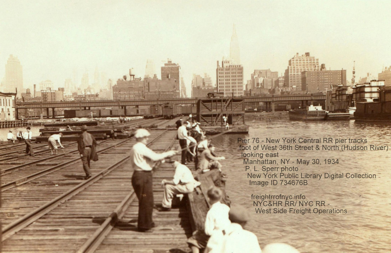
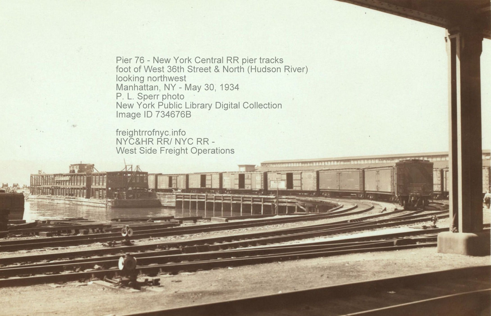
Looking
west along West 36th Street at Twelfth Avenue and North (Hudson) River
- January 22, 1931
The boxcar and the gondolas (some full of manure from cleaning
the cattle boats) are on the bulkhead tracks.
Cattle boat "El Paso" and another unidentified cattle boat
tied
to south side of Pier 76. The piershed of Pier 77 can be seen on right
edge of image
Frank Savastano photo
New York Municipal Archives - Department of Records and Information
Services (DORIS)
Image ID: REC 0069 03 21 0531-004
added 23 June 2026
.
.
Looking
north along Twelfth Avenue between West 36th and West 35th Street
(behind photographer) - March 13, 1931
The boxcar and the gondolas (some full of manure from cleaning
the
cattle boats) are on the bulkhead tracks out of view on left
edge.
Pennsylvania RR West 37th Street Yard in view
center middle
with their triangular stockhouse. Note how their older wooden livestock
chute blocks most of Twelfth Avenue with only a narrow two lane opening.
This was replaced with a telescoping folding chain link fence to better
open up the thoroughfare to multiple lanes of vehicular traffic.
Note the LCL Merchandise
Container on the flatbed truck, to right of car and in between
buildings.
Building to immediate right, H. A. Post, Hay Straw & Grain; is
West 35th Street between Twelfth and Eleventh Avenues.
Frank Savastano photo
New York Municipal Archives - Department of Records and Information
Services (DORIS)
Image ID: REC 0069 03 23 0546-0013
added 23 June 2026
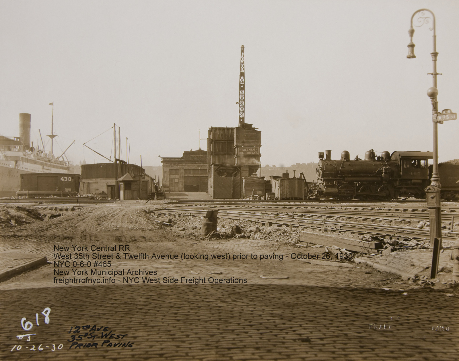
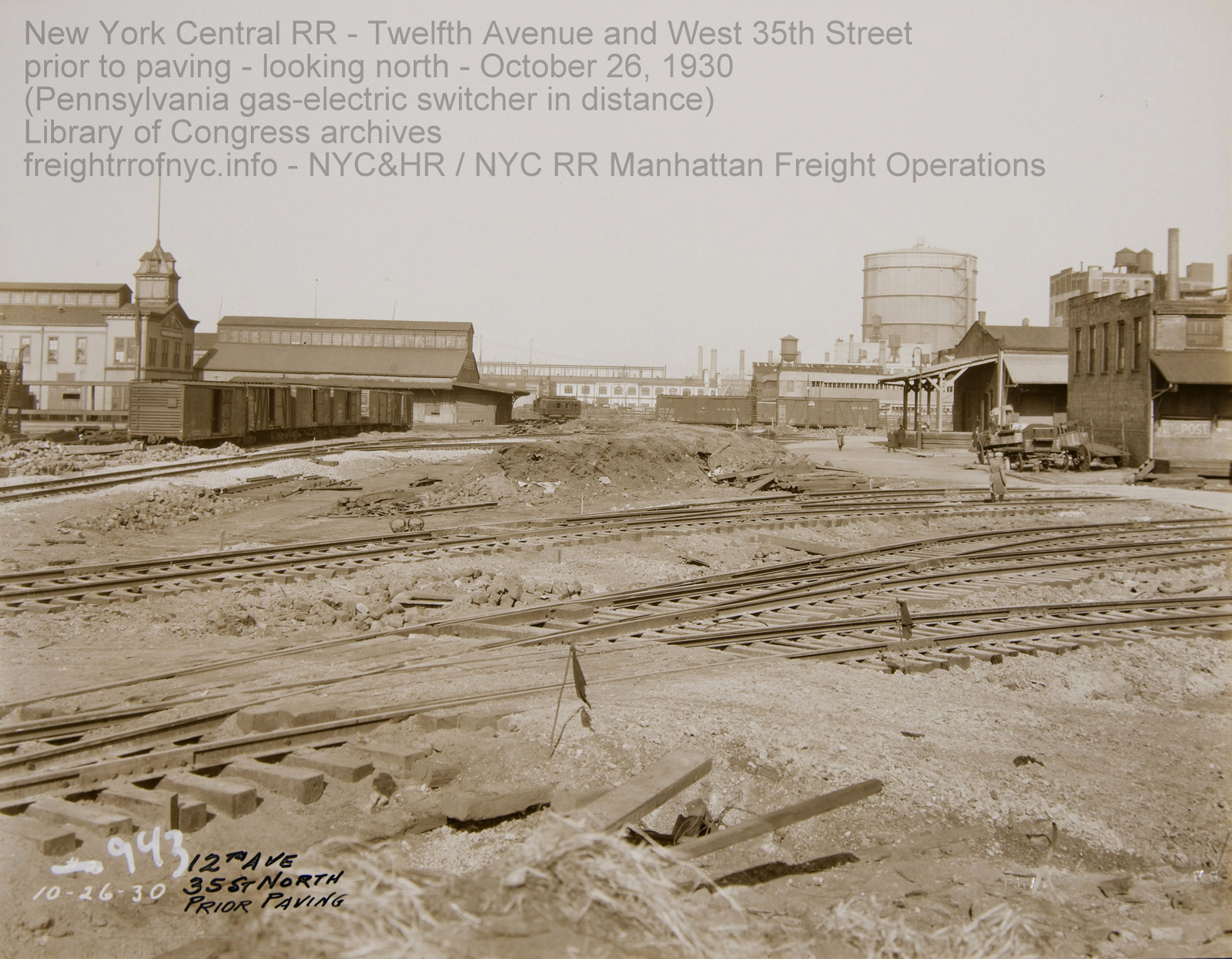
Looking
north along Twelfth Avenue at West 35th Street, prior to paving -
October 26, 1930
This
is now Route 9A, with Javits Center to right, Pier 78 to left.
The cut of boxcars of left side of image are on New York Central
bulkhead tracks, the same tracks in the West 36th Street image with
manure gondolas.
The tracks crossing diagonally in foreground lead to the West 35th
Street Yard (former West Shore RR.)
The tracks to the right of the cut of boxcars on bulkhead track
crossing diagonally behind the pile of dirt lead to the West 36th
Street Yard (also former West Shore RR yard).
Pennsylvania
RR
gas-electric switcher at West 37th Street towards center of image in
background.
Frank
Savastano photo
New
York Municipal Archives - Department of Records and Information
Services (DORIS)
added 15 August 2025
.
.
.
Panning
a little more
to the east, but still looking north along Twelfth Avenue at West 35th
Street, after paving - March 13, 1931
From
left: the cut of boxcars and manure gondolas are on New York
Central
bulkhead tracks, protective wood fence to protect traffic.
Pennsylvania
RR 78 on left. The Boston & Maine boxcar hay tracks. In the far
background, the PRR gas-electric switcher can be seen to left of avenue
paving,
Buildings on right side of image are hay houses and private warehousing
concerns.
Frank
Savastano photo
New
York Municipal Archives - Department of Records and Information
Services (DORIS)
Image ID: 0069 03 23 0546-0012
added 23 June 2026
.
.
Another block to the south, and this is the scene. We are still looking
north along Twelfth Avenue but now at West 34th Street,
after paving - August 30, 1931
From
left: a switchman and a crossing watchman at the "entrance" to the
bulkhead tracks, which only now is apparent they come out of the West
32nd Street Yard and curve across Twelfth Avenue.
The "El Paso" cattle boat can be seen through the gate supports moored
to Pier 76, with Pennsylvania RR's Pier 77 and Pier 78 as a
backdrop.
The wood fence to protect traffic is now seen in its entirety. Note the
space between the bulkhead tracks as well as between the rail is not
paved, therefore could not not used as team tracks.
Frank
Savastano photo
New
York Municipal Archives - Department of Records and Information
Services (DORIS)
Image ID: 0069 03 28 0607-0007
added 23 June 2026
.
.
We shall now moving inland by one block (to the east), and arrive at Eleventh Avenue to continue our virtual tour..
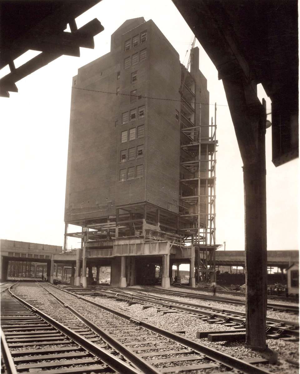
Eleventh
Avenue and West 36th Street looking southwest - July 24, 1937
Construction of Eleventh Avenue Viaduct over yards, as well as
underpinning R. H. Macy warehouse for
subgrade / tunnel to West 60th Street
New
York Public Library Digital Archives
P.
L. Sperr photo
added 19 August 2025
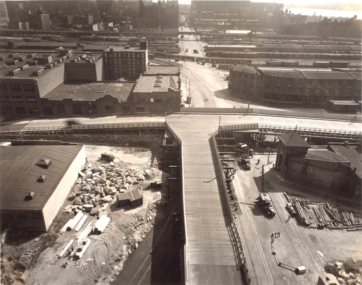
Eleventh
Avenue and West 35th Street looking south at West 34th Street ramps -
June 25, 1937
Construction of Eleventh Avenue Viaduct over yards. Taken from the roof
of the R. H. Macy warehouse.
New
York Public Library Digital Archives
P.
L. Sperr photo
added 19 August 2025
.
.
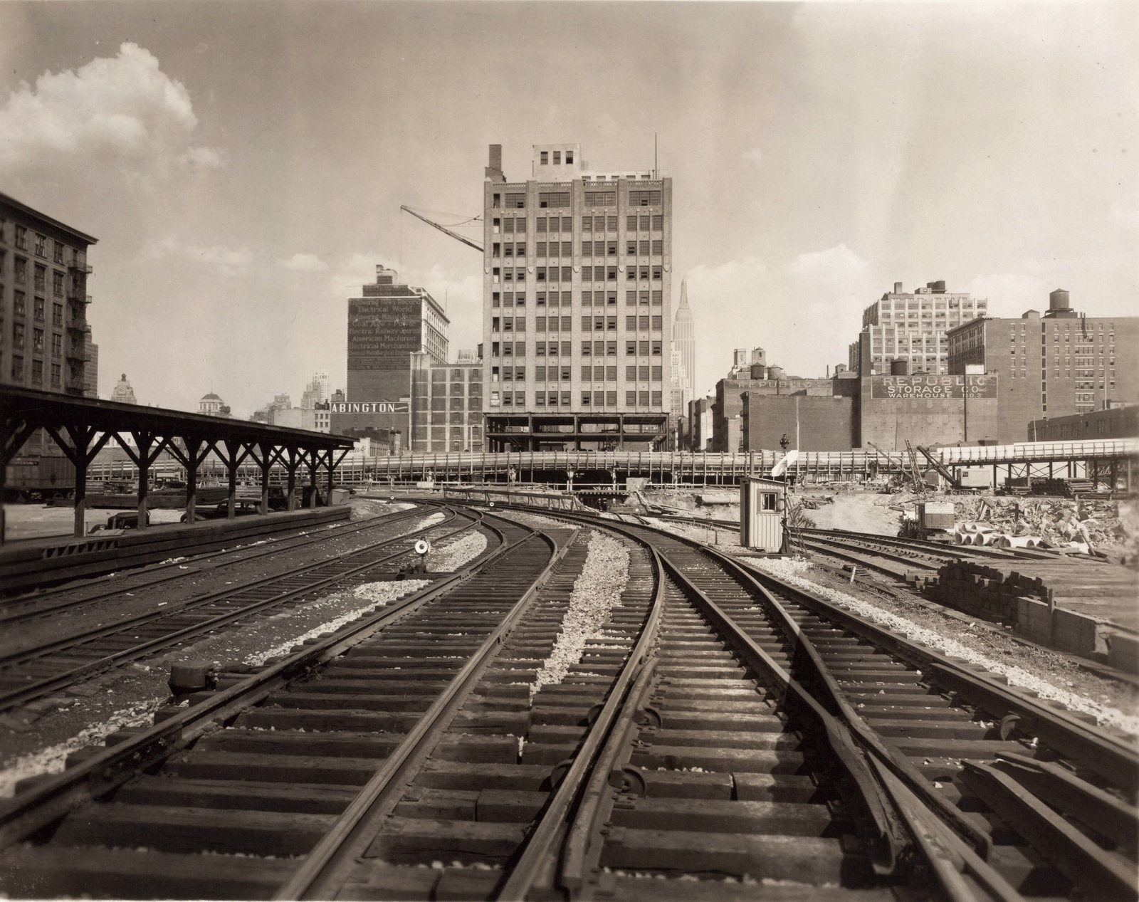
looking
east from
midblock between Twelfth and Eleventh Avenues at West 35th Street
(left) to West 34th Street (right) - June 25, 1937
Construction of Eleventh Avenue Viaduct over yards, as well as
underpinning old R. H.
Macy Warehouse building for
subgrade / tunnel to West 60th Street.
New
York Public Library Digital Archives
P.
L. Sperr photo
added 19 August 2025
.
.
Around 1954, the block bounded by Twelfth and Eleventh Avenues, West 36th Street and West 37th Streets, formerly occupied by Universal Carloading was redeveloped into a direct truck-railcar Less Than Carload "LCL" transfer facility. With tractor-trailers taking up more and more of the market as well as more space than the "straight job" truck (cab and cargo box on single chassis), it was necessary to offer a space and service where these trucks could be backed in, and unloaded directly to or loaded from boxcars.
 West 36th Street - new Less Than Carloard "LCL" freight transfer platform -May 11, 1954 West 36th Street to left, West 37th Street to right, looking west. New York Central System Historical Society Digital Archives - Image ID WR54169 added 01 May 2026 |
||
| . | ||
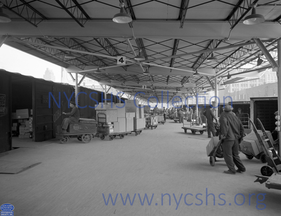 West 36th Street - new Less Than Carloard "LCL" freight transfer platform - May 11,1954 West 36th Street to left, West 37th Street to right, looking east. New York Central System Historical Society Digital Archives - Image ID WR54171 added 01 May 2026 |
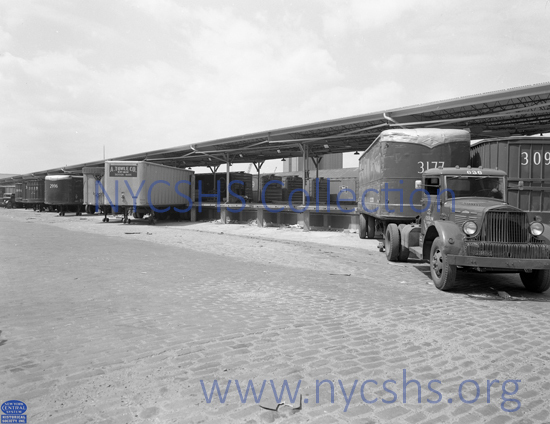 West 36th Street - new Less Than Carloard "LCL" freight transfer platform - May 11,1954 photographer standing on West 36th Street looking northwest. New York Central System Historical Society Digital Archives - Image ID WR54170 added 01 May 2026 |
|
West 34th Street
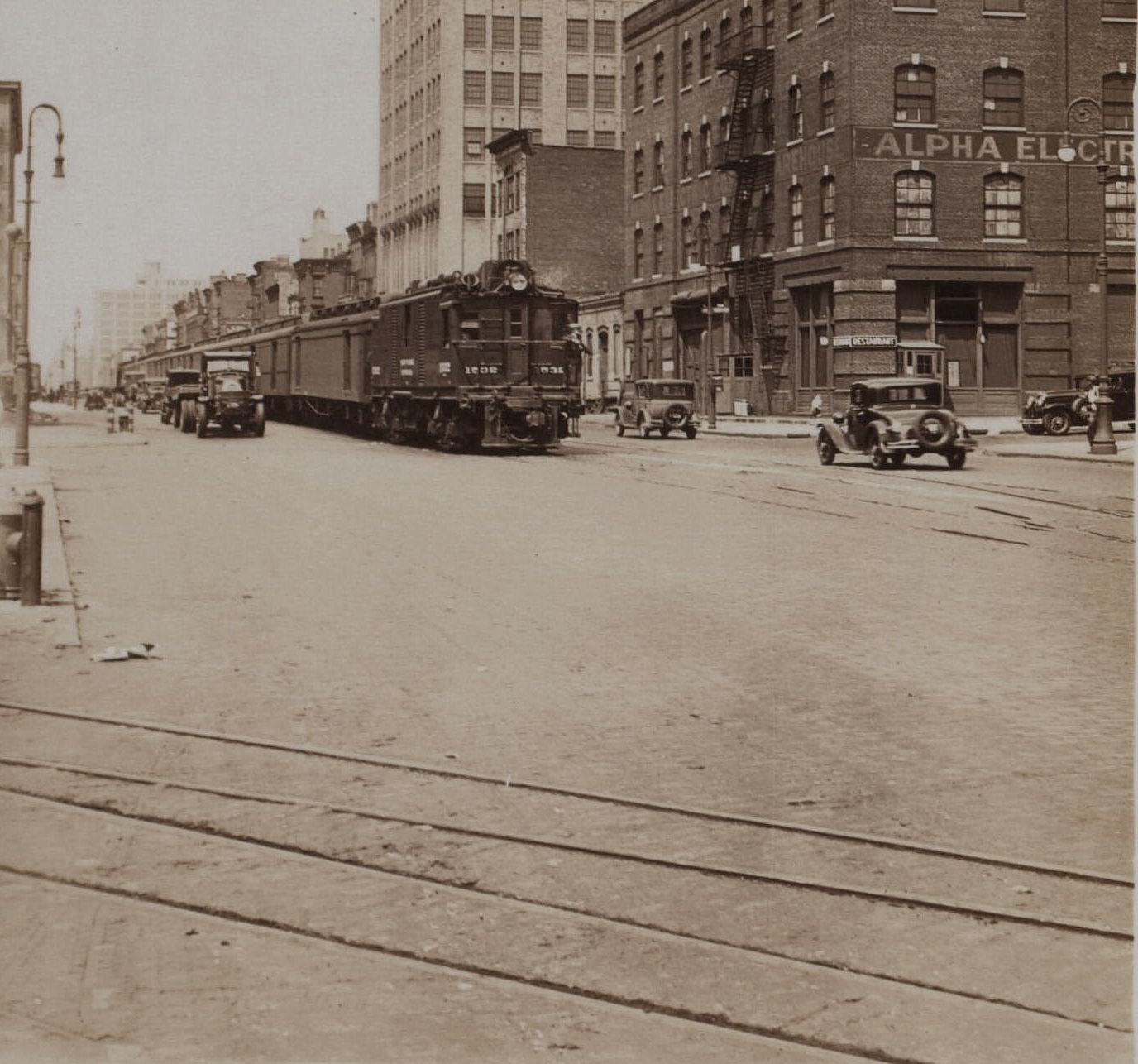
Looking
north along west
side of Eleventh Avenue and West 34th Street - July 9, 1932
NYC
Tri-Power #1532 with mail express baggage.
Tracks in foreground lead to mid-block alley that services Meatpackers
Row along West 34th Street.
New
York Public Library Digital Archives
P.
L. Sperr photo
added 19 August 2025
.
.
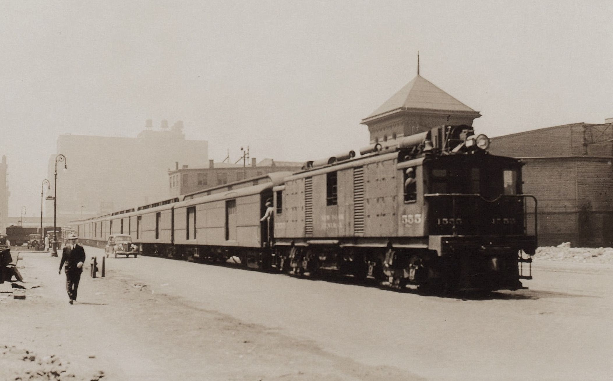
Looking
south along east side of Eleventh Avenue from West 35th Street - no
date
(but High Line trestle is built, so post-1933)
The Meatpackers Row track alley is barely visible on right edge of
image.
NYC
Tri-Power #1555 with railway express cars heading north.
New
York Public Library Digital Archives
P.
L. Sperr photo.
added 19 August 2025
.
.
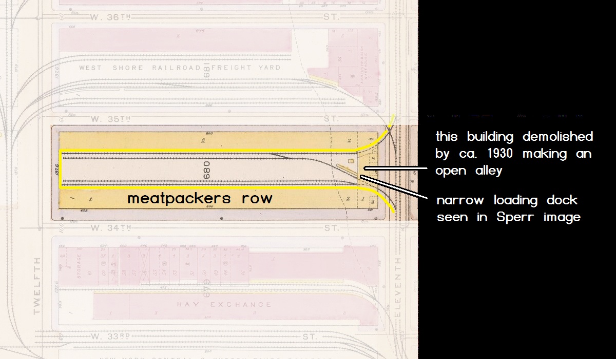
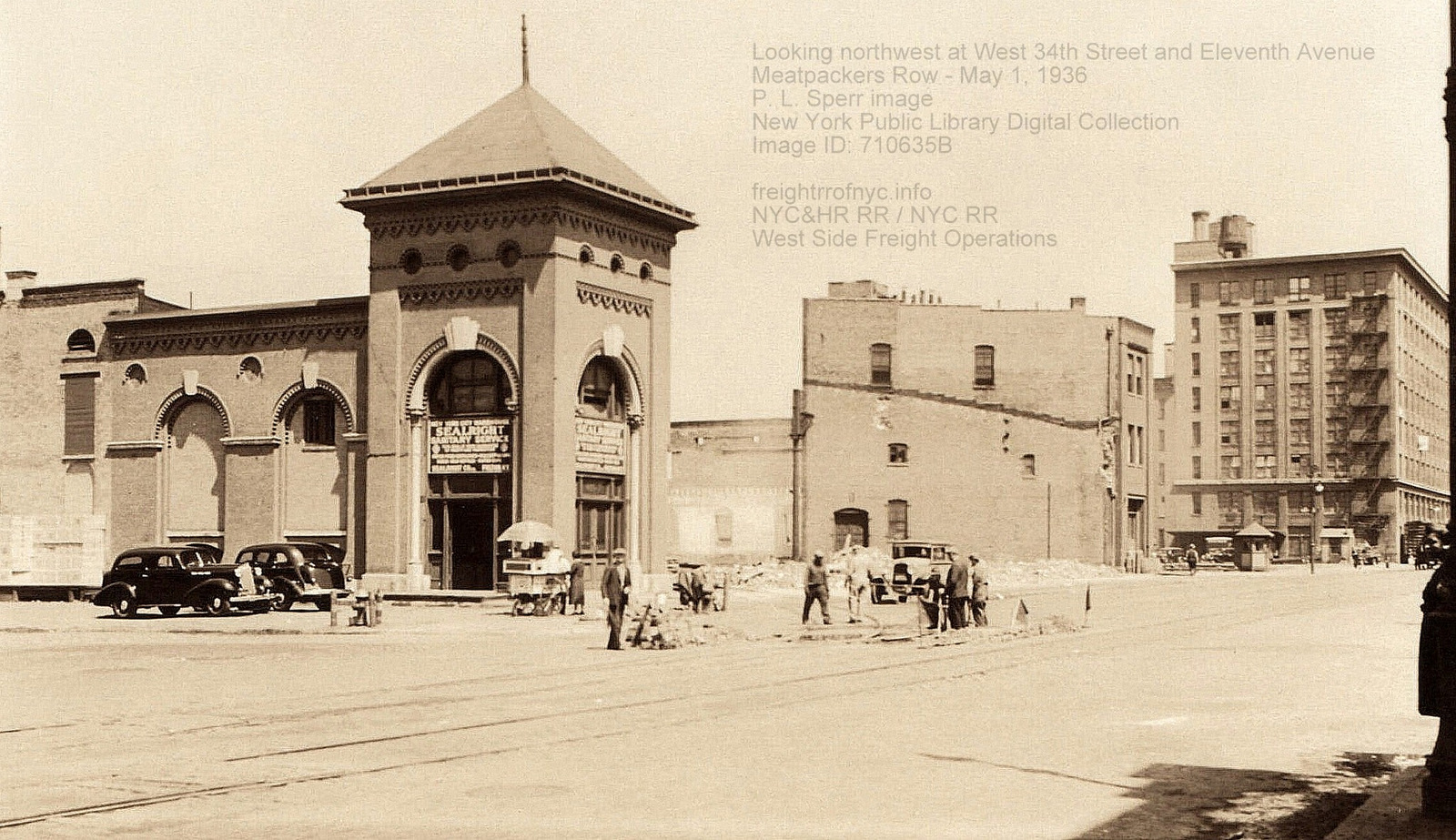
Looking
northwest from east side of Eleventh Avenue
and West 34th Street - May 1, 1936
Trackmen
are performing some work to the turnout to the mid block track alley
between West 35th Street and West 34th Street
that services MeatPackers Row along West 34th Street.
P.
L. Sperr photo
New
York Public Library Digital Archives
Image
ID: 710635B
added 24 June 2026
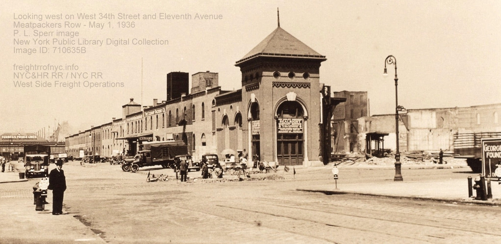
Looking west
from West
34th Street towards Eleventh and Twelfth Avenues - May 1, 1936
Trackmen
are performing work to the turnout to the mid-block track alley (which is more visible
in this image) between West 35th Street
and West 34th Streets
that services MeatPackers Row along West 34th Street: Sealrite Sanitary
Service, Cudahy Packing. Note the small narrow platform to left of
lamppost.
Note the High Line trestle at end of West 34th Street.
P.
L. Sperr photo
New
York Public Library Digital Archives
Image
ID: 710635B
added 24 June 2026
.
.
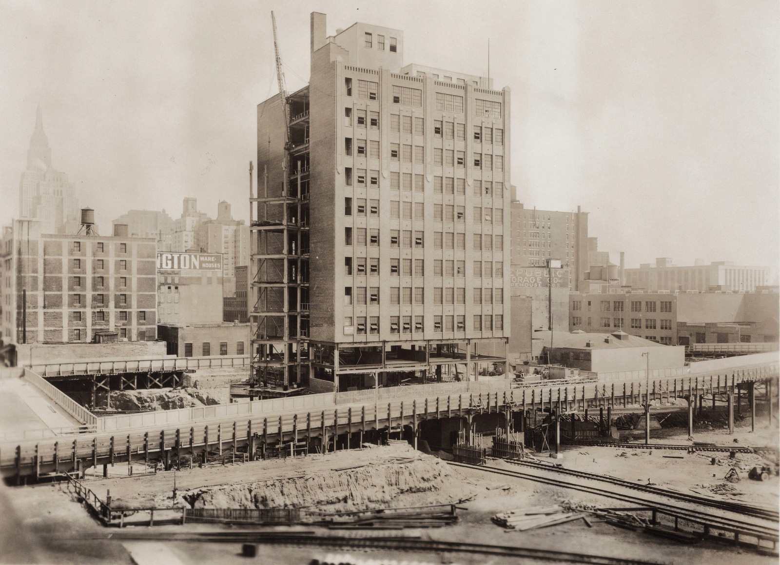
Eleventh Avenue and West 36th Street (left) to West 34th Street (right)
looking east-southeast - July 24, 1937
Construction of Eleventh Avenue Viaduct over yards, as well as
underpinning R. H. Macy
Warehouse building
for subgrade / tunnel to West 60th Street
New
York Public Library Digital Archives
P.
L. Sperr photo
added 19 August 2025
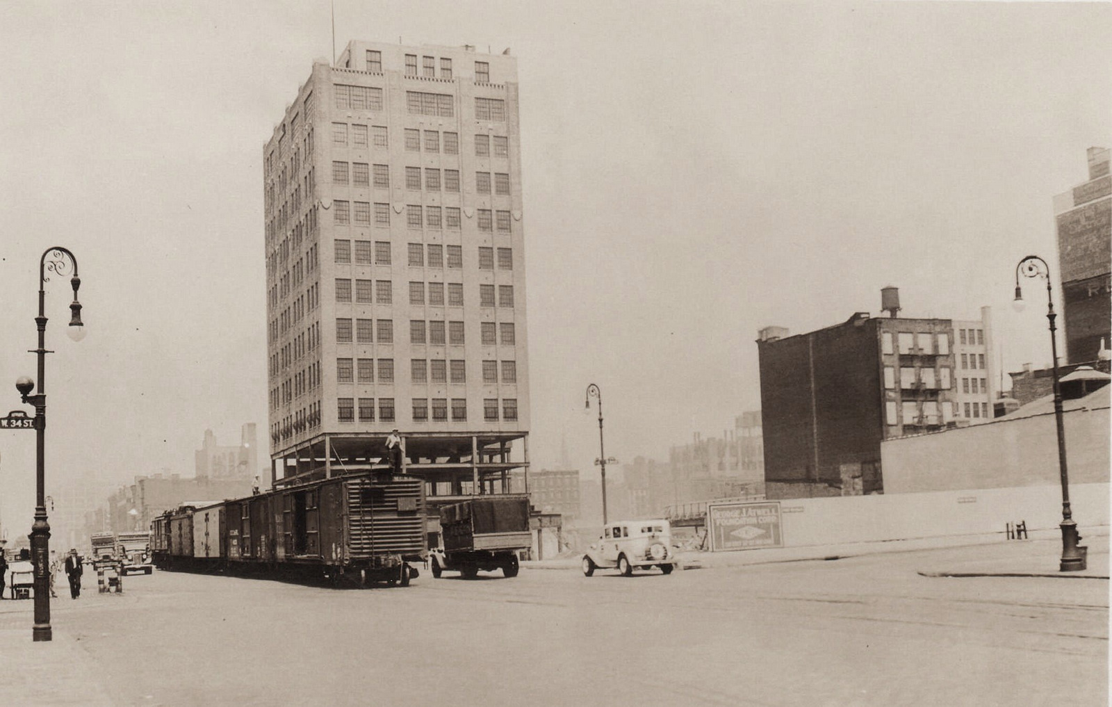
Looking
north east along Eleventh Avenue at West 34th Street - August 12, 1936
Construction of Eleventh Avenue Viaduct over yards, as well as
underpinning for
R. H. Macy Warehouse, for subgrade / tunnel
to West 60th Street.
New
York Public Library Digital Archives
P.
L. Sperr photo
added 19 August 2025
.
.
West 33rd Street - Transfer Bridges
In addition to the three transfer bridges (Bridges 2, 3 and 4) located at West 70th Street; and the solitary transfer bridge located at West 62nd Street (Bridge 1B); the New York Central also had another pair of transfer bridges located between Piers 73 and 72 at the foot of West 33rd Street; of which trackage was connected directly to the West 33rd and West 32nd Freight Yards.
It has not been ascertained as to what date this pair of transfer bridges were constructed. They are listed in the 1916 Department of Commerce - Ports of the United States and are listed in the 1932 Port of New York, V2. Due to the wood enclosed gantry style of construction, it is estimated these transfer bridges were constructed ca. 1885-1890. There is conflicting information regarding dates of use: the accounting in Joint Report with Comprehensive Plan of 1920, these bridges were built, but not in use. P. L. Sperr images of the area show carfloats at the bridges in 1929, and devoid of carfloats in 1930.
These transfer bridges would however be the first transfer bridges located in Manhattan to be shut down by New York Central. I would presume their having been torn down in conjunction with the construction of the West Side Highway. Referencing the 1942 edition of the Army Corps of Engineers Port and Terminal Facilities and Terminals, the transfer bridges are no longer extent; whereas the transfer bridges north at the West 60th-72nd Street Yard would remain in service until 1968.
Furthermore, is should be noted these transfer bridges were not utilized for direct carfloat / freight traffic between New Jersey and New York (as the transfer bridges located at West 60th-West 72nd Yards were). It is understood that the transfer bridges at West 33rd Street were utilized for loading carfloats of freight arriving at West 33rd Street Freight Station and surrounding yards, but however was destined for delivery further south at the Barclay Street pier.
Freight cars for Barclay Street Station, would arrive at West 72nd Street Transfer Bridges or directly by train into the West 60th Street Yard. These cars would be grouped together and forwarded by street railroad operations to the West 30-36th Street Yards. Here, they would resorted if necessary; then they would be loaded upon station carfloats (two tracks with center platform) via the West 33rd Street transfer bridges and towed by tugboat to be placed at the pier at Barclay Street, of which was an "inbound only" freight station. After the freight cars were unloaded, the carfloat with empty cars would be brought back to the West 33rd Street transfer bridges; the empty freight cars brought off the carfloat and into the yards, loaded with freight if applicable and classified as to final destination (Albany, Buffalo, Chicago etc), then brought by train via street running to the West 60th Street Yard, where the cars were to be re-blocked (assembled) into the appropriate northbound / westbound train.
This may appear like duplicitous handing, but this was in fact the way it was done. We have seen the Brooklyn Eastern District Terminal having a similar method of sorting and forwarding: all freight was brought first to Kent Avenue Yard, with freight cars unloaded from the carfloats and brought into the yard, then those freight cars destined for the Brooklyn Navy Yard or Pidgeon Street, were blocked together then reloaded upon a carfloat with either all Navy Yard or all Pidgeon Street freight traffic. There was no direct traffic from other railroad terminals or locations to Navy Yard or Pidgeon Street - all freight had to go through Kent Avenue first.
As such, it was the same for carfloat traffic out of these West 33rd Street transfer bridges.
![]()
Looking
east from Hudson River at
West Side, Manhattan, NY - 1929
From left to right: Pier 74 with Lehigh Valley covered
barge, Pier 73, West 33rd Street Transfer Bridges, Pier 72
P. L. Sperr photo
NYPL Digital Collection Image ID 734673F
added 05
April 2024
.
![]()
Looking
west at Hudson River at
West Side, Manhattan, NY - December 20, 1930
West 33rd Street Transfer Bridges with Pier 73 to and Pier
74 to right.
P.L. Sperr photo
NYPL Digital Collection ID 712072F
cropped and annotated by author
added
28 April 2026
.
.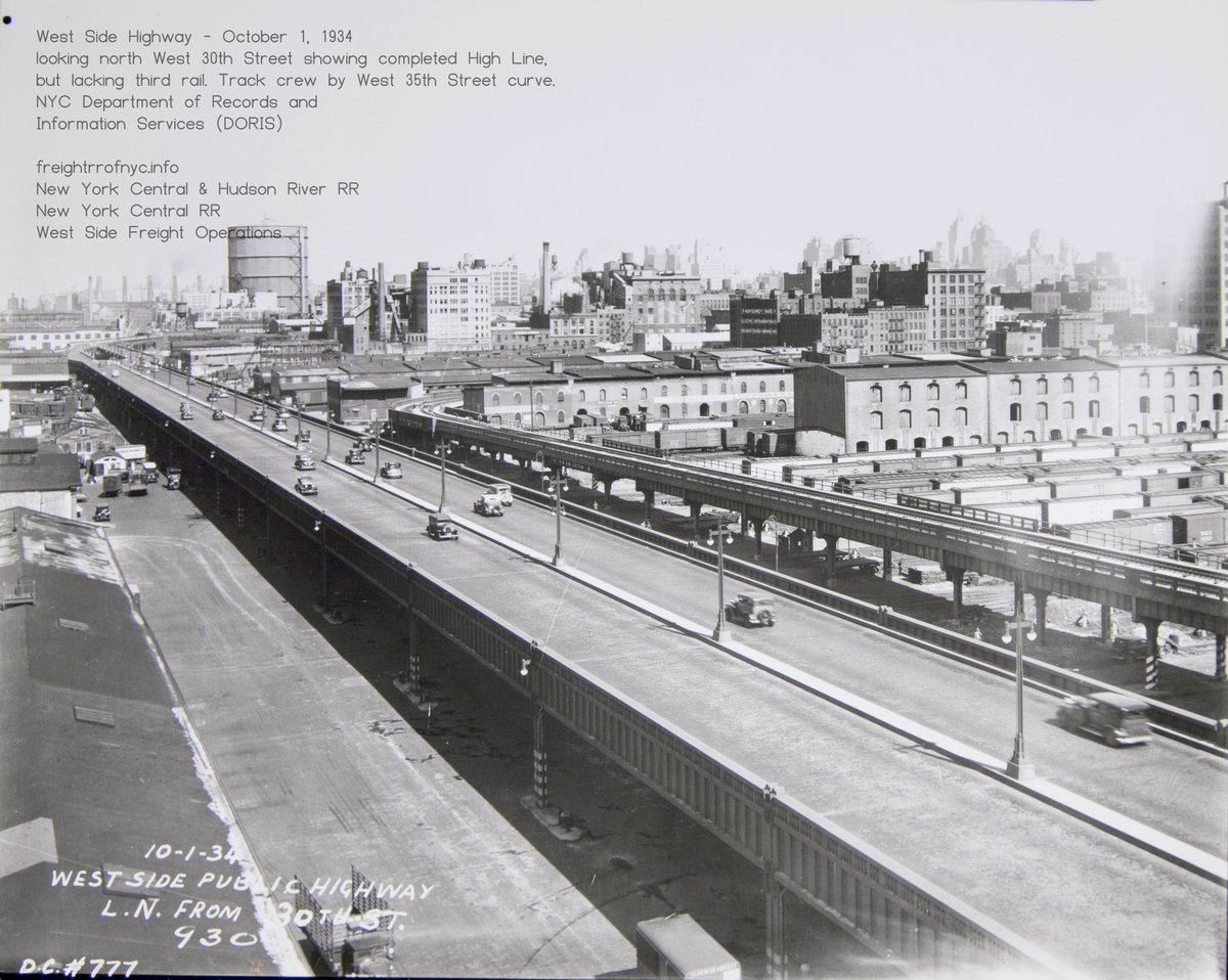
West
36th - 32nd Street Yards & Freight Houses - October 1, 1934
Looking north from West 30th Street. High Line construction is
completed, but third rail has not been installed yet, and most of the
original lofts are still standing.
New
York City Department of Records and Information Services (DORIS) - New
York City Municipal Archives
added 14 October 2025
.
.
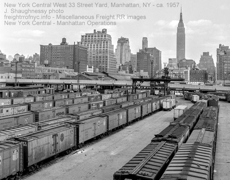
Looking east at West
33rd - 31st
Street Yards from High Line at Twelfth Avenue & West
32th Street - 1957
Rows of ice cooled refrigerator cars on team tracks.
Looking east at Eleventh Avenue
Viaduct and Empire State Building
Jim Shaughnessy photo
added 05
April 2024
.
.
West 33rd Street & Eleventh Avenue "West Side Terminal" Freight Depot - American Express
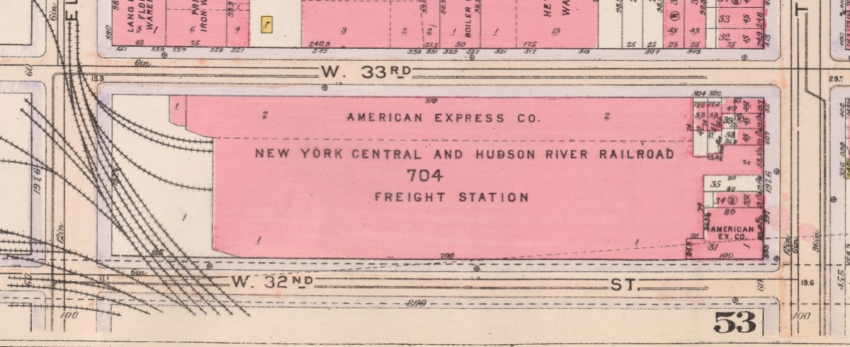 .
.
.
.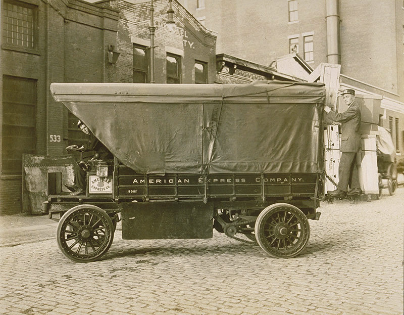
1911 G. W.
Bromley Property Atlas
This facility was constructed sometime between 1902 and 1910. The freight station part of the structure was constructed similar to pier station, that it had an open space frame design with a clerestory, which allowed three tracks to run its length with a center loading platform. As can be seen by the images below, even automobiles could be shipped from this Depot.
The building immediately to its north, was American Express
Company. From what I have been able to discern, is this American
Express was connected with the railroad as sort of an express freight
expediter.
American
Express began as an express mail and freight-forwarding company.
Founded in 1850 by Henry Wells, William G. Fargo, and John Warren
Butterfield, it transported valuables including gold, currency, and
packages across the United States. The company exited the delivery
business in 1918.

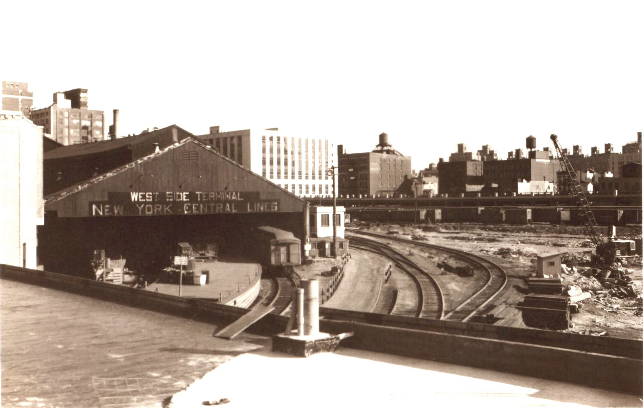
 Interior of West 33rd Street West Side Freight Depot - March 10, 1931 Facing east towards Tenth Avenue New York Central System Historical Society - Image ID WR160176 added 26 May 2026 |
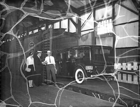 Interior of West 33rd Street West Side Freight Depot - March 10, 1931 Facing southeast towards Tenth Avenue and West 32nd Street New York Central System Historical Society - Image ID WR160177 added 26 May 2026 |
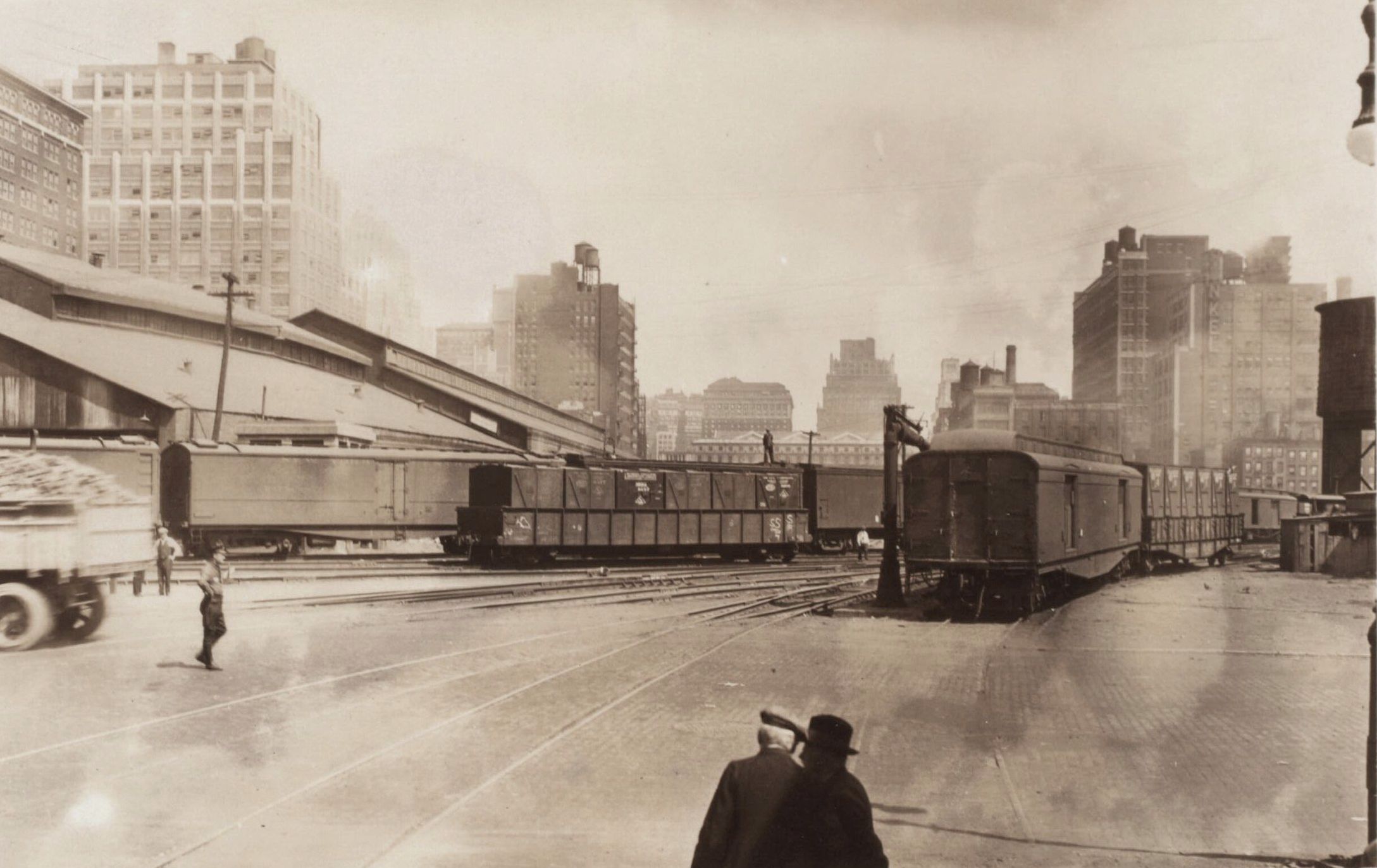
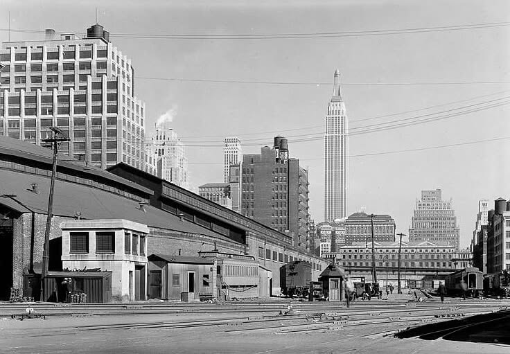
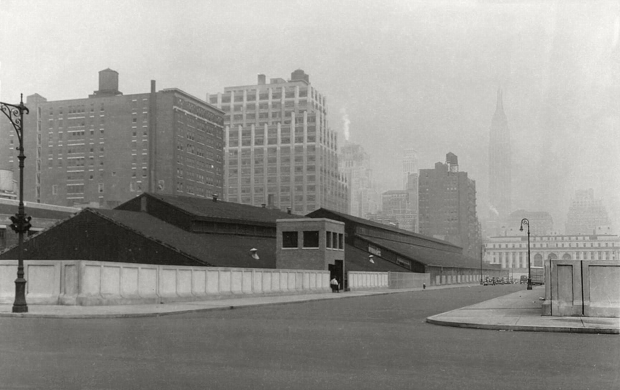
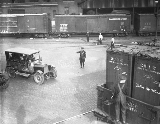
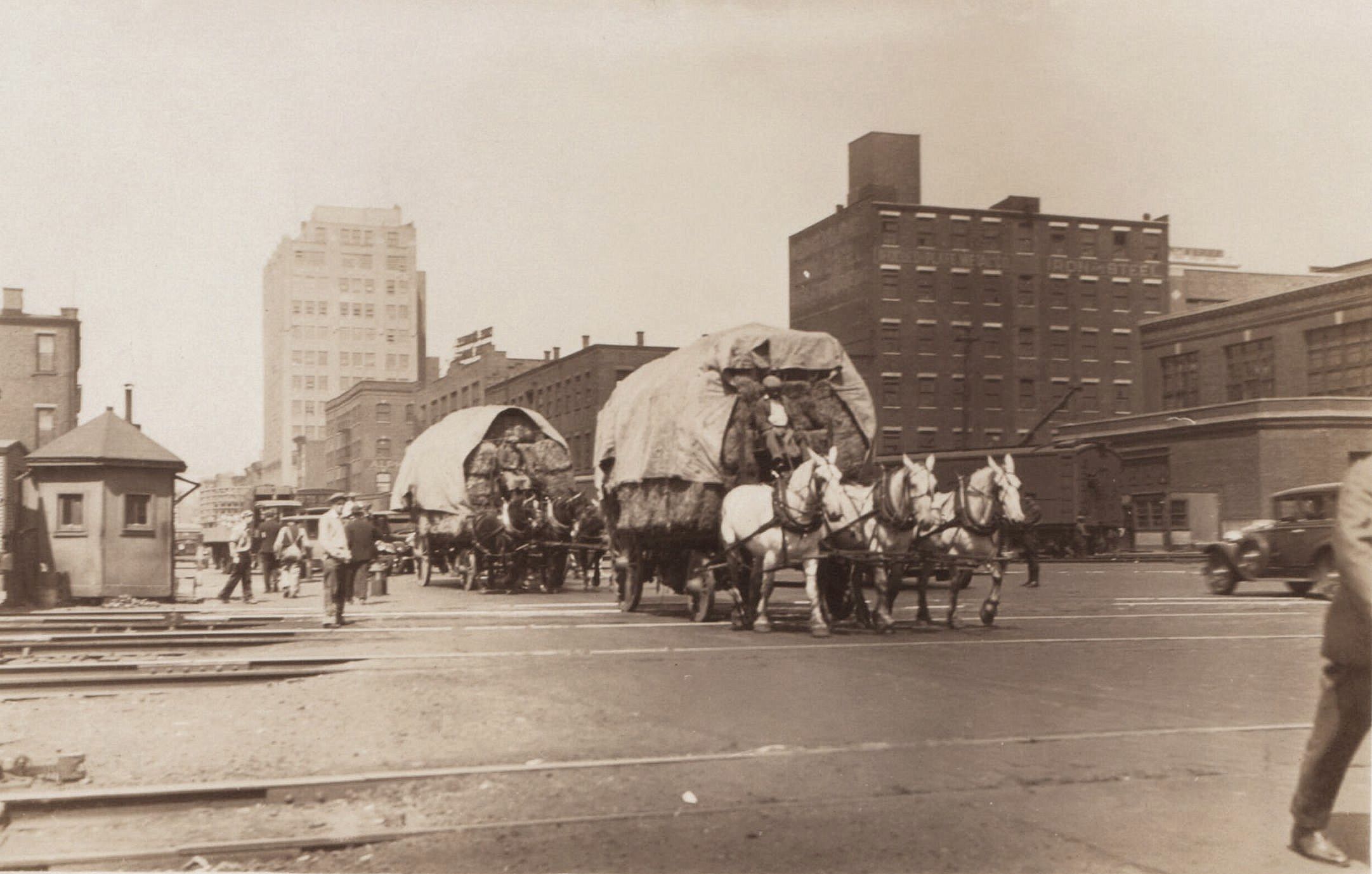
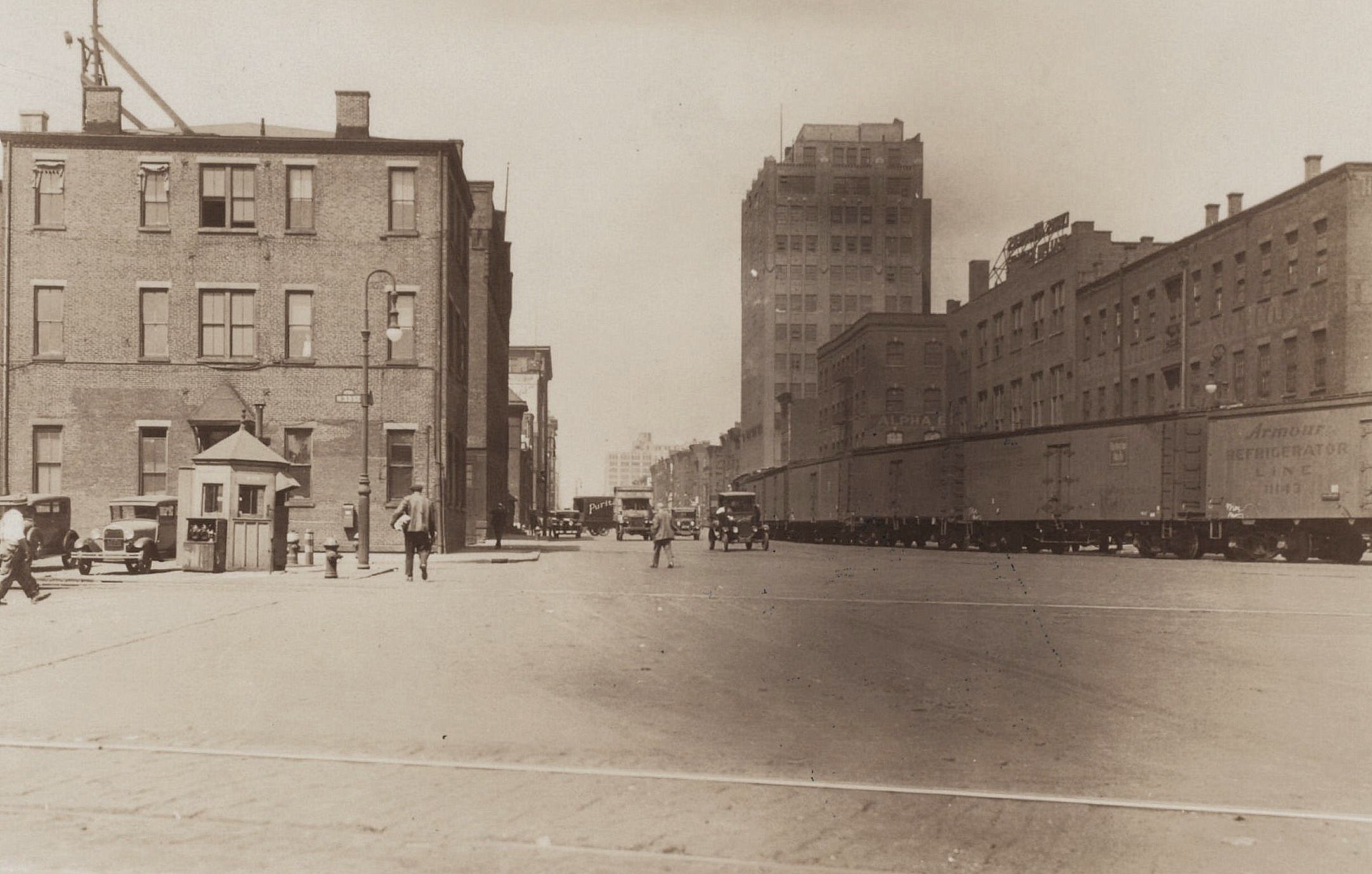
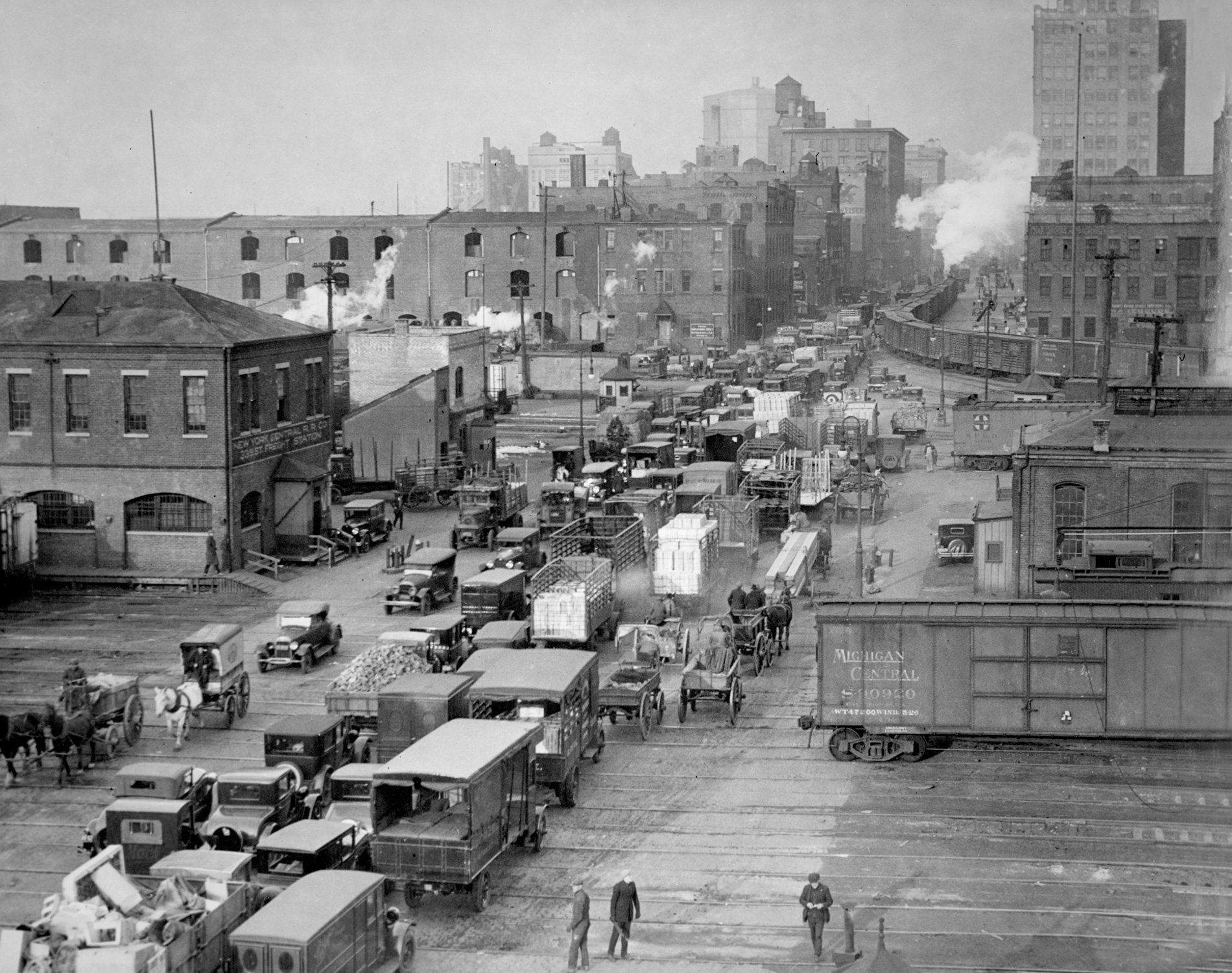
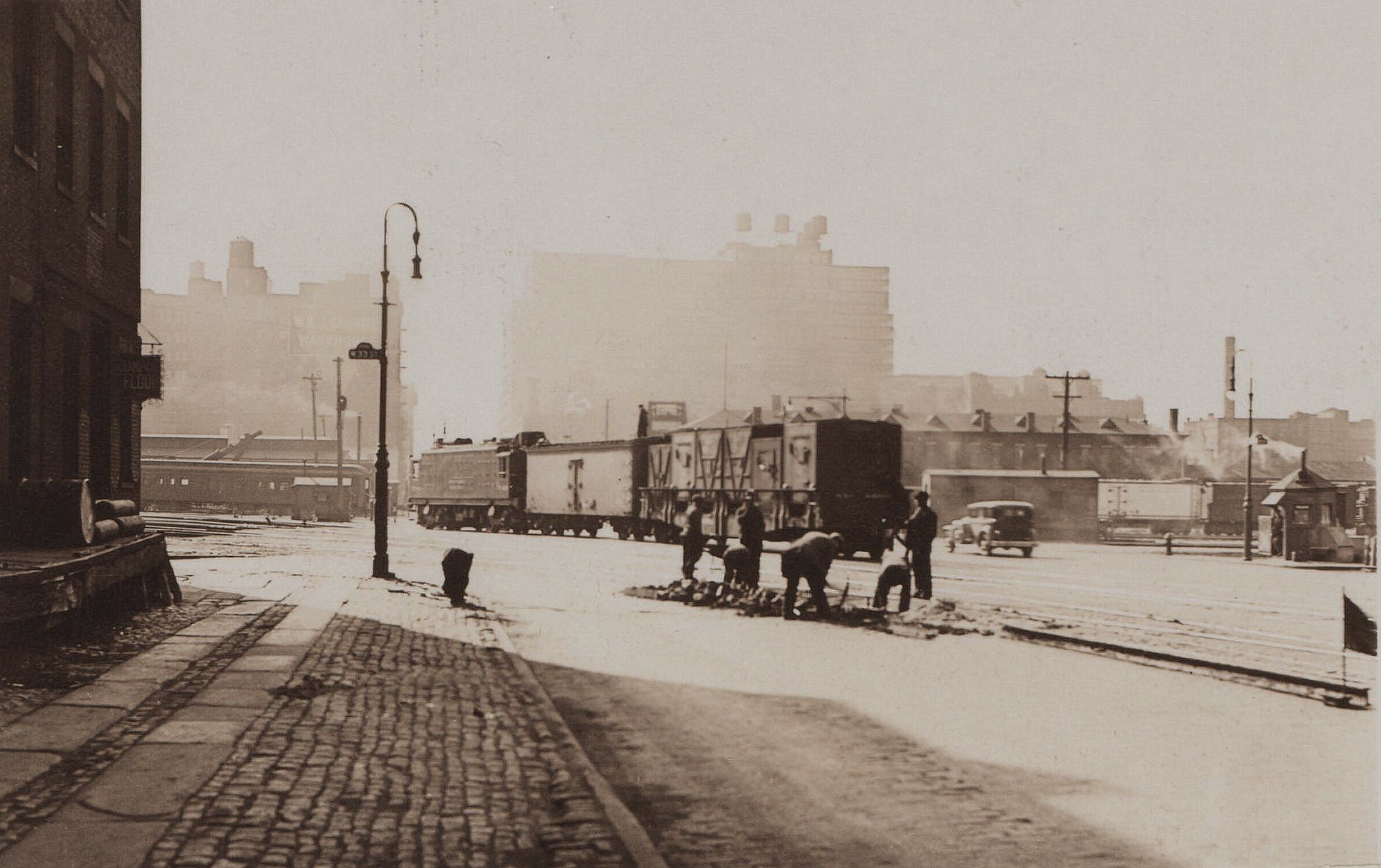
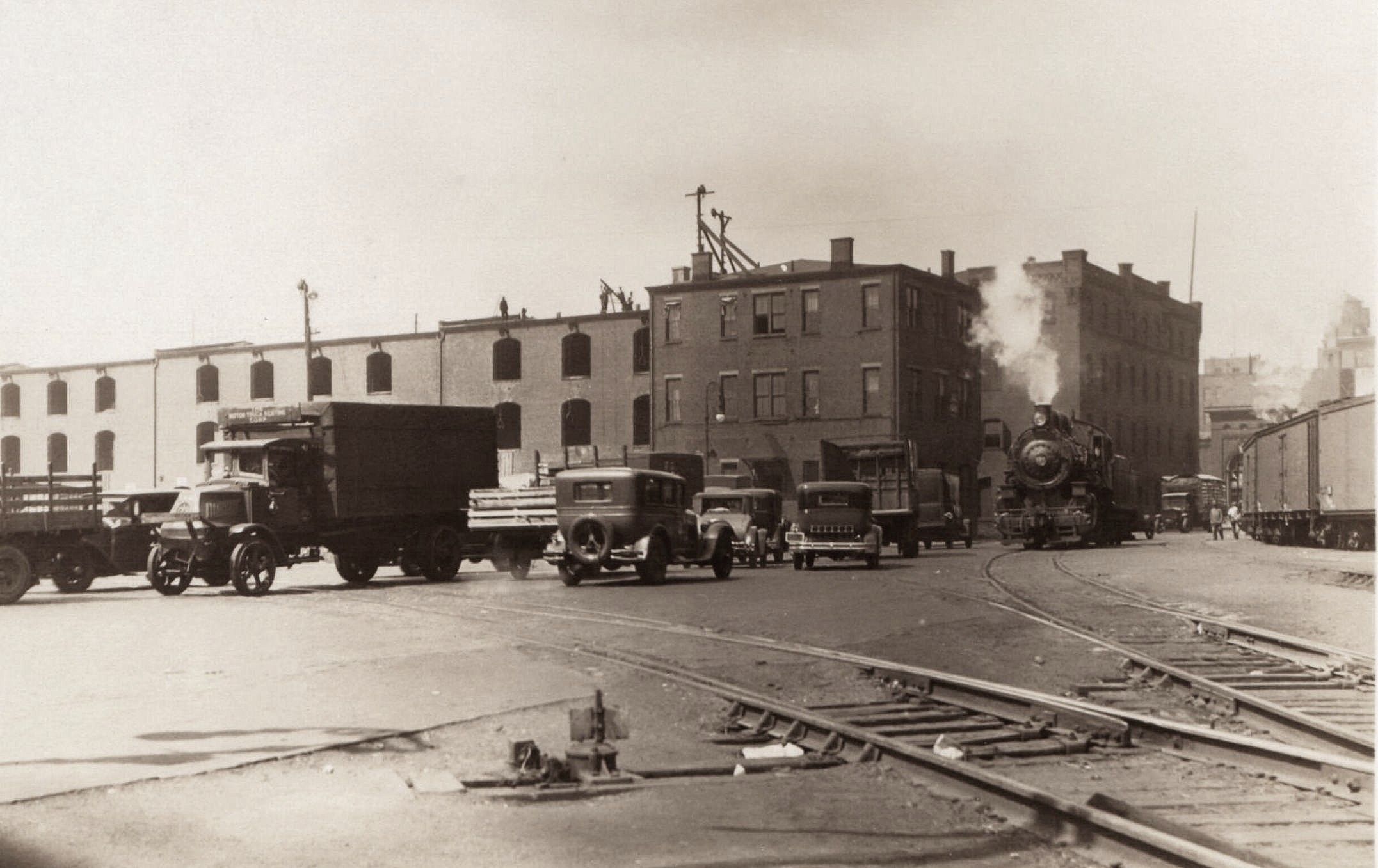
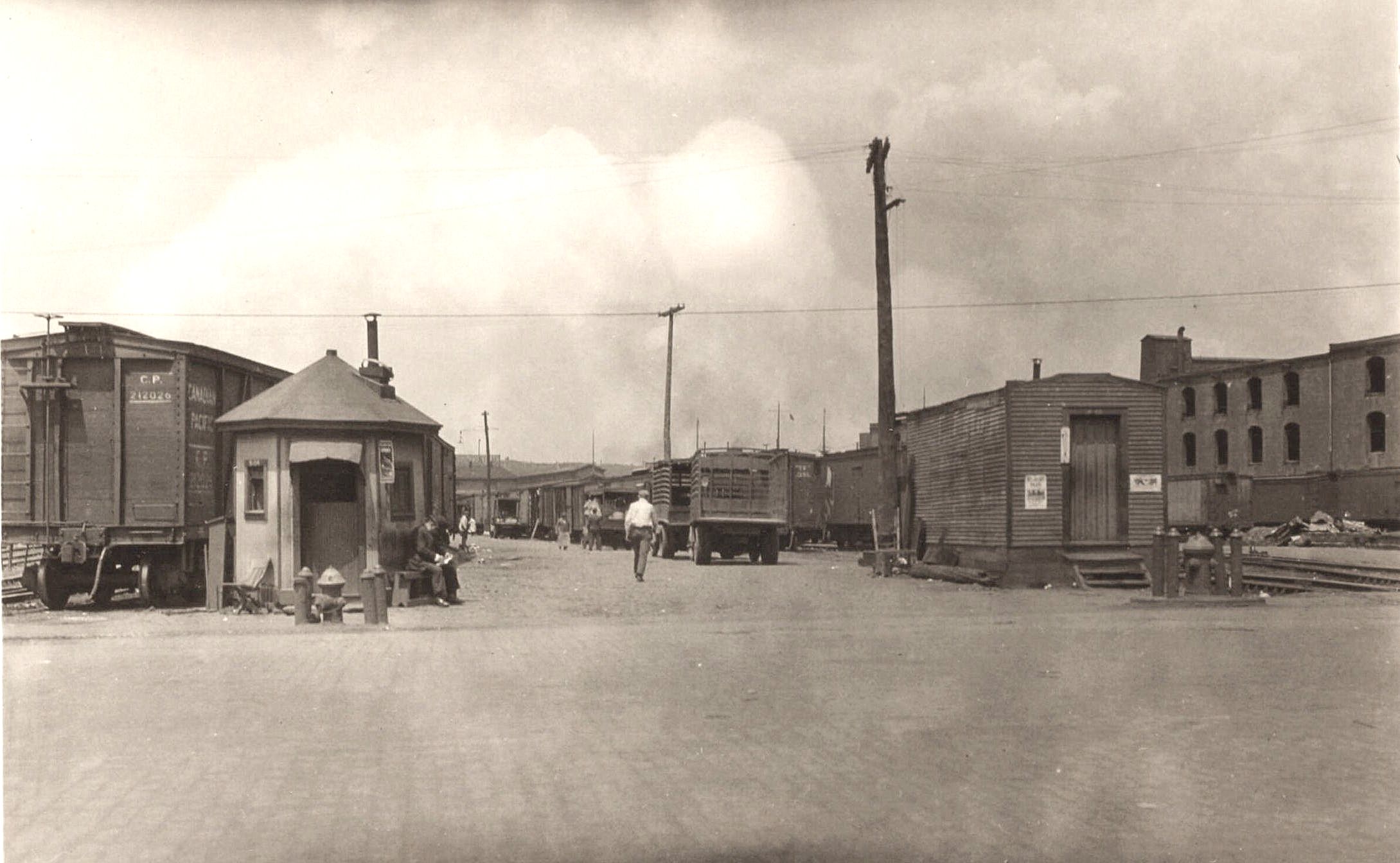
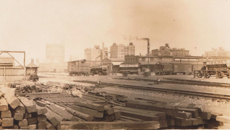
West 32th Street - unidentified
Tri-Power [DES-3]
entering yard from
Eleventh Avenue.
Looking west-northwest at West 32th Street,
Manhattan, NY - March 17, 1929
P. L. Sperr
photo
NYPL
Digital Archives
added 05
April 2024
.
.
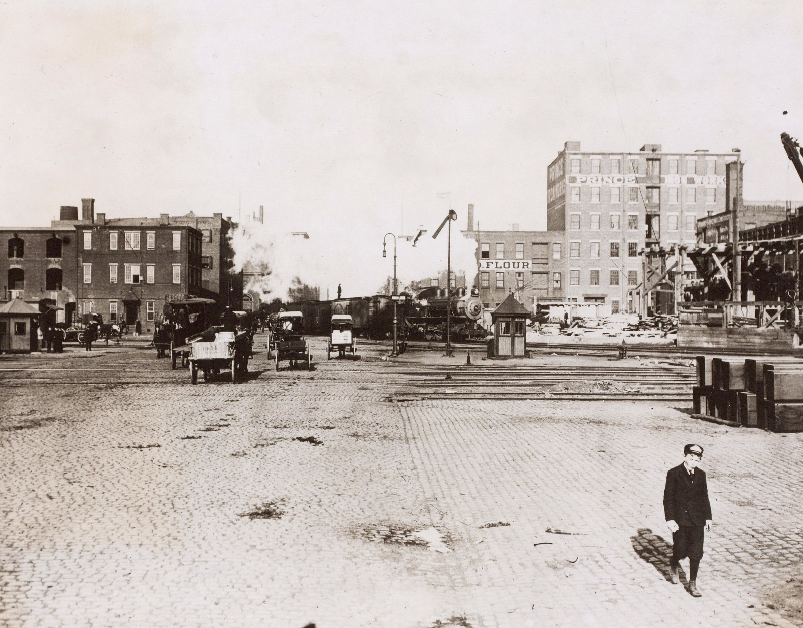
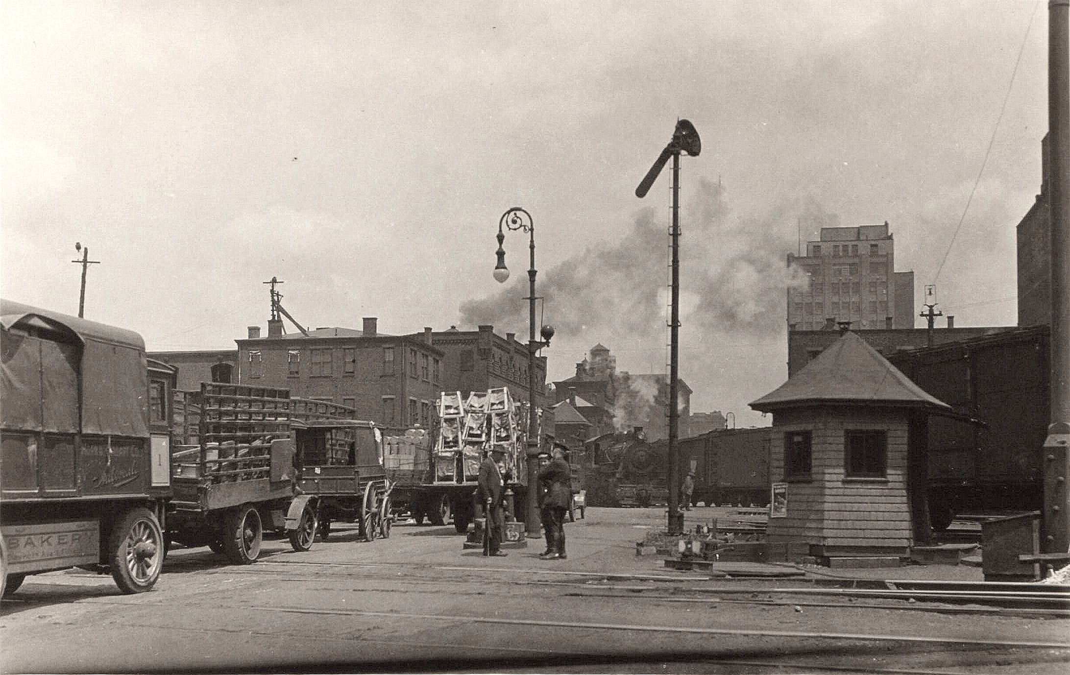
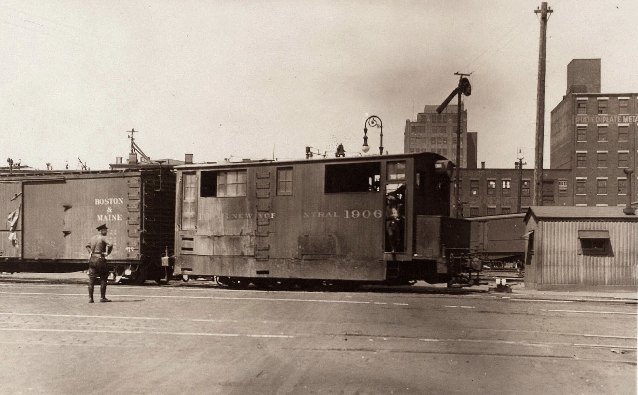
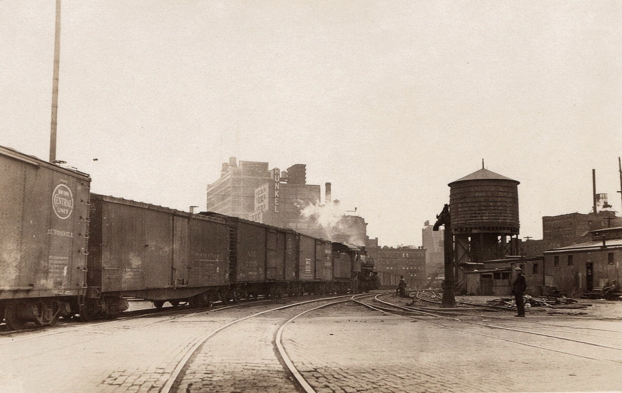
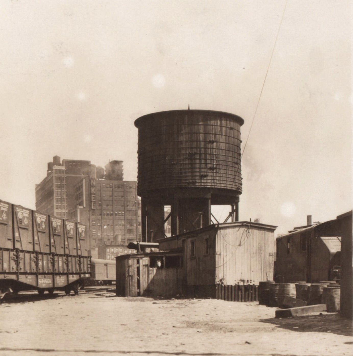
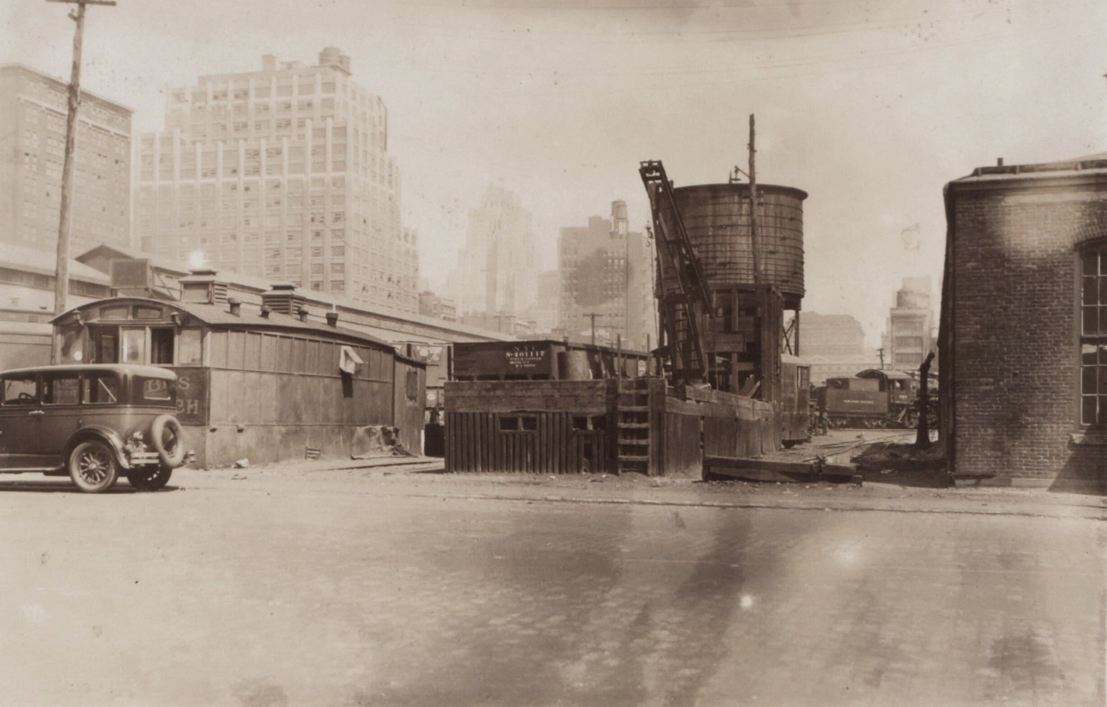
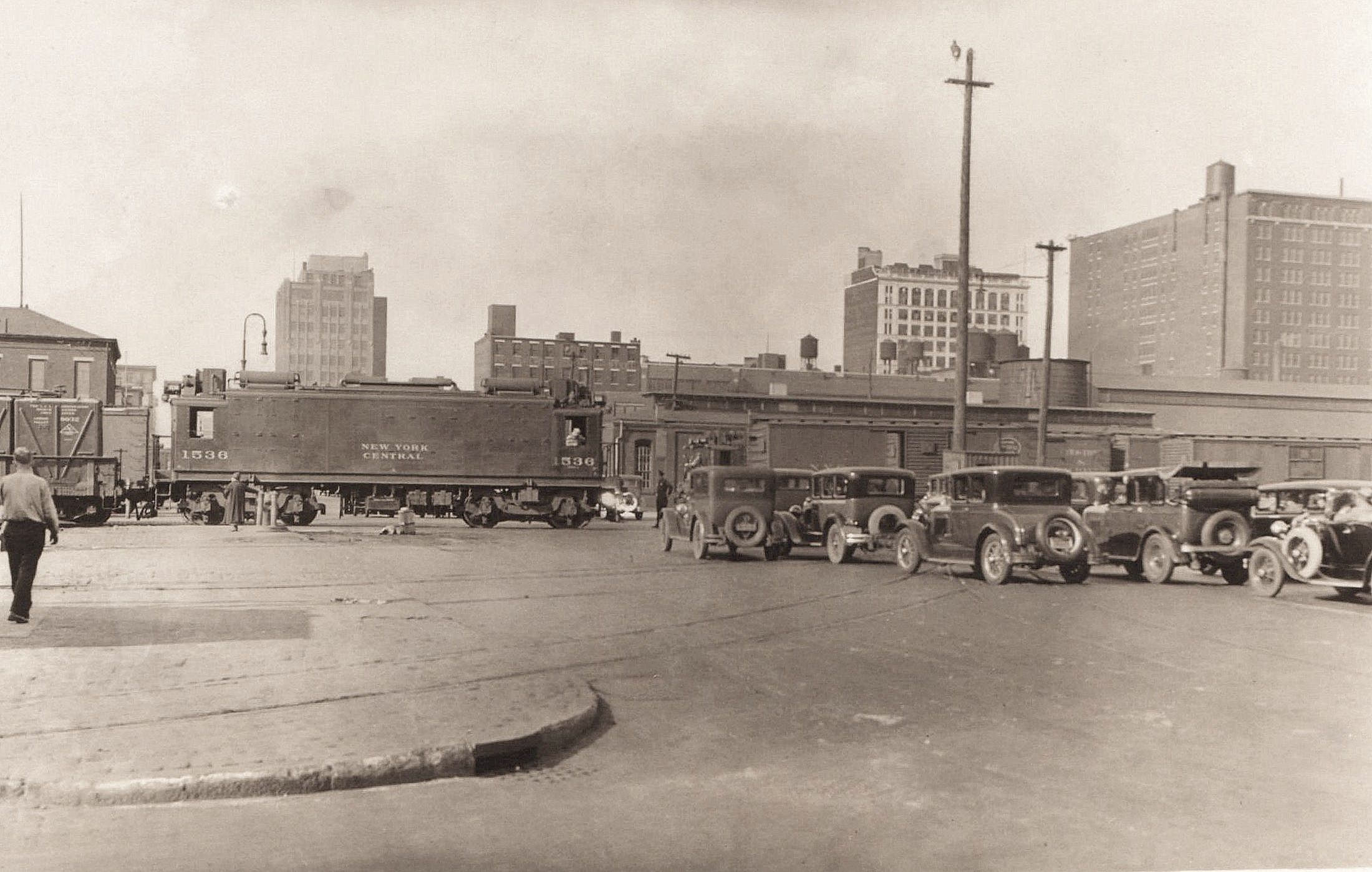
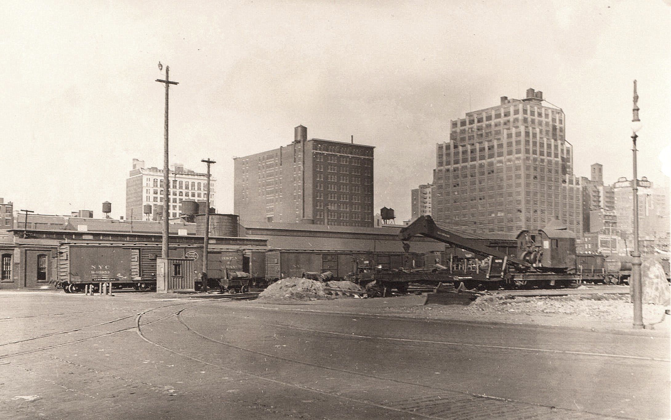
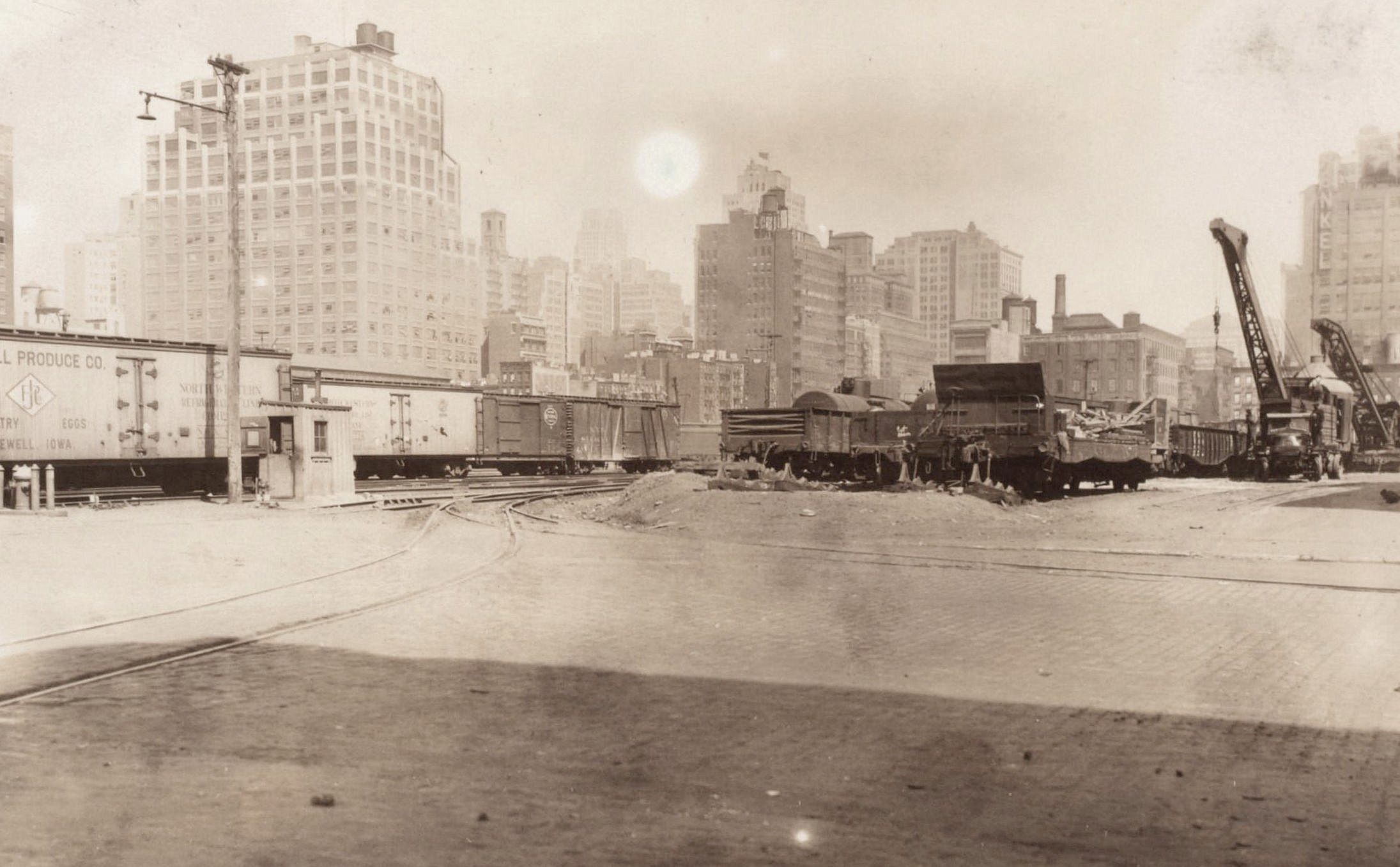
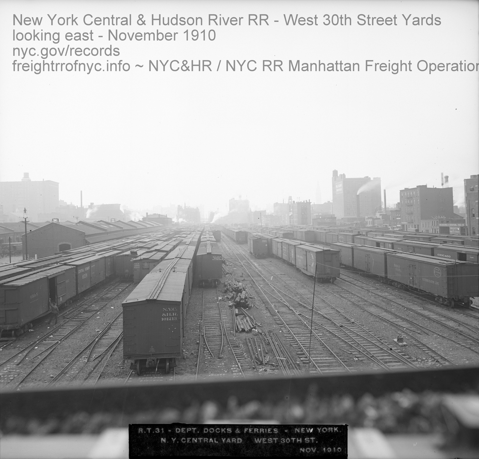
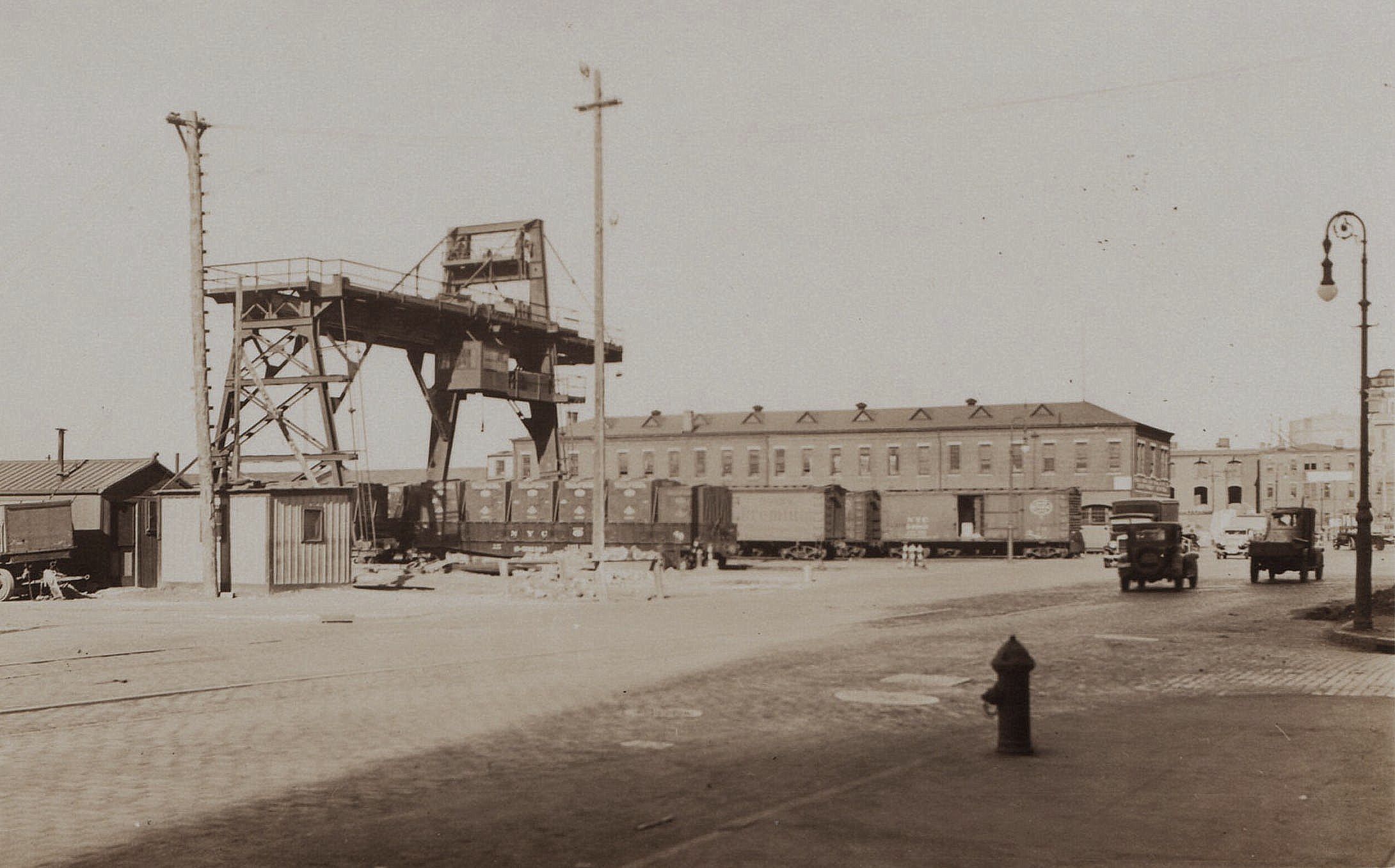
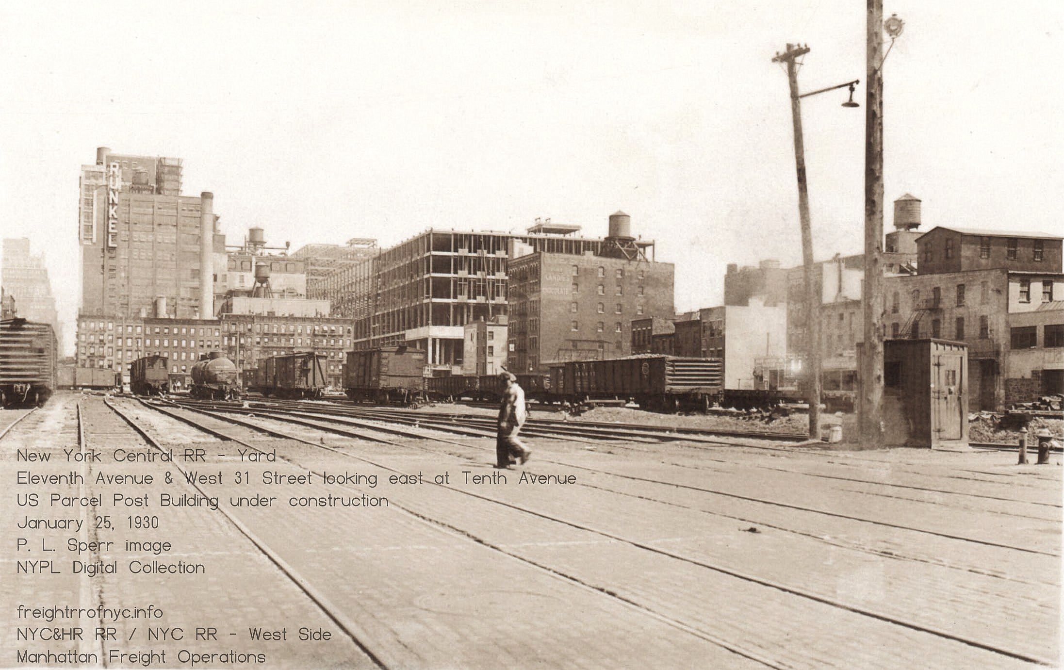
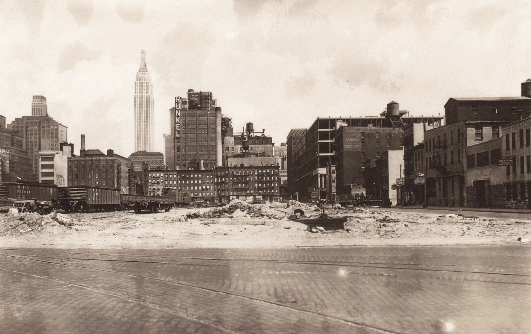
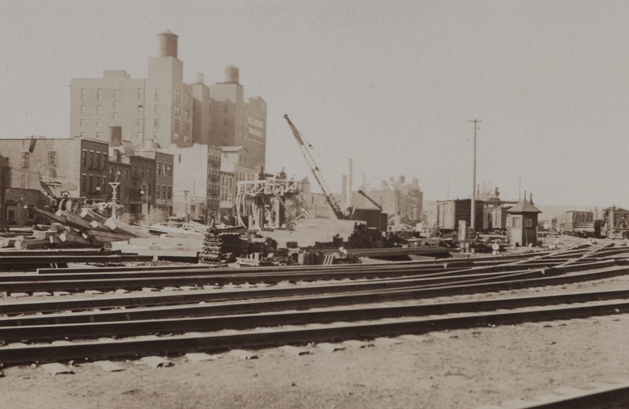
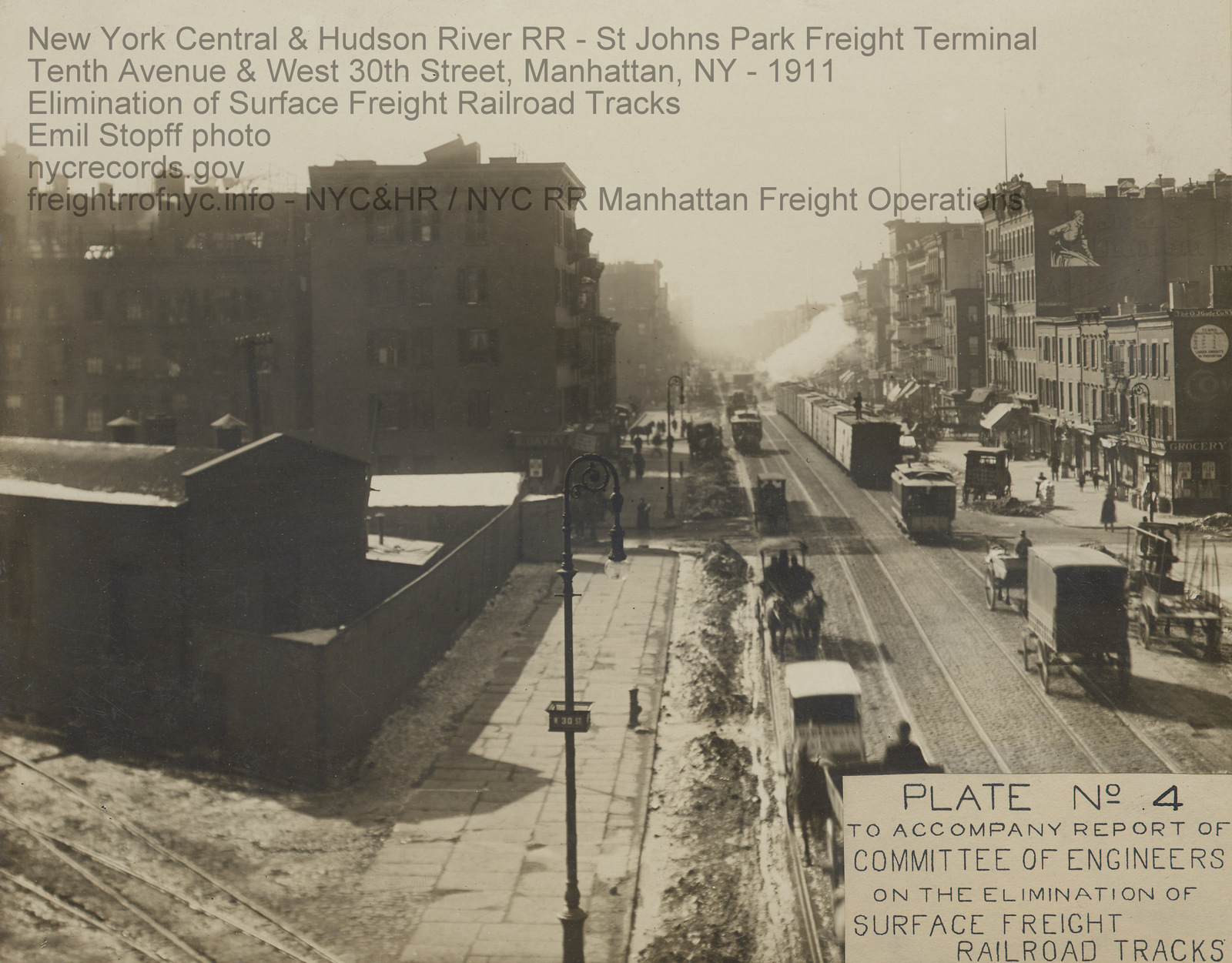
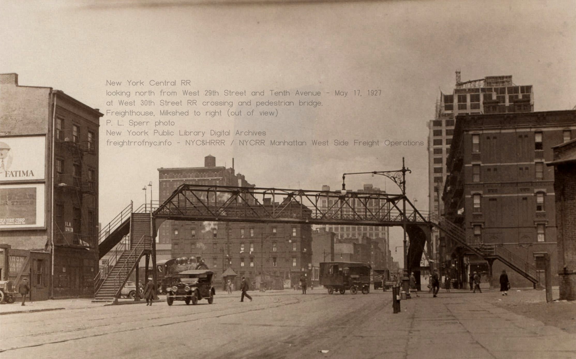
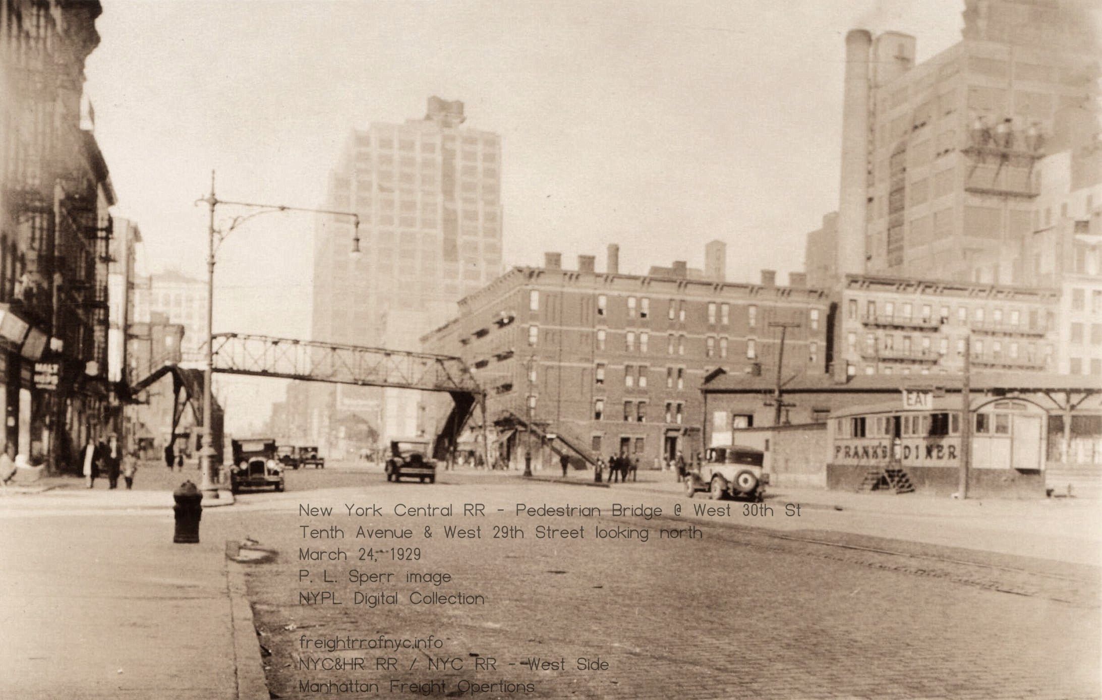
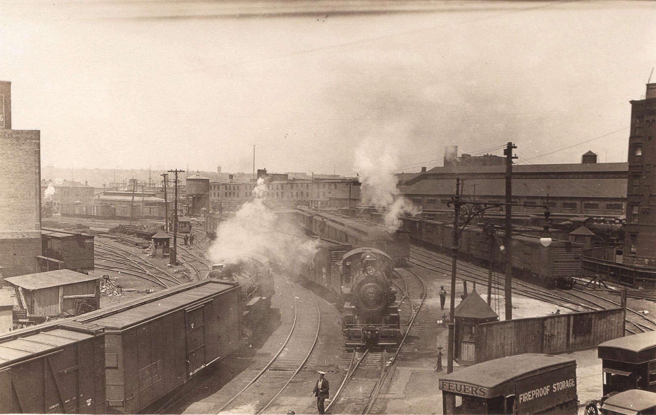
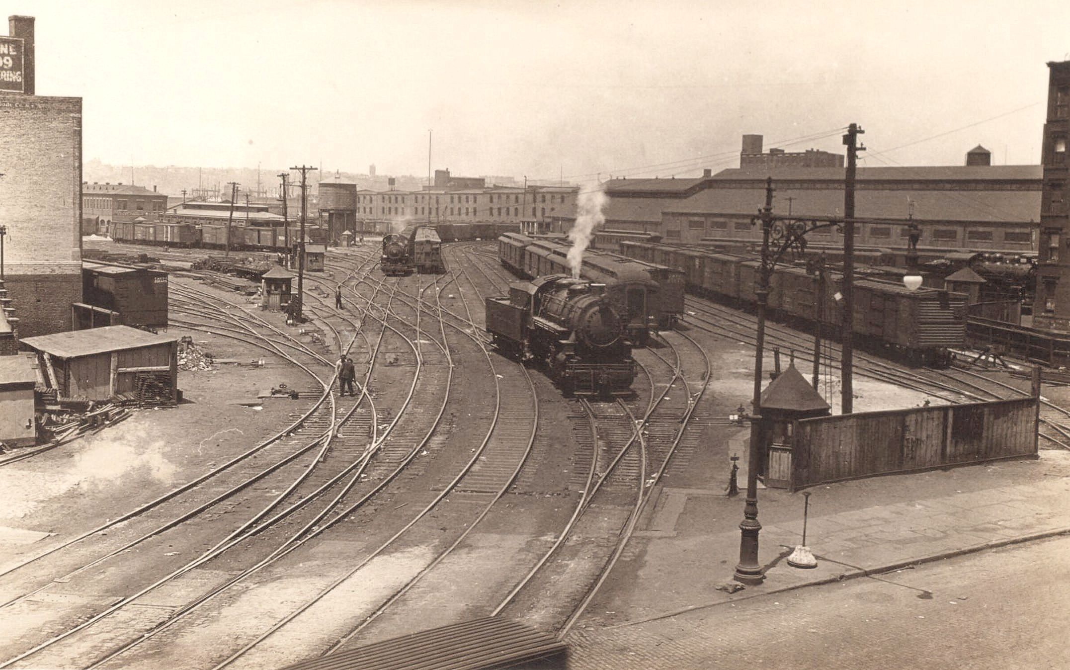
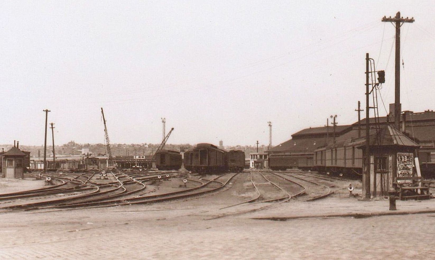
.
.
I found this particular image taken by Ewing
Galloway, important to include here, because while the P. L. Sperr
images are taken ground level, and (mostly) contain surface detail,
they do not show the overall layout of the yards to the piers, and
especially so, prior to the West Side Improvement reconstruction taking
place.

from Tenth Avenue and
West 31th Street (looking west) - 1929
Note how the boxcars to the left (south) of the west / northbound
freighthouse are aligned and no driveways for team loading are
present.
Since boxcar lengths of the era was almost always of uniform length
(either 36 or 40 feet) boxcar doors were lined up to those on adjacent
tracks and once the doors were open,
"bridge plates" (also known as "dock plates") were used to join boxcars
from one track to the next; and to allow hand trucks and electric or
gasoline mules
(tractors with small trailers) to access boxcars on parallel tracks
away from the freighthouse platform. Compare this image to the April 1966 image a few
chapters below.
New
York Public Library Digital Archives
E.
Galloway photo
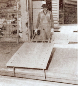 .
.
Bridge plates
shown in yellow.
.
.
Tenth Avenue and West 29th and West 30th Street - Milk Sheds - NOT PASSENGER PLATFORMS
Located between West 30th Street and West 29th Street Ninth and Tenth Avenues, were the Milk Sheds.
These milk sheds are often and very aggravatingly misidentified as "passenger platforms" or "a passenger station" in several urban blogs, and repeatedly in Facebook groups.
They were not. While it appears these platforms have a decidedly passenger "air" to them; they were built around 1900 and to facilitate the loading and unloading of milk cans.
These milk sheds were long roofed platforms, and the west ends were curved to accommodate the trackage entering diagonally from the yards between Tenth and Eleventh Avenues. These platforms were dedicated for the use of unloading full cans of raw milk and crates of dairy products (cheese, cream, etc.) from reefer cars, and usually specially marked "MILK". These cars were also known as "can cars."
These milk cans, had a 40 quart capacity (10 gallons) and
when
full weighed 110 pounds. The milk was then transported to bottlers
where it was sold to the
public, or sent to schools and institutions. Empty milk cans were
washed out and sanitized, returned to the
platform in the evenings, and loaded into the milk cars and brought
back to
the dairy
farms in Upstate New York for reuse. This cycle operated 24 hours a
day, 365 days a year.
My reasoning for these platforms not being for passenger service; is simple. Elementary, my dear reader. The platforms shown in the images are "high level" (or elevated) platforms. They are at the height of the beds of horse drawn wagons or flatbed stake trucks.
The former West 30th Street Station is located parallel to the northernmost high level platform, but is not connected to it, or to any of the other platforms. And for that matter, the platform around the West 30th Street Station is of a lower height which corresponds to the height at the bottom step at the ends of old passenger coaches.
As the West 30th Street Station platform was not connected to the other platforms, this also means, passengers would have to walk out of the Depot Building on West 30st Street, turn left and walk half a block west to Tenth Avenue, turn south and cross the tracks, then climb the six or seven narrow stair / steps without handrails at the end of the platform as seen in the above images.
Out of all the railroads entering the New York area, the New York Central RR carried the greatest share of milk haulage. Obviously, the benefit of bringing it directly into Manhattan was a significant factor for this.
There were three milk stations that were served by the West Side Line:
Borden's had a plant at 615 West 131st Street (beginning 1937), and Sheffield had three: 632 West 125th Street, 524 West 57th Street, 529 West 28th Street.
|
|
![]()
Look.. Unless the human race has been joined by a new type life form, that is short, round, two handles with white blood; and weighs about 40 pounds empty and 110 pound full; those are not passengers.
.
.
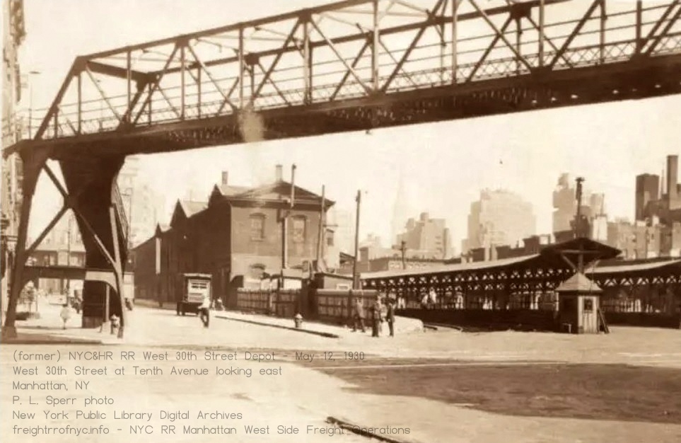 Observe at the platform height difference between the actual West 30th Street Station platform on left by wood fence and the height of the milk platforms. The Milk platforms were higher to match the height of the floor of milk wagons and flat stake trucks hauling the milk cans |
|
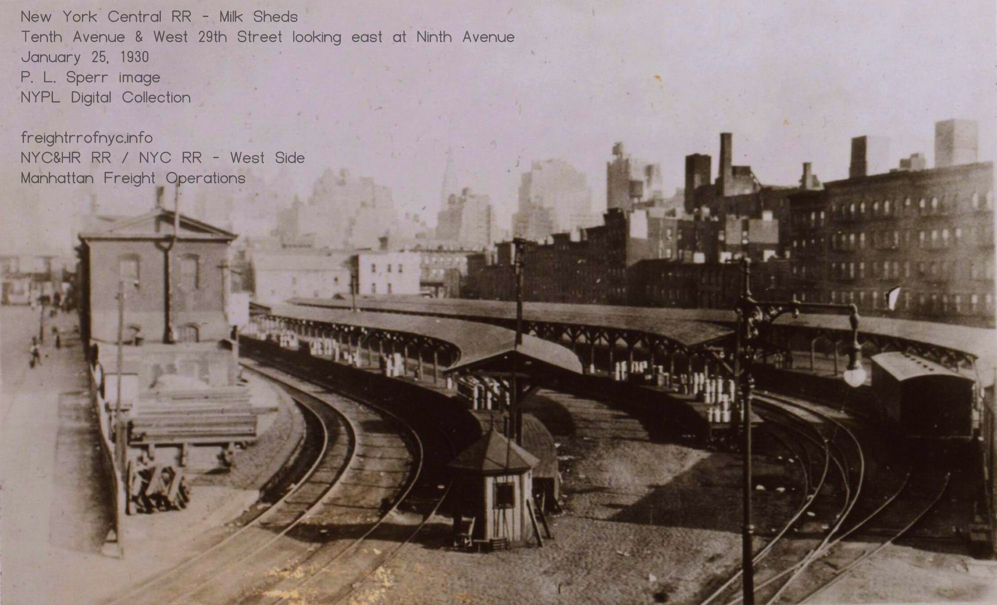 The low platform attached to the 30th Street Station is the only platform in this image that would have saw passengers, from the Dolly Varden service. |
|
.
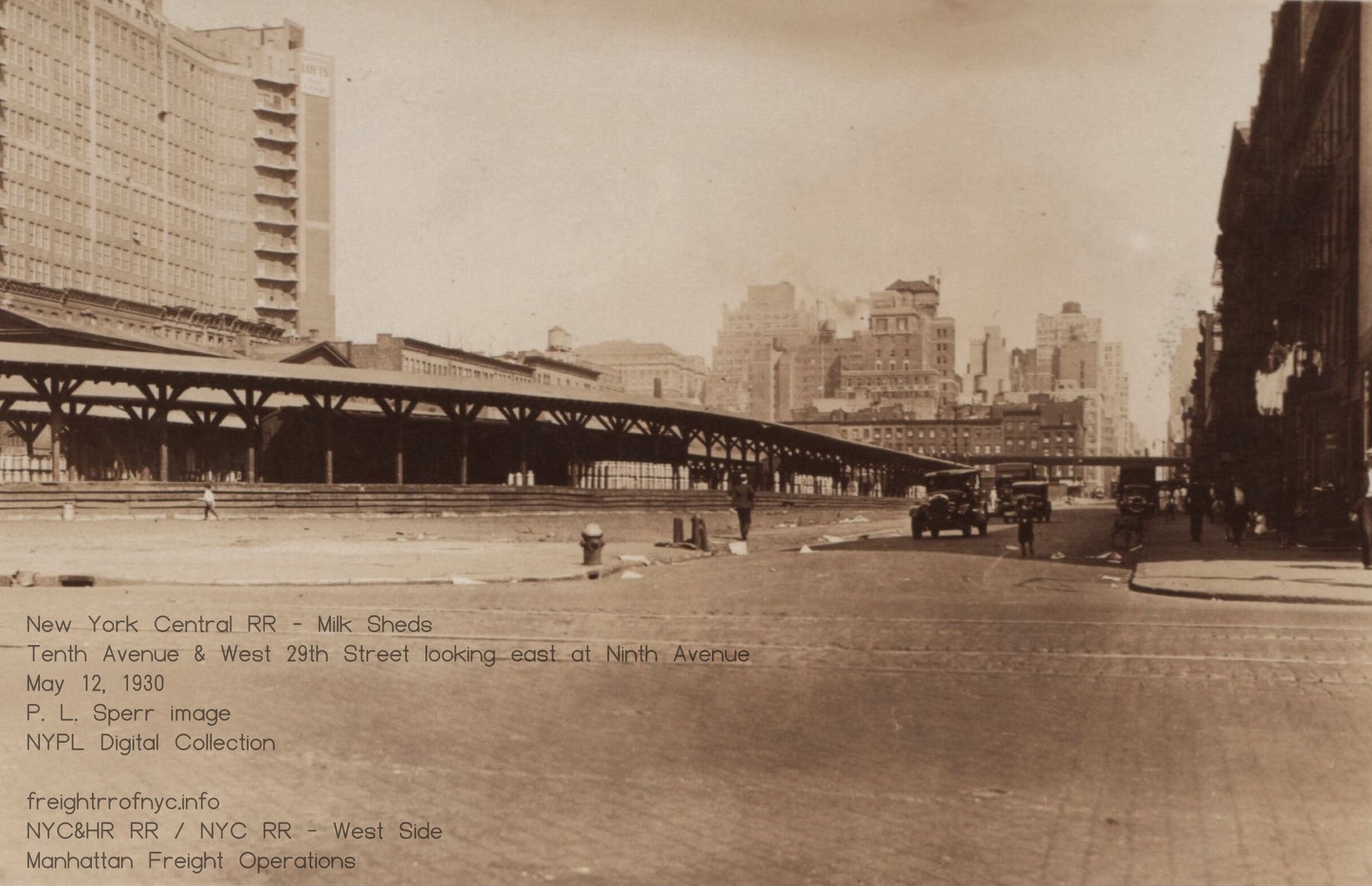 |
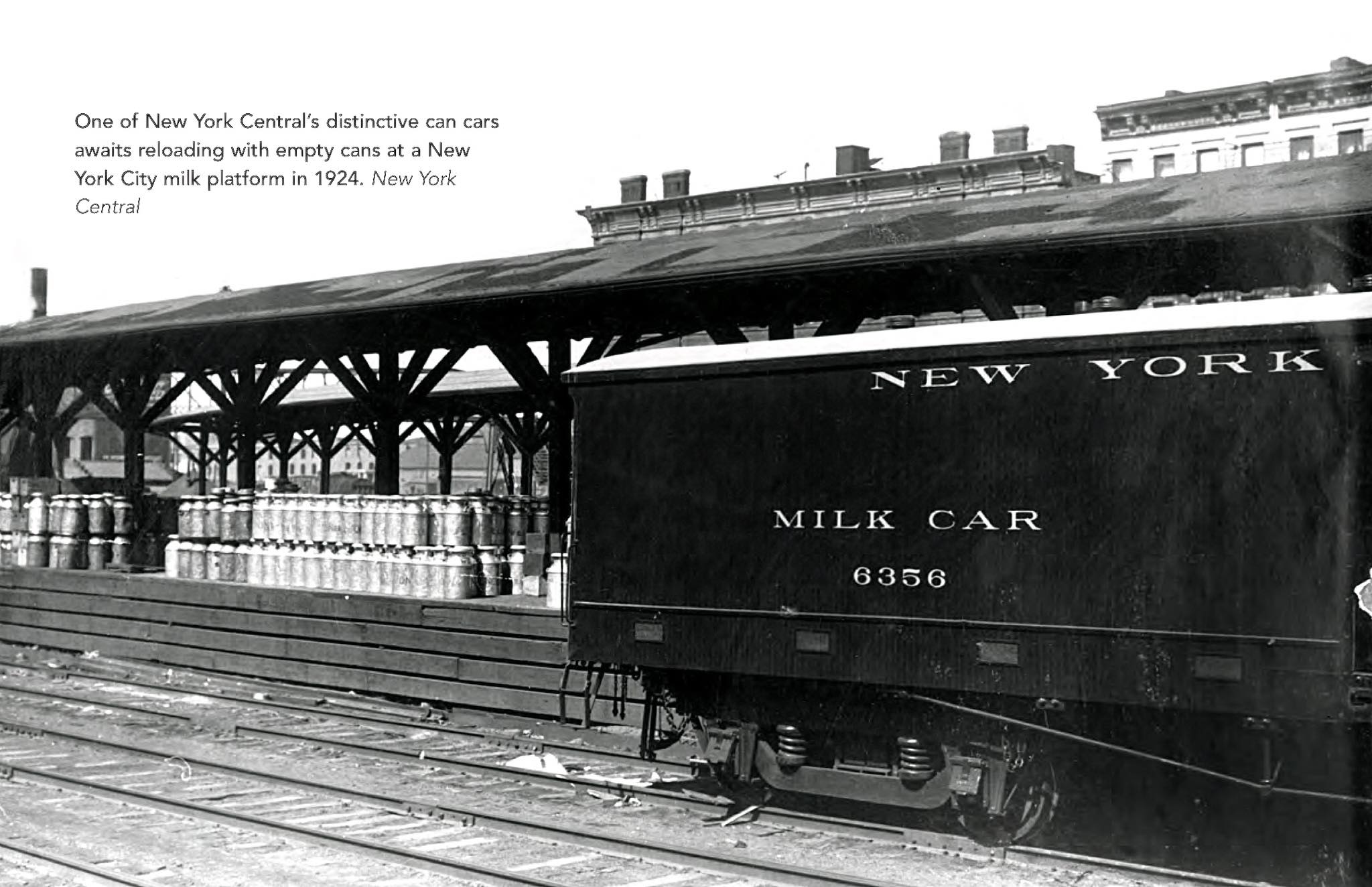 I don't know about you, but if you still have doubts.. Perhaps the milk cans and the milk cars give you the answer. |
.
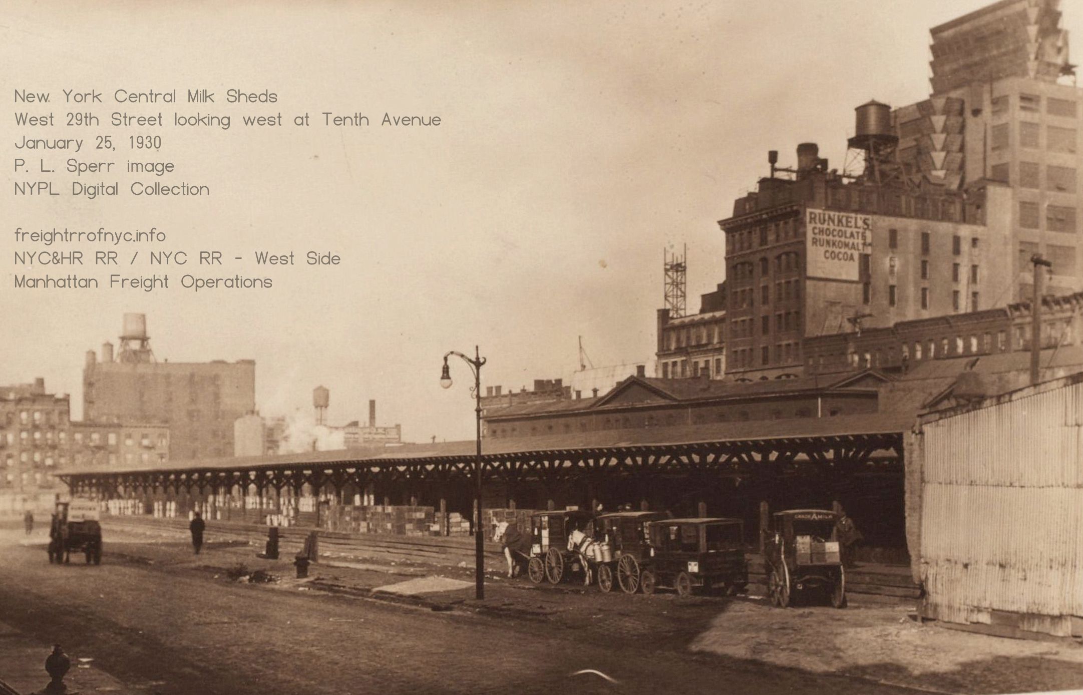 |
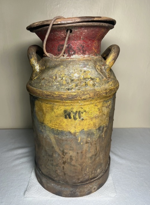 |
milkshed images: New York Public Library Digital Archives P. L. Sperr photos milkcan: eBay Milk
cans were usually embossed with the name of the farm "Elgin" (of the
Catskills), or the cooperative that the farm belonged to
Dairyman's League (DairyLea) or the dairy company: Crowley, Sheffield, Queensboro, etc Color coding and painted numbers were used to track the can and either painted letters or embossed tags for the railroad which carried it and the milepost that can was dropped off and received from. U&D - 51 (Ulster & Delaware MP51 - Kelly Corners) O&W - New York Ontario & Western Rwy NYC - New York Central, etc. Ergo, this can is marked NYC, for New York Central. |
| Here we see
milk men with horsedrawn wagons (and a very primitive internal
combustion powered truck!) lining up. By Spring of 1931, these milksheds will be razed and the property developed into the US Parcel Post Building. |
This means, passengers would have to walk out of the Depot Building on West 30st Street, turn left and walk half a block west to Tenth Avenue, turn south and cross the tracks, then climb the six or seven stair / narrow steps with no hand rails at the end of the platform, and as seen in the above images.
Careful reference to those images, shows the Ninth Avenue end of platforms also appear to have been not connected with a "head house". Likewise, any platform to platform changes would also require walking to the extreme ends of the platform, climbing down the six or seven steps (note - no handrails!), crossing the tracks, then climbing back up the steps on the adjacent platform.
AS if the visual evidence is not enough to convince you, I submit for your approval, the 1916 G. W. Bromley Property Atlas for the area. Even here, the platforms are marked as "Milk Shed"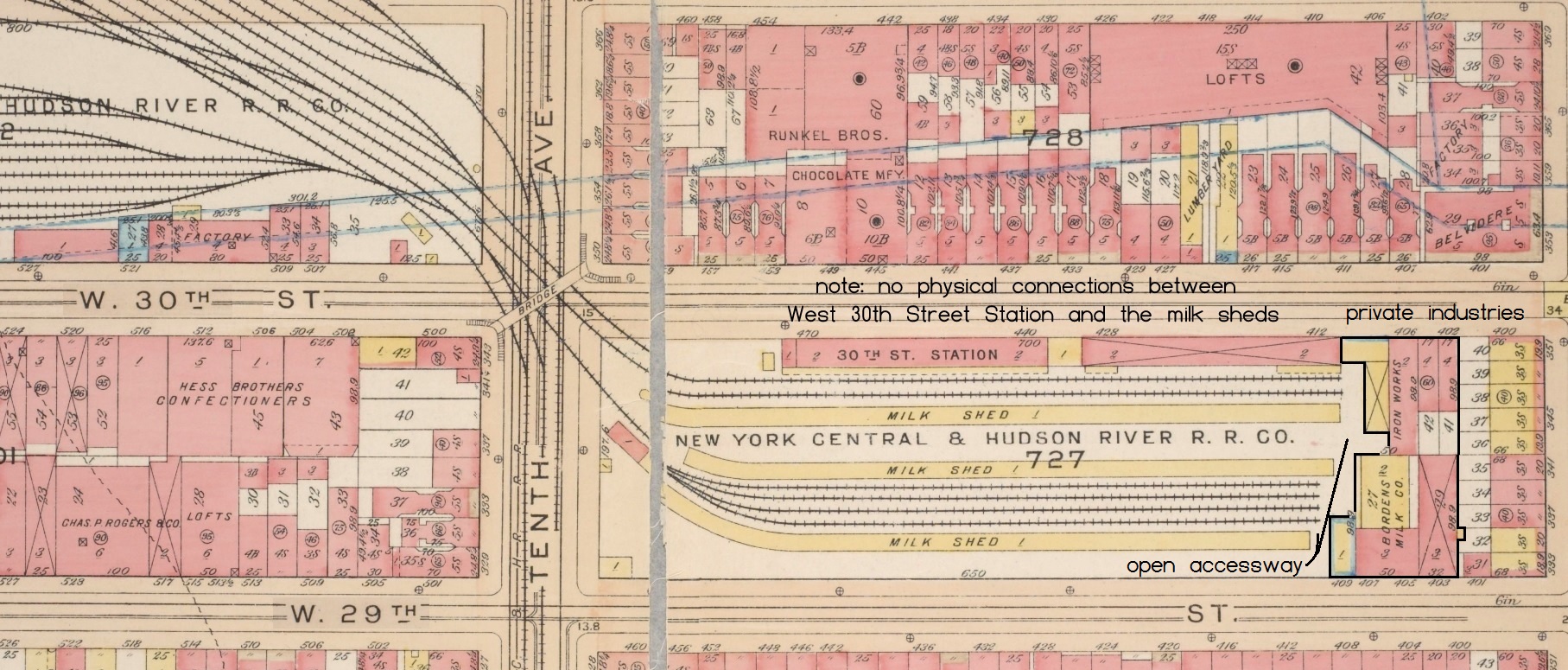
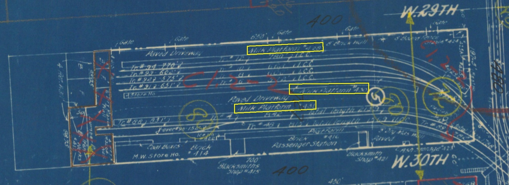
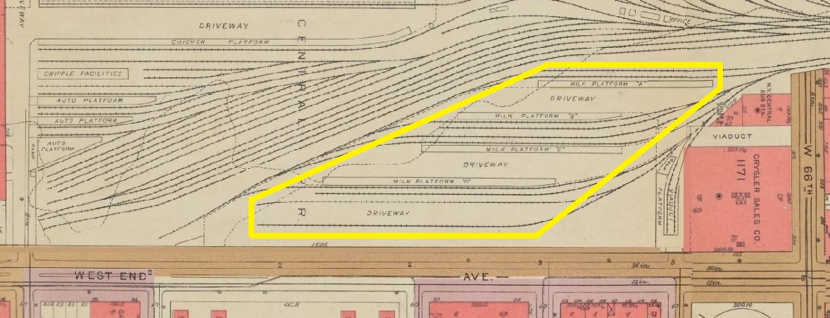
These
milk platforms would be razed in 1929 for the construction of
the Morgan Parcel Post Building.
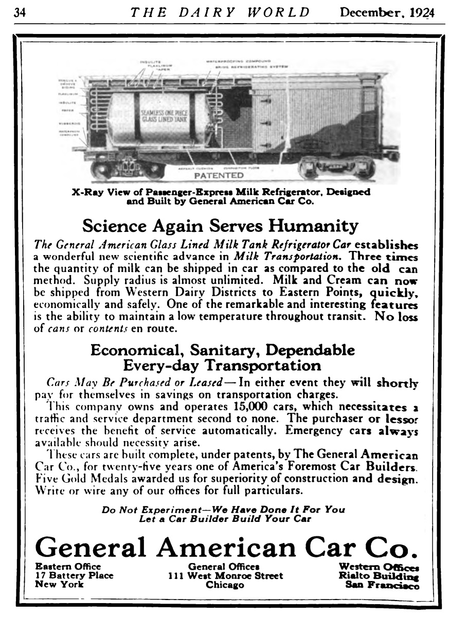 |
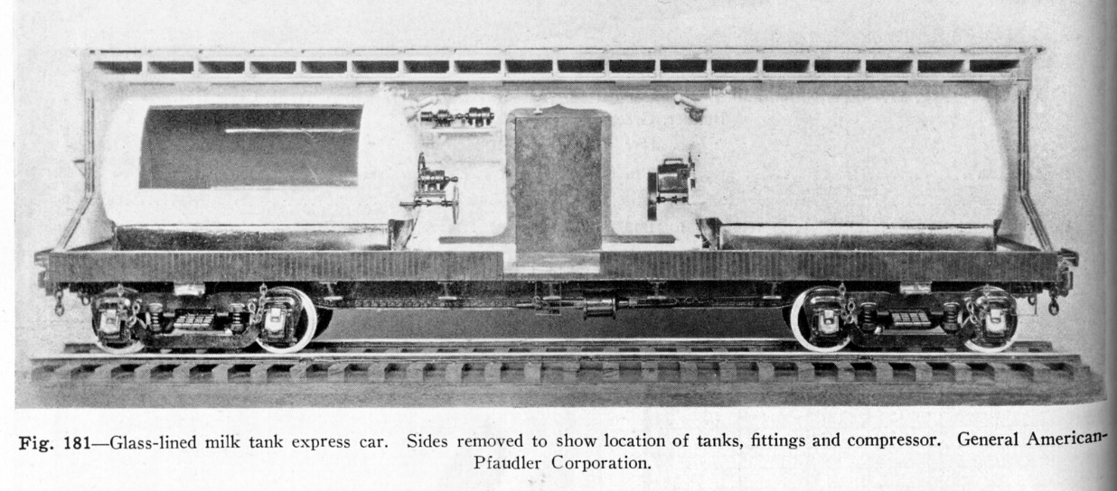 Transportation via the milk cans above was the first era of milk transport. During the mid 1920's; a less labor intensive and more economical way method of transport was developed. This was the express milk tank car. The end of one can be seen in the top left image above. From outward appearances, it looked like a non-descript elongated box car or perhaps a railway express car. But internally, it was revolutionary. The interior contained two glass lined tanks of two to three thousand gallon capacity. These cars also incorporated a brine refrigeration system (instead of manually loaded blocks of ice); and a motorized system of paddles in the tanks to keep the butterfat from separating from the milk. Not only were these two tanks easier to clean and sterilize (than the many individual cans), it also reduced the amount of labor needed for transport of milk. All that was required was one, maybe two men; and hoses from the trackside dairy tanks to the car, to fill the tanks. At the bottlers, the same. The small armies of husky men to unload the thousands of milk cans at the destinations were no longer required. Neither were the milk sheds taking up vast amounts of space. |
|
Following
both the advent of the express milk tank cars and the relocation of
rail traffic to the sub-grade cut between West 60th and West 36th
Street, the milk platforms at West 29th Street were demolished and new
ones constructed at the southeast corner of the West 60th Street Yard. Following shortly thereafter the construction of the sub-grade cut in 1937, Sheffield Farms built and opened a new processing plant directly next to the this cut at West 57th Street, and a dedicated rail siding constructed just to service this facility in June 1938. Construction of this siding can be seen in the June 30, 1937 image, and has a dedicated chapter above. This new Sheffield facility consolidated the operations of their three older and smaller pre-existing processing plants located in Manhattan:
|
 |
|
|
According to bronze plaque near the location where the West 30th Street Station once stood; it is claimed that President-elect Abraham Lincoln was the station's first passenger, when opened in February 1861 and on his way to his inauguration.
In the drawing of Lincoln's funeral train departing West 30th
Street seen at right, the
curvature of the tracks is apparent, but note: there are no platforms.
These types of stations usually were fully
planked at rail height for the ease of walking as movement of baggage
dollies. |
|
As such, following the relocation of those long distance passenger trains to Grand Central Depot; the West 30th Street Yard was, for the most part almost exclusively a freight terminal, yet keeping in mind the arrival and departure of the local passenger service between West 30th Street and Spuyten Duyvil. For this, the passenger train would have arrived and departed from the single depot platform.
It appears that most short passenger runs on branch lines (not just the New York Central) were referred to as a "Dolly Varden"; and research reveals that many trains of this type on different railroads throughout the world are called "Dolly Varden", which was a character in Charles Dickens' "Barnaby Rudge."
Also note the placement of a run-around switch for the locomotive to change ends (without one, it would be trapped at the end of this dead end track without a means for escape), and also note the difference in height between the depot platform and the milk platform.
Upon its opening in 1871, you would think all local and long distance New York Central and Hudson River Railroad passenger service would have been consolidated to the Grand Central Depot located at East 42nd Street and Fourth Avenue. While it has not been documented as to the reason why; it is shown that passenger service was retained on the West Side Line, most likely to provide those employees, whether those working for the railroad or employed by those industries located along the line; with some form of continued, convenient service.
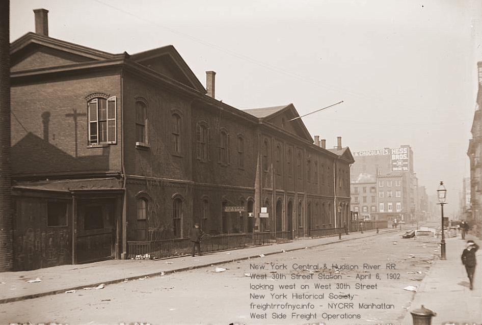 |
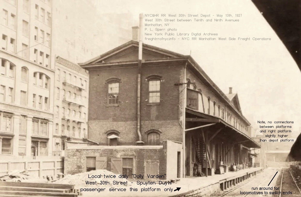 |
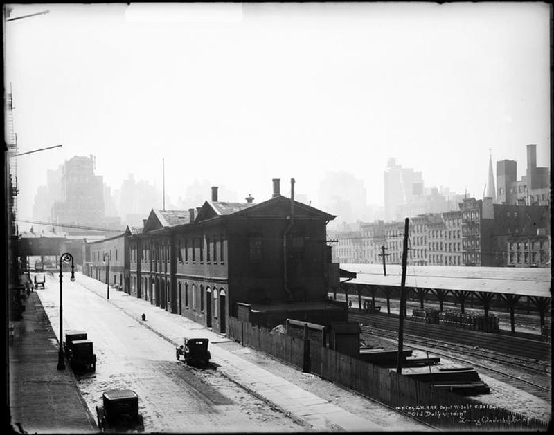 repository unknown, date unknown - ca.1925? Irving Underhill image via Sahib Akhundzadeh . . |
|
|
Not passenger platforms. Milk platforms |
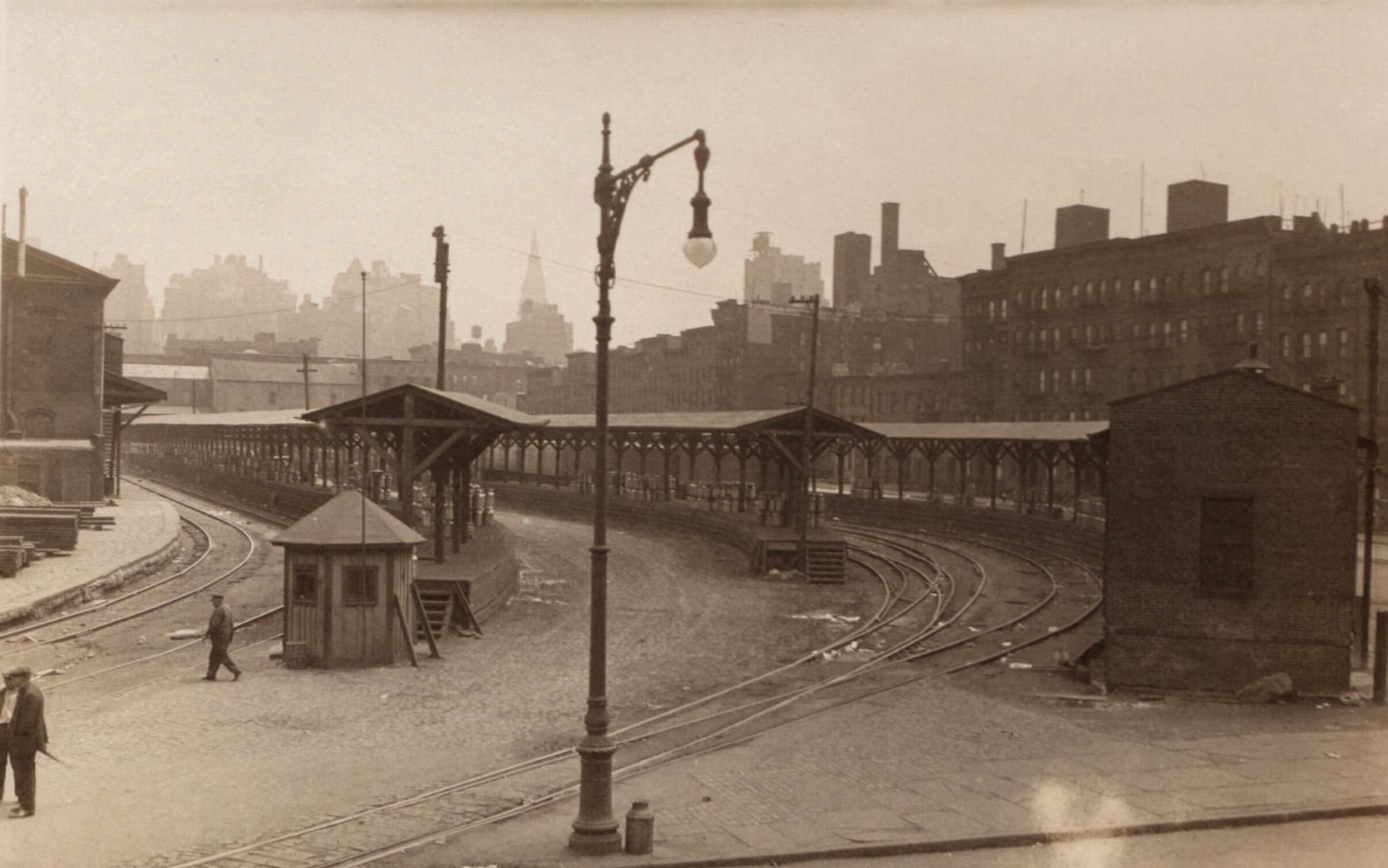 Those steps: no handrails, narrow and steep. Not conducive for passenger use, especially carrying baggage. Why are there no ramps for baggage carts, if they were passenger platforms? |
|
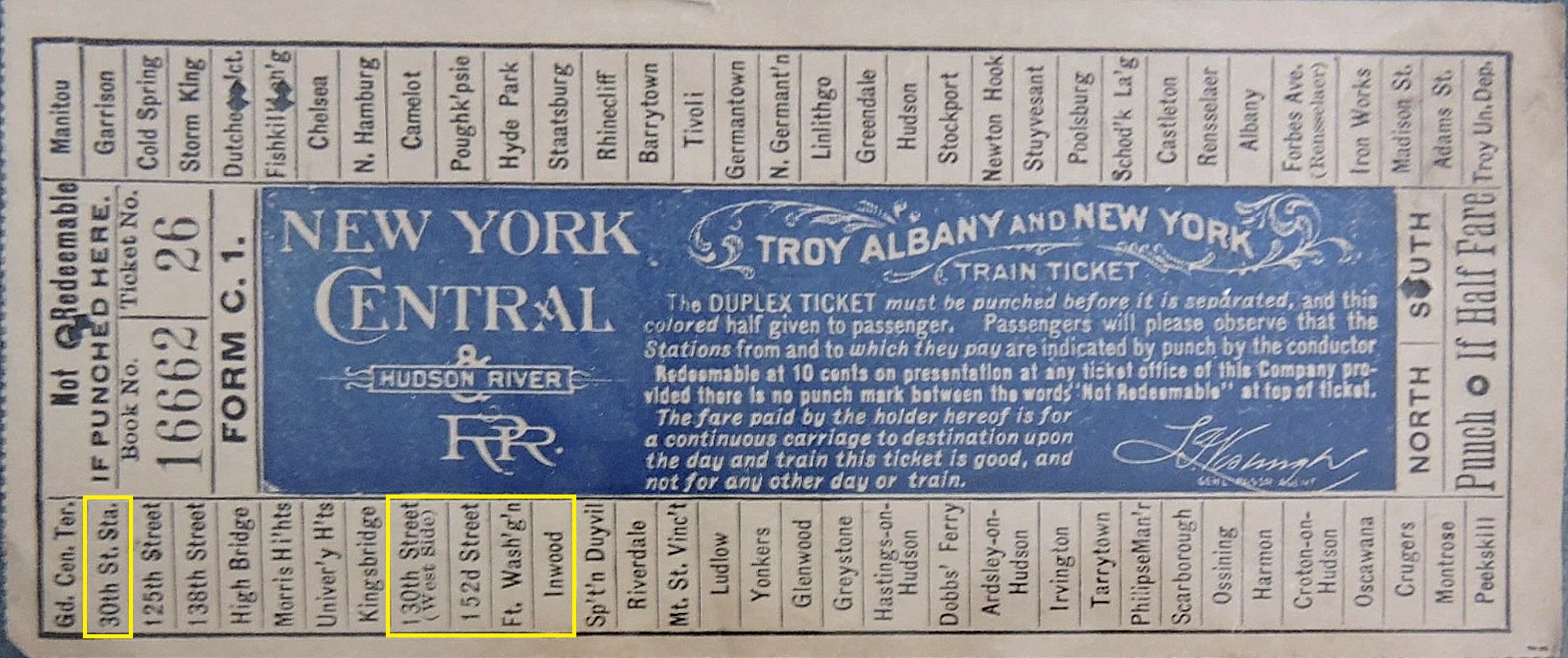 |
While
not punched for any of
the West Side Line stations; this train ticket does list thoe stations;
and since the ticket is stamped for 1910; it
reflects those stations were still in fact on the passenger tariff
sheet for service. |
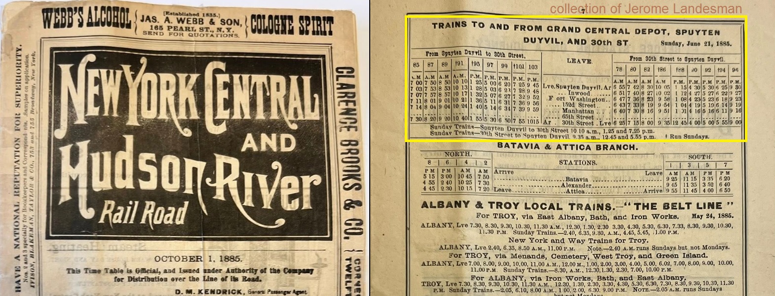
|
I suppose, the existence of this service should not have come
to
me as great a shock as it did,
because I have seen an image of a New York Central passenger train in
the streets. I, sadly to say; wrote this off as a special or excursion.
As my specialty is freight operations, I just did not put two and two
together. But with thanks to this ETT and research on both the part of other historians and now myself, proves there was in fact limited First Class passenger service between Spuyten Duyvil and West 30th Street Terminal twice a day, in both directions: For the northern direction (timetable direction westward) there was:
For southbound service (timetable direction eastward) you had:
To be perfectly clear, passenger service ended at West 30th Street Terminal. There was no passenger service south of West 30th Street or upon the High Line. Anyone with this or other issues of timetable that show 30th Street Branch, please get in touch with me. Also this ETT specifies milk trains from the following: Rutland, Mohawk, Harlem, Rome, Watertown & Ogdensburg, Rensselaer & Saratoga, Delaware & Hudson, and Mohawk & Malone. I *think* R&P is Rome & Potsdam. Additional ETT's as I locate or acquire them may be viewed and compared in their chapter: Employee Time Tables & Train Symbols |
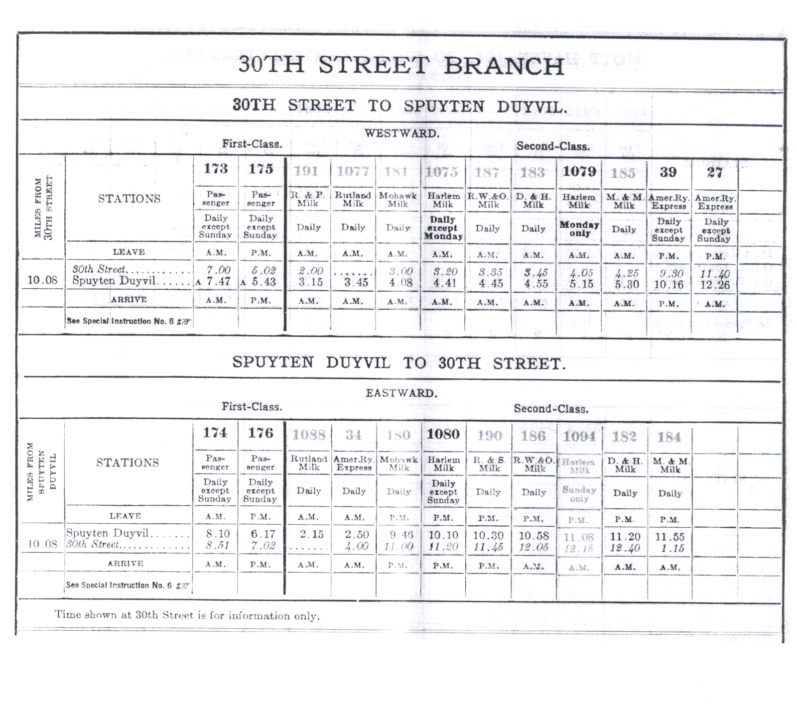 June 26, 1921 Employee's Timetable showing passenger service on West Side Line two trains a day, each direction; no service on Sunday. authors collection |
In
the September 2007 issue of Trains Magazine, it is mentioned in regard
to West Side passenger service, the following train running in 1934 on
the 30th Street Branch had this schedule:
Note that a passing time for West 60th Street, not a depart time. These other stops at West 130th Street, West 152nd, Fort Washington and Inwood may have been relegated to flag stops after this date. Never the less, with the West Side route terminating at the Spuyten Duyvil Station on the Hudson Line, would allow passengers to go further north, or to go further south to stations in the Bronx and if desired, transfer to either the Putnam Line or the Harlem Line, or even the East Side of Manhattan. From what little can be discerned about this service on the West Side, the passenger service was interrupted temporarily from about 1917-1918 by the US Railroad Administration during and shortly following World War 1. |
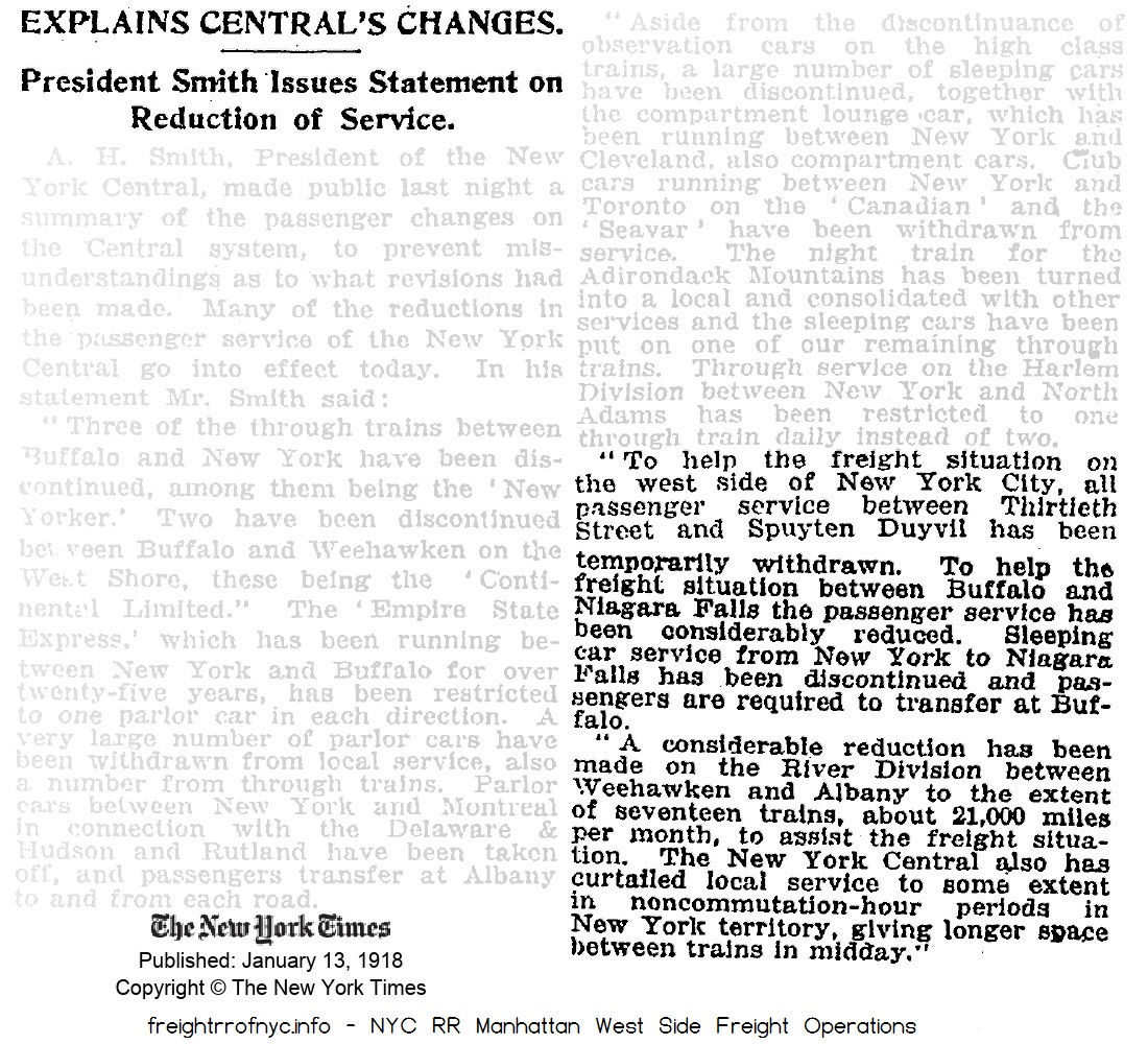 |
|
|
|
|
| November
12, 1906 - northbound at West 145th Street Another variant (non-pocketing) of the "monocle" type. Does not appear to be illuminated either (no light housing). The brick and stone structure is part of Riverside Park; and unrelated to railroad. |
March 28, 1906 - West 152th Street - northbound |
|
| . | ||
|
|
|
|
| October 20, 1907 - West
152rd Street northbound and southbound flag stop signals In this image we see an non-illuminated semaphore blade (no lenses, no light housing) to the left (in photo, in actuality to the right) of the Hall Automatic Signals on the northbound track. A rope and pulley system (very similar to a clothes line!) can be seen in the image. Also circled is a high mounted (to the shanty eave) dwarf semaphore, which would be used for southbound passengers. |
1908 - West 152nd Street - looking south |
|
|
|
||
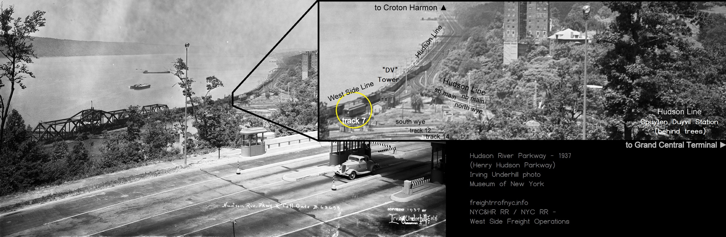
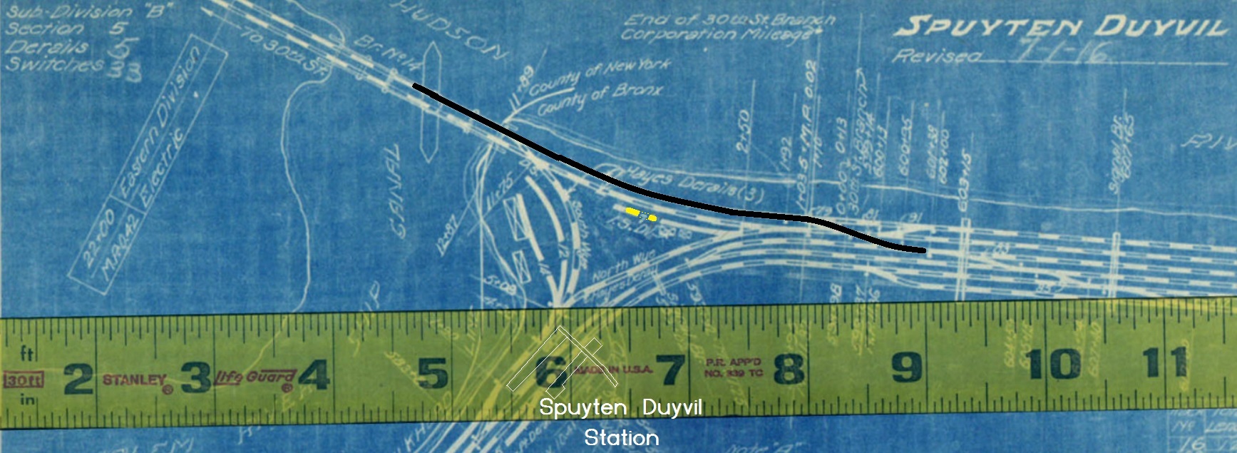
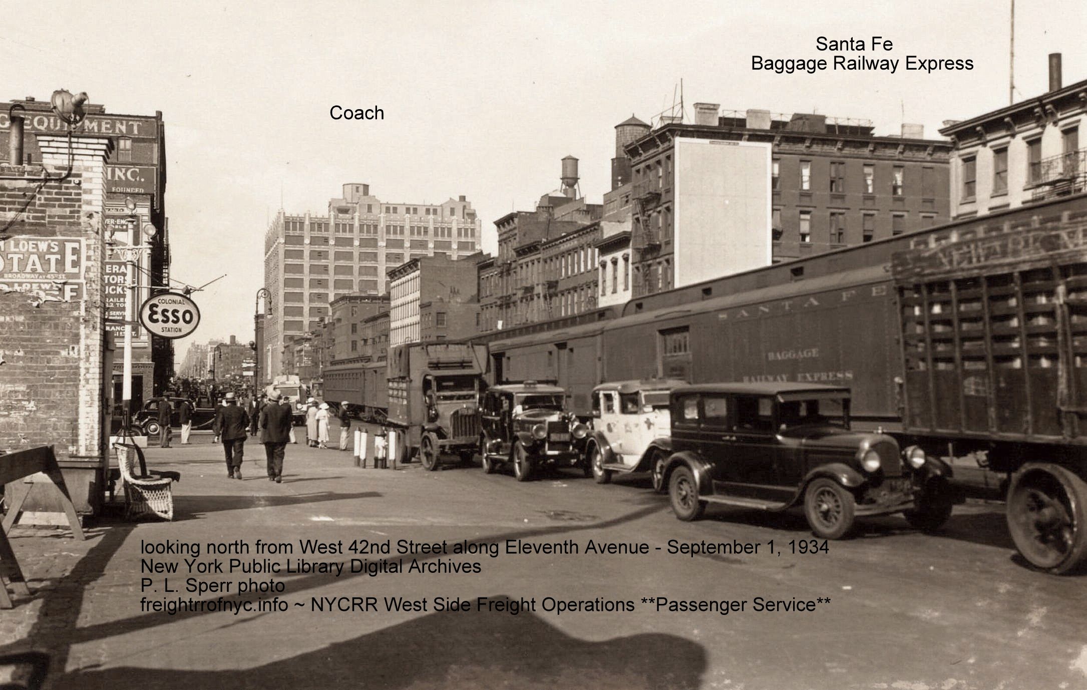 Clearly a coach bringing up the rear of a baggage railway express train on Eleventh Avenue - September 1, 1934 P. L. Sperr photo New York Public Library Digital Collections For a lightly used branch line service, this method of "mixed train" or "mixed consist" has been used to great success in many locations and on many branch lines in past eras of operation, where a dedicated passenger service run was not economical. In todays world of operation, it's practically unheard of in the United States; due to safety regulations, the formation of Amtrak, dedicated union crafts, and of course where the Class 1 freight railroads (and their stockholders) disdain anything to do with passenger service, unless they were forced to. For historical note, most mixed passenger / freight service was abolished by the 1970's with the formation of Amtrak. However, Amtrak itself was the last to have this mixed service: regularly scheduled long distance passenger trains had special Amtrak Express boxcars added to the rear of the train at certain large metropolitan cities. These 61' boxcars, built to passenger train cushioning and braking standards with trucks (wheel set assemblies from former passenger cars); were ordered and delivered in 1986. Despite a few small technical hiccups in the early equipment; this service was expanded under the "Growth Strategy" of the 1990s Amtrak board of directors ("Amtrak by the Numbers", D. C. Warner / E. Simon, 2011 - White River Publications; ISBN 978-1-932804-12-9) usually consisted of expedited small package and freight (no furniture) and second and third class mail service. These Amtrak Express cars were added to the passenger train at major metropolitan stops: New York City, Buffalo, Chicago for that routing. I know for fact Albany, NY had facilities for the service. This author embarked on a first class (roomette) sleeper car journey departing Albany to Sandusky, Ohio, in February 1999. I thought I was fortunate, as the sleeper car I was assigned to was the last car in the train, and I would be able to look out the back of the car like riding in a caboose. That was until 10 minutes later and an Amtrak switcher locomotive tacked on three express boxcars and two Amtrak AMTZ mail contract road railer trailers (truck trailer vans set on railroad wheel bogies - look up Norfolk Southern Triple Crown service for more details) behind the sleeper car! It was okay; I had a great dinner in the diner, and played chess with my sleeping car attendant: Spright, (yes, that was his name; a large African-American male with a great passenger car service demeanor!) after he went off duty at midnight. This Amtrak service actually turned a profit; until it eventually became a logistical nightmare. The Class 1 freight railroads were balking at the competition; and the Federal Government, despite giving schedule and track priority to passenger trains, stopped enforcing the paying of penalties for delaying Amtrak of and by the Class 1's. So, the Amtrak express service as well as the passenger trains they were attached too, found itself being delayed along the route. Ultimately, this Amtrak Express service was abolished in 2004. But enough memories, let's get back to vintage New York City freight railroading. |
|||
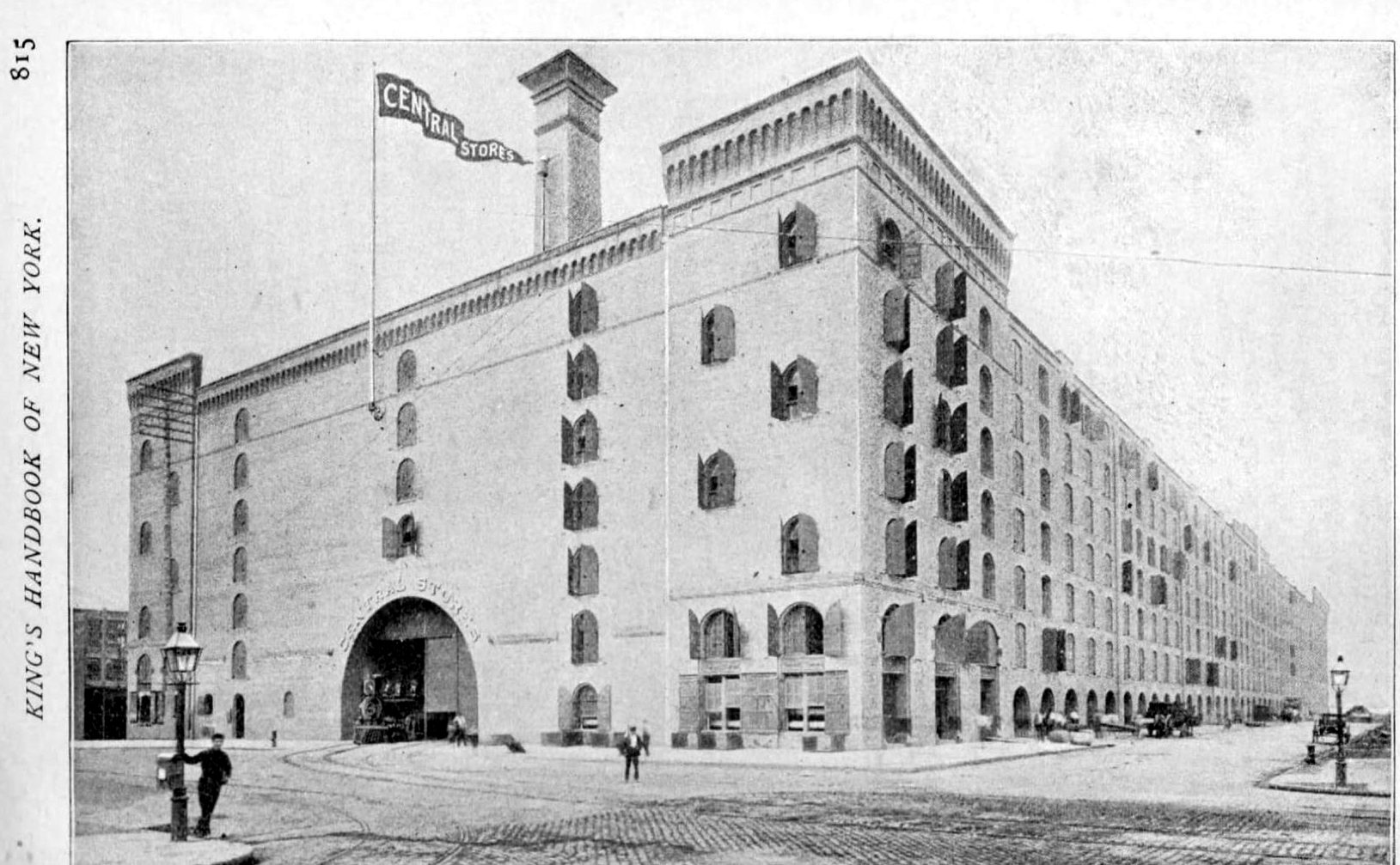 King's Handbook of New York - 1893 added 10 May 2026 |
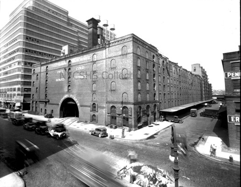 July 1934 New York Central System Historical Society - Image ID PB311003 added 10 May 2026 |
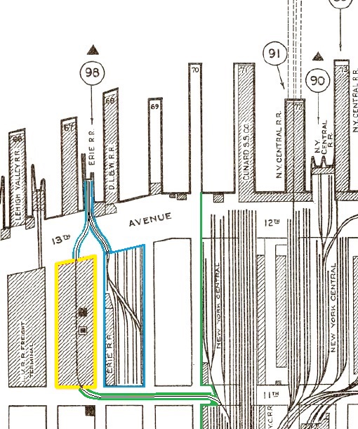 |
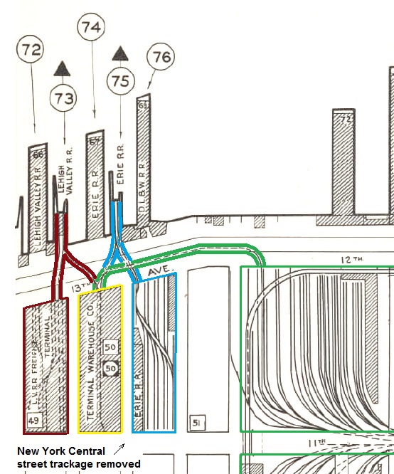 |
|
| 1932: spur track from New York Central yard (green) occupies Eleventh Avenue providing service to Terminal Stores (yellow), as does track from Erie RR (blue) map is collection of and annotated by author added 10 May 2026 |
1942: New York Central Eleventh Avenue spur track removed; a new track on Twelfth Avenue is installed. This map shows Terminal Stores (yellow) now has service from three competing Class 1 freight railroads: Lehigh Valley (maroon), Erie (blue) and New York Central (green). map is collection of and annotated by author added 10 May 2026 |
Tenth Avenue & West 24th Street
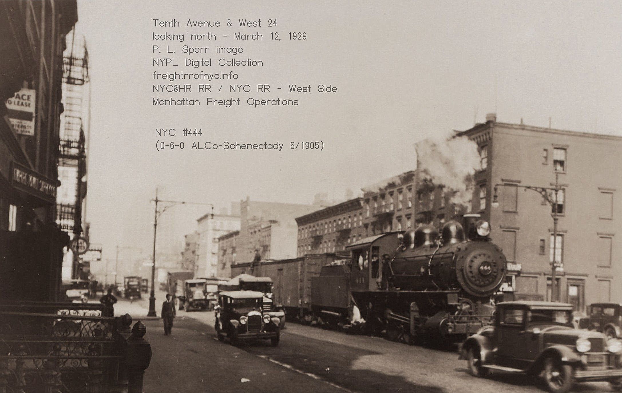
NYC #444 [0-6-0, ALCo 1905] heading south on Tenth Avenue at West 24th
Street - March 12, 1929
This is a rarer photo than one would suppose - the general policy of
the New York Central freight operations in Manhattan was that the use
of locomotives with tenders
were avoided south of West 30th Street Yard.
New
York Public Library Digital Archives Image ID:710499B
P.
L. Sperr photo
added 19 August 2025
.
.
Tenth Avenue & West 21th Street
Church of Guardian Angels
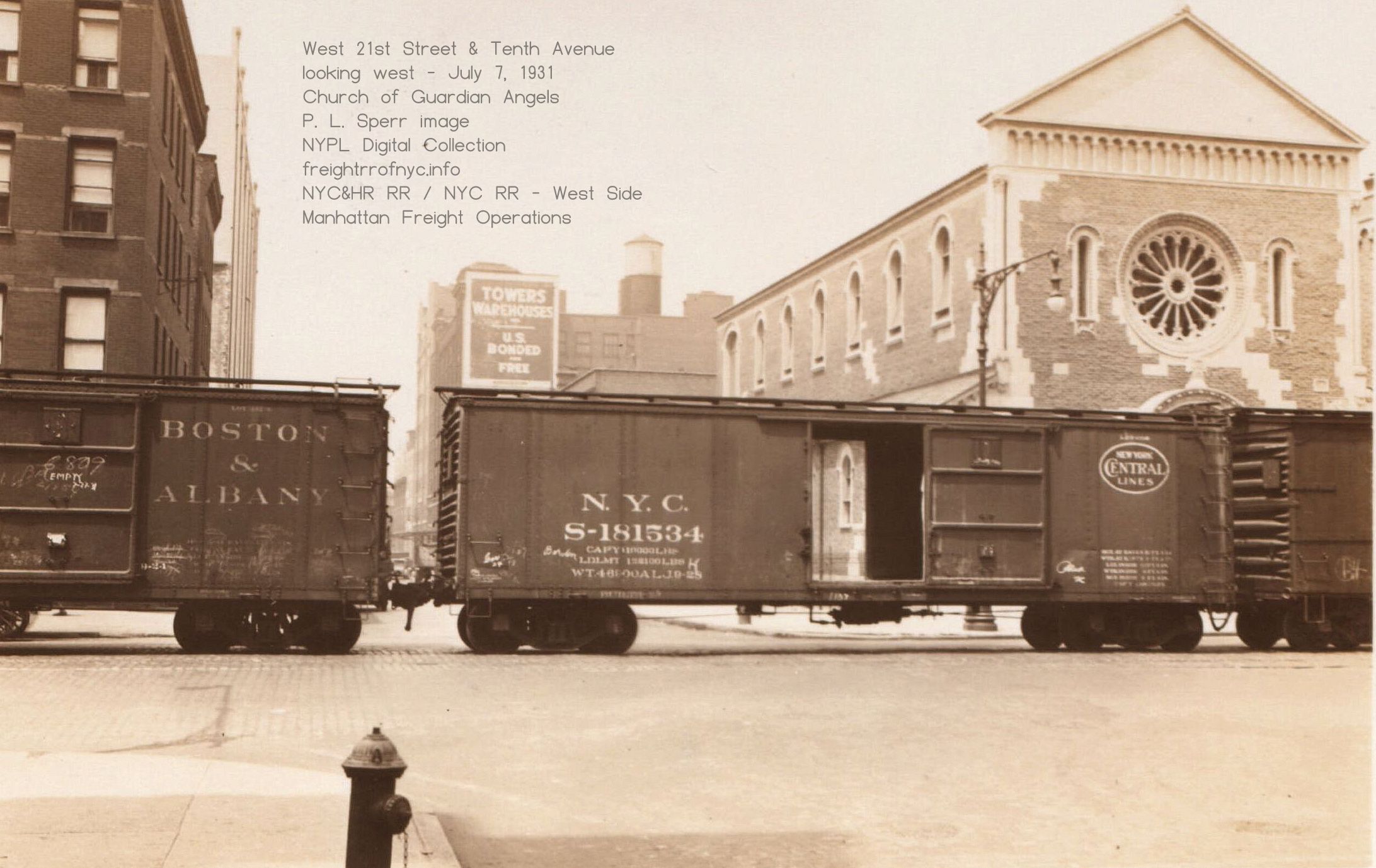 |
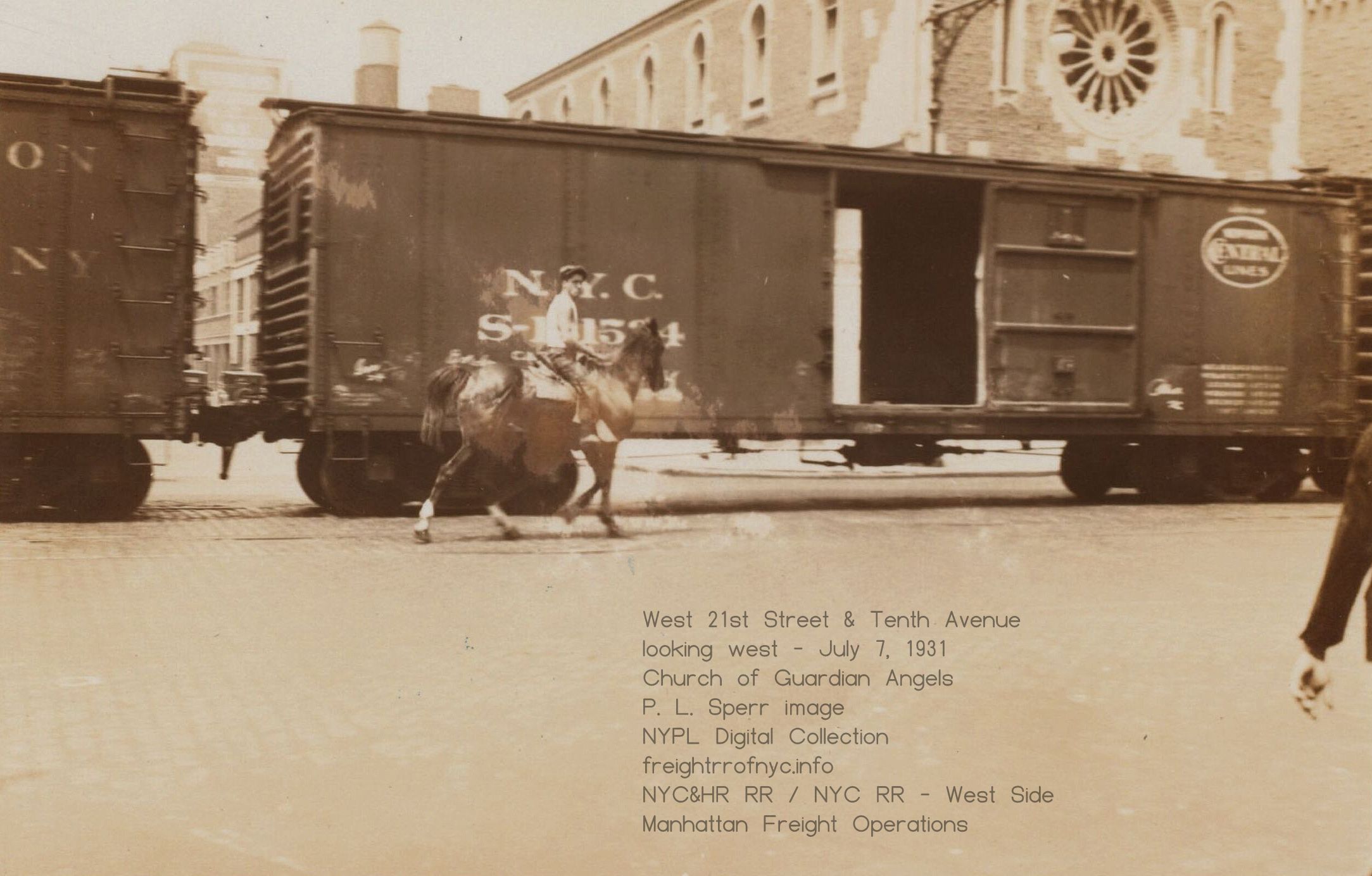 |
|
West 21st Street and
Tenth Avenue (looking
west)
- July 7, 1931
Church of Guardian Angels. In less than two years, the High Line will be built behind the church. New York Public Library Digital Archives P. L. Sperr photo added 19 August 2025 |
|
Tenth Avenue & West 17th Street - Fresh Produce Yard Team Tracks
United States Trucking Corp.; B & J Auto Spring
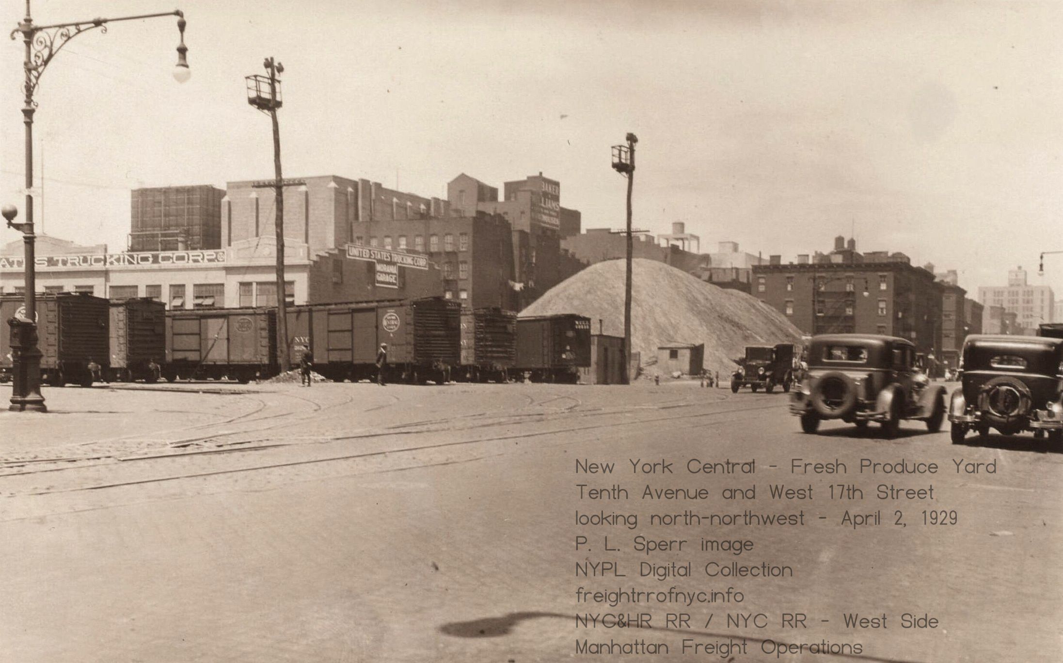 Tenth Avenue &
West 17th Street (looking northwest) - April 2, 1929
United States Trucking Corp. New York Public Library Digital Archives P. L. Sperr photo added 19 August 2025 |
| . . |
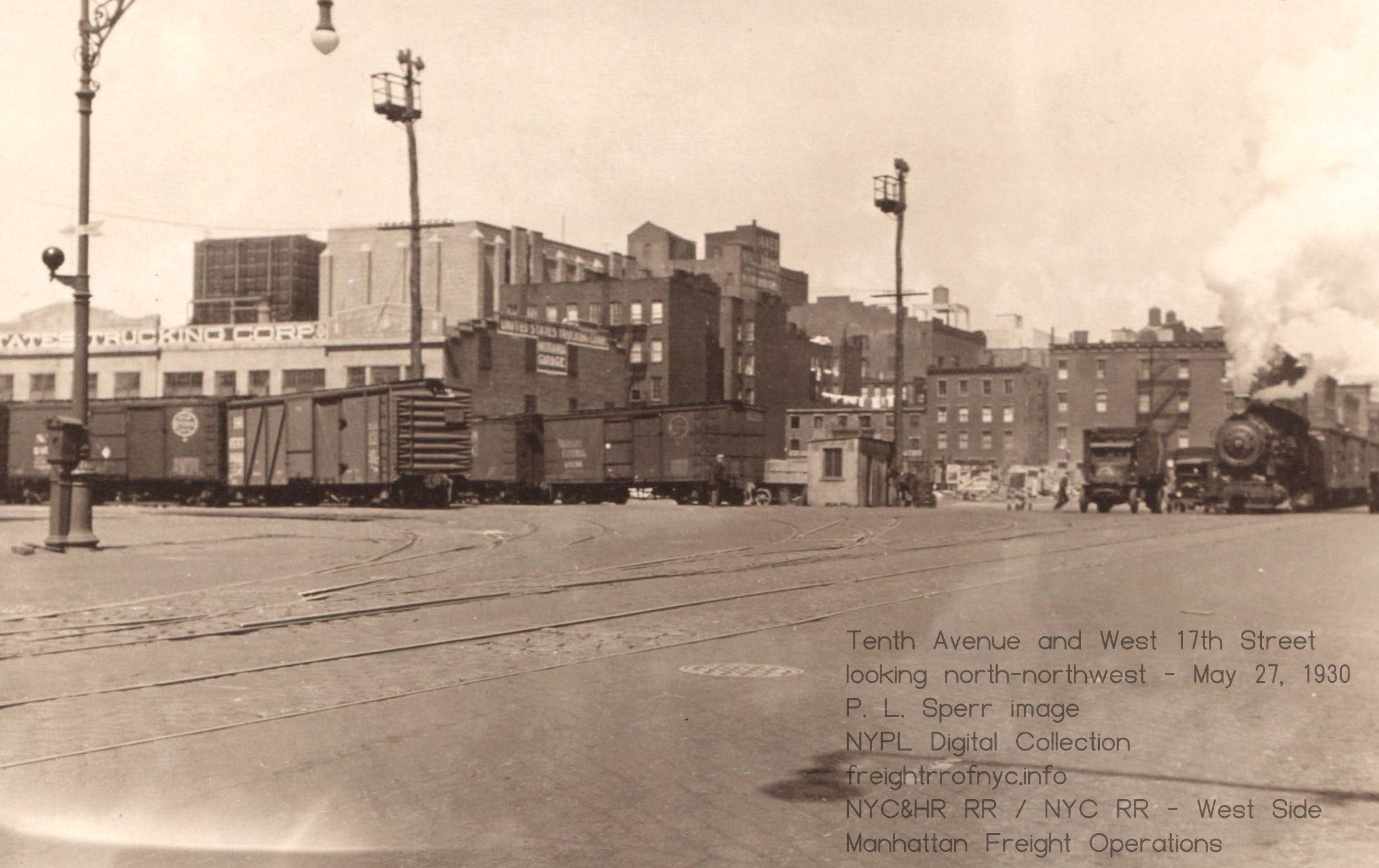 Tenth Avenue & West 17th Street (looking northwest) - May 27, 1930 New York Public Library Digital Archives United States Trucking Corp. P. L. Sperr photo added 19 August 2025 |
| . . |
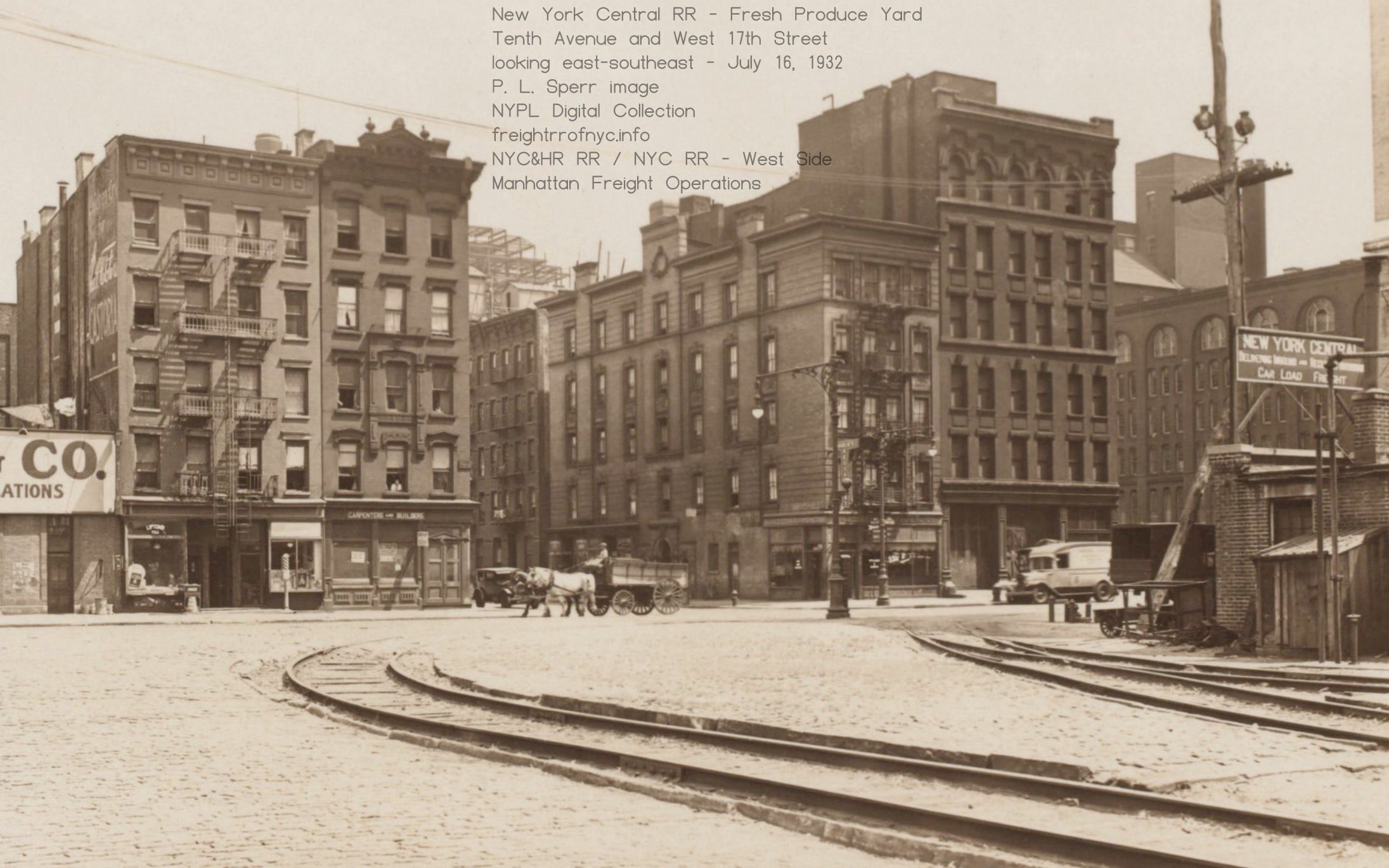 Tenth Avenue &
West 17th Street (looking east-southeast) - July 16, 1932
New York Public Library Digital Archives P. L. Sperr photo added 19 August 2025 |
| . . |
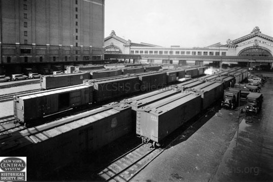 Tenth Avenue & West 17th Street (looking west-southwest) - Summer 1935 New York Central System Historical Soceity added 10 May 2026 . . |
Tenth Avenue & West 17th Street (looking east) - July 16, 1932 Looking east from Eleventh Avenue. B&J Auto Spring on Tenth Avenue. New York Public Library Digital Archives P. L. Sperr photo added 19 August 2025 |
| . . |
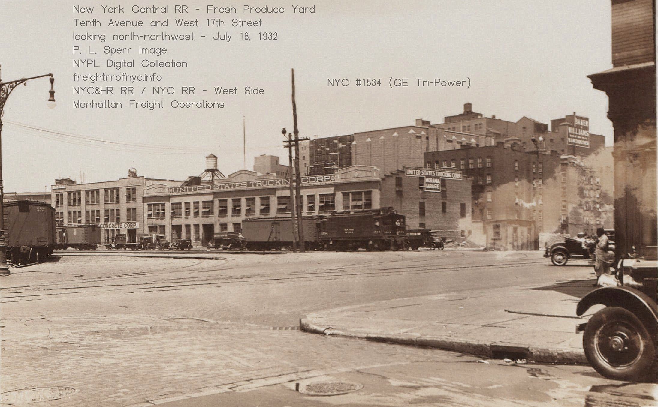 NYC #1534 coming onto on Tenth Avenue from the West 17th Yard Looking northwest. United States Trucking Corp. New York Public Library Digital Archives P. L. Sperr photo added 19 August 2025 |
| . . |
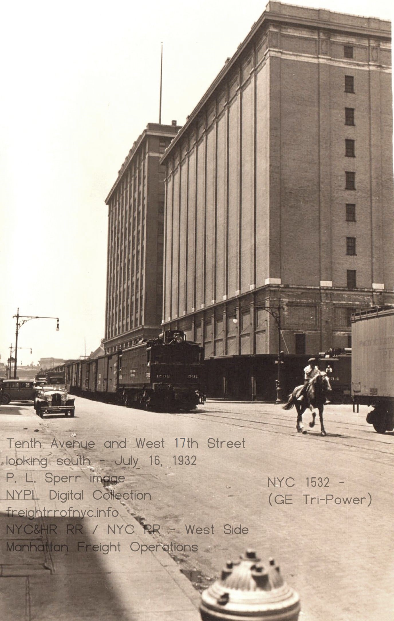 NYC #1532 coming north on Tenth Avenue, #1534 waiting to pull onto Tenth Avenue from the West 17th Yard (looking south) New York Public Library Digital Archives P. L. Sperr photo added 19 August 2025 |
| . . |
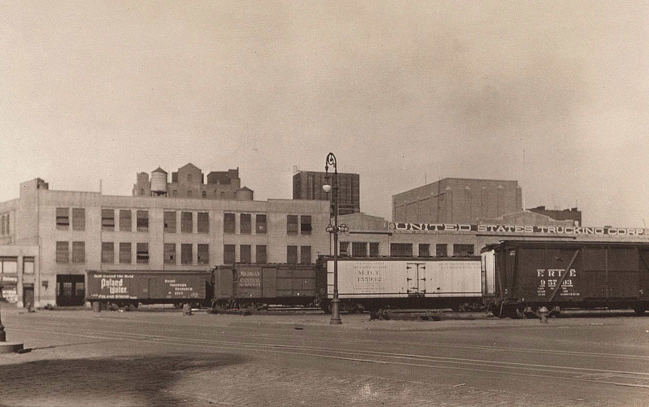 Looking northeast from Eleventh Avenue and West 16th Street - April 2, 1929 United States Trucking Corp. in on West 18th Street. New York Public Library Digital Archives P. L. Sperr photo added 19 August 2025 |
Tenth Avenue & West 14th Street - Uneeda Biscuit /
Uneeda Bakers (Nabisco)
Looking north from Tenth Avenue & West 14th Street - July 24, 1924 National Biscuit on left (west) and right (east), with Merchants Refrigerating behind (west building). The open area behind Merchants is the Fresh Produce Yard. New York Public Library Digital Archives Standard Photographic Service Borough President of Manhattan added 19 August 2025 |
| . . |
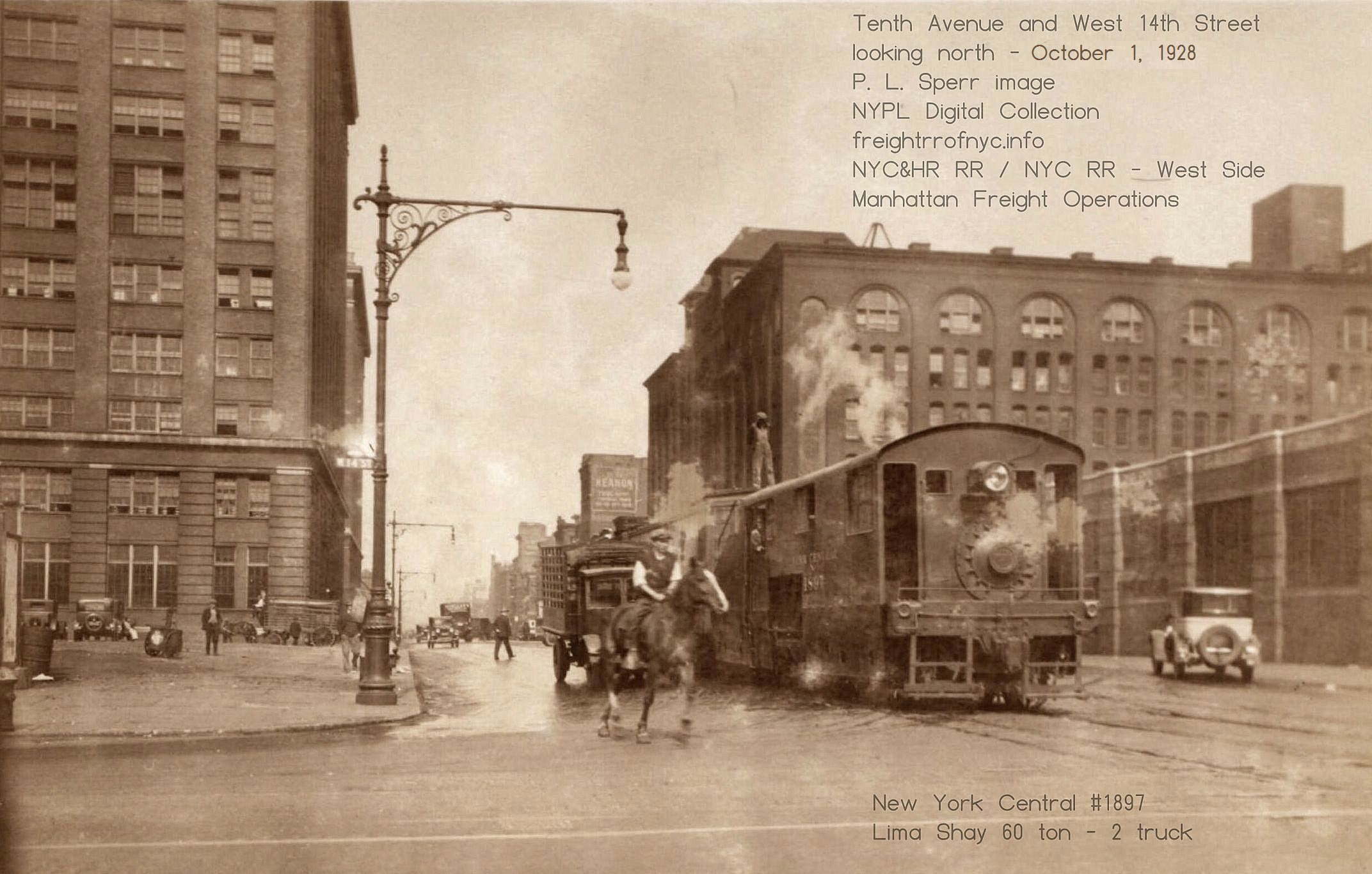 Looking north from Tenth Avenue &
West 14th Street- October 1, 1928
National Biscuit on left (west) and right (east). NYC #1897 (Lima Shay) New York Public Library Digital Archives P. L. Sperr photo added 19 August 2025 |
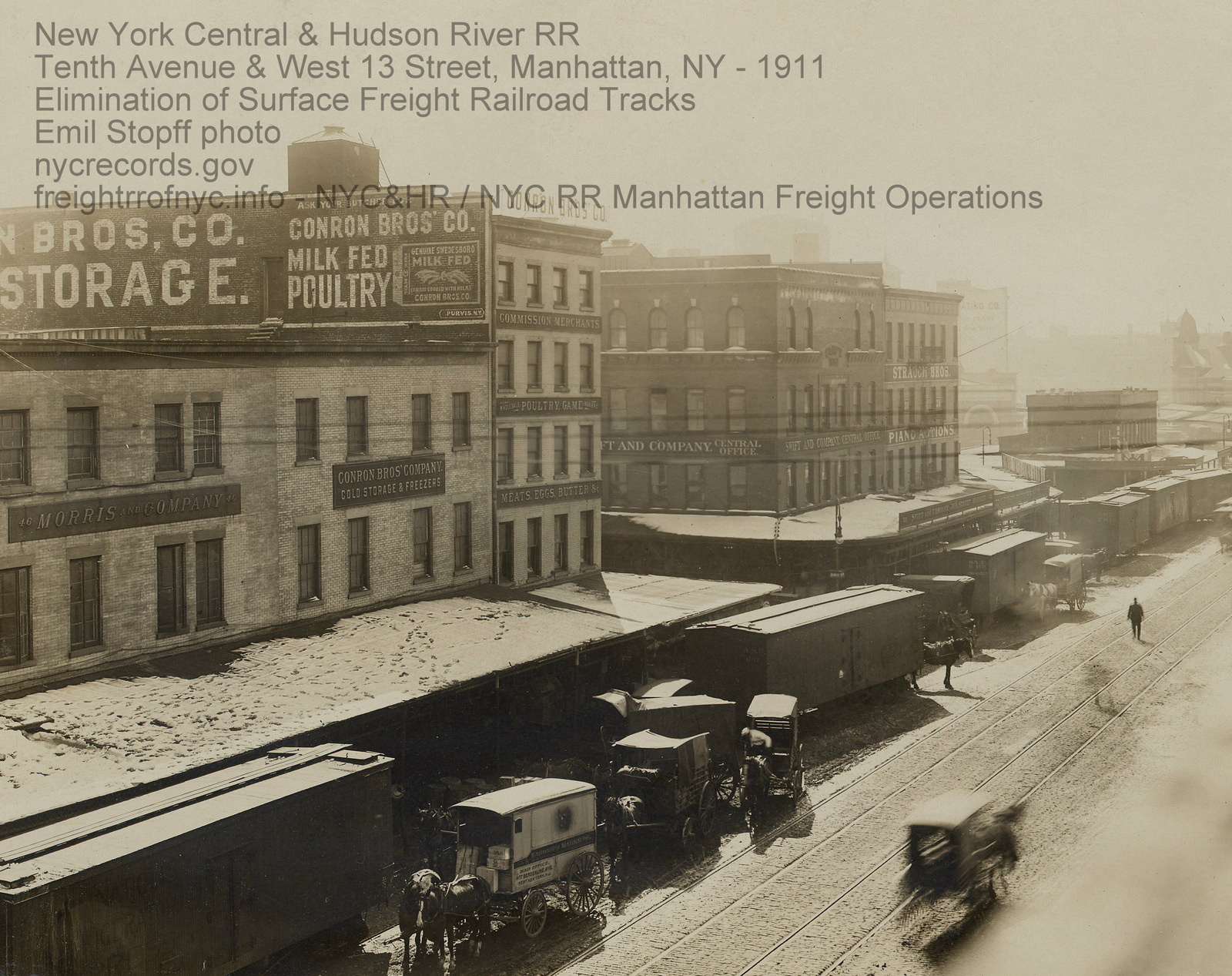
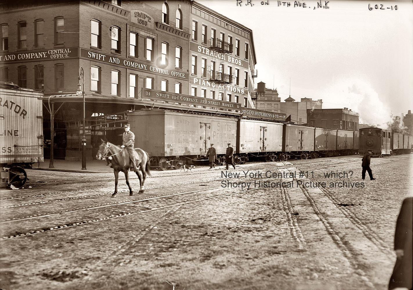

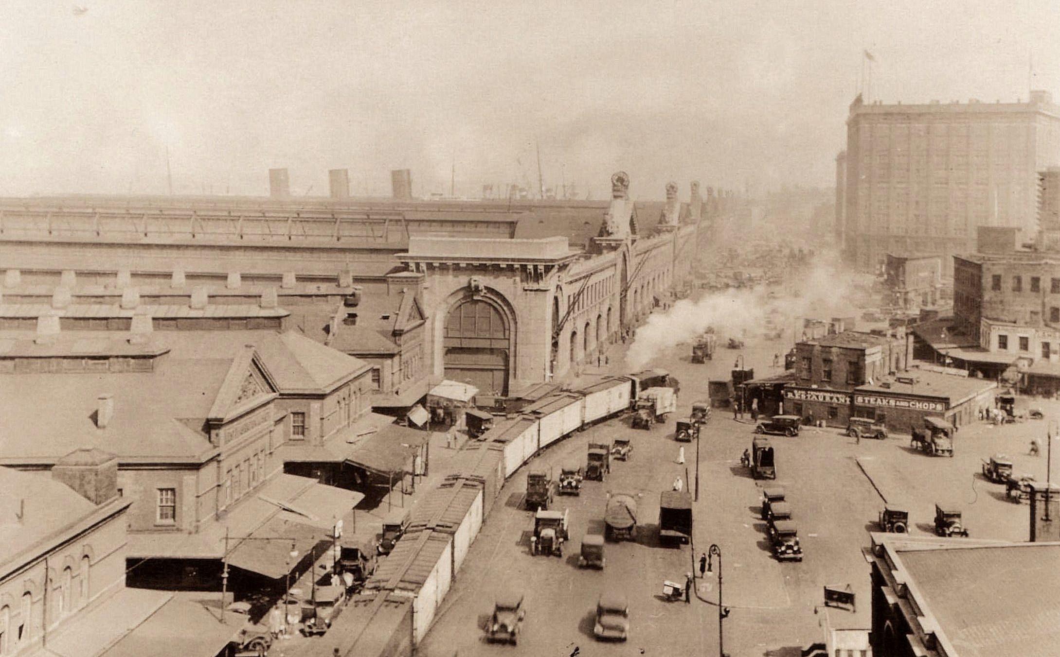 Looking north along West Street (Eleventh Avenue) at Gansevoort Street - April 31, 1929 Northbound Shay type locomotive. Taken from roof of Manhattan Refrigerating building New York Public Library Digital Archives P. L. Sperr photo added 19 August 2025 |
||||||||||
| . . |
||||||||||
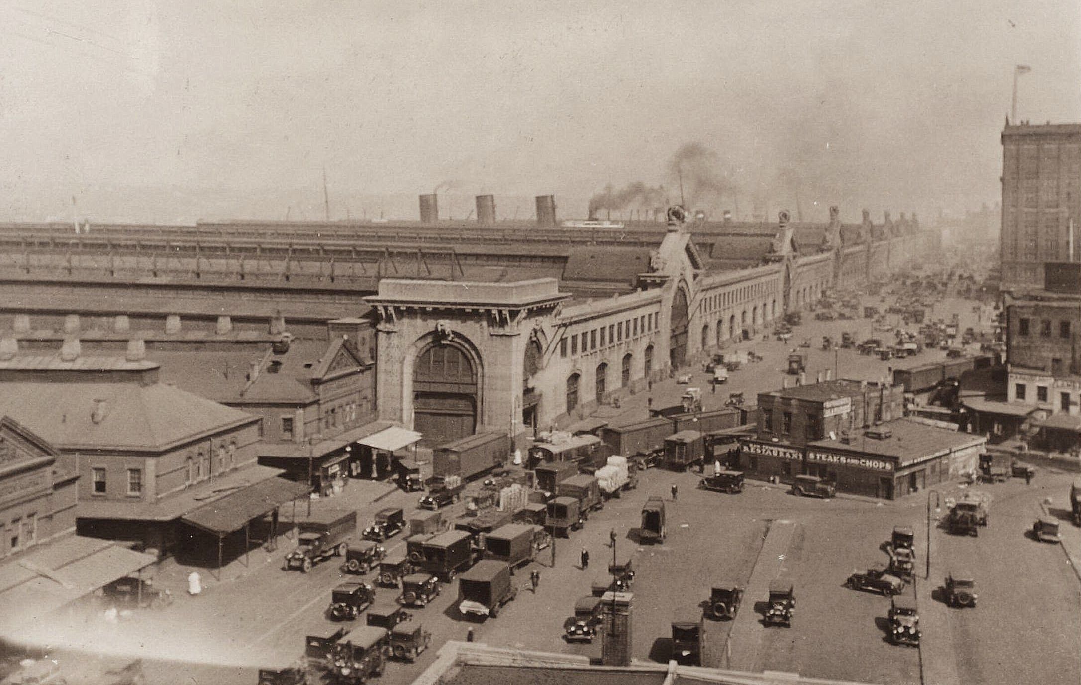 Looking north along West Street (Twelfth Avenue) & Gansevoort Street - April 31, 1929 Shay type locomotive shoving refrigerator cars in front of meat packers. Taken from roof of Manhattan Refrigerating Co. New York Public Library Digital Archives P. L. Sperr photo added 19 August 2025 |
||||||||||
| . . |
||||||||||
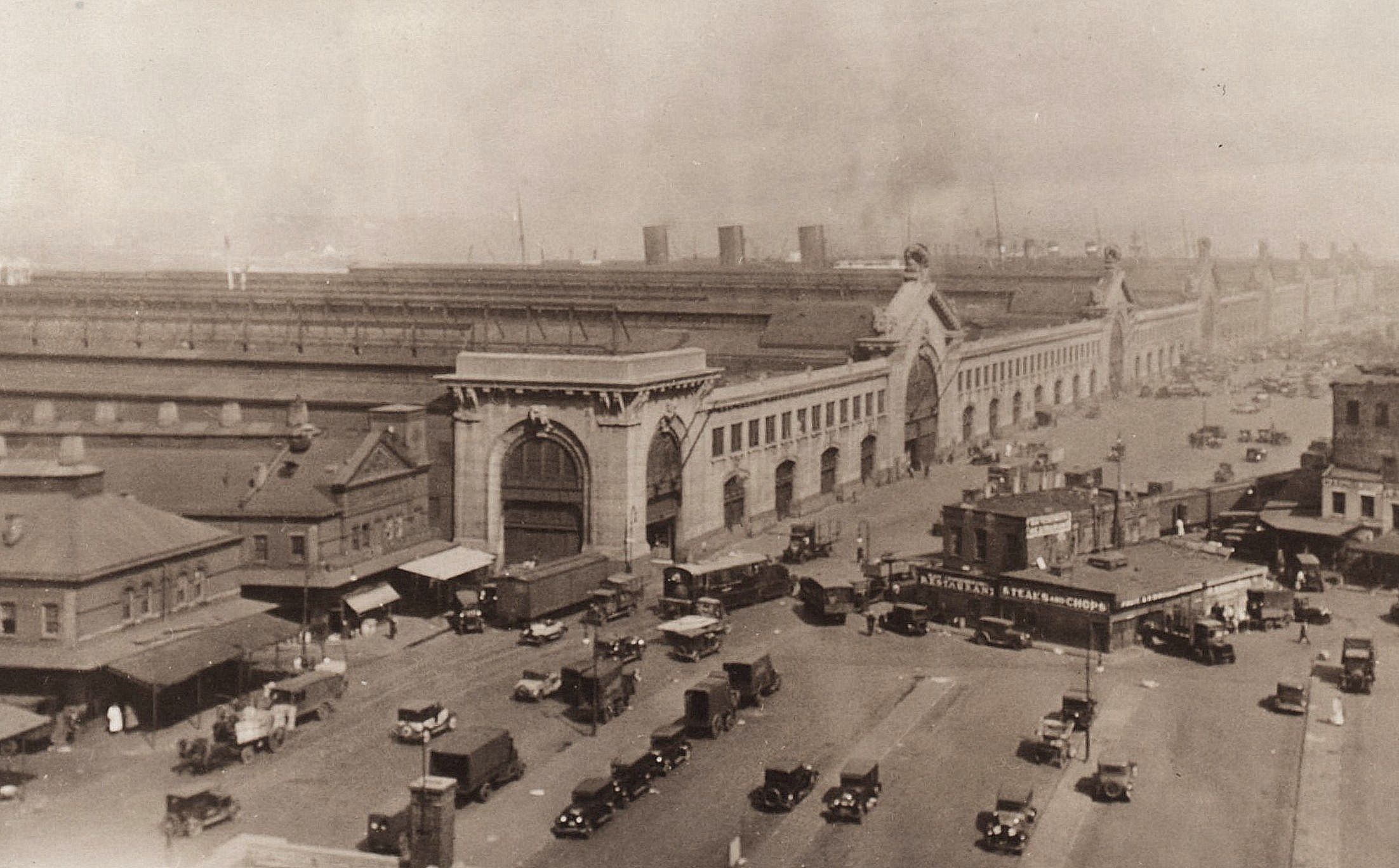 Looking north along West Street (Twelfth Avenue) & Gansevoort Street (looking north) - April 31, 1929 Shay type locomotive running light. Taken from roof of Manhattan Refrigerating Co. New York Public Library Digital Archives P. L. Sperr photo added 15 August 2025 |
||||||||||
| . . |
||||||||||
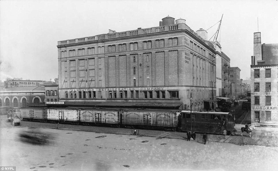 West Street (Tenth Avenue) & Horatio Street - ca. 1915 Looking east-northeast at Manhattan Refrigerating Company / David Mayer. added 15 August 2025 . . It
is worth mentioning that the Meat Packing District's webpage on Manhattan
Refrigeration is in error. It states:
"Artificial refrigeration and refrigerated trucking fueled the growth of the meatpacking business to an industrial and national scale. In the Meatpacking District, this was best exemplified by the Manhattan Refrigeration Company, which began operating in the neighborhood in 1898. The company built a massive complex that eventually included 9 buildings bounded by Horatio, Washington, West, and Gansevoort Streets. The complex was fueled by a central power station that delivered cooled air through underground refrigeration conduits to cold storage warehouses within an 18-block radius. These refrigerated buildings were not chilled by "cooled air" through street conduits, it was chilled salt water or brine that was pumped through the conduits. It was only inside of these buildings, that the chilled brine was passed through an evaporator where it chilled the air in that particular room or set of rooms. Basic thermodynamics clearly states chilled liquids will retain temperature better than chilled gases over distance. Chilled air (a gas) is not efficient for traveling distances as chilled liquids (salt water). A brine system uses a chilled liquid (salt water / brine) as a secondary refrigerant to transfer thermal energy from a target area (the freezer rooms) to a primary refrigeration system. The brine circulates in a closed loop to provide reliable cooling, especially for industrial applications that require temperatures below freezing. Thermodynamic principles: The brine cooling system operates on the principles of the vapor-compression refrigeration cycle, but with an intermediate step involving the brine.
Additionally, several City of New York documents state the Manhattan Refrigeration Co. (as well as others) paid a yearly fee for the placement of conduits to both draw salt water from the North (Hudson) River, was well as to pump chilled saltwater to the various buildings under the streets, and the New Washington Street Market. 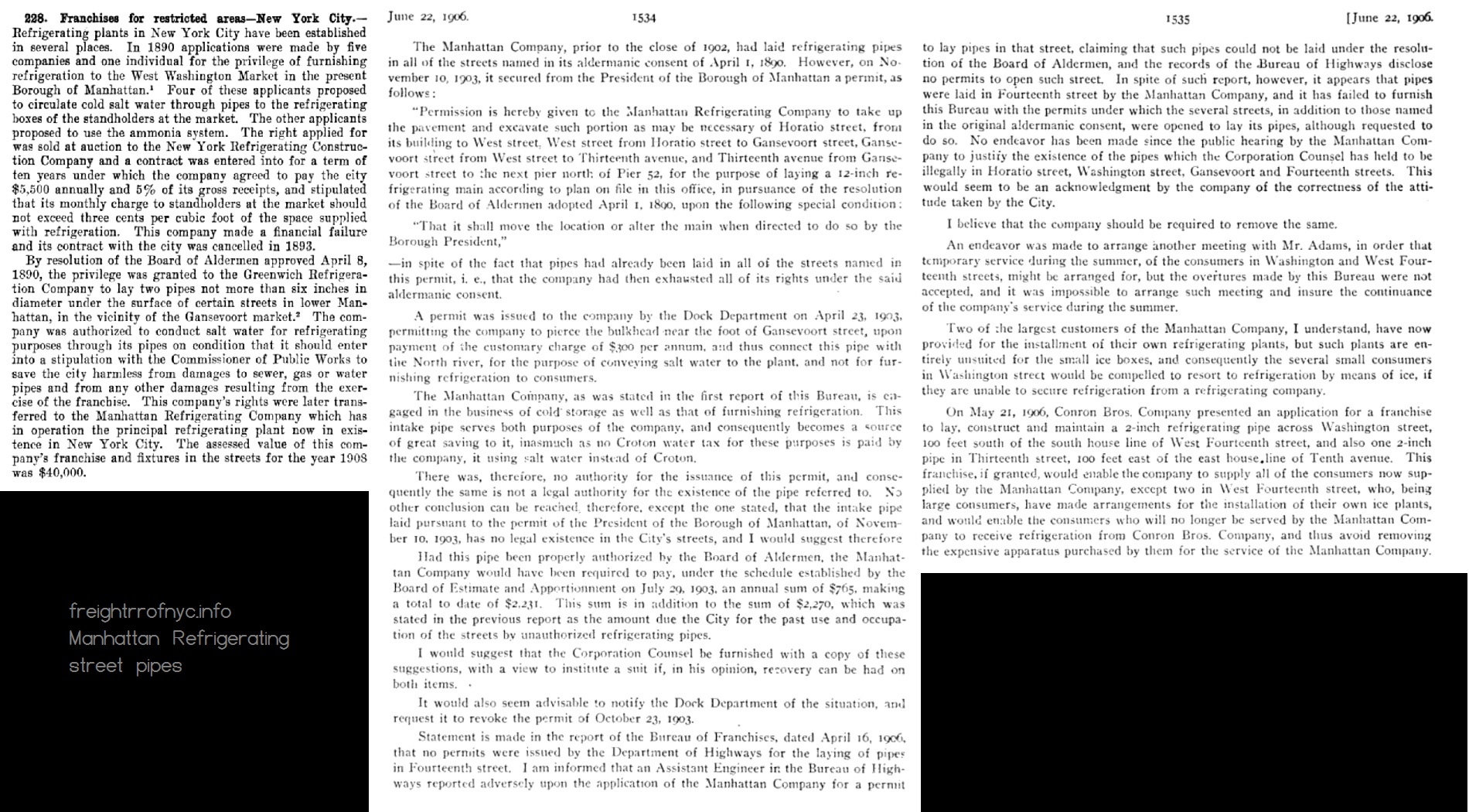
Many ice rinks use this system, where chilled
brine is
pumped through pipes cast in a concrete base, and where water is placed
on top, to freeze.
This may be trivial, but accuracy in history is paramount to a historian. |
||||||||||
| . . |
||||||||||
|
|
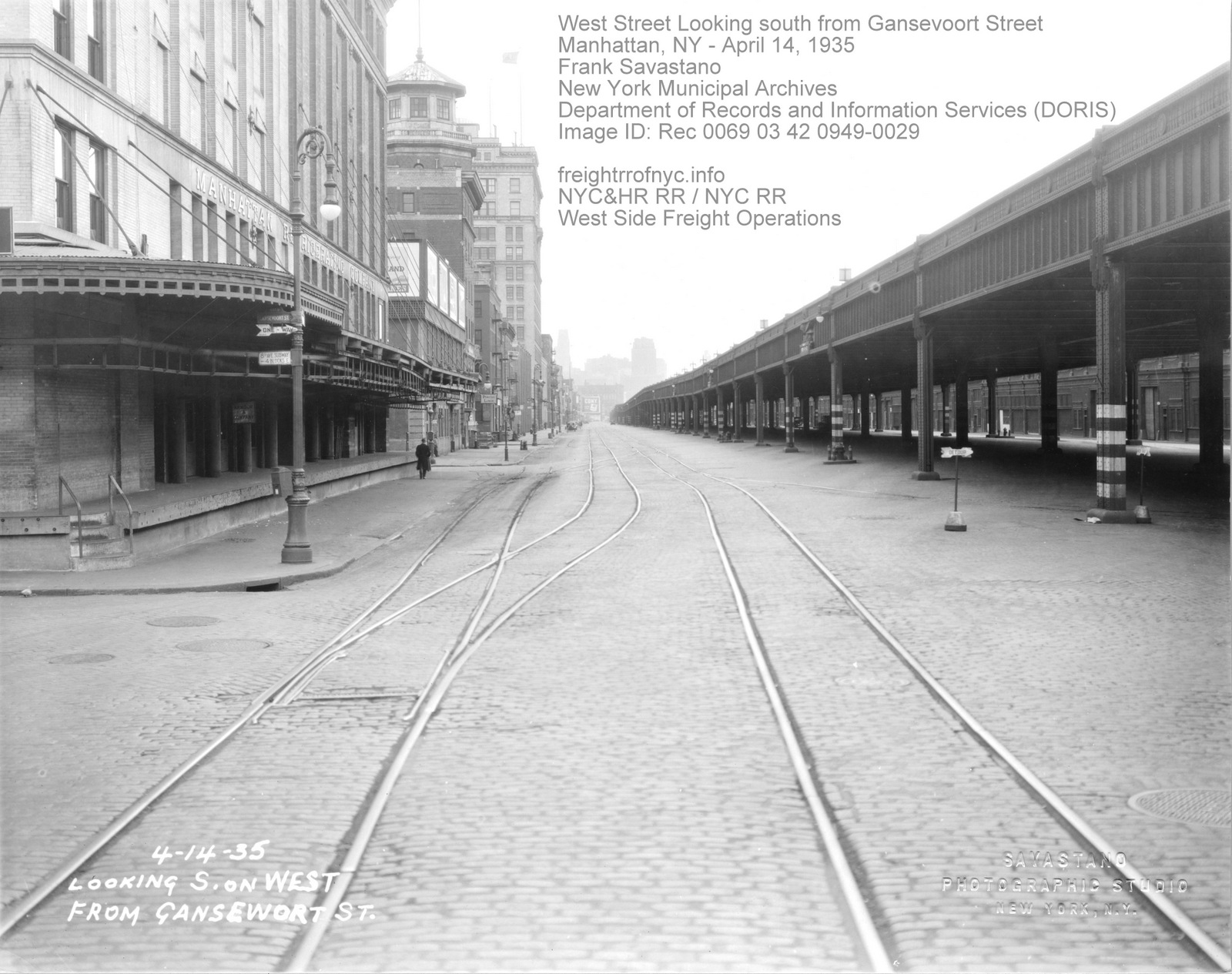
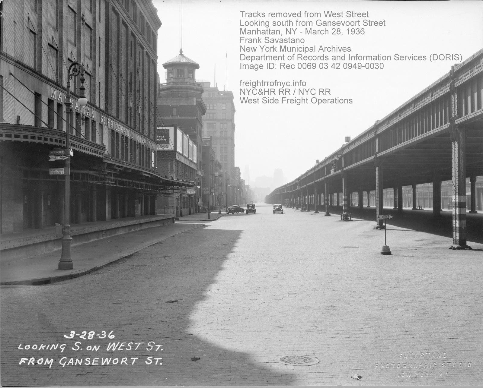
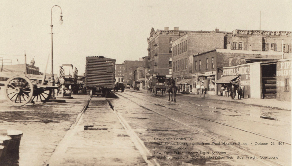
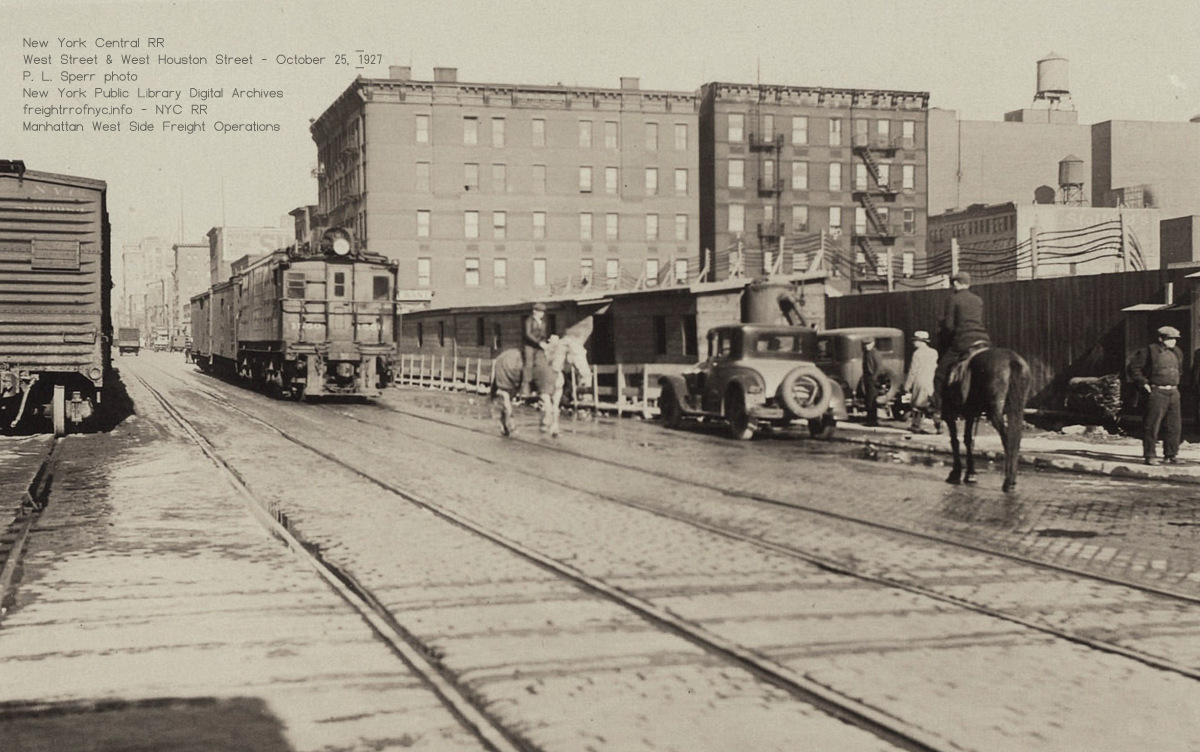
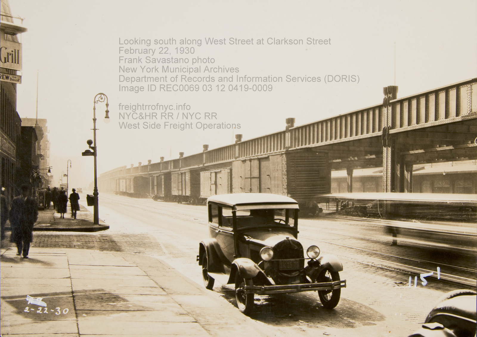
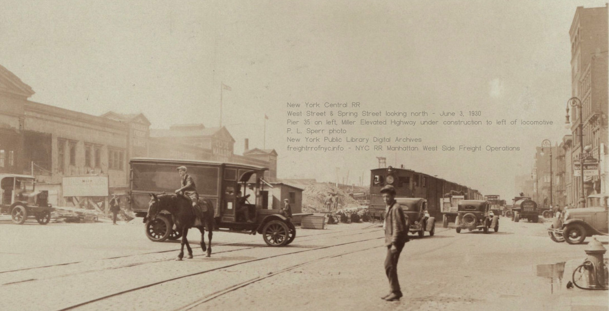
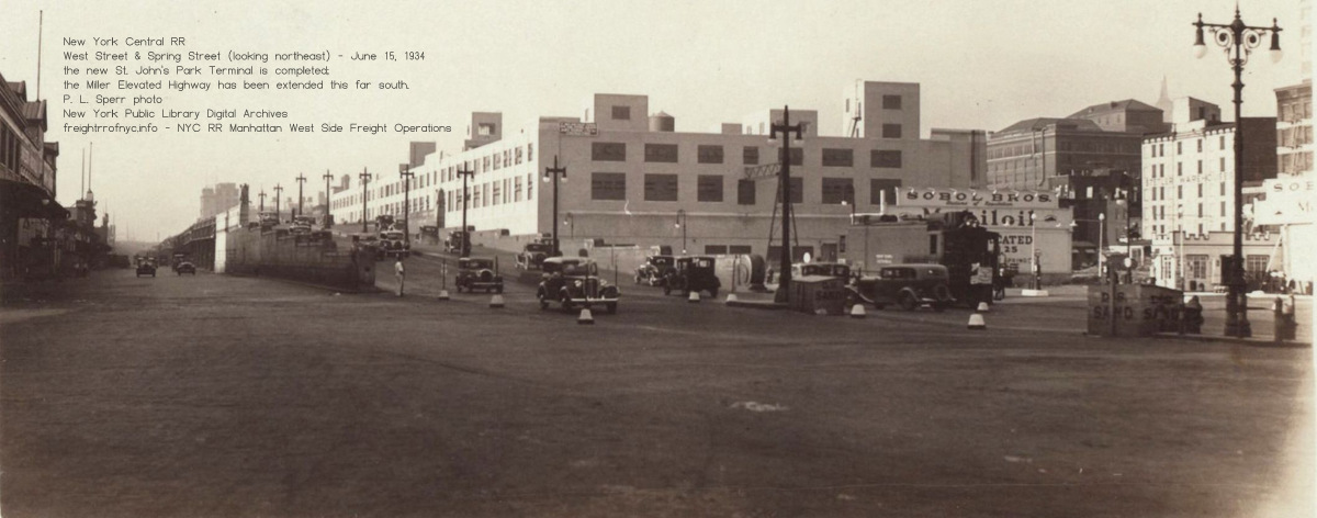
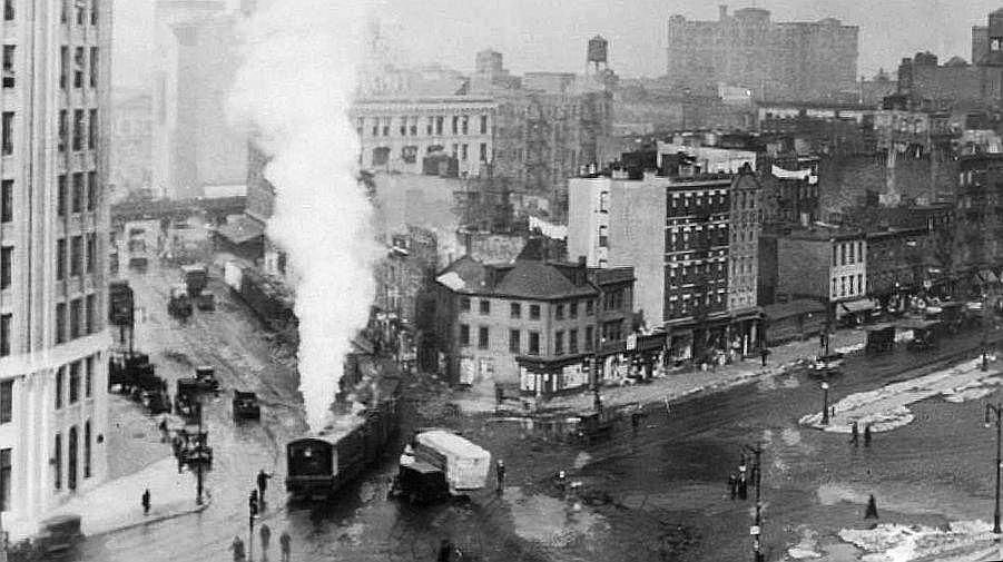 Looking west-northwest with locomotive on Canal Street turning right onto Hudson Street - unknown date Note, that is not the High Line over Canal Street behind the train, that is the IRT Ninth Avenue Elevated over Greenwich Street. added 15 August 2025 |
| . . St. John's Park Terminal (first): 1868 - 1927
. .
Contained within the book "Port of New York Terminal
Facilities", by Gratz
Mordecai, 1885 is this diagram of the old St. John Park Terminal, as
well as particulars to its design and operation.
. .
|
| . . |
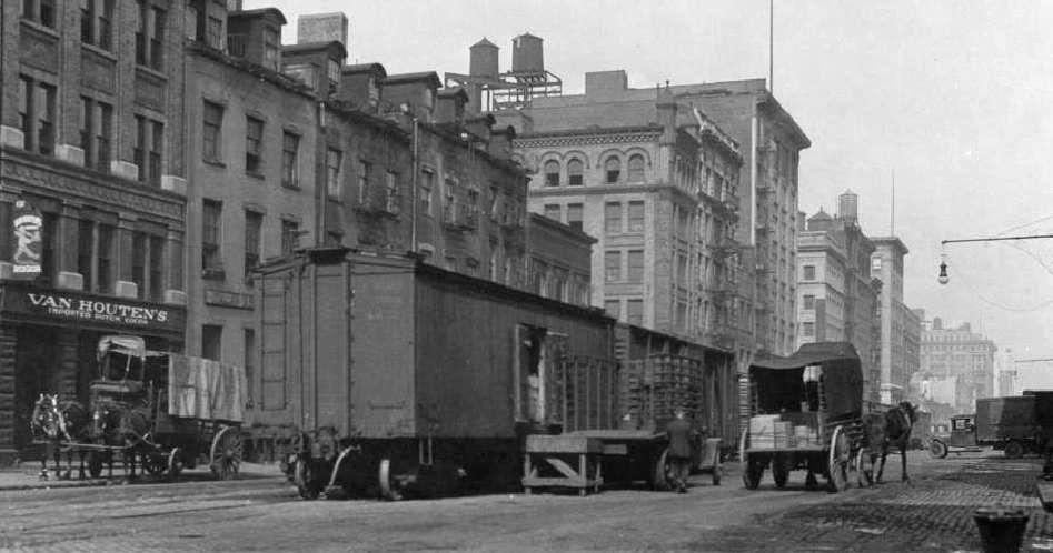 Hudson Street and Beach Street looking north - ca. 1920 St John's Park Terminal out of view right edge. This is an interesting image for it shows portable ramps and platforms used for loading / unloading of boxcars on street trackage, thereby making them impromptu team tracks. added 15 August 2025 |
| . . |
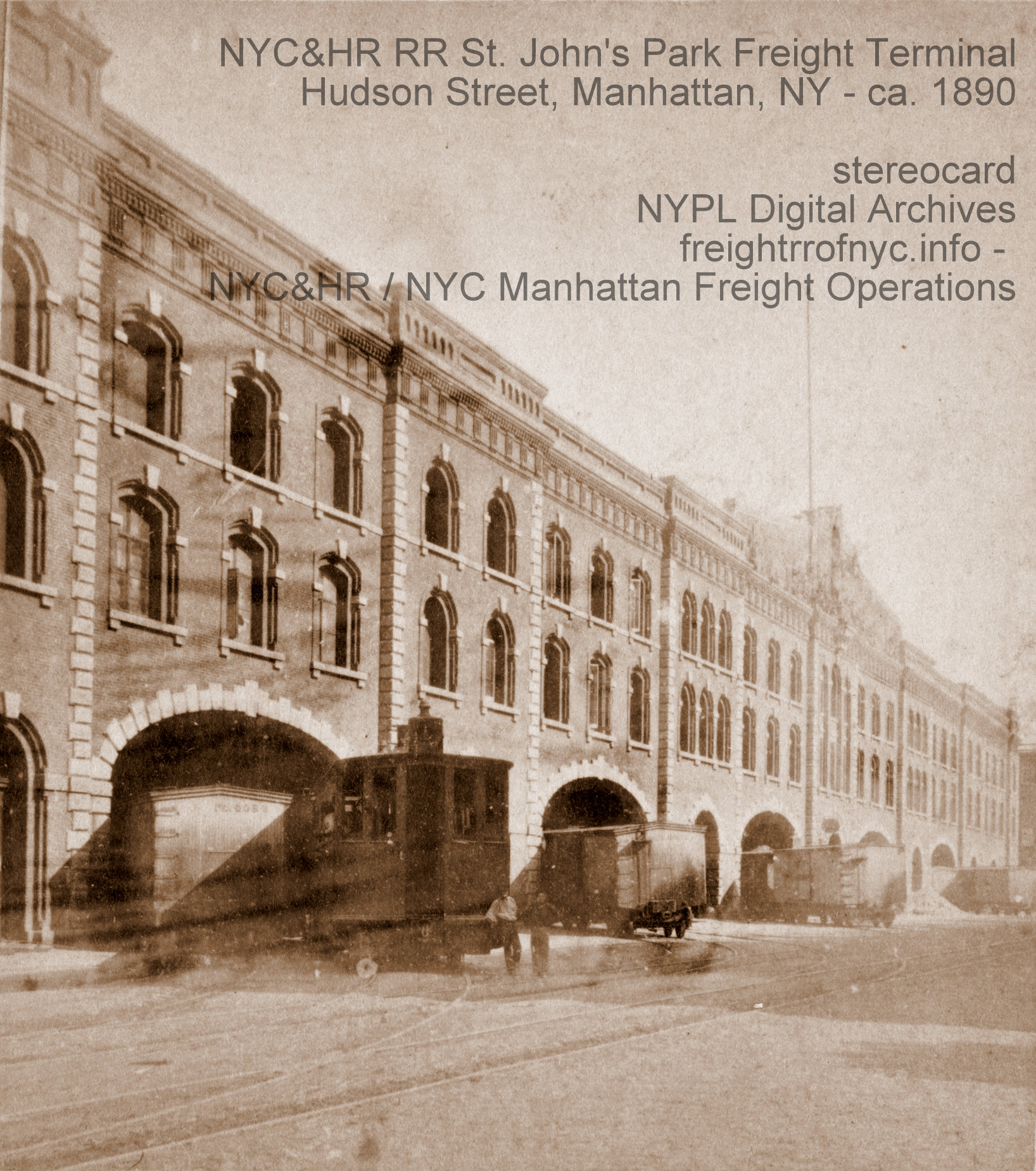 St. John's Park Freight Terminal - 1890 0-4-0T Dummy with crew posing on Hudson Street (looking southeast) Stereoview Card added 15 August 2025 |
| . . |
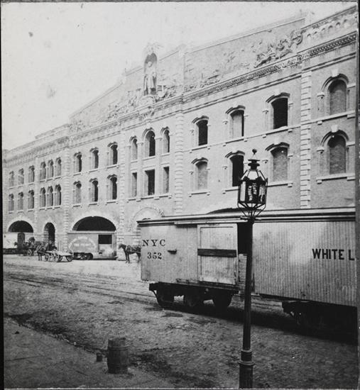 St. John's Park Freight Terminal - undated Showing Vanderbilt Sculpture and Pediment over main entrance. Hudson Street (looking northeast) added 15 August 2025 |
| . . |
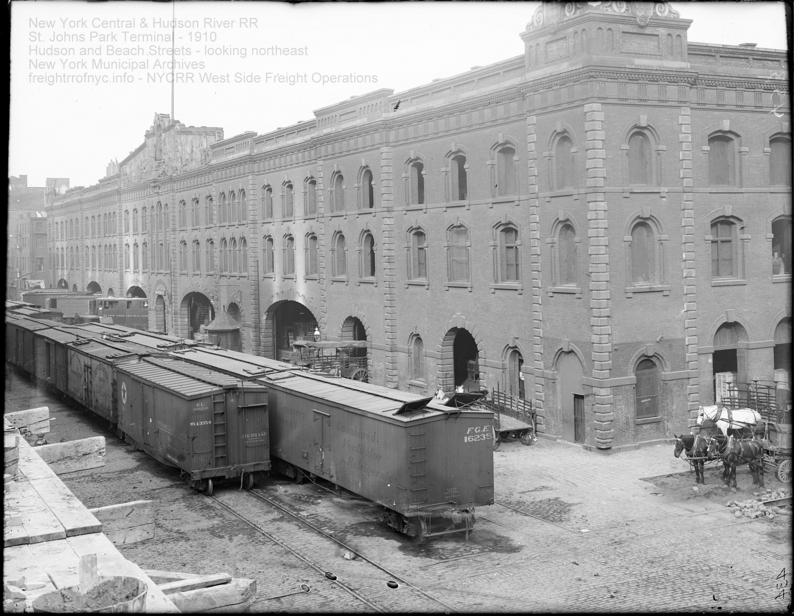 St. John's Park Freight Terminal - 1910 Looking northeast from Hudson Street and Beach Street New York Municipal Archives added 15 August 2025 |
| . . |
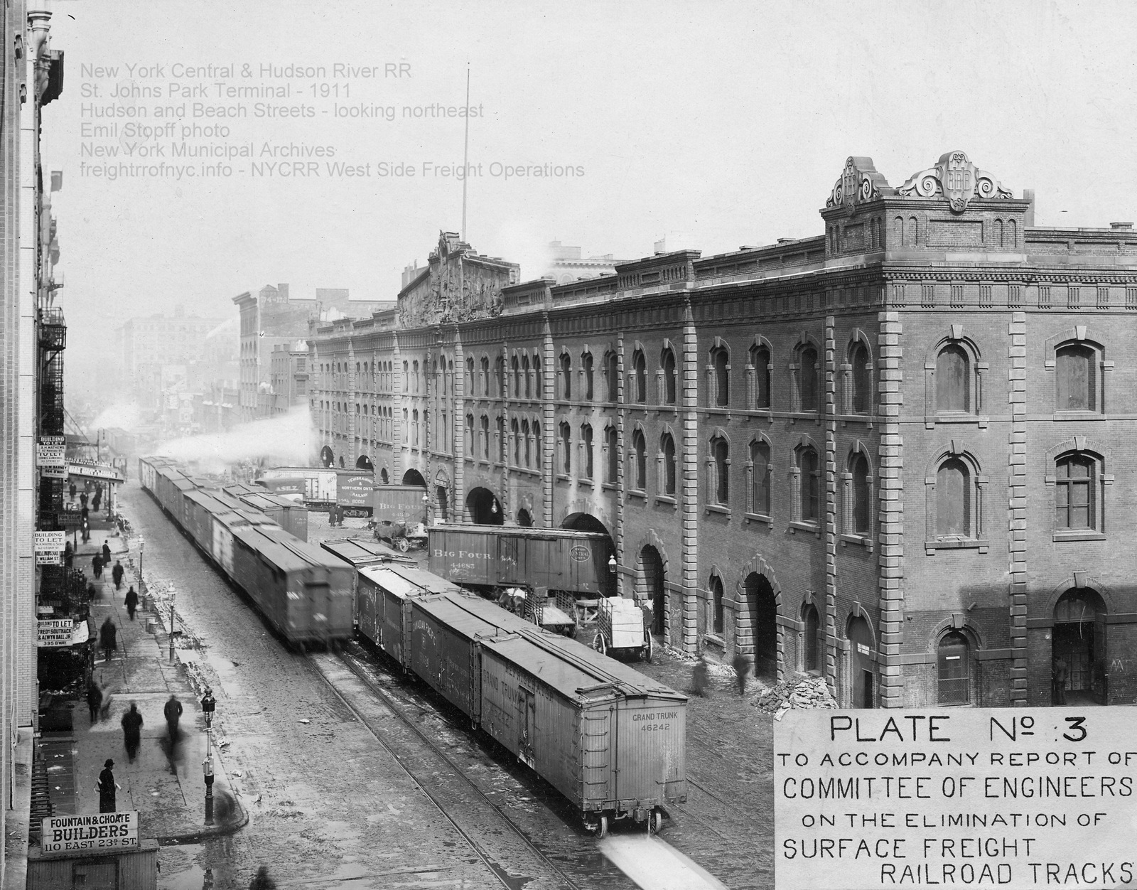 St. John's Park Freight Terminal - 1911 Looking northeast from Hudson Street and Beach Street Emil Stopff photo New York Municipal Archives added 15 August 2025 |
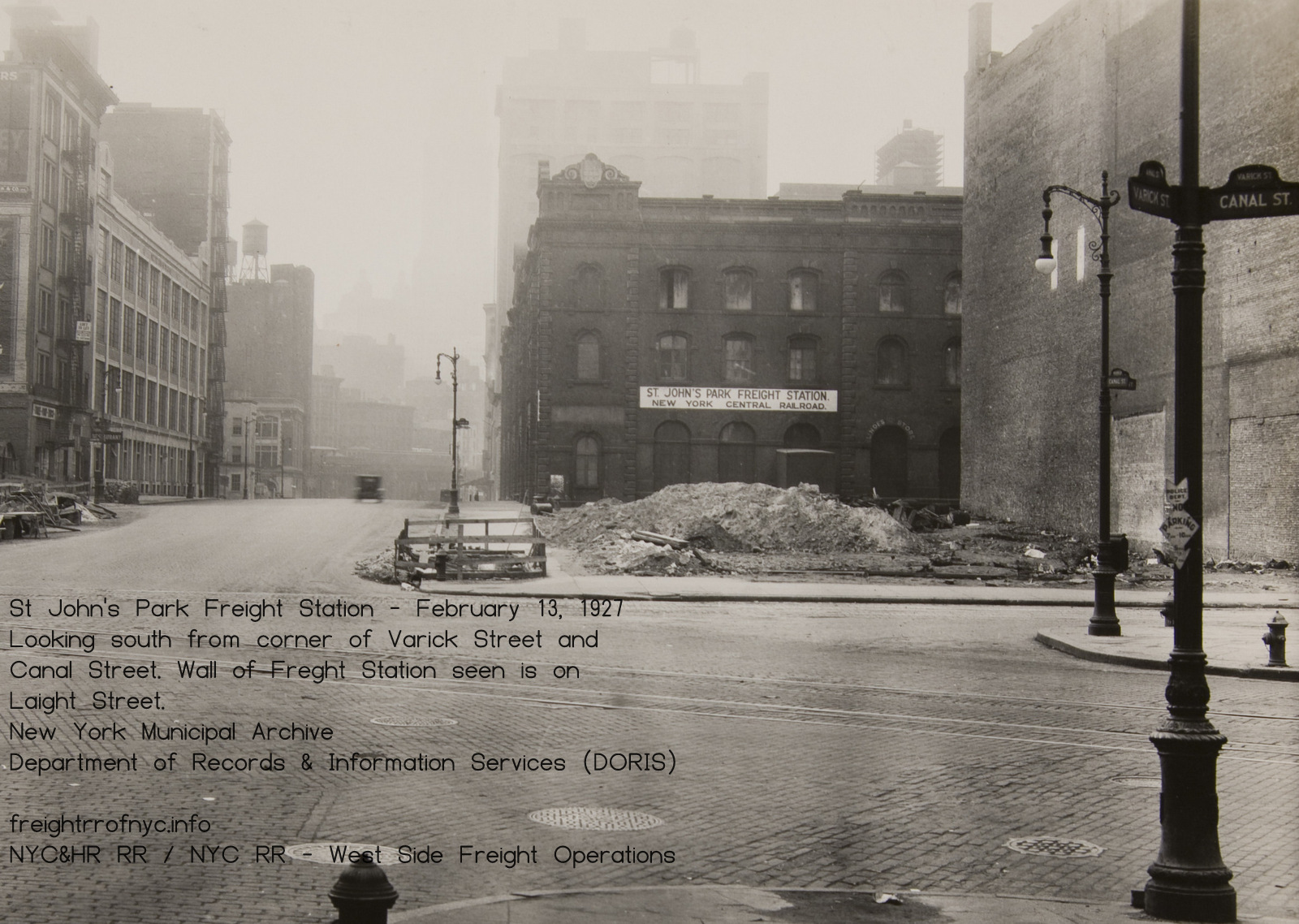
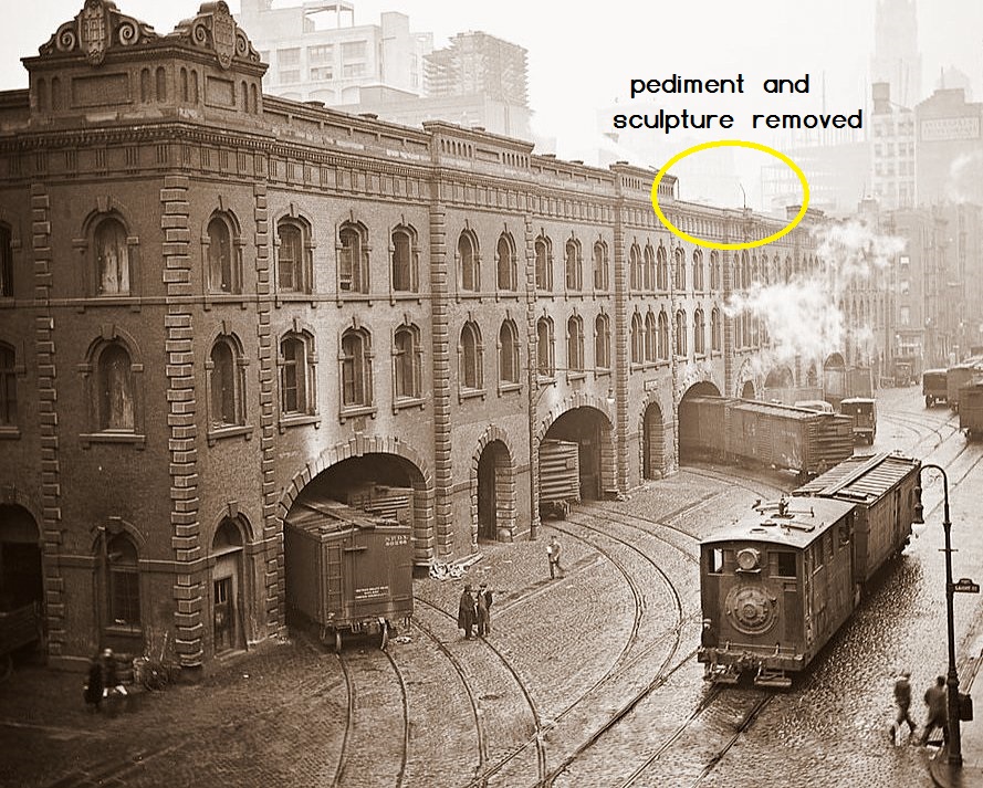
"The boxcars have some steel ends mixed in, but most glaring of all, the 150 foot Bronze relief and Vanderbilt statue are missing from the facade top in this photo. I would think this would place it towards the end of its working life (on or about 1928 to 1932)."
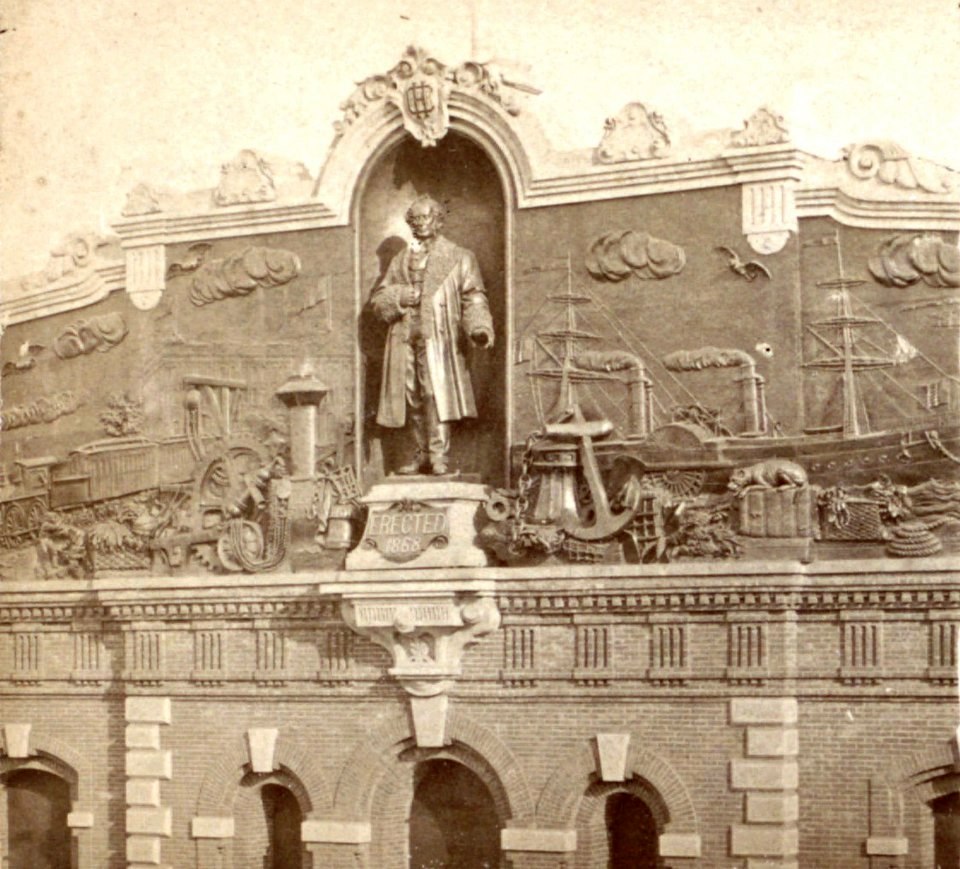 sculpture and pediment prior to removal from St. John's Park Freight Station. |
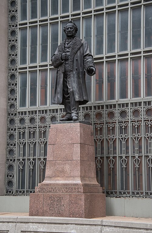 sculpture on display, south facade Grand Central Terminal Wikimedia Commons, image by MJ. |
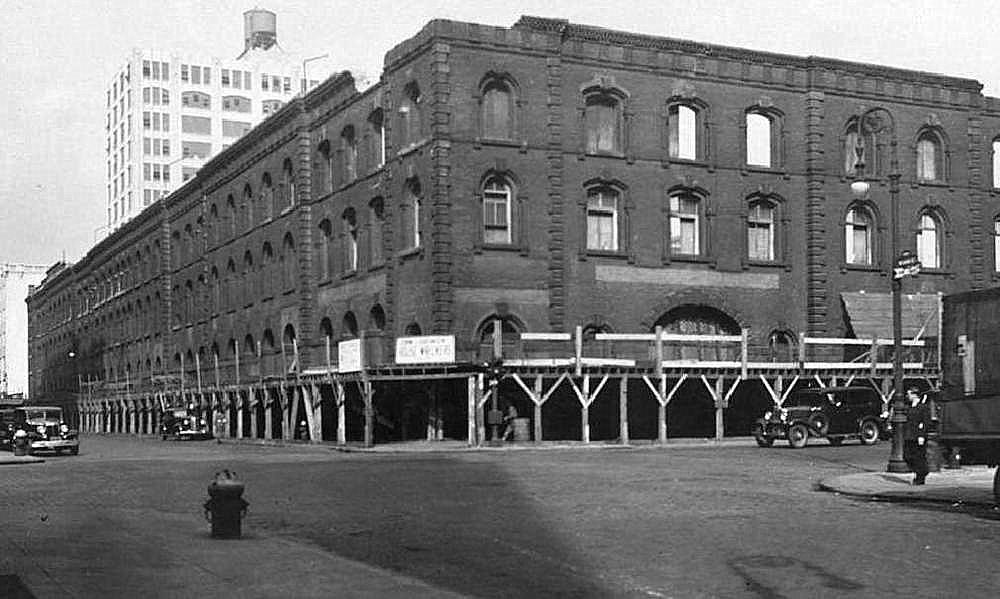 demolition begins, 1936 |
 |
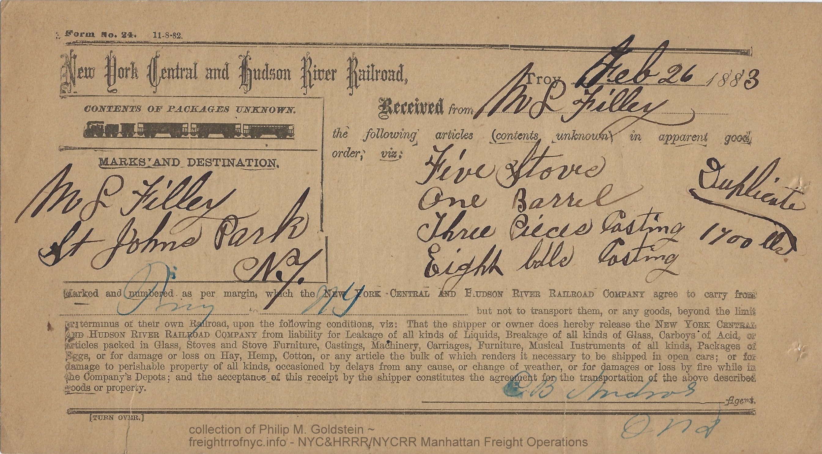 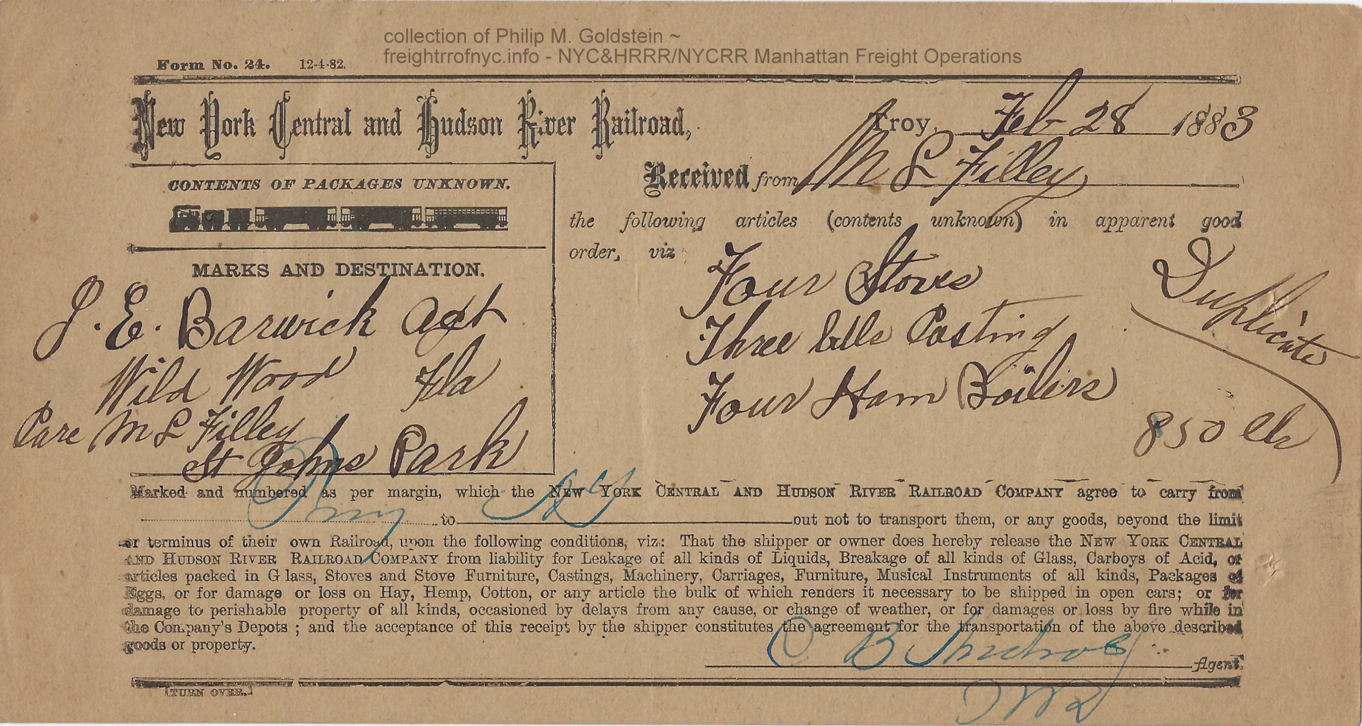  Duplicate Shipping Receipts for freight delivery from Troy, NY to St. Johns Park Freight Terminal; Manhattan, NY - 1883 Form 24 M. L. Filley J. E. Barwick, agent Wild Wood, Florida authors collection |

| you are on: | Page 1: | History and Operations: 1846 through 1941 (street operations) |
| go to: | Page 2: | History and Operations: 1926 through 1982 (West Side Improvement; High Line & sub-grade cut operations) |
| go
to: |
Page 3: | Locomotive & Equipment Histories, Rosters & Images |
| go to: | Page 4: | Maps (Property Atlases, Port Terminal Facilities, Track, Siding Location and Valuation) and Employee Time Tables |
| Ordinances of the Mayor, Aldermen and Commonality of the City of New York | D. T. Valentine | 1859 |
| Port of New York Terminal Facilities | Gratz Mordechai | 1885 |
| Documents of the Assembly of the State of New York | 1917 | |
| Report of the Commission to Investigate the Surface Railroad Situation in the City of New York | 1918 | |
| Joint Report with Comprehensive Plan | New York, New Jersey Port and Harbor Development Commission | 1920 |
| Water Terminal and Transfer Facilities for the First District of New York | US Government Printing Office | 1920 |
| The New York Central Electrification | General Electric | 1929 |
| Port and Terminal Facilities, Port of New York; Volumes 1, 2 and 3 | War Department, Army Corp of Engineers | 1932, 1942, 1953 |
| New York Central Early Power | Alvin Staufer | 1967 |
| The Wreck Of The Penn Central | Joseph R. Daughen & Peter Binzen; | 1971 |
| When the Steam Railroads Electrified | William D. Middleton | 1974 |
| Memories of New York Central Steam | Arnold Haas | 1980 |
| The Port of New York, Volume 1 and 2 | Carl W. Condit | 1981 |
| Dawn of the Diesel Age | John F. Kirkland | 1983 |
| Historic American Engineering Report NY-557A | Thomas R. Flagg & Gerald Weinstein | 2006 |
- Sahib Akhundzadeh
- Thomas R. Flagg
- Al Galanty
- Stephen Grande
- Terry Link / Canadian Southern website
- Richard Maudsley
- Paul Woods
- New York Central Railroad Fangroup on Facebook
- New York Central System Historical Society
- New York City Department of Records and Information Services (DORIS)
- New York City Municipal Archives
- New York Public Library Digital Collection
- New York Times digital archives
Like what you see? Suggestions?
Comments?


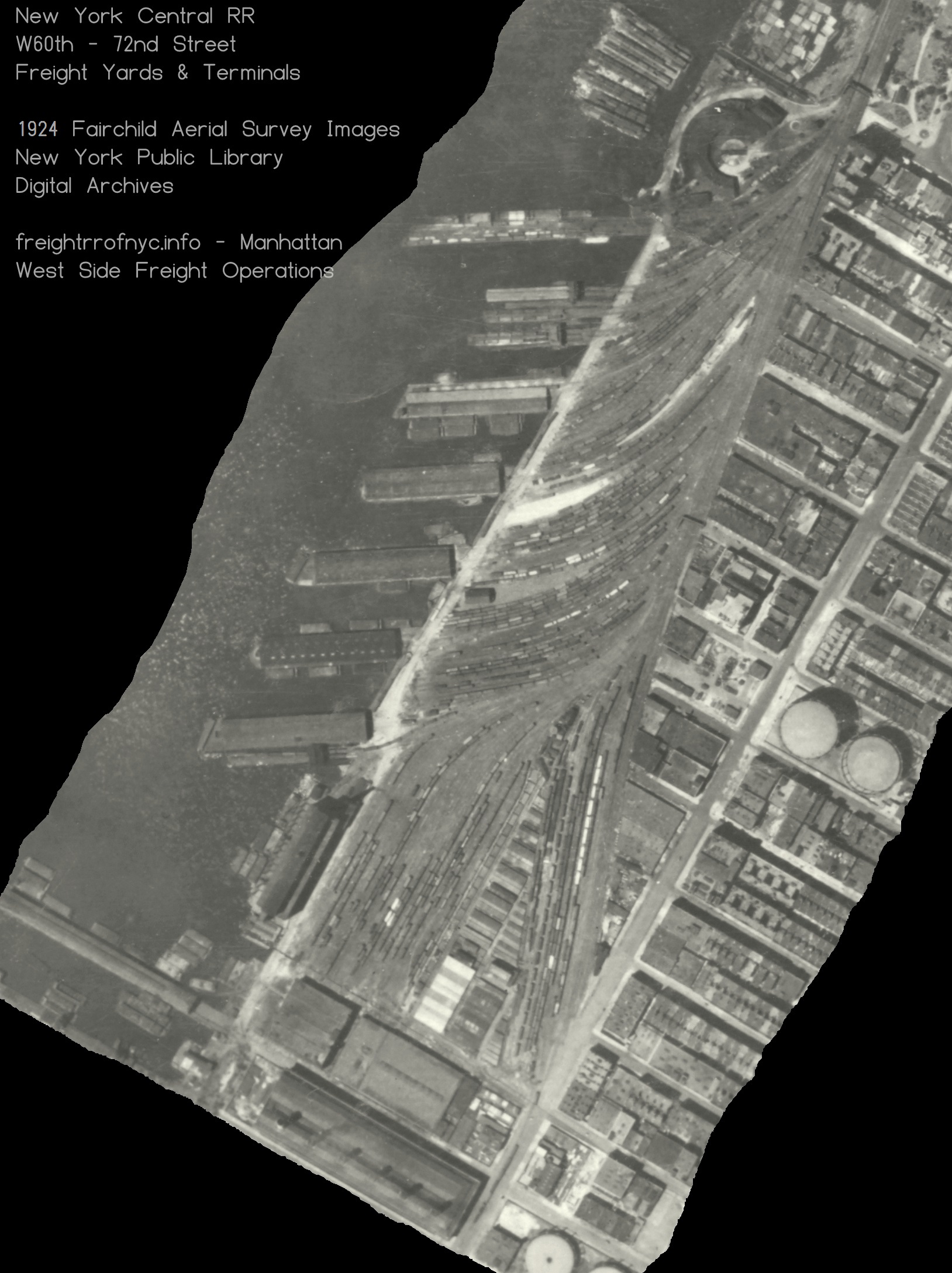
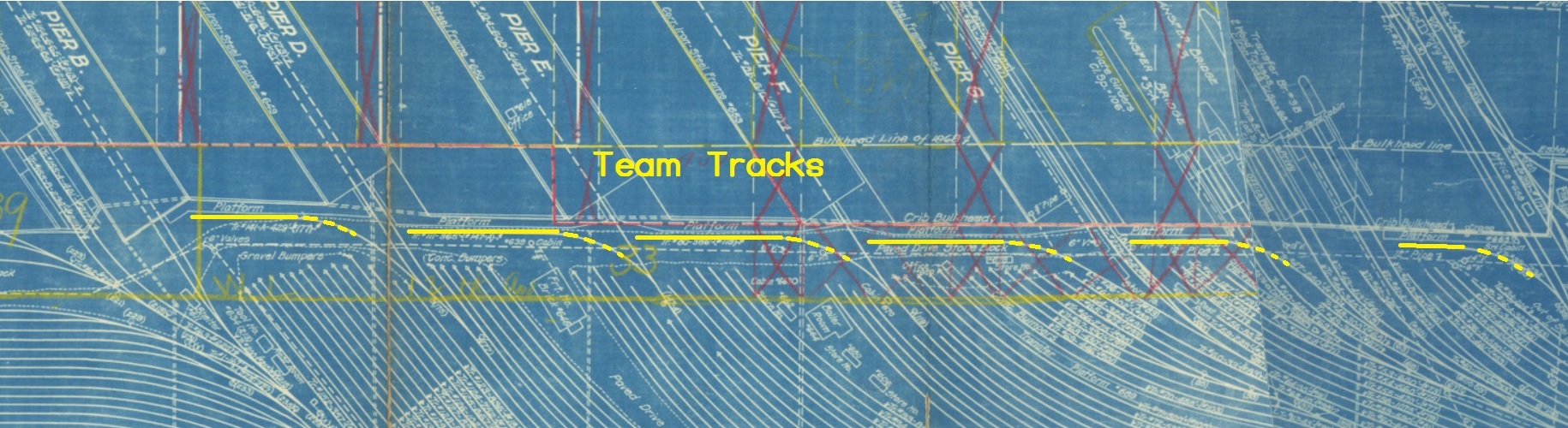
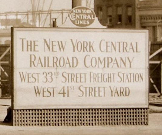
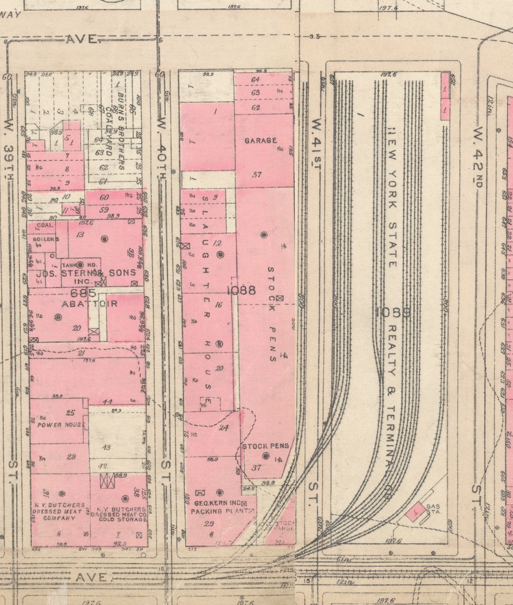

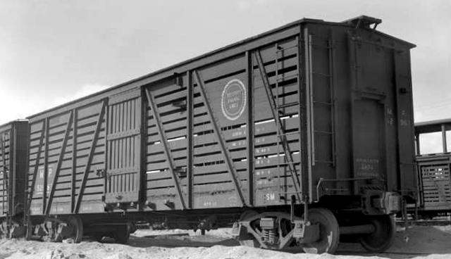
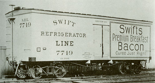
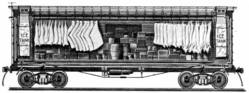
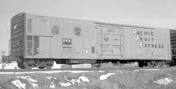
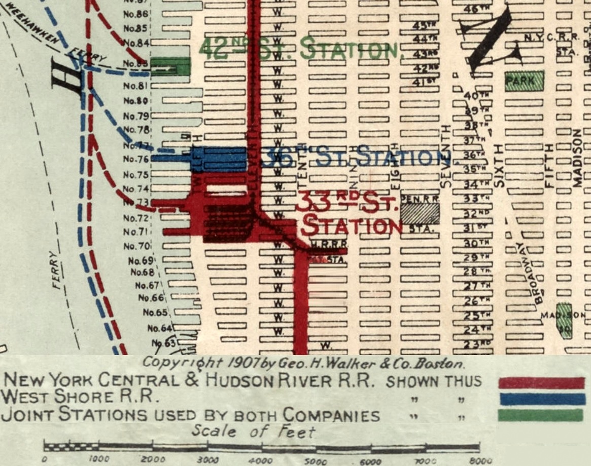
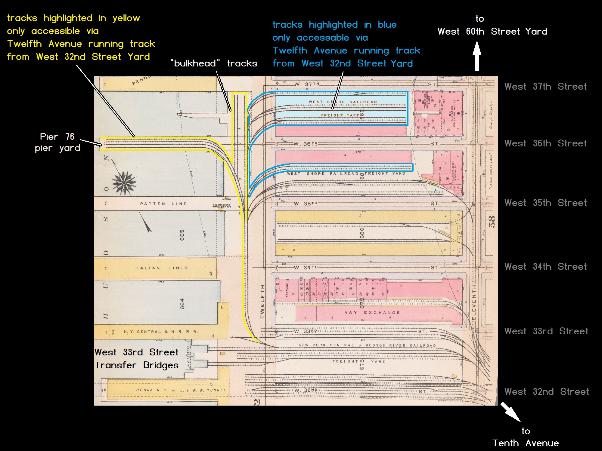
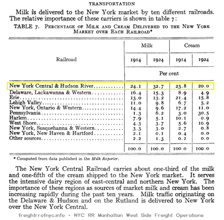
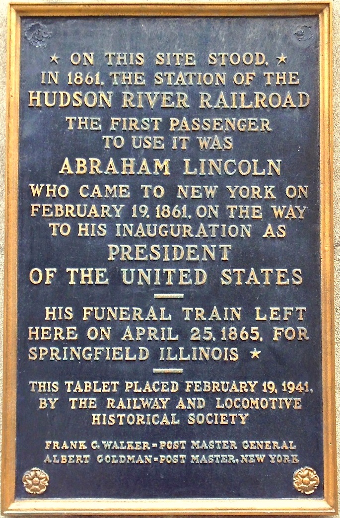
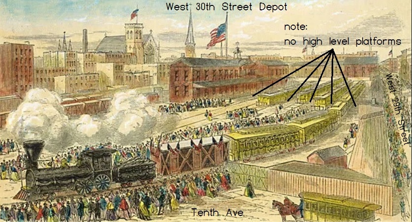
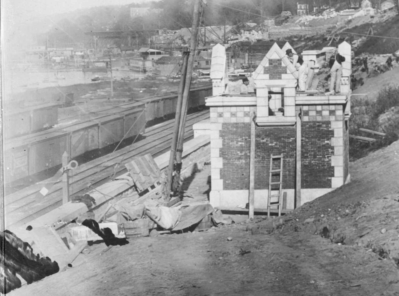

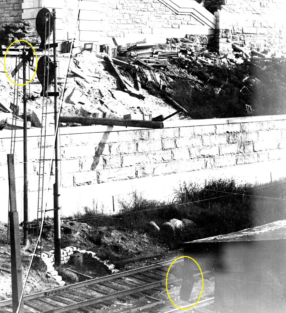
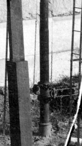
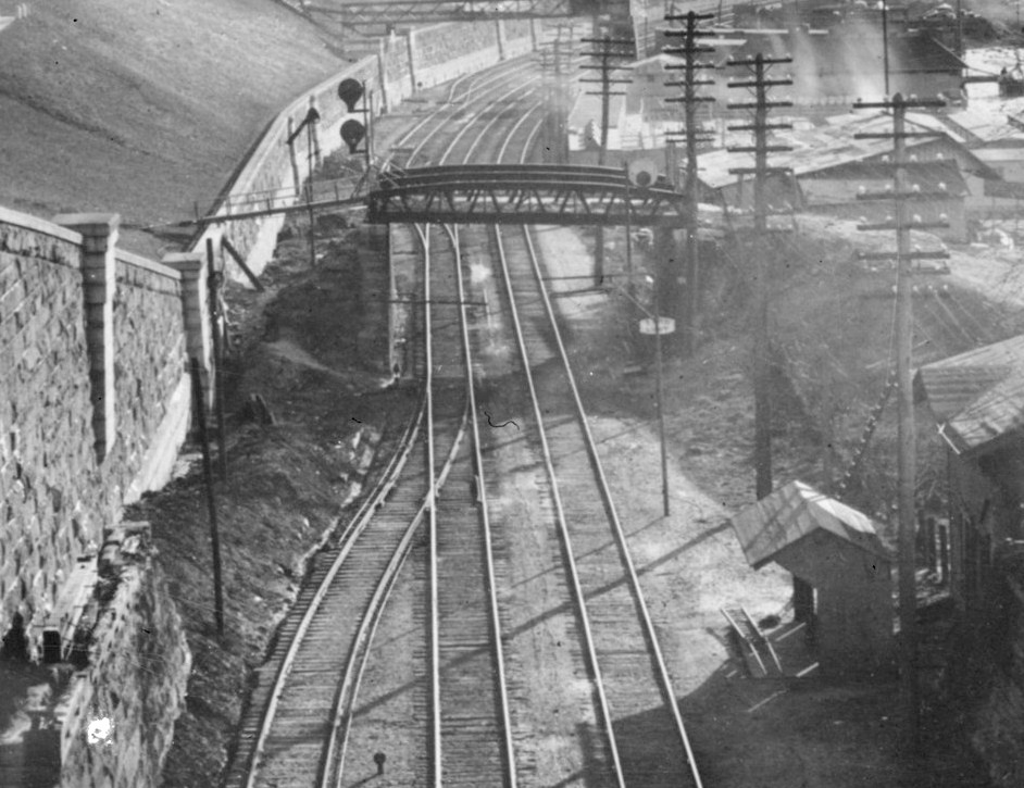
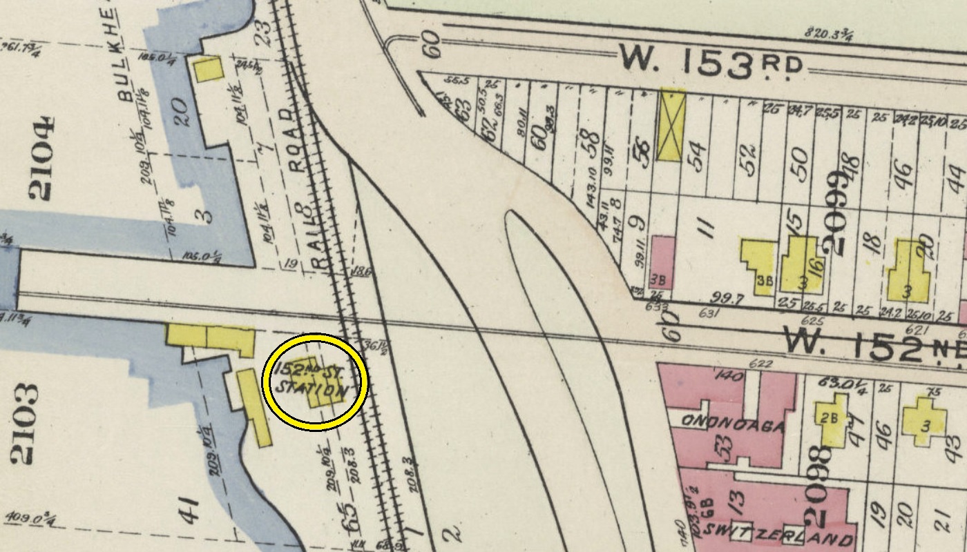
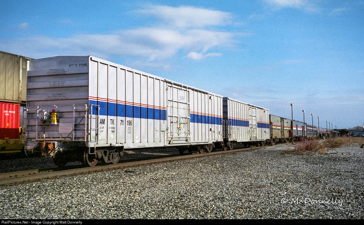
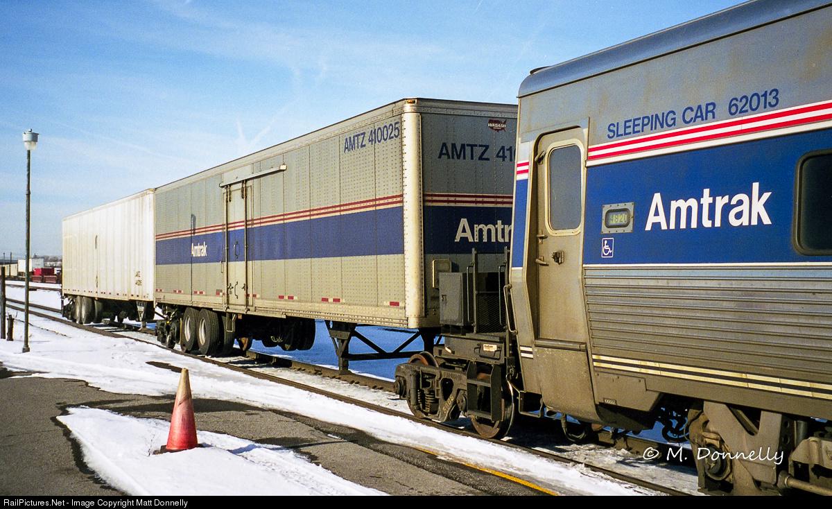
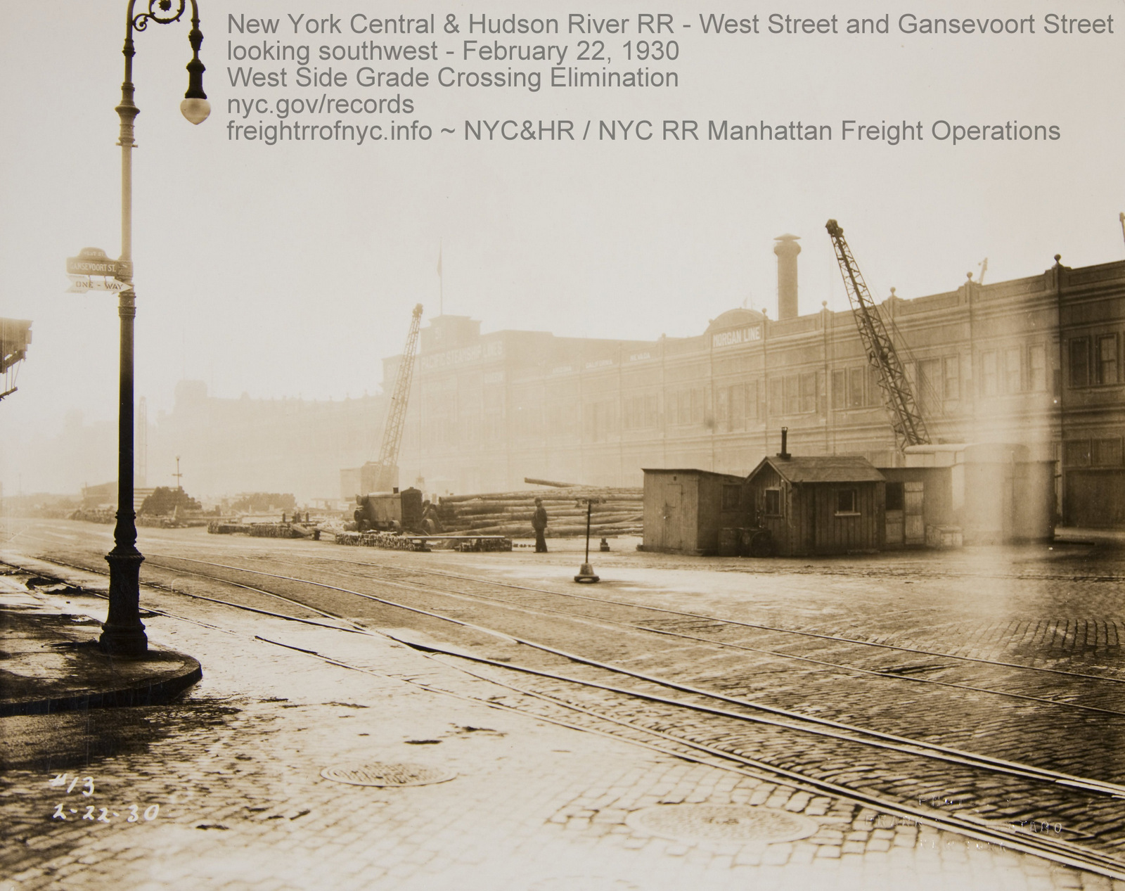
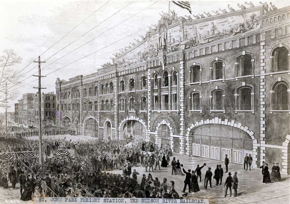
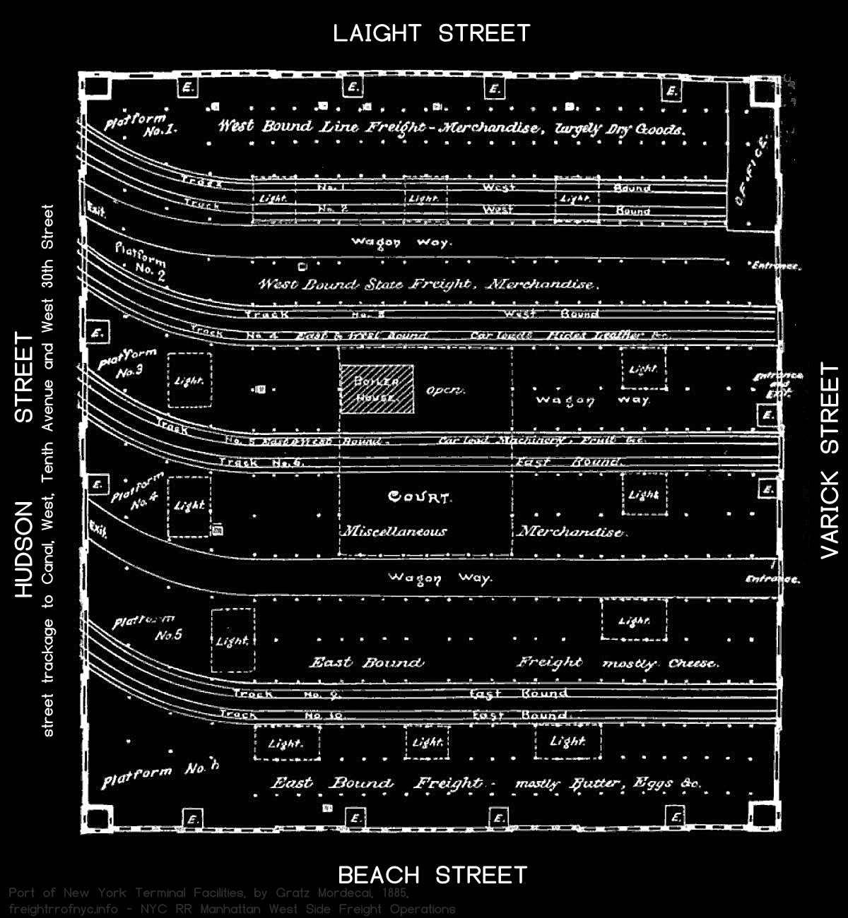

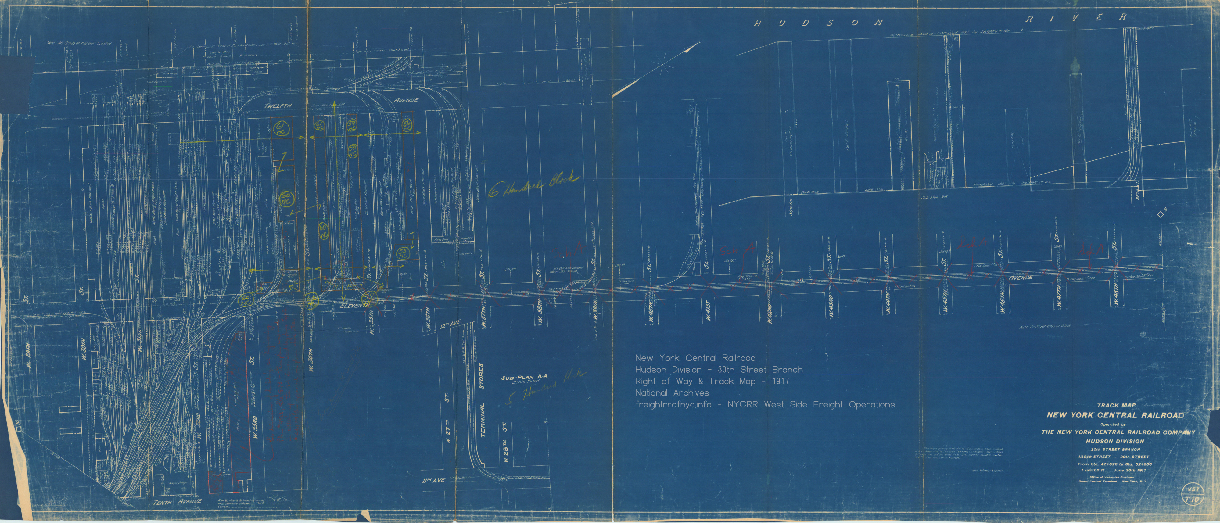