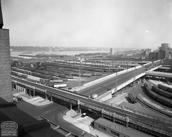
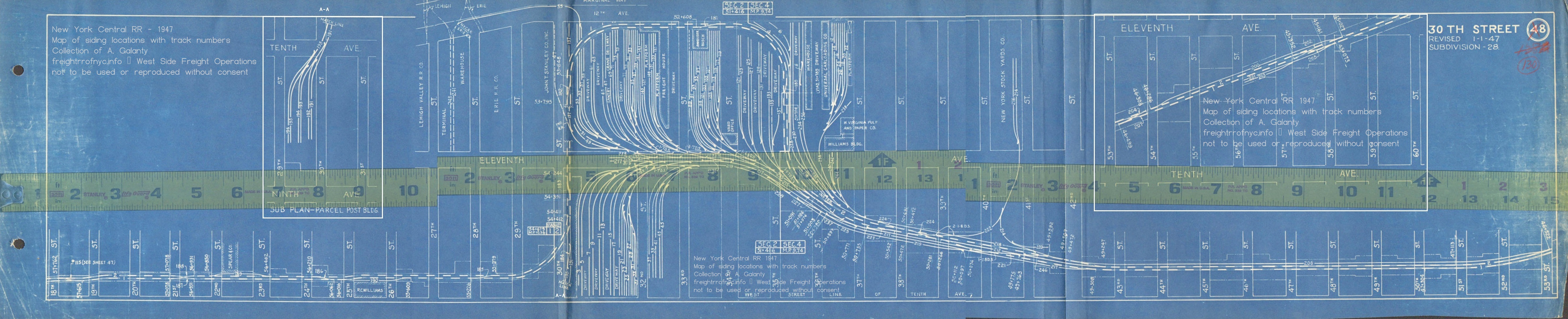
The High Line & the West Side: New York Central RR - Manhattan Freight Operations
.
INDUSTRIAL
&
TERMINAL RAILROADS &
RAIL-MARINE OPERATIONS OF BROOKLYN, QUEENS,
STATEN
ISLAND, BRONX &
MANHATTAN:
No
A.I. nonsense and conjecture. Just good old fashioned research by
actually reading, analyzing, interpreting and collating information
through books, industry and trade journals, newspaper articles,
official documents and publicity releases, legal precedence and more.
Real facts, not rail
fiction.
High
Line West Side Line West Side Improvement Project Meatpacking District
National Biscuit
Nabisco Uneeda cold
storage Merchants Refrigerating Manhattan Refrigerating Hells Kitchen
Chelsea Village Tribeca upper horse escort
manhattan cowboy Death Avenue Eleventh Avenue 11th Avenue Tenth Avenue
10th Avenue
Washington
Street
St. John's Park Freight Terminal street running trackage steam dummy
Baldwin American Locomotive ALCO Schenectady 0-4-0 0-6-0 B-B tripower
tri-power Lima Shay
geared 30th Street Branch
.
National Biscuit, east
siding (track 27) - High Line - August 13, 1940
NEW
YORK CENTRAL
RAILROAD . West
Side, Manhattan - Freight Operations 30th
Street Branch - New York Terminal District, Hudson Division
.
Page 2: . the West Side Improvement Projects:
Grade
Crossing Elimination and Electrification: 1926 to 1931
.
the
High Line, and the Sub-grade cut:
1929
to 1941 .
Late
Operations
1941 to 1968
..
PENN
CENTRAL RAILROAD CONRAIL .
.
post-New
York Central History and Operations:
1968 until 1982
As the author, it is imperative I explain to reader before anything
else; that they must be keep in mind there was a period
of time where operations in the street and those segregated from the
street
(the High Line and the sub-grade cut) per the West Side Improvement
Project overlapped and took place simultaneously.
The internet blogs and "local history" pages on
the
High Line and the surrounding neighborhood would lead one to believe,
the opening of the High Line in 1934
eliminated street running of the freight train once and for all on the
same day.
As I have stated before, and will state again: this
is NOT the case.
The
High Line removed most of the street running
freight traffic, but not all of
it. It was the beginning of the end, but not THEend.
If
there were 30 trains / movements per day, than I say 24 were
eliminated. The morning, afternoon and evening movements of
cars to the Fresh
Produce Market at West 17th Street and Tenth Avenue still took
place. And since the Fresh Produce Market was located on the surface,
and an integral part of the
freight delivery process of Manhattan; freight haulage via street
running would continue to take place until March 1941. Years
after the High Line
and the sub-grade cut opened.
This
street running also applied to livestock cars from the West 30th-36th
Street yards
that still kept flowing along Eleventh Avenue to the New York Stock
Yard Co,
located at West 41st Street between Twelfth and Eleventh Avenues as
well. Even
though the sub-grade cut opened to freight service in 1937 between the
West 60th - 72nd Street Yards and the West 36 - 30th Street Yards;
street operations
on Eleventh Avenue continued to the West
41st Street New York Stock Yards Stock House, until 1940 (when the wye
and stub track was excavated and subsequently connecting the Stock
House tracks to the sub-grade cut.)
And last but not least, street
operations to the Terminal Stores Warehouse at West 27th Street, which
was
relocated from trackage on Eleventh Avenue to Twelfth Avenue, but in
actually
street operation was neither replaced by operation via the High Line or
sub-grade cut, but
was merely relocated to a more "industrial" and less pedestrian
thoroughfare.
So, to put it
succinctly; street operations did
not "miraculously end" and was replaced with segregated operation. The
street and segregated rail traffic co-existed at the same time for a
duration of several years. If the date
of the image is after 1929 yet before 1941 - then both street
and segregated operations were taking place. The High
Line (and likewise the sub-grade cut) were not the "miracle cure" some
make it out to be. I cannot stress
this enough.
This "end of" date is contrary to what most urban blogs will
have
you
understand. "Death Avenue" didn't simply end when the High Line opened
in 1933
- street operations continued until 1941, seven years after the High
Line and the cut opened to service. Street operations on Eleventh
Avenue didn't end when the sub-grade cut opened in 1937 - they ended in
1940.
It just isn't as simple as saying "here one day,
gone the next".
Aside from that, it must also be kept in mind, that New York
Central Railroad operations for the West Side were constructed and
opened in phases, and some of those phases took place in
parts; i.e.: the
West 30-36th Street Yards were rebuilt right through the 1940's, while
remaining open to
operation. One part of the yard would be cordoned off, the track
removed,
the infrastructure re-constructed, then track re-laid into the new
configuration and placed into
service. Then the railroad and/or contractors would move to the next
part. All the
while, remaining portions of the yard remained in service.
So, for me the author to simply say to you, the reader; "Here
is the
West 33 Street yard before, and here it is after" is most difficult,
and almost impossible for the sake of chronological continuity.
Extenuating circumstances of operation dictated street operation to
remain in effect, even after the stipulated agreements of the West Side
Improvement Project took place.
As such, it is equally
difficult to refer to some locations in the post-Improvement era,
because they pre-date it, so on occasion and throughout this website
you will find images and maps showing comparisons to both eras. This
unfortunately duplicates some content of the chapters on Page 1, but
this is
necessary so you the reader will not have to flip between two pages for
comparison.
Also, it is necessary to inform the reader, that
the
improvements and relocations of railroad property due to the
construction of the West Side Highway / Miller Elevated Highway and the
Henry Hudson Parkway; took place before the West Side Improvement
Projects for the railroad phases were
agreed upon. Therefore, images showing the reconstruction of the
railroad due to the West Side Highway should not be considered part of
the West Side Improvement
Project aimed at the railroad, even though it came under the same name.
And so I found it very agonizing on how to decide
in which manner to break up
the previously published "one massive page" - the original page 1 of
this website. Maps and locomotives, yeah; they could go on
their own page without really jeopardizing the continuity of the
property
history. With that stated and all things being equal; this page is
organized in the following manner:
recap of West Side Improvement,
West Side Improvement approval process;
Phase 1: electrification of entire line as
well as realignment and
covering of the line north of West 72nd Street to West 153rd Street
Phase 2, part 1: construction of the High
Line (northern part) West 35th to West 20th Streets
Phase 2, part 2: construction of the High
Line (southern part) West 20th Street to the new St. John's Park
Freight Terminal
Third Rail Territory: where was it?
Phase 3, excavation of sub-grade cut; West
36th Street to West 60th Street
Last Ride of the West Side Cowboy March 1941
Yard Revitalization & Facilities - West 60th to
West 72nd Street
Yard Revitalization & Facilities -
West 36th to West 30th Street
Last Ride of the West Side Cowboy
Pulling the Last Rail
Unfortunately, even with this organization by "improvement
phase",
there is a lack of chronological or geographical continuity. To say the
history is disjointed,
is an understatement.
Perhaps that is why
these very highly
detailed
webpages on the West Side Freight Operations are the only known
compilation of information regarding the West Side Improvements and
Operations ever published (printed and bound or
electronic
form) to date. Yes, there have been quick blurbs about one particular
segment, and a world of AI generated photo captions and conjecture;
but nothing in such a complete scope of presentation as presented here..
So let it be written, so let it be done.
Philip M. Goldstein
Returning to the West Side Improvement Project(s) - Riverside
Park: the battle rages on
As discussed on Page 1,
the battle over West Side Improvements raged since before the turn of
the century.
..
Riverside Park -
1925
Looking north from West 135th Street.
Brown Brothers image
courtesy of KermitProject.org
added 19 October 2025
.
.
Upon undertaking research for this particular chapter, I
found myself
inundated with hits and results of newspaper articles about the
struggle to get a plan, any
plan; approved. What is particularly interesting to read, I
took note in
several of the articles of the moderation and willingness to negotiate
of the part of the Central.
And as you will read for yourself, it was mostly
the
shenanigans and lack of unified jurisdiction and bureaucracy between
the City agencies that kept delaying things.
Please keep in mind that most of the newspaper
articles
shown below were published the day after a proceeding or vote took
place.
November 28, 1929
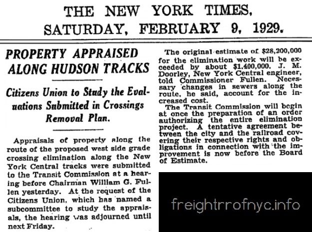
February 9, 1929 - First
appraisals of grade crossing elimination work to be performed:
$29,600,000 and a tentative agreement
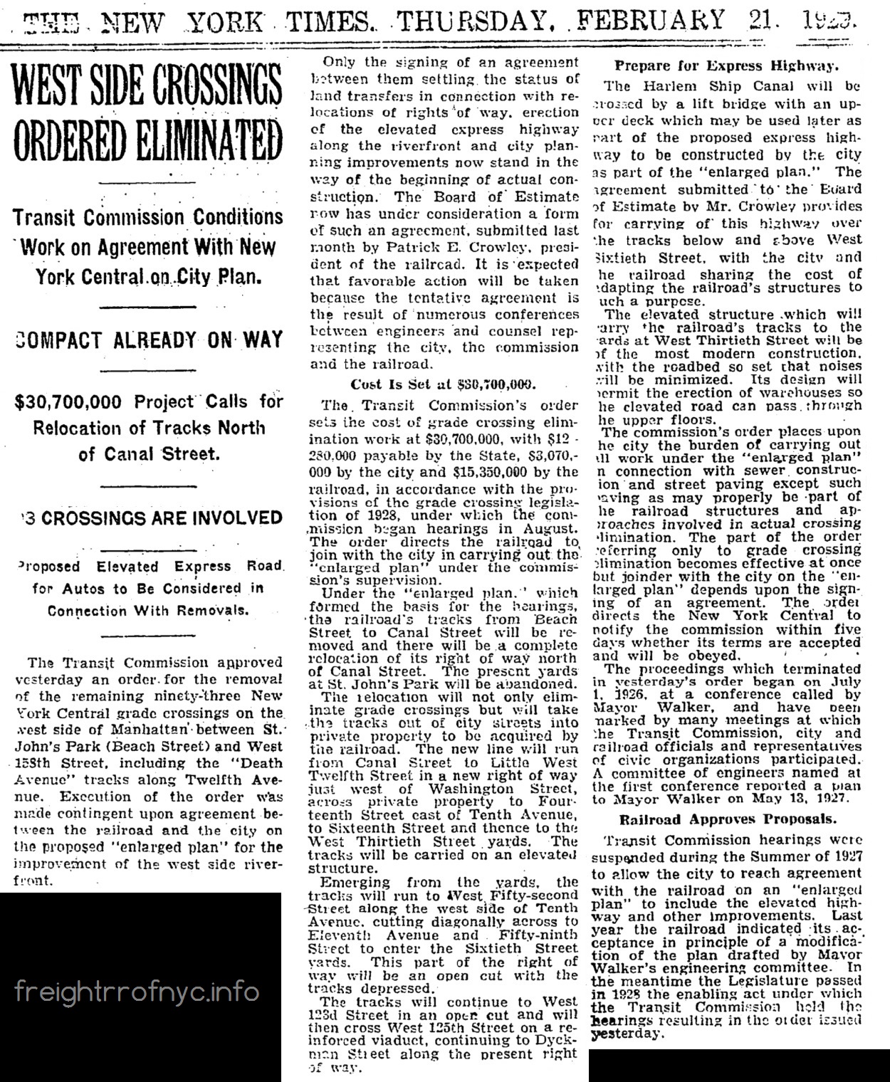
February
21, 1929 - Order to eliminate West Side crossings between St. John's
Park Freight Terminal and West 155th Street. Costs now $30,700,000.
$12,280,000 by the State of New York, $3,070,000 by the City of New
york, and $15,350,000 by the New York Central Railroad. And the
railroad approved these appraisals.
.
.
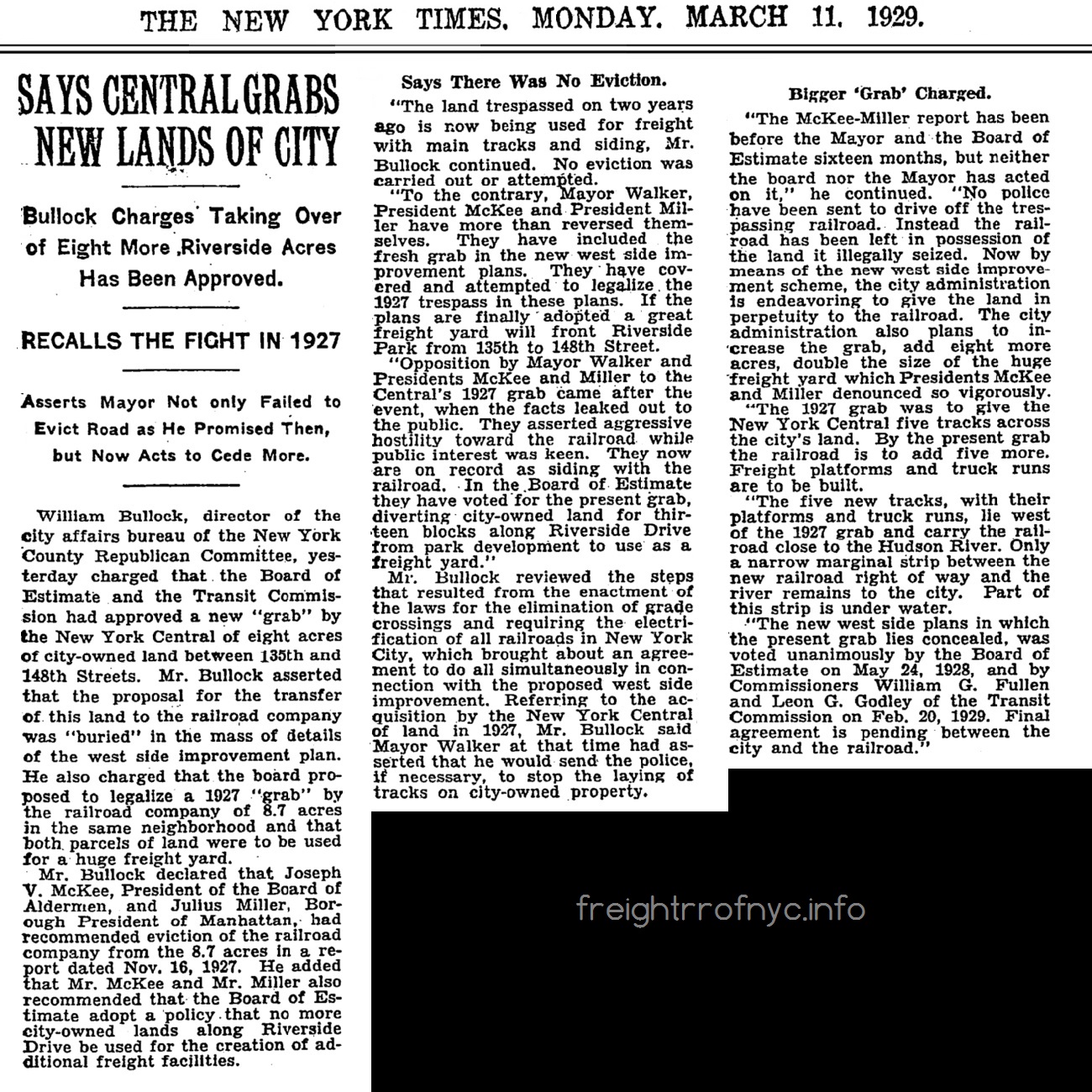
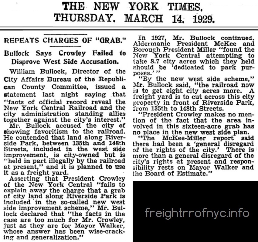
March 11, 1929 - William
Bullock, director of City Affairs Bureau of the New York County
Republican Committee;
accuses the City Administration and the New York Central Railroad of a
"land grab." Proof that opposition and delays were not always
perpetrated by the railroad.
.
.
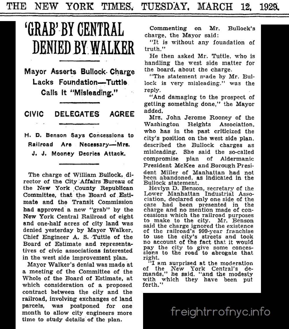
March
12, 1929 - Mayor Walker repudiates William Bullock's claim. Also, note
last paragraph: "I am
surprised at the moderation of the New York Central's demands, and the
modesty with which they have been put forth."
March 14, 1929 - William
Bullock, repeats his accusations.
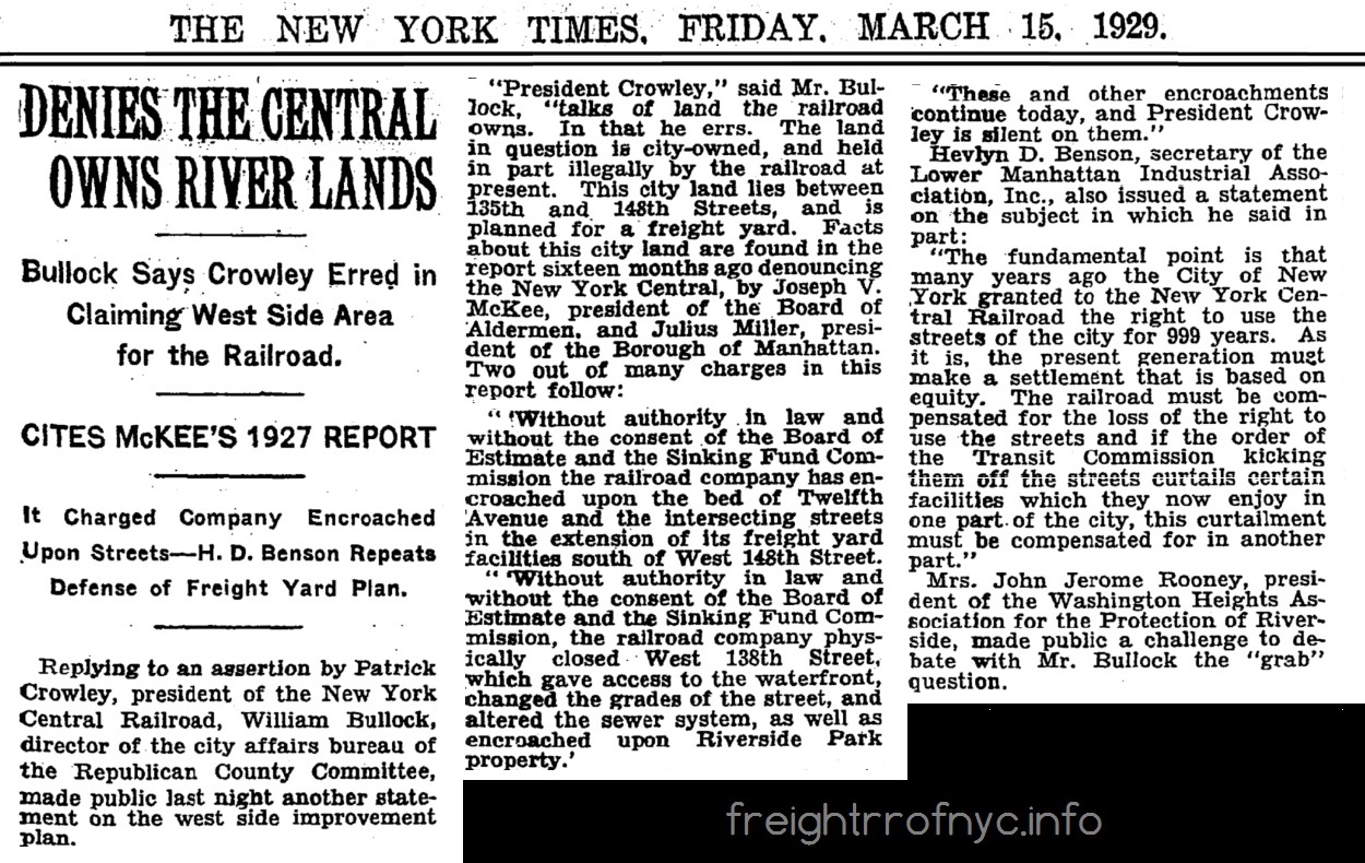
March
15, 1929 - Bullock states
President of the New York Central Railroad Patrick Crowley is claiming
the railroad does not own the land, that in reality the City does.
.
.
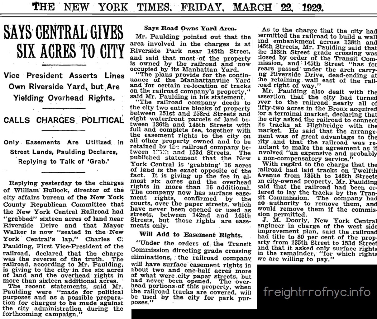
March 22, 1929 - NYCRR
First Vice President Charles C. Paulding states the railroad
owns land, but is giving up property amounting to 6 acres and the air
rights to 16 more to the City of New York.
.
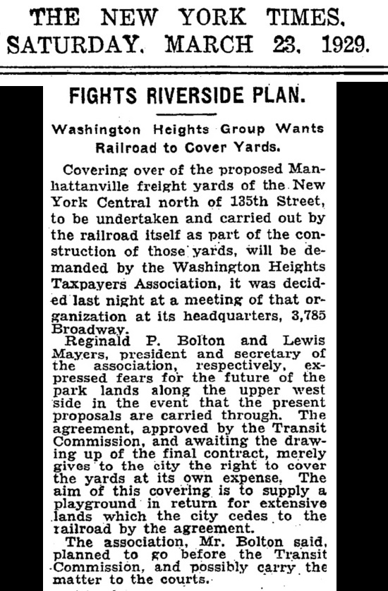
March
23, 1929 - Proving enough
is never enough; now the Washington Heights Taxpayers Association is
demanding a roof over the West 135th Street Yard. Pipe dream.
..
.
April
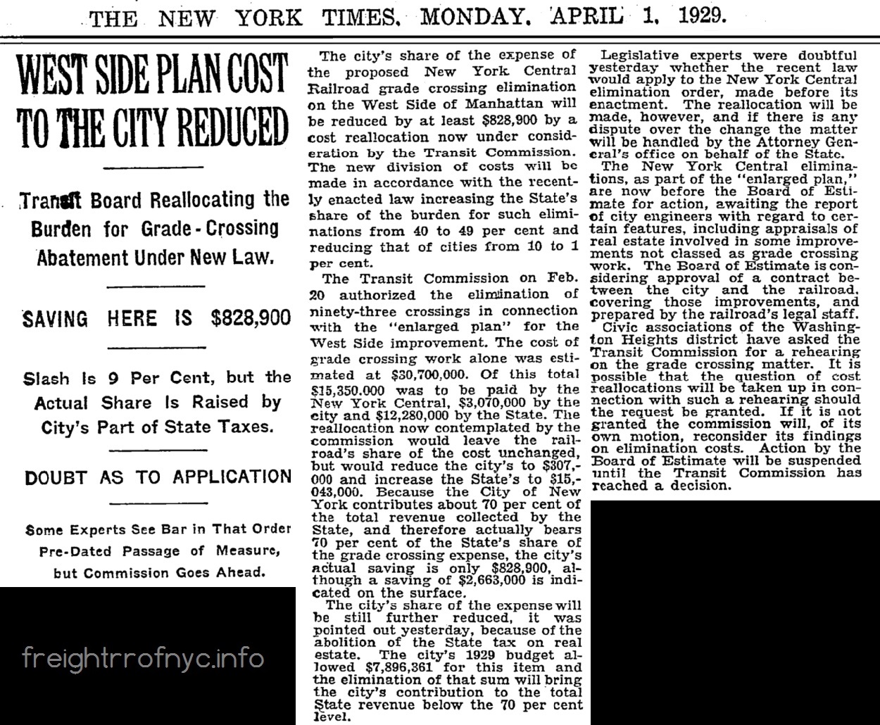
1, 1929 - The Transit Commission reallocates funding to reduce the
City's cost of the grade crossing elimination by $828,000 and pushes
more of the financial burden onto New York State.
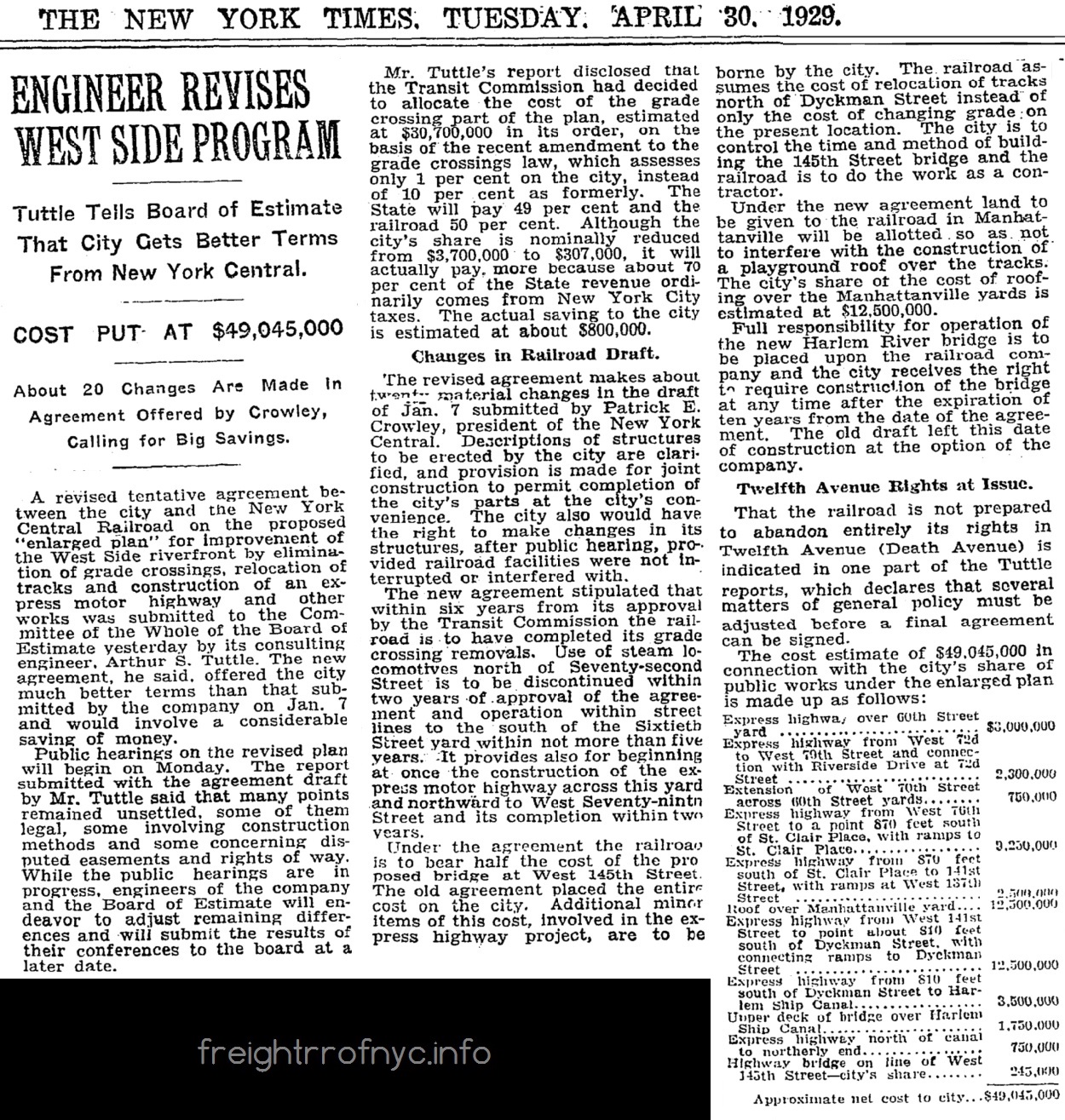
April
30, 1929 - A revised tentative agreement by the Board of Estimate
consulting engineer, Arthur S. Tuttle; states a six year time line for
grade crossing removal.
Also note that this agreement
specifies the use of steam locomotives is
to be discontinued north of West 72nd Street within two years of the
agreement. Which reinforces the conclusion to my research that
the Kaufman Act was no
longer in effect. Why discontinue something that is already banned?
.
..
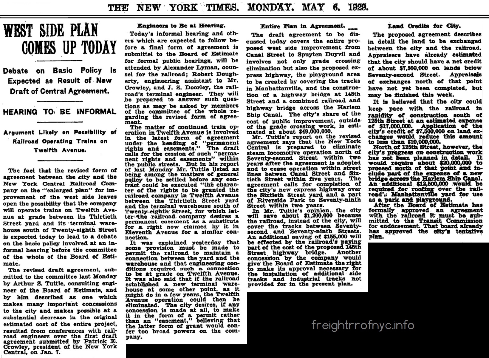
May 6, 1929 - The
West Side Plan comes up for informal discussion. One of the points for
discussion is use of street trackage to access the terminal warehouse
located at West 28th Street between eleventh and Twelfth Avenues. In
giving up its trackage on Eleventh, the railroad would like to use and
easement on Twelfth Avenue instead.
Also, it is reiterated that
the New York Central has to give up steam locomotive use within two
years, and
to cease street operation between Canal and West 60th Streets within
five years; after the agreement is reached.
.
.
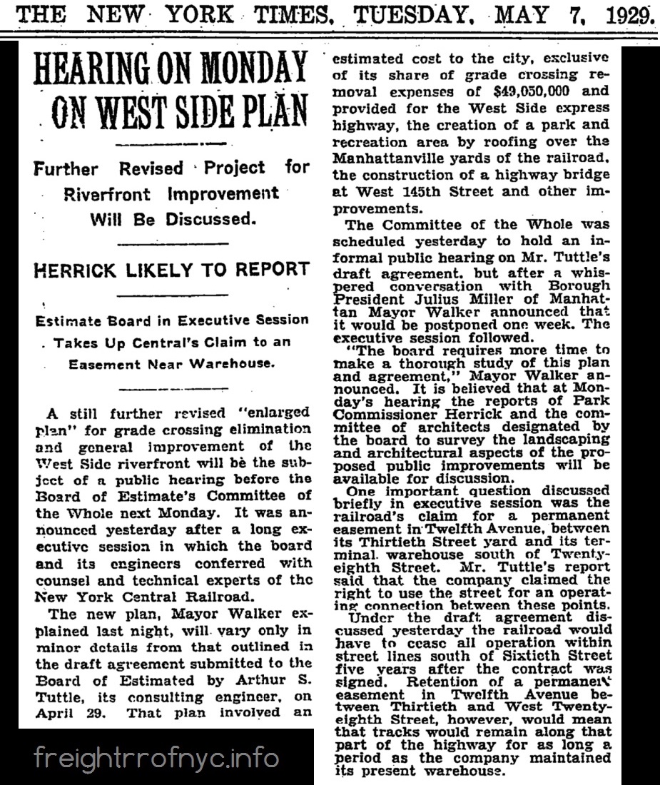
May 7, 1929 - Another
hearing for another revision.
.
.
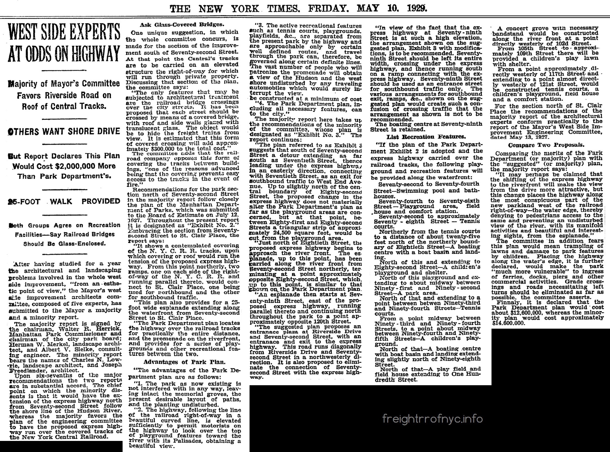
May 10, 1929 - City
experts at odds over placement of Parkway: either on roof of railroad
right of way or along the shore line. While not directly impacted the
railroad portion of the plan; this article demonstrates the conflicts
of various issues amongst the various City agencies. Each wanted their
own vision.
.
.
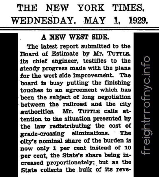
May 1, 1929 - Steady
progress in planning. And the City is shirking off more of the cost of
the grade crossing elimination costs onto the State.
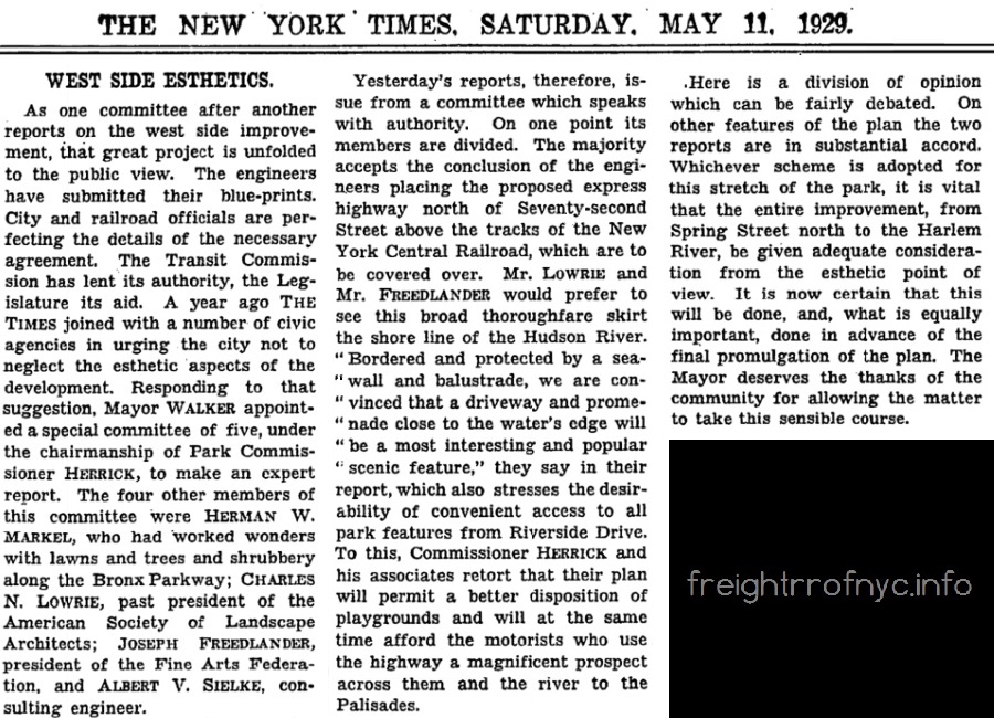
May
11, 1929 - Discussion of West Side Improvement aesthetics.
.
.
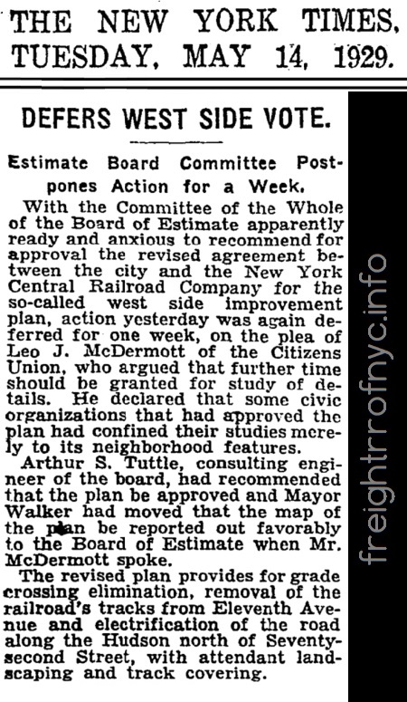
May 14, 1929 - Estimate
Board defers vote for one week.
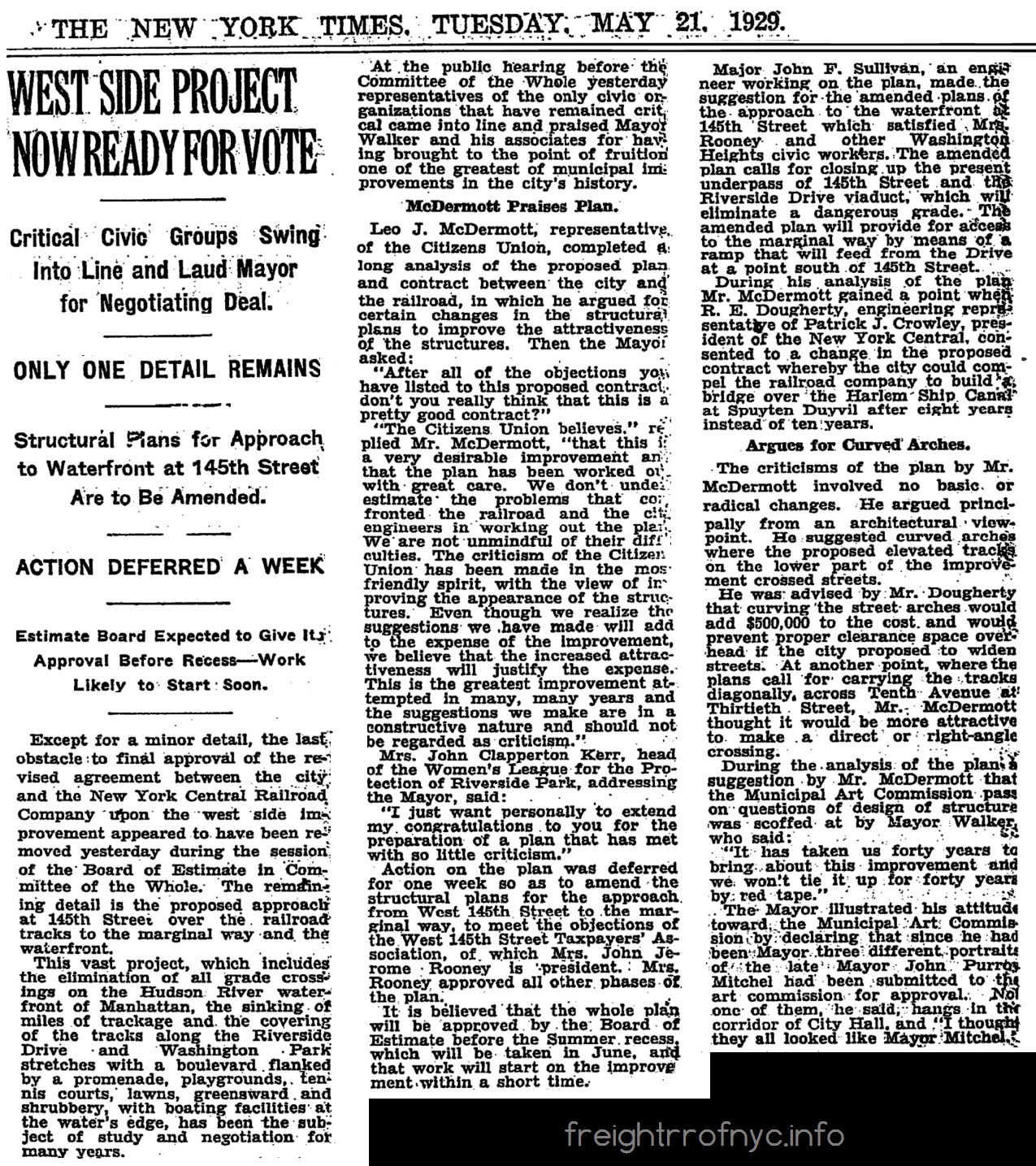
May 21, 1929 - West Side
Improvement Project ready for vote.
intentionally
left blank
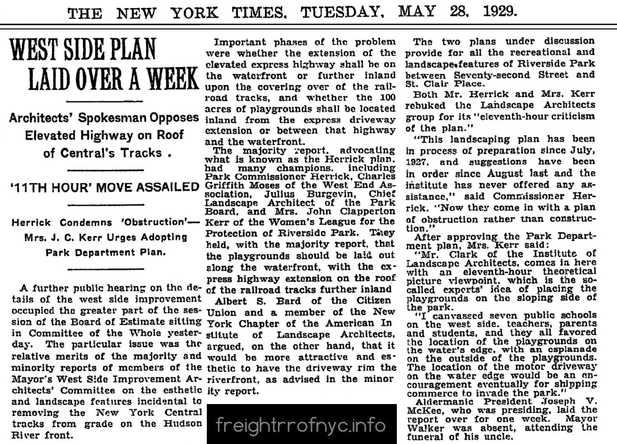
May
28, 1929 - Vote postponed another week: where to put the parkway, where
to put the playgrounds...
.
.
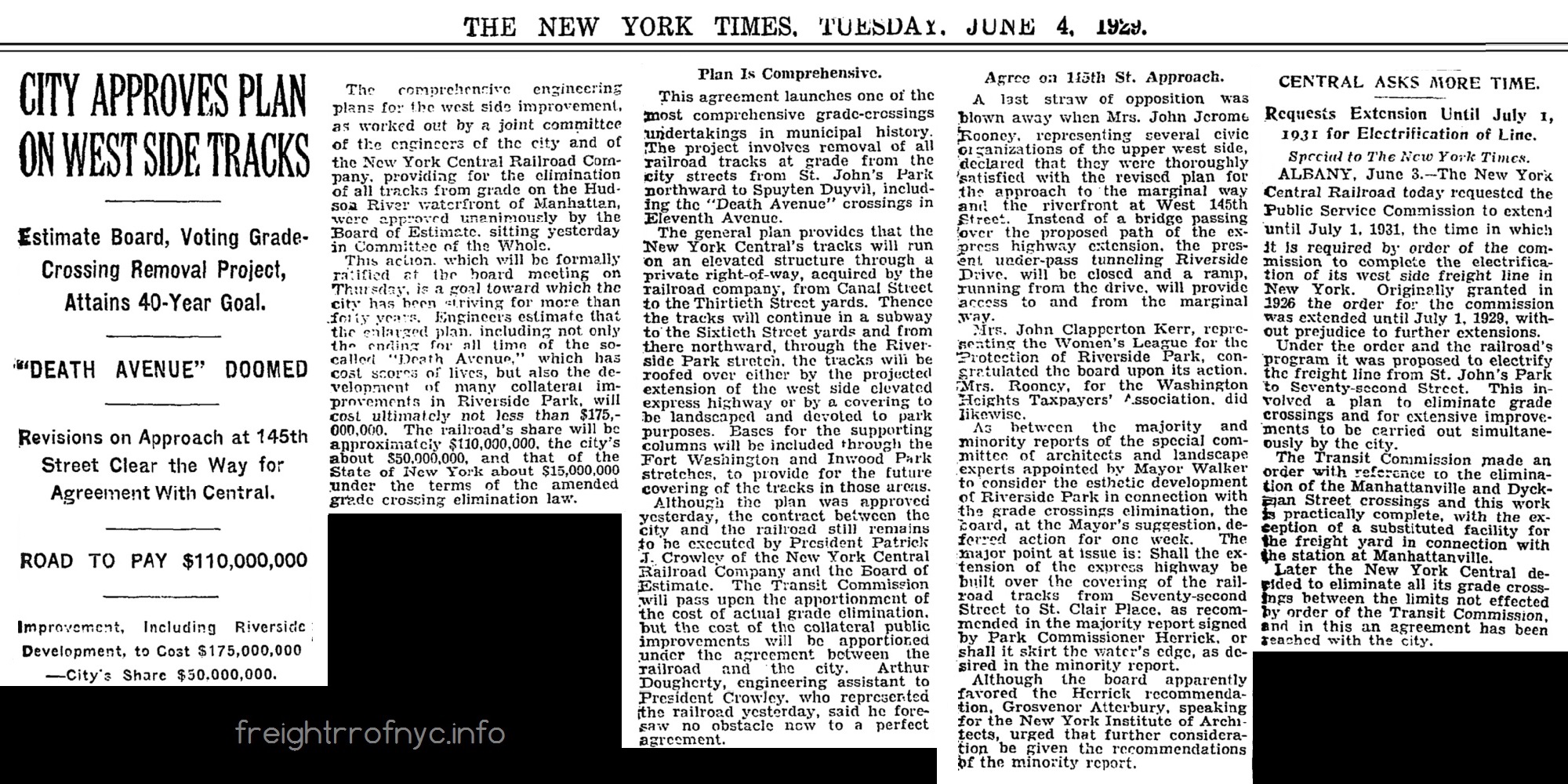
June 4, 1929 - YAY! The
City Estimate Board votes yes! One City agency down, how many more to
go?
.
.
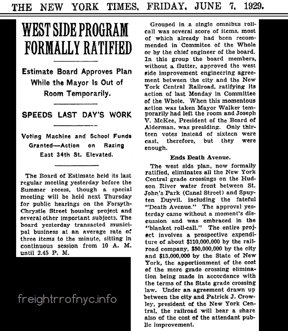
June 7, 1929 - West Side
Plan formally ratified!
June
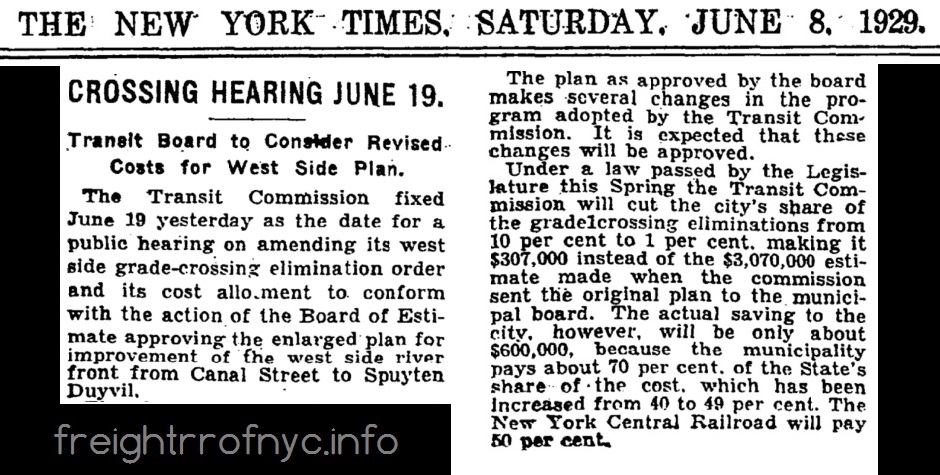
8, 1929 - Transit Board fixed a date for public hearing on grade
crossing elimination.
.
.
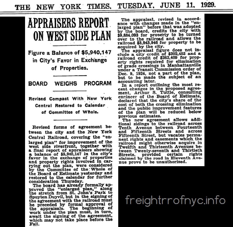
June 11, 1929 -
Appraisers
report on West Side Plan - balance in City's favor of almost
$6,000,000. Also allows additional sidings at Tenth Avenue &
West
14th and 15th Streets (cold storage warehouses)
and vacates the permanent rights and easements of the railroad Twelfth
& Thirteenth Avenues between West 27th Street and West 30th
Street
(the spur to Terminal Stores Building?)
.
.
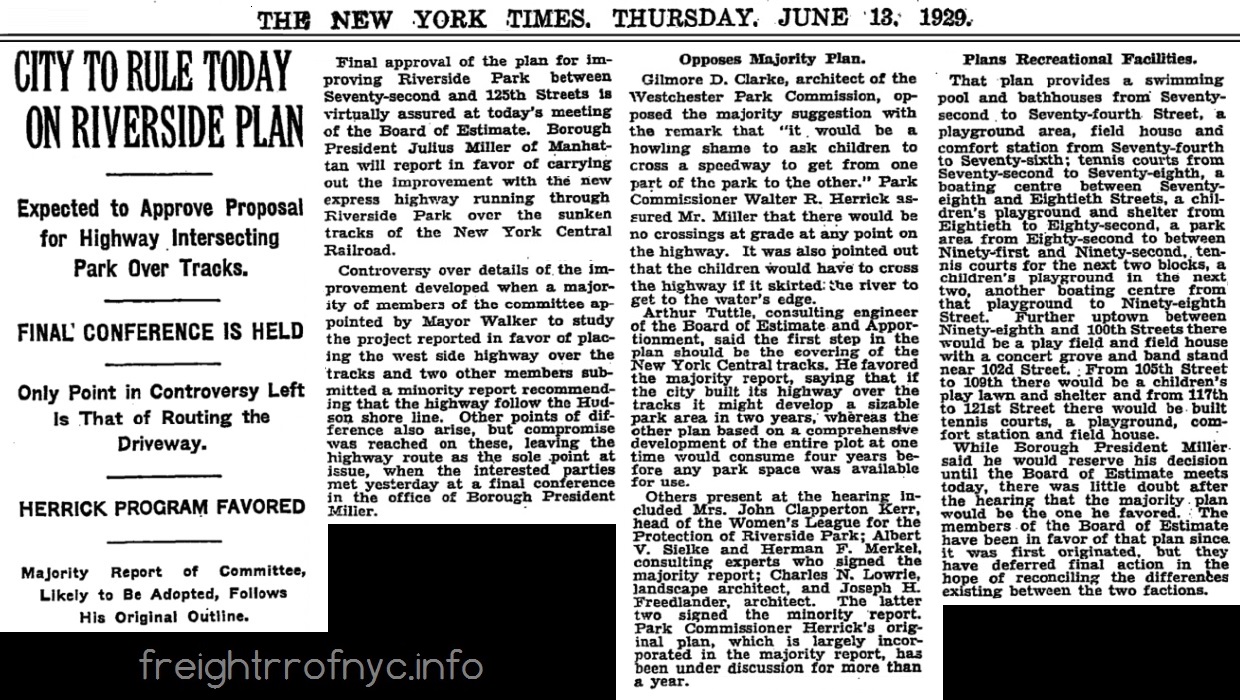
June
13, 1929 - City to rule today on Riverside Plan
.
.
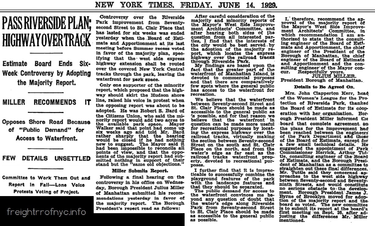
June
14, 1929 - West Side Plan passes Estimate Board. City agencies still
arguing over placement of highway.
.
.
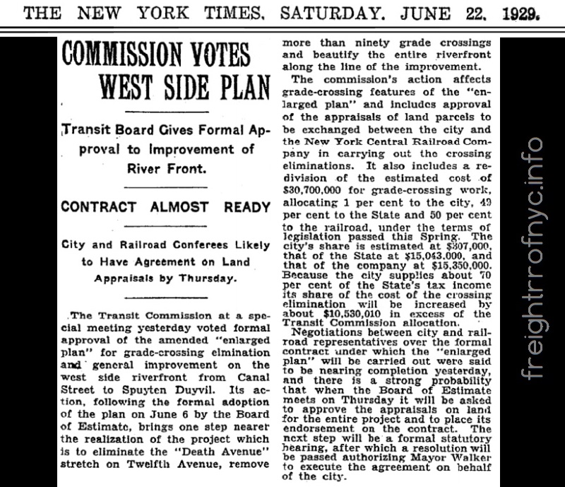
June 22, 1929 - Transit
Commission votes on West Side Plan, gives formal approval.
.
.
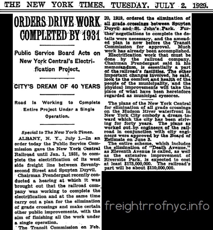
July 2, 1929 - Public
Service Board acts on electrification of New York Central trackage
north of West 72th Street and Spuyten Duyvil and grade crossing
elimination.
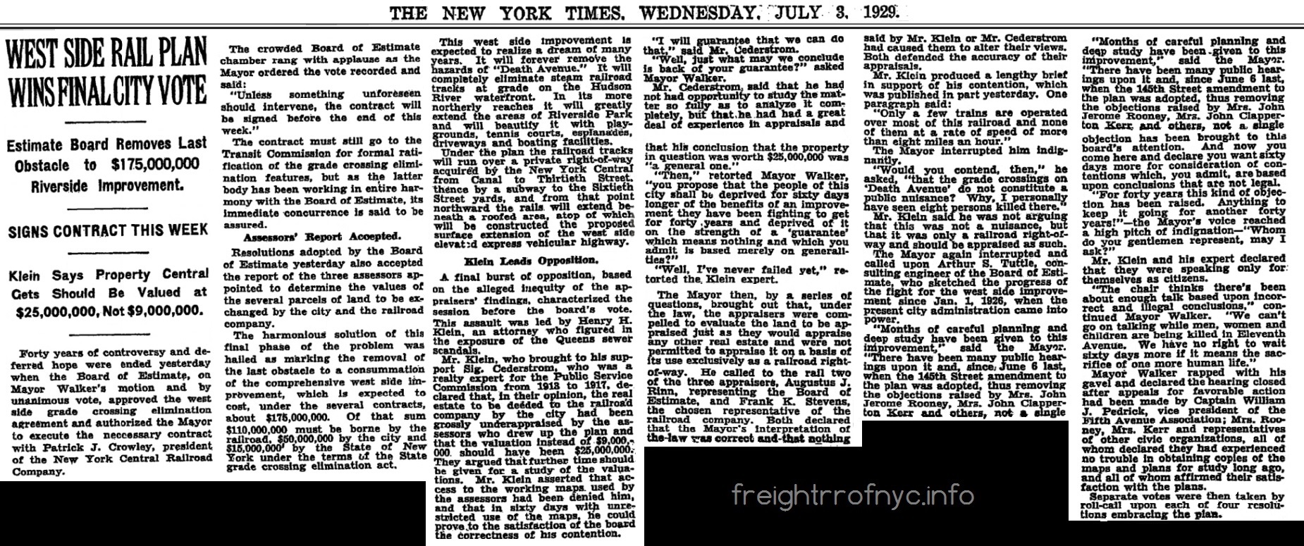
July 3, 1929 - West
Side Plan wins final City vote. Estimate Board removes last obstacle to
Riverside Improvement. And another voice in opposition: Henry H. Klein,
an attorney.
.
.
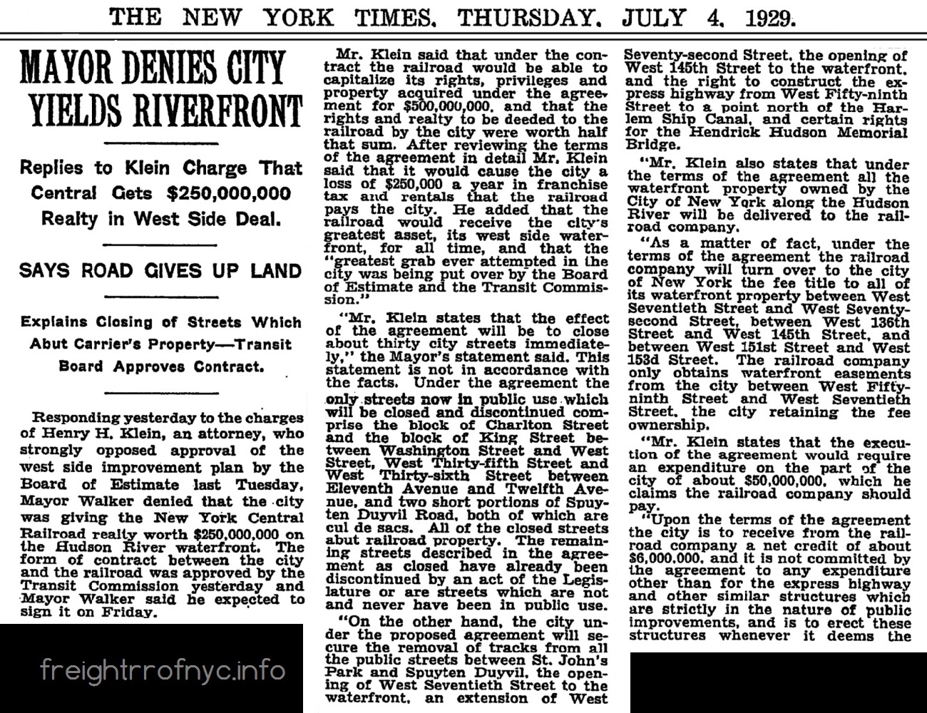
July
4, 1929 - Ugh. Back to this argument: Mayor Walker denied that the City
was giving the New York Central Railroad land worth $250,000,000.
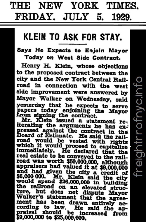
July 5, 1929 - Klein
still rambling on.
.
.
intentionally
left blank
July
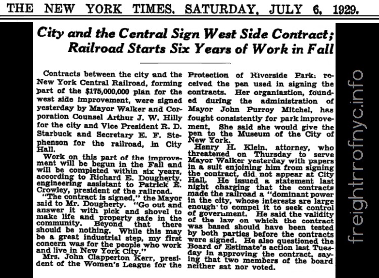
6, 1929 - The contract
is Signed!! 40 years in the making. The City of New York and the New
York Central reach an official
agreement to eliminate grade crossings in Manhattan. Klein, who
threatened to serve papers on Mayor Walker was nowhere to be found.
.
.
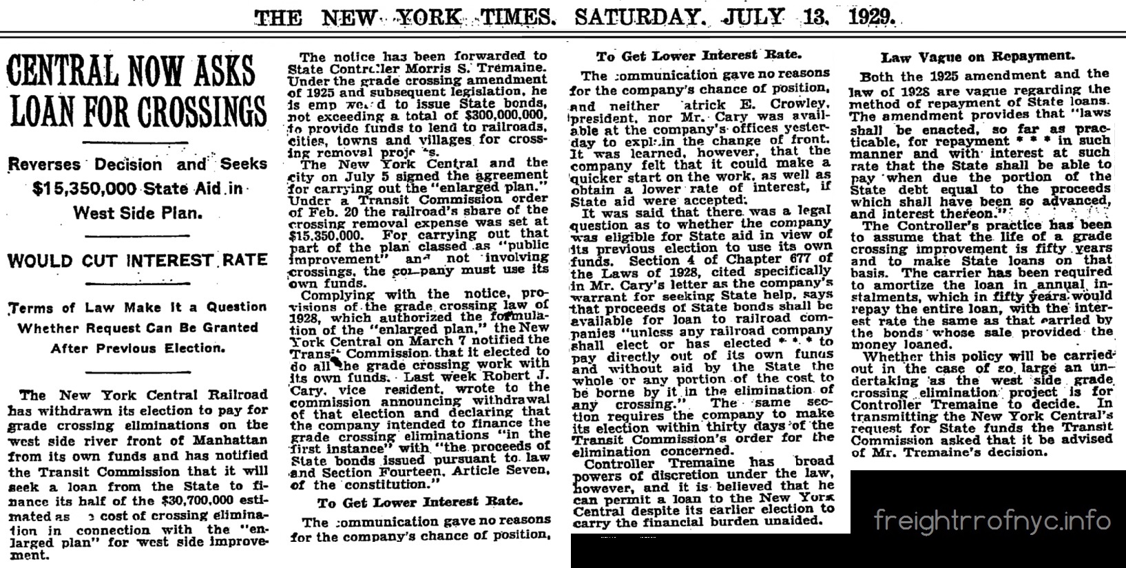
July 13, 1929 - Now
it is the Central's turn to beg for money. Apparently if it started
work earlier, it would get a lower interest rate on the loan.
.
.
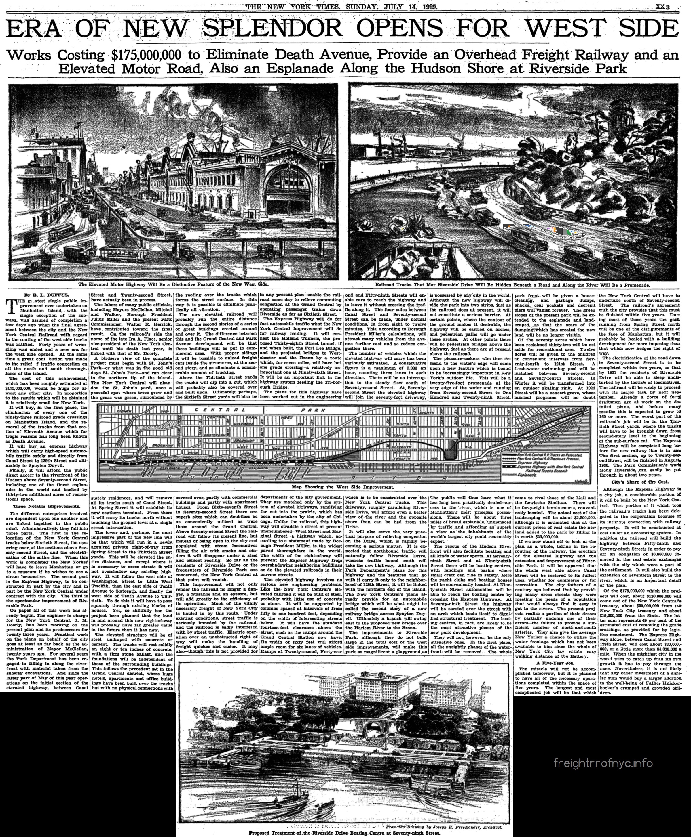
Era of New Splendor Opens for West Side - July 14, 1929
.
.
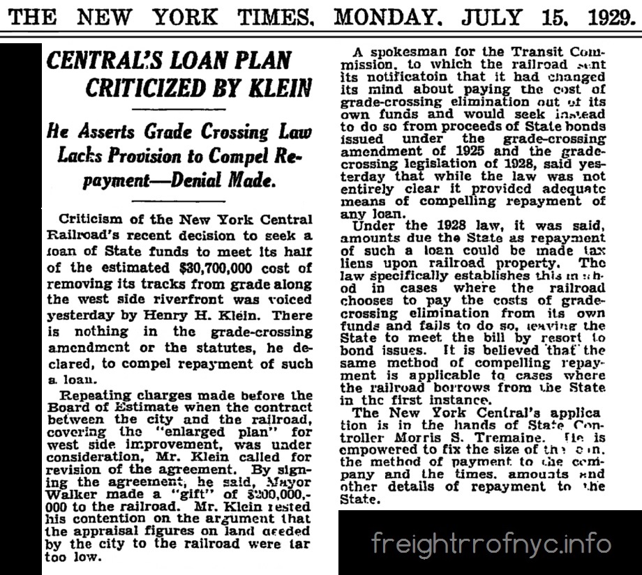
July 15, 1929 - Ugh! Not
this Klein guy again.
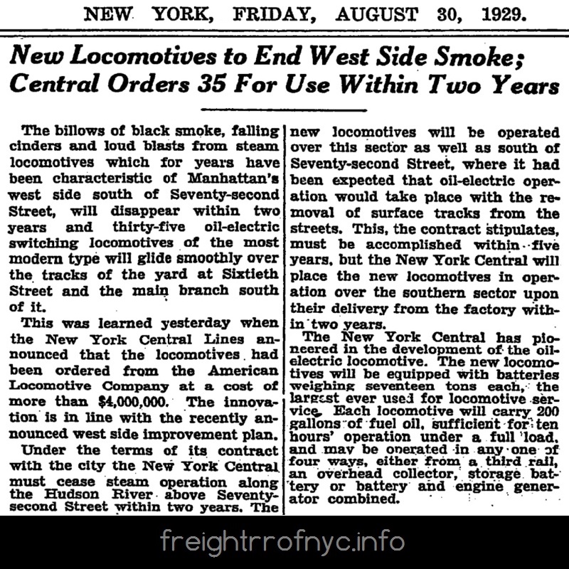
August 30, 1929 - New
York Central orders 35 oil-electric switchers (Tri-Power; DES-2) from
American Locomotive.
.
.
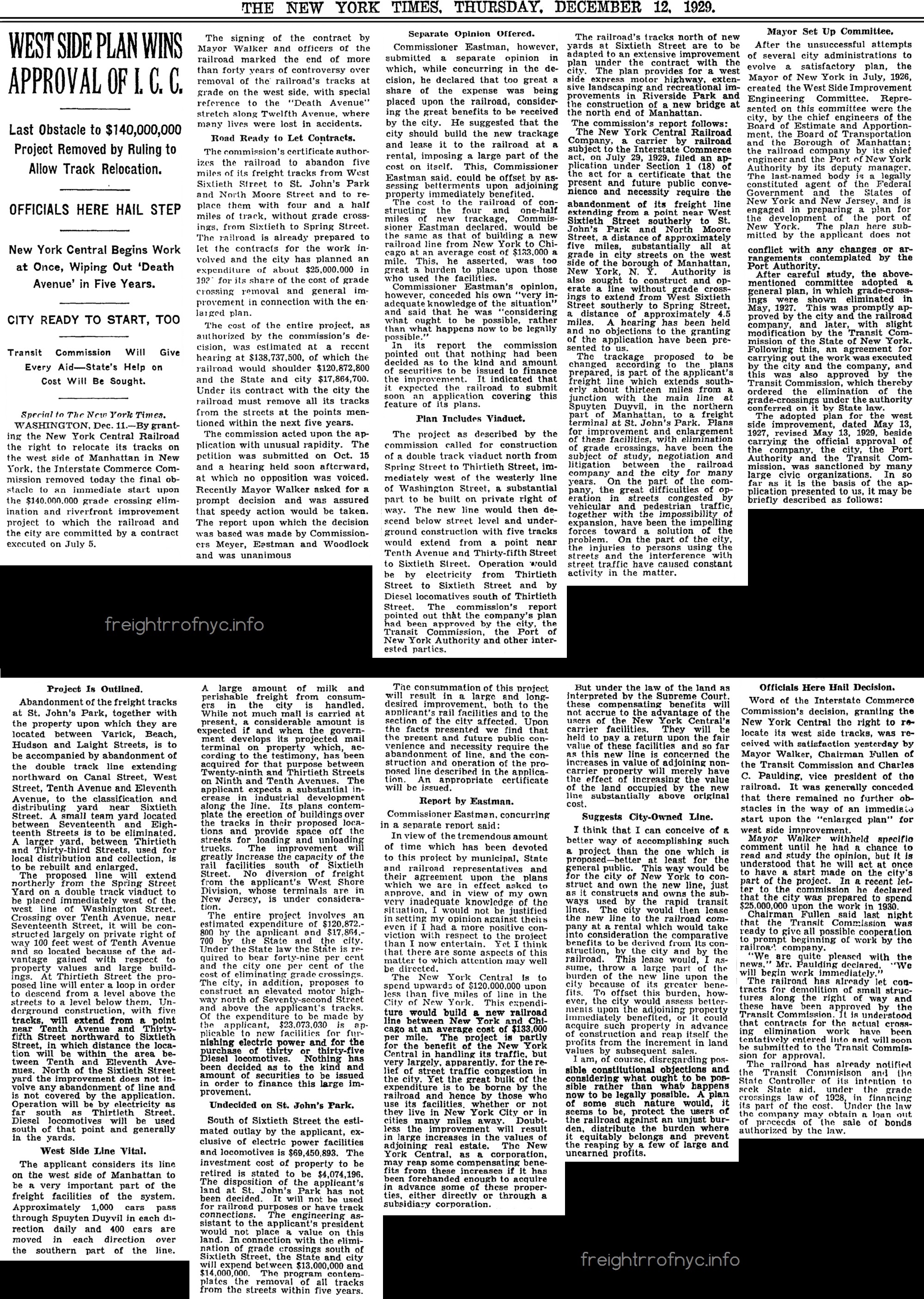
December 12, 1929
The West Side Plan wins approval from federal Interstate Commerce
Commission.
Cost of project now $137,737,000 with $120,872,800 to be paid
by
the railroad. It should be noted, that prior to reaching this decision
on December
12; a very note worthy event took place - the Stock Market crash in
October 1929 - and the start of the Great Depression. A lot of the work
on the West Side Improvement Project in the coming years, excavation,
moving soil and rock and grading in Riverside Park is going to
performed by persons enrolled in the Works Progress Administration.
.
.
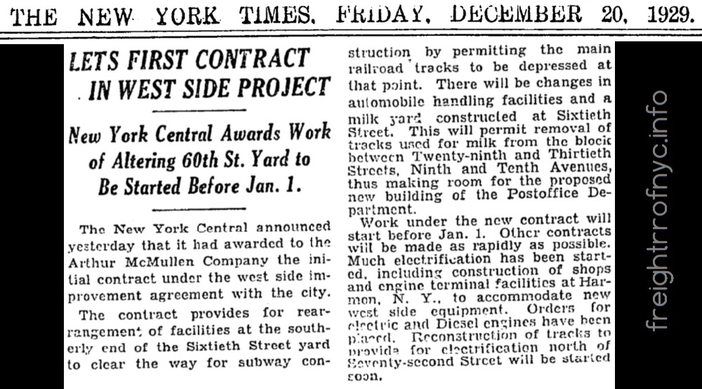
December 20, 1929
First
contract awarded to Arthur McMullen Company for rearrangement of
trackage at south end of West 60th-72nd Street Yard. Also,
the Milk Yard to be relocated to West 60th Street; and allow
the
Morgan Parcel Post Building to be constructed.
. .
The West Side Improvement Project finalized: The High Line &
the open sub-grade cut
The West Side Improvement battle, that had been raging since the turn
of the century (and previously discussed at length in this chapter on Page 1);
after years, no; decades of honest negotiation,
numerous under-the-table
political and legislative end runs; finally, we come to the as-built
remedy to the "West Side Problem".
After
agreeing to plans in 1927; and following yet two more years of legal
wrangling and ironing out the smallest details; and coming to a grand
total of twenty or so years of
bargaining, bickering, shrugging shoulders and finger
pointing to and from various City and State agencies and the railroad; all
the pieces were finally in place.
The City of New York and
the
New York Central Railroad had finally reached an agreement regarding
the West Side Side Improvement Project.
It
would take place in multiple parts: the first phase would be
southern segment West 30th Street to Beach Street. This including
razing of buildings, land preparation
and
construction of the High Line taking place in 1929 through 1934. This
would be an elevated structure beginning at West 35th Street loop to
West 30th Street and to parallel alongside Tenth Avenue.
The second
phase would entail the excavation of the "subway" or more technically
correct, and open sub-grade cut. This also required the acquisition of
land.
Perhaps phases in not quite the apt word, as these
projects took place sometimes simultaneously, yet at other times
separately.
Mayor Jimmy
Walker; R. D. Starbuck, a vice president of the New York Central; and
E.
F. Stephenson, the New York Central Railroad's secretary signed the
documents
on July 5, 1929.
The
agreement called for construction to start immediately, a
timetable as follows:
electrification north of
West 72nd Street and
diesel electric motive power for operation south of that; to be
installed by 1931. (Completed and
which the New York Central was planning to do anyway.)
train movements on city
streets to be eliminated by
June 30, 1934. (Missed target date
with City permission - street movement of trains did not end until
1941.)
the trackage in
the street on Tenth Avenue was to be
relocated to a viaduct between West 34th Street and St. John's
Park, "the High Line" (completed,
1934)
the trackage on Eleventh
Avenue was to be relocated to a
walled open sub-grade cut containing the railroad tracks north of West
34th Street to West 60th Street,
(completed, 1937)
the two yards at
West 30th Street and West 60th Street and the three smaller yards
at West 17th Street, West 41st Street and West 145th Street were to be
expanded to 4,000 car capacity. (Completed)
the existing surface St.
John's Park Terminal to be razed and new elevated terminal
constructed at Spring
Street. (Completed)
The
New York Central Railroad literally was giving the City
more than the City was requesting. The New York Central would
give up
its ownership of some of the land along the Riverside waterfront, in
exchange for land for the routing a few hundred feet to the east. The
City agreed to finance some of the relocation. And
according to the media, The New York Central Railroad began
construction started immediately. Like
within minutes. Apparently the work crew was standing by for word from
the officials the moment the order was signed.
The
cost of this ambitious
project had now reached $175,000,000 in 1929 dollars ($3,200,000,000 in
adjusted 2024 dollars), freight traffic on line was averaging about
1,700 cars daily. All work on this project took place under the
supervision of the railroad's chief engineer, J. W. Pfau.
So
yes; when you
consider why present day freight railroads have a particularly
resistive attitude against
additional regulations and / or having to relinquish or relocate
property and
assets,
perhaps some of you will bear in mind and recall this and
decades long situation and history.
Contractors
for the second phase (High Line) were James Turner Co. and George A.
Fuller
Co., with the steel contractors being American Bridge Co.;
McClintic
Marshall
Co. and the Fort Pitt Bridge Works. Structural design of
Riverside Park
was the work of Madigan - Hyland Company. General contractor for the
construction of the new elevated St. John's Park Freight terminal was
the James Stewart Co.
Third phase (sub-grade cut) contractors were the
Thomas Crimmins Contracting Co., George J. Atwell Foundation Corp, the
P. T. Cox Contracting Co. and Corbetta Construction Co.
.
. .
First phase of construction: 1926 - 1931 Electrification and Grade
Crossing Elimination of the West Side Freight Line from
West 72nd Street to Spuyten Duyvil
Starting our journey in the north, the
finalized West Side Improvement Plan as agreed upon; was for the New
York Central Railroad to electrify the existing
right of way from the railroad swing-bridge
at Spuyten
Duyvil.
But as it has been revealed, the New York Central
had been
planning on pursuing this goal prior to the agreement. Straight
electric freight locomotives were ordered in 1925 for other lines in
the New York suburban area, to join the already in service all electric
passenger locomotives used in and out of Grand Central. So it was only
a natural step to expand this power source into freight service on the
West Side.
The goal here was not so much to eliminate railroad
traffic, as it would be to eliminate remove steam locomotive use. The
Kaufman Act of 1923 failed - it was found unconstitutional. So, instead
of forcing the New York Central Railroad to give up steam, the City and
State tried asking nicely. And the New York Central accepted.
Strangely enough, while this section of the right of way
was the most contested and protested, as can be read in the following
newspaper articles; ironically, it would require the least amount of
reconstruction or realignment.
In retrospect, perhaps,
that is a bit of understatement. Adding third rail power is a
relatively straight forward process - install longer ties every 5th or
6th tie to support the third rail support, hook the third rail to a
sub-station for power. But one must supply the electricity to that
third rail. That requires additional infrastructure. Significant
infrastructure.
Power for the electrification of the West Side
Line came
from the New York Central Railroad generating station located in Port
Morris, the Bronx. This generating station was backed up by
an identical power generating station located on the Hudson River in
Glenwood, near Yonkers in
Westchester County. These generating stations were built and opened in
1906 for the electrification of the Park Avenue Line, as well as
connecting suburban lines. However, it was only natural for these
plants to supply the power for the West Side Line as well.
POWER STATIONS
As a precaution against possibility
of failure of power at the generating
source, duplicate stations were located at Glenwood, near Yonkers,
and at Port Morris . The initial equipment of each station included
sixteen
625- horsepower boilers with superheaters and mechanical stokers, and
four 5000-kilowatt steam turbine generators .
Provision was made for
an ultimate increase in total capacity to 30,000 kilowatts. It is an
interesting commentary on the progress of the art to note that, after
nearly twenty years of service, these
5000-kilowatt units are being replaced
by 20,000-kilowatt units which require
no more space than was originally
provided for units of one-fourth the
capacity. Not only is the new equipment a great improvement as regards
space occupied,
but it is much more efficient and enables the company to produce
electric power at a much
lower cost.
At the present time, the modern units handle all of the load, the older
turbines
being held in reserve. The equipment of both the power stations at the
present time is
given in the accompanying tables. The power- station units are designed
for generating
three-phase, 11,000- volt, 25-
cycle current, which is transmitted without change to the
several substations.
At the Port Morris station,
which is now considered the
main generating plant, bituminous coal is used entirely.
Provision is made for transferring the coal directly from
the cars to overhead bins,
a storage capacity of 3500
tons being available.
At the
Glenwood Station, which is
located nearer to the residential section, the off-peak load is carried
on coal-burning boilers, and the peak load
on boilers burning fuel oil.
PRESENT BOILER EQUIPMENT
The present boiler equipment of the Port Morris plant consists of
sixteen 625- horsepower and four 673-horsepower boilers, all equipped
with underfeed stokers for burning
bituminous coal. The Glenwood plant also has sixteen 625-horsepower and
four 673-horsepower boilers, of which four are equipped with underfeed
stokers for burning bituminous
coal, six with chain grates for burning anthracite, and ten for burning
fuel oil.
TRANSMISSION AND DISTRIBUTION SYSTEM
Under the present conditions of operation, power is transmitted at
11,000 volts to the
nine original substations, all of which are equipped with synchronous
converters and are
manually operated. Additions
have been made to the equipment
from time to time so that these
original stations now contain a
total of 66,500 kilowatts.
During the last three or four
years, it has been found necessary
to increase the substation capасity because of additional traffic.
This has been done by the addition of new substations of the
automatic type, located approximately midway between the
older stations.
The 11,000- volt, high- tension lines are carried in ducts
throughout the congested districts, and on steel poles located
on the right-of-way, in the outside sections . Low-tension power
is fed from the substations to
the third rails by underground
feeders . The third rails act as the
main d-c. feeders and are connected together at intervals
through circuit breakers located
in circuit- breaker houses.
The
Yonkers Branch, recently placed Automatic Substation at Wakefield
in service, is fed from Kingsbridge and Glenwood substations. Three new
substations are
planned for supplying power to the West Side tracks when the
electrification of tracks in
this district is completed.
THIRD RAIL
The contact conductor is
known as the Wilgus-Sprague under-running third rail and was
first used by the New York Central. It is particularly designed to
safeguard employees and
others from accidental contact. It is also arranged so that the contact
surface is not exposed to sleet or snow.
This insures freedom from tie-ups in bad weather. The rail itself is of
the
bullhead type weighing 70 pounds per yard. The contact surface is
located 2 3/4 inches above
the top of the running rail and the center line 2 feet 4 1/4 inches
from the gauge line of the nearest running rail. This rail is used at
all points except where intricate switch layouts prohibit
the use of a continuous conductor
near the level of the track.
At
such points, a rigid overhead conductor is used. Gaps are left in
the third rail opposite substations
to facilitate sectionalization and
the isolation of any defective
portion of the contact line. Flexible ribbon bonds are soldered to
the side of the third rail. The
track bonds are 16.8 inches long,
pin- expanded into 1 -inch holes
drilled in the track rail.
On the
main line, both rails are double-bonded; but in the yards, only
one of each pair of rails is bonded.
The New York Central
Electrification, by General Electric - January, 1929
GEA -902
This
information above, was ascertained from a very informative book
regarding
the electrification of the New
York Central Railroad, was published by
General Electric in January 1929. While this publication is all
encompassing, it contains some specifics regarding the power and
locomotives used on West Side Line in Manhattan on pages 23 and 33.
General
Electric: The New York Central Electrification - January 1929
.
.
And with electrification, the smoke nuisance issue so
vociferously stated by the Upper West Side residents, was eliminated.
The New York Times Digital Archives has an article
stating
that the first experimental train, running on electric power
took place on June 1, 1931 between
Spuyten Duyvil and West 72nd Street. This was an experimental or test
trip south with
locomotives 1213 (renumbered 313) and 1214 (renumbered 314) "running
light" (meaning no railroad cars, just the locomotives). However the
locomotives returned to Croton-Harmon later
that the evening with a train of empty milk cars.
These would
have been R2 Class electric (only) road freight locomotives built in
1931 with
C-C wheel arrangement. These locomotives were built by American
Locomotive Co. in Schenectady, NY with General Electric propulsion
systems and was rated for 2500 hp.
Proving once again, nothing is ever simple as it
seems;
historical credit is also given to another locomotive for being the first
electric powered train to run on the West Side of Manhattan in revenue
freight service. This was New York Central #1255 - a B-B wheel
arrangement Q Class freight electric (only) switching motor built in
March
1926; developing 1665 horsepower, and a max speed of 40 mph. It was one
of a class of seven identical locomotives built by American Locomotive
Co in Schenectady, NY with General Electric propulsion systems.
There is a pair of undated images in the New York
Central
System Historical Society Digital Archives, reflecting this trip and
seen below. It appears the train is made up of mostly LCL containers
following two gondolas of regular freight.
New York Central System Historical Society Image ID
WR040147
New York Central System Historical Society Image ID
WR040148
But
electrification was only one issue: as sporadic intervals, there were
grade crossings that the people used to cross to get to the shore line;
and that, auto traffic to boat houses, yacht clubs, and riverside
swimming areas.
This necessitated the "Elimination of Grade
Crossings", or
"Grade Crossing Elimination", with the wording depending on which
periodical you were reading.
Unlike the
Midtown and Chelsea issue of grade crossings, with one every block; it
was not
so much of an issue here in the "northern territory" of Manhattan,
where most of the West Side Line was surrounded by unimproved
area. In most cases here, a simple ramp and pedestrian or
narrow
street bridge was installed over the tracks connecting with the street
grid above the tracks..
But the Manhattanville area would be another
matter entirely, and we'll get to that in a few moments.
Spuyten Duyvil
.
Spuyten Duyvil Swing Bridge - May 1954
Looking south at a pair of R2 Class electric
locomotives:
New York Central #316 and sister; heading north with mail / express
train.
Herbert H. Harwood photo
added 20 May 2026
.
.
Dyckman (pronounced DIKE-men) Street
Grade Crossing Elimination - date unknown
Note no third rail at this location on this date, switchman's shanty on
right edge.
New
York Public Library Digital Collection - Image ID 734615B
(the image description card associated with this image is mismatched in
the library digital collection.. It states this is "the Bowery")
.
.
Looking west-northwest at Dyckman Street viaduct - about 1930
E. Galloway image
New York Public Library Digital Collection - Image ID 719406B
.
.
Looking north-northeast at Dyckman Street, Manhattan - October 1937
Tracks on viaduct; Henry Hudson Parkway to right; Spuyten Duyvil
railroad swing bridge to north.
Note foot bridge to boat basin bottom right.
New York City Department of Parks
New York Public Library Digital Collection - Image ID 720357B
.
..
West 156th Street
..
Marginal
Street and West 156th Street - January 13, 1932
Looking south. I know I'm pretty much beating a dead horse here, but
someone want to tell me which is the bigger eyesore?
The railroad; or the ramshackle boat houses, abandoned vehicle hulks
and industries? Remember this is 1932! The railroad is electrified - no
more steam locomotives.
New York City Department of Records and Information Services (DORIS) -
New York City Municipal Archives
added 13 October 2025
.
.
West
155th Street - January 13, 1932
Looking
east at Milk cars
on the siding.. Image notes state "Victoria House". I don't know if it
means Victorian style house, or the home was named Victoria House. I
cannot find reference to it.
What I do know is that apartment building is still standing, and its
address is 775 Riverside Drive East.
New York City Department of Records and Information Services (DORIS) -
New York City Municipal Archives
added 13 October 2025
.
.
West
151th Street - ca. 1940's
Looking south with stone gazebo in foreground at West
145th Street Yard with six
lane Henry Hudson Parkway opened in 1937.
unknown provenance (please contact
me with either provenance, date or repository.)
added 13 October 2025
.
.
.
West 135th - 149th Street - Manhattanville Yard
By this time in the
history of the West Side Line, the
Manhattanville Yard was the northern most of freight facilities of the
New York Central in Manhattan.
Originally consisting of a running
siding at and around West 152nd street, and a separate yard at
West 142nd through 145th Streets, the yard gradually expanded to
encompass several more blocks.
The reason?Actually, two of them. This became the North
Manhattan milk terminal, to service Borden's,
which had a plant located at 615 West 131st Street (beginning 1937),
as well as Sheffield Dairy which had a plant located at 632 West 125th
Street.
A traveling gantry crane appears to have been
installed
here during the 1920s, presumably for the transloading of LCL
MilkTainers (although a traveling gantry would in practice be used for
other LCL containers and oversize loads needing transfer.)
The second reason being, all surface trackage that
had
been in the vicinity of West 130th Street Yard, was eliminated due to
the Grade Crossing Elimination, and only those businesses that were
adjacent to the elevated viaduct could receive service. This left the
little guy out, so team tracks were moved here to compensate.
The yard as originally laid out was overlapping
stub
sidings (some opening to the north, some to the south) to give equal
opportunity to local trains of either direction. Following the time of
the West Side Improvement, the yard was reconfigured to a diagonally
oriented double ended yard (similar to the West 60th - 72nd Street
yard, after it was reconfigured ca. 1960.)
West 145th Street
Station - Milk Platforms - January 19, 1929
Looking
north with George Washington Bridge towers under construction, just
prior to electrification.
Also
note cantilevered street at West 155th, Riverside Drive West and
the stone gazebo at West 151st Street (behind steam plume.)
I'll say it
again. The railroad is less of an eyesore than the boatyard, land fill
and jumble of buildings.
New York
City Department of Records and Information Services (DORIS) - New York
City Municipal Archives
added 13 October 2025
.
West 145th
Street Station - August 30, 1931
A
little further north
than above image and looking north. Note that a third rail has been
added to the main line
and yard tracks. No more steam locomotives here!
Also
note cantilevered street at West 155th, Riverside Drive
West and the stone gazebo at West 151st Street.
Still
unimproved landfill and a jumble of buildings two and half years later
but with the
George Washington Bridge almost
finished in background.
New
York City Department of Records and Information Services (DORIS) - New
York City Municipal Archives
added 13 October 2025
.
.
West 145th Street Yard
- July 31, 1931
Looking
southeast as milk
transfer platforms at West 144th Street.Note third rail at this
location on sidings at this date.
The hemispherical balls seen next to the third rail are the underground
feeder cables in a weather resistant covering.
P. L. Sperr
photo
New York
Public Library Digital Archives
added 30 August 2025
West 145th Street Yard -
July 31, 1931
Milk
transfer platforms looking southeast from West 142nd Street.
P. L. Sperr
photo
New York
Public Library Digital Archives
added 30 August 2025
West 145th Street Yard -
July 31, 1931
Looking
northeast at milk transfer platforms at West 142nd Street.
P. L. Sperr
photo
New York
Public Library Digital Archives
added 30 August 2025
West 145th Street Yard -
West 142nd Street & Riverside Park - July 31, 1931
Looking
north-northeast from West 138th Street.
P. L. Sperr
photo
New York
Public Library Digital Archives
added 30 August 2025
.
.
Traveling gantry crane at West 145th Street Yard, Manhattan, NY - July
19, 1927
Looking northeast.
New York Central System Historical Society - Image ID
PB644001
added 12 May 2026
.
.
Looking north into West 145th Street Yard from West 130th Street
viaduct construction.
New
York Central System Historical Society Image ID -
WR050087
.
.
.
West 130th Street Viaduct - Manhattanville Weber
McLoughlin Coal
Burns Brothers Coal
Wright Gillies
Bartel & Co.
Freight Station
meat packers?
As
stated above at the beginning of the chapter, while most of the line
north of West 72nd Street was a relatively "simple"
realignment
due in part to the unimproved nature of the surrounding area to the
right of way; it was another matter entirely upon reaching the West
136th through West 124th Street area better known as Manhattanville.
A significant amount of heavy commercial
businesses and
industries were located here, directly next to the railroad and of
which quite a few of them receiving service via the railroad. Simply
building upon empty land was not an option as it could be north and
south of this location.
Furthermore, enough of a
conglomeration of businesses and road traffic existed
directly trackside in Manhattanville, that keeping both the railroad
service at
the surface with the public, as well as introducing high voltage third
rail power supply was not
a safe option.
Therefore, a great deal of
realignment would be necessary to relocate existing surface trackage,
and to shift it away from where the abutments and trestle pilings would
be built for the Viaduct to go over this location. All the while this
construction was taking place, rail service was maintained to existing
coal silos and other
industrial firms in the area.
In a way, this viaduct may be considered the
"Little High
Line" as it bore some similarity to its big brother: elevation above
the streets, and offering service via second storey platforms.
This required the building of temporary platform extensions
to
reach the tracks now some dozens of feet away from the industry.
All images below are part of the "EGC" series of images held
by
the New York Central System Historical Society dated June 1926 through
1927; unless otherwise noted. Images are in geographic order, not
chronological order.
Looking
north from West 132th Street - June 30, 1926
Grade crossing in view.
Image ID PB644018
added 20 May 2026
Looking north from West 131st Street- September 7, 1926
Image ID - PB644035
added 20 May 2026
Looking north from West 130th Street - June 30, 1926
Grade crossing in view.
Image ID PB644014
added 20 May 2026
.
Looking east-southeast from West 131st Street - June 30, 1926
Image ID PB644019
added 20 May 2026
Looking south from West 132nd Street at platform extensions - June 30,
1926
Image ID PB644017
added 20 May 2026
.
Looking north from West 133rd Street - June 30, 1926
Image ID PB644016
added 20 May 2026
Looking northeast at West 134th Street - June 30, 1926
Image ID PB644015
added 20 May 2026
.
Looking north from West 124th Street at fill for gradient up to viaduct
- September 7, 1926
Image ID PB644002
added 20 May 2026
Looking north-northeast from St. Clair Place (West 125th Street) at
south abutment -
Note the freight platform under the viaduct.
Image ID - WR100094
added 20 May 2026
.
Looking south from St. Clair Place atop south abutment -
October 6, 1927
Image ID - PB644047
added 20 May 2026
.
Looking
north-northeast at West 136th Street (north abutment) - September 7,
1926
Image ID PB644038
added 20 May 2026
Looking north-northwest at West 136th Street (north abutment) -
September 7, 1926
Image ID PB644034
added 20 May 2026
Looking
north from West 134th Street - September 3, 1926
Image ID - PB644033
added 20 May 2026
.
Looking north from West 128th Street - October 26, 1926
Image ID PB644036
added 20 May 2026
Looking north-northwest from West 136th Street - July 28, 1926
Image ID PB644004
added 20 May 2026
.
Looking north at "West 130th" Street Freight Station under construction
- March 23, 1927
West 135th Street.
Image ID PB644023
added 20 May 2026
Looking
north at "West 130th" Street Freight Station - March 23, 1927
West 135th Street.
Image ID: WR050086
added 20 May 2026
.
West
130th Street Station - April1, 1938
Looking
north from West 135st Street Viaduct
P. L. Sperr photo
New York Public Library Digital Archives
added 30 August
2025
.
Looking south at bare viaduct deck - waiting for laying of track and
ballast - July 13, 1927
Taken from Burns Brothers coal silo platform
Image ID PB644020
added 20 May 2026
Looking south with ties and rails in place - October 6, 1937
(The platform used in image to left can be seen in this image)
Image ID PB644048
added 20 May 2026
.
Looking
north-northeast from West 125th Street with ties and rails in place
and new loading "second storey" loading docks - October 6, 1927
Image ID PB644044
added 20 May 2026
Looking north from West 125th Street at new ballast. No third rail
installed yet
- November 18, 1937
Image ID PB644049
added 20 May 2026
.
Looking
north from West 132nd Street at new ballast. No third rail installed
yet.
- November 18, 1937
Image ID PB644050
added 20 May 2026
Looking
north from West 133rd Street at new ballast. No third rail installed
yet - November 18, 1937
Image ID PB644051
added 20 May 2026
Despite the railroad's best efforts, once the
trestle was
built and the railroad no longer able
to offer service, most of these smaller industries folded up and left.
One or
two small concerns built trestle level platforms, but the heyday
of this area passed. Also, as coal was being phased out as a
heating source by
the late 1930's, the coal silos the railroad diligently went around,
were not long for the world either.
A quick side
note before moving onto the next locations images. I, as a youngster,
while in a car heading north on the Henry Hudson Parkway; distinctly
recall two boxcars spotted at the platform for the industry located at
West 130th Street. I wouldn't know the name of the industry located at
that location at that time; but Google Maps shows the address as 2350
Twelfth Avenue; and Google Books reflects the address was occupied by
the West Harlem Pork Center in the late 1980's. This
structure is now occupied by F.W. Webb Plumbing & Heating
Supply
(which opened in 2021 and w-a-a-a-y after freight service ended!)
I seem to recall asking myself how were they going
to get
those boxcars out of there, as I was interested enough in railroads
then to know the Spuyten Duyvil swing bridge was out of order. This
would mean the industry would have to be prior to 1991. The platform is
still there and visible, but no longer used (as the line is now the
Amtrak Empire Connection).
Naturally, if anyone can recall the name of the
industry, feel free to reach
out.
Google Maps Street View-
looking northeast
Google Maps
Aerial View
.
Automobile & Pedestrian Bridges
So, from Spuyten Duyvil to the West 60th Street
Yard, third rail was
installed or to be installed on main tracks and most sidings. In order
to put this
alternate form of propulsion into use, street grade crossings needed to
be eliminated.
Ergo, road bridges or pedestrian pass-overs were
constructed (these are known as "over-grades" in railroad engineering
parlance), and the
railroad right of way shifted so streets could be continued to let both
residents and businesses continue about their business.
Prior to the electrification; and where adjacent
streets
did not cross the tracks at grade; not pedestrian bridges for getting
over the tracks and accessing the shoreline were located at West 83rd,
West 86th, West 92nd, West 147th, West 151st and West 155 Streets.
With the electrification and grade crossing
elimination; road bridges to get over the tracks needed ramps
and
approaches (some temporary, some permanent); as well as being connected
to the street grid a few hundred feet to the east up the embankment of
Riverside Park. It was not an easy engineering feat.
Please keep in mind these images are not in
chronological
order, but geographical order first; then if possible in chronological
order.
This was done to better represent the changes over time to one
particular area.
There are several more images pertaining to this
subject,
however these exemplify the lengths the railroad went to appease the
City of New York. At
least one of these locations (West 152nd Street) had a road bridge
connecting the city street grid over the tracks and to the boat
industries located on the shore line. However, when the City of New
York commenced on the building of Riverside Park, with its stone keeps
and gazebos, and the cantilevered roadway at West 155th Street; this
road bridge was removed and not replaced. Street traffic was diverted
to West 158th Street grade crossing.
The point of this, is to reflect that not
all impediments to the Hudson River shoreline on the Upper West Side
were caused by the railroad's existence or expansion.
assembling one of the bridges.
New York Central System Historical Society Image ID
PB644030
West 146th Street looking north
Here we see automobile overpass support bents being constructed,
with a pre-existing pedestrian bridge in the background.
New
York Central System Historical Society Image ID PB644009
.
West
146th Street overgrade looking north.
Note the roadway cutting into the embankment of Riverside Park.
New
York Central System Historical Society
Image ID PB644024
West
146th Street overgrade looking south
New
York Central System Historical Society Image ID PB644040
.
West
146th Street overgrade
Looking south at West 145 Yard and Milk Platforms
New
York Central System Historical Society Image ID PB644052
West
146th Street overgrade
Note that
the third rail ties have been installed
New
York Central System Historical Society Image ID PB644058
.
West 151st Street looking north at pedestrian footbridge.
New
York Central System Historical Society
Image ID PB644008
It is important to note that at this particular location the
bridge used stone abutments that belonged to an pre-existing (and
removed) bridge that once provided access to the shore line. This
bridge was in place before the first Riverside reconstruction project
which was performed by the City of New York in 1906-1910, and can be
seen in the image at right.
The point of this is to reflect, not
all impediments to the Hudson River Shoreline on the Upper West Side
were caused by the railroads existence.
.
Looking
north at pedestrian bridge at West 155rd Street
New
York Central System Historical Society Image ID PB644007
.
West 123rd Street through West 72nd Street - "Get it out of our sight!"
Converting to electric propulsion was but only one part of
the
Improvement Plan. While the third rail was installed along the old
right of way to remediate the usage of steam locomotives; a new right
of way was taking shape a few dozen feet to the east.
Coinciding with this particular stretch of new
right of way, was the intent to
"bury" it - place it underground, unseen and segregated from public
viewing and access.
Therefore, electrification by 600 volt third rail lent itself nicely
(with exception) to these plans.
This "tunnel" per se; was not built using a
conventional tunneling
method like
the New York City subway lines had been - those built with either with
the "cut and cover" method (soft ground) or "boring through" (hard
ground / stone) method.
For the West Side Line and this segment
of the route; the new
tracks were laid on a newly graded right of way slightly to the east of
the existing right of way. Tracks were
laid with third rail power supply and two concrete walls were poured on
either side of the tracks.
Once the walls had been erected, the roof was
constructed
made of girders laying perpendicular to the walls, and
poured concrete decking resting on the girders and thus forming the
"roof". Then, to the outside of the walls, they were back filled and
graded to
match the existing terrain. But we are getting ahead of ourselves.
Excavation
and grading of the new right of way in Riverside Park, approximately
75-100 feet east of existing tracks - July 11, 1931
Note
the third rail already in place next to old tracks! Excavated material
is brought across the tracks to shore line and dumped to increase
shoreline area
P. L. Sperr photo
New York Public Library
Digital Archives
added 19 October 2025
.
.
Works
Progress Administration Laborers working at Riverside Park - May 16,
1934
New
York City Department of Park & Recreation
added
19 October 2025
.
.
The original plan as
originally designed and contained within the Improvement Plan, is
described as comparable to a two level Roman
aqueduct without the tall support columns. The trains would run along
through the bottom level, and automobiles on the top level. Pedestrian
tunnels built at regular intervals under the railroad tracks would
grant residents access to the waterfront.
Only one part of the design came to fruition: the
railroad tunnel. As constructed, it saw
stone walls with arches on the west side of the
railroad right of way, with Romanesque arches at intervals to
allow
the tunnel to ventilate. The east side wall would be solid stone or
concrete.
Steel I-beams would be laid across on top, and when paved over, a
roadway was planned to run along the top of the tunnel.
Showing
the east wall. This side will be backfilled.
courtesy of Stantec Consulting
Services - Pre-Scope investigation of Reconstruction of Drainage
Systems In Riverside Park, Archeological Assessment of 2022
West 89th Street
Google Maps
added 19
October 2025
West 83rd Street
.
Work between 72nd and
79th Streets was well underway in
1934 when Robert Moses was appointed City of New York Parks
Commissioner; and he put an immediate halt to the project calling it a
"visionary scheme." His view was that the highway on top of the tunnel
would divide the residents from the park and waterfront, despite the
many pedestrian tunnels that were planned to run under the tracks
giving those residents access to the shoreline..
While not part of the railroad's fight or
agreement, but
worth mentioning: Moses' plan was move the highway to the very
shoreline
itself (which if one reads, was one of the original sticking points to
approving the
Project back in 1929).
The original roadway portion of the plan was ultimately denied, and
tunnel roof became the walkways of Riverside Park.
This in effect defeated the very purpose of
burying the
railroad, as by such would have returned residential access to the
shore. This was the plan to begin with! Moses
would however retain the railroad tunnel and cover it with earth making
additional parkland or pedestrian paths, tennis courts and recreation
areas. The City approved this $11,000,000 plan with little to no
opposition (anyone surprised?)
And so construction resumed. Concrete walls were poured to
either side of the tracks, covered with an I-beam and back filled
with earth, thereby making a tunnel.
The
shoreline was landfilled as planned and greatly
expanding the park area; only to be consumed by Moses' Henry Hudson
Parkway!
All of this construction was completed by 1941.
In short, the
railroad was lambasted over decades for blocking access to the river,
but it was "okay" when Robert Moses did it with a highway. .
The
south portal of this "tunnel" was located at the north end of the
railroad yard at West 72nd
Street (until the yard too was redeveloped). The north portal is
located just past West 123rd Street (the north portal lies mid-block
between West 123rd Street and LaSalle Street) and can been seen from
the Henry Hudson Parkway - Route 9A.
And for this stretch of the route, again, the
railroad
was out of sight. Completely. The goals of the West Side Improvement
Project were reached. The residents were pleased.
.
West
71st Street to Spuyten Duyvil - September 8, 1937
McLaughlin Aerial Service
New York City Department of Parks & Recreation collection
added
19 October 2025
.
West
Side Tunnel
Due to the number of tracks shown, this appears to be just north of
West 72nd Street.
unknown provenance - ca. 1940
.
The railroad tunnel still exists to this day. A
rail
connection
was built in 1986 at West 36th
Street for the West Side Line (running north-south) to access Penn
Station (running east-west).
However the trackage would remain
unused by any railroad for several more years. As a result, the
tunnel become a home to itinerant homeless persons; as well as graffiti
artists who used the large walls as canvases and paint some rather nice
murals. For better or for worse, (depending if you are an urban
explorer / modernist or a
traditionalist that eschews unconventional lifestyles), the tunnel
served some of the citizens. At this point
the tunnel took on the name "Freedom Tunnel" in recognition of graffiti
artist Chris "Freedom" Pape, who used the tunnel walls to create some
of his most notable artwork. (Honestly, I thought it was named for the
freedom from organized society the homeless persons used the tunnel
for.. See, even this historian is still learning.)
On April 7, 1991;
Amtrak shifted its long distance and regional service from Grand
Central Terminal trains to Penn Station. This would include the
following services: "Adirondack", "Berkshire Flyer", "Empire
Service",
"Ethan Allen Express", "Lake
Shore Limited" and "Maple Leaf". The homeless persons living in the
tunnel were forced out (some managed to keep this their home
surreptitiously and remain
until 1994), at which time the last "unofficial" tenant left, but the
tunnel is
still used covertly by the homeless.
.
West
Side Tunnel a/k/a "Freedom Tunnel" - 2015
Will Ellis photo
added 19 October 2025
West Side Improvement
Projects Advancing Rapidly - November 29, 1931
. .
"Removal of rails on Eleventh Avenue south of West 60th Street"
With the
simple part of the Improvement Plan out of the way; let us delve into
the intricate parts of the plan.
On December 31, 1929;
two events of historical importance pertaining to West Side Freight
Operations took place.
The first, received significant publicity. For in the
pavement where
the rails of the New York Central Railroad entered upon Eleventh
Avenue, at the northwest corner of the intersection of West 60th
Street; stood City of New York Mayor Jimmy Walker and New York Central
Railroad president with a spike puller.
They in turn
removed the "first spikes" from the rails to symbolize
the cessation of street operations (they appear to be
on the northbound track - the track that ran on the east side of
Eleventh Avenue.)
Ironically, this event was pure symbolism. This is
because, the freight trains still
needed
to transverse Eleventh Avenue from the West 60th Street
Yard to
the West 36th Street Yard, until
the sub-grade cut could be excavated and constructed and tracks laid.
Construction of this sub-grade cut would not open to full service and
eliminate all Eleventh Avenue rail traffic until 1940. Eleven
years after the "spikes were pulled."
There are plenty of images showing
trains running along Eleventh
Avenue after this December 31, 1929 spike pulling
date as you are about to witness.
Furthermore, we know from fact that rail
service continued on Eleventh Avenue from West 36th Street to West 41st
Street location of the New York Stock Yards, even after the sub-grade
cut opened in 1937; as the trains still needed to get to West
41st Street,
and that sub-grade spur had not been built yet to the New York Stock
Yards; and this would not open
until 1940.
Those sticking points aside, it was a lovely
ceremony,
full of typical 1930's wardrobe and glad handling. This
ceremony
was fortunately filmed and preserved; and can be viewed through the
link at right by clicking on the image.
At this time I would like to thank the University
of South
Carolina - Moving Image Research Collections for granting permission to
publish this film; considering the film is still under copyright.
A New York Times article published the following
day can be read below.
Showing
the "start" of the West Side demolition -
City of New York Mayor James J. Walker & New York Central
President Patrick Edward Crowley,
Each one pulling one of the spikes that started it. - December 31, 1930 Click
on image to view film of ceremony
video used with permission: University of South Carolina Libraries -
Digital Collections
Fox Movietone News Story 4-823
still: New York Central
System Historical Society - Image ID WR140034
Pried
loose by long crowbars wielded in turn by Mayor Walker and Patrick E.
Crowley, president of the New York Central, the first two spikes were
removed from the "Death Avenue" tracks at noon yesterday. Five minutes
later the contractors' crews had started the $150,000,000 joint
enterprise of the city and the railroad for elimination of all
Manhattan grade crossings on the west side and general improvement of
the Hudson River front from Canal Street to the city line.
The
ceremony took place in Eleventh Avenue, between Sixtieth and
Sixty-first Streets, where the "Death Avenue" tracks emerge from the
railroad yards. It was witnessed by hundreds of dwellers in the
tenements which line the easterly side of the avenue at that point.
They leaned from their flag-bedecked windows as Mayor Walker and Mr.
Crowley, flanked by city, State and railroad officials, pried loose the
first two spikes on the westerly rail. Their cheers rattled the
microphone of the talking movie apparatus into which Mayor Walker and
Mr. Crowley spoke.
The two spikes will be
gold plated and
preserved as mementos of the happy end of a forty-year controversy
between the city and the railroad.
The ceremony took place
in
the shadow of one of the railroad's most modern locomotives, the last
to pass over that particular section of "Death Avenue” track. Mayor
Walker and Mr. Crowley took their places near the section of track to
be removed and the crowbar was inserted under the first of the two
spikes. The Mayor took a firm grip on the other end of the bar.
"Mr.
Crowley,” he said, "this is an occasion of which I am indeed proud.
Before this spike is taken up may I not extend to you and to those
associated with you the sincere congratulations of the people of the
city for the splendid spirit shown by you in making this move possible?
There is one note of regret which I must express-that we have not with
us today the late Ira A. Place of your legal department who gave many
years of his life to furthering this great project."
"This work which we are
starting here today will go down in history as one of the greatest ever
undertaken by any municipality."
Mayor
Walker put his weight against the crowbar and the first spike left the
ties. Mr. Crowley stepped up and grasped the bar, now in position under
the second spike.
"Time for Work," Says
Crowley.
"I thank
you for your compliments, Mr. Mayor," he said. "For forty years this
west side improvement has been talked of. Now the time for talk is past
and the time for work is here."
President Crowley, with
a skill
born of past experience, levered the second spike from the rails. The
locomotive whistle sounded three long blasts. Cheers and the shrieks of
small horns sounded from the surrounding tenement windows. The
locomotive and its trailing passenger coach backed slowly into the
yards. Five minutes later two lengths of track had been removed by
businesslike workmen and a police detail of 100 patrolmen, 10
sergeants, mounted men and 10 traffic policemen dispersed the large
crowd which had witnessed the ceremonies.
The last
locomotive to pass over that piece of track was piloted by J. J. Lyons
of 2,360 Third Avenue. His fireman was W. O. Colbert of 239 West 230th
Street. W. M. Polly of Croton, N. Y., who had the west side "passenger
run"—still scheduled on the company's timetables—for twenty-four years,
was in charge of the coach.
Mr. Polly recalled the
hundreds of
troop trains that had passed over the Death Avenue rails, not only in
wartime but in peacetime, too, to discharge their passengers at
steamship docks.
"Cowboy Troop" Missing.
One group was
absent from the ceremonies yesterday-the eight men and twenty-four
horses comprising the famous "cowboy troop" whose function it has been
for years to ride ahead of the puffing locomotives as they wheeled
along Death Avenue. They will soon pass from the scene, but their
services will be needed for at least part of the four years that it
will take before all of Death Avenue, from Canal Street to Sixtieth
Street, has been cleared of rails.
With President Crowley
yesterday were R. E. Dougherty, his engineering assistant, who will
have charge of the elimination work; Vice Presidents R. B. Starbuck, G.
H. Ingalls and Charles C. Paulding, General Superintendent F. M.
Melius, D. W. Dinan, general manager of the road east of Buffalo, and a
score or more of department chiefs.
With Mayor Walker were
Transit Commissioner Charles C. Lockwood, Charles F. Kerrigan,
assistant to the Mayor; Charles S. Hand, the Mayor's secretary;
Corporation Counsel Hilly and officials from various branches of the
municipal service.
New York Times - January 1, 1930
But, as I have pointed out; the ceremony was a
feint. A
ruse. A publicity stunt. Here, in this image taken nine years later, we
still see trains on Eleventh Avenue and West 54th
Street, and
running on both tracks. This is kind of hard to do when you have
"pulled the spikes" and removed the rail.
Obviously, the event was to commemorate the
start
of work to eliminate street operations. Sort of like the first shovel
scoop. But obviously, it was not actually a celebration for the
conclusion of work or the cessation of freight service on the city
streets. That wouldn't take place for another 11 years.
Eleventh
Avenue and West 54th Street - November 22, 1939
Looking
north at Packard Motors Building (787 Eleventh Avenue, constructed 1927
- no railroad freight service)
Even
with the sub-grade cut having opened in 1937; freight trains are still
operating on city streets.
New
York Central System Historical Society - Image ID WR260435
added 11 May 2026
.
Second Phase of Construction, Part 1:
Construction of the High
Line (northern portion) from West 30 to West 20th Streets - 1929
through 1933
The second event, took place at an unknown
location in the
West 30th - 36th Street Yard: excavation and pile driving began for the
High Line.
This part of the West Side Improvement project
received a lot more fanfare after it started.
This was the part of Improvement that was more in view of the public's
eyes, that
of which was promised that would actually impact lives for the better.
For it took place more in
the heart of the business district that was slowly evolving; from
industrial and blue collar commercial, to white collar commercial and
professional, as well as modest residential replacing the slum-like
tenements and cold water railroad flats with a shared bathroom on each
floor..
The construction of the
elevated High Line structure (which was not constructed
over the avenue
thoroughfares as originally planned in the 1910's; and like most New
York City rapid transit elevateds were); but was now set off
approximately 100 feet west of Tenth Avenue, not quite mid-block, and
revised to only two to four
tracks in width, not six or eight.
Along the route, at irregular intervals; were
sidings to
serve industries and businesses directly adjacent to the line. Some of
these business already existed and merely needed to punch a hole in
their wall to access a loading dock, while others moved into structures
built specifically with a rail service platform next to the elevated
structure.
Because the High Line was not built on or under
the avenue itself, there was minimal disruption to automobile and
pedestrian traffic. At most, perhaps one or two streets were closed
off for the girders to be raised and riveted into place over that
particular sheet, but once that was accomplished, the street was opened
to traffic again.
The
first section of the line to open was the section from
the incline at West 36th Street between Eleventh
and Tenth Avenues to
West 20th Street. As stated before many times, it
did not open all at once. Upon reaching its full height of 30 feet
above the
street at West 35th Street and Twelfth Avenue and two tracks in width,
it looped around the West 36th-30th Street Yard Complex and turned east
and parallel to run on the north side of West 30th Street. Just after
Eleventh Avenue, two tracks split off and curved to the south-southwest
and entered upon the High Line portion that ran 100 feet west of Tenth
Avenue. The other two tracks continued straight and then jogged
slightly south into the Morgan Parcel Post building of the US Post
Office Department.
Returning to the High Line running tracks, a short third
track siding (but run-around capable) was installed for the R. C.
Williams Company, a grocer; located
between West 27th and West 25th Streets. The two running tracks
continued south for two blocks before another third track run-around
siding was
built to service the warehouse of Spear & Company (a
furniture
company) located between West 23rd Street and West 22nd Street.
It is here for the duration, that High Line service
temporarily
ended, and this was the southernmost point of freight service from the
opening on August 1, 1933.
.
Second Phase of construction - Part 2
Construction of the High
Line (southern portion) West
20th Street to St. Johns Park Freight Station (new) - 1933 through 1934
Construction
on the High Line continued, until the next section was completed and
opened,
including the new St. John's Freight Terminal on June 28, 1934.
The two track running main continued south to West 17th
Street where
the tracks curved to the east and crossed diagonally over Tenth Avenue
and entered under the second of two National Biscuit Company buildings.
A siding
split off the east side for National Biscuit; and to the west, tracks
exited the Cold
Storage Warehouse and the western Nabisco building.
At West 14th Street,
the High Line turned due south, and
was four tracks wide, and this was the Meat Packing District.
The outer
tracks servicing Cudahy, Armour, Morrell and Wilson meat packers
located between
West 14th and West 13th Street, and miscellaneous meat packers between
West 13th and West 12th Streets. The northbound siding ended at Little
West 12th Street, leaving two running tracks and the southbound siding.
This siding continued south into the Manhattan
Refrigerated Cold
Storage Warehouse between Horatio and Gansevoort Streets. Here, the
southbound siding merged back into the southbound running tracks and
the High Line was simply two running tracks.
Between Bethune and Bank Streets, the two tracks
ran
through the Bell Systems Laboratory Building, but Bell Systems was
never a customer on the High Line. The tracks simply ran through the
building on their way south.
At Charles Street a small one block southbound
siding once
again was installed, running through and servicing the building here,
where Whitehead Metal and Cudahy Packing were occupants. The siding
merged back into the running track at West 10th Street, returning the
line to two running tracks, for the next three blocks.
At Leroy Street, the two running tracks split, and
split again, to form eight stub end tracks within the new union
freight terminal
with second storey trackage and platforms. This was the new St. John
Park Freight Terminal.
And with that, we have reached the southern most reach of the
High Line.
High Line Construction Images
And, thanks to the New York Times Digital Archives article
below
right, we now have a confirmed date in which the High Line openedto freight traffic. We also learn that the High Line opened in two
phases.
The first section from West 35th Street to West
20th
Street opened onTuesday,
August 1, 1933
The second section from West 20th Street to St.
John's
Freight Terminal opened on Thursday, June 28, 1934
It is also on this second date that the High Line
was also officially dedicated.
Unfortunately, (and I sound like a broken record
here) both the High Line website and many
resultant blogs on the High Line Park have this 1934 date as the date
freight service
began,
and this is obviously erroneous. The opening on August 1, 1933 was not
a soft
opening or a test run. It was "the"
opening - revenue freight moved on this date. The High Line just wasn't
complete.
Many railroads (among other things) open on one
date, albeit incompletely;
out of necessity, and then other portions or segments are completed
afterwards adding to and extending the route already in service.
Even the New York City Subway opened in sections
upon
gradually being expanded. However, it is the initial opening date of
the subway on October 27, 1904; and not the date that the extensions
were completed that are touted as the opening date.
Look, I get it... A lot has been written on the High Line. It
is
a popular attraction with the "locals" since it was repurposed as an
urban park. But
wouldn't one rather have accurate historical information?
Once construction was started, it progressed at a
rapid
pace. All those years of delay were uncorked. The following series of
images were taken by the George B. Fuller Company (one of the
contractors of the project). These images pertain to the area of West
30th Street from Tenth Avenue to Twelfth Avenue, and represent only a
small three block portion of the High Line's construction in a 6 month
period from October 1932 through June 1933.
looking west along West 30th
Street from Tenth Avenue towards Eleventh and Twelfth Avenues - October
26, 1932
George B. Fuller Company construction images
New York Public Library Digital Archives
added 11 October
2025
.
.
Tenth Avenue and West
31st Street looking west at Yard - January 26, 1932
Pilings
for High Line being erected.
New York
Public Library Digital Archives
P.
L. Sperr photo
added 19 August 2025
.
.
looking
east-southeast at Morgan Parcel Post Building at intersection of West
30th Street and Tenth Avenue - October 26, 1932
George B. Fuller Company construction images
New York Public Library Digital Archives
added 11 October
2025
.
.
And nine days later....
looking
west-southwest at Morgan Parcel Post Building at intersection of
West 30th Street and Tenth Avenue - November 4, 1932
George B. Fuller Company construction images
New York Public Library Digital Archives
added 11 October
2025
.
.
looking
east along West 30th Street, mid block between Eleventh and Tenth
Avenues. Morgan Parcel Post Building on right edge - November 20, 1932
George B. Fuller Company construction images
New York Public Library Digital Archives
added 11 October
2025
.
.
looking
east along West 30th Street from mid-block between Twelfth and Eleventh
Avenues, atop the High Line Elevated under construction - December 13,
1932
George B. Fuller Company construction images
New York Public Library Digital Archives
added 11 October
2025
.
.
looking
east along West 30th Street from mid-block between Eleventh and Tenth
Avenues, atop the High Line Elevated under construction; Morgan Parcel
Post Building right edge - December 13,
1932
George B. Fuller Company construction images
New York Public Library Digital Archives
added 11 October
2025
.
.
looking
north-northwest along Twelfth Avenues, High Line Elevated under
construction (West Side Highway behind) - December 13,
1932
George B. Fuller Company construction images
New York Public Library Digital Archives
added 11 October
2025
.
.
looking
east along West 30th Street from Twelfth Avenue, High Line Elevated
under construction (West Side Highway behind) - December 13,
1932
George B. Fuller Company construction images
New York Public Library Digital Archives
added 11 October
2025
.
.
looking
southwest from corner of Eleventh Avenue and West 30th Street, High
Line Elevated under construction - June 3,
1933
Erie Railroad West 28th Street Freight Station and Starrett-Lehigh
Building under trestle
George B. Fuller Company construction images
New York Public Library Digital Archives
added 11 October
2025
.
.
looking
west along West 30th Street from Tenth Avenue to Eleventh Avenue, High
Line Elevated under construction (West Side Highway in distance) - June
3,
1932
George B. Fuller Company construction images
New York Public Library Digital Archives
added 11 October
2025
.
.
looking
southeast at corner of Morgan Parcel Post Building
under photographer is intersection of Tenth Avenue (left to right) and
West 30th Street (upper left corner to lower right corner) - June 30,
1932
George B. Fuller Company construction images
New York Public Library Digital Archives
added 11 October
2025
.
.
High Line Opening
High Line Customers
There in fact were not a
great amount of car load customers along the High Line as one would
expect. All told, about
ten. But, those few customers generated the most traffic.
Of course there hundreds receiving LCL freight at
St John's Park.
above open to
freight service - August 1, 1933
below open to freight service - June 28, 1934
West
19
jog
West
18 / 19
single
x over (#114) main to main
West
17 / 18
40
degree curve to east, and crosses over Tenth Avenue
West
16
40 degree curve to west,
parallel with avenue
West
16 / 17
Merchants
Refrigerating
cold
storage
single
track spur to west, indoor double track (slightly lower than running
track)
32
and 24 "Northern Spur"
West
15 / 16
National
Biscuit
bakery
single
track spur to west, indoor (slightly
lower than running track)
West
15 / 16
National
Biscuit
bakery
single
track spur to east, dead end at building wall
track
30
West
15
single
x over, main to main (#117)
main
main siding
West
14
double
x over, sb main to west siding / west siding to sb main (#112 &
113), up to 4 tracks
West
14
turnout
to east siding, 3 tracks north
West
13
Armour,
Wilson, Morrell, Cudahy
meat
sb
main to west siding (#111)
Meat
Packing District
nb
main to east siding
siding
main main siding
still
4 track
West 12
east
siding merges with nb track
Little
West 12 - W14
to
4 track heading north, east siding for meat packers
Little
West 12
Cudahy
meat
west
siding double x over sb main to west siding, west siding to sb main
(116 / 109)
Horatio
/ Gansevoort
Manhattan
Refrigerating
cold
storage
beginning
of siding to west of running tracks, with siding ending in Merchants
Refrigerating
double
x over nb main to sb main (107 / 108)
Jane
west
siding from West 10 becomes sb main, start of third track (siding) to
west
two
tracks
Jane
/ W 12
double
X over (105 / 106)
Bank
/ Bethune
Bell
Laboratories
no
service
two
tracks through building (no service / no siding)
West
10 / Charles
Whitehead Metal
metalwork
siding
(22) to west of sb running track
double
X over (104 / 103)
curve
3 degree to west
LeRoy
/ Morton
double
x over (102 / 101)
tracks
start splitting for St John's Park Freight Terminal
Charlton
/ LeRoy
St
Johns Park Freight Terminal
to
8 tracks
end
of main track, platform, three sidings, end of main track,
platform, three tracks.
The
High Line, being the core subject of this page; is shown in the
following series of images; most of which were taken during, or just
after completion. Keeping this series in order, best displays the over
purpose and route of the High Line.
Twelfth Avenue & West 35th
Street
- May 30, 1934
Looking east at approach ramp and beginning of High Line.
West 35th was
dead-ended when the High Line ramp was constructed.
This
portion of the ramp would be demolished in 1980 and a new ramp built
one block south at West 34th
Street to accommodate the construction
of the Jacob Javits Convention
Center and in the hopes that the High Line would remain in service.
Looking east.
Location marker 1 in High Line map below.
P. L. Sperr
photo
NYPL Digital Archives
added 05
April 2024
.
.
The
beginning of the High Line looking southwest from West 35th Street- ca. 1957
Looking
south-southwest from
West 35th Street and Eleventh Avenue through West 30th Street and
Twelfth Avenue.
Library of Congress
added 15 August 2025
.
March
1957
New York Municipal Archives - Image ID dma 08944
.
Looking east at West 37th Street - West 30th Street Yards - April 1966
Department
of Marine & Aviation - New York City Municipal Archive
added 10 October 2025
.
.
Looking
east at West 34th Street - West 26th Street Yards -
April 1966
Compare this image to the Ewing Galloway
image of 1929 Note a great deal of the trackage to the right of
the
westbound freight station along West 33rd Street; both between Tenth
and Eleventh Avenues as well as Eleventh and Twelfth Avenues
has been eliminated. A space of about three tracks removed, and paved
driveways installed between every two tracks or so, to allow for direct
carloading from tractor trailer truck (team loading)
Department
of Marine & Aviation - New York City Municipal Archive
added 10 October 2025
.
..
Looking
south at West 36th Street - West 30th Street Yards - April 1966
Department
of Marine & Aviation - New York City Municipal Archive
- Image ID dma 20837
added 10 October 2025
.
.
West 30th - West
31st Street Team Tracks and Traveling Gantry Crane from High
Line - September 6, 1957
Looking
north-northwest from atop the High Line towards Twelfth Avenue.
New
York Central System Historical Society Digital archives - Image ID
NG605090
added 01 May 2026
.
Eleventh Avenue
and West 29th Street looking north at High Line
trestle and West 30th Street - August 25, 1940
Morgan
Parcel Post Building out of view one block to right.
New York Public Library Digital Archives
P.
L. Sperr photo
added 19 August 2025
.
.
High
Line looking northwest at West 30th Street Yard , Manhattan, NY - 1934
Taken from roof of Morgan
Parcel Post Building, with Parcel Post Building lead tracks bottom
center.
Switches and curve
at middle left is High Line main route to
St. Johns Park Terminal
Note, every sixth tie is extra length for the support brackets of a
third rail.
added 05
April 2024
..
.
West 30th Street: United States Post Office Department - Morgan General
Mail Facility - "Parcel Post Building"
Beginning in 1930, there came about a major
reconstruction
of the West 30th Street Yards in response to the West Side Improvement
Project, to which the long planned High Line would see
construction.
Part of this reconstruction involved the block bounded by
Ninth
and Tenth Avenues, West 30th and West 29th Streets, with the milk
sheds being demolished and the site
redeveloped.
On this spot, the US Postal Office Department (currently
known as
the US Postal Service) had constructed their Morgan General
Mail
Facility, better known as the Parcel Post Building. Designed
by James A. Wetmore, the acting supervising architect of the Public
Works Branch of the United States Treasury Department; this ten storey
building would provide 2.2 million square feet. This edifice would be
designed to incorporated direct rail service.
.
excavation of lot for General Mail Facility / Parcel Post Building
(looking west-northwest) - April 9, 1931
Formerly
occupied by the West 30th Street Depot and Milk Shed platforms.
New
York Public Library Digital Archives
P. L. Sperr photo
added 19 August 2025
.
Construction
of General Mail Facility / Parcel Post Building looking east-southeast -
June 2, 1931
General Mail Facility at West 30th Street and Tenth Avenue
under construction. Ninth Avenue Elevated in background.
New
York Public Library Digital Archives
P.
L. Sperr photo
added 19 August 2025
.
.
June 30, 1933
Rail spur into General Mail Facility at West 30th Street
and Tenth Avenue under construction.
note extra length ties every sixth for third rail supports.
added 19 August 2025
.
When the High Line was built, the "main line" for downtown
Manhattan including the Meat Packing District and St. Johns Park
Terminal turned south just prior to Tenth Avenue. However a short two
track spur continued east and diagonally crossed Tenth Avenue and
entered the Parcel Post Building. Here the two tracks split into to
three pairs of two tracks each between high level platforms.
One of the unique features of this location, was the tracks
were
inclined within the building at .026% up from Tenth Avenue to Ninth
Avenue. This might have been done to assist the train rolling back
towards the yard, or possibly to move cars within the building without
the need for a locomotive.
..
.
Dedicated trains from all points of the
United States and
carrying mail for the New York metropolitan area; eventually were
routed to and came south on the West Side Line, which were then
switched directly into the upper level by being shoved into the Parcel
Post Building.
First class mail that arrived by train to the New York
Central
Yards was brought to the James A. Farley Post Office two blocks north
at Eighth Avenue and 31st Street, via an underground vehicular tunnel
between the two buildings.
First Class Mail that arrived via the Pennsylvania Railroad
went
directly upstairs to Farley. Parcel Post packages were brought to
Morgan via the tunnel.
Tenth Avenue and West 29th Street looking northeast. Tri-Power
locomotive on High Line branch outside the doors of Parcel Post
Building.
West Side Improvement Project Brochure - June 28, 1934
added 19 August 2025
.
.
.
Tenth Avenue and West 29th Street (looking north) - May 30, 1934.
Morgan Parcel Post Building on right, with High Line access.
New
York Public Library Digital Archives
P.
L. Sperr photo
added 19 August 2025
.
Most of the public is unaware of a tunnel under Ninth Avenue
connecting the basement of the Morgan Parcel Post Building
with
the basement of the James A. Farley General Post Office, a block to the
north and west of the Morgan building. This tunnel, while not large
enough for full size vehicles, does see small vehicle traffic in the
way of golf cart sized vehicles and electric tractors towing carts
(like at the airport)
This tunnel was used for specifically for the
exchange of
mail and parcels between the New York Central Railroad mail trains
(arriving from Chicago via Albany, NY) and Pennsylvania
Railroad
mail trains stopping at Pennsylvania Station (from Washington DC) or
via the New York, New Haven & Hartford (via Boston, MA.)
The Morgan Parcel Post Building was the primary
sorting
facility for mail and parcels. Any mail that of which was destined for
Manhattan, was transfered via the tunnel and brought upstairs to the
Farley Post Office. Mail arriving from Chicago and Albany for
destinations south, would be sorted and brought via tunnel to the mail
platforms in Pennsylvania Station.
Likewise, mail arriving via the Pennsylvania
Railroad or
the New Haven Railroads via Pennsylvania Station, would be brought via
the tunnel under Ninth Avenue to the Morgan Parcel Post Building for
sorting, and forwarding to its destination.
In 1967, the Morgan Building suffered a huge and devastating
fire
putting it out of commission. Unrelated, the US Postal Service further
discontinued transporting mail on seven of their eight remaining routes
by rail on April 30, 1971. With the High Line being severed in 1980 for
construction of the Jacob Javits Convention Center, rail service ended
for the entire High Line.
West 30th Street looking east at Tenth Avenue (prior to area
redevelopment) - ca. 1990's
Street level looking up at High Line trestle connecting
Parcel Post Building
Jim Henderson image
added 19 August 2025
.
.
West 28th Street - R. C. Williams, grocers warehouse
Looking south at loading
dock & siding (#190) of R. C. Williams.
New York Central System Historical Society - Image ID
WR180040 added 17
May 2026
Spear & Company - furniture warehouse
Looking north at loading
dock & siding (#189) of Spear & Company furniture.
New York Central System Historical Society - Image ID
WR180038 added 17
May 2026
.
.
#1867
/ #188 crossover at West 21st Street. Spear and Co. Warehouse visible
past crossover
New York
Central System Historical Society - Image ID added 17
May 2026
West
19th Street looking north
New York
Central System Historical Society - Image ID WR180029 added 17
May 2026
.
Looking north from West 18th Street (foreground) to West 29th
Street (background) ca. 1934
United States
Trucking Corp. is on west 18th Street. Track crossover and
jog in alignment in foreground is West 19th Street; double crossover is
West 21st Street,
Spear & Company siding (left side)
is West 23rd Street, crossover is West 25th, jog in shadow
is West 26th Street, with siding for R. C. Williams (right side), with curve left at West 29th Street to West
30th Street.
Note,
no electric third
rails or support ties.
added
05
April 2024
.
.
Merchants Refrigeration - cold storage
Looking
north-northwest on spur track into Merchants Refrigerating Cold Storage at
Tenth Avenue & West 16th Street-
ca. 1945
Photographer
is standing slightly higher on running track viaduct, with the tracks
S-curving and running towards West 17th Street at upper right.
Note No third rail. - locomotive is on battery power within the
building.
New
York Central #1541 [DES-3]
ALCo
/ GE Tri-Power - ALCo c/n 68374 / GE c/n
11126, built November 1930
unknown
photographer
added
05 April 2024
.
.
.
.
Looking south-southwest at Merchant's Refrigeration Building from West 18th Street and Tenth Avenue - ca. 1934
The primary reason why street operations couldn't end with the opening
of the High Line, can be seen on the right side of this image: the West
17th Street Fresh Produce Yard.
Why a facility was not built, something akin in design to the St.
John's Park Freight Terminal; with tracks at viaduct level and
elevators to the street remains an unanswered question.
.
.
Looking southwest from
High Line at West 17th Street Fresh Produce Yard - date
.
.
.
National Biscuit Company - Nabisco - Uneeda Bakers / Ritz
National Biscuit siding (east building) looking southeast - August 13, 1940
The siding
the locomotive is on dead ended within the building and did not project
from south wall.
Tri-Power (DES-2) #546.
.
.
National
Biscuit siding (east building) looking southeast - August 13, 1940
This siding dead end
within the building and did not project from south wall.
Boxcar in shadow, sitting on northbound running track. Tri-Power
(DES-2) #546.
New York Central System Historical Society Image ID
WR270456
.
.
Looking
southeast at Nabisco east
siding, within building - August 13, 1940
New York
Central System Historical Society Image ID WR270463
.
.
Looking
south at locomotive, now on northbound running track - August 13, 1940
(Nabisco east
siding in above images, to left of locomotive pilot)
Barely visible on right edge is slightly lower siding to Nabisco (west
building) and Merchants Refrigeration.
Tri-Power (DES-2) #546.
New York
Central System Historical Society Image ID WR270452
.
.
Looking
north
at train pulling north on northbound running tracks - August 13, 1940
Photographer
is
standing under the Nabisco east building, with support piling on left
edge.
Merchants Refrigeration building on left.
Barely visible are rails on slightly lower siding curving into
Merchants Refrigeration.
Tri-Power (DES-2) #546.
New York
Central System Historical Society Image ID WR270451
.
.
Looking
north
at train pulling north on northbound running tracks - August 13, 1940
. Photographer is
standing under the Nabisco east building, with support piling on left
edge. Merchant Refrigeration building on left.
Barely visible are rails on slightly lower siding curving into
Merchants Refrigeration.
Tri-Power (DES-2) #546.
New York
Central System Historical Society Image ID WR270459
.
.
Looking north at
National Biscuit (west, east and portion of south buildings) at Tenth
Avenue & West 14th Street - date?
Note,
no electric third
rails, and spur to Nabisco and Merchants Refrigerating Co. descends
lower than running track.
Kalmbach
Library
added
05 April 2024
.
.
Looking
north from Tenth Avenue & West 14th Street - March 31, 1937
National
Biscuit (west building) left, and east building (right) with Ritz sign
New York Public Library
Digital Archives
P. L. Sperr photo
added 19 August 2025
.
.
Looking
north-northeast at National
Biscuit (east building and portion of south building) Tenth Avenue &
West 14th Street - June 20, 1935
New York Public Library Digital Archives
P. L. Sperr photo
added 19 August 2025
.
.
National
Biscuit (west building) at Tenth Avenue & West 14th Street
(looking north) - March 31, 1937
New
York Public Library Digital Archives
P. L. Sperr photo
added 19 August 2025
.
.
National
Biscuit (south building) looking east from Eleventh Avenue / West
Street, West 15th Street on left, West 14th Street on right -
June 20, 1935
National
Biscuit Company "Nabisco." Empty lot is now 14th Street Park
New York Public Library Digital Archives
P. L. Sperr photo
added 19 August 2025
.
Cudahy Packing / Swift / Morrell / Armour
Looking south-southeast at Intersection of West 14th Street and Tenth
Avenue, and newly built Cudahy / Morrell Packing facility.
Note the High Line trestle has not reached this far
south yet, but the
building has been designed for pass through of four tracks.
New York
Central System Historical Society Image ID
.
.
West 15th Street - ca.
1934
Taken
from the northeast corner of roof of the National Biscuit Company (west
building) and looking
south.
From bottom: track under construction is spur to Nabisco, foreground
cross street is West 14st Street,
Tracks
entering through building is Cudahy, Armour, Morrell, and Swift Company
with sidings on both sides (zig
zag of West Side Highway to right),
tracks through building in distant background is Manhattan
Refrigerating.
Note,
no third
rail support ties on any tracks.
added
05
April 2024
Looking
south at Cudahy / Morrell Packing from West 15th Street (under
photographer)
Tri-Power
(DES-2) #546
New York
Central System Historical Society Image ID
looking west-northwest at Cudahy Packing garage, with High Line
overhead.
Corner of Gansevoort and Washington Streets.
Tri-Power (DES-2) #551
New York
Central System Historical Society Image ID
Got meat? Cudahy
Packing platform, between Gansevoort and Little West 12th Street,
facing east.
New York
Central System Historical Society Image ID
Tri-Power
(DES-2)
locomotive at Swift & Company platform, between Gansevoort and
Little West 12th Street, facing north.
Nope, no third rail here either.
New York Central System Historical Society Image ID
.
.
looking north
from atop the
Manhattan Refrigeration building at 109/116 double crossover; Swift
& Co. Packing platform and Gansevoort Meat Market,
Armour and Morrell platform one block behind. National Biscuit makes up
the tall buildings in background.
Washington Street below, intersection is Little West 12th
Street
Tri-Power
(DES-2) #?
New York
Central System Historical Society Image ID
.
.
Looking west from Little West 12th Street. Locomotive is spotting cars
for meat market platforms.
West Side Highway and Pier 53 head house in background.
Tri-Power
(DES-2) #52_
New York
Central System Historical Society Image ID
.
looking
southwest at Cudahy Packing garage (street level), with High Line
siding and service platform
under construction; and Manhattan Refrigeration Company cold storage
warehouse
from Little West 12th Street and Washington Street.
New York
Central System Historical Society Image ID
.
.
looking
southwest at completed Cudahy Packing garage (street level), with High
Line siding and service platform
and Manhattan Refrigeration Company cold storage warehouse
from Little West 12th Street and Washington Street.
New York
Central System Historical Society Image ID
.
.
Looking north from two blocks south from above image; at south wall of
Manhattan Refrigeration.
Siding at left leads to Manhattan Refrigeration loading platform
(covered), then meat packers loading platforms a block and two behind.
Tri-Power
(DES-2) #
New York
Central System Historical Society Image ID
Bell System Laboratories
While Bell Labs was not a known customer of the High Line,
its
prominent building is a well known landmark along the line. Therefore, it is shown
here.
Looking
south from roof of Manhattan Refrigeration at north wall of
Bell Systems Laboratories. (no rail service)
New York
Central System Historical Society Image ID
Looking south at Bell Systems Laboratories. Tracks pass through - no
rail service.
Washington Street and West 12th Street.
New York
Central System Historical Society Image ID
Whitehead Metal
Looking
southwest at Whitehead Metal stub siding, west side of running track.
intersection of Washington Street and Charles Street looking at West
10th Street.
New York
Central System Historical Society Image ID
Looking
northwest at Whitehead Metal stub siding, west side of running track.
intersection of Washington Street and West 10th Street.
New York
Central System Historical Society Image ID
.
High Line looking south
from Christopher Street at St.
Johns Park Terminal; Manhattan, NY - 1933/1934
Note, no electric third
rails.
Looking
south.
added
05
April 2024
.
.
Washington Street
& West 10th Street - 1936
looking west under the High Line, West Side Highway on
West Street
unknown provenance.
.
In the interim:
Franklin Street Station (no trackage) - Pier 23: 1930 - 1934
As some of the more observant of
you who are following
closely,
you will take notice of a time span in which there was no Freight
Station located in Lower Manhattan. This would took place 1930 through
1934.
It is well recorded that the original
St. John's Park Terminal was closed in 1930. Some sources
erroneously
state it was razed in 1927 to make space for
the
Holland Tunnel exit plaza. Matter of fact, the old St. John's Park
Freight Terminal was not demolished until 1936. The Holland Tunnel exit
rotary that now occupies the location was not constructed until 1958,
over twenty years after the freight terminal closed it's doors.
The proposed new
"Spring Street" Terminal
(that would also come to be called St. John Park Terminal as well)
would not open for business until 1934.
So what
did the New York Central Railroad (and its customers!) use for a
freight
terminal in Lower Manhattan for those four years? If my
understanding is correct, the New York Central redirected Less Than
Carload (LCL) Freight to their Pier Station at (new) Pier 23, at the
foot of Franklin Street.
This conclusion comes
from my encountering a New York Times
article seen at right, regarding New York Central notice to abandon
service at this
location
filed for 1934, which coincidentally is the same year the "new" St.
Johns Park Terminal opened.
The Franklin Street Station / Pier 23 was 859' x
70' and the Franklin Street Pier Station was open for
many years prior to 1930.
There are two routes for freight to have reached Franklin
Street Pier
Station: if it was so noted on the waybill, freight could have been
shipped directly from the New York Central yard in Weehawken, NJ in a
covered barge or by boxcar on carfloat, to the Franklin Street pier /
Pier 23.
Or, it could have arrived via freight train into
Manhattan at the West 30th Street Yard. Then transfered to covered
barge or boxcar on carfloat (via the West 33rd Street transfer
bridges); and brought alongside the Franklin Street pier for final
delivery.
In the course of this research, it is learned than Franklin
Street was
for inbound less than carload "LCL" freight only, no outbound.
As far as I can tell, outbound less than carload
freight would
be to either go to New York Central's other pier stations
at Pier 17 at Park Place; or Pier 31 at DeBrosses Street; or brought by
the customer to the West
33th
Street Freight Station. One
can only imaging the inconvenience of having to go "all the way uptown"
to ship this freight for the duration.
Carload
freight customers would obviously be unaffected, and continue to
received
their freight by the trains running in the streets.
.
.
.
St. John's Park Freight Terminal (second) -
"Spring Street Terminal": 1934 -
1960
550
Washington Street
Looking south from Leroy
Street at St.
Johns Park Terminal; Manhattan, NY - ca. 1934
Southern terminus of the High Line - 550 Washington Street
at West
Houston Street.
Note, no third
rails.
.
Following
the widely publicized plans to segregate the rail line from the
streets, a new
elevated freight station was proposed, designed and constructed.
By the beginning of 1930, the New York Central Railroad was
acquiring
land for the so called elevated "Spring Street Freight Terminal", which
would replace the surface level St. John's Park Terminal. However,
reference to this Spring Street Terminal is hardly encountered, with
almost all railroad references calling it the St. John's Park Freight
Terminal.
Plans for the new terminal were announced in July 1930. The
dimensions
of the structure measured 1,250 feet in length, with Clarkson Street on
the north and Spring Street on the south. The width of the structure
was to average 250 feet and fall between West Street on the west and
Washington Street on the east.
This new terminal would
replace eighty-eight existing residential tenements, which were already
in the process of being razed. Although plans for the above-ground
section of the terminal had not been finalized, it was expected to be
either four or seven stories tall based on sub-surface conditions and
surveying. The work entailed closing off King,
Charlton, and Spring Streets and a
bridge over Houston Street.
Preliminary drawings put forth by Edward A. Doughtery, the
architect; originally called
for a 12-storey structure. Revisions were filed with the New York City
Department of Buildings in March 1931, which now called for a 17 storey
tall building. By November 1930, the building site had largely
been
cleared.
The New York Central Railroad had intended to rent
out space to commercial tenant on the upper floors. As planned at
17 stories, the structure would have offered 3.6 million square feet
had it been built.
Plans called for multiple tracks on the
second floor, capable of accommodating 190 railcars, as well as loading
docks for trucks and freight customers below situated at ground
level.
In February 1932, the New York
Central Railroad requested a $7.5 million loan to finance the West Side
Improvement project, including the cost of the new freight depot.
Initially, $10 million would be spent to build a portion of the
terminal to meet "current needs". That November, revised plans were
filed for only a three-storey building with a projected cost of $2.5
million.
According to a contemporary New York Times
article, the reduction of size was due to cost, as the original
structure would have $12.5 million. However, a subsequent New York
Times article cites opposition from brokers as a reason for reducing
the building's height.
The final plan of the building, as it would be
constructed; would serve only the New York Central Railroad's own
direct
purposes as a dedicated rail terminal; but the structure as built had
support pilings capable of handling a larger building should the
situation change, and the upper stories be added at a future date. It
would be built on 311 caissons reaching down to bedrock, in case of
expansion.
As built, the floors constituted 205,000
square feet each, and were the largest in New York
City at the time of their construction. Each storey could accommodate a
load of 300 pounds per square foot.
The "Spring Street Terminal" and the elevated rail viaduct
the "High Line" to service the terminal; were
dedicated on Thursday, June 28, 1934, with ceremonies at the terminal
building.
With the opening of this new terminal, the New
York Central Railroad
filed plans to also abandon the nearby Franklin Street station on (new)
Pier 23 (no trackage, lighterage only), which was
being used to make local deliveries.
The new terminal quickly
became known as St. John's Park Terminal because the old terminal had
been so well known as such. The third floor was leased in 1937 to the
Borden Company, which used that space as a warehouse for refrigeration
equipment.
This new terminal building was constructed
with all modern amenities;
fireproofed with
sprinker system;
pneumatic
tubes connecting freight offices on upper floors with track level
platforms as well as ground level for expedient handling of freight
bills and invoices;
14 freight elevators, 2
of which were truck elevators between track level platforms and ground
level;
track level had 8 tracks
with high level platforms to facilitate ease of loading / unloading
concrete floors and
platforms on track level for ease of cleaning
two refrigerator rooms
on track level for high value perishable freight
ground floor could
accommodate 127 trucks;
5
ton hoist on south side of building for direct transfer of freight from
railroad car on track level to truck bed on ground level.
.
Outdoor track
level platforms - 1936
New York Central System Historical Society - Image ID WR250061
added 10 May 2026
Indoor track level platforms - 1936
New York Central System
Historical Society - Image ID WR250057
added 10 May 2026
.
Handling freight at St. Johns Park: crates of eggs from car,
unloading dairy products, etc. - 1936
New York Central System
Historical Society - Image ID WR250052
added 10 May 2026
.
F.
C. Linde Company - Store No 1 - US Customs Bonded Warehouse - March 1,
1940
Loading bays 27E and 28E
New York Central System
Historical Society - Image ID WR260680
added 10 May 2026
Universal Carloading & Distributing
Loading bays 28W through 22W
New York Central System
Historical Society - Image ID WR260683
added 10 May 2026
.
Loading
bays 32E through 41E - March 1, 1940
New York Central System
Historical Society - Image ID WR260682
added 10 May 2026
Loading bays 32E through 34E - March 1, 1940
New York Central System
Historical Society - Image ID WR260681
added 10 May 2026
.
Street Level:
truck loading docks - March 1, 1940
New York Central System Historical Society - Image ID WR260685
added 10 May 2026
Third Rail
Territory - So where exactly was it?
The above map relevant
to the time period of third rail use: 1937 - ca. 1955 .
One of the topics of frequent
discussion among both casual rail enthusiasts as well urban historical
bloggers with no technical or mechanical knowledge, is whether the
entire High Line from St. John's Park Terminal to West 35th Street was
"electrified territory"
(meaning being equipped with third rail for powering those locomotives
the could be powered by it - the Tri-Powers)
or was third rail only installed in certain sections?
All too often its stated that the entire line was
electrified with third rail. This is not the case.
First, we must discuss the type of locomotives owned by the
New
York Central that were used on the High Line and
that could receive third rail power. The New York Central RR had
several
types of third rail powered "straight electric" locomotives for both
passenger and freight use, and for both yard switching and road
service. We also know at first, the New York Central RR tracks with
third rail
existed between Spuyten Duyvil and West 72nd Street.
However, New York Central also announced during
the West
Side Improvement phase, that all switching south of West 72nd Street
was to be done with DES class locomotives. (Dawn of the Diesel Age,
Kirkland, p.128)
The West Side Improvement booklet published by New
York Central, is a little more specific:
"Operation
will be by electric third rail to 30th Street. Switching 30th and 60th
Street Yards and to industries south of 30th Street will be by Diesel
electric locomotives."
For this West 72nd Street to West 36th Street
section of
the main line, locomotives consisting of the New York Central Q and R2 "straight electric" classes were used in
addition to the Tri-Powers. But neither the Q or R2 types of
locomotives had internal
battery power or diesel-electric power, therefore they could not be
used south of West 30th Street, because it was here that the third rail
ended.
As we can plainly see from the image directly
below, we
have an R2 class straight electric locomotive #333 standing at West 36
Street
a few hundred feet east of the beginning of the incline for the High
Line. And we have third rail.
New York
Central System Historical Society Image
Ironically,
the Q, R and R2, (and the S, and T classes) had small pantographs
mounted on the roof of the cab or on top of the hoods
of the locomotives (this pantograph can be seen directly behind the
headlight on #333 at left. These small pantographs would contact an
overhead third
rail mounted to the roof of the Park Avenue Tunnel or the ceiling over
the tracks of Grand Central Terminal, so as to power the locomotives
through switch gaps.
The High Line and the sub-grade cut between West
60th and West 36th Streets had no such
installations.
Therefore the only types of locomotives
that could both run on the third rail powered section as well
as the
un-powered sections, were the DES-2 and DES-3 classes, the
"Tri-Powers". Only these were third rail capable, battery power and of
course, diesel-electric power.
We
do know the Q class
(steeplecab), the R class (double boxcab) and the R2 class (single
boxcab) were geared for, and led freight
trains commencing
in 1926. The straight electrics could go north
from West 72nd Street to Spuyten Duyvil, then farther north to
Croton-Harmon Yard, or turn east and south along the Harlem River to
Highbridge, the Bronx Terminal Market or Mott Haven Yards.
Predating the Q,
R and R2 class freight locomotives, were the now famous S & T
Motors. Again, these were external electric powered. The S was
designed for moderate to high speed passenger service as well as
switching in Grand Central Terminal, and the T class for road use
passenger service.
Again, neither had internal battery power, therefore they could not
operate on un-powered right of way in the yards, along the High Line or
in the industries.
With this explained, none of the straight electric
locomotives could work south of West 30th Street, which was the
southern-most point of uninterrupted third rail. And they would have had
to stay on the main tracks.
So it was specifically
necessary for a locomotive to have battery power for use on the High
Line and in the
West 30th - 36th Street Yards for three
reasons. The
first; being the yards would have contained hundreds of
gaps in a third rail located by each switch, if third rail had actually
been installed (it had not).
The second reason is, why go through all the
effort of
having a locomotive designed and built with a battery power source, if
one could simply install a third rail power source in those buildings
with
inside trackage?
High Line - Twelfth Avenue - West 34th Street and West 33rd Street -
third rail visible next to tracks
Fairchild Aerial Survey Image - 1951?
nyc.gov - New York Municipal Archives image
.
High Line - parallel to West 30th Street, by Eleventh Avenue - April
1957
J. Shaughnessy image
High
Line - parallel to West 30th Street, by Tenth Avenue - April 1963
WCPC collection
..
We do know
without a doubt that the open sub-grade cut from West 60th Street
through
West 36th Street had third rail installed, following the West Side
Improvement project.
I believe, based on images; third rail power ended
by
crossover 185 (over West 28th Street) and seen in the map at right.
Images of the High Line,
south of West 29th Street through St. John's Park Terminal; do
not show any signs
of these extra long railroad ties being installed on the tracks.
Third rail support shoes or brackets were installed on cross ties
that were 10 feet in length, and about 2 feet longer than the standard
cross tie lengths of 8 feet.
These ties were installed at approximate
intervals of every sixth tie, or about every 15 feet. We can see these
extra long ties in the 1937 image at above right of the construction of
the
open sub-grade cut between West 36th and West 60th Streets.
Using these construction images dated 1933 through 1937; we see that
the High Line incline ramp from West 35th
Street up to the Morgan Parcel Post Building definitely had third rail
installed, and was still installed as of 1957 as it is
seen in the J. Shaughnessy image of 1957 above left. (It
remains to be determined if
it was still energized at this time.)
However, by the April 1963 image from the WCPC collection seen
above right;
the extra long ties are
still present, but the third rail is removed. But by this time,
diesel-electric switching locomotives of various ratings were common
place.
Unfortunately, all
copies of this particular image on the web, are small and compressed,
and in
trying to enlarge or zoom does not yield the resolution necessary to
make a firm determination, and I have not yet located
the repository in which the original image rests. It could simply be a
shadow of the handrail.
So, most things having
been considered, it does not appear the third rail was installed along
the entire length of the High Line; that only those locomotive types
that were self
powered: diesel-electric or battery; could have worked the unpowered
portions of Freight Yards and the High Line; and the duration of third
rail usage on the High Line was limited to West 35th Street to West
29th Street.
It
would not be until I located the following that I get a
definitive answer. The official booklet published in 1934 by the New
York Central RR, on the West Side Improvement. We now know where a
great deal of the unattributed images on the web come from, and it also
contains a great deal of information.
.
.
.
West Side Improvement Booklet issued by New
York Central RR - 1934
..
electric
operation to West 30th Street,
switching and service south of West 30th Street by diesel
electric.
St.
John's Park Freight Terminal
.
..
St. John's
Park Freight Terminal
.
electric
operation to West 30th Street,
switching and service south of West 30th Street by diesel
electric,
Elimination of 105 street crossings, discontinuance of steam
locomotives,
development of Riverside Park
abandonment of
old St. John's Park Freight Terminal opened in 1868
Bell Telephone
Laboratories at Bethune Street,
Manhattan Refrigerating Company and direct siding
.
Cudahy
Packing Co.
Armour & Co.
Smith & Co. West 13th Street
National
Biscuit Co (Uneeda Bakers / Nabisco) - West 14th and 15th Streets
Merchants
Refrigerating Co - West 17th Street
.
High
Line Viaduct between West 17th Street and West 2th Street
R.
C. Williams Building - 265 Tenth Avenue
Spear & Co Warehouse
Church of Guardian Angels
Morgan
Parcel Post Building - Tenth Avenue & West 30th Street
.
intentionally
left blank
West
30th Street Yard
New
York Stock Yards Co. - West 41st Street, Eleventh to Twelfth Avenues
.
.
Railway Age - June 23, 1934
New
York Central Completes elevation of 2.3 Miles of Busy Freight Line in
New York City
.
"Death Avenue" didn't die when the High Line was born, or when the
sub-grade cut opened.
Street
Operations Continue! For a "little" while - only 8 more years!
.
Contrary to popular belief, and yet another misconception is
that when the High Line opened
to service for it's full length in 1934, all street running railroad
operations on Tenth and Eleventh Avenues ceased.
And as you about to learn, it did not. The High
Line was not the replacement for
Eleventh Avenue street running (the sub-grade cut was); with the High
Line being the replacement for
Tenth Avenue street running. Furthermore, even street running
on
Tenth Avenue was not eliminated with the opening of
the High Line in 1934.
Because of its nature of operation on the surface,
the West 17th Street
Fresh Produce Market still needed rail service. That meant freight
trains still had to operate street level from the
West 30th Street Yard to West
17th Street to service the market.
After 1934, street running ceased south of West
17th
Street and on West Street, Washington Street, Canal Street, et al. But
north of West 17th Street and Tenth Avenue? You were still going to run
into trains operating on the street.
It is only when the Fresh Produce Market closed in
March
1941 - last ride of the West Side cowboy; did the
final train to operate on Tenth Avenue take place, and operations on
Tenth Avenue cease in their entirety. And this did not take
place until March 1941. That's right, 1941 - seven years after the High
Line
was opened all the way to Beach Street and the St. John's Park Freight
Terminal. and and 4 years after the sub-grade cut opened to service.
If there were a total of 30 trains running along
the street in a 24 hour period, at least four and possibly
six trains remained:
two (or three) in each direction - one morning, (possibly one
afternoon) and one evening; would have to be retained to service the
Fresh Produce Market.
So, even after the grade crossing elimination and electrification
adjacent to Riverside Park, the High Line, and the sub-grade cut were
completed and opened to service, they did not eliminate
street operations. The frequency of trains operating in the street was
just reduced and as such, freight train movements
were no longer the large
nuisance or safety issue to pedestrians and automobiles.
But, while the High Line and the sub-grade route
was and
remains, a novel solution to both the operational
hazards to pedestrians as well as those inadvertently caused
traffic jams
while the locomotive was switching freight cars in the street,
it should be noted that
despite the fanfare and even after the High Line was
finished and opened for service, this did not eliminate the
need for
street
running, and it continued albeit in a much reduced capacity.
This is even stated in the New York Times article
(highlighted text) published June 28, 1937 to announce the opening of
the sub-grade cut. Take special note of the highlighted text:
The Fresh Produce / Perishable Goods Yard was located
between West 17th and West 18th Streets on the west side
of Tenth
Avenue, and has been discussed a few chapters previous.
Even though cessation of street running on Tenth
Avenue
was expected in 1939; it would not cease until March 1941, with
Eleventh Avenue running ceasing a year prior.
.
Third Phase of Construction:
The sub-grade cut "subway"
between West 58th Street to West 35th Street - 1934 through 1937
Technically speaking, the excavation of, and the installation
of
trackage in the sub-grade cut between West 35th Street and West 60th
Street constituted a fourth (chronological) phase of
construction, (if you count the two parts of construction of the High
Line).
In addition to the
construction of the elevated High Line
from
West 35th Street to St John's Park Freight Terminal; an open sub-grade
cut was to be built from West 35th Street to West 60th
Street. This
sub-grade route separation was
as equally important to
the West Side Improvement Project, as the High Line would be south of
it.
Without the sub-grade cut, the New York Central
would have
remained operating its trains on Eleventh Avenue. To mention the High
Line in one breath and on a website / blog, and nothing about the
sub-grade cut; leaves off fully one third of the West Side Improvement
Project, but an equally important third of the project.
Yet, for some odd reason; the urban blogsters and
neighborhood historians miss this importance.
Equally as ironic, it is this sub-grade route
remains in service to this
day, and continues to serve Manhattan
in a railroad capacity (albeit Amtrak passenger service to and from
Penn Station and not freight), and not just as a "park" as the High
Line
is now. Granted, the sub-grade cut is just
not as photogenic then (I mean that I understand - it's a trench with
railroad tracks - no buildings, no structures.
I also get it that a
published history with images in todays age, wouldn't be worth spit;
mostly because
the sub-grade cut is all covered up now (a few openings still exist).
Boring, yes. But again, the sub-grade cut is as important historically
to the West
Side Improvement Project, therefore it must be included in the history
and must
be discussed.
Overview:
Starting at West 60th Street, exiting the
yard and progressing south; the right of way would lowered into an two
track open air
sub-grade cut mid block between Eleventh and Tenth Avenues and proceed
south. Each cross street would go over the tracks on a small overpass,
maintaining continuity of the street grid.
A third track double ended siding on the west side
began
at West 58th Street through West 54th Street, forming the underground
siding for the Sheffield Farms plant. On the east side of the two
running tracks were a coupe of stub tracks.
The tracks went back to two Running Tracks at West 54th, then
a
block later opened back to three tracks, with that third track a very
long double ended siding, which also led into
north leg of the wye at West 41st Street. This wye, with the west leg
veering off to the west and becoming the spur track running west one
and half blocks to the New York Stock
Yard Building and Slaughterhouse. The south leg of the wye formed a
another siding at West 39th Street running along side the Running
Tracks where at West 37th Street began to fan out. Three sidings on the
east side of the cut, led to the Yards located between West 30th Street
and West 34th Street, north of Eleventh Avenue. The Two Running tracks
ran into the West 35th Street led directly to the High Line. The siding
to the west, split into three stub tracks serving West Virginia Pulp
& Paper, and the Williams Building. One track swerved around
these
buildings to the west and opened up into the West 36th Street Yard and
platforms for Universal Carloading.
The West 35th to West 60th Street sub-grade route
and tunnel opened to freight service on
June 28, 1937; three years after the
High Line. And even after this sub-grade routing was
finished, it should be noted: street operation of freight
trains continued until 1941.
Please note, that our virtual journey
will progress from south to north, unlike other chapters.
.
Looking
north from West 36th Street overpass - May 1, 1936
Sub-grade cut excavation, temporary West
37th Street overpass; St. Cyril's Church spires visible above overpass.
P. L. Sperr photo
New York Public Library Digital
Archives
added
20 August 2025
.
.
Temporary
Eleventh Avenue Viaduct and West 35th Street looking south at West 34th
Street ramps - June 25, 1937
Construction of Eleventh Avenue Viaduct over yards. Taken from the roof
of the R. H. Macy warehouse.
New
York Public Library Digital Archives
P.
L. Sperr photo
added 19 August 2025
Looking east from
mid-block between Twelfth and Eleventh Avenues at West 35th
Street - June 25, 1937
Photographer
is standing on start of High Line incline. Note the
opening in embankment (straight ahead) for sub-grade cut, and
the short
steel bridge (red)
allowing
railroad access to existing yard trackage located between
West 34th and West 30th Streets, Tenth through Twelfth Avenues.
Note
the straight track coming through embankment (blue) which is NOT
connected by date of this image, but will be within 48 hours.
All
trains are
still entering this yard from Eleventh Avenue street running (orange
& yellow) by the tracks seen curving to left. Pink represents
the
loading platform tracks.
Construction
of Eleventh Avenue Viaduct over yards, as well as underpinning old R. H.
Macy Warehouse building for subgrade /
tunnel to West 60th Street.
New York
Public Library Digital Archives
P.
L. Sperr photo
added 19 August 2025
.
.
Un-annotated
version of above image for your viewing pleasure - June 25, 1937
New York Public Library Digital Archives
P.
L. Sperr photo
added 19 August 2025
.
.
One
month later - July 24, 1937
Looking
east-southeast
at Eleventh Avenue and West 36th Street (left edge) to West 34th Street
(right).
Tracks between sub-grade cut and High Line at bottom right.
Track
at bottom of image is (former) lead off Eleventh Avenue no longer in
service.
Note
the remains of embankment just above it, necessary to access yards
south of West 34th Street.
As these tracks are now connected into the
sub-grade cut, the
embankment track is no longer needed.
Temporary
Eleventh Avenue Viaduct over over yards, as well as underpinning R. H. Macy
Warehouse building
for subgrade / tunnel to West 60th Street.
New York Public Library
Digital Archives
P.
L. Sperr photo
added 19 August 2025
Because
of the unique angle (northeast / southwest) at
which the sub-grade cut entered the West 36th Street Yard complex, the
images taken in the vicinity of West 35th through West 37th Street come
in on an angle to the street grid.
Looking southwest at
West 35th overpass (left) Eleventh Avenue Viaduct
(right) - July 24, 1937
Now on the east side of Eleventh Avenue, the underpinning R. H. Macy warehouse for subgrade cut and
yard access.
Tracks to left
lead to West 30th through West 32nd Street Yards, and Railway Express.
Trackage under
warehouse leads to West 33rd and West 34th Street Yards, with tracks on
right of image are leads to High Line.
Note third rail
is not yet installed.
New
York Public Library Digital Archives
P.
L. Sperr photo
added 19 August 2025
.
.
Still looking
southwest with R. H.
Macy warehouse overhead,
West 35th Street overpass on left edge and
Eleventh Avenue Viaduct seen under it. Locomotive is now on
West 35th Street Yard lead (track 215).
Northbound
running track (#1) is right edge of image, leading to High Line
incline.
Note the use of third rail power installed on some tracks.
.
.
Looking
southwest with R. H. Macy warehouse over, West 35th Street overpass on
left edge and Eleventh Avenue Viaduct seen under it.
Locomotive is on
northbound running track (#1), leading to High Line incline.
The track
extreme at right of image is the southbound running track "Running
Track 1" leading to High Line.
Note the use of third rail power on some
tracks.
.
.
ca. 1937
Looking north-northeast from West 36th Street. Note third rail not yey
installed.
unknown provenance
added 30 June 2026
.
.
Looking north from West 36th Street overpass
- July 24, 1937
West Side Improvement Project - subgrade
routing
Note tie lengths for installation of third
rail supports.
The spires of Sts. Cyril &
Methodius and St. Raphael Church (502 West 41st Street) are visible on
right side of image.
New York Central RR Publicity
photo
New York Public Library Digital
Archives
added
20 August 2025Sheffield Farms siding
.
.
Moving down into
the cut, and few dozen feet to the west
grants us this view. The locomotive is on Running Track #1, the
photographer is on Running Track #2
and the track behind the worker
is track #218, which in one block hidden by the pillars) leads into the
wye and Track 222, which turns to the west and leads to
New York Stock Yard stock house one and
a half blocks to the left (west).
The spires of Sts. Cyril &
Methodius and St. Raphael Church (502 West 41st Street) peek up over
the West 40th Street overpass.
.
.
Still looking
north, and moving north, the photographer is under the West 40th Street
overpass.
Track
#218, enters the 2-1-8 double slip switch with track 222 curving into
the darkness and leading to New York Stock Yard (stock house one and
half blocks to the left - west).
The train (insulated reefer cars)
is crossing over from Running Track 1, with 212 siding ending under the
crossover running track. The track to right of photographer is Running
Track 2
The
spires, and apse and transcept of Sts. Cyril &
Methodius and St. Raphael Church (502 West
41st Street) are now clearly visible.
.
.
West
41st Street / West 40th Street / West 39th Street - Stock boats, Stock
tunnels, Stock pens and "Abbatoir Row"
Cattle
and sheep and goats and pigs and chickens - Oh my!
The stock pens were on the north half of the block bounded by
West 41st Street and West 40th Street, Eleventh and Twelfth
Avenues.
There was no "stockyard" per se; that served the stock house.
A
single spur track (highlighted in yellow) came off the southbound track
of the Eleventh Avenue
running track. This track turned west onto West 41st Street and was
aligned
just inside of the southern curb line of West 41st Street, and ran
along
the north wall of the stock house along the sidewalk, and cattle were
unloaded directly from livestock cars into the building.
It is understood this original stock house was two storeys.
By
the late 1920's, the miscellaneous structures of the New York
Consolidated Gas Co. located on the
block to the north (between West 42nd and West 41st Streets were
razed), and the block
directly north of the
stock building was graded, and several pair of team tracks installed
and connected with switches to the running track along Eleventh Avenue.
The team yard driveways were paved with Belgian block. This team yard
allowed dressed beef to be loaded into refrigerated cars for
transport to the meat packers further south at Gansevoort
Market,
or shipped directly out of Manhattan.
Around this time, the stock house was rebuilt and expanded to
three storeys, Following that renovation; and beginning in 1937,
sub-grade stub tracks were excavated into the bottom level of the
building which routed
from the sub-grade cut and to replace Eleventh Avenue street
running. The tracks entered through the east wall of the stock building
approximately 15 feet below the surface of the street. Because the land
naturally slopes down towards the waterfront, what is sub-grade at
Eleventh Avenue is at grade at Twelfth Avenue.
The
junction of this stub track with the running tracks in the sub-grade
cut can still be seen out of the right side windows of a
southbound Amtrak trains running the Hudson Line and heading into Penn
Station.
these three maps: north
is right
north is up
north
is right
Fairchild
Aerial Survey Images - 1924
Showing street track curving off Eleventh Avenue onto West 41st Street,
and no yard on the block north.
New York Public Library Digital Archives
added 19 August 2025
.
Empty stock cars
on Eleventh Avenue at West 37th Street - February 7, 1932
Heading from Abbatoir Row towards the West 30-36th Street Yards
(looking south)
New York Public Library Digital Archives
P. L. Sperr photo
added 16
August 2025
.
.
Loaded
stock cars on Eleventh Avenue at West 37th Street - March 20, 1935
Heading to Abbatoir Row from the West 30-36th Street Yards
(looking south).
New York Public Library
P. L. Sperr photo
added 16 August 2025
.
One of the better images I've encountered, and to which
caused me
some great enjoyment. Images of the wye are especially scarce.
Looking south-southwest.
- July 24, 1937
Note that there are no rails installed yet on Track 214 or 222 (ties
laying haphazardly.
Service via these tracks would not commence until 1940; as excavation
to Twelfth Avenue was still underway,
as well as shoring up the stock house building to install the sub-grade
tracks.
P. L. Sperr photo
Gift of New York Central System Publicity Bureau
New York Public Library Digital Collections - Image ID 733563B
West Side Improvement Projects
This next image is heavily damaged, but for what its worth,
it
gives us the view looking west at the wye, before the air-rights were
sold, and it was covered up.
Looking west,
with West 40st Street overpass - March 4, 1938
Eleventh Avenue in background.
New York Central System Historical Society - Image ID WR230147
.
.
We are fortunate as the air-rights over some of the West 41st Street
wye were being re-developed when this satellite image was taken,
offering this great aerial perspective - 2026
The Michael J. Quinn Bus Depot now stands on the site of
the stock house and slaughterhouse.
Google Maps
annotated by author
.
.
Looking north along
Track 222
Eleventh
Avenue one block to left, New York Stock Yard stock house 1½
blocks to left.
Looking
east - Track 214 to left, Track 222 to right;
sub-grade cut running tracks behind granite formation in center.
Eleventh
Avenue and New York Stock Yard stock house behind photographer.
These
two images circulate every now and then in various New York area
railroading groups on Facebook.
As they have been shared and reshared numerous times, I do not know who
to credit; so if these are yours, please
contact me so you can be duly accredited. My deepest thanks
for capturing this!
Passengers on southbound Amtrak Hudson Line service into New York Penn
Station, can see this wye from the right side of the train (just before
entering the curve into NY Penn Station.)
Personally speaking, I have witnessed Amtrak Maintenance Of Way track
equipment stored on Track 222 back around 2016 and 2018.
.
West 41st Street - New York Stock Yards - February 15, 1941
Looking west from Eleventh Avenue.
The area to right was the former open stockyard.
New York Central System Historical Society - Image ID WR280375
West
41st Street - New York Stock Yards - February 15, 1941
Looking southwest at east entrance door.
The area to right was the former open stockyard.
New York Central System Historical Society - Image ID WR280381
.
West
41st Street - New York Stock Yards - February 15, 1941
Looking southeast at east entrance door, eleventh
Avenue in background.
The remnant of the open stockyard track lead can be seen in the
mismatch pavement center left of image.
New York Central System Historical Society - Image ID WR280382
.
West
41st Street - New York Stock Yards - February 15, 1941
Looking
south at west entrance door.
(The open stockyard was behind photographer.)
New York Central System Historical Society - Image ID WR280378
West 41st
Street - New York Stock Yards - February 15, 1941
Looking east-southeast along West 41st Street
mid-block at west entrance door / driveway.
(Former open stockyard to left. Twelfth Avenue behind photographer)
New York Central System Historical Society - Image ID WR280379
.
West 41st
Street - New York Stock Yards - February 15, 1941
Looking east along West 41st Street at southwest
corner of building.
Former open stockyard to left. Twelfth Avenue behind photographer
New York Central System Historical Society - Image ID WR280376
.
.
V. Loewers Brewery - siding off the north leg of the wye
What fun
would any research be, if we didn't encounter at least one image that
something couldn't be identified. With these, I can tell you what is
being done, but not what the load it is or where.
Sometimes it is necessary for research to result
in hours
or even days of beating yourself up on possibilities; until the answer
is found, or potential answers are exhausted. Then, sometimes answers
come through dumb luck and coincidence. This answer for this location
conforms to the latter. I originally posted these images in a "Where
Was" chapter on this page; hoping that someday, another historian could
pin point the location. Turns out, I would be that historian and it
would take place within 24 hours.
In this particular case, we are witness to a bulk
freight
transfer via pneumatic (suction) pipe of a powder or granular commodity
- flour, sugar, sodium bicarbonate (baking soda), baking
power,
maltodextrin, calcium carbonate; something along those lines.
The four images below, in the New York Central System
Historical Society archives; are dated September 1,
1941
but have different captions:
New York Central
System Historical Society - Image ID WR290378
New
York Central System Historical Society - Image ID WR290391
"Showing
the New York Time[sic] paper handling at Rossiter Stores and
close-up looking west of 30th Street yard."
.
New York Central System
Historical Society - Image ID WR290386
New York Central System
Historical Society - Image ID WR290388
"Showing
the National Biscuit flour handling and close-up looking west of 30th
Street yard."
The
use of a kraft or wax paper lining on the floors and
walls of the boxcar, leads me to conclude it is something in the food
ingredient or food additive field. I'm leaning towards sugar, as
whatever is in the images has a granular but not powdered look about
it. Also, it has been
recorded that sugar was shipped exactly in this fashion.
Furthermore, I highly doubt it is anything even
remotely caustic such as hydrated lime (calcium hydroxide),
salt or cement; as all are hydroscopic (absorb moisture) and harden (of
which why lime and cement are shipped in either carboys (metal
cylinders) and later in covered hoppers.
As the laborer shoveling
is barebacked, barehanded and sweaty;
either of those three items would do no good for the mans skin, should
they get on him - they all can cause anything from minor skin
irritation, contact dermatitis; right up to severe skin burns.
Furthermore, whatever he's moving, is not too dusty as it is
not all over
the mans black pants; so I am leaning away from flour, baking soda or
baking powder. He's not shoveling in
actuality - but more or less guiding
the item into the pipe nozzle.
In the top left image taken outside the boxcar,
we are looking at an open air single track stub ended siding dead
ending against a building wall. There are other rails laid out on ties,
which
means a possible second track at one time, or near a yard.
There is nothing visible on right edge of top left image but
sky;
no other buildings. But, this is not pier, or waterfront (not with the
rock outcrop.) This has to be inland from the bulkhead.
Now I'll tell you why I think the images had been
miscaptioned:
Rossiter
Stores was located at the southwest corner of the
West 60th Street Yard (to the west of the sheep house and to the east
of
Elevator A and the West Side Highway). The Rossitor warehouse was a
square structure with
a loft like appearance: no windows, but steel arched top shutters that
covered openings. The
building in the images is brick, with a poured concrete foundation, at
least
four storeys in height; has windows (rather nice ones at that) and
barely visible is the bottom of a bay window enclosure. The
windows in the image above are light industrial / commercial style. Not
like big banks of
multi-paned windows we would see used in multi-storey warehouse or
industrial buildings. We also have stairs leading from the rather small
wood
plank freight platform built on top of natural rock outcrop.
.
This
clearly isn't paper handling for the New York Times either,
and of which was also located at West 60th Street Yard after 1959, not
West 30th Street.
.
As
for National Biscuit
flour handling; by 1941 National Biscuit was serviced by the High Line
-
therefore, no natural rock at ground or track level. Furthermore,
images exist of the National
Biscuit siding, which was indoor, adjacent to the main track as seen
below; and as we can see the platform had floor hatch leading to a
chute for unloading sacks of flour:
National
Biscuit siding - High Line
New York Central System
Historical Society - Image ID WR270463
National
Biscuit siding - High Line
New York Central System
Historical Society - Image ID WR290389
I poured over
the various track and property maps and aerial imagery for
several locations and eras, especially the yards; and I have not been
able to match the "L"
configuration of building and track. I burned myself out
thinking
about this possible location and went to bed. The next day, I started
fresh. Doing something else completely: I was going through my
bookmarks organizing them, and I just happened to open a link by
accident: of the West 41st Street Wye.
I looked at this atlas plate, because I make it a
point to
study details and memorize them. I noticed the stub track off the north
leg of the wye to "V (Valentin) Loewers Brewery". It is a
business
I had not encountered before, and wondered if there were any images in
the New York Public Library Digital Archives.
I found
several of the building but nothing, that conclusively proved the
location of the track, and being that the siding was sub-grade I
doubted I would
find anything. I said to myself, "What are the chances of the building
still existing?" and on whim I opened Google Maps. Well, wouldn't you
know, the "kindergarten" building was in fact still standing, and the
backwall was a spot on match for the windows, bay window and location!
Then I notice the shadow on the bottom of the image - the photographer
is standing under the West 41st overpass!
south face of
"Kindergarten" building
New York Central
Railroad Siding Location Map - 1947
.
.
Oh and by the way, the commodity in the boxcar -
brewers
sugar crystals. And the "Kindergarten" building is now home to the NYPD
School Safety Division.
So,
with
that; I feel I have positively identified the location. Months of
research, photo interpretation and comparison over dozens of images
taken over various decades, hours of analyzation; and it comes
down to
sheer luck. Sometimes, that's how it happens. Better that happens than
a question remains unanswered.
There are two lessons to be learned from this
chapter:
luck sometimes beats research; and always verify - as we see clearly a
reputable repository has miscaptioned these images.
Returning to the sub-grade cut and our journey
north:
.
Looking south
from between West 41st and West 40th Streets. The photographer is on
Track 212 and looking at the West 40th street overpass
(foreground - top)
and West 39th Street overpass (over locomotive on
Running Track 1).
From left: Track 217, loco is on Running Track 1, photographer is on
Track 212 (Running Track 2 is out of view immediately to the right.)
Note the prodigious light standards for night work in this images and
preceding. These tracks were active 24 hours a day.
Now
the photographer is on Track 222 and looking south with the West 40th
street overpass (foreground - top) and West 39th Street overpass (over
locomotive on Running Track 1).
Behind the photographer, Track 222
curves to the right to the New York Stock Yard Co. stock house. From
right to left, Track 222, Track 218, Running Track 2, Track 212,
Running Track 1 (with loco)
Looking
south from West 52nd Street overpass - July 24, 1937
Photographer is on Running Track 1 (left), Running Track 2 (middle),
Track 206 (right)
New York Central Publicity photo
New York Public Library Digital Archives
added 20 August 2025
Sheffield Farms Processing Plant - underground
railroad siding - West
58th to 54th Streets - post 1937
.
Looking north from West 57th Street
overpass - July 24, 1937
Southbound Tri-Power leading train entering Eleventh Avenue from West
60th Street Yard in center of photo.
Under construction in image is new Sheffield Farms bottling plant, with
unbuilt sub-grade siding - Track 200.
Running Tracks 2 and 1 to right of unbuilt
siding.
New York Central Publicity photo
New York Public Library Digital Archives
added 20 August 2025
As we have seen in the images of the West Side Improvement
Projects,
Sheffield Farms, a rather large dairy concern in the New York City
region, constructed a new processing plant at 525 West 57th Street.
Because
the West Side Line railroad right of way was now sub-grade and;
underground offloading
docks were constructed adjacent to a siding track. This unloading dock
was located on the west side of the right of way, between West 58th
Street and West 54th Street.
looking north
- July 24, 1937
Under
construction in image is new Sheffield Farms bottling plant pump
& tank rooms,
with unbuilt platform and sub-grade siding.
West Side Improvement Project - sub-grade routing
(note
southbound Tri-Power leading train entering Eleventh Avenue from West
60th Street Yard in center of photo. Street running was still taking
place in 1937!
New York Public Library Digital Archives
added 20 August
2025
.
After the opening of this milk plant in June 1938; most milk
tank cars seen in the
images of the West 60th Street Yard, milk was no longer being drawn off
by direct transfer to trucks, and with said trucks transporting milk to
the
processing plant.
A new underground siding opened to rail traffic
around this date, allowing several milk tank cars to be spotted
directly
adjacent to the Sheffield plant.
Once loaded milk tank cars was
spotted on this siding; Sheffield employees would connect stainless
steel pipes, constructed in sections with tee swivel union fittings,
that
were used to connect from the pumps in the pump rooms to the outlets on
the Milk Car tanks.
Being underground, this operation could
hardly be seen by the layman. We are fortunate that the New York
Central System
Historical Society has six images taken for a publicity spread in
"Westsider Magazine".
These are the only known images of this
particular operation known to me, and I thought them worthy to include
here. If you know of others, and would like to see them here; please email me.
Milk Tank Car at the underground Sheffield Farms siding at West 58th
Street.
That's daylight to the left of the car of the sub-grade ROW.
New
York Central Railroad System Historical Society - Image ID: WR260471
added 05 May 2026
Stainless
pipe connected to Milk Tank Car at West 58th Street.
New
York Central Railroad System Historical Society archives
added 05 May 2026
.
glass lined tank in Milk Tank Car (another behind photographer)
New
York Central Railroad System Historical Society - Image ID WR260470
added 05 May 2026
stainless
pipes with tee swivel unions use to make the connections from tank to
pump.
New
York Central Railroad System Historical Society - Image ID WR260478
added 05 May 2026
.
Another
view of stainless pipes with tee swivel unions use to make the
connection from tank to pump.
New
York Central Railroad System Historical Society - Image ID WR260476
added 05 May 2026
stainless steel pump in pump room.
New
York Central Railroad System Historical Society - Image ID WR260477
added 05 May 2026
.
The West 60th Street "Portal"
The portal to the sub-grade cut located at West 60th Street,
isn't so much as a tunnel portal as it is a very wide overgrade of
Eleventh Avenue on an angle. Thing length and angle lend itself to be
dark underneath; so it has all the appearance of a tunnel portal, so
for simplicities sake, let's call it a portal.
Here are four nice images of that portal. Originally, I was not
going to include them in an effort to save space on the page. On
retrospect,
I am glad I included them, as two of the images contain the DES-2
prototype
Tri-Power Diesel-electric / Battery / Third Rail locomotive #1525.
There aren't many images of this locomotive "in action" that
I could
find during my research; as most are "standing still" roster and
publicity images.
Note that only a few tracks are below grade and
have
access into the "portal": From left to right: Running Track 1, Running
Track 2, staging track 212, 211 and 210. These staging tracks were for
trains already assembled and ready to head south to West 36th Street
Yard for breakdown. Also, Sheffield Milk Tank trains would be
spotted on the staging tracks just prior to their being shuttled south
two blocks to their respective underground siding.
As these were staging tracks, only those cars
getting
ready to move south, occupy these tracks. All railroad cars
behind
these first five tracks, and higher and at yard surface level. These
tracks are stub end storage sidings; mostly for empty express baggage
cars and mail cars wait for assignment.
unknown #
DES-3 southbound on Running Track 2 heads into the portal off the
#212 yard staging track at West 60th Street - September 1, 1941
New York Central System Historical Society - Image
ID WR290445
added 26 May 2026
unknown
# DES-3 southbound on Running Track 2 heads into the portal at West
60th Street
off #212 yard staging track t - September 1, 1941
New
York Central System Historical Society - Image ID WR290441
added 26 May 2026
.
DES-2
#1525 emerging
from the portal northbound on Running Track 1 at West 60th Street,
with mail / baggage express cars on the southbound #210
staging
track t
- September 1, 1941
New
York Central System Historical Society - Image ID WR290439
added 26 May 2026
DES-2
#1525 on Running Track 1 takes the curve into the Yard coming upgrade -
September 1, 1941
New
York Central System Historical Society - Image ID WR290442
added 26 May 2026
West 60th - 72nd Street Yards - December 19, 1937
Milk cars on the
staging tracks at about West 63rd Street. Note third rail
installation.
These milk tanks cars are waiting to be brought to the new Sheffield
Farms underground siding at West 57th Street.
P. L. Sperr photo
New York Public Library Digital Archives
added 20 August 2025
.
.
.
"Death Avenue" didn't die when the sub-grade cut opened.
Street operations continue for 4 more years! .
Contrary to popular belief, and yet another misconception is
that when the High Line opened
in 1934, all street running railroad operations ceased. We addressed
that misconception a few chapters previous.
Now, we are completing yet another phase of the
West Side
Improvement Project, and despite that, street operations are retained
out of necessity.Street
running on
Eleventh Avenue between the West 36th Street Yard and West 41st Street
had to
continue in operation, to service the New York Stock Yards Company
stock house.
It was
not until the replacement routing for this firm, which entailed both
the sub-grade cut
AND additional new excavation from the sub-grade cut to under the New
York
Stock Yards building, which was completed in 1940, that street running
on Eleventh
Avenue was
completely eliminated. This entailed the "true" completion third phase
of construction,
which we discussed above.
So, even after the Riverside Park grade crossing elimination,
electrification, covering; the High Line being built; and the sub-grade
cut being excavated and completed; these
did not eliminate street operations.
The frequency of trains operating in the street
was merely reduced and as such, freight train movements
were no longer the large
nuisance or safety issue to pedestrians and automobiles, but they were
still there.
This is even stated in the New York Times article
(highlighted text) dated June 28, 1937:
.
New York Central Facilities & Services in Manhattan - Overview
.
We shall start our impromptu tour of the New York
Central
West Side operations in the north beginning with the West 145th Street
Yard, and then head south to Manhattanville, then to West 72nd through
West 60th
Street Yards (starting at West 72nd Street).
Then with a brief stop at "Abbatoir Row" at West
41nd Street between Eleventh and Tenth Avenues; we then proceed from
Twelfth Avenue at West 36th Street working our way south by east
through the railyards and facilities, to Tenth Avenue.
We then proceed south along Tenth Avenue, to the
Fresh
Produce Yard at West 17th Street, Uneeda Biscuit at West 14th Street,
the Gansevoort Meat Market and intersect with West Street / Twelfth
Avenue and then finally down to St. John's Terminal. Images are then in
chronological order per location.
The New York Central List of Station and
Facilities, issued September 1925 lists the following:
New York Central
Railroad - List of Station and Facilities, September 1925
.
Located
in "The Port of New york Board of Engineers for Rivers and Harbors, War
Department in cooperation with the United States Shipping Board -
1926", this reference contained a series of tables reflecting the
freight car capacities of the various railroad yards throughout the
City of New York. This table was excised from the chapter on the New
York Central.
According to the New York Central Report of the Board of
Directors to the Stockholders dated December 31, 1929; the 30th Street
Branch comprised of 12.37 miles of double main track and 66.70 miles of
yards of sidings.
The following table is a compilation of all listed facilities
over the decades that were known to have existed at one time or another
(but not necessarily concurrently), whether by listing in a official
document or
seen on property maps. Not included in the following table are
several pier stations such as Barclay Street and Pier 5, as these were
serviced by carfloat and not by direct rail service.
Please note that the locations shown for passenger service are post-1877 opening
of Grand Central Depot / Grand Central Terminal; and are observed on a
1910 Conductors Cash Fare Ticket.
location
milepost*
facilities
Inwood
(Dyckman
Street)
.98
Freight
Station
Fort
Washington
2.58
Depot
West 152nd Street
3.75
Yard
Foundry
Yard
these three locations
merged into one big facility ca. 1930
West 148th - 143 Streets
4.00
Freight
Station
Yard
Milk
LCL
West 130th Street -
"Manhattanville"
4.82
Meat
Packer
West
72nd - 60th Streets
8.40
Freight
Station
Yard
Stock
Yard
Milk
Grain
Elevators
Transfer
Bridges (4)
Poultry
Auto
West
59st Street
8.50
Freight
Station
West
41st Street
9.45
Stock
Yard &
Slaughterhouses
West
36th Street
9.70
Freight
Station
Yard
West
33rd Street
9.79
Freight
Station
Yard
Transfer
Bridges (2)
Express
Svc
West
30th Street
10.06
Yard
Milk
LCL
West
17th Street
10.62
Fresh
Produce Yard
old
St. Johns Park Terminal
12.39
Freight
Station
*
from Spuyten Duyvil
.
West 60th Street to West 72nd Street Terminus, Repurposing
of Yard Facilities
With the introduction of electric and Diesel-electric
locomotives
into Manhattan; steam locomotives were no longer brought into the
borough. As such, the coal trestle and coaling facilities adjacent to
the West 72nd Street Roundhouse, as well as the water tower, were
removed. This allowed for more area to service and store locomotives
near the shops, as well as provide a footprint for supports of the West
Side Highway.
Over the
ensuing decades, additional property was acquired (triangle at
northeast corner
of 1955 map below), and the yard facilities were reconfigured to
accommodate
the changes in freight haulage. From the 1800's to around
1930,
the stock pens at the south end of the yard were done away with and
warehouses constructed, along with auto unloading platforms
and Live Poultry Market. The
freight station at West 59th Street was closed and property
usage ceded to the City of New York Department of Sanitation (which,
ironically still occupies the site.)
By the 1940's, the bulk storage of grain was no longer
necessary
in the New
York City area. The original Grain Elevator A, which had been built in
1876, and had a capacity of
1.5 million bushels of grain and was one of the largest single
structures in New York City; burnt down in April 1889 in a huge
conflagration, along with Elevator B which was located on the pier.
After the fire, Elevator A was built
back slightly larger somewhat combining the capacities of the two
previous elevators. For
those of you who are interested, a bushel of grain weighs 60
pounds.
In
1941, a
new grain elevator was constructed at Albany,
NY (130 miles
north) and of
13.5 million bushel capacity, which pretty much supplanted those in the
New York City proper.
Elevator A was dismantled, nd the grain elevator site
repurposed. It would now would be home to a small cement loading plant
built in its
footprint.
The advent of mechanical refrigeration also led to a decline
of the local
slaughterhouses, what with meat now being able to be processed closer
to the stockyards of the Midwest.
As such, the stock yard at West 60th Street was closed, with any
remaining inbound livestock destined for West 41st Street brought
direct. The former stock yard space
was re-developed into the Live Poultry Terminal area. Trackage and
poultry platforms were
constructed, arranged as such with a track on one side and a wide
driveway on the other.
Poultry cars would be spotted at these platforms, and poultry buyers
would back up their trucks to the platforms to load.
Additional platforms were built to
the east of the poultry area for automobile unloading, which by the
1940's as you can imagine, especially after the conclusion of World War
II; was really becoming a major shipping commodity into Manhattan.
A chicken in every pot and an automobile in every garage finally became
reality!
New milk platforms were
built in the in acquired
triangle bordered by West 65 and West 62 along West End Avenue.
These replaced the milk platforms that were located at West 30th Street
between Ninth and Tenth Avenues and that were razed for construction of
the Morgan Parcel Post Facility.
.
Just about the time that 1955 Bromley Property Atlas was
published, New York Central sold that triangle of land where the milk
sheds were located to the New York Times, for an anticipated printing
plant as referenced in the October 1955 issue of New York Central
Headlight. This printing plant became operational in July 1959, and
ceased operations in 1976 with the opening of the Carlstadt, NJ
plant.
This is important, as we know Conrail was handling carloads
of paper in
1982 at West 60th-72nd Street Yard for the New York Times, and where it
has been stated trucks were transporting the rolls of newsprint from
the yard in Manhattan to New Jersey.
Industry in Manhattan, no matter what it was, was slowly
withering away.
.
Some of the
following images were taken as part of a series
for surveying the route and subsequent construction of the Miller
Elevated Highway a/k/a West Side Highway.
This images on this page are post-1929 and for
earlier
views and operations and structures of the yard prior to this date, I
respectfully refer you to the Chapter on Page
1.
Because of the vastness
of this facility, I have made an
attempt to separate images into geographical groupings. T
.
Locomotive Coaling Trestle, Roundhouse, Turntable
.
West 72nd Street, looking north from the end of the West Side Highway
construction - December 1931
Tri-Power working running track
New York City Department of Records & Information
Services (DORIS) / New York City Municipal Archives
added 14 October 2025
.
.
West 72nd Street, looking northeast from the Pedestrian Bridge -
October 23, 1947
Tri-Power working running track. West 72nd Street ramp to West Side
Highway over locomotive.
New York Central System Historical Society - Image ID
NG605306
added 10 May 2026
.
.
Railroad
Young Mens Christian Association "YMCA" at West 72nd Street - September
17, 1931
Looking
south-southwest. Note roof of YMCA has been removed and building
"flat-topped" to permit West Side Highway to pass overhead.
Also the coal trestle with chutes can be seen, which allows us to see
how the older steam locomotives were fueled; however,
by this date,
steam has been replaced and the coal trestle and water tower are out of
service.
The pedestrian bridge where above image were taken, can barely be
discerned above the trestle and camouflaged by West Side Highway
girders.
Locomotive to left of coal trestle is R Class, locomotive to right is
Tri-Power DES-3 class.
New York City Department of Records & Information
Services (DORIS) / New York City Municipal Archives
.
.
.
West 72nd Street Terminal and West Side Highway with West 72nd Street
ramp - March 11, 1932
Note R2 class (straight electric) locomotives bottom right corner.
Frank
S. Savastano photo
added 01 June 2026
.
.
West 60th -
72nd Street Terminal - September 28, 1931
Looking south from apartment
building roof at West 69th Street. Transfer bridges to right of West
Side "Miller" Highway which is under construction.
New
York City Department of Records and Information Services (DORIS) - New
York City Municipal Archives
.
.
General
view of shop area at West 72nd Street - September 28, 1931
Looking
south-southwest. Note water tower has scaffolding around it -
presumably ready to be
taken down as there are no more steam locomotives to this facility.
New York City Department of Records
& Information Services (DORIS) / New York City Municipal
Archives
.
.
General
view of shop area at West 72nd Street - June 1, 1932
Looking
south-southwest. Note coaling trestle and water tower are gone.
Locomotive on left edge is Tri-Power class DES-3, locomotive at center
right is R class.
New York City Department of Records & Information
Services (DORIS) / New York City Municipal Archives
.
.
General view of
shop area at West 72nd Street - August 18, 1931
Looking
south-southwest.
Note that girders for West Side Highway are brought directly to
location of construction by railroad car. Very convenient!
New York City Department of Records
& Information Services (DORIS) / New York City Municipal
Archives
.
.
Pier
E roof (looking southeast) - June 26, 1931
Note combine baggage / passenger car in yard. That should be on the
carmen's repair tracks.
New York City Department of Records
& Information Services (DORIS) / New York City Municipal
Archives
added 15 August 2025
.
.
Pier
E roof (looking southeast) - June 26, 1931
Note combine baggage / passenger car in yard. That should be on the
carmen's repair tracks.
Frank S. Savastano photo
New York City Department of Records
& Information Services (DORIS) / New York City Municipal
Archives
added 15 August 2025
.
.
West
60th - 72nd Street Terminal - September 23, 1937
Looking north from West 64nd Street, taken from upper
level of Elevator
A. Transfer bridges to left of West
Side "Miller" Elevated Highway.
West 67th Street footbridge on right edge.
Associated Press photo
.
.
Looking
northeast at
outshore ends of (from left to right) Transfer Bridge #2, Pier G, F, E,
D, B and Transfer Bridge #1B - no date
New York Central System Historical Society - Image ID
WR050187
added 11 May 2026
.
With the construction of
the
sub-grade cut to West 36th Street in 1937, the running tracks that
formerly entered the street at grade at West End Avenue and West 60th
Street, now required to become completely
sub-grade by the West 60th Street "portal." This meant a
gradual decrease in elevation from the surface beginning some ways
north, and this would be at West 70th Street.
This in itself is not and issue, except this left a
dilemma; as the "east yard" trackage for the Chrysler Warehouse, and
the milk platforms remained at the surface east of the running tracks,
thereby the depression
of the running tracks would leave the east yard with no access.
The answer was to leave one of the original running tracks
intact as a
yard lead (Track 3) and move the running tracks each one track to the
west.
A turnout (#233) located at approximately West 71th Street ,
where all
tracks were on a level plane at the surface; allowed trains
working the east yard to switch onto and across the running tracks
(Tracks 1
& 2) and into the west portion of the yard.
.
Looking north from West
60th at west side of yard - September 1, 1941
New York Central System Historical Society - Image
ID WR290437
Looking north from West
60th at center of yard - September 1, 1941
New York
Central System Historical Society - Image ID WR290436
.
Looking north from West
60 at west side of yard - 1957
New York
Central System Historical Society - Image ID NG605334
.
Looking northwest from West 61st Street and Eleventh Avenue - May 1,
1939
Milk Platforms and Socony gas station
New York
Central System Historical Society - Image ID WR250484
.
Looking west from about West 65th Street at west side of yard - May
1,1939
Freighthouse under West Side Highway, note Weehawken grain elevator
across river.
Believed to have taken from roof of Chrysler Building.
New York
Central System Historical Society - Image ID WR250475
.
DES-3 southbound on
sub-grade Running Track 2 heads
into the
portal off the
#212
yard staging track at West 60th Street - September 1, 1941
New York
Central System Historical Society - Image ID WR290445
Looking south at center of yard and Poultry Platforms from
West 65rd Street - July 23, 1947
Taken from Chrysler Viaduct
New York
Central System Historical Society - Image ID WR390054
Looking south at west side of yard from West 64th Street - 1957
Taken from top of boxcar at Pier B driveway
New York
Central System Historical Society - Image ID NG605335
.
Looking north at east side of
yard from West 67th Street - April 14, 1942
Taken from footbridge. Note east yard incline track extreme right.
New York
Central System Historical Society - Image ID WR300363
.
West 70th Street, east
side of yard, looking south - November 21, 1949
Note east yard
incline track
extreme left. Taken from West 71st Street foot bridge.
New York
Central System Historical Society - Image ID NG605068
West 71th Street, center
of yard, looking southwest - October 23, 1947
Taken from West 71st Street foot bridge.
New York
Central System Historical Society - Image ID NG605303
.
Looking south from West
71st Street footbridge. . November 21, 1949
Taken from West 71st Street foot bridge.
Note train on east yard incline track under
West 67th Street footbridge (partly hidden by smoke.)
New York
Central System Historical Society - Image ID NG605067
.
Looking south from West 70th Street at east side of yard - no date
east yard incline track extreme
left. Third rails present.
New York
Central System Historical Society - Image ID NG504008
West 70th
Street, east side of yard looking south - March 24, 1961
East yard incline track extreme
left with switch #233 bottom left.
Note third rails have been removed.
New York
Central System Historical Society - Image ID NG605240
.
Looking south from West 70th Street at center of yard -
October 23, 1947
Taken from foot bridge over yard.
Note empty cement bottle gondolas bottom right corner (openings in
sidewalls for hoses and side braces)
New York
Central System Historical Society - Image ID NG605305
.
.
West 60th - 72nd Street Terminal - ca. 1940's
Looking south from West 72nd Street. Transfer bridges to right of West
Side "Miller" Highway.
unknown
provenance
..
.
West
60th - 72nd Street Terminal - ca. 1940's
Looking south from West 72nd Street.
.
This next set of images are from a series of Fairchild
Aerial Survey Images from 1955. By this point in time, we also can see
that at least two transfer bridges; the wooden
Howe truss bridge with wood gantry house as well as the steel French
design bridge (center right) are still in service; with an empty
carfloat as the steel pontoon float bridge.
November 1955
Looking south southeast - West 72nd
Street at bottom
Fairchild Aerial Survey Images
New York Municipal Archives - Department of Records and Information
Services (DORIS)
Image ID: REC0125 09 28668 (cropped by author)
added 23
June 2026
.
.
November
1955
Looking east - West 72nd Street at
left, West 59th Street at right
Fairchild Aerial Survey Images
New York Municipal Archives - Department of Records and Information
Services (DORIS)
Image ID: REC0125 09 28667 (cropped by author)
added 23
June 2026
.
.
November
1955
Looking north-northeast - West 59th
Street at bottom nd Street at left, West 68th Street at top
Fairchild Aerial Survey Images
New York Municipal Archives - Department of Records and Information
Services (DORIS)
Image ID: REC0125 09 28665 (cropped by author)
added 23
June 2026
.
.
November
1955
Looking north - West 60th Street at
bottom, West 72nd Street at top
Fairchild Aerial Survey Images
New York Municipal Archives - Department of Records and Information
Services (DORIS)
Image ID: REC0125 09 28664 (cropped by author)
added 23
June 2026
.
.
November
1955
Looking northeast - West 72nd Street
at left, West 59th Street at right.
Note the 1B transfer bridge still in place at center bottom, and Grain
Elevator A has been removed (and formerly occupied the
open yard tracks with covered barge also at center bottom.)
At the time
of this image, this location now houses a cement handling facility.
Fairchild Aerial Survey Images
New York Municipal Archives - Department of Records and Information
Services (DORIS)
Image ID: REC0125 09 28667 (cropped by author)
added 23
June 2026
.
This next series of aerial survey images are from 1957. In
the
two year period of the above series and these, the #1B Transfer Bridge;
(located at the foot of where West 63rd Street would
fall), has been removed.
.
1957
Looking northeast from West 59th Street - Note that
Transfer Bridge 1B is now removed. Three barges are present at the
cement handling facility.
New
York City Municipal Archives - New York
City Department of Records & Information Services
(DORIS)
added 15 August 2025
.
.
.
1957
Looking south - the yard has not yet
been reconfigured into a double ended set up.
Almost all tracks are stubs,
with the only run through tracks are those
going into the sub-grade cut at upper left corner.
New
York City Municipal Archives - New York
City Department of Records & Information Services
(DORIS)
added 15 August 2025
..
.
.
1957
Looking
southeast
New York
City Municipal Archives - New York
City Department of Records & Information Services
(DORIS)
added 15 August 2025
.
.
With the widespread proliferation of trucking in the 1950's,
and
with that being exacerbated by the opening of the Eisenhower Interstate
System; door to door trucking
became prevalent and it diminished the need for terminal to pier
lighterage. As a result and without a need for lighterage transfer,
pier houses became superfluous.
The New York Central Railroad owned this property
(not the
City of New York as with most other piers along the Hudson River),
therefore property taxes needed to be paid, more so
on upon improved lots. So, to reduce expenditures, some pier houses
were demolished. Some burned, and others collapsed from neglect. Since
the pier houses were no longer needed and demolished, the need for the
pier yards was also eliminated.
As such, the New York Central Railroad rebuilt the
West 60th Street Yard about 1962-1965 (exact date
uncertain). With
this rebuilding, the yard track configuration was changed. Note
in the next two images, the yard trackage layout now consists of a
central main track supplied ladder yard or "hourglass"
configuration (where as the old configuration seen above was
groups of dead end sidings in groups or "subyards" in front of the
piers.
The team tracks & yard has been
thinned out, to allow access for ever larger tractor trailers.
.
.
Looking east-southeast from Hudson River - June 1974
Northern
part of West 60th-72nd Street Yard.
Original image: Hope Alexander / DOCUMERICA
Environmental Protection Agency / National Archives & Records
Administration
annotations by author
with thanks to Sahib Akhundzadeh
added 10 October 2025
.
.
Looking south-southeast from Hudson River - May 1974
Southern
part of West 60th-72nd Street Yard.
Original image: Hope Alexander / DOCUMERICA
Environmental Protection Agency / National Archives & Records
Administration
annotations by author
with thanks to Sahib Akhundzadeh
added 10 October 2025 ..
.
Looking south - ca. 1978-1980
Olive Newton image
.
.
. The "New YMCA" - 1948
Around March 1948, a new YMCA building was constructed at the
West 72nd Street facility. This building was constructed behind the
roundhouse (to the west), whereas the old one had been to the north of
the roundhouse. It is presumed the old location, which had it's upper
storey and roof removed for the construction of the West Side / Miller
Elevated Highway over it, became dark and foreboding.
This new YMCA was much less ostentatious than the
previous
one but was located where it received afternoon sunlight.
The three interior images below were previously
attributed with the old YMCA, but have been moved here.
New YMCA exterior - March 17, 1948
New York Central System Historical Society
Image ID: WR400027
added 26 June 2026
Recreation
/ Reading Roon - March 17, 1948
New York Central System Historical Society
Image ID: WR400030
added 26 June 2026
.
Dining
counter - March 17, 1948
New York Central System Historical Society
Image ID: WR400029
added 26 June 2026
Kitchen
- March 17, 1948
New York Central System Historical Society
Image ID: WR400028
added 26 June 2026
.
.
.
West 60th Street Poultry Yards & Platforms - Live Poultry
Terminal
It is understood there had been some form of poultry
unloading
in the West 60th Street Yard since the turn of the century, but to what
extent and to what details exactly, are lacking. Nothing is reflected
on property atlases.
As beef transport to the West 60th
Street Yard via cattle boat / stock barge slowly dwindled during the 1920's, and such
transport was rerouted directly to the stock houses in and around
West 40th Street in Midtown; the stock yards at West
60th Street were downsized and repurposed.
Also, with the construction of the sub-grade open
cut as
part of the West Side Improvement Project, trackage in the vicinity of
the southeast corner of the railroad property at West End Avenue and
West 60th Street and where it entered upon Eleventh Avenue was
eliminated for the excavation of new right of way; and new trackage
built in place of the stock yards west of this location.
A little more to the west, around 1927 (exact year
uncertain), a few of the existing tracks were removed and auto
platforms build to unload automobiles,
as well as a repair shop "cripple facilities" for railroad cars
needing expedited repair to get the cars returned to revenue service.
Located in the center
along the south edge of the yard, with a driveway
entrance at West 60th and West End Avenue; were the Poultry
Platforms.
But
the most significant change was the construction of the poultry
platforms. It
is believed this poultry area replaced the West Washington Street
Market, which was falling victim to its age (opened in 1889) and slowly
being encroached upon, with the West Side Highway and other improvement
happing in the neighborhood.
Several
of the yard tracks were removed, and two long covered
platforms approximately 700' in length each and two driveways were
built in their
place. The combined lengths of both platforms offered a 39 car
capacity; of which by 1929, constituted the arrival of 50 percent of
the New York metropolitan area's poultry, equating to about 12,000
carloads annually.
Here,
dealers and wholesalers could park parallel or back their truck right
up to the platform, which offered direct access across the platform to
the doors on the poultry cars.
Crates of chickens, turkeys, ducks, pheasant and
other edible fowl would be off
loaded at these platforms, weighed and recorded, then placed onto
trucks for resale or slaughter.
In 1941, according to Department of Markets
officials,
120,000,000 pounds of live poultry came into the city at two main
markets: at the Sixtieth Street railroad yards and at the West
Washington Market, along the Hudson River at Thirteenth Street, both in
Manhattan. All poultry will now be handled at the new market in Long
Island City - August 3, 1942
These poultry platforms saw use up until the late
1950's, perhaps early 1960's.
This poultry platform area is highlighted in yellow in the
1955 Property Atlas
seen at right.
West
60th Street Yard Poultry Platforms -
September 9, 1930
Main (double) driveway (looking
northeast) with original two narrower platforms.
New
York Central System Historical Society - Image IDWR150089
added
28 April 2026
West
60th Street Yard Poultry Platforms (looking northeast) - September 9,
1930
Main
(double) driveway (looking
northeast) with original two narrower platforms.
showing from
left to right - driveway, track, covered platform, double driveway,
platform
New York Central System Historical Society - Image ID WR150088
added
28 April 2026
Purpose built freight cars designed for transporting
poultry were switched and spotted along two parallel platforms with a
wide driveway between them. Think of a boxcar, but instead of solid
walls, there were open mesh grate to permit the flow of fresh air (and
the escape of that wet gym sock smell of chickens - I live in Texas up
the road from a chicken farm. Trust me, when the wind is just right, it
smells like a high school gym locker room, especially after a rain.)
Think of the car as a rolling cage, with shelves. Each chicken crate
was inserted into a shelf and secured in place, with a quarter turn
lock.
The crates were accessed through a central door
located along the side.
West 60th Street Yard
Poultry Platforms
Live poultry car "Flamingo" LPTX 1017 - built October 1923 - ca 1935
New York Central System Historical Society
added 28 April 2026
West 60th Street Yard
Poultry Platforms - ca. 1935
Live poultry car
"Flamingo" LPTX 1017
New
York Central System Historical Society
added 28 April 2026
.
.
West 60th Street Yard
Poultry Platforms
Poultry crates behind outside mesh.
New York Central System Historical Society
added 28 April 2026
West 60th Street Yard
Poultry Platforms
Interior of car with poultry crates. Looking at end of car from center
access. Note the quarter turn locks to secure the crates.
New York Central System Historical Society
added 28 April 2026
.
.
West 60th Street Yard
Poultry Platforms
While the one side of the poultry car was against the platform, the
other side was open to allow for fresh air.
New York Central System Historical Society
added 28 April 2026
As
can be viewed here, dealers and wholesalers could park
parallel or back their trucks right
up to the platform, which was level with the door on the poultry car
for ease of transfer and handling.
West 60th Street Yard
Poultry Platforms
Flat bed / stake trucks parallel parked along one of the poultry
platforms
New York Central System Historical Society
added 28 April 2026
West 60th Street Yard
Poultry Platforms
(looking south) IRT power station in background
New York Central System Historical Society
added 28 April 2026
.
.
West 60th Street Yard
Poultry Platforms - no date
A pair of laborers manhandle a poultry crate off the scale,
while a couple of its occupants stick their heads out.
New York Central System Historical Society
West 60th Street Yard
Poultry Platforms - no date
employee
(s) and truck of of S. Edelstein Live Poultry, 303 Elton Street,
Brooklyn, NY.
New
York Central System Historical Society
West 60th Street Yard
Poultry Platforms - undated
Note the white geese on left edge of image
New York Central System Historical Society
.
.
Because of the small nature of the poultry, partly due to the
public
access
nature of the poultry platforms, and then the onset of desperation
following the Depression beginning in October 1929; a squad of special
watchmen
were assigned to the poultry
platforms. A young delinquent might be able to carry off one or two
birds, but a few crates were worth their weight and easily absconded
with.
West 60th Street Yard
Poultry Platforms - January 20, 1930
Poultry Policemen
New York Central System Historical Society
West 60th Street Yard
Poultry Platforms - undated
Poultry Policemen
New York Central System Historical Society
The
new poultry platform - ca. 1940
north is right
When
Elevator A, (the grain storage elevator) located at the southwest
corner of the West 60th Street Yards; was no longer needed and
dismantled; the resultant size of the adjacent car storage yard (tracks
168 through 230 in the map at left) was no
longer necessary or relevant.
About 1940, several of the east
tracks were removed (#187, 188, 189, 205) were removed, and
a third wider poultry platform (reflected in yellow), with a
single
track on the east length (#230) and a new driveway running its length
on the west side of the platform (show in red) was constructed to the
west
of the original two platforms around.
What makes this even more
intriguing, is not a single map in my collection reflects this third
platform. It's not shown in either the 1942 Port Facilities Map, the
1951 New York Central Siding Location Map (of which the map at left is
modified from), the 1955 G W. Bromley
Property Atlas or even the 1965 Port Facilities Map.
I would have expected that at least
the official New York Central issued siding location maps to be more
accurate.
No dice - it shows side by side siding tracks from West Side Highway to
the original two poultry platforms. Matter of fact, it does'nt show
these plaforms either - just their driveways.
If it weren't for these
images, I would have said the third poultry platform didn't exist. But
the proof is in the
images.
The final arrangement was thus:
yard
- new driveway - new poultry platform - new track - new driveway -
existing track - old poultry platform - double driveway - old poultry
platform - track - track
for cripple repair shop - auto platforms (which
aren't shown either!)
Original
poultry platforms - September 9, 1930
Note small platform with wagons, where the new platform would be built.
West Side Highway not built yet.
New York Central System
Historical Society - Image ID WR150089
New
poultry platform with larger eave and new driveway - September 1, 1941
west of
original two platforms
New York Central System Historical Society - Image
ID WR290453
Both
images taken from roof of warehouse.
.
West 60th Street Auto Platforms
While perusing the images of the poultry cars, I happened
across
these images of the auto loading / unloading platforms at the West 60th
Street Yard in the New York Central
System Historical Society Digital Archives as well.
Do not let the old cars fool you - these were
taken in
1951 - and the cars were part of a vintage auto race from Chicago to
New York. They are being shipped back to Chicago.
It should be noted, that the majority of
automobile
shipments were waybilled to the auto facility located at Kingsbridge
Yard in the Bronx. However, certain shipments could be waybilled for
West 60th Street.
(It should be noted, that several of
the images in the
NYCSHS archives are labeled as being West 60th Street or New York, NY
yet should be "Bronx, NY" and are in fact Kingsbridge, as trees can be
seen over the boxcars. There were no trees in the West 60th Street
Yard!)
West 60th Street Yard
Poultry Platforms - September 20, 1951
Loading antique automobiles for return to Chicago a race to New York.
New York Central System Historical Society
.
.
As we are working counter-clockwise around the Yard, our next
location brings us north up West End Avenue from West 60th Street to
West 63rd Street to the:
West 63rd Street Milk Platforms - "A" - "B" - "C" - "D" & the
"east yard"
1947
New York Central
RR Siding Location Chart
1955 G. W. Bromley Property Atlas
added 05 May 2026
Following the razing of the the milk sheds and platforms at
West
29th Street and Tenth Avenue for the construction of the Morgan Parcel
Post Building in 1930; the southeast corner of the West 60th Street
Yard was
reconfigured, and four new milk platforms constructed here.
These new platforms appear longer in length than their West
29th
street counterparts, there are more tracks nine versus six, and some
are configured with a connecting track to switch around a standing
train, allowing a locomotive to pull a train of milk cars alongside the
platform instead of always pushing them into place. Essentially, this
was a runaround track arrangement, or a partial double ended ladder
yard for tracks 246, 247, 248, 250, 251, 252.
What is evident is the several of the tracks are next to very
wide driveways. The reasons for this are clear, as some image show a
tractor trailer loading a portable milk tank; the newest attempt in
specialized bulk handling.
West 63rd
Street Milk Platforms - May 1, 1939
Looking north-northwest from West 61th Street and West
End Avenue.
Socony Gas Station at foot of West 61st Street and entrance to Milk
Platform driveways
New York Central System Historical Society - Image ID 250474
added 05 May 2026
.
West
63 Milk Platforms - September 1941
Note roof supports being installed on Platform B
From
left to right, "Platform
D", "Platform C" and "Platform B". "Platform A" is out of view
to right
and slightly behind photographer. Taken from roof of Chrysler Warehouse
at West End Avenue.
New
York Central System Historical Society - Image ID NG603016
added
05 May 2026
West 63 Milk Platforms - September 1941
Note roof supports being installed on Platform B
From
left to right, "Platform
D", "Platform C" and "Platform B". "Platform A" is out of view
to right
and slightly behind photographer. Taken from roof of Chrysler Warehouse.
New
York Central System Historical Society - Image ID NG603016
added
05 May 2026
.
West 63rd Street Milk
Platforms - October 11, 1939
From
left to right, "Platform D", "Platform C" and "Platform B". Platform A
is out of view to right and slightly behind photographer. Taken from
roof of Chrysler Warehouse.
New York Central System
Historical Society - Image ID PB503186
added 05 May 2026
West 63rd Street Milk Platforms - July 23, 1947
Even in 1947, the old school milk can was still in use! Queensboro
Farms truck at "Platform C"
and
Queensboro Farms is still in business!
New York Central System Historical Society - Image ID WR390052
added 05 May 2026
.
West 63rd Street Milk Platform - December 7, 1945
New
York Central System Historical Society - Image ID: WR 350309
added
05 May 2026
West 63rd Street Milk Platform - December 7, 1945
New
York Central System Historical Society - Image ID: WR 350308
added
05 May 2026
.
West 63rd Street Milk Platform - December 7, 1945
New
York Central System Historical Society - Image ID: WR 350307
added
05 May 2026
intentionally left blank
.
.
West 65th Street Chrysler Warehouse - West End Avenue and West 65th and
West 66th Streets
1947 New York Central RR Siding Location Chart
1955 G. W.
Bromley Property Atlas
added 05 May 2026
Located at the block bounded by West End Avenue and West 65th
and
West 66th Street, a rather large multi-storey warehouse that was
constructed
by the Chrysler Corporation in 1929 as a parts and servicing facility,
on land owned by the New York Central Railroad.
Technically speaking, this was privately operated
property
and not railroad operated; but is included here for continuity.
From
the "West End Rag" March 8, 2022:
"The
building at 125 West End Avenue was originally built in 1929 for the
Chrysler Corporation on land owned by the New York Central. The
facility was designed with an internal ramp and was utilized for auto
parts storage and service. A rail siding on the lower level allowed for
easy delivery of parts. It remained with Chrysler for 30 years, though
during World War II it was leased by the Army for quartermaster
functions according to a New York Times article from 1943.
In 1957, the
building was
purchased by the New York Times, to supplement a large printing plant
the paper was building on land stretching along the west side of West
End Avenue from 62nd to 65th Street. The plant was intended to
eventually be the main printing facility for the Times, with the paper
keen to get its production operations out of the crowded confines of
Times Square and attracted by the ability to deliver newsprint via rail
to this location. The 125 West End building was used for storage in
support of the printing operations in the main building.
The Times
began printing
sections of its Sunday paper at the West End site in 1959, but plans to
eventually move all production to this location never panned out.
According to a retrospective on the plant written in the Times in 2015,
technical problems with the printing process there and difficulty
maneuvering trucks in tight confines prompted the paper to build a
larger printing plant in New Jersey in 1975 and to begin phasing out
printing operations on West End.
It took the
Times another
10 years to sell its West End printing plant property to developers,
using the space to park trucks during the interim. And it took another
10 years before developers would complete construction on the West End
Towers building at West 63rd Street in 1995, with a towing company
parking trucks there for some time after the Times had moved out.
Meanwhile, 125
West End
escaped the wrecker’s ball and continued to soldier on in commercial
service, housing various retail and light manufacturing operations.
ABC/Capital Cities purchased the building in 1982 and housed radio
operations and some set design facilities there, also constructing a
building for television studios on the site of a power substation next
door along West 66th Street. ABC remained for nearly 40 years, but with
the network now having decamped for the Hudson Square neighborhood
downtown, 125 West End was in need of a new purpose."
While the construction of the building itself is
nothing special to note and of common "industrial" aesthetics, the
unusual feature of this building was that it was equipped with an
externally mounted ramped viaduct starting at street level at
the intersection of West 65th Street and West End Avenue on the east
face of the building, that rose in elevation to meet the fourth story
(from the
street) on the west face on West 66th Street.
As the lay of the land has
it, the Chrysler Warehouse was built into a notch of sloped
land. West
End Avenue increases in elevation from ground level at West 60th Street
to approximately two stories high at West 65th Street.
As such, there were several stories of the Chrysler Warehouse
located below ground at West 65 th Street, that were accessible by
truck at West 61st Street driveway, and by railroad car and truck on
the lowest level
of land at the bottom most storeys of the warehouse via the entrance on
West 66th Street. All
told, this design
allowed automobile and truck access to the third and fourth storeys via
the inclined viaduct, as well as ground level / railroad yard level.
The west face of the building over looked the massive
railroad yard and the Hudson River, and
the south face over looked the "new" milk platforms and Midtown
Manhattan.
Most notable is that under the "wrap-around"
viaduct, was
a two track siding that was surrounded by a
concrete auto unloading platform. By nature of its design, it allowed
unloading in all sorts of weather as the deck of the viaduct acted as
an awning over the platforms.
It is also understood, that these auto platforms,
supplanted
the wooden open air auto platforms at West 60th Street.
Perhaps the following images will better explain
and help visualize the arrangement.
An
oblique view, looking northwest at the south and east faces of the
Chrysler Warehouse
at West 65th Street and West End Avenue - 1942
The two unloading platforms are under the inclined viaduct, out of view
from the Avenue.
New York Central System
Historical Society - Image ID WR320234
added
05 May 2026
An
oblique view, looking southeast at the north and west faces of the
Chrysler Warehouse
at West 66th Street. Note the Viaduct has now reached the fourth storey.
The two unloading platforms are also accessible via the driveway under
the viaduct
and one block to the right (south) - 1942
New York Central System
Historical Society - Image ID WR320234
added
05 May 2026
.
Because
of the shadowed nature of the auto loading platforms under the viaduct,
the next few images are excessively lightened for detail.
Looking north at south face of Chrysler Warehouse at West 65th Street
(West End Avenue out of image to right). Barely visible are auto
boxcars under the viaduct, one appear to have Great Northern Rwy. logo.
Yard level driveway at left, tracks in foreground and to
right
lead to milk platforms "C" and "D" behind photographer - 1942
New York Central System
Historical Society - Image ID WR320240
added
05 May 2026
An
oblique view, looking northeast at south and west faces of Chrysler
Warehouse at
West 65th Street (West End Avenue out of image to right.) A Tri-Power
locomotive is working the milk platform "B" - 1942
New York Central System
Historical Society - WR320245
added
05 May 2026
.
Under the
Chrysler viaduct, looking north at the foot of West 65th
Street - 1942
at
concrete unloading docks of Chrysler Warehouse and driveway opening at
West 66th Street.
Tracks in foreground lead to milk platform "D"
New
York Central System Historical Society - Image ID WR320246
added
05 May 2026
Under the
Chrysler viaduct, looking east at
concrete railroad unloading docks of
Chrysler Warehouse at foot of West 65th Street - 1942
Tracks in foreground lead to milk platforms "C" (extreme foreground)
and "D" (mid-foreground)
New
York Central System Historical Society - Image ID WR320226
added
05 May 2026z
.
.
.
.
Eleventh Avenue and West 54th Street
It's 1939, and STILL trains are running on the
Avenue! Eleventh Avenue and West 54th Street - November 22, 1939
Looking north at Packard Motors Building (no railroad
freight service)
Even with the sub-grade cut having opened in 1937; freight trains are
still operating on city streets.
New York Central System Historical Society - Image ID WR260435
added 11 May 2026
.
.
West 30th - West 36th Street Yards
.
West 35th Street .
looking
southwest
.
looking west
West 30th Street - West
37th Street
- September 1, 1941
Both were taken from the
roof of The R. H. Macy warehouse.
from right to left: High
Line
lead tracks, box cars in West 34th Street Team Yard (new); West 34th
Street ramp, West 33rd Street car storage yard; West 33rd Street ramp;
Universal Carloading platforms and transfer houses (new);
West 32 through West 30th Street Team Yards (old).
from
left to right: boxcars on #137 Team Track in West 34th Street
Yard);
High Line
lead tracks and incline (directly under photographer), siding #230,
(square flag driveway) sidings 234 & 236 against old
storehouses; truck driveway;
Universal Car Loading and West 36th Street Yard tracks.
West 36th Street, and Pennsylvania RR West 37th Street Freight Station
at top right quarter of image with Lincoln Tunnel Ventilation Shaft.
New
York
Central System Historical Society Digital archives - Image
ID's: WR290409 (left) WR290415 (right
Around 1954, the western half of the block bounded by Twelfth
and Eleventh Avenues,
West 36th Street and West 37th Streets, formerly occupied by Universal
Carloading was redeveloped into a direct truck-railcar Less Than
Carload "LCL" transfer facility. With tractor-trailers taking up more
and more of the market as well as more space than the "straight job"
truck (cab and cargo box on single chassis), it was necessary to offer
a space and service where these trucks could be backed in, and unloaded
directly to or loaded from boxcars.
West
36th Street - new Less Than Carload "LCL" freight transfer platform
-May 11, 1954
West 36th Street to left, West 37th Street to right, looking west.
New
York Central System Historical Society Digital Archives - Image ID
WR54169
added
01 May 2026
.
West 36th
Street - new Less Than Carloard "LCL" freight transfer platform - May
11,1954
West 36th Street to left, West 37th Street to right, looking east.
New
York Central System Historical Society Digital Archives - Image ID WR54171
added
01 May 2026
West
36th Street - new Less Than Carloard "LCL" freight transfer platform -
May 11,1954
photographer standing on West 36th Street looking northwest.
New
York Central System Historical Society Digital Archives - Image ID WR54170
added
01 May 2026
.
Looking south at West 34th Street and Eleventh Avenue
(east side of Eleventh Avenue)
from
the roof of the southwest corner of R. H. Macy Warehouse - September 1, 1941
New York
Central System Historical Society Digital archives - Image ID
WR290412
added 01 May 2026
Looking
south-southwest at West 34th Street and Eleventh Avenue
(west side of Eleventh Avenue)
from
the roof of the southwest corner of R. H. Macy Warehouse - September 1, 1941
New York
Central System Historical Society Digital archives - Image ID
WR290413
added 01 May 2026
Taken from the roof of
the building at the southwest corner of West
37th Street and Eleventh Avenue looking south-southwest - January 22,
1953
West 34th Street ramp mid-image, unoccupied High Line lead
tracks empty behind row of boxcars and line of parked vehicles.
New
York Central System Historical Society Digital archives - Image ID
WR52016
added 01 May 2026
West 34th Street
Team Tracks and incline ramp of High Line - September 6, 1957
Looking east
from atop the High Line incline ramp towards West 35th Street and
Eleventh Avenue Viaduct
New
York Central System Historical Society Digital archives - Image ID
NG605119
added 01 May 2026
West 34th Street
Looking
northeast at West 34th Street Yard Team Tracks - December 9, 1947
Following the completion West Side Improvement Projects, the various
yards were
reconstructed.
Here we are looking northeast from mid
block between Twelfth Avenue and Eleventh Avenues, at the "new"
facilities of West 35th Street Yard: team tracks, and the Eleventh
Avenue Viaduct.
With
the ever growing size of commercial trucks, ever wider driveways were
needed. Driveways made of poured concrete instead of packed dirt or
Belgian block were the order of the new era.
The train with CRRNJ and Great Northern boxcars is on the incline up to
the High Line Trestle.
New York Central System Historical Society Digital
archives - Image ID WR380322
added 01 May 2026
.
.
West
34th Street Team Tracks - December 9, 1947
The photographer of the image above, having moved a little more east,
is now looking northwest.
The photographer is standing roughly in the alignment of where West
35th Street, when it connected to Twelfth Avenue. The
handrail of
the incline up to the High
Line can be seen,
as well as the ventilation shaft of the Lincoln Tunnel at Twelfth
Avenue and West 37th Street.
New York Central System Historical Society Digital
archives - Image ID
WR390295
added 01 May 2026
.
West
34th Street Team Tracks - May 19, 1947
Here we are looking west from the Eleventh Avenue Viaduct, at the "new"
facilities of West 34th Street Yard: team tracks.
With the ever growing size of commercial trucks, ever wider driveways
were needed. Driveways made of poured concrete instead of packed dirt
or Belgian block were the order of the new era.
The photographer is still standing on the Eleventh Avenue Viaduct, but
has moved a few dozen feet to the south, closer to the West 34th Street
ramp.
New York Central System Historical Society Digital
archives - Image ID WR380322
added 01 May 2026
.
.
West 34th Street
Yard Team Tracks, driveways and incline ramp of High Line - September
6, 1957
Looking
northeast from atop the High Line incline ramp towards West 35th Street
and Eleventh Avenue Viaduct.
West 34th Street can be seen in bottom left corner of right image.
New
York Central System Historical Society Digital archives - Image ID
NG605120
added 01 May 2026
.
.
looking
north east along Eleventh Avenue at West 34th Street - August 12, 1936
Construction of sub-grade cut under Eleventh Avenue, as well as
underpinning building for sub-grade tracks to West 60th Street
Sub-grade cut is behind and under white billboard fencing and runs
under photographer.
old R. H. Macy Warehouse.
New
York Public Library Digital Archives
P.
L. Sperr photo
added 19 August 2025
.
.
West
32th - 36th Street Yards & Freight Houses - October 1, 1934
Looking north from West 30th Street. High Line
construction is completed, but third rail has not been installed yet.
New
York City Department of Records and Information Services (DORIS) - New
York City Municipal Archives
added 14 October 2025
.
.
.
West 33rd Street
.
Policeman
directing
traffic at railroad crossing of Eleventh Avenue between West 33rd and
West 32nd Street (looking northeast) - no date
Facade
of West 33rd Street Express Freight Depot can be seen top right)
New York Central System Historical Society - Image ID WR060026
added 11 May 2026
.
.
east
side of Eleventh Avenue and West 33rd Street looking south -
February 7, 1932
Tri-Power
(NYC #1540?) with a reefer and LCL container car. Note passenger car in
yard.
New
York Public Library Digital Archives
P.
L. Sperr photo
added 19 August 2025
.
Eleventh Avenue between and West 33nd and West 32nd Streets
(looking south) - August 24, 1940
The
High Line is built, and the West 32nd - 31nd Street Yards are now under
reconstruction, as the Eleventh Avenue Viaduct is being erected.
New
York Public Library Digital Archives
P.
L. Sperr photo
added 06 May 2026
.
.
The new West 33rd Street Freight Terminal "East &
Westbound"
About 1935, and following the completion of the High Line and
the
start of construction of the sub-grade cut to West 60th Street, the New
York Central also embarked upon an ambitious modernization plan for its
yards in Manhattan. Part of modernization plan was to reconfigure the
track leads to meet the throat tracks of the sub-grade cut at West 36th
Street between Tenth an Eleventh Avenue, wheras .
Some modernization however, was to address changes
in freight handling. Electric
and propane powered fork lifts were now commonplace, and eliminated a
great deal of the manual loading and unloading; and multiple handling
of freight.
With the proliferation of internal combustion
powered
trucks for final mile delivery, one of these modernization projects was
the construction of a truck to boxcar / boxcar to truck
freight
transfer station: a truck would back into a saw-tooth shaped loading
dock. This
new
freight house had a "C- shaped" covered loading platform
surrounding four tracks in the center, and three additional tracks to
the south. This meant when the boxcar doors were aligned, allowed the
use of bridge plates from box car door to boxcar door and bridge over
the four tracks.
In
this graphic at left, yellow shows the use of bridge plates, used to
bridge the gap between boxcars, as well as between platforms and
boxcar.
The white boxcar would be unloaded first and a
path
cleared to the door on the opposite side, and opened. The door
was
then opened on the light gray car on the adjacent track as well, and a
yellow bridge plate laid to connect those two boxcar floors.
A pathway was then cleared through the light gray
car, to
the opposite door, where it was opened as well as the door on the dark
gray car opened and the red car, and a yellow bridge plate laid;
connecting those boxcar floors.
Now, with a pathway cleared to the opposite door
of the red
boxcar, and when that was opened and bridge plate laid, connecting to
the platform; forming a bridge through the boxcars from one platform to
another.
And multiple paths could be opened up. Freight
handlers were not restricted to a single route.
When 50 and even 60 foot long boxcars entered
usage by the
railroads; the boxcar doors (not the car ends) were aligned with the
doors of 40 foot cars on adjacent tracks, as represented by the blue
boxcar in the digram above. There may have been empty track to the
front and rear of the longer boxcar, but it could be unloaded
expeditiously like other boxcars, regardless of additional length.
The new freight house at West 33rd Street had roll
up
doors, directly at the platform edge driveway (truck) side. This
allowed more floor space as opposed to keeping the wall clear for
sliding doors, of inward or outward swinging doors. Once backed into
the loading dock, a truck could be loaded or unloaded directly
into or from the freight building. Once checked in (or checked out) and
placed into or taken from a boxcar for forwarding.
While I don't believe it was intentional, the
design
provided a somewhat symmetric counterpart to the old depot and American
Express Co building directly across Eleventh Avenue, to the east.
Another interesting feature, is the lift bridge.. How it
functioned is
not clear. Was it lowered when boxcars were not underneath to shorten
the distance of going around the platform? Was it a lifting gantry? We
simply do not until further information makes itself available.
This facility was located between Twelfth and
Eleventh
Avenues, West 33rd Street and West.32nd Street. When West 33rd Street
and the rest of the street grid was inclined up towards and to meet
Eleventh Avenue Viaduct from Twelfth Avenue, the west end of the
building was street level, but the east end was now below the street.
north is up
north
is right - undated
Note how the boxcars are lined up evenly.
New York Central System Historical Society - Image ID PB311052
.
Looking
west at the new 33rd Street Freight Terminal - September
1, 1941
New York Central System Historical Society - Image ID WR290390
added 01 juney 2026
Looking
southeast - March 1, 1940
Morgan Parcel Post Building top center of image, old freight depot on
left edge.
New York Central System Historical Society - Image
ID WR260677
added 26 May 2026
Looking east. Note zig-zag unloading dock - March 1, 1940
New York Central System Historical Society - Image
ID WR260676
added
26 May 2026
.
Interior of freight house, facing east. - February 11, 1942
Along
left side are roll up doors to truck loading dock along West 33rd Street
Doors to
right open to platform and boxcar cul-de-sac.
New
York Central System Historical Society - Image ID WR300282
added
26 May 2026
Boxcar cul-de-sac - March 1, 1940
Note
caboose bottom left. Possibly being used as freight agents office.
The "lift bridge" in center middle of image.
New York Central System Historical Society - Image ID WR260678
added
26 May 2026
.
Freight
transfer at the West 33rd Street Freight Station - January 22, 1953
Images exemplify small less than carload freight
shipments.
New York Central System Historical Society Digital Archives - Image ID:
WR52012, WR52011, WR52010
added 01 May 2026
1 carton of
asbestos covering to James Hughes, West Davenport, NY - December 27, 943
weight 43 pounds,
purchased from Atlantic & Pacific Supply Co.
$72 prepaid
shipped in C
(Clinchfield?) RR 113415
.
.
2 cartons of iron pipe
fittings C. B. Hubbard - February 12, 1944
weight 57 pounds,
purchased from Seaboard Plumbing Specialites Co.
$55 prepaid
shipped in Norfolk
Western RR 41336
.
.
5 gallon cans of wood
filler, varnish and floor wax for Charlotte Valley Central School -
June 21, 1944
weight 488 pounds,
purchased from Hillyard Co.
$229 full prepay
shipped in Baltimore
& Ohio RR boxcar 272310
all three waybills
shipped from 33rd Street Freight Station
collection
of Philip M. Goldstein
.
.
West 32nd - 31st
Street Yard - Twelfth Avenue & West
32th Street - March 4, 1937
Rows of ice cooled refrigerator cars on team
tracks.
Looking east at
Eleventh Avenue Viaduct and Empire State Building, presumably
from approach ramp of High Line
P. L. Sperr photo
NYPL Digital Archives
added 05
April 2024
.
.
Looking
east in aerial view of West 33rd - 31st Street Yards - no date
West Side Highway and Twelfth Avenue in foreground; Eleventh Avenue
Viaduct dissects middle,
with curved wall West Side Freight Station Terminal and Railway Express
building middle top center.
with Tenth Avenue and Interlocking A of Pennsylvania RR tracks to
Pennsylvania Station top right
New York Central System Historical Society - Image ID PB311052
.
.
Looking
northeast in oblique aerial view of West 33rd - 31st
Street Yards - no date
West Side Highway and Twelfth Avenue bottom left corner, with High Line
viaduct curving up West 30th Street;
Eleventh Avenue Viaduct dissects middle,
with curved wall West Side Freight Station Terminal and Railway Express
building middle top.
New
York Central System Historical Society - Image ID PB572006
.
.
Eleventh Avenue between and West 33nd and West 32nd Streets
(looking southeast) - August 24, 1940
The
High Line is built, and the West 32nd - 31nd Street Yards are now under
reconstruction, as the Eleventh Avenue Viaduct is being erected.
West Side Freight Station Terminal / Railway Express Terminal on left.
New
York Public Library Digital Archives
P.
L. Sperr photo
added 06 May 2026
.
.
West 32nd Street
.
Eleventh Avenue and West 32th Street (looking north-northeast) - June 2, 1931
NYC Tri-Power #1536 shoving LCL car west.
New York
Public Library Digital Archives
P.
L. Sperr photo
added 19 August 2025
.
.
Eleventh Avenue and West 32nd Street (looking northeast) at Yard -
January 21, 1931
Brick
building left edge is enginehouse. Master Printers Building at right.
New York Public Library Digital Archives
P.
L. Sperr photo
added 19 August 2025
.
.
Looking northeast at West 30th - 32nd Street Yards between Eleventh
Avenue (left) and Tenth Avenue (right) - September 1, 1941
West
30th
Street and High Line in bottom foreground with main line to St. Johns
Park Freight Station (right center) and spur to USPOD Morgan Parcel
Post Building (out of view right edge).
The buildings under the High Line are Meyer Kornblum Co. meat coolers.
Taken from roof of AJ Sloane Bldg (Eleventh Avenue)
authors composite of two images:
New
York Central System Historical Society - Image ID WR290408 &
WR290414
.
West 31st Street
Eleventh Avenue and West
32nd Street (looking east-northeast) at Yard - January 21, 1931
Master
Printers Building at left, Runkel Chocolates at right.
New York Public Library Digital Archives
P.
L. Sperr photo
added 19 August 2025
.
.
Looking
east from
Eleventh Avenue between West 31st and West 30th Street (on right) -
date in error May 17, 1927 (not!) 1930?
Empire
State Building, Runkel
Chocolates, Morgan
Parcel Post building under construction.
New
York Public Library Digital Archives
P.
L. Sperr photo
added 19 August 2025
.
.
.
West 30th Street
.
looking
north-northwest on east side of Eleventh
Avenue and West 30th Street - January 28, 1932
Less
Than Car Load Shipping Containers - the predecessor to todays
intermodal containers.
The West 33rd Street Freight Station.
New
York Public Library Digital Archives
P.
L. Sperr photo
added 19 August 2025
..
.
Eleventh Avenue and West 31st Street (looking east) at Yard, and US
Morgan Parcel Post Building under construction - January 20, 1930
Note
the High Line access doors are roughed into the
building, but no High Line structure appears to have been constructed
as of this date.
New York
Public Library Digital Archives
P.
L. Sperr photo
added 19 August 2025
.
Taken from
almost the location. Looking east between West 31st and West 30th
Streets at Eleventh Avenue - May 23, 1939
Meyer Kornblum warehouse under High Line.
New York Central System Historical Society - Image ID
WR250489
These next two images were taken from the same exact spot 15
months apart. Note the
changes to the yard track structure, the completion of the Eleventh
Avenue Viaduct, and overall modernization of the area.
Looking northwest
from West 30th Streets at Eleventh Avenue - May 23, 1939
Meyer
Kornblum warehouse under High Line bottom right.
New
York Central System Historical Society - Image ID WR250495
Looking
northwest from West 30th Streets at Eleventh Avenue -
September 1, 1940
Meyer Kornblum warehouse under High Line bottom right.
New York Central System Historical Society - Image
ID WR290410
This image
accompanies the image above at left in dating and continuity.
Looking north-northeast from West 30th Street between Eleventh (to
left) & Tenth Avenues (to right) - May 23, 1939
Note old layout
of yard,
stacked LCL containers, and the diagonal tracks leading to Tenth Avenue
street tracks (of which would remain in service for two more years.)
diverging running tracks for High Line to West 14th Street and St
John's Park Freight Terminal
at right center. Morgan Parcel Post Building out of view to upper right
corner.
New
York Central System Historical Society - Image ID WR250488
.
.
Olympia Transportation Refrigerated Services - UNDER the viaduct
This particular location was located under the Eleventh
Avenue
Viaduct, between West 31st and West 32nd Streets and serviced by a two
dead end stub tracks: #215 and #217.
Space was so apparently valuable and hard to come
across,
that platforms were were squeezed into every nook and cranny of the
yards, including under the viaduct trestle work to take advantage of
every square foot of room:
.
Looking
southwest.
Looking
northeast
West 32nd - 31st Streets
- under Eleventh Avenue Viaduct - May 7, 1954
This structure is credited as being a meat transfer platform, signed
for Olympia Transportation Co. Refrigerated Services;
and is located
directly under the Eleventh Avenue Viaduct between West 31st
and
West 30th Streets
What is particularly interesting is the installation of ground level
third rail! This location should correlate to Tracks 215 and 217 in the
New
York Central RR Siding Location Chart - 1947
Sheet
130 - West 18th Street to West 60th Street.
.
.
Terminal Stores Warehouse: Eleventh Avenue & West 27th through
28th Street
Before progressing any further south on our virtual journey,
we
need to address a little discussed spur out of the yards on Eleventh
Avenue.
According to the 1932 Port & Terminal
Facilities Map, it
reflects a single track came out of the West 30th Street Yard and
re-entered the Eleventh Avenue right of way and turned south, where it
continued for two and half blocks. Here, located on the block bounded
by Eleventh and Twelfth Avenues, West 27th and West 28th
Streets, was the Terminal Stores Building, a cold storage
warehouse. That single track on Eleventh Avenue came to a split and
made a sharp 90 degree turn to the west, and entered the Terminal
Stores building. However, both the image in King's Handbook and the New
York Central publicity image show two tracks in the avenue.
The Terminal Stores could very well be the oldest
existing, and surviving; railroad service structure on the West Side,
as it was constructed by William
W. Rossiter in 1891. Rather than being one large warehouse; internally
it is comprised of twenty-five sub-buildings and lofts, and these
individual
"stores" were used to store wines and liquors,
rubber, fur coats and robes, rugs and other floor coverings,
tapestries, and burlap and cloth theatre sets. Four units
functioned as United States bonded warehouses (King, 1893; Miller,
2012).
At the time of its construction, private
refrigeration was
uncommon and the building was one of few (and one of the first)
that offered cold storage facilities on the West Side of Manhattan.
King's Handbook of New York - 1893
added 10 May 2026
July 1934
New York Central System Historical Society - Image
ID PB311003
added 10 May 2026
Railroad service to a building like this would be
unremarkable, save for the fact that in highly unusual case of
connectivity and interchange; as seen in the 1932 Edition of the Port
and Harbor Terminal Facilities Map; the tracks were connected in the
middle of the building, allowing the New York Central tracks to join
with tracks belonging to the Erie Railroad, and likewise their float
bridge on the bulkhead and with a little bit of switching, their West
28th Street Freight Station.
By the 1942 Edition, and as expected; the tracks
for the New York Central
are no longer showed on Eleventh Avenue (the southern ramp to the
Eleventh Avenue Viaduct over the New York Central Yards would have
blocked this routing), but a new spur track has been built out of the
west side of the New York Central yard, proceeding south along Twelfth
Avenue, then turning 90 degrees east and now entering the Terminal
Stores building from that direction, along with the Erie Railroad. Also
shown is a connecting track from the Lehigh Valley RR float bridge
serving their West 27th Street Freight Station, ultimately giving the
Terminal Stores service from three
(competing) Class 1's.
For all the locations contained on this website, I
believe
this is the only case of where multiple competing Class 1 terminal
railroads have joint trackage and by proxy, interchange.
The Terminal Stores building still stands to this
day, now
with New York City landmark preservation status. The exterior has been
restored to as it appeared the early 20th Century, while the interior
has been repurposed; first in 1986 through 2001 as a nightclub "The
Tunnel"; and most recently again for light commercial, retail and
entertainment usage, including a central courtyard.
1932:
spur track from New York Central yard (green) occupies Eleventh Avenue
providing service to Terminal Stores (yellow), as does track
from Erie RR (blue)
map is collection of and annotated by author
added 10 May 2026
1942:
New York Central Eleventh Avenue spur track removed; a new track on
Twelfth Avenue is installed.
This map shows Terminal Stores (yellow) now has service from three
competing Class 1
freight railroads: Lehigh Valley (maroon), Erie (blue) and New York
Central (green).
map
is collection of and annotated by author
added 10 May 2026
We shall now return to the Tenth Avenue Right of Way to
continue our journey south.
.
.
Tenth Avenue & West 17th Street - Fresh Produce Yard Team Tracks
United States Trucking
Corp.; B & J Auto Spring
And
here we have come to the reason why street operations continued for so
long on Tenth Avenue.
Even after the High Line was built and opened to its full
length in 1934, after numerous
newspaper articles touted about demise of Death Avenue, and all the
resultant urban blogs; there was no other way to haul freight cars to
or from this location without street running.
The Fresh Produce Yard was very important aspect of Manhattan
operations. Fresh fruit from the tropics arrived via ship, off loaded
and drayed into the yard for loading upon railroad car; while fruits
and vegetables arriving from the west were placed in the yard for
shipping back to the tropics or overseas.
From
all known resources and signage evident in the images, this location
was for the "Delivering Inbound or Receiving [Produce?] Car Load
Freight" operation, meaning full cars of produce; not smaller less than
carload LCL lots.
Tenth Avenue &
West 17th Street (looking northwest) - April 2, 1929
United
States Trucking Corp.
New York Public Library Digital Archives
P.
L. Sperr photo
added 19 August 2025
.
.
Tenth
Avenue & West 17th Street (looking northwest) - May 27, 1930
New
York Public Library Digital Archives
United
States Trucking Corp.
P.
L. Sperr photo
added 19 August 2025
.
.
Tenth Avenue &
West 17th Street (looking east-southeast) - July 16, 1932
New
York Public Library Digital Archives
P.
L. Sperr photo
added 19 August 2025
.
.
Tenth Avenue &
West 17th Street (looking west-southwest) - Summer 1935
Taken from the High
Line. West Side Highway in background and in front of pier houses.
New York
Central System Historical Society
added
10 May 2026 .
.
Tenth
Avenue & West 17th Street (looking east) - July 16, 1932
Looking east from Eleventh Avenue. B&J Auto
Spring on Tenth Avenue.
New
York Public Library Digital Archives
P.
L. Sperr photo
added 19 August 2025
.
.
NYC
#1534 coming onto on Tenth Avenue from the West 17th Yard - July 16,
1932
Looking
northwest. United States Trucking Corp.
New York Public Library Digital Archives
P.
L. Sperr photo
added 19 August 2025
.
.
NYC
#1532 coming north on Tenth Avenue - July 16, 1932
#1534 waiting to pull onto
Tenth Avenue from the West 17th Yard
(looking
south)
New York Public Library Digital Archives
P.
L. Sperr photo
added 19 August 2025
.
South of Canal Street
West Street and Spring
Street looking northeast - June 15, 1934
Pier 35 on left, Miller Elevated Highway
completed to this location, new St. John's Park Terminal almost
completed.
The locomotive is on the original right of way to the old St. John's
Park Terminal, and about to curve southeast onto Canal Street.
P. L. Sperr
New York Public Library Digital Archives
added 20
August 2025
..
.
The Last Ride - of Man, Horse and Locomotive on the Street - March 29,
1941
This
"late date street running" is evidenced by the series of March 29, 1941
images
of George Hayde and Cyclone - it was on this date,
that street running
finally ceased - some seven years after and not
1934 when
the High Line opened for
service, as most urban blogs would have it.
Real facts - not rail fiction: The accurate
start dates of High Line service and the end date of street
running.
I
reiterate for the misinformed, stubborn armchair railfans and
the revisionist historians:
Street running on Tenth Avenue south of West 30th
Street Yard DID NOT
cease with the opening
of the High Line, which was on Tuesday, August 1, 1933. There were
still industries and pier leads that were not adjacent
to the elevated High Line route and that were accessible only by street
operations, i.e.: the New Washington Street Market by the piers.
Opening of the High Line removed most of the
street running, but not all.
This reduced (the still necessary) street running, and alleviated a lot
of the pre-existing hazards and risk of pedestrians getting injured as
had been in the
past.
The first dedication, took place when the first section of
the
High Line opened: August 1, 1933, for the segment of line
from
West 34th Street to West 20th Street. This
comprised of TWO passenger trains of 11 cars each. They
departed
Grand Central Terminal, went north to Spuyten Duyvil, then south on the
West Side Line. One of these dedication trains was hauled by
NYC
TriPower locomotive #1526 seen in the New
York Times article in the preceding chapter.
The second dedication took place of June 28, 1934 (Thursday);
and
for the segment of track from West 20th Street to St. Johns Park
Terminal.
The third dedication took place on June 28, 1937, for the
subgrade and tunnel portion of the line from West 60th to West 36th
Street, Hauled
by locomotive #528.
Furthermore, street operations continued
on Eleventh Avenue between West 36th Street Yard and West 41st Street
Stock Yard and would not be
abolished until June 28, 1937
with the opening of the West Side Tunnel.
Street running south
of West 30th Street on Tenth Avenue ended
on the day of the following images: March 29,
1941.
With all the pieces of the West
Side Improvement
puzzle finally in place: the electrification of the line north of West
36th, the High Line, "quiet and smoke free" Diesel-electric
locomotives; NOW the New York Central could cease street
operations.
And, even the New york Central recognized the
historical
importance of this operation. Two events took place marking the event.
On this date, New York Central #529, an ALCo / GE
Tri-Power [c/n 68362 / GE c/n
11114, built July 1930] pulled
14 cars of fresh
oranges north to the West 33rd Street Yard. This train was escorted by
George Hayde and his mount "Cyclone"; departing at 10:50
a.m, March 29, 1941. Mr. Hayde began work
as a West Side Cowboy 8 years prior at the age of
22.
This was the last ride of the West
Side Cowboy, and this was the last New York Central train to operate in
the streets south of West 30th Street.
Tenth
Avenue at
West 17th Street.
Building
is 101 Tenth Avenue with High Line trestle right center.
Note: third rail shoes
on the truck of the locomotive.
Tenth
Avenue at
West 17th Street.
Building
is 101 Tenth Avenue with High Line trestle right center.
Note: third rail shoes
on the truck of the locomotive.
.
Tenth
Avenue at
West 17th Street.
Building
is 101 Tenth Avenue with High Line trestle right center.
Note: third rail shoes
on the truck of the locomotive.
Tenth Avenue at
intersection of West 26th Street looking south.
The white
building is 259 Tenth Avenue - R. C. Williams (wholesale groceries)
warehouse.
.
Taken from
the High Line Trestle lead into the Parcel Post
Building at West 30th Street looking southerly towards West 29th
Street.
.
The cutting room floor. Like most photographers, there are
those
images that weren't selected to represent the occasion. Whether it be
due to bad lighting, underexposure, undramatic composition,
cluttered foreground, or a host of other reasons.
But I thought enough of them, to post them here.
Now, the publicity photographer no doubt took about a dozen
shots
of the trip. And I am well aware my website and its pages have a
technical bent to them and are "cold" or lacking emotion.
But when I encountered these images in the New
York
Central System Historical Society's digital archives, simply under
"employees", they struck a chord with me. These two images deserved a
little
more recognition than what they have been given.
No doubt Mr. Hayde had affection for his mount
Cyclone,
and I believe without a doubt, Cyclone reciprocated those emotions.
unknown photographer
And in 2026, that kid on the right edge of the right image,
might still very well be alive.
It is believed all are New York Central
System Historical Society - Digital Archives
added 05
April 2024
.
.
June 25, 1941 - Last Rail Pulling Ceremony
Unlike the spike pulling ceremony of 1929 at the West 60th Street Yard
and Eleventh Avenue; this ceremony and event actually was
the culmination and end of 95 years of street operations coming to an
end.
After the last ride of George Hayde and Cyclone; a second commemorating event took place, with
the City of New York officials as a co-host. This was a "last
rail" pulling ceremony was held on June 25, 1941. Politicians, public
officials, railroad management, the press; and a smattering of public
congregated at the Intersection of West 29th and Tenth Avenue.
From the New York Times - June 25, 1941
"After
fifteen years of work the tremendous West Side Improvement of the New
York Central Railroad has been completed. It will be a happy symbolism
when Governor Lehman, Mayor La Guardia, Borough President Isaacs and
others participate today in ceremonies incident to removing the last
remaining rail from one of the streets over which the Central's trains
have run for more than eighty years.
New York is celebrating more than
the West Side Improvement as such. It is hailing the disappearance of
the last shred of "Death Avenue," the actual menace of which has long
since passed. It is renewing its expression of gratitude for the Henry
Hudson Parkway and for the extension of Riverside Park down to the
waterfront, both of which were largely made possible when the railroad
tracks, as part of the larger project, were covered by a steel and
concrete roof north of Seventy-second Street.
A cause for celebration
also is the removal of railroad grade crossings at 105 intersecting
streets. Commercial enterprises in midtown are expected to benefit by
the construction of the railroad tracks through existing and
soon-to-be-erected buildings. Out of this one widespread improvement
the city has received many advantages. The project has proved well
worth the more than forty years of planning and negotiation by city and
railroad it took to bring it about.
New
York Central System Historical Society - Image ID WR290126
added 10 May 2026
Looking
north on Eleventh Avenue and West 28th Street - Terminal
Store & Warehouse building on left.
New
York Central System Historical Society - Image ID WR290125
added 10 May 2026
Alright boys, get it outta
here.
Looking south on Eleventh
Avenue and West 28th Street - Terminal Store &
Warehouse building on left.
New York Central
System Historical Society - Image ID WR290124
added 10 May 2026
Obviously, the railroad or the City of New York could have
simply
excavated or paved over the rail without any fanfare. But, good copy
makes good faith and for good face, and vice versa.
...
1960's - 1970's: The Decline of Freight Railroads In Manhattan
There was a lot of contributing factors to the end
of
railroad freight service in Manhattan. Some of these factors were
endemic to all freight railroads as whole.
By the era of the late 1960's to early 1970's,
most, if not all of the
railroads located in the Eastern United States, were either operating
at a loss or
bankrupt. Containerization, or "InterModal shipping" eliminated a lot
of less than carload or "break bulk" in railroad shipping beginning in
the early 1970's.
Interstate "OTR" Trucking was another reason.
Another reason was businesses fleeing the high
taxes of
central Manhattan location for outer boroughs or New Jersey.
Add to this, growing global importation of
products made overseas.
The Upper
West Side along
the Hudson Shore was home to every conceivable industry: chemical
works, paints and varnishes, pharmaceutical, power generation, boat
yards, boat building and repair; trans-oceanic shipping, garbage
incineration, blacksmithery, hay storage, machine shops,
fabrication, manufacturing, general repair, building construction,
furniture and cabinet making,
breweries, clothing, printing and graphic arts, book binding, paper and
cardboard boxes, even automobile and heavy truck assembly and with that
auto and truck dealerships; not to mention the
abbatoirs and slaughterhouses, butchers, offal and fat rendering
plants, fishmongers,
bakers,
coffee roasters, cocoa processing, chocolatiers; and warehousing to
store all of the aforementioned items.
I love this map published by the Merchants
Association of
New York in 1922. Note how there is essentially no industry north of
59th Street, or east of the cemeteries in Brooklyn and Queens. You may
click on the map for a high resolution image.
.
A whole lotta 'ations
going on.
Post 1945, commercialization with urban expansion
and
encroaching residentialization
of the West Side of Manhattan, slowly pushed the heavy industries out
of the area. White collar replaced blue collar. Glass and steel office
towers replaced factories. Offices replaced offal.
What little farmland that still existed in
northern
Manhattan (and other rural area areas of New York City), the farms had
been
bought up, the land developed to house the growing population.
These people needed a place to work, so light
commercial
and retail opened along the avenues, and a whole new way of City life
took root.
As this gentrification was taking place in
Manhattan; the
produce markets, meat markets, the Fulton Fish Market and most of the
wholesale food suppliers relocated to either the Brooklyn Terminal
Market (opened in 1941 and replacing the Wallabout Terminal Market) or
the Hunts Point Terminal in the Bronx which opened in 1962.
Hunts Point was built on redeveloped industrial
land, the
Hunts Point Terminal Market started at 40 acres and has gradually
expanded to its present 60 acres. Hunts Point has dedicated rail
access; at first via the New York, New Haven & Hartford RR;
which
in 1968 became part of Penn Central (along with the New York Central
and Pennsylvania Railroads). This compensated for
some of the rail traffic lost from Manhattan.
The Hunts Point Market is
now made up of three separate markets: Hunts Point Cooperative Meat
Market,
Hunts Point Terminal Produce Market and the New Fulton Fish Market.
Presently, it contains seven refrigerated and
freezer
buildings that are governed by the United States Department of
Agriculture; and the location is responsible for 60% of the daily stock
for all of New York City’s residents and for feeding 30 million people
within the broader region.
So, in effect it consolidated the separate market
areas formerly located in Manhattan.
.
Refrigerization
The old method of meat production was in keeping
the animal alive until its
destination. This was because of lack of modern portable self-contained
refrigeration. Advent of the mechanical refrigerator freight car
alleviated this. Following this, livestock was now being slaughtered in
the
Midwest and the South at the stockyards in Chicago, Kansas City and
Fort Worth, close to where the livestock was bred and raised. Slaughter
and
primary processing (whole
sides of beef) was accomplished near the
stock yards, with the dressed sides shipped to New York for further
butchering.
Here is an analogy: you are going on a road trip,
a long
ways from home. You put your drinks in a ice chest. Several hours
later, most of the ice is melted, but your trip isn't over yet. You
stop at a convenience store, a gas station or truck stop and buy a bag
of ice and fill the cooler. You're good for another 6-8 hours. This
same process was the same for non-mechanical (ice) refrigerator cars.
Every 24 hours or so, new blocks of ice (about 100 pounds each) would
be added to the bunker of
the car to maintain temperature. Now multiply this by the thousands of
cars
daily heading every which direction carrying meat and dairy.
Now, if you are a regular traveler, you invest in
a
portable refrigerator for your vehicle; which thanks to miniaturization
and consumerism and cheaper overseas labor; you can purchase a
portable type electric powered refrigerator for a couple of hundred
dollars at WalMart or off Amazon. These choices obviously did not exist
in the
1920's and 1930's. You used ice, and the train stopped every day or so,
so the ice in the cars could be replenished. Once mechanically
refrigerated cars were developed and became wide spread, stopping every
so often was not needed.
Therefore the meat could be processed close to the
growing farms; eliminating the transport of live animals. This led to the
regionalization of commodities,
i.e.:
instead of being locally slaughtered and butchered; these were replaced with
already butchered and packaged meat; being shipped directly from
meat processing plants next to the slaughterhouses in the Midwest; to the New York Metro
area.
Modernization -
Heating Fuels
Coal for
heat and/or power was phased out. The hauling of coal from breaker to
coal trestle was a huge source of income for the railroad. Manual and
laborsome, coal furnaces for heating gave way to automatic fuel oil and
natural gas boilers and furnaces.
With exception to the large models, coal furnaces
required
the manual removal of ash, the stoking (addition) of fresh coal and
periodic grate shaking to ensure an even and constant heat.
Fuel oil and natural gas,
which replaced coal; came in by barge or tanker ship or by underground
pipeline. These liquid and gaseous fuels could and were automatically
fed into the furnace which equated to less labor; and furthermore, the
haulage and dumping of ashes and cinders diminished. With electric
thermostats, they only turned on when demand called for it. Hot water
was made when the float arm sensed the hot water storage tank
depleting.
.
Elimination -
Feeds & Grains
Hay and feed for
livestock was no longer needed as those previously mentioned "rural"
farming areas that were in northern
Manhattan, and the outer boroughs; was usurped
by the building of residential and white collar business / and light
commercial areas. Horses gave way to the automobile.
.
Regionalization
and Mass Production of Prepared Food Stuffs
On must remember that prior the age of the
supermarket; a
lot of daily essentials were locally delivered: milk, ice, seltzer water, baked
goods, pharmacy and over the counter medications, and even
coal was delivered to homes or apartments. The local grocers (which
carried a little bit of everything, and are the predecessor to the
current day "bodega") often had "a boy" (or two) of pre-high school yet
working age males; that would bring your purchases to your home after
shopping. Some local merchandisers had "call service": you
called
in the order, and the delivery boys brought it around a few hours
later. And usually, the delivery service was free (although a good tip
to the delivery boy ensured the eggs in your next order were
pre-scrambled.)
Most of this way of life was discarded when the
"supermarket" came about. Your selection and the competition of
"national brands" of foods i.e.: Wonder Bread, Libby's, Green Giant,
Swanson, Campbells, Kraft, et al; was greater and usually
came at
a lower price because the company was able to buy in bulk. But to
retain the cost savings, the delivery service, the butcher and fresh
fish counters were done away with; along with the personalized service
from the proprietor. However, some city supermarkets retained the
delivery service for upper class neighborhoods and still do. Home
delivery is actually making a comeback - AmazonFresh, Instacart; et al.
Because
of the national chains of supermarkets that opened throughout the New
York Metropolitan area, such as A&P, (The Great Atlantic
&
Pacific Tea Company) which was the undisputed heavyweight of the 1930s.
While they started out as a "tea company," A&P consolidated
thousands of their small "economy stores" into a massive fleet of
modern supermarkets. Kroger, a major player that operated smaller
neighborhood markets, but quickly adapted to the "supermarket" trend by
opening larger combination stores to compete with rising upstarts.
Safeway aggressively grew throughout the 1920s and 1930s by acquiring
regional chains; as well as King Kullen, ShopRite, Waldbaums, PathMark.
These chain supermarkets purchased their goods on
a
stupendous scale. A small grocer might order a case of canned corn or
green beans once a month. A supermarket ordered dozens of cases at a
time - and its regional and centrally located warehouse ordered by the
boxcar load. But those boxcars weren't coming to Manhattan anymore.
Dry grain
storage (wheat, barley, corn and eventually soybeans) for foods was
relocated out of the City and many of the bakers or users of grain
relocated
to the outer boroughs or moved out of state. Subsequent regionalization
of large scale industrial bakeries like Continental Baking
(Wonder Bread)
eliminated most of the smaller
local bakeries. The same could be stated for dozens of edible food
categories.
This went for most of the edible food stuffs
consumed in
the Metropolitan area. The local population growing their own
vegetables in courtyards and back courts gave way to canned goods, or
"imported" fresh produce.
Preservatives and hermetically sealed packaging allowed the
manufacture, transport and sales of precooked or at the least, prepared
food, ready to cook TV Dinners and other prepackaged foods.
And so, local groceries, bakers,
butchers and produce vendors gave way to national chain supermarkets
that were regionally supplied from centrally located warehouses of mass
produced edible goods.
.
Federalization - Roads and Highways
One must keep in
mind, prior to the late 1920's and early 1930's; railroads were the "go
to" for long distance travel. Horse and wagon teams picked up the
freight from the railroad terminal or siding and brought it the final
couple of miles or so to the recipient or vice versa from the shipper.
This changed with the advent of the internal
combustion
power truck. At first, the trucks merely augmented the horse and wagon
for short distance hauling, with early trucks being chain driven and
solid tires not having the range to go more then 20 miles. Parts were
not so readily available and early truck operation temperamental. If
you broke down a few blocks from the garage, okay; but dozens of miles
from your garage? It could be an all day wait before someone got to
help you and the truck brought back to the garage for repair.
But like all other machinery before it and since,
the
truck improved - more reliable and powerful engines, pneumatic tires,
higher range transmissions and better cargo carrying capacity. As they
improved, the trucks began to travel farther and farther distances. Add
to this, gasoline stations became widespread along heavily travel
routes, allowing for more opportunities to refuel. The driver didn't
have to wait to get back to the garage to refuel. Back then, most truck
depots dispensed the fuel, before or upon conclusion of the days
driving.
This in turn led to an expansion of the trucks
areas of
operation; and as such, began to take away from the railroads. Not all
of a sudden, but gradually. But the cumulative effects of this "new"
method of freight transportation over long distances took their toll on
the railroads. The
enactment of Federal gasoline
and fuel taxes collected from the public sales of fuel took place in
1932, and these monies went into
expanding and maintaining the roads and highways. John Q. Public
purchases a tank of fuel for his family picnic trip, and the gasoline
tax went into the Federal coffer. The truck which also uses the road
(also paying their fair share of tax on fuel),
But the railroads were a private entity. They and
they
alone paid the taxes on every mile of track, every square inch of
property, every structure (new or old). If the railroad needed new
locomotives, new rolling stock? It came from the profits, or were added
to the debt roll. The transportation system in the United States now
tipped in favor of the private operator using infrastructure funded
through public taxes.
This would have been completely different had the
trucking
company using the road was directly financially responsible for filling
the potholes, widening, the building of interchanges and repaving, the
construction of rest areas.
.
The
Interstate Highway System, Interstate Trucking &
Containerization
By the 1950's; what
was left in the way of shippable commodities to the New York Area;
both local and interstate trucking now took most of the railroads
remaining business. Not
all, but enough that the railroads really started feeling the pinch.
Trucking was no longer localized "final mile" delivery, or even
regional (of
which those in effect killed the offline freight terminals /
carfloating freight from New Jersey), but it was also the coming of age
for long distance, over the
road "OTR" trucking. Door to door as you will.
The New York State Thruway (I-87 and I-90) opened
in 1954,
and threw open the
door to road shipping to and from Montreal and the St. Lawrence Seaway;
and Buffalo, via the Great Lakes. Canada was now "right up the road."
With the opening of I-95, the southern ports in Baltimore, Norfolk, Charleston, Georgia
and were now just "down the road." Go a little west, and the
door
to New Orleans and Galveston and Houston was opened.
This highway building boom effected
passenger revenue as well: New York Central's long haul passenger
revenue (New York City to Buffalo) fell 51 percent by 1956. It must
also be kept in mind; the way the railroad regulations were set
up, was that revenues were transfered from profitable lines
and
routes to those operating in the negative. The railroads were pretty
much prohibited from abandoning money losing routes (passenger or
freight). Without passenger revenue to help offset freight revenue
loss, it had become a lose-lose proposition.
And the situation against the railroads and in
favor of trucking only got worse. In 1956, the Federal Aid Highway
Act was passed, and with it the Eisenhower Interstate Highway System
was launched, which within a few short years, connected the West Coast
with the East Coast, as well as the East coast with the Southern and
Gulf ports; much less neighboring states. By 1965, increasing
amounts of commodities from the Far East were arriving at ports in
California or Seattle. These ports were now only a 6 or 7 day drive for
a single driver, and team drivers made the journey in 3 days. And they
could deliver the load directly from the shipping dock to the door of
consignee.
The
railroads serving the New York Metropolitan area;
including the two largest: the Pennsylvania and the New York Central;
could not pump
enough money, or pump it fast enough into their aging infrastructure or
compete with these advancements. Especially, since the finances were
not
there. The US Government was financing the Interstate Highway System
leaving the railroads to paying their own way. The Fed and local
municipalities offered tax incentives for the construction or expansion
of airports. The railroads were privately owned with minimal to no
assistance from governments. They were taxed on every mile of rail and
every structure standing - whether it was new, old or out of service.
What the railroads
had by the 1960's, which was post war boom; was rapidly becoming or had
become outdated, outmoded, or was plain and simply out of order.
According to 1965 Port Facilities Maps (Volume 3)
and
the corresponding Descriptions of Facilities (Volumes 1 and
2) rail service remained on the High Line as far south as Bank Street
to
service the Cold Storage Warehouse located at Gansevoort Street
(Manhattan Refrigerating). This
contradicts a previous Wikipedia entry that service on the High Line
ended resulting in demolition south of West 14th Street.
Demolition of the High Line south of
Washington Street did not occur for several more years.
Despite only being 26 years old, the New York Central
Railroad was
granted
permission to cease servicing the St. Johns Park Freight Station on
January 30, 1960 due to the diminishing freight traffic and due to the
increase of truck and tractor-trailer hauling. This is worth further
retrospect, as the new St. John's Park Freight Terminal was literally
walking distance from the Holland Tunnel. Yet it was never used by the
railroad for OTR truck freight distribution.
The St. John Park Freight Terminal was decommissioned for
rail
service and converted to a warehouse. The building was renovated with
750,000 square feet of offices. It remains standing today, but largely
unrecognizable as originally constructed; having been renovated,
several times and modernized over the decades, as well as having had
the upper stories constructed.
1968 - Penn Central
.
The merger of the Pennsylvania and the New York
Central
Railroads and its subsequent failure is well known chapter in the
history of Northeast railroad industry, as well as bankruptcy courts. I
will not expound upon the
minutia of what took place, but will just touch upon the basics. I can
merely suggest you read "The Wreck of the Penn Central" (Joseph & Peter Binzen
Daughen - 1971, Little Brown & Co; ISBN 978-0316095204).
A result of ongoing loss of trade due to
trucking, was but one of the reasons the
Pennsylvania
and New York Central and the New York, New Haven & Hartford
Railroads were merged into Penn Central in 1968. At first, the
principals of Penn Central
did not even want to include the New Haven Railroad; but it was in
short, forced into the
three way merger by the Interstate Commerce Commission the following
year. This merger
unfortunately;
was an
abject failure. While the premise was correct, it was executed poorly.
Incompatible Personalities
From the
start, the attempted merger in keepnig the executives from both
entities,
resulted in a clash of corporate personalities which complicated the
new
organizational structure and the chain of command.
The New York Central, was forward-looking; had
built a modern
railroad and included many younger people; of whom clashed with the
traditionalist "old school" thinking of the Pennsylvania
Railroad. When
it became obvious that the Pennsylvania's management "style" would be
continued into Penn Central; thousands of disaffected New York Central
employees abandoned ship, and sought employment with other railroads or
left the field entirely.
Even Penn Central's high level executives could
not work
together amongst themselves. Chairman of the Board Stuart Saunders
(from the Pennsylvania), allegedly referred to president Alfred E.
Perlman (from the New York Central) as:
"the worst enemy I've ever had in my life;
he's cost me untold millions of dollars." (United States Securities and Exchange
Commission, 1972)
In most cases, when a new organization takes over the
infrastructure of
an old; its straightforward to eliminate the superfluous, because all
members are attempting to operate in the best interest of the new
organization. Not in this
particular case.
With the Penn Central merger, it was attempted to
merge the employee
structure (labor as well as management) with as minimal employee lay
offs. As such, executives as well as middle management from the old
hierarchies were resistant to
slash their workforces and infrastructure from their former operating
areas,
and leaving (and hoping) "the other guy from the other side"
to do
it to theirs.
Triple the Debt Roll, Triple the Rosters, Triple the Costs,
Triple the Dead Wood
The
Pennsylvania and New York Central, which while both were shaky
financial ground, were treading water. The
Interstate Commerce Commission forced the two railroads to include the
perpetually bankrupt New Haven Railroad into the merger in 1969. The
life raft
that had been thrown to the PRR and the NYC, was now swamped with rouge
wave.
This
effectively now combined
the debt
roll of three financially strained corporations: the Pennsylvania, the
New York Central and the New Haven Railroad. Now
instead of having two fleets of depreciated out-of-date locomotives and
rolling stock and dilapidated properties; they had three. Triple
the land taxes.
Again, Lines East (New York and Pennsylvania) were
ok;
but Lines West (Ohio, Indiana & Illinois) with now double the
equipment: running or those needing repair or
non-serviceable. With the New Haven thrown into the mix, it was a new
ball game.
Think of this analogy: In General Motors branding,
you had
GMC, Chevrolet, Buick, Pontiac, Oldsmobile, Cadillac, Saturn, Hummer,
and Geo. All General Motors
products. When GM was facing the auto crisis (as were all the auto
manufacturers) in 2008; and realized its duplicity across several
brands, it
discontinued the slower sellers and kept the four best sellers: GMC,
Chevy, Cadillac and Buick. Keep in mind, each brand had its own entry
"base" level, mid-level and top of the line packages.
Not shown in this early map is the inclusion of the New Haven Railroad.
Returning to the Penn Central situation, as can be seen by
the map at right; there as very little
duplicitous trackage between the New York Central and the Pennsylvania
Railroads in the States of New York and Pennsylvania.
But once upon entering Ohio, west of Cleveland,
Indiana
and to a lesser degree Illinois; the two railroads ran parallel routes,
sometimes within sight of each other or even within feet of each other
for several stretches.
So the conflict began between management on which
lines to
sell off or abandon: The old heads from the Pennsylvania did not want
it to be "their" trackage, likewise the New York Central
management did not want it to be theirs.
And to abandon trackage needed Federal approval
under the
jurisdiction of the Interstate Commerce Commission, which was more
often than a multi-year process to abandoned tracks and routes.
So until the ICC formally approved of a petition to abandon,
the
railroads endured the taxes. It had to keep providing the service to
any customer along the line. Once a line was approved for abandonment,
it was triple the cost to raze old structures, remove
superfluous trackage, scrap old equipment. It was expenses times three.
It simply was not "keep the good locomotives from
one company, the
structures from another, and the trackage from another".
It was good times went bad, and the bad times went
to worse.
.
Incompatible
Technologies
Not only were the executives not talking to one
another,
but it was soon found the "modernized electronically organized" car
reporting and tracking computers of both the New York Central and
Pennsylvania were incompatible with one another.
Data gathered on the
New York Central could not be decoded or read by the Pennsylvania's
office
(now Penn Central's office) in Philadelphia. While both ran IBM
hardware and software; the Pennsylvania RR used printouts and punched
reel to reel tapes, while the New York Central used IBM punch cards.
The Pennsylvania used a teletype inquiry system that was updated
periodically - every few hours; while New York Centrals' was
"random access disc" and updated quickly within minutes.
This led to freight cars (loaded andempty)
being
lost, yards were clogged with freight cars with no directions on what
train they should be coupled onto, freight waybills went missing. One
traffic manager reported a freight shipment that took 26 days to
transit from Selkirk Yard (Albany, NY) to Brighton (Boston)
Massachusetts. 156 miles straight east down the main track. The freight
car spent 18 days alone at Selkirk Yard waiting to be moved. A
loaded coal train of 100 cars was "lost for ten days outside of
Syracuse".
It
also stated that a customer consignment which consisted of a valuable
cargo
which had been lost along with the boxcar it was in. Said furious
customer
walked the tracks for weeks until he located the boxcar and his cargo
himself.
New York Central locomotives used in cab signals;
Pennsylvania used visual signals on right of way (with exception to
North East Corridor electric operations). New York Central locomotives
had cushioned armrests for engineers, Pennsylvania's did not. Central's
engineers refused to operate PRR locomotives until armrests were
installed.
None of this was an isolated event at the
beginning or
soon after of the merger, which could possibly be excused as teething
problems. No, it became business as usual and occurred during
the
next eight years that Penn Central existed.
It goes without
saying, the customers (both shippers and receivers) did not take to
this too kindly, and quickly found other methods of shipping; vis a
vis, the trucks.
.
Investing
and Spending on Credit, Indifference to stock holders, Questionable
Accounting
With the merger, there was an accelerated period
of
purchasing land investments. Some made sense (Madison Square Garden)
which was over Penn Station. But a great deal of others did not: small
aviation companies, oil pipelines, maritime companies and such under
"PenPhil."
Penphil
was a controversial private investment company formed in 1962 by David
C. Bevan and Charles J. Hodge (executives of the Pennsylvania Railroad
/ Penn Central). It became the center of major congressional
investigations (led by Congressman Wright Patman) into the unethical
use of corporate power and conflicts of interest.
Once Penn Central began to fail, underwriters and
forensic
accountants examined the ledgers of Penn Central, it was found to be a
more precarious position than as stated during the merger process.
Funds
shuffled from healthy streams of income to those that were failing, to
make them appear healthy. It was in no other terms, financial fraud.
Time magazine:
The
Core Problem: The 1968 merger of the Pennsylvania and New York Central
railroads suffered from deeply incompatible corporate cultures,
duplicative assets, and massive debt.The Accounting Fraud: To mask the
company's financial bleeding and maintain stock prices, management
engaged in "creative accounting" and fraudulent reporting. The SEC
investigated the company for maintaining consistently overoptimistic
earnings projections while internal documents showed they were rapidly
running out of cash.Commercial Paper Scandal: Desperate for cash, Penn
Central issued billions in short-term debt (commercial paper) to
investors. Even when it became clear to insiders and Wall Street firms
like Goldman Sachs that bankruptcy was imminent, they continued to sell
this debt to unsuspecting clients.
Mother
Nature
Thrown in for good measure, Mother Nature acted up.
First, was the February 1969 Nor'easter that brought 20 inches (or
more) of
snow to the New York City Metropolitan Area and the Hudson Valley. The
winter of 1968-1969 was bitterly cold, and with older railroad
equipment that
should have been replaced five to ten years (or even more) before this,
said equipment does not deal with such low temperatures happily. And
when this
equipment broke, they couldn't be repaired because snow was either
piled
up or bitter cold prevented work in
car repair facilities, which were mostly outdoors.
Diesel engines in both locomotive and work equipment (cranes, fork
lifts) won't turn over and
/ or the engine blocks freeze and crack. A locomotive that came in from
further
west or south on the head of a train, or those at the shop for simple
basic maintenance; would wind up out of service for weeks, if not
months now; because their engine blocks cracked from the extended
frigid
temperatures.
What wasn't broken, could not move. Switches
froze, electrical power lines sagged under the weight of snow and ice
and snapped; rails joints broke, or the rail itself broke from
contraction.
Multiple trains of 100 cars or more were marooned for days in and
around Selkirk Yard, by Albany; which is a major switching point for
freight
destined to into New York City or points east. Trains
couldn't leave the yard; loaded trains couldn't get to terminals to be
unloaded, unloaded trains couldn't get to their destinations to be
loaded. Penn Central was hiring day laborers to shovel snow off the
right of way and the costs for removal of snow and ice for January and
February 1969 alone was $8,500,000 (adjusted for inflation 2025:
$65,700,000). It
was to say the least, a logistical and financial nightmare.
Penn Central was
further damaged in Hurricane Agnes in 1972. Agnes tore
through the heart
of the Mid-Atlantic states, with an emphasis on Pennsylvania and New
York and severely damaging or destroying several railroad lines. Agnes
caused devastating flooding of multiple yards, and the washouts of
bridges and lines
throughout Northeast Pennsylvania. Agnes cost an estimated $20,000,000
worth of damage to the railroad itself, and an estimated $3.1 billion
dollars in damage to the Northeast Region as a whole (adjusted for
inflation to 2025 equates to $155 billion).
These directly effected the New York Metropolitan
Area freight traffic.
.
Money
Losing Passenger Service
When the Penn Central merger was announced, Stuart
Saunders had planned on discontinuing passenger service.
Passenger service became increasingly unprofitable
in
1950. For the period 1963 through 1968, the PRR and the NYC lost about
$210 million each on the service (approximately $42 million each
year.). In 1967, one year prior to merger, the railroads spent
$1.24 on every $1.00 ticket sold to a passenger. The loss for 1967 was
85 million dollars, 100 million dollars for 1968, and $105
million
for 1969. 1970 was 131 million in loss.
Obviously, abolishing passenger service
would save
Penn Central that much more money. Fortunately, it was 1971 and
Congress organized Amtrak to take over long-distance passenger travel.
However, this did not alleviate the commuter heavy routes Penn Central
was operating: the Hudson and Harlem Lines, North East Corridor between
Washington DC, Philadelphia, Trenton, New York, and Boston.
Penn Central was operating 40 to 60 year old
passenger
equipment, well past it service life. Not only was it breaking down
frequently, but it genuinely was becoming unsafe. Penn Central
sounded the warning bell, and to some degree the states of New York and
Connecticut assisted to some financial degree for commuter service;
they spent $104 million of 144 new commuter cars on the New Haven route
(New York to Boston). New Jersey ponied up funds for 35 cars and a
promise to buy 45 more the following year. New Jersey also committed
funds to rebuild several overburdened stations. SouthEastern
Pennsylvania Transportation Authority (SEPTA) agreed to purchase 116
new passenger cars costing $250,000 each (total: $28,500,000) if Penn
Central would kick in 4.4 million dollars. Sure why not, it already was
in deficit..
It was just another drop in the bucket.
Mail
Strike
Adding
to these issues, a postal strike in 1970 that curtailed what
mail and packages were still being handled by trains; with a loss of
25% in mail haulage revenue for the railroad for the first quarter of
1969. This hurt the corporation when it was needed the most.
With
everything considered, the railroad was losing a million
dollars a
day. All
this and more, led to the Penn Central Bankruptcy filing, which at
the time it was filed in 1970, it
was the largest bankruptcy proceeding the United States had ever seen,
and would remain so until the Enron bankruptcy in 2001.
Again, all the tribulations of the Penn Central is all
covered
extremely well in the "The Wreck Of The Penn Central"
(by Joseph R. Daughen & Peter Binzen; Little, Brown &
Co; 1971; ISBN 9781893122086.
Dry as I found it, it is highly informative and I highly recommend it.
1973
Recession
The financial situation of the Penn Central was
not alone.
Almost all of the remaining Northeast Railroads
were encountering mounting fiscal problems, and it all
cannot be blamed on trucking. These were just one symptom
of an major ailment that was the financial stature of
the United States at that time. The US economy in the early
1970's as a whole; was severely ill. The
1973-1975 Recession; saw
stagflation, high unemployment and high inflation all existing
simultaneously.
The country was paying for the cost of the Vietnam
Conflict, with no tangible financial or political reward. At least with
World War II, the United States paid to rebuild Germany and Japan, we
became allies and
purchased their products and they purchased ours. Until this point, the US
dominated the global market. But now, global
competition from Japan and Germany was causing the US economy to suffer.
.
1974 Oil Crisis
Add to this, the Arab Oil Embargo of
1974 as result of the Yom Kippur War (Syria and Egypt vs. Israel) which
caused oil prices to rise 300%. Diesel locomotives use
(guess what?) Diesel fuel. This embargo even
resulted in rationing of fuel (odd / even days of purchase) for the
civilian consumer.
New York City
by itself was in dire financial straits and was technically bankrupt in
1975. The
city had run out of money to pay for normal operating expenses (police,
fire, sanitation, transit, health services, courts and judiciary, et
al.) The City also faced the prospect of defaulting on
its existing obligations and declaring bankruptcy. The City admitted an
operating deficit of at least $600 million, contributing to a total
city debt of more than $11 billion and
the City found it was unable to borrow money from the credit markets.There
were numerous reasons for the crisis, including overly optimistic
forecasts of revenues, underfunding of pensions, use of capital
allocations and reserves for operating costs, and poor budgetary and
accounting practices. This in turn led to demoralized inner city
residents which led to urban blight, and with it; the vandalization of
railroad equipment and properties in areas of the Bronx, and Manhattan
as a result of reduced policing.
The preceding year of 1974, six Class 1 railroads
of the
Eastern United States (plus the Ann Arbor in Michigan) were
bankrupt, or just about to be. These included the Penn Central,
Reading, Central New Jersey, Erie Lackawanna, Lehigh Valley and the
Lehigh and Hudson River. To
resolve this issue and solve the Penn Central bankruptcy debacle, the
US Government enacted the 3R Act which provided interim funding to the
bankrupt railroads as well as defined a new Consolidated Rail
Corporation under the Association of American Railroads.
Pre-Staggers
Act regulations
Prior to the enactment Staggers act, which we will
get to
in a moment; railroads with money losing routes or services were forced
to retain them. A very lengthy legal process was require to formally
cease service to a route, and any business however small, could
petition the Interstate Commerce Commission for a continuance of
service from a railroad , if another source of transportation was not
available.
Many a small livestock feed, wood mill or propane retailer
located along a branch line;
of which may have received one or two covered hoppers of grain, a load
of logs or a tank car of propane per month; would take
exception
to the notice of abandonment forcing the railroad to provide rail
service. There was no available money on the railroad's parts to upkeep
and maintain that particular railroad line. So it became dilapidated,
and washouts and shoulder slumps which caused minor derailments became
frequent, hindering timely delivery.
Legislation would be required to streamline the
abandonment process for the railroad.
And by now you are probably wondering "what does
this have to do with Manhattan freight operations?"
Penn Central now owned the lines leading into
Manhattan.
Penn Central #9666 - West 33 Street Yard;
Manhattan, NY - ca. 1971
ALCo S4
(ex-NYC 8500/8600 series)
Looking
south from the West 34th Street ramp with West 33rd Street ramp in
background.
Stan
Goldstein photo
collection
of Philip M. Goldstein
added
05 April 2024
.
.
West 33 Street Yard; Manhattan, NY - ca. 1971
non-mechanical (ice
bunker) refrigerated boxcars of Pepper Packing company, Denver Colorado
(MNX 2339);
with Pacific Fruit Express (PFE 200320) mechanical refrigerated boxcar
in foreground.
Looking
southeast from the West 34th Street ramp. Eleventh Avenue to
left, with West 33rd Street ramp to right.
Roof peaks of old West 33rd Street Express Freight Depot can be seen
over viaduct.
Stan
Goldstein photo
collection
of Philip M. Goldstein
added
05 April 2024
The 3R and 4R Act
Congress passed the Regional Rail Reorganization Act of 1973
(the
"3R Act") to salvage those viable freight operations from Penn Central
and
other failing rail lines in the northeast, mid-Atlantic and midwestern
regions, through the creation of Conrail. Conrail began operations in
1976.
This 3R Act was later augmented by the Railroad
Revitalization and Regulatory Reform Act of
1976, often called the "4R Act," for the four "R's" that make up the
name.
Both the 3R and the 4R Acts are federal laws that
established the
basic outlines of regulatory reform in the railroad industry and
provided transitional operating funds following the 1970 bankruptcy of
Penn Central Transportation Company.
The law approved the "Final System Plan" for the
newly
created Conrail and authorized acquisition of Northeast Corridor
("NEC") tracks
and facilities by Amtrak.
The 4R Act was the first in a series of laws,
which
collectively are described as the "deregulation of transportation in
the
United States". The 4R Act was followed by the Airline Deregulation Act
(1978),
the Staggers Rail Act (1980), and the Motor Carrier Act of 1980.
Following the massive bankruptcy of the Penn
Central in
1970, Congress created Amtrak to take over the failed company's
intercity passenger train service, under the Rail Passenger Service
Act.
The full and unabridged text of the 4R Act may be
read
Although the 4R Act established guidelines, at
first
the Interstate Commerce Commission (ICC) did not give much effect to
its legislative mandates. As regulatory change began to appear from
1976 to 1979, including the phasing out of the collective rate making
authority, most major railroads shifted away from their effort to
maintain the historic regulatory system and came to support greater
freedom over their rail pricing, both for higher and lower rail rates.
Major railroad shippers also continued to believe
that
they would be better served by more flexibility to arrive at tailored
arrangements that were mutually beneficial to a particular shipper, and
to the carrier serving a particular shipper. The judgments supported a
second round of legislation.
1976 - Enter Conrail
.
Conrail
was then formed
by the US Government to bail out the
failing railroads; and consolidate them. Conrail (its legal name:
the Consolidated Rail Corp.)
was incorporated on February 1, 1974; 85% of which owned by the
Government, 15% by employees.
April 1, 1976; was the first day of
operations for Conrail. A significant amount of
the duplication of
routes by formerly competing railroads were now narrowed down by
abandoning the most
unfavorable and / or more dilapidated or circuitous routes. The
Pennsylvania and the New York Central literally paralleled each other
between Toledo, Ohio and Chicago, Illinois. The government was allowed
to do what the privately owned railroads were prohibited from doing.
Conrail began operations
with 17,000 miles of track stretching from Boston to
Chicago
and St. Louis, and being armed with $2.1 billion of federal funding.
Designed as a 10-year federal government experiment, Conrail was
technically a private, for-profit corporation operating under a Board
of Directors dominated by government appointees until it had repaid
most of its debts, after which time ownership was to be returned to
private interests. (Which it was, when sold at significant profit in
1999.) But at the start, it struggled during its first seven years,
requiring a couple of government bailouts to keep it in operation.
from Wikipedia:
Conrail
declared enormous losses on its federal income tax returns from 1976
through 1982, resulting in an accumulated net operating loss of $2.2
billion during that period. Congress once again reacted with support by
passing the Northeast Rail Service Act of 1981 (NERSA), which amended
portions of the 3R Act by exempting Conrail from liability for any
state taxes and requiring the Secretary of Transportation to make
arrangements for the sale of the government's interest in Conrail.
After NERSA was implemented, Conrail, under the aggressive leadership
of L. Stanley Crane began to improve and reported taxable income
between $2 million and $314 million each year from 1983 through 1986.
Conrail's
government-funded rebuilding of the dilapidated infrastructure and
rolling stock it inherited from its six predecessors succeeded by the
end of the 1970s in improving the physical condition of tracks,
locomotives and freight cars.
.
1980 - Staggers Act
However,
fundamental economic regulatory issues remained, and Conrail continued
to post losses of as much as $1 million a day. Conrail management,
recognizing the need for more regulatory freedoms to address the
economic issues, were among the parties lobbying for what became the
Staggers Act of 1980, which significantly loosened the Interstate
Commerce Commission's rigid economic control of the rail industry. This
allowed Conrail and other carriers the opportunity to become profitable
and strengthen their finances.
The
Staggers Act allowed the setting of rates that would recover capital
and operating cost (fully allocated cost recovery) by each and every
route mile the railroad operated. There would be no more
cross-subsidization of costs between route-miles (that is, revenue on
profitable route segments were not used to subsidize routes where rates
were set at intermodal parity, yet still did recover fully allocated
costs). Finally, where current and/or future traffic projections showed
that profitable volumes of traffic would not return, the railroads were
allowed to abandon those routes, shippers and passengers to other modes
of transportation. Under the Staggers Act, railroads, including
Conrail, were freed from the requirement to continue money-losing
services.
The Staggers Act, is so named for Harley O.
Staggers (D- WV).
The Staggers Act followed the Railroad
Revitalization and
Regulatory Reform Act of 1976, which
reduced federal regulation of railroads and authorized implementation
details for Conrail, the new northeastern railroad system. The 4R
reforms included allowance of a greater range for railroad pricing
without close regulatory restraint, greater independence from
collective rate making procedures in rail pricing and service offers,
contract rates, and, to a lesser extent, greater freedom for entry into
and exit from rail markets.
In other words, closer to home and prior to the
Staggers Act, a money losing freight
line like the West Side Freight Line was required to remain serviceable
even if
it wasn't showing a profit. We are not talking of a break even
standpoint, or even a small loss.
These regulations exacted a heavy financial burden
of
the railroads. And it did not apply to just freight - it applied to low
volume passenger lines as well.
The Staggers Act for better or for
worse, remedied that. It didn't make money? Shut it down. Get rid of it.
A significant amount of the duplication of
routes by formerly competing railroads were now narrowed down by
abandoning the most
unfavorable and / or more dilapidated or circuitous routes. The
Pennsylvania and the New York Central literally paralleled each other
between Toledo, Ohio and Chicago, Illinois. The government was allowed
to do what the privately owned railroads, prior to and including Penn
Central were prohibited from doing -
abandoning unprofitable routes; or duplicitous routes from mergers.
By 1978, the High Line saw only two to five
carloads of
freight per week. The rest of the line didn't fare much better. When
you look at it from a point
of upkeep, the
West Side Freight Line was a very expensive
piece of real estate. It consisted of
more than a lightly used ground level railroad through an unimproved
park like area. It
ran through very pricey real estate and likewise the taxes of said
property, not to mention the West Side Freight Line required:
maintenance
of the swing bridge at Spuyten Duyvil. In 1968 it was slightly damaged
by a boat strike, which forced it to be left in the open position for
two weeks, preventing rail traffic from using the West Side
Line. After
this, it became notorious for either breaking down while open
preventing trains from going across, or breaking down closed which
prevented maritime traffic from transiting to and from the Harlem River.
maintenance
of the tunnels at West 123rd to West 72nd Streets from West 60th to
West 36th Streets; which required pumps to drain out rainwater;
maintenance
of elevated High Line structure from West 30th Street to St. John's
Park; which required rust remediation, repainting and concrete deck
repair;
the
empty yards in Chelsea, Hell's Kitchen, and the Upper West Side took up
real estate; that many entrepreneurs were demanding to be sold off and
developed. Ergo, the land was continuously climbing
in value as well as tax assessments and burdens;
assignment of at
least one locomotive and one crew to perform the switching
and the required maintenance;
and
all the while inner city strife led to the rise in vandals destroying
what
they can, up and down the line; on a whim. It was cost prohibitive to
police the line.
.
.
1980: The End of the High
Line (West 35th to West 14th Street)
The St. John's Freight Terminal was already allowed to be
closed
and discharged from railroad ownership by 1960. Remaining rail service
on the High Line terminated on the south end at Manhattan Cold Storage.
The end for the High Line finally came in November
1980. The last
freight
movement was three refrigerated boxcars of frozen turkeys.
The High
Line was then shut down (at first, alleged to only be a
temporary shut down) due to the
construction of the Jacob K. Javits Convention Center, which would
come to occupy the West 36th Street freight Yard and the
offline rail-marine West 37th Street Freight Terminal of the
Pennsylvania Railroad (Twelfth to eleventh Avenues, West 34th through
West 37th Streets).
The construction of the Javits
Center required the existing "beginning" of the incline to the
High Line at
West 35th Street (opened to rail service in 1933) to be demolished and
replaced with a new curved
incline located one block south at West 34th Street. The tracks
were reconnected, but in this
interim phase of disconnection, the last two freight customers
on the High Line waiting for reactivation, relocated to New Jersey.
So, despite of constructed the new ramp, Conrail
no longer had any customers to
serve along the High Line route.
The tracks to the High Line have subsequently been
removed
with the reactivation of the sub-grade cut for Amtrak Empire Connector.It is worth noting, that
while the physical track
connection has been removed; the sub-grade cut connecting the
Amtrak Empire Connector to the base of the High Line incline is still
there and unencumbered, should on the extremely miniscule (read: nil)
chance should it ever be decided to return rail service to the High
Line.
At this time, Conrail also had turned
to using their rail yards in the Bronx and
New Jersey, and then contracting with trucking for the "final mile"
delivery.
This also took place during the maturation of Intermodal
Containers. This
is the era in which we saw the construction of new, modern container
handling facilities in New Jersey. The
intermodal container could go cross country by rail, to a suburban rail
terminal, be transferred to a truck with little effort and within
minutes; and
go directly to an urban industry.
Or it could be brought to a container
port and transfered to trans-oceanic ship and sail across to another
country; and likewise in the other direction.
Modern docking berths were dredged for the new
Ultra Large Container Ship designs; new
piers with wide aprons for the turning of multiple large trucks; cranes
and gantries; as well as storage yards for empty containers, the road
trailers to carry those containers, repair shops for those trailers; or
secure limited access areas for loaded containers waiting for US
Customs inspection.
These container ports had minimal overhead
obstructions, and
easy interstate highway access; unlike New York City with low
overpasses and narrow streets to gain access to a tunnel or bridge to
get to an interstate.
The container facilities in New Jersey at Port
Elizabeth and Port
Newark, dominated the field. Their vast acreage (most of it
reclaimed from obsolete industrial properties or tidal flats) allowed
for massive container cranes, on-dock rail service, and large
marshaling yards that cramped urban waterfronts lacked, as well as room
for future expansion.
To keep cargo within city limits, the $54 million
Red Hook
Container Terminal opened in July 1981, located adjacent to the
Atlantic Basin in Brooklyn. Additionally, the city purchased the
Howland Hook Marine Terminal in Staten Island in 1973 (which was
subsequently leased to the Port Authority in 1985).
The 1980s saw a rise in "minibridge" and "reverse
minibridge" intermodal networks. This diverted significant
trans-Pacific trade to West Coast ports like Los Angeles and Seattle,
causing East Coast ports like New York to experience slower growth in
national cargo shares.
Physical
limitations of the tunnels and High Line for modern rail equipment
seals it's fate
But with the multiple overpasses and
tunnels that comprised the West Side Line, the Intermodal Containers
were too
tall when doublestacked. This would have required rebuilding the
Spuyten Duyvil swing bridge for even to get doublestack intermodals
into
Manhattan.
Further south the Riverside tunnel would either
have to
have it's roof raised or the roadbed excavated to allow for greater
clearance. The limited height of
the numerous side street overpasses from West 60th Street to West 36th
Street would need to be addressed. The Eleventh Avenue Viaduct over the
yards was not high enough neither, so that would also have needed to be
solved.
If double stacks were to even hypothetically get
to the
West 36th Street Yard, further transport on the High Line, the High
Line also ran through several
buildings - National Biscuit, Manhattan Cold Storage, Cudahy Packing,
and Bell Laboratories; along its routing and they were had not been
constructed with the necessary clearance for double stacked
containers.
In short, modifying or reconstructing the
structures was not cost efficient. This
meant the top layer of containers would have to be taken off and put on
its own car and thereby lengthening the train. If made too
long, having to a create a
second train, with all necessary expenses of additional locomotives and
the crews to operate them would have been required. This can done when
a particular railroad line
is blocked (whether due by derailment, schedule heavy maintenance, or
weather related impacts; and where trains must utilize an alternate
rail line for rerouting. But it is not a cost
effective as a regular practice.
This double handling was
not
a cost effective option, especially when
double stacks could go directly into New Jersey just across the Hudson
River. Furthermore,
an intermodal container at
its destination, needs to be lifted off it carrier (properly called a
"well car" since the bottom containers sit in a well to further lower
their overall height).
Since St. John's Park Freight Terminal was no
longer
owned by the railroad, it had no tract of land wide enough south of
West 30th through West
35th Street Yards to allow for unloading of the Intermodal Containers,
which
requires large traveling gantries and the land adjacent to the tracks
in which to put the containers down on a truck frame to move container
to holding or unloading area.
Therefore, any Manhattan operations would have had
to remain a boxcar operation.
With
the opening of the Verrazzano Bridge in 1964, and the existing Holland,
Lincoln Tunnels and the George Washington Bridge, trucks were now
simpler to make the final mile delivery from the deep draft container
ports on the New Jersey and Staten Island shoreline into Manhattan.
This loss of final mile freight
traffic
over the previous decades was not specific
to the High Line, but was endemic to the rail transportation industry
as a whole.
As a result,
Conrail announced plans to abandon the High Line, but by law had to
offer it for sale to any group that might still operate it as
a
freight
line. The City of New York supported its abandonment and demolition.
However, a
transportation consultant, Peter Obletz; offered $10 (yes, ten dollars)
to acquire the High Line for a minimal freight operation and Conrail
accepted the bid, and Conrail could now avoid the costs of demolition
to the tune of $5,000,000.
The bid made by Mr.
Obletz was under continuous challenge from local real estate developers
and property owners, and there were several studies performed to check
the feasibility of using the High Line for light rail service
(passenger trolley) along the route and connecting the Javits
Convention Center with Battery Park City and with it; the World Trade
Center and the Financial District. The Metropolitan Transportation
Authority, which operates the New York City subway and the commuter
railroads: MetroNorth and Long Island Railroad; had
no specific
plan, but had been negotiating with Conrail to acquire the line.
By this time however, the property owners
adjacent to and
under the route, claimed the High Line had already effectively been
abandoned, and with it; the easements over their properties lapsed. The
matter was to be resolved either by the Interstate Commerce Commission
or a special rail court. This eventually led to the creation of the
High Line as a linear park, which it remains today.
Railroad freight service north
of West 60th Street hung on for only two more years.
.
.
1982: The End of the West 30th Street Branch (Spuyten Duyvil to West
35th Street)
By 1982, under
Conrail operation; only one regular
customer remained in the West 72nd Street Yard. This customer was The
New York Times newspaper,
which received boxcars of newsprint rolls, manufactured in Canada and
Pacific Northwest.
Previously discussed earlier in this website, but
I will reiterate it for continuity. The
New York Central sold the triangle of land that formerly held the milk
sheds at West 65th Street and West End Avenue to the New York Times for
an anticipated printing plant. This
printing plant was constructed and became operational in July 1959. It
ceased operations
in 1976 (17 years) with the opening of the New York Times Carlstadt, NJ
plant. Ironically,
after the New York Times closed this printing plant,
now the newsprint was offloaded at West 72nd Street and then
trucked to their new printing plant in Carlstadt, New Jersey! After the
closing of
the West 30th Street Branch, the railcars would be shipped direct to
the
printing plant in New Jersey.
According to an article published March 18, 2024 in Trains
magazine, authored by Kent Patterson; Conrail had one final movement
before ceding the trackage to Amtrak. This involved the movement of two
privately owned passenger cars that were stored at the now unused West
30th Street Yard. These passenger cars were owned by rail enthusiast
and Metropolitan Transit Authority real estate staffer Peter Obletz.
Obletz’s passenger cars consisted of the New York
Central
No. 404, a dining section from a twin-unit diner, and an ex-Santa Fe
lunch-counter dormitory car (which had been converted to the privately
owned diner, "Epicurious". The cars were stored in
a fenced-off area near the New York Central yard office.
Quoting Mr. Patterson's article:
"The move was simple. An Oak Point
(the Bronx) road-switcher, I believe
it was OP-11, crept down from 72nd Street Yard to 30th Street to haul
away the two private passenger cars. Mr. Obletz was there with a friend
as car attendants. These cars were to be set out on track 77, a short
siding behind DV (Duyvil) tower. OP-11 then would continue to Oak
Point, finishing up. Later that night, Conrail’s regularly scheduled
OP-SE (Oak Point to SElkirk)
freight train would take the cars west. A pair of EMD
SW1500s of Penn Central early 1970s vintage
did the honors. At the 72nd Street Yard we dropped four newsprint loads
at the New York Times’ track and left a handful of cars there from
other work, mostly at Yonkers. Frank Sorci was
the engineer. Having our group tagging
along annoyed him but he went along with everything and even posed for
a photo. Going south (eastbound technically), Frank parked his train
with Conductor Morgan Davis, for a spell to play cards with the
conductor and brakeman, possibly just to make me nervous about missing
the afternoon light.
The car pick-up at 30th
Street was
uneventful. A few fans showed upon reaching 72nd Street, and some
daylight remained for viewing. Here, after stopping briefly for
pictures, the crew grabbed six empty newsprint and other cars
and
headed back towards Oak Point. A quick stop at DV was made for the
passenger car drop."
.
And with that,
136 years of railroad freight service to and from Manhattan had come to
an end.
.
.
1987: West Side Yards - LIRR John D. Caemmerer Yards
.
While
construction of the Jacob
Javits Convention Center in 1979, took up the northern part of the yard
from West 34th to West 36th Streets and from West Street (Twelfth
Avenue) to Eleventh Avenue, the former railyards
between West 30th and West 36th Streets, Tenth and Twelfth Avenues would see their being kept a railroad
operation.
Upon the bankruptcy
sales of Penn Central, the State of New York purchased the site.
Track
connections were then made to New York Penn Station, and the yard
rebuilt, including third rail power to accommodate off-duty commuter
trains of the Long Island Rail Road.
Prior to this, empty trains (also known as
"dead-heads");
had to run back east to the Sunnyside Yards in Queens, to "lay up"
until the afternoon rush hour. Then these trains had to make the trip
back west through the East River Tunnels back to Penn Station to take
on passengers.
Mind you, this not only added mileage to the
equipment,
but tied up what precious few tracks there were in Penn Station and
complicated movements for incoming trains from both Amtrak and the Long
Island Rail Road that were carrying passengers.
And so this southern portion of the yard
between
West 30th and West 33rd Streets became a train-storage yard used by the
Long Island Rail Road, now known as the West Side Yards. The yard
opened in 1987, immediately increasing train capacity through Penn
Station. The West Side Yards are also known as the "John D. Caemmerer
Yards", of whom was a New York State Senator from East Williston, who
helped obtain $195.7 million for its construction. The portion of the
yard from West 33rd Street to West 34th Street, became a parking lot
for the Jacob Javits Convention Center.
Looking north from West 29th Street
(bottom of image)
Looking west from Tenth Avenue
(Penn Station and Farley Post Office behind photographer)
Long Island Rail Road
Yard - West Side of Manhattan - April 1987
both images: D. Keller
not to be reused with consent of photographer
Until 2015, these railyards were "open air",
meaning
exposed. The "air rights" for the yards was subsequently sold and built
over in 2015, allowing skyscrapers to built
over the railyards, and thereby generating income for the State. The
following image, courtesy of Google and the Metropolitan Transit
Authority, shows the beginning of construction to cover the yards at
center and middle bottom
Looking west with West 30th Street and High Line Linear Park along left
side on image; Eleventh Avenue Viaduct horizontally across center;
Twelfth Avenue and Hudson River across top.
West 34th Street top right corner.
.
April 7, 1991: West
Side Tunnel & Sub Grade Cut Reactivation - "The Empire
Connection"
North of the High Line; the West Side Tunnel, which had been
the
former sub-grade open cut between West 60th and West 36th Streets (and
should not be confused with the Riverside Tunnel, or Freedom Tunnel);
over the decades had its air-rights sold by the railroad, for the
development
of buildings over the openings between streets. This tunnel, like
Riverside tunnel to the the north; had become a haven for the homeless
and an impromptu playground for kids for several years.
Nevertheless, the entire line was chosen to
be reactivated for Amtrak usage. This was primarily because
Amtrak had outgrown the space
available to them at Grand Central Terminal; so they decided to
relocate their operations to Penn Station.
However, there were other
reasons for this relocation:
Secondly: as the following Amtrak NorthEast
Regional / MetroLiner / Acela commuter trains,
and their
long distance trains (including several now abolished trains)
that
run / ran on the North East Corridor; already utilized Penn Station:
"Pennsylvanian"
and "Keystone Service";
to Pennsylvania;
Philadelphia, Harrisburg, Altoona, Pittsburgh;
"Carolinian"
to North Carolina;
Charlotte, Raleigh-Durham;
"Crescent"
to Atlanta, GA; and New
Orleans, LA;
"Palmetto"
to Savannah, GA;
"Silver
Meteor" to Miami, FL;
"Silver
Star" to Tampa FL;
"Cardinal"
to Indianapolis, IN
and Chicago, IL.
On the other
hand, Amtrak's Empire Service (regional commuter service from New York
City to Albany and Buffalo, NY) as well as the long distance train
counterparts serving Chicago, Montreal and Toronto, Canada; as well to
Vermont; had been utilizing Grand Central Terminal:
"Lake Shore Limited"
to Chicago, IL;
"Adirondack" to
Montreal, Canada;
"Maple
Leaf" to Buffalo, Niagara
Falls, Toronto, Canada:
"Ethan
Allen Express" to Burlington and
Rutland, VT:
"Vermonter"
to Burlington, VT.
Therefore, any passenger
wishing to transfer between trains at either Penn Station and Grand
Central Terminal; quite simply could not do so directly, because the
trains were
at two different locations which were "only" 1½ miles apart.
Passengers
either walked (not a viable option with a lot of luggage) or
they called a taxi cab, of which could take 30-45 minutes or more to
navigate the typical mid-day Midtown gridlock with the meter running,
just sitting in traffic.
It wasn't even convenient to use the New York City
subway
between Penn Station and Grand Central, requiring the use of two trains: from
Penn Station one would have to take the uptown or train to
Times Square-42nd St (one stop). Here, transfer to the 42nd Street
Shuttle train directly to Grand
Central. It was "only" an 8 minute
trip if everything was operating on schedule; but
if hauling baggage,
it was not convenient. There were no baggage cart rentals (i.e. Smarte
Carte®) like you
might find at airport terminals.
So,
Amtrak made the decision (a wise one in this author's eyes, for what my
opinion is worth) to relocate
their Empire Service based regional service (Buffalo to New
York
City) as well as their Chicago and Canada routed long distance services
to Penn Station.
Thirdly; this relocation to Penn Station also
allows
Amtrak to
access its service and repair facilities located in Sunnyside
Yards in Queens, just a short 3½ mile trip through the East River
Tunnels.
Prior to this, all Empire Service and long distance equipment operating
on
the Hudson Line and into Grand Central; would have to go back north to
Albany-Rensselaer (90 miles north) for servicing
and anything beyond a basic running (performed on spot) repair.
So, on April 7, 1991; following all the necessary upgrading
and
improvements to the former trackage and the installation of
communications and signaling along the West Side of Manhattan
completed; Amtrak
was now able to route their New York based long distance
trains into Penn Station,
via Spuyten Duyvil across the swing bridge, down the West Side
through the Riverside tunnel, through the sub-grade cut and into Penn
Station.
This routing is now known as
the West Side Connector, also known as the
"Empire Connector" or "Empire Connection."
Amtrak could now
put all of its eggs in one New York City station, and relinquish
Grand Central Terminal to the commuter trains of MetroNorth.
.
.
Whatever mode uses it; freight or passenger railroads or a
public
park, by the High Line being saved is preserving the history
of
railroading in Manhattan.
.
..
..
Memorabilia
Shipping
Receipts for stoves, barrel, castings, ham broilers
from Troy, NY to St. Johns Park Freight Terminal; Manhattan, NY - 1883
Form 24
M.
L. Filley
J. E. Barwick, agent Wild Wood, Florida
authors
collection
. Delivery
Receipt: 2 kegs from Wheeling Corp
shipped in Seaboard Air Line boxcar 13420
Delivery Receipt: July 7, 1944
Hanford Bros, East Meredith, NY
form NYCS AE 40-6
shipped from Pier 34 East River
authors
collection
Tally
Slip: 1 carton of asbestos covering to James Hughes, West
Davenport, NY - December 27, 943
weight 43 pounds, purchased from Atlantic & Pacific Supply Co.
$72 prepaid
shipped in C (Clinchfield?) RR boxcar 113415
.
.
Tally
Slip: 2 cartons of iron pipe fittings C. B. Hubbard - February
12, 1944
weight 57 pounds, purchased from Seaboard Plumbing Specialites Co.
$55 prepaid
shipped in Norfolk Western RR 41336
.
.
Tally Slip: 5 gallon cans of wood filler, varnish and floor wax for
Charlotte Valley Central School - June 21, 1944
weight 488 pounds, purchased from Hillyard Co.
$229 full prepay
shipped in Baltimore & Ohio RR boxcar 272310
all shipped from 33rd Street Freight Station
collection of Philip M. Goldstein
Ordinances of the Mayor,
Aldermen and Commonality of the City of New York
D. T. Valentine
1859
Port
of New York Terminal Facilities
Gratz Mordechai
1885
Documents
of the Assembly of the State of New York
1917
Report
of the Commission to Investigate the Surface Railroad Situation in the
City of New York
1918
Joint
Report with Comprehensive Plan
New York, New Jersey
Port and Harbor Development Commission
1920
Water Terminal and
Transfer Facilities for the First District of New York
US Government Printing
Office
1920
The New York Central
Electrification
General Electric
1929
Port and Terminal
Facilities, Port of New York; Volumes 1, 2 and 3
War Department, Army
Corp of Engineers
1932, 1942, 1953
New York Central Early
Power
Alvin Staufer
1967
The
Wreck Of The Penn Central
Joseph
R. Daughen & Peter Binzen;
1971
When the Steam Railroads
Electrified
William D. Middleton
1974
Memories of New York
Central Steam
Arnold Haas
1980
The
Port of New York, Volume 1 and 2
Carl W. Condit
1981
Dawn of the Diesel Age
John F. Kirkland
1983
Historic
American Engineering Report NY-557A
Thomas R. Flagg
& Gerald Weinstein
2006
.
.
.
Special Thanks...
to
the following people, organizations and repositories that have
generously contributed to this website; or have made research for this
website just a tad easier;
Sahib
Akhundzadeh
Thomas R. Flagg
Al Galanty
Stephen Grande
Terry Link / Canadian
Southern website
Richard Maudsley
New York Central
Railroad Fangroup on Facebook
New York Central System
Historical Society
New York City Department
of Records and Information Services (DORIS)







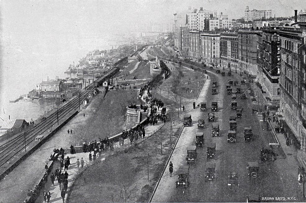

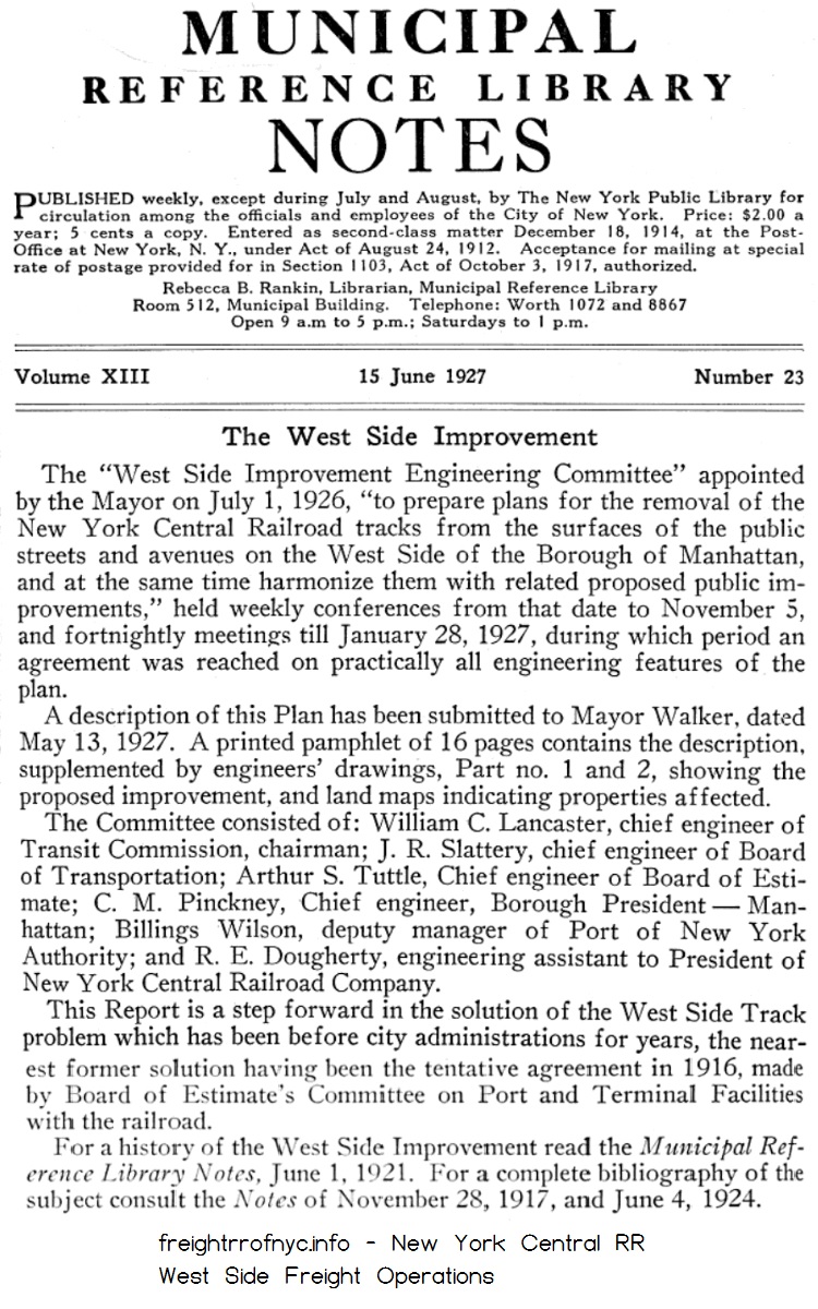
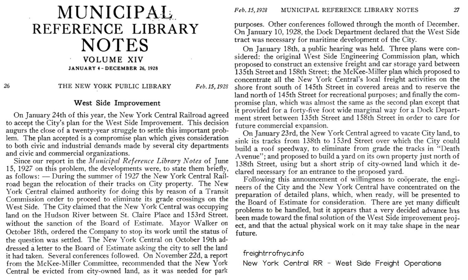
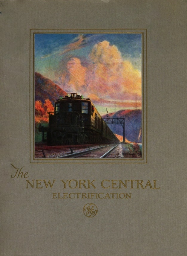
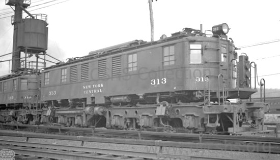
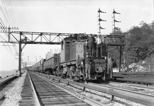
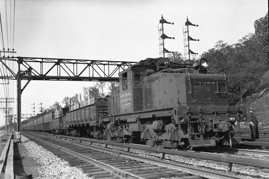
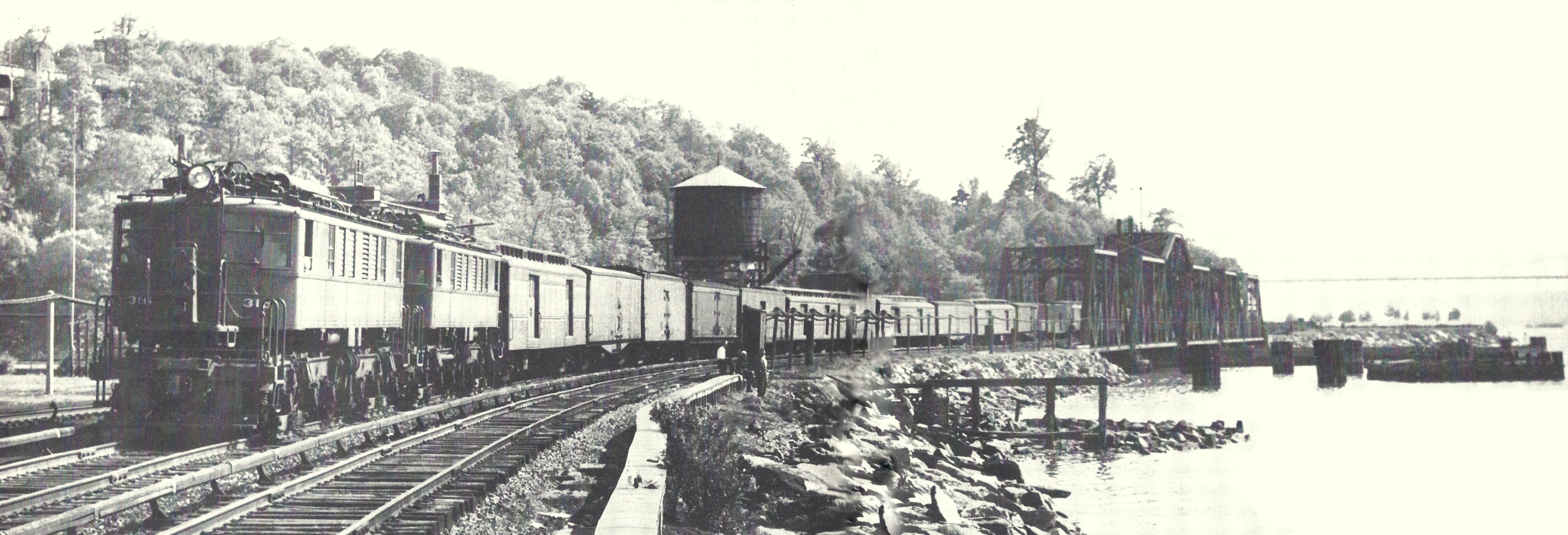
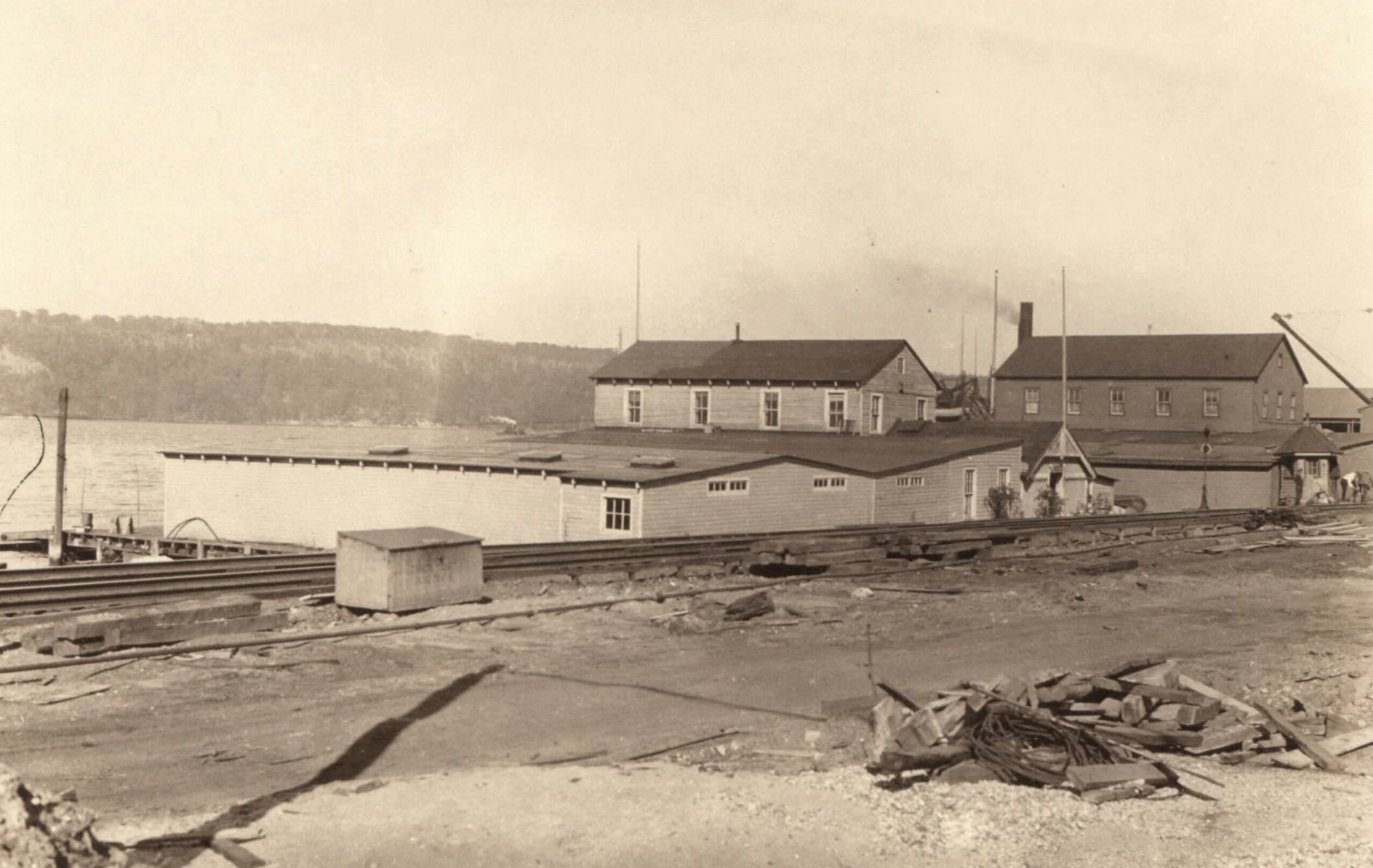
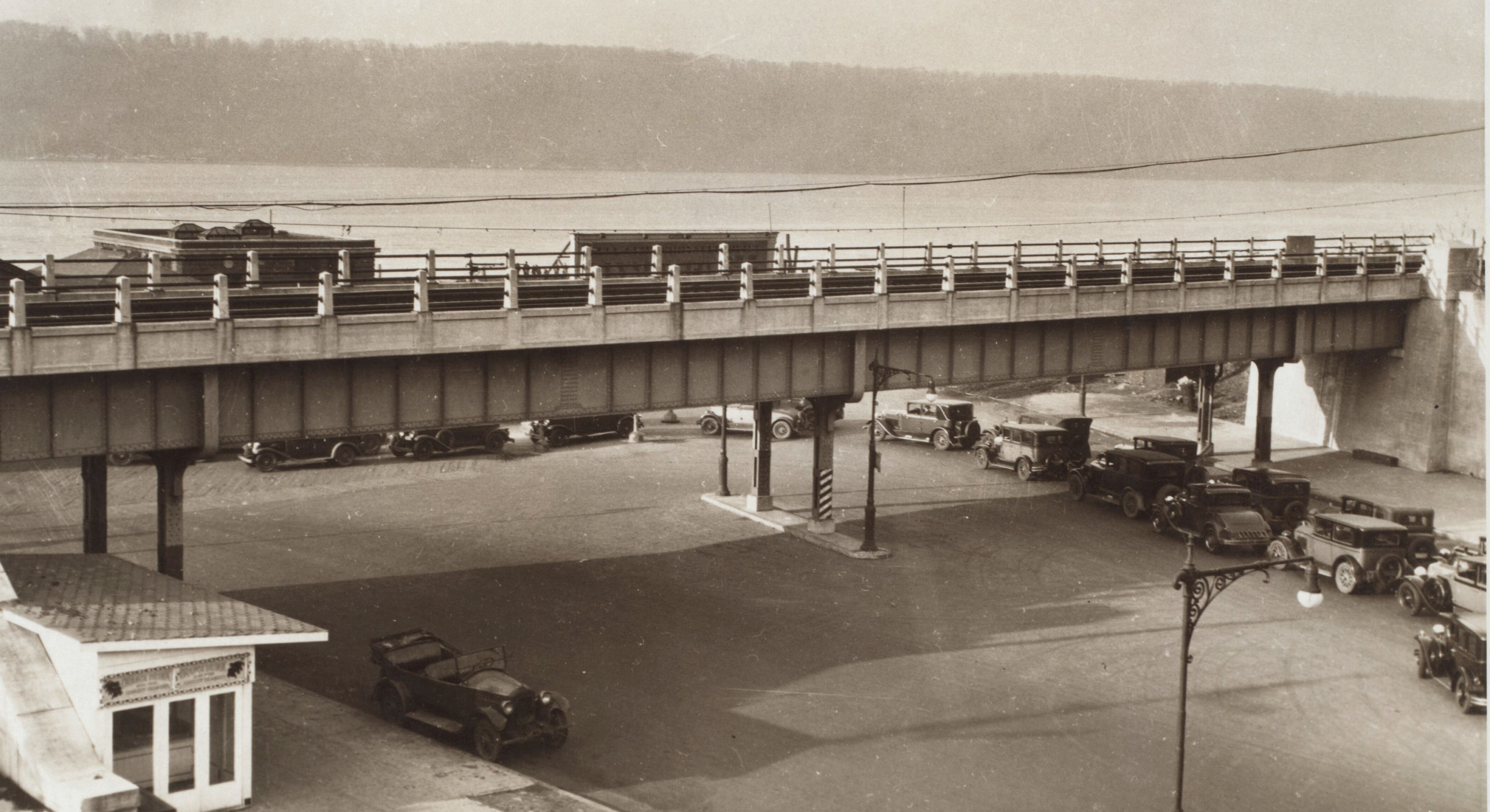
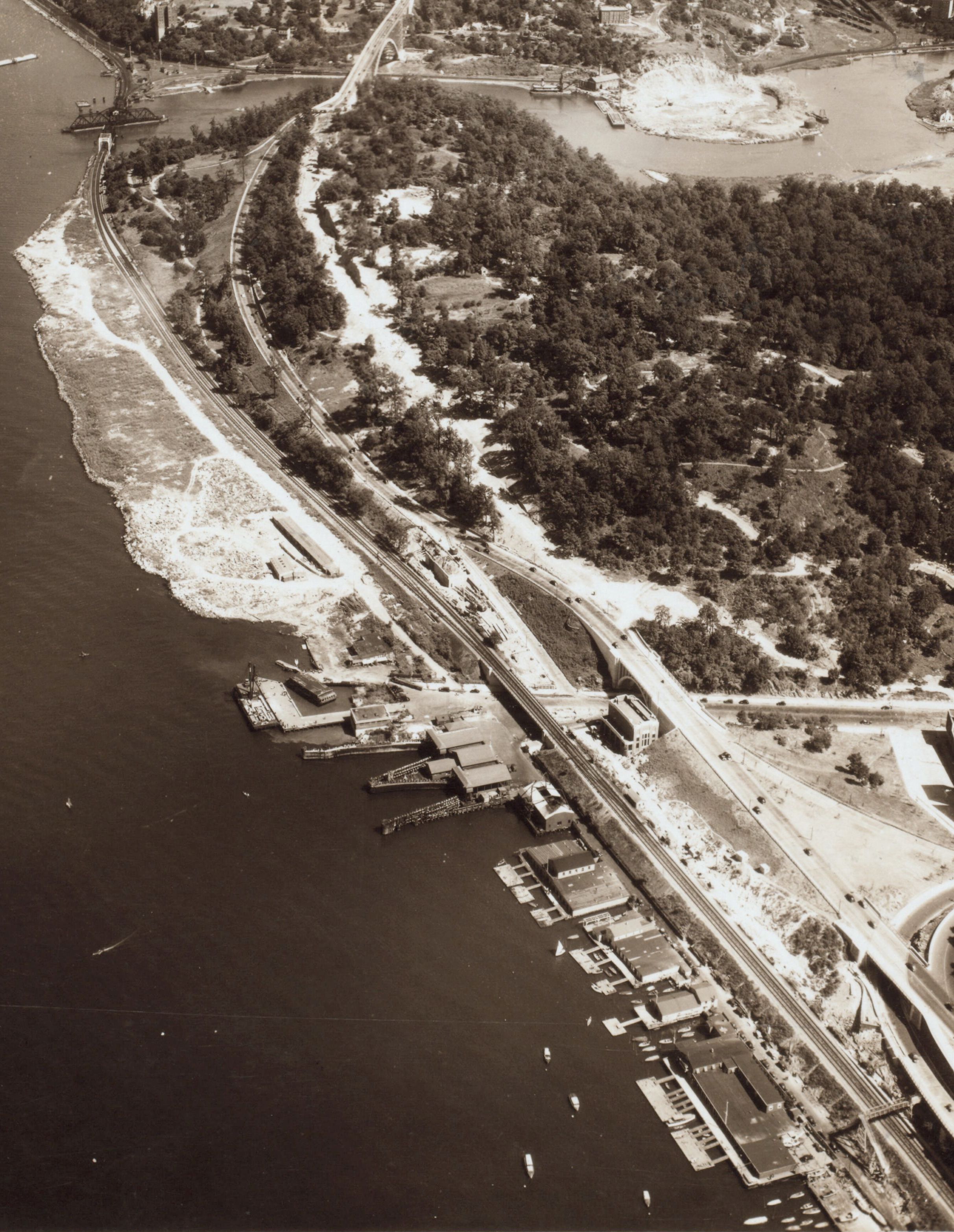
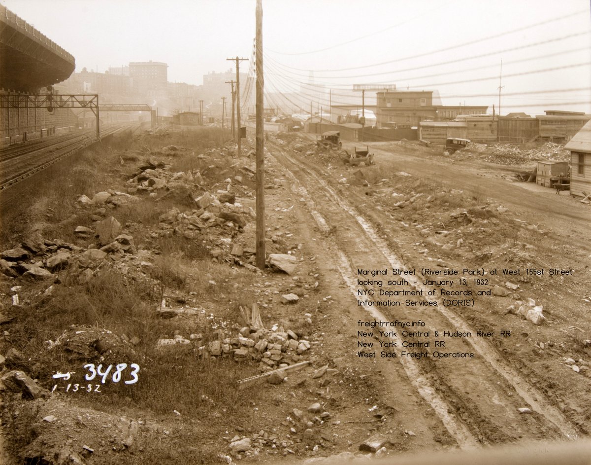
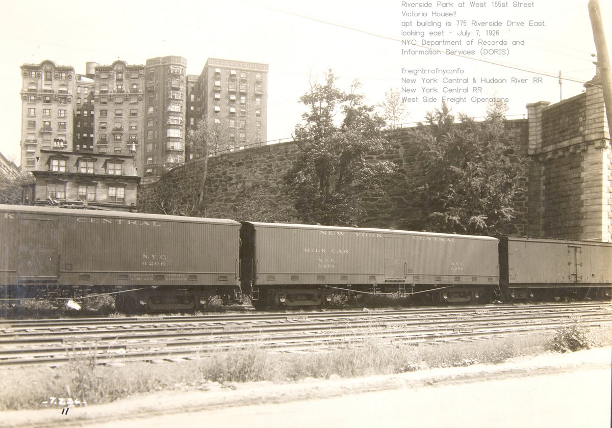
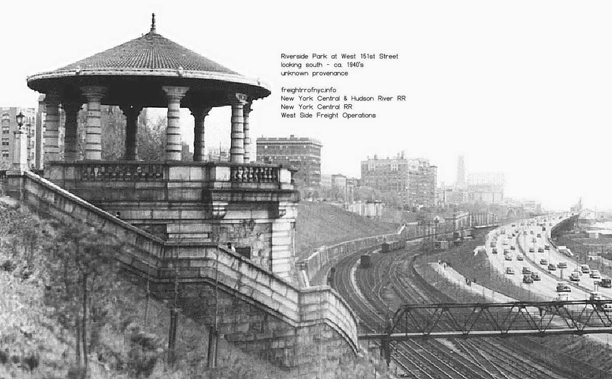
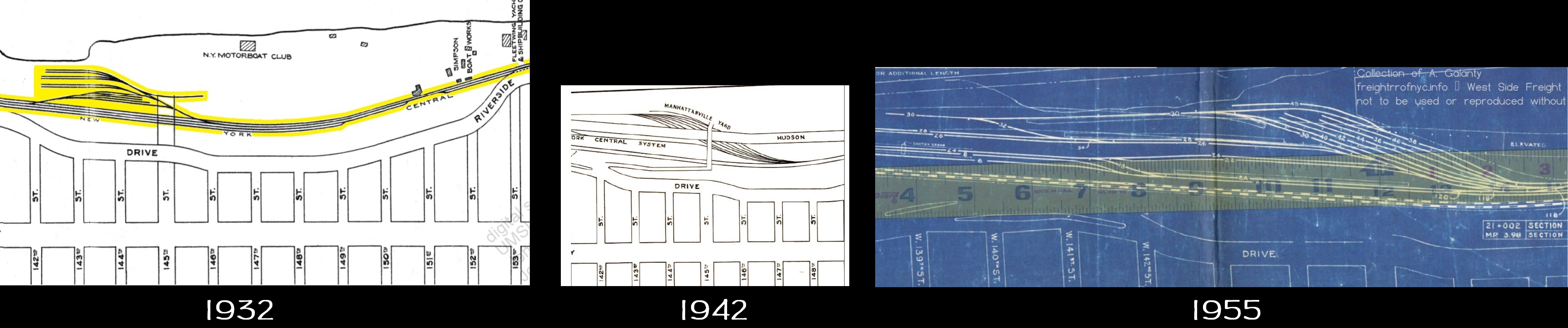
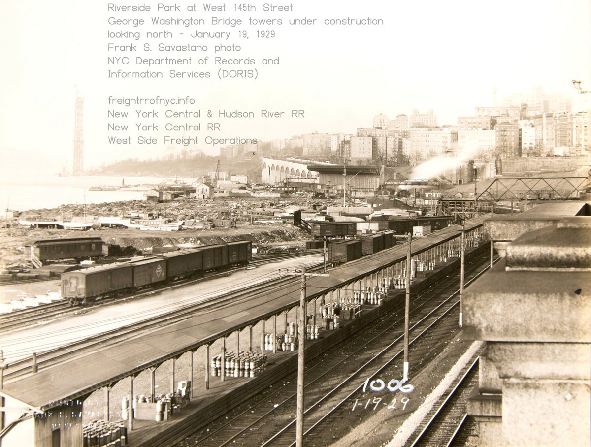
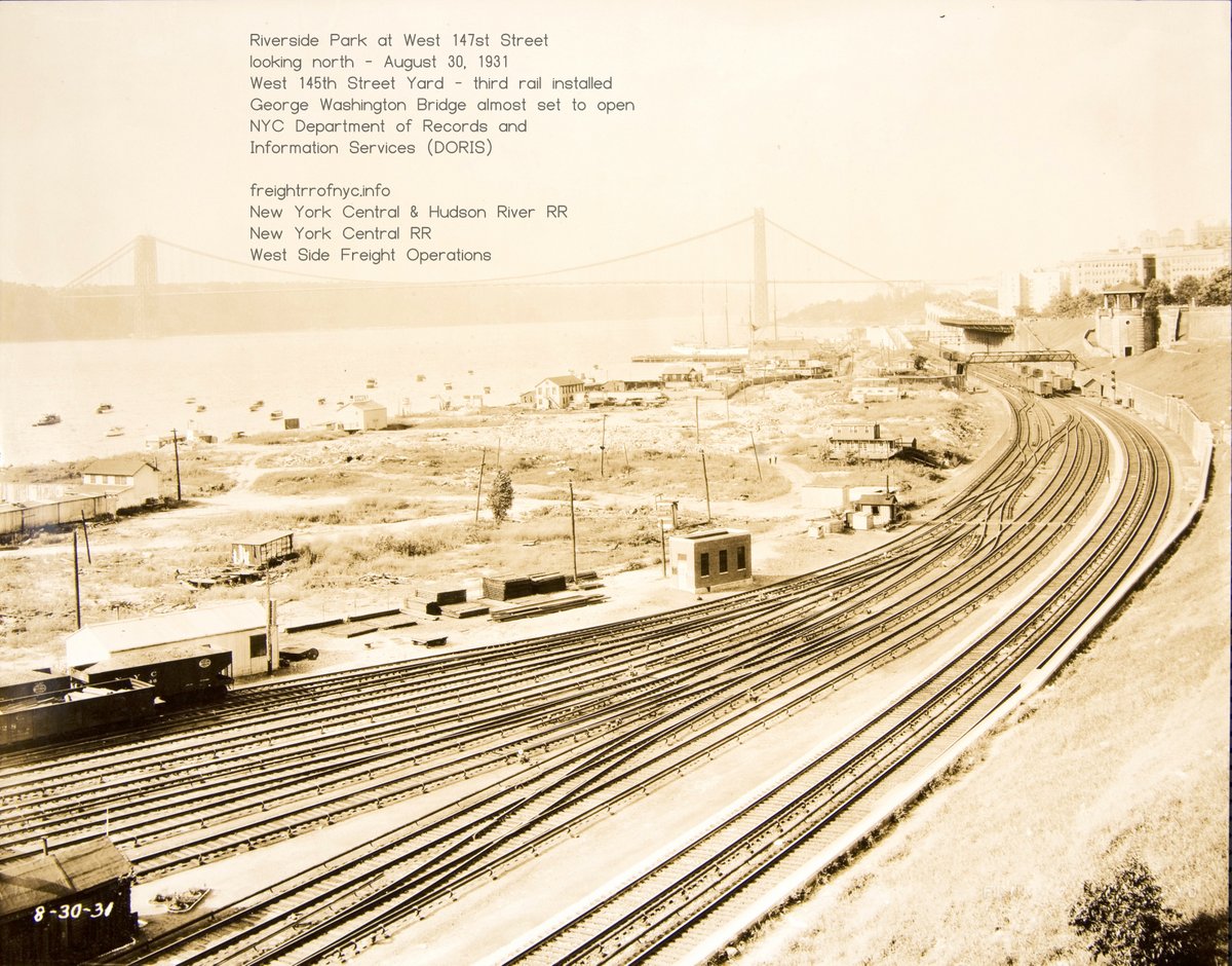
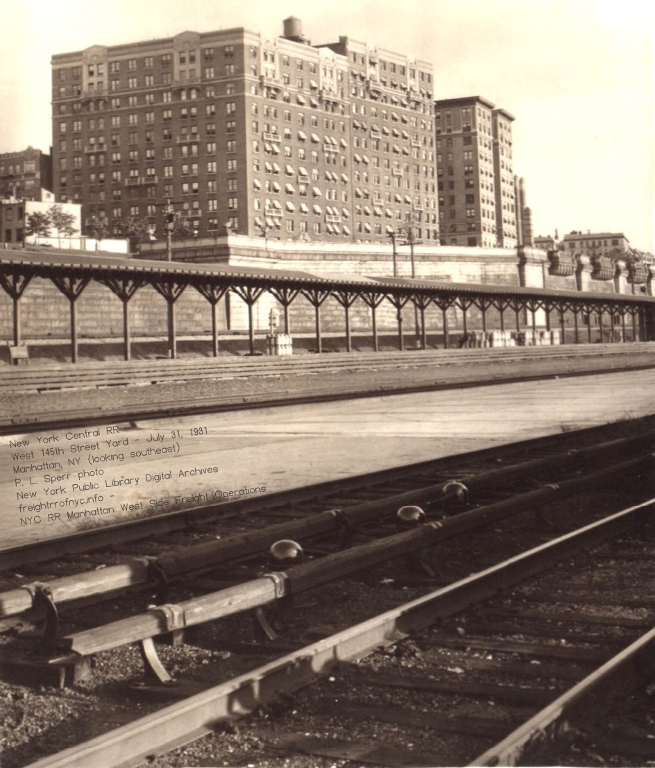
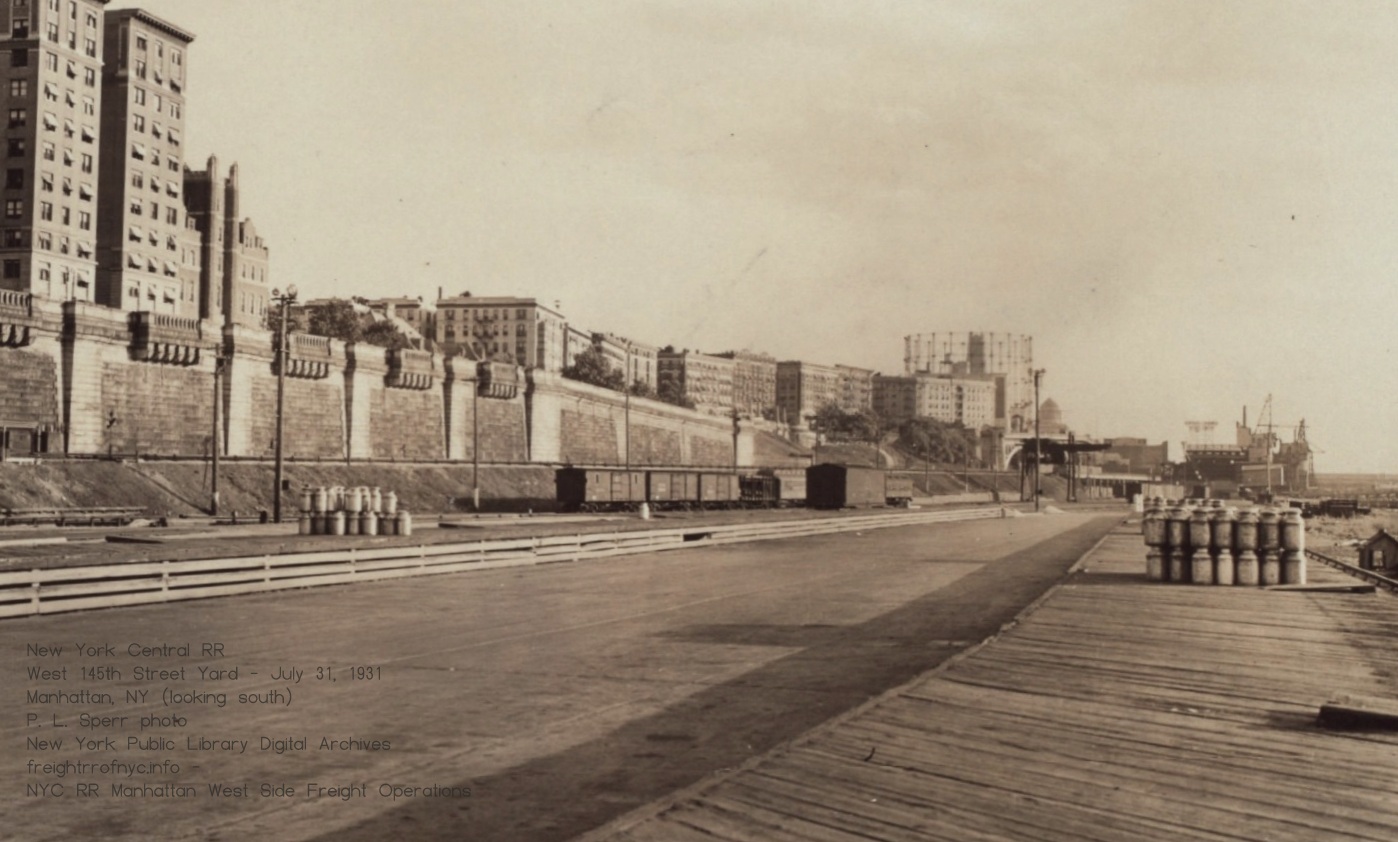
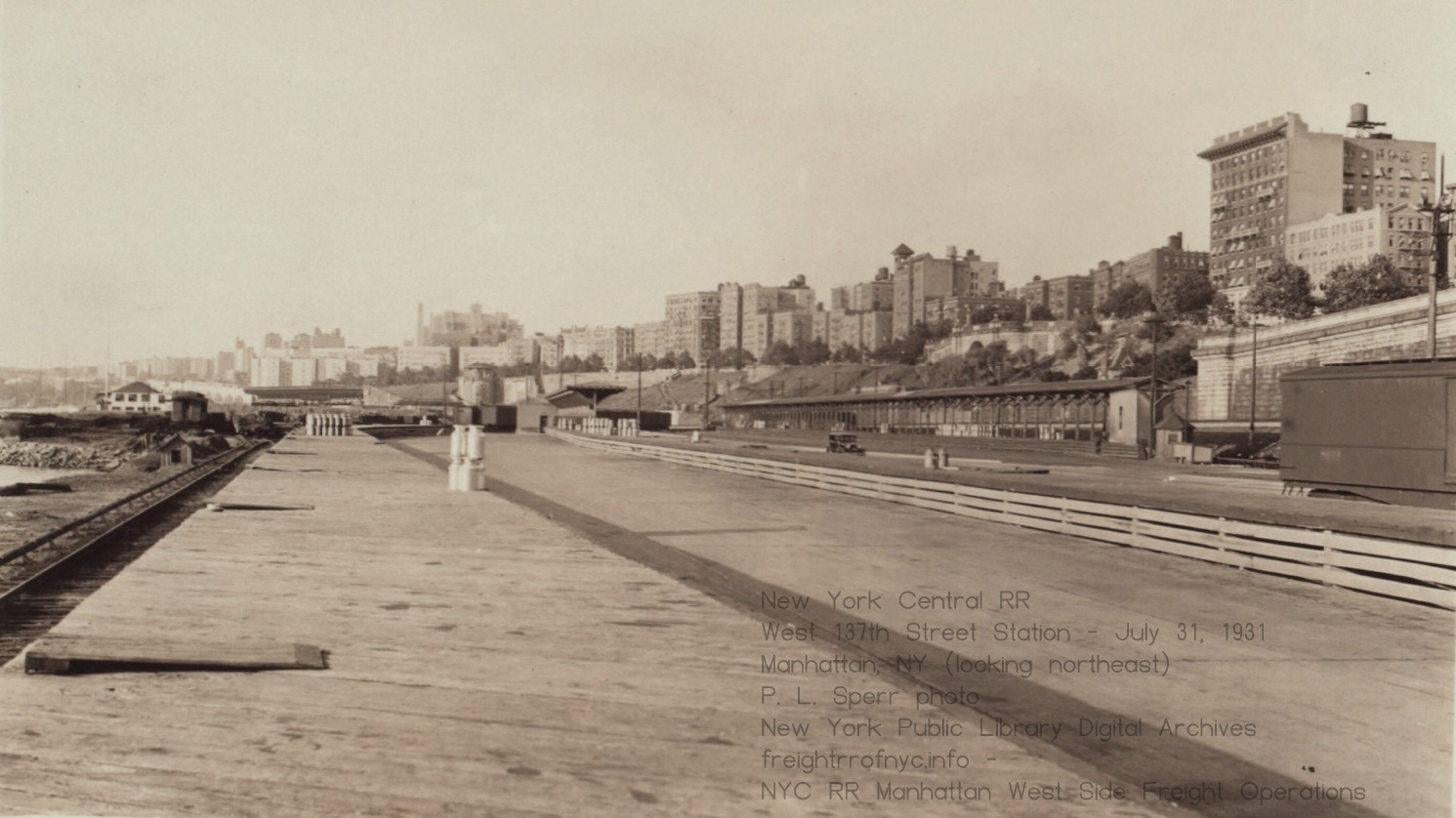
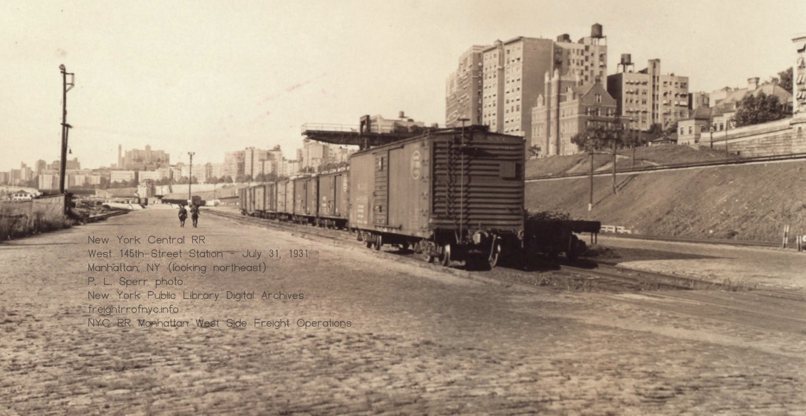
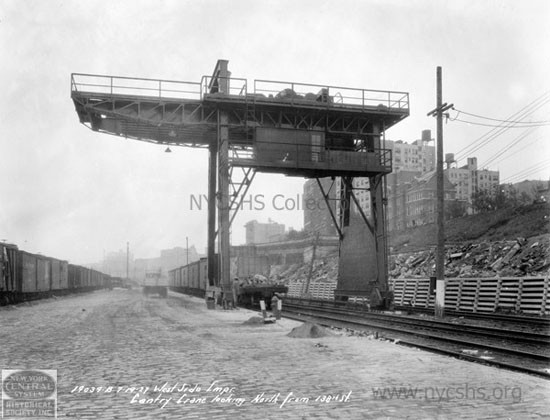
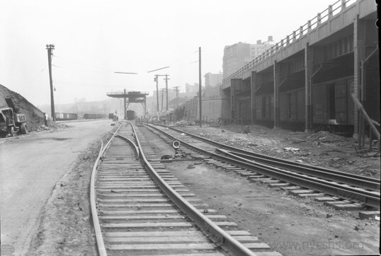
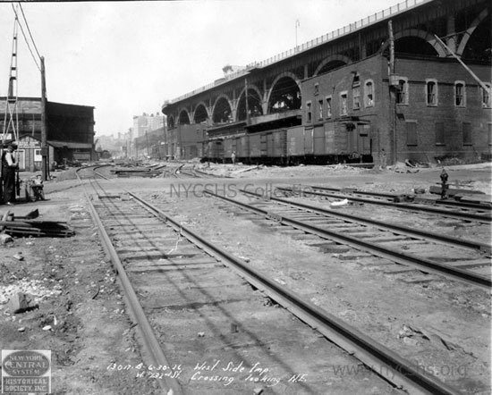
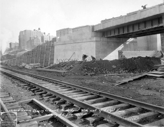
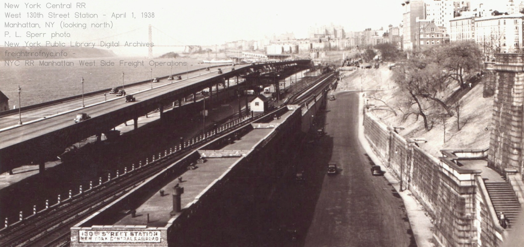
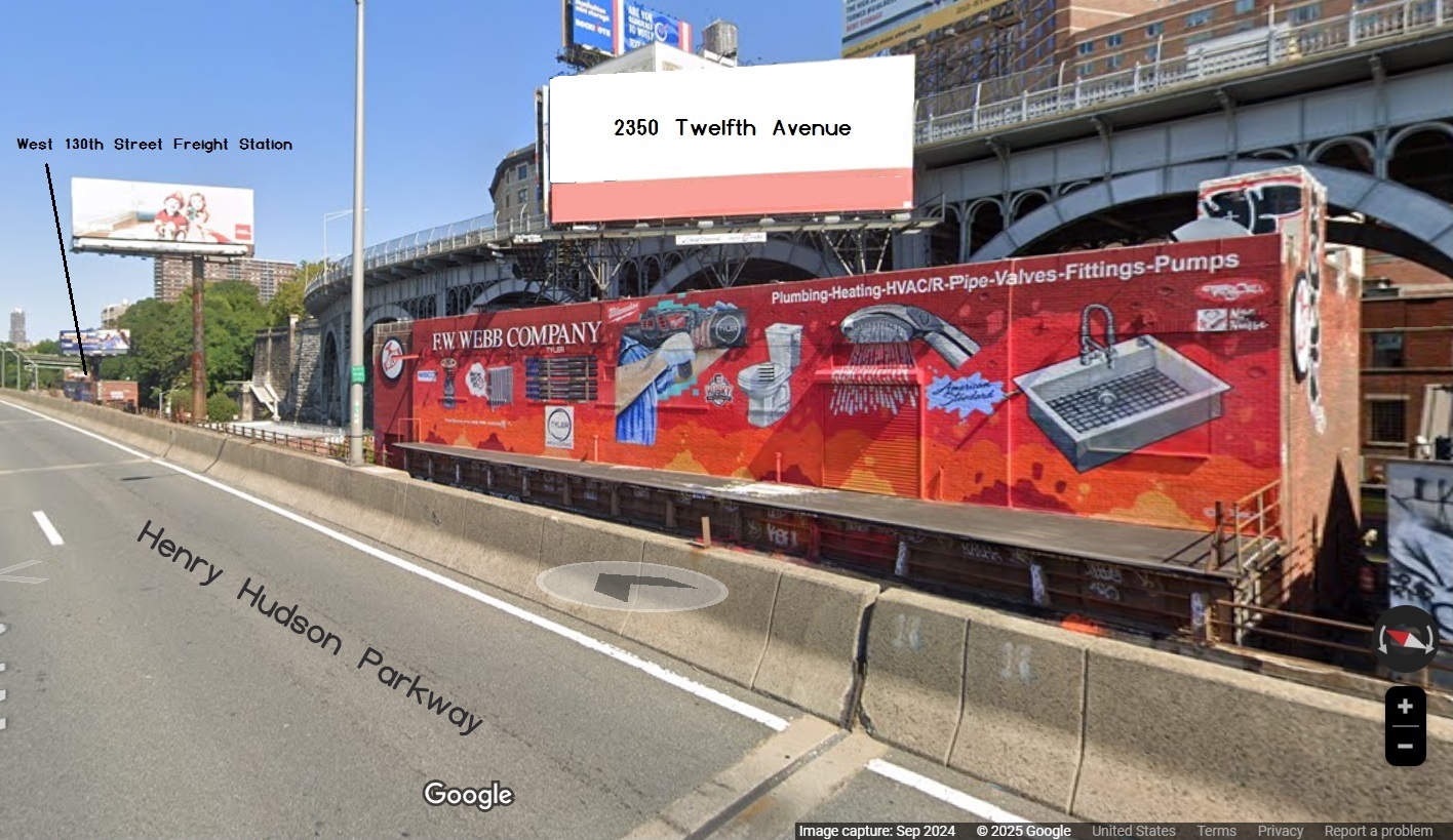
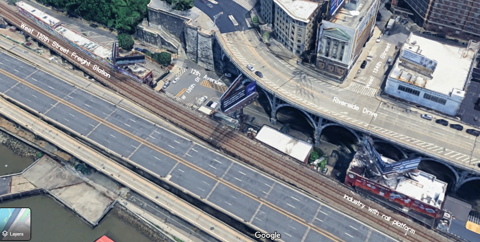
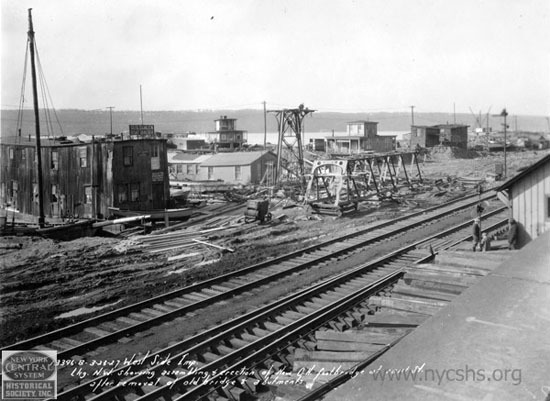
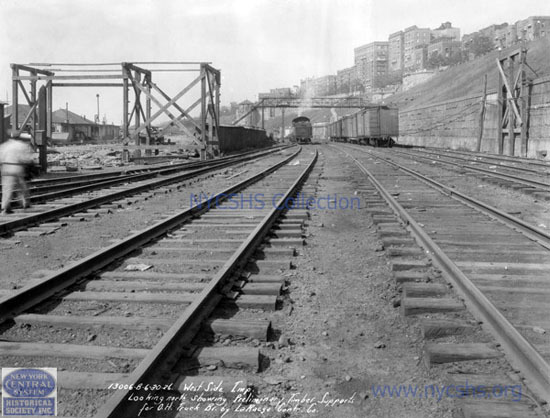
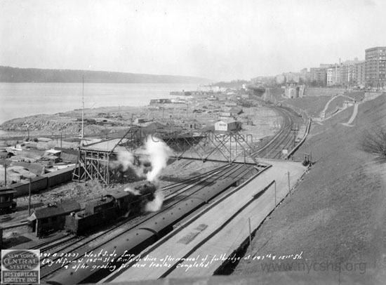
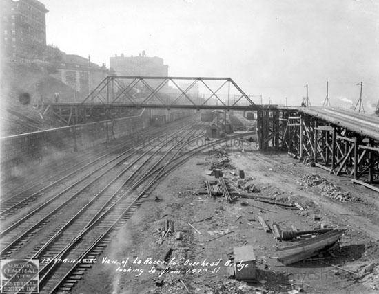
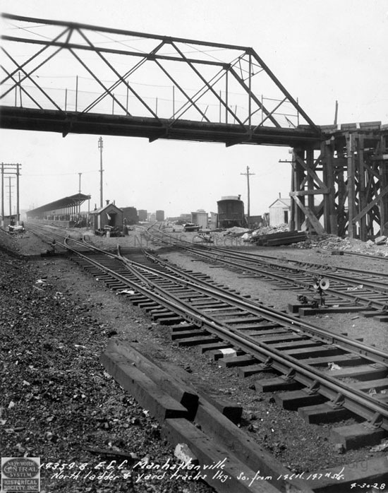
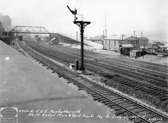
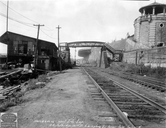
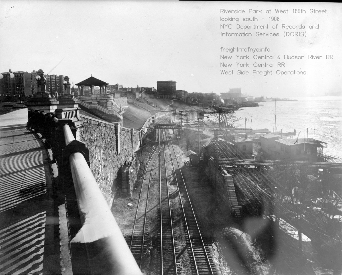
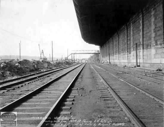
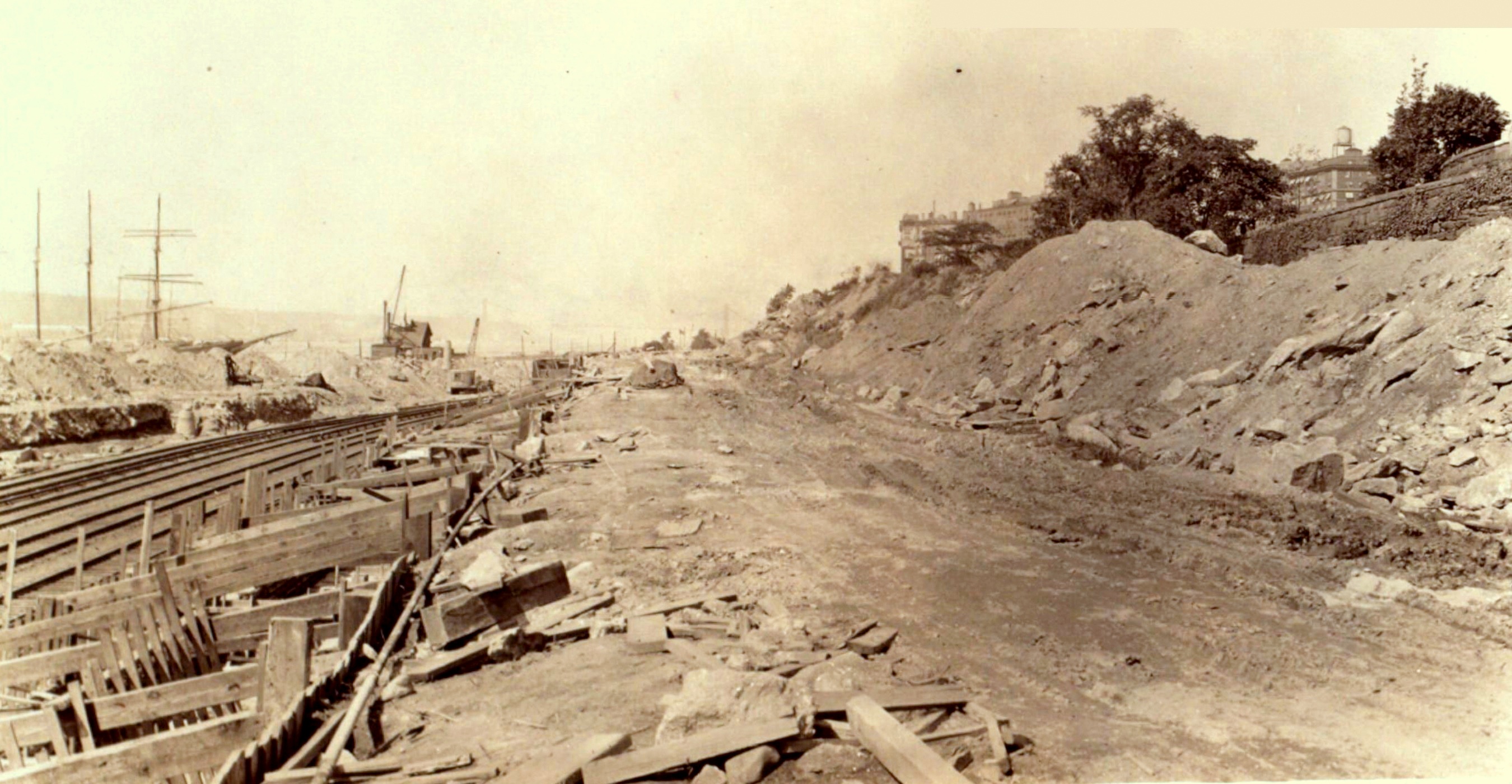
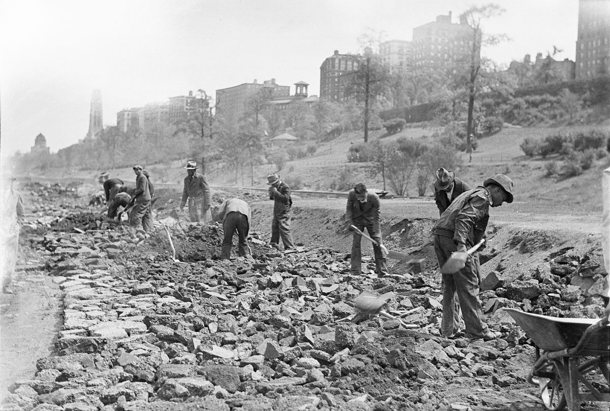
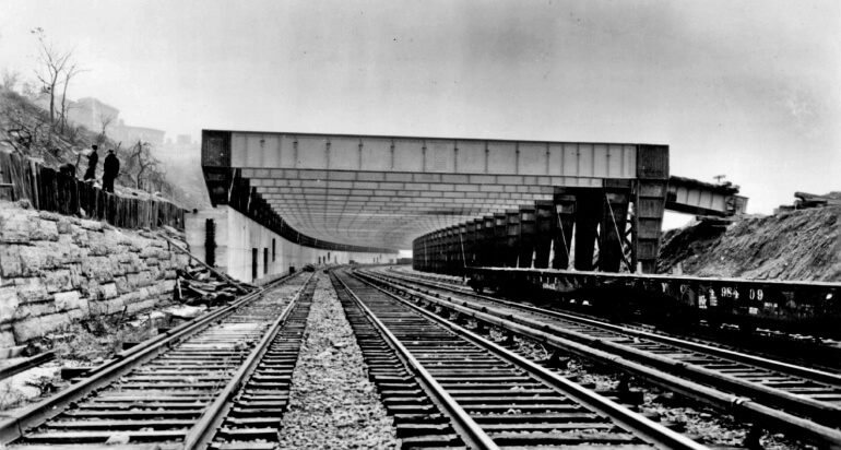
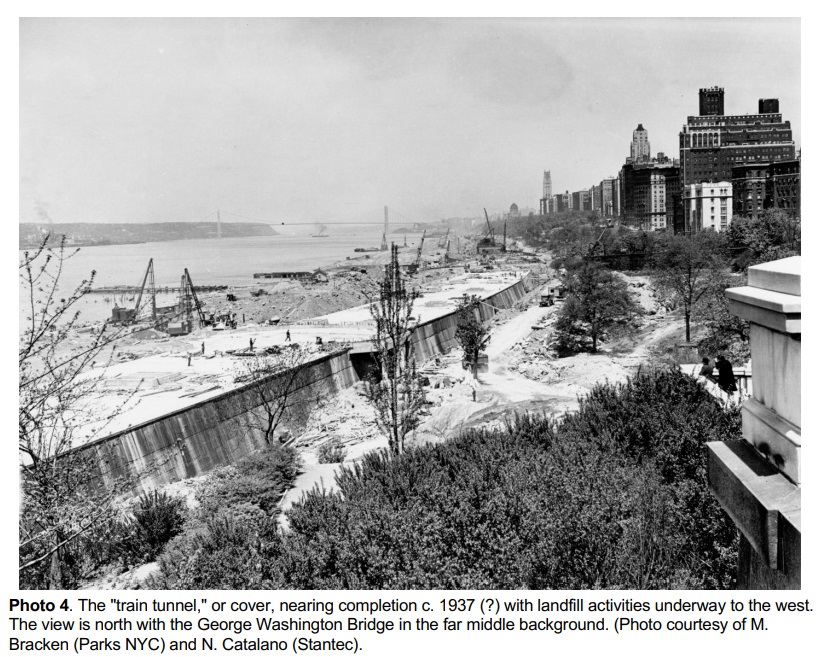
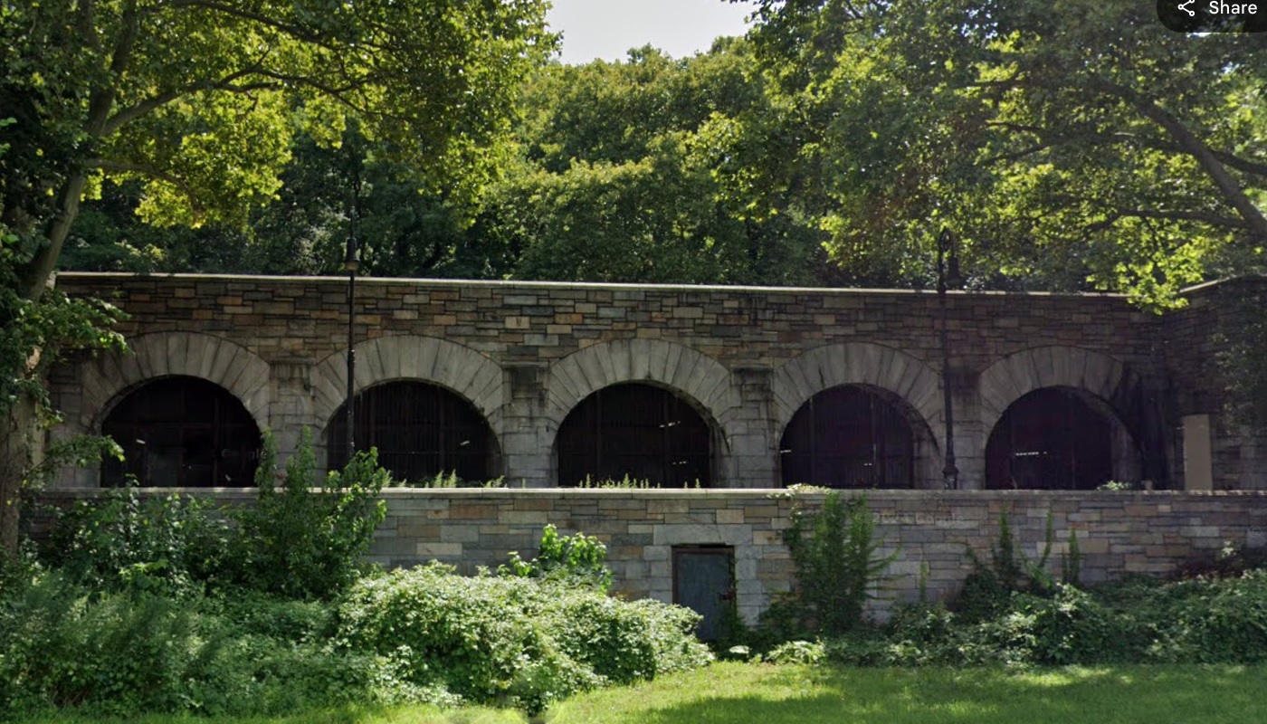
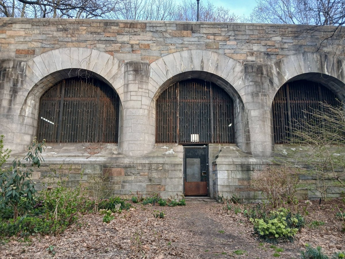
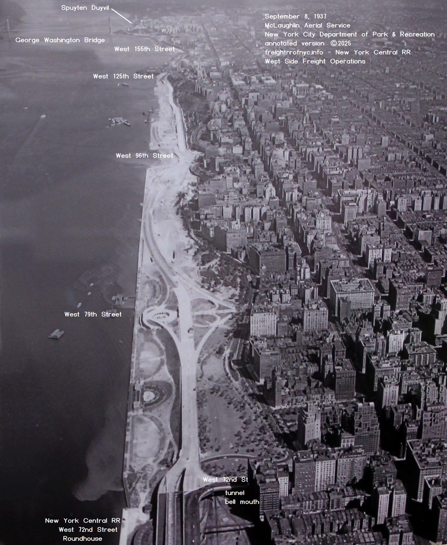
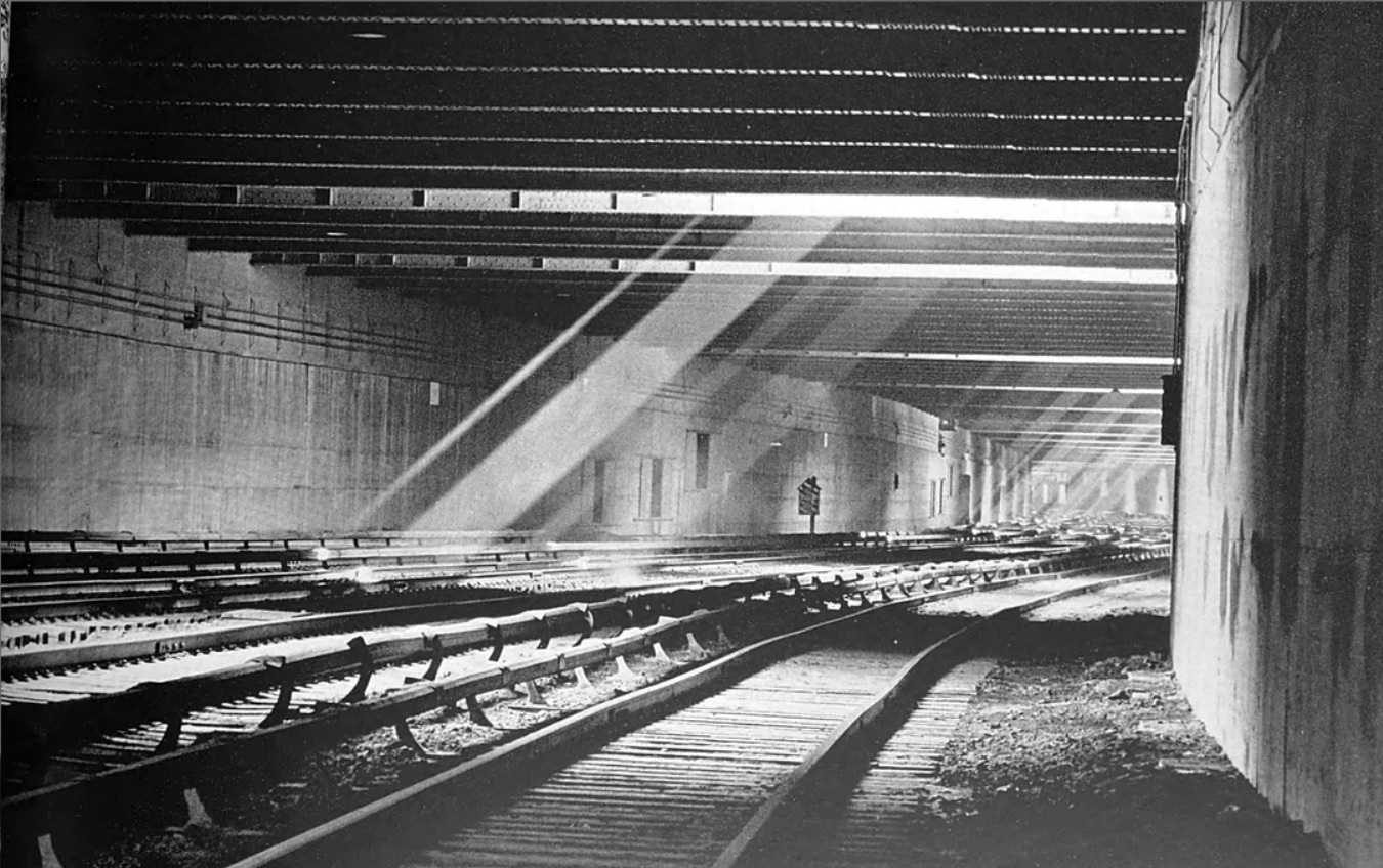
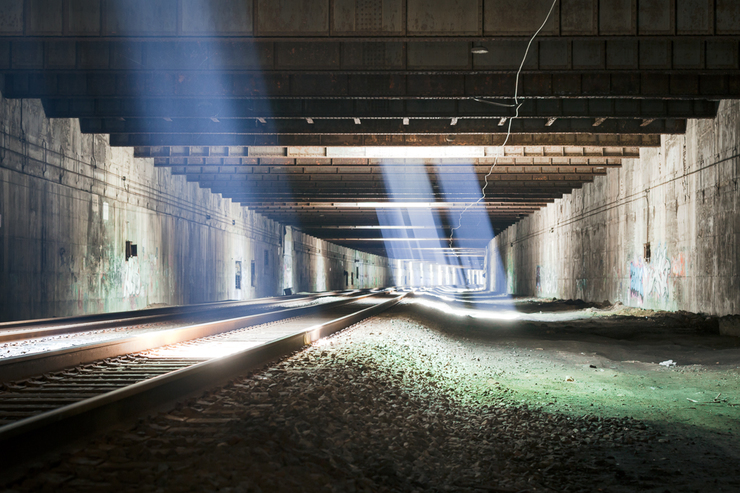
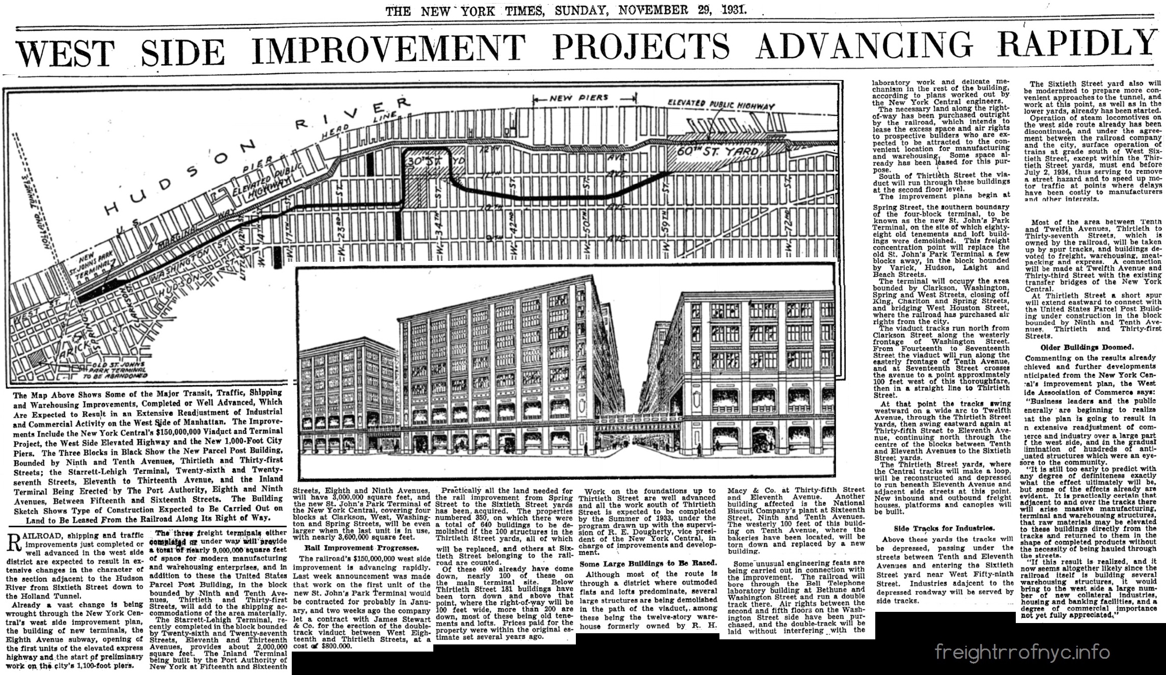
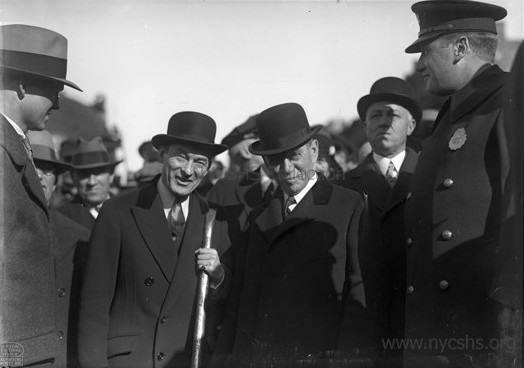
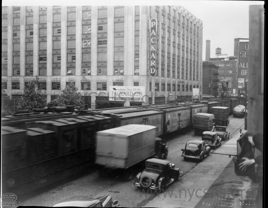
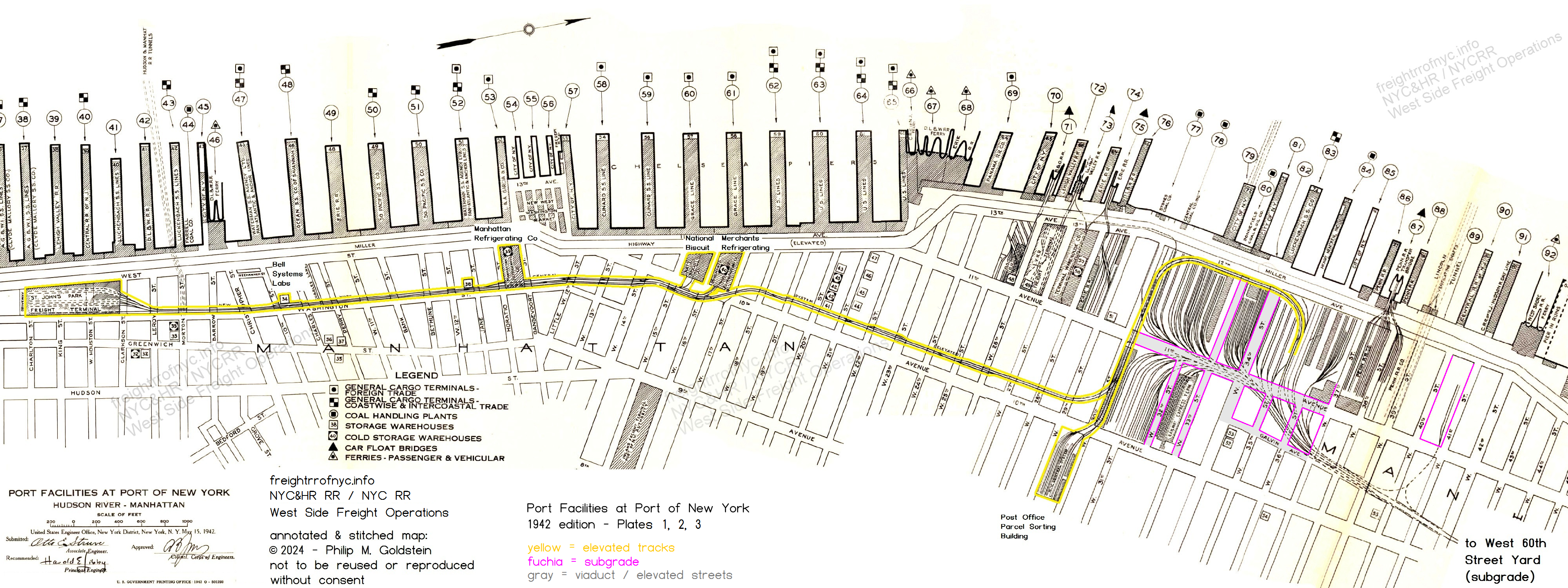
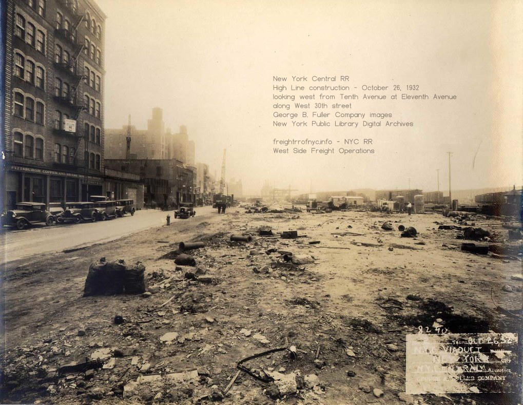
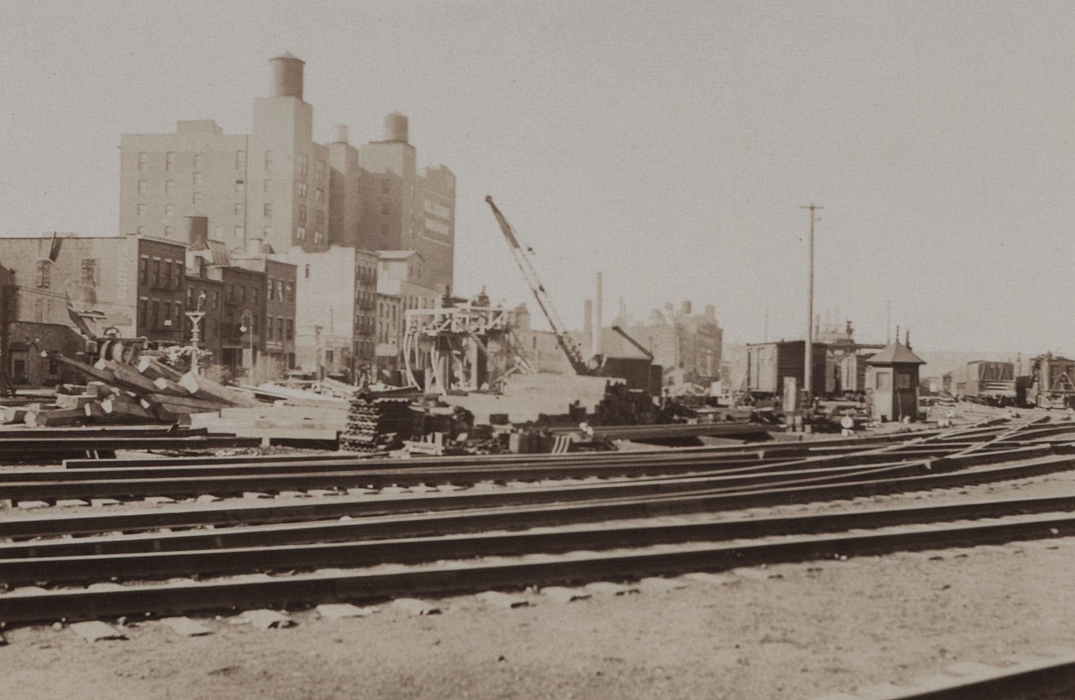
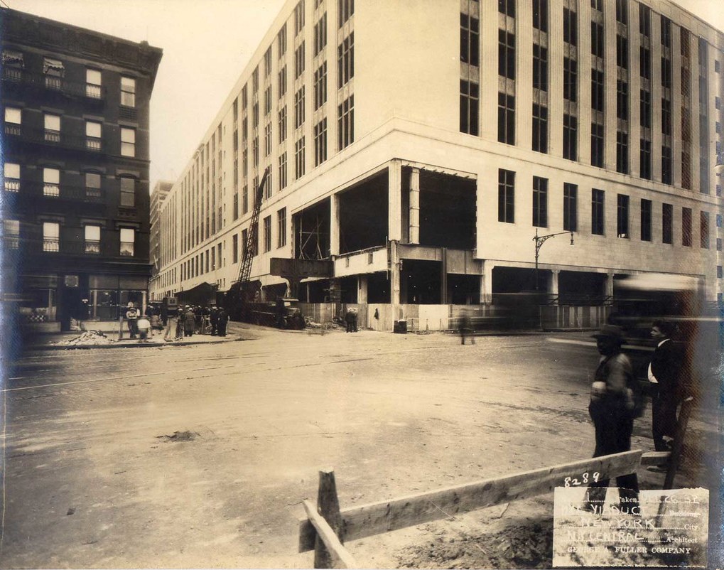
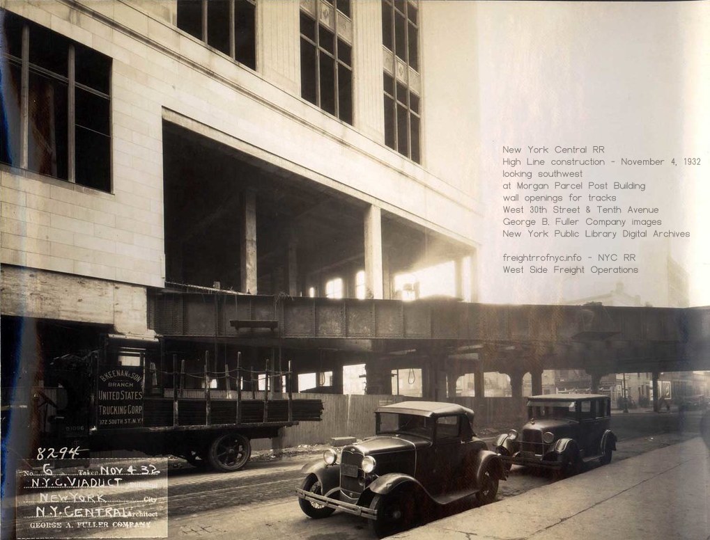
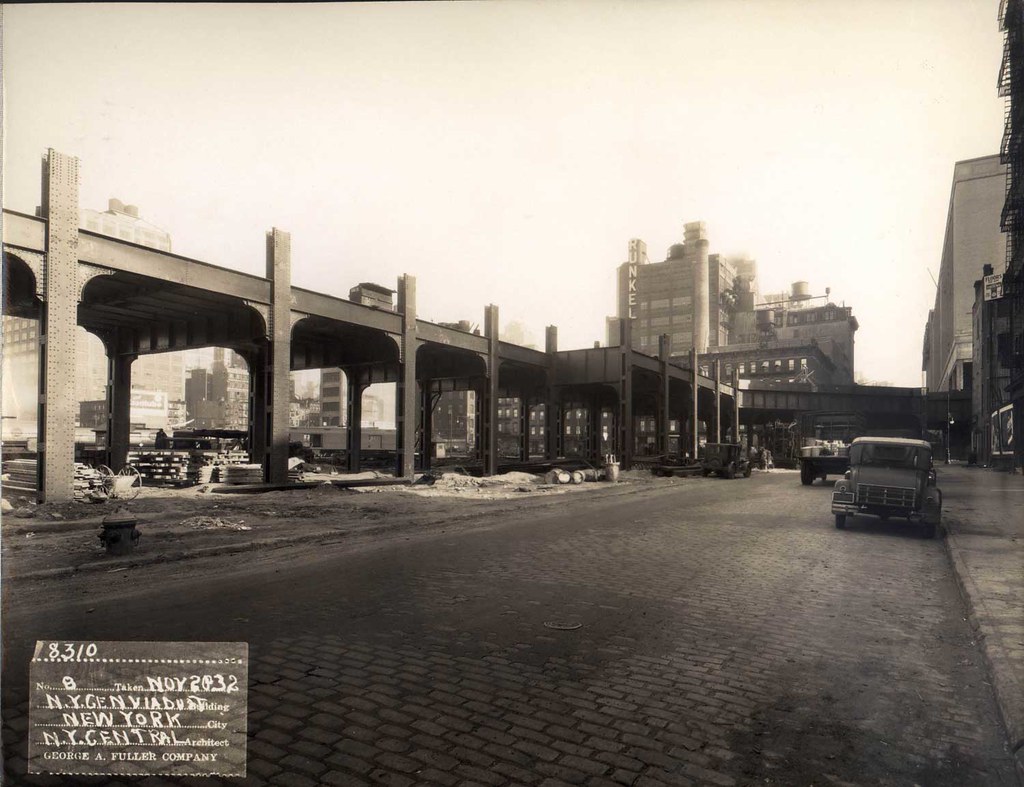
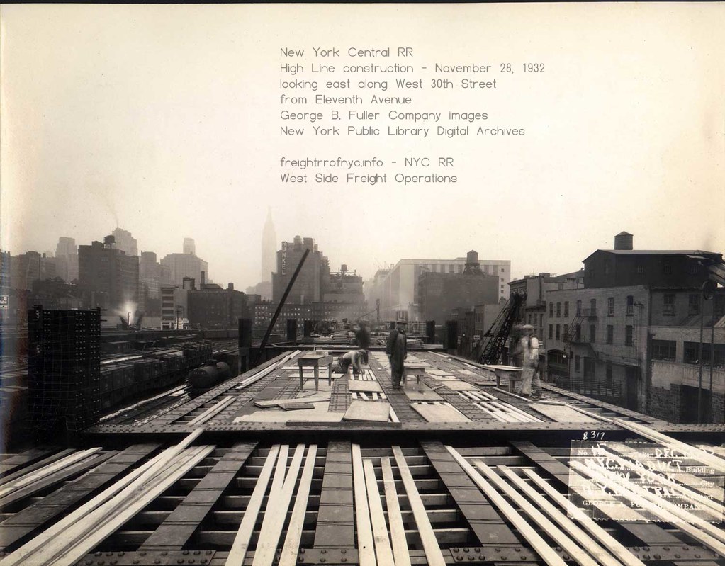
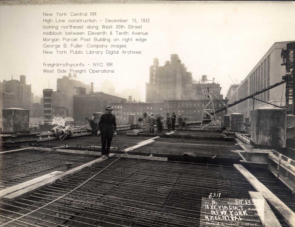
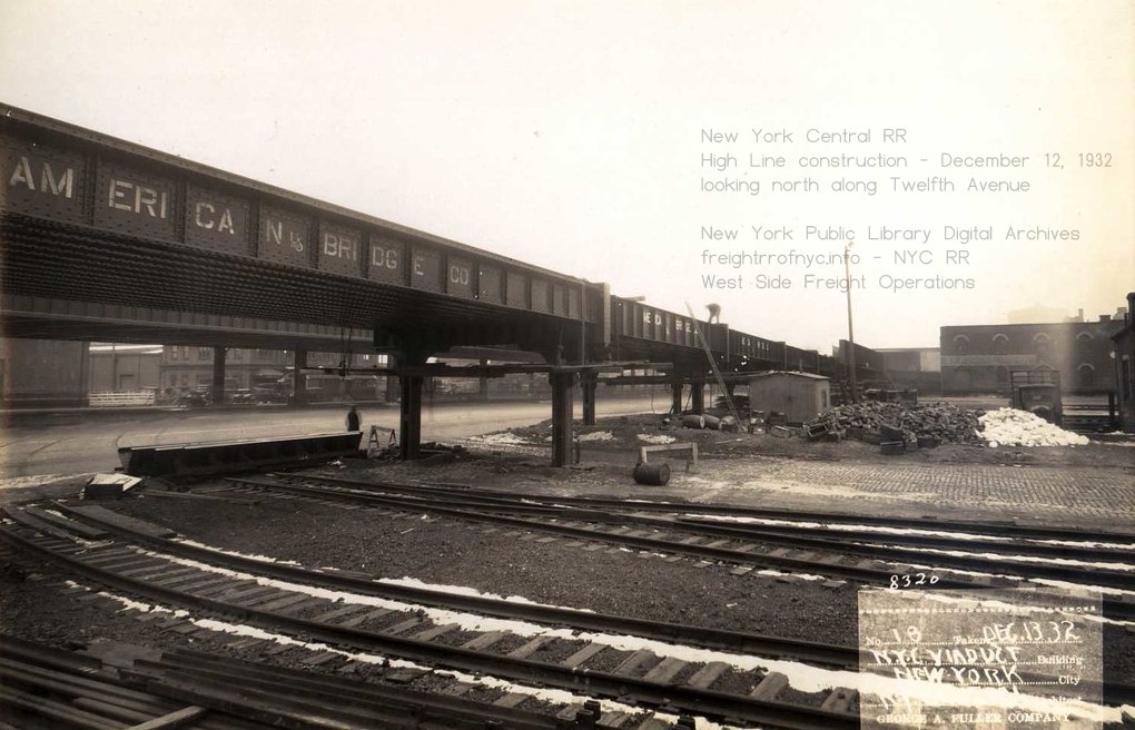
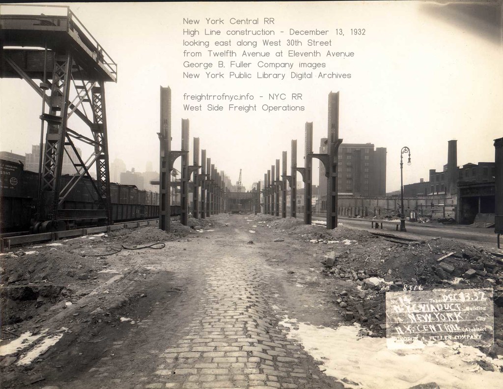
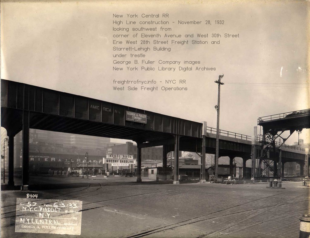
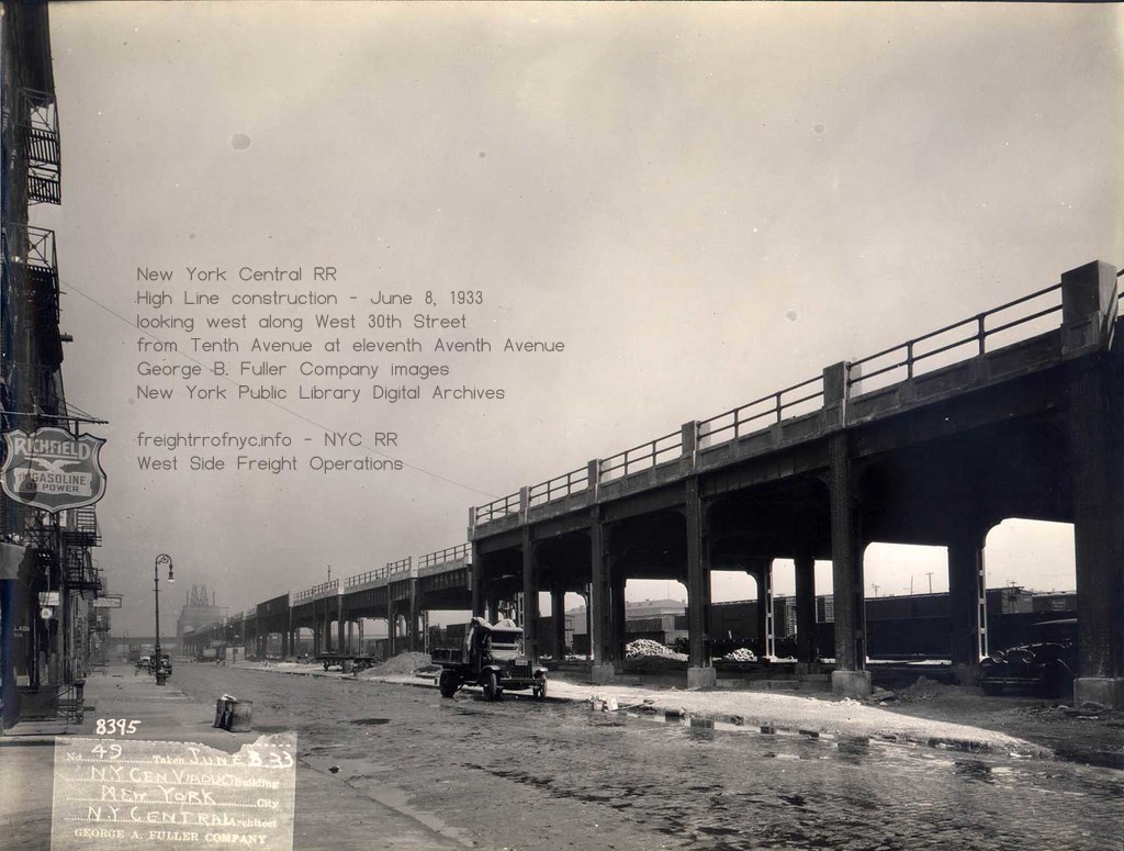
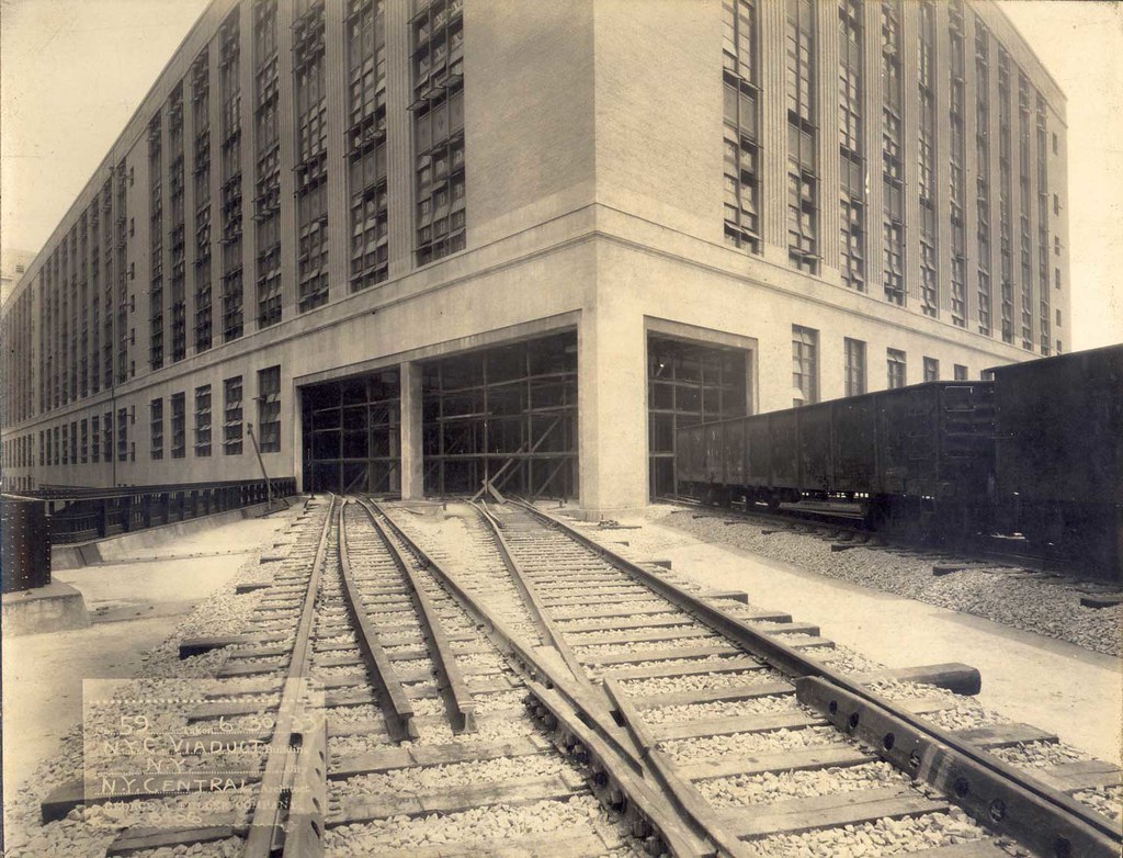
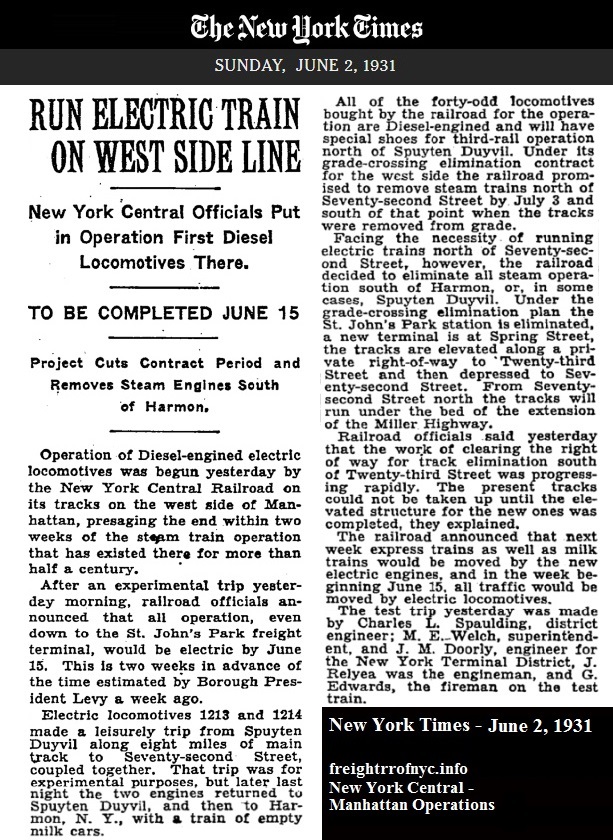
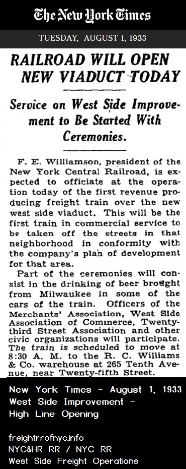
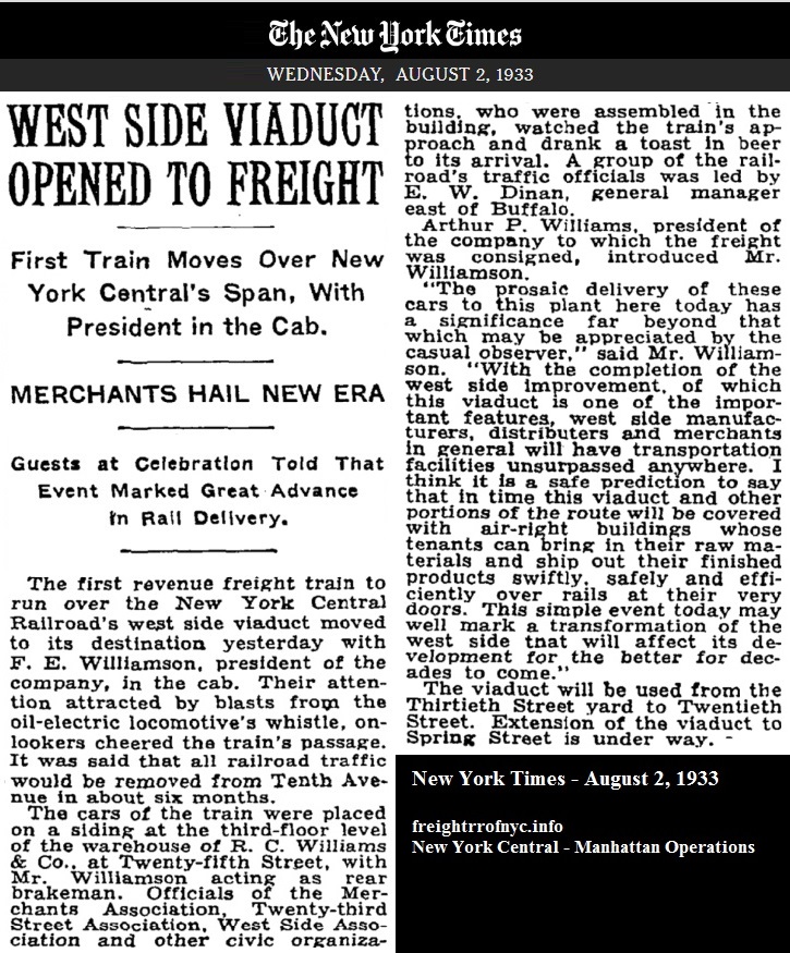
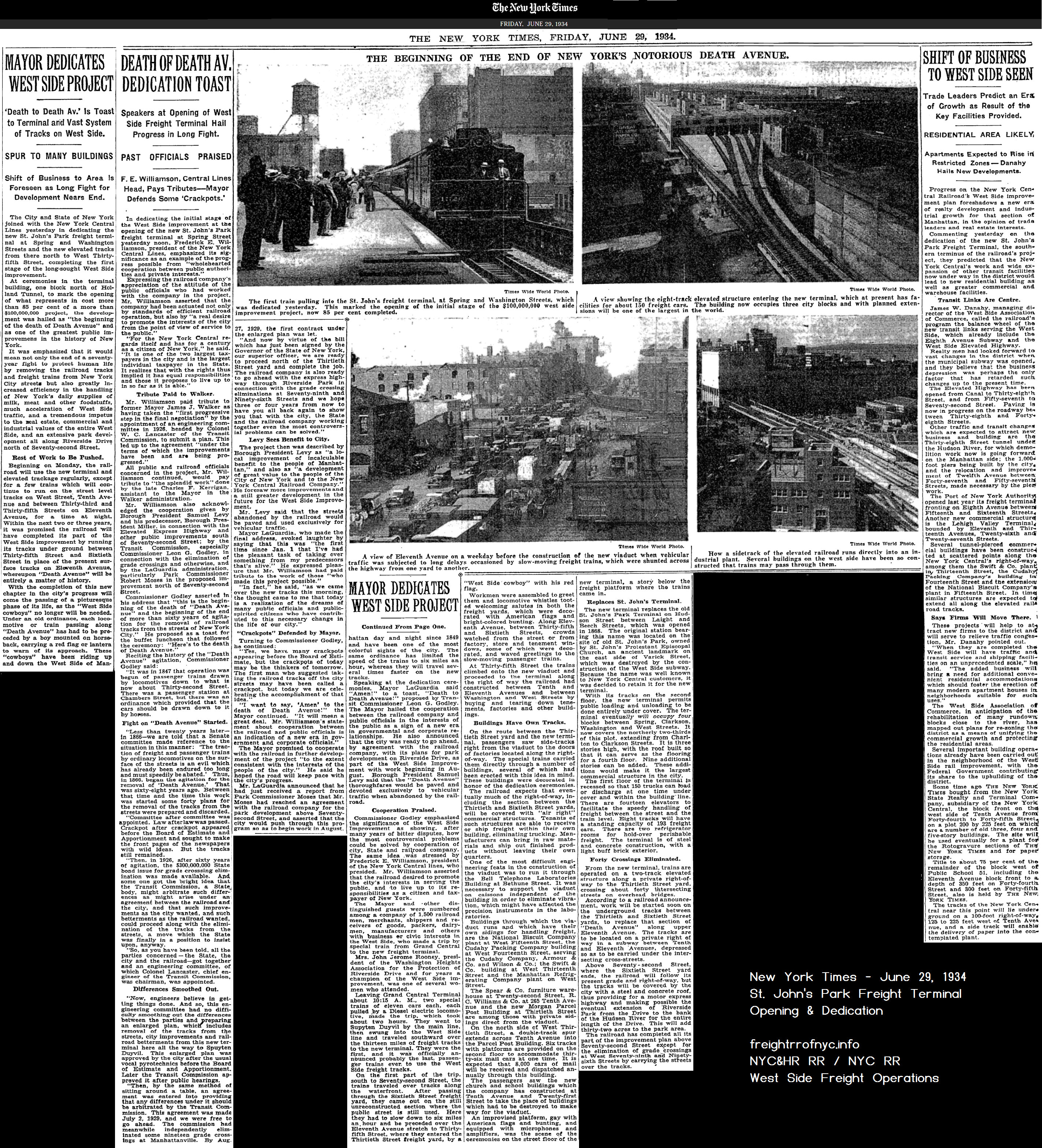
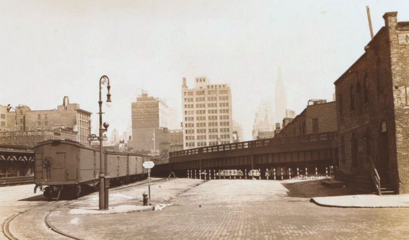
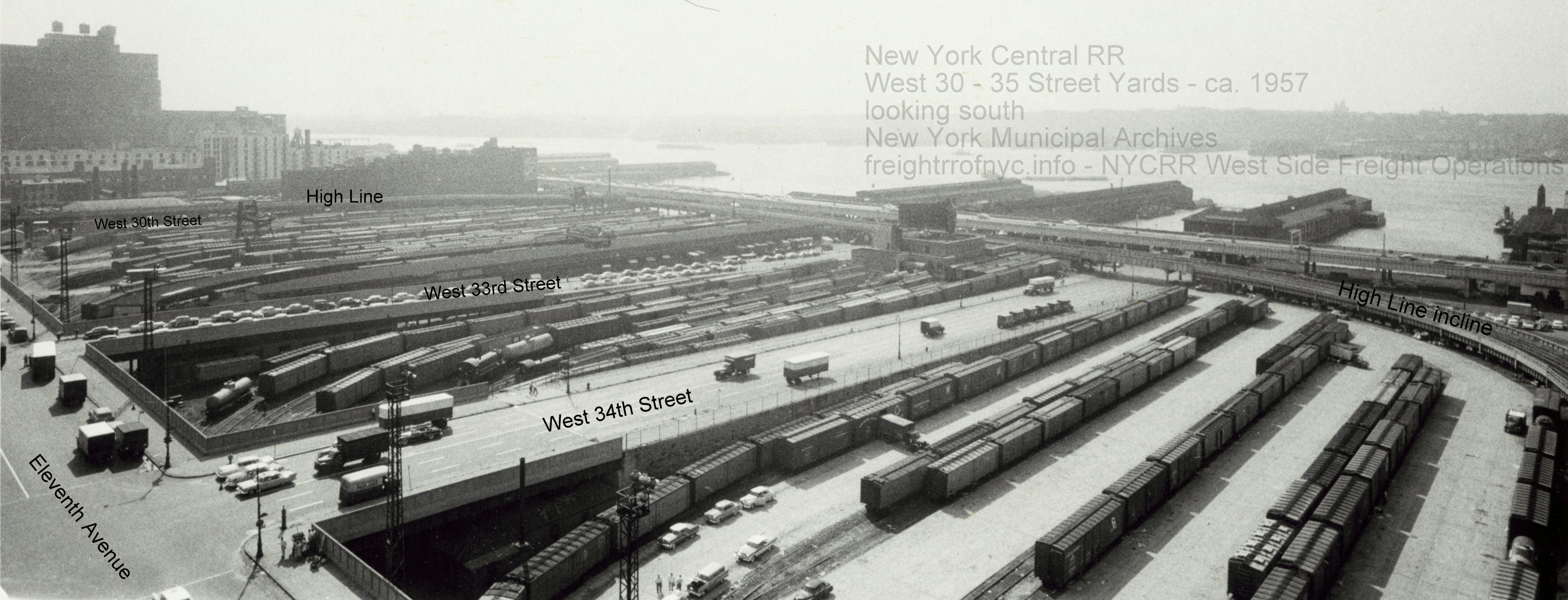
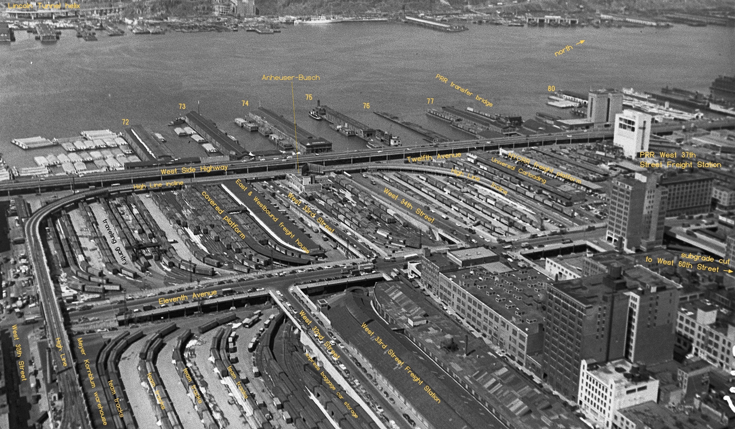
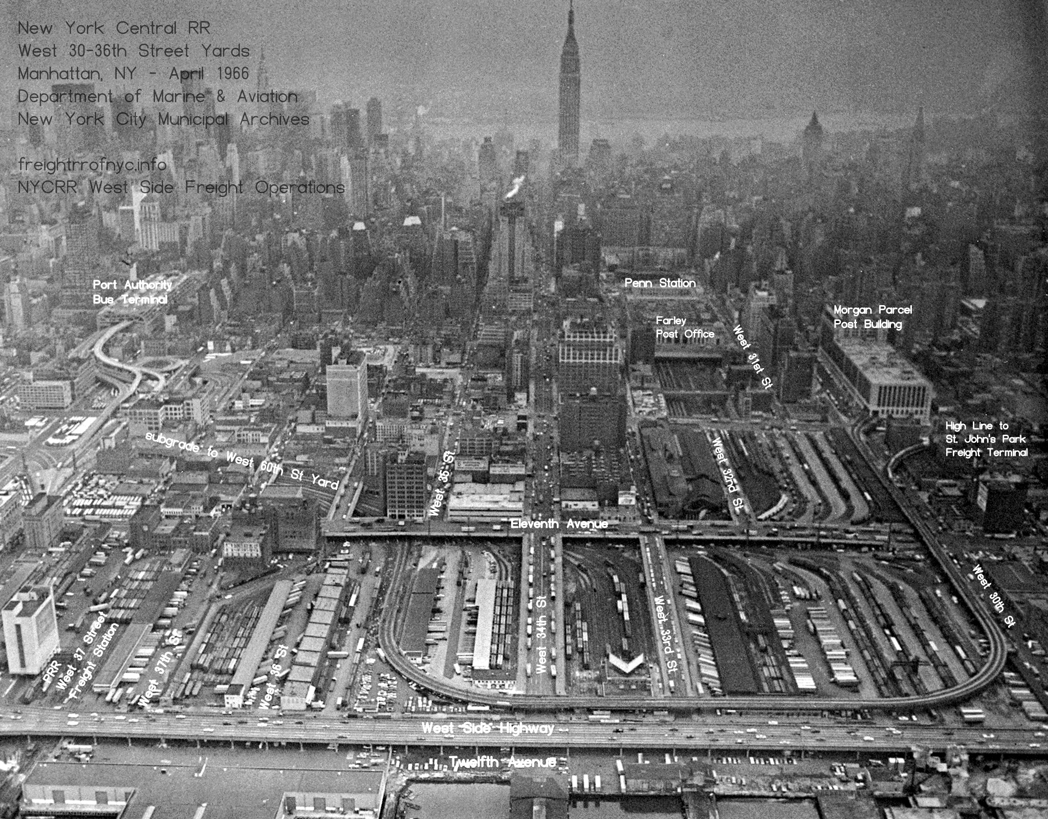
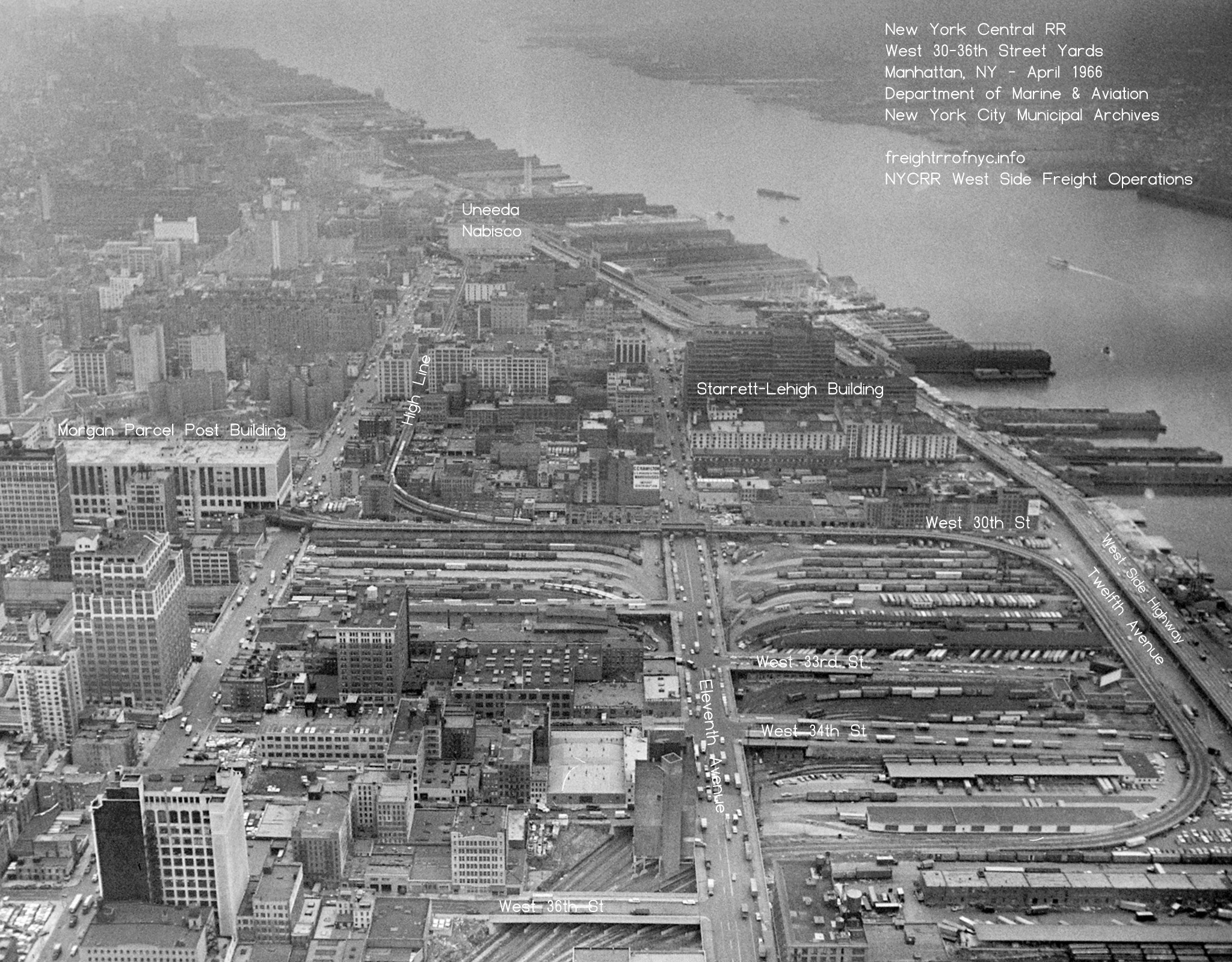
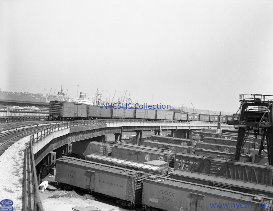
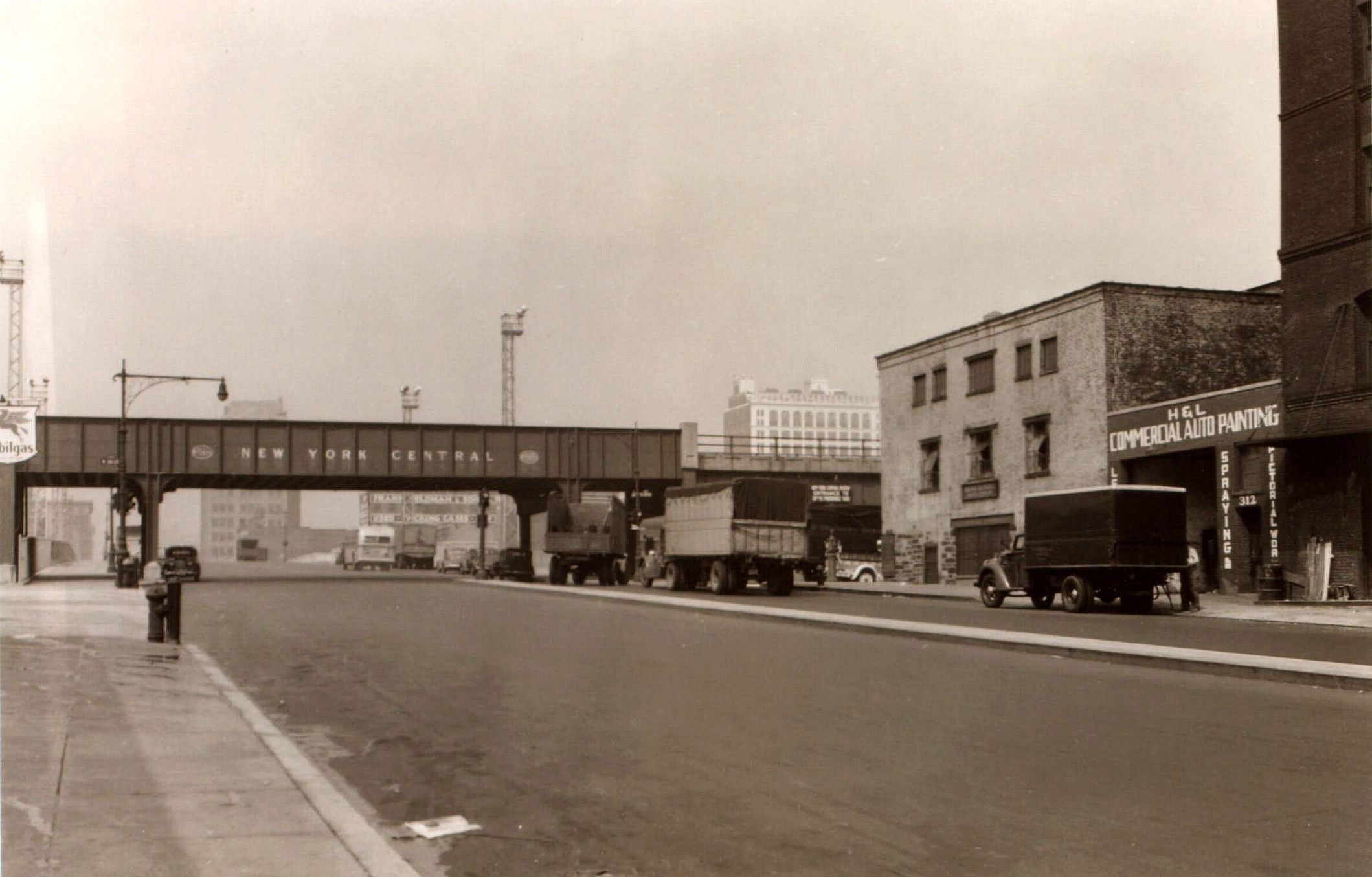
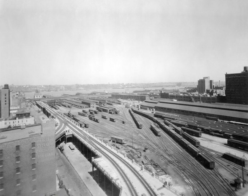
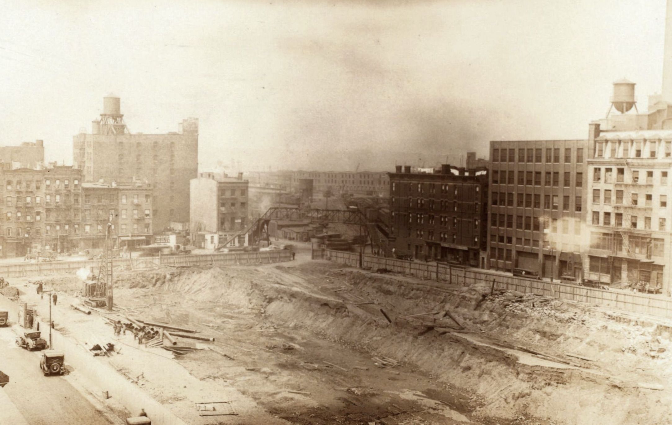
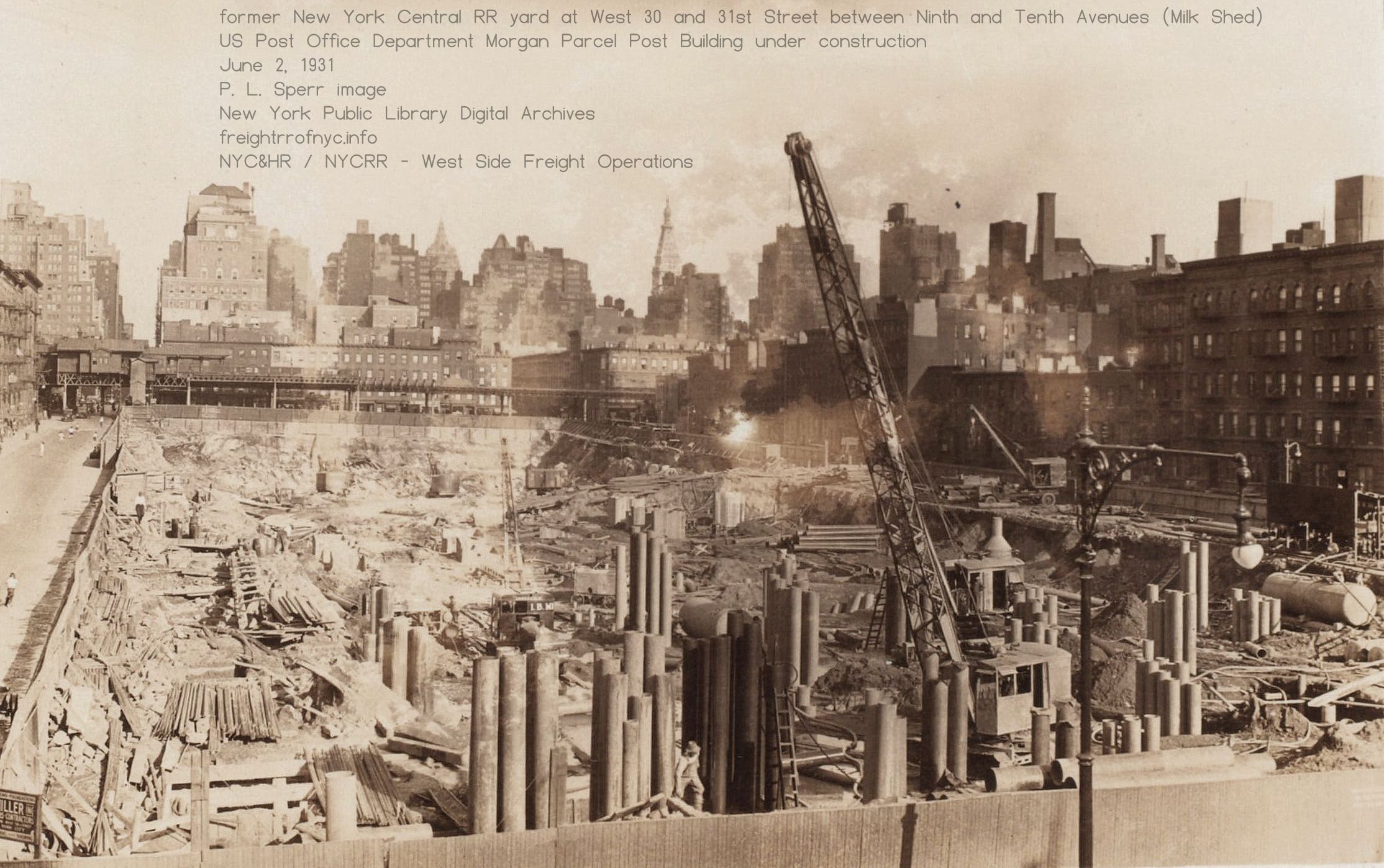
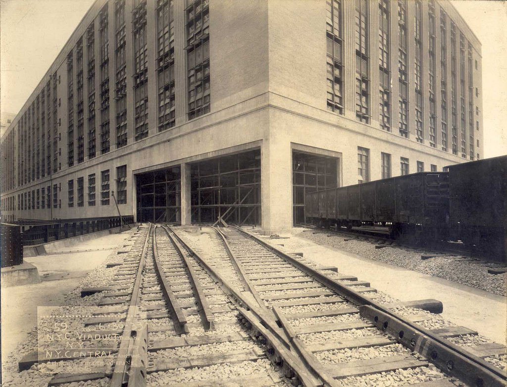
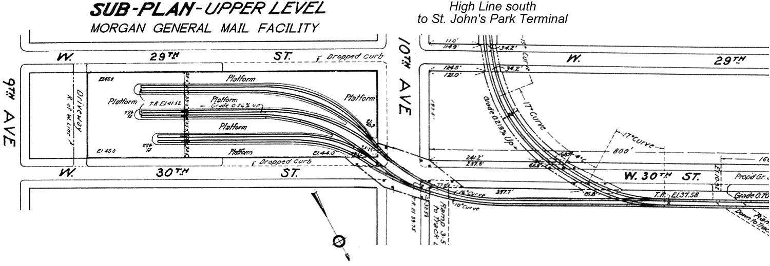
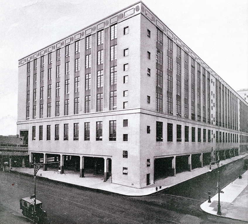
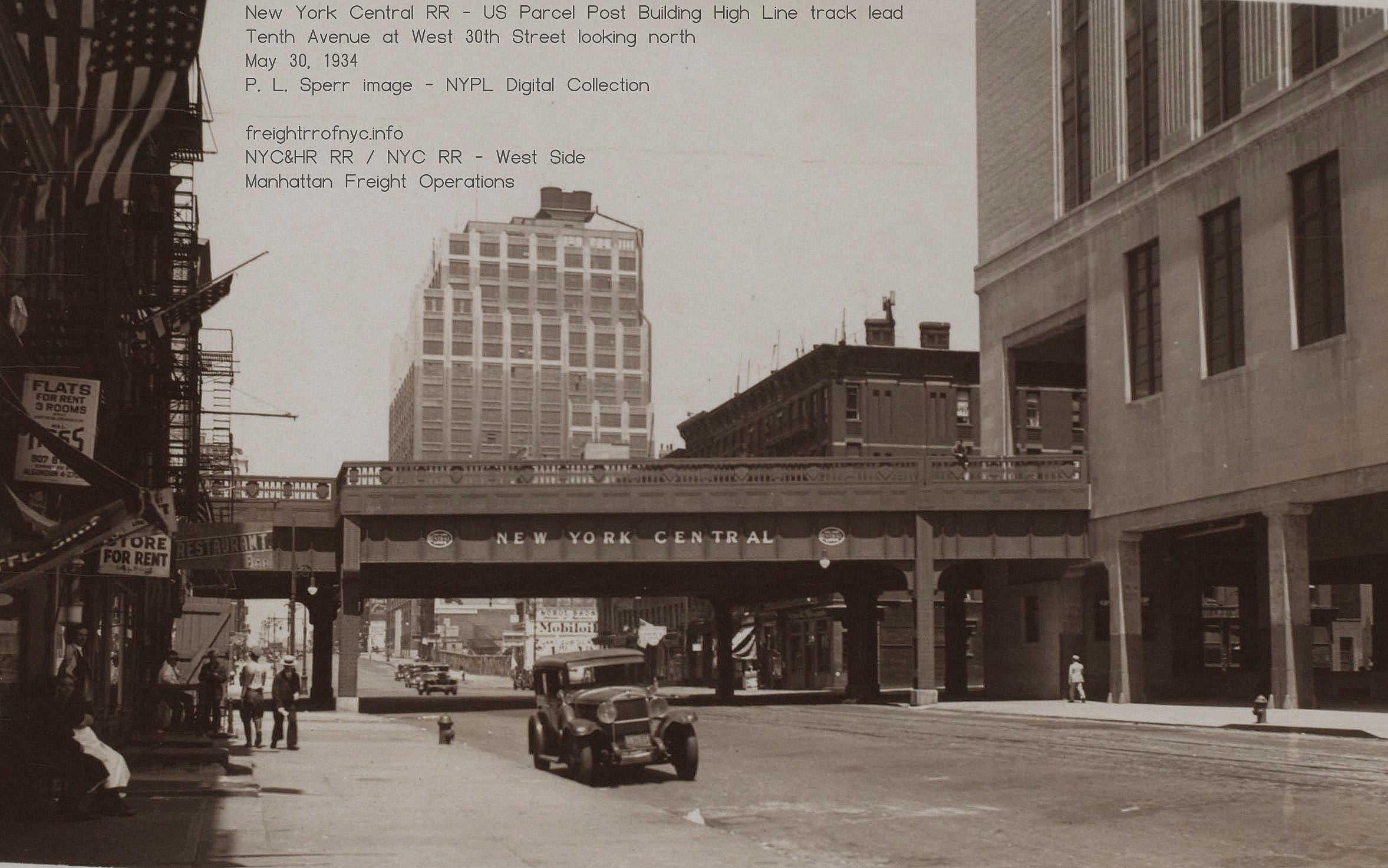
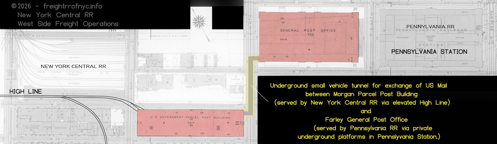
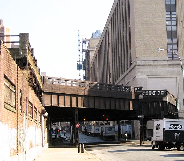
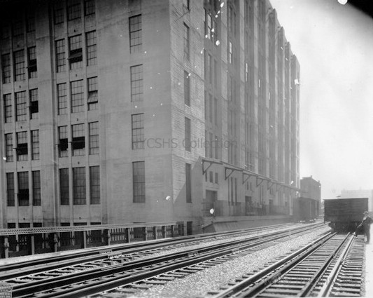
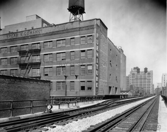
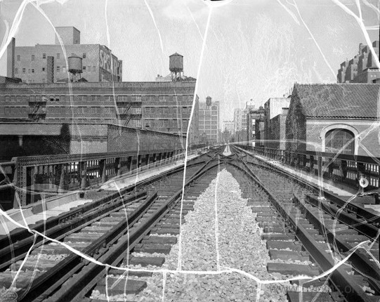
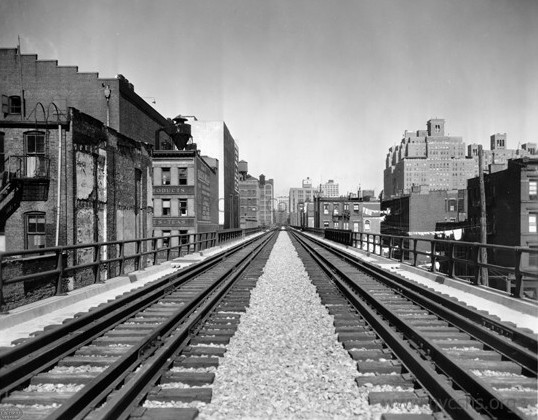
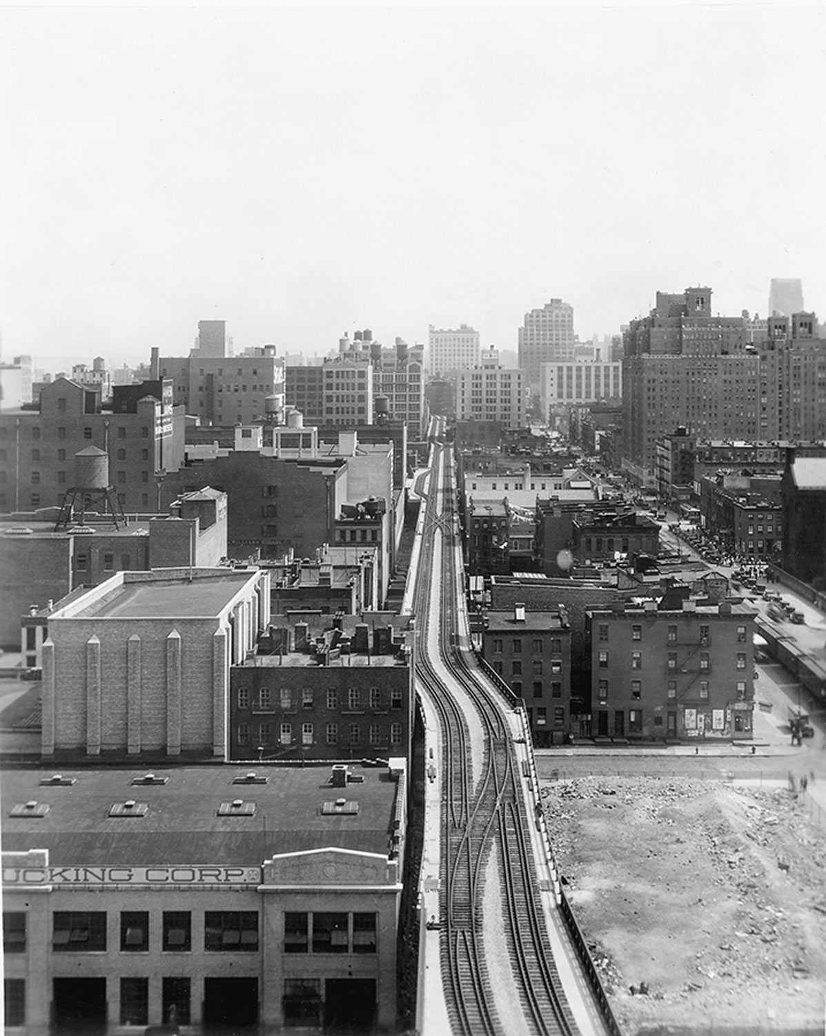
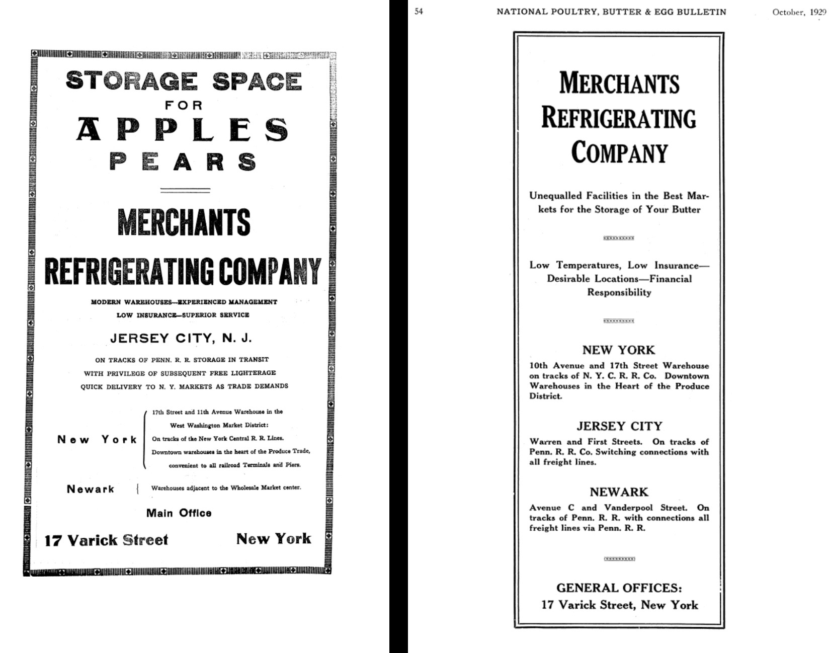
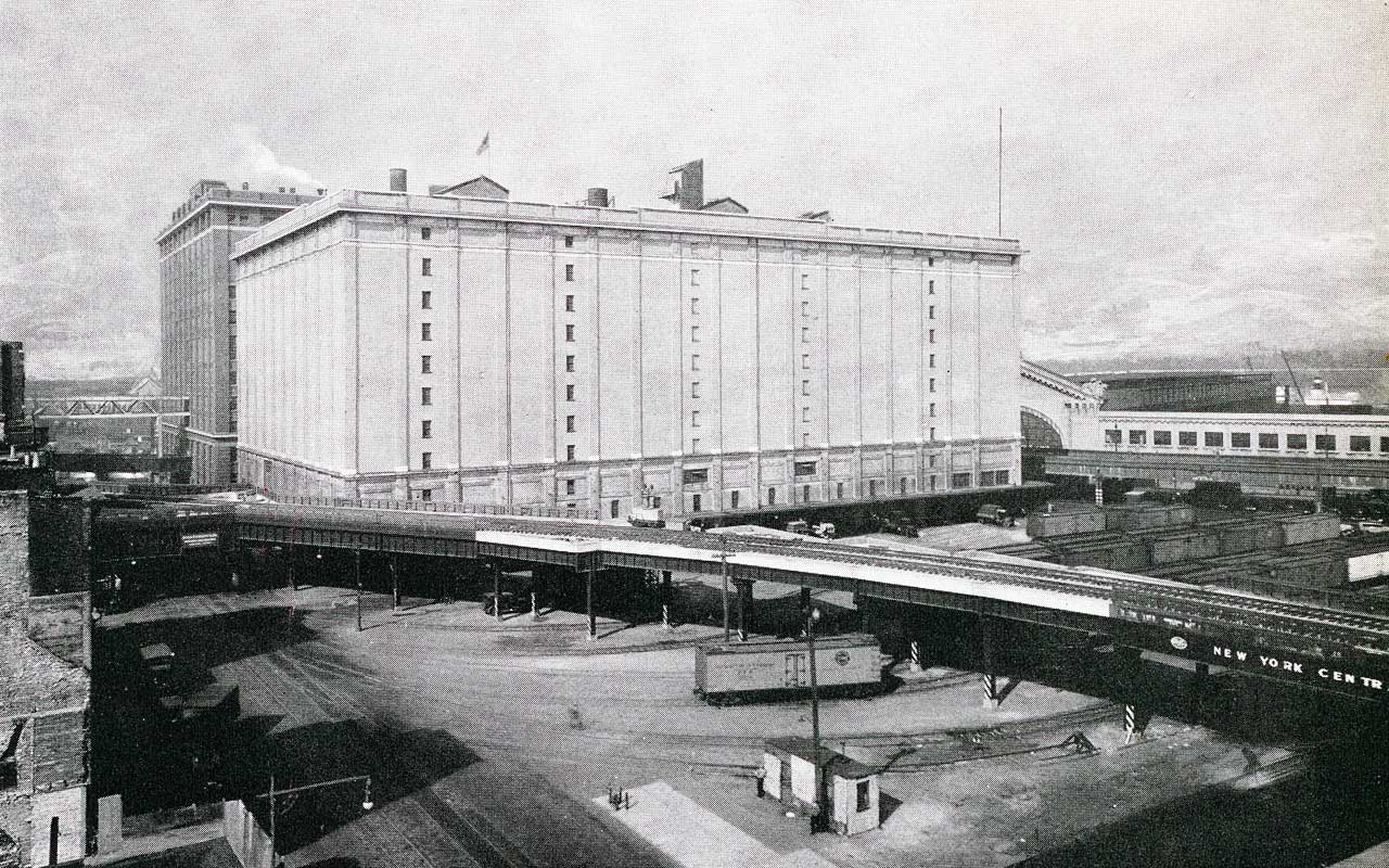
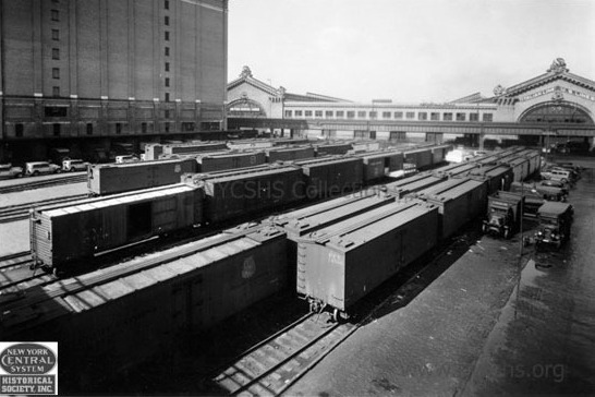
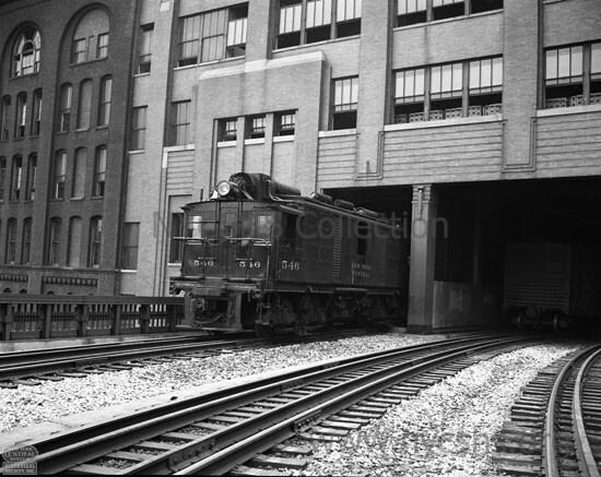
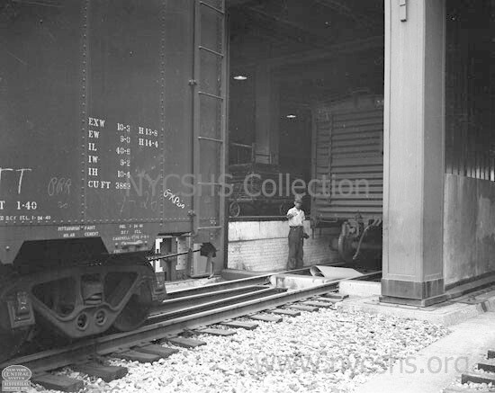
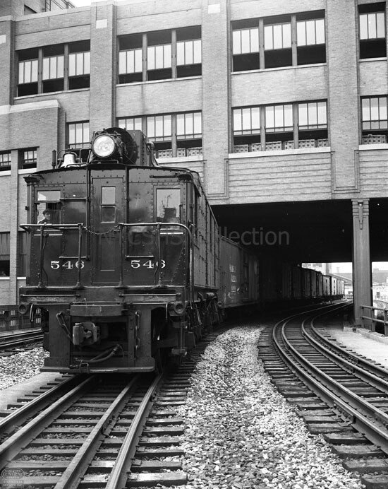
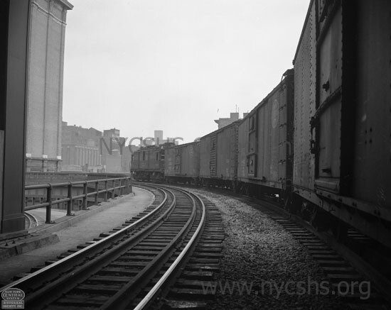
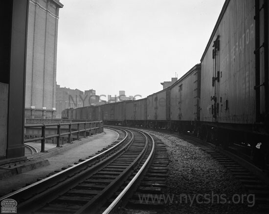
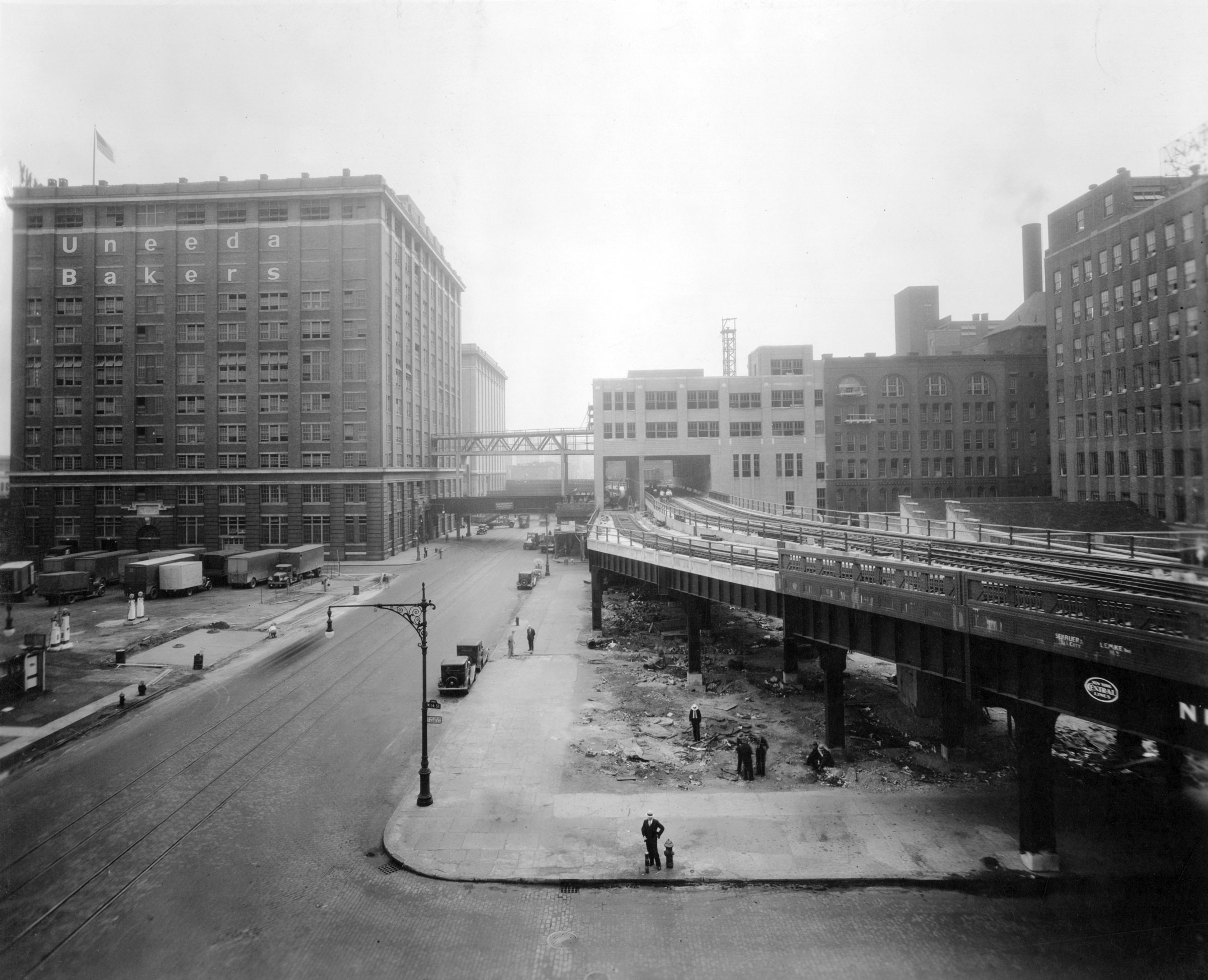
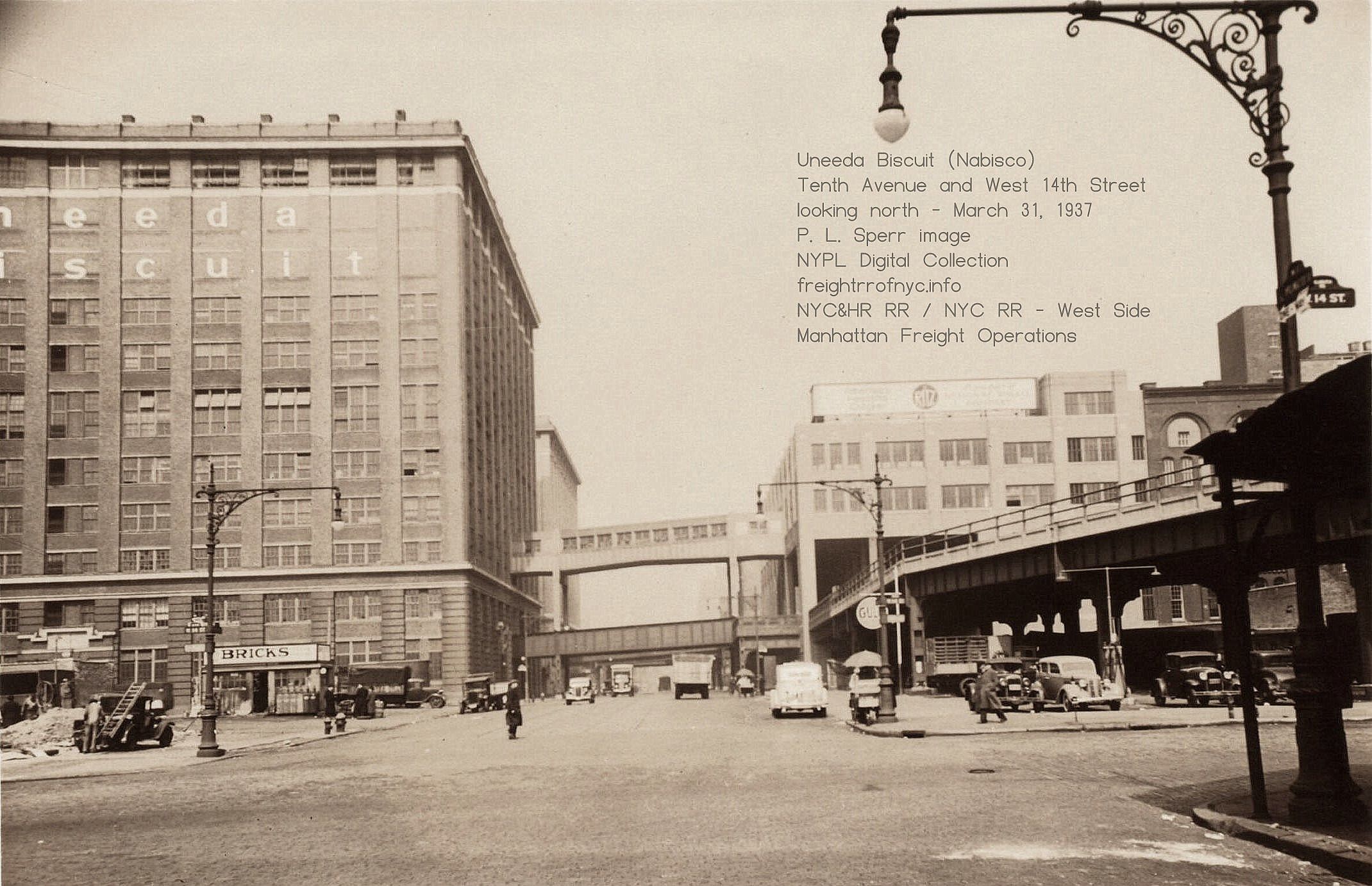
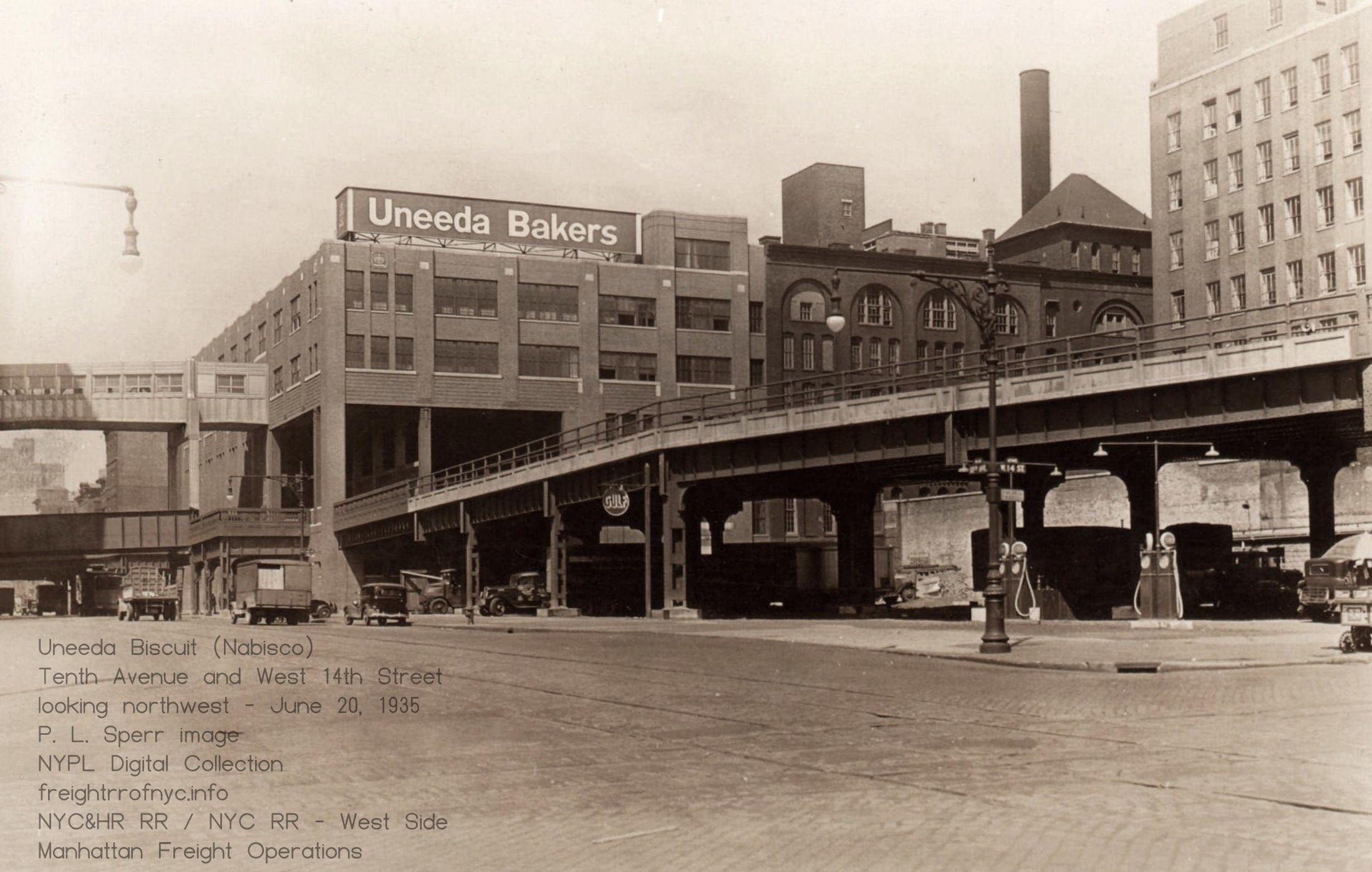
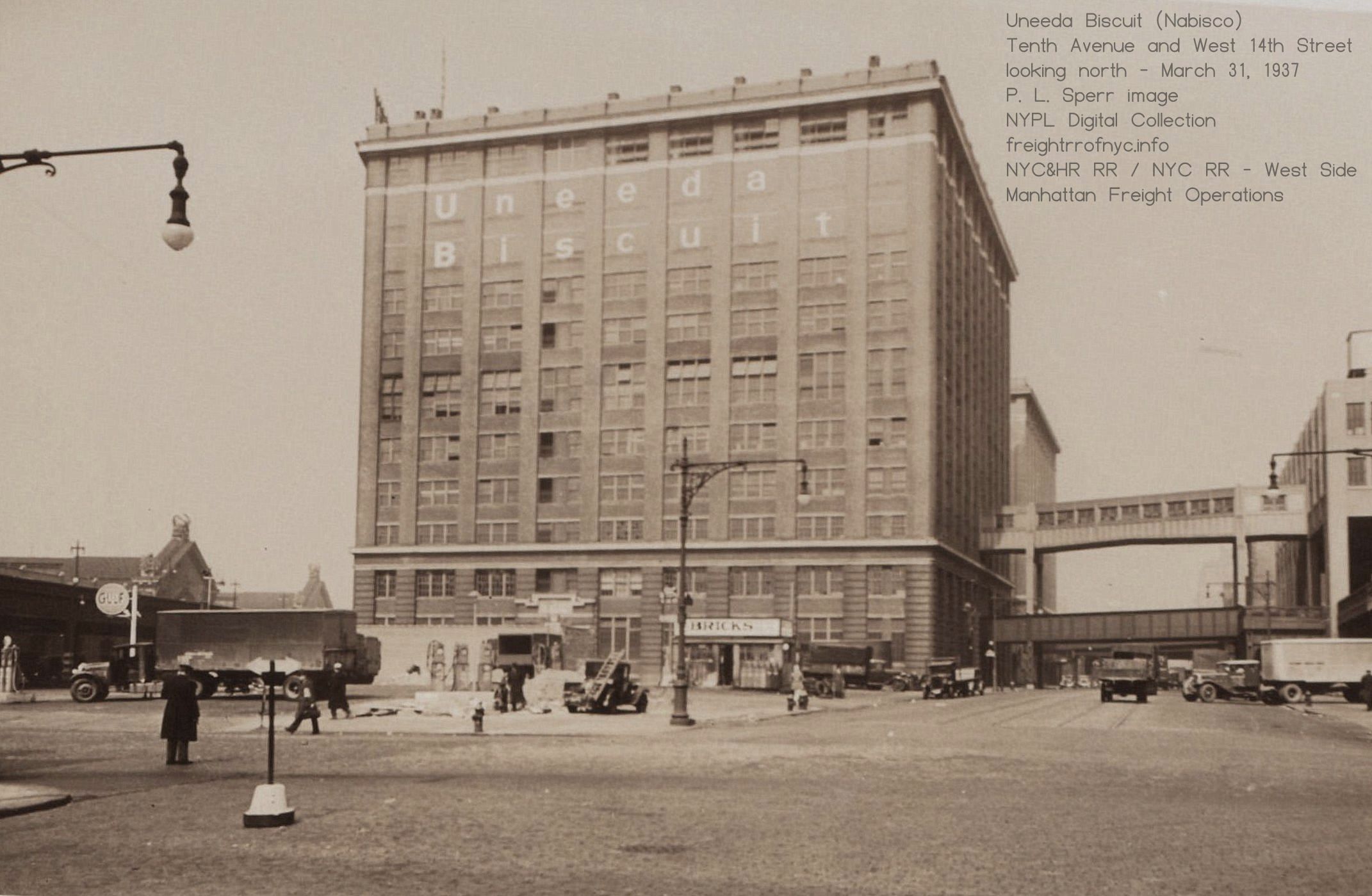
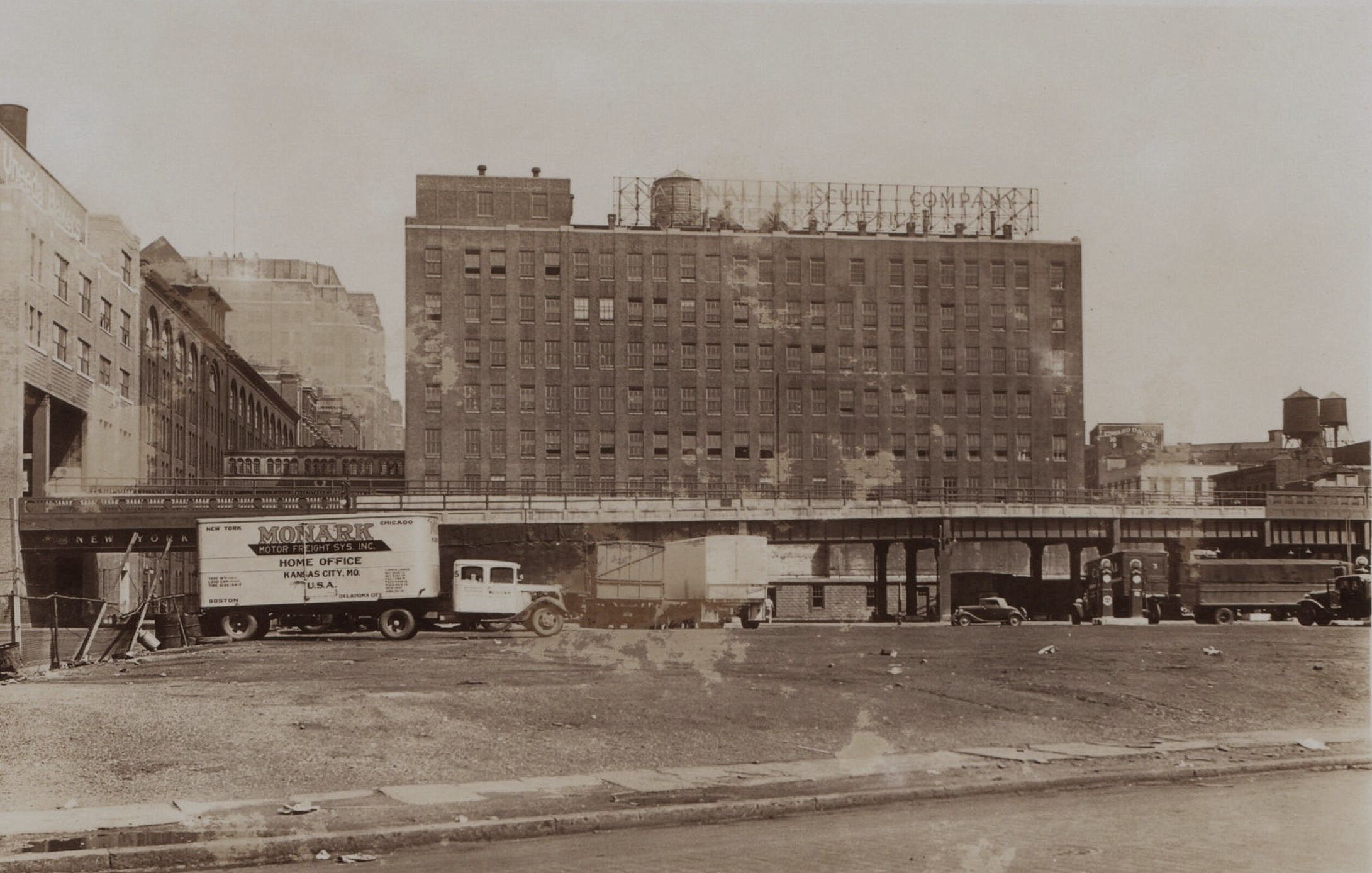
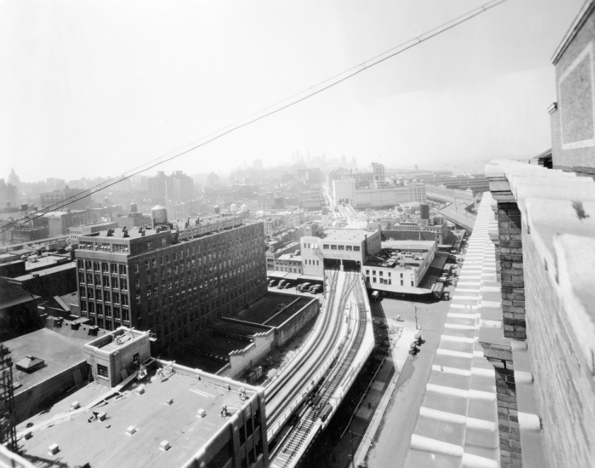
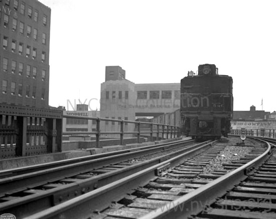
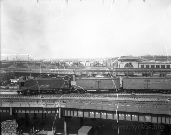
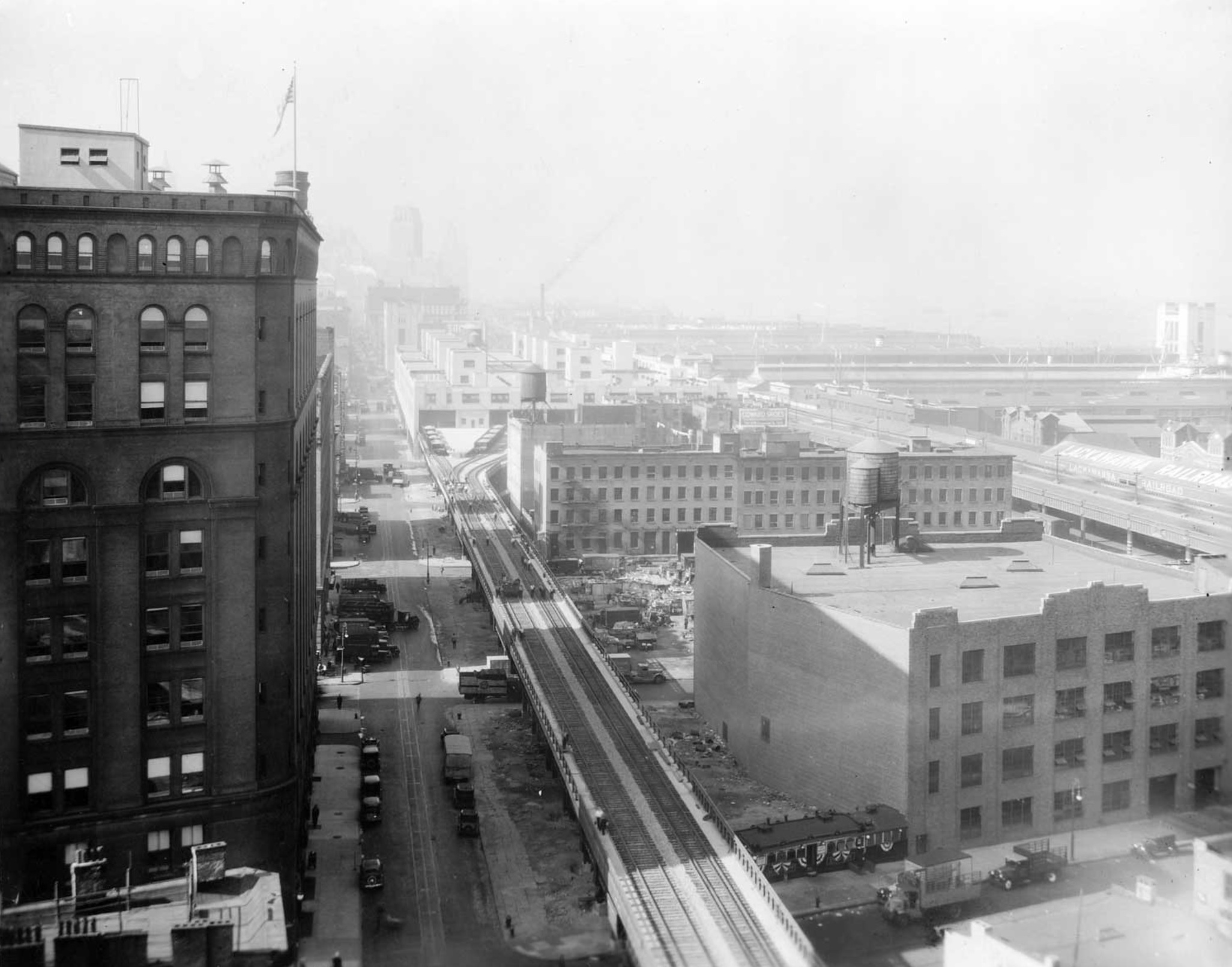
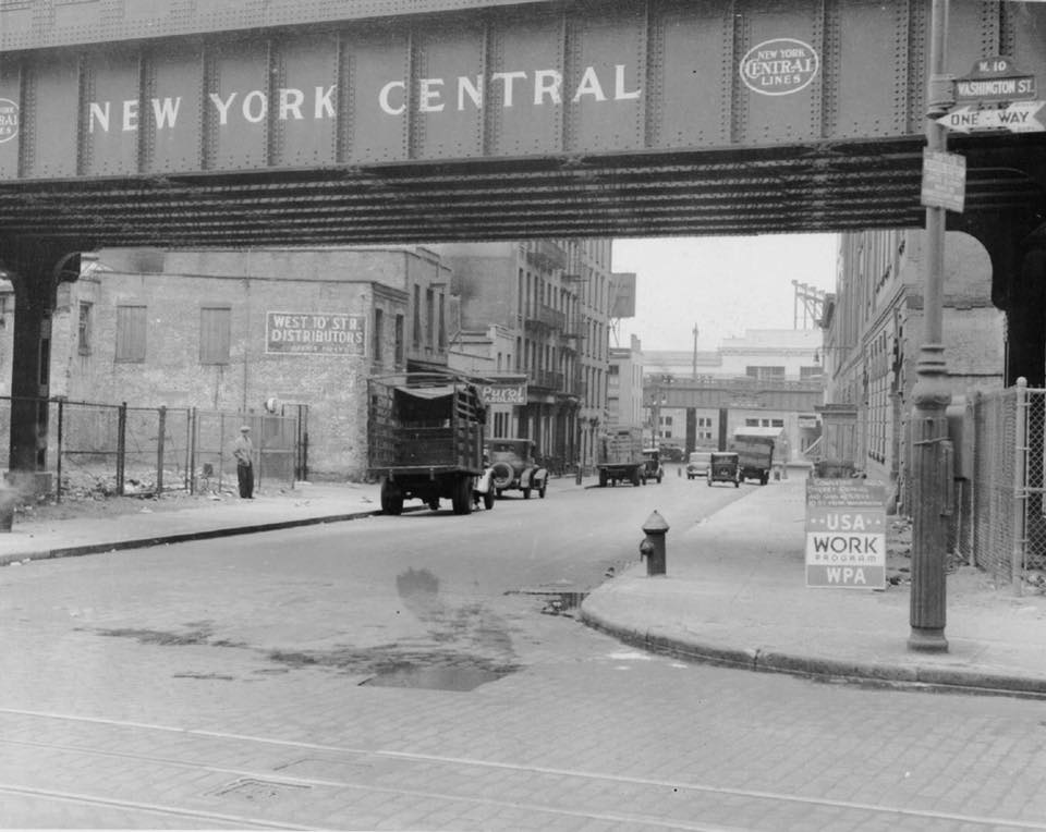
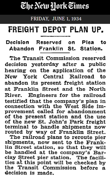
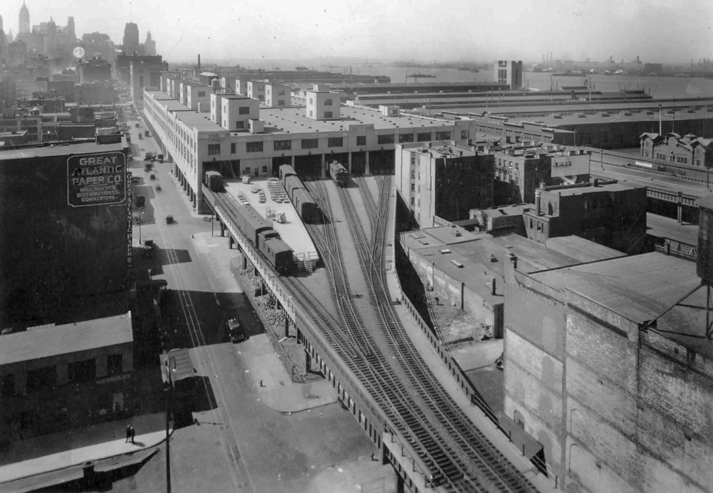
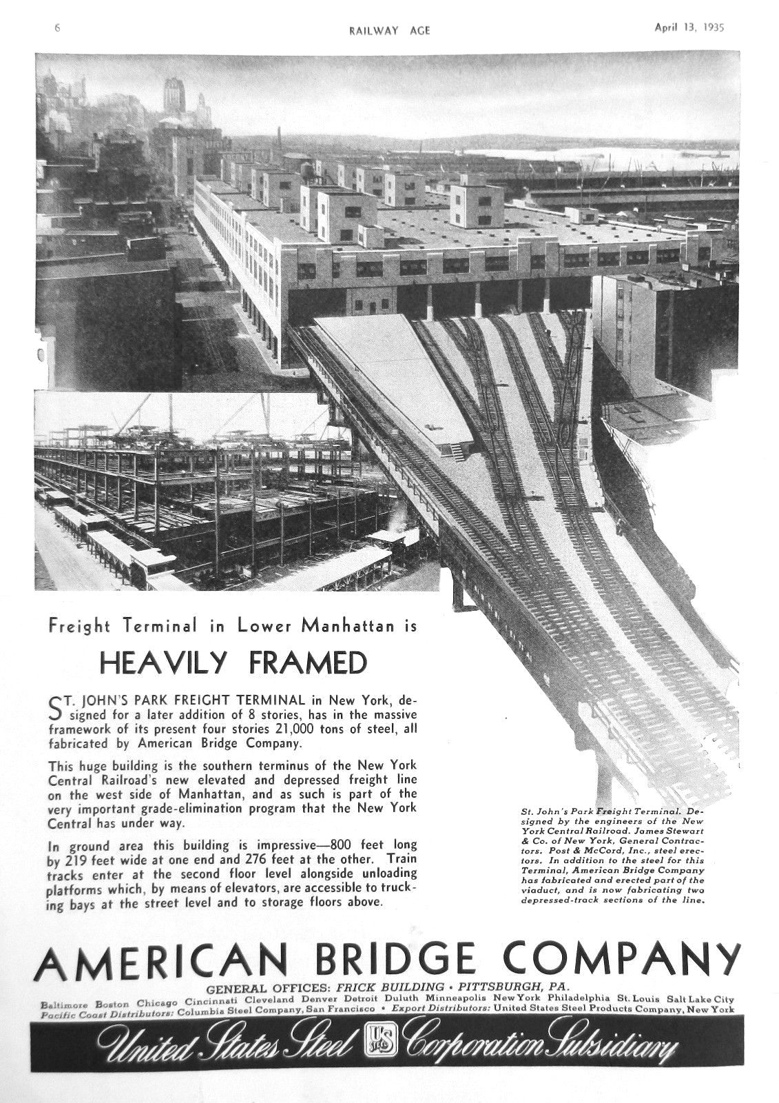
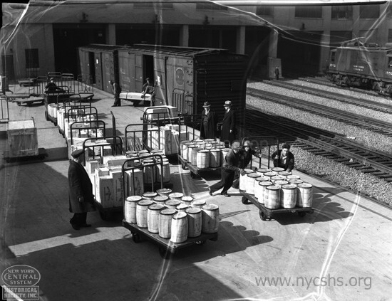
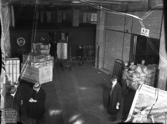
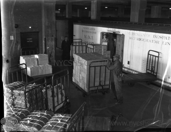
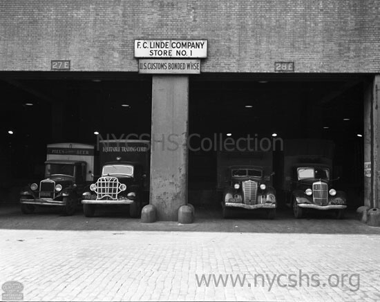
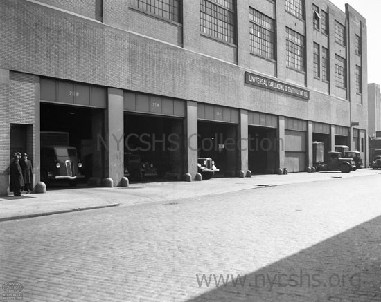
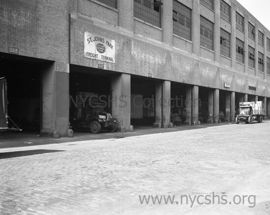
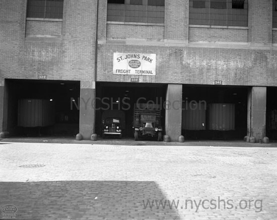
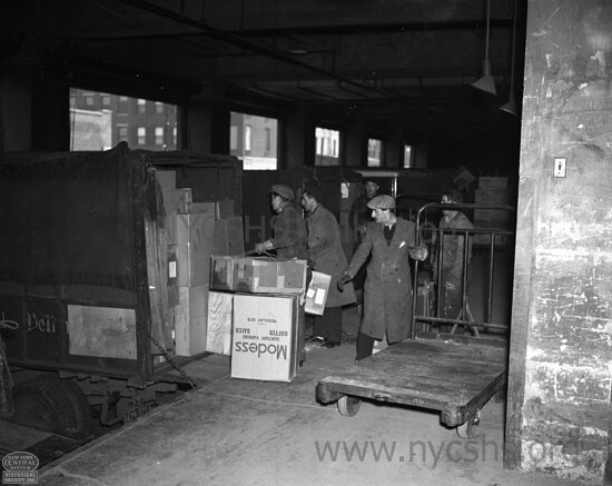
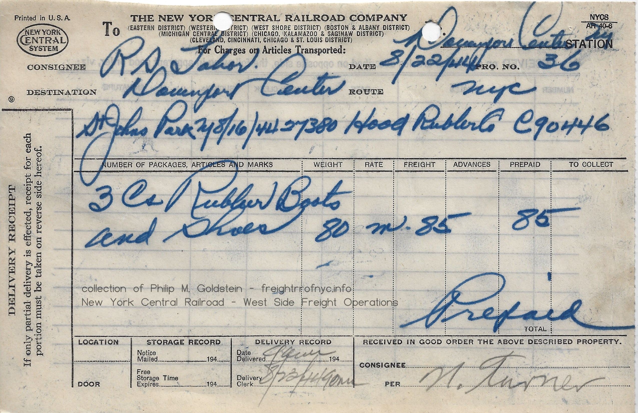
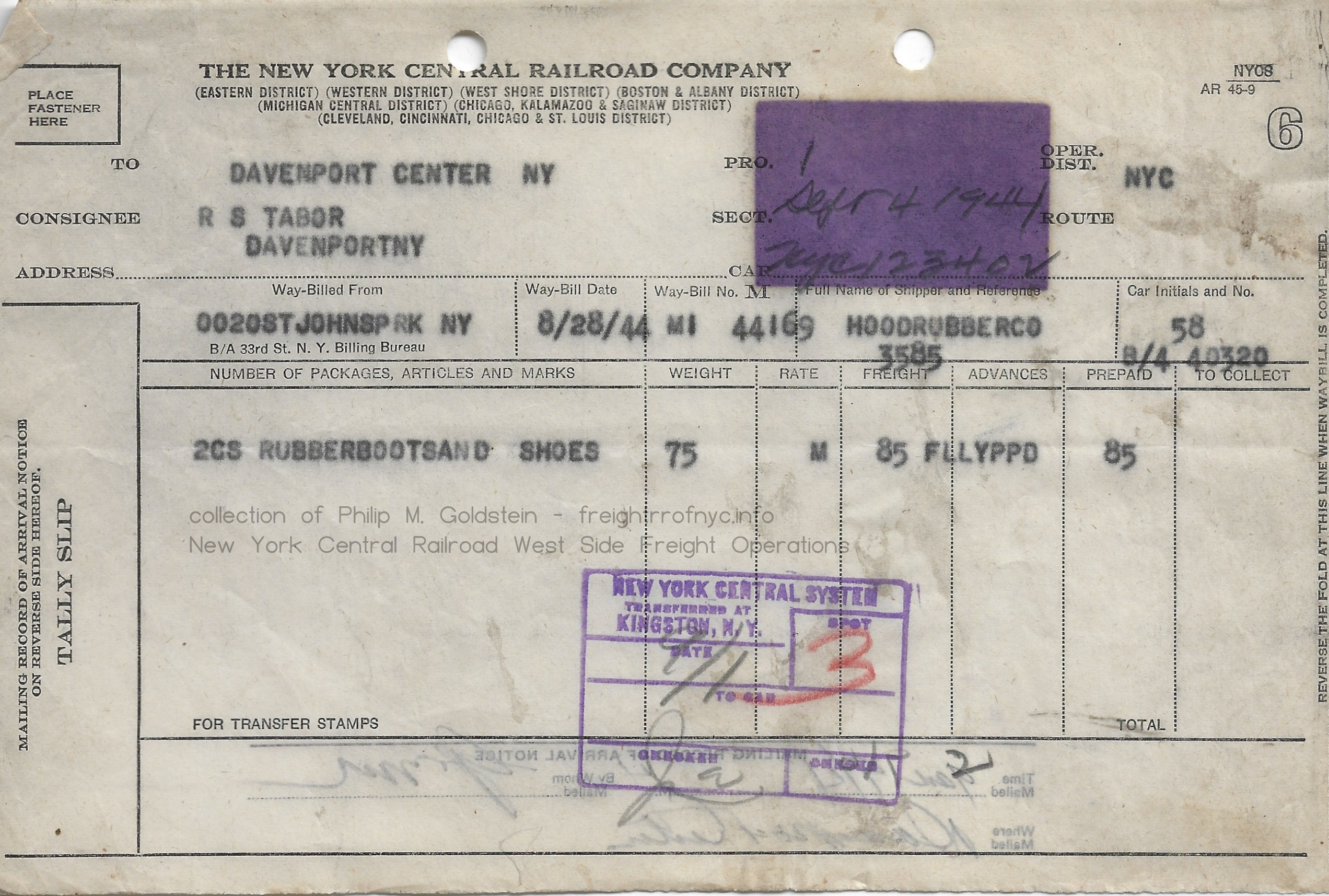

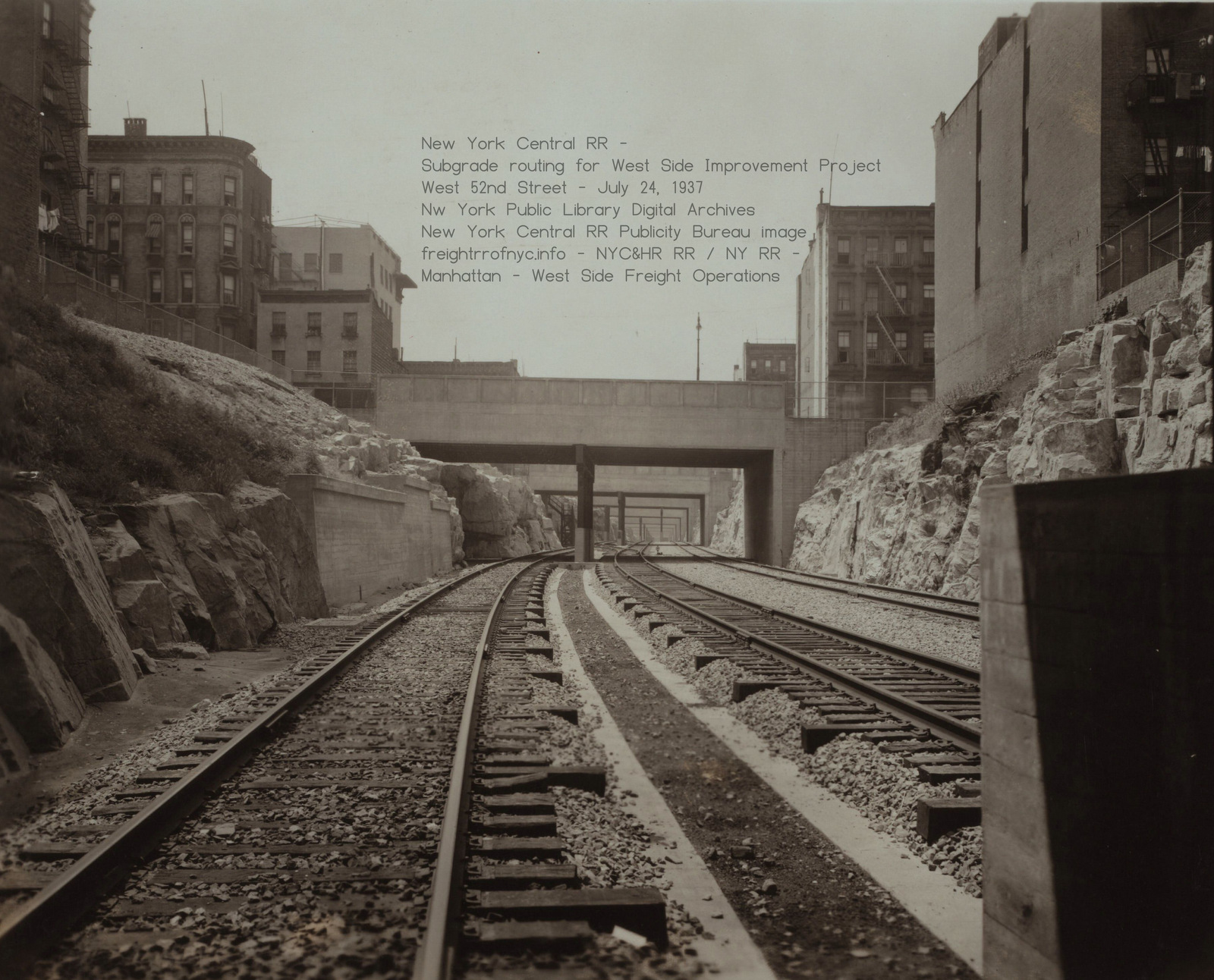
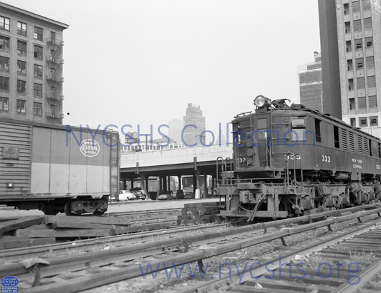
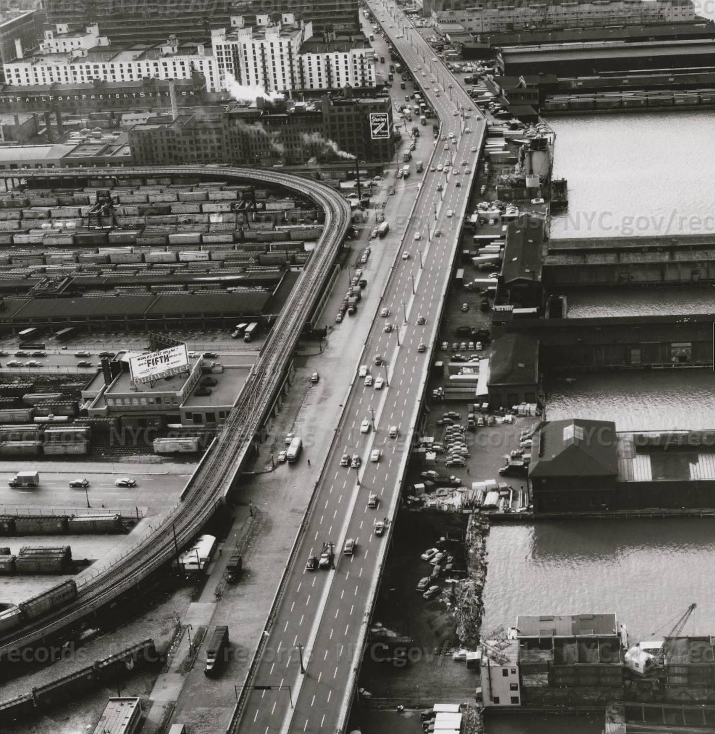
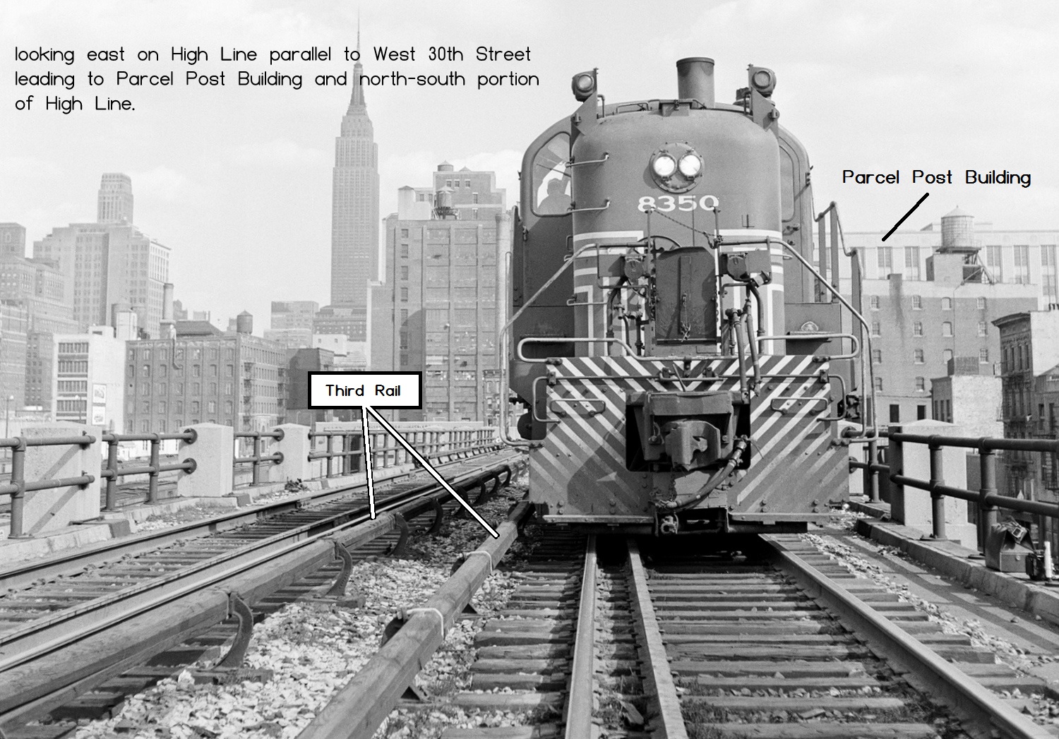
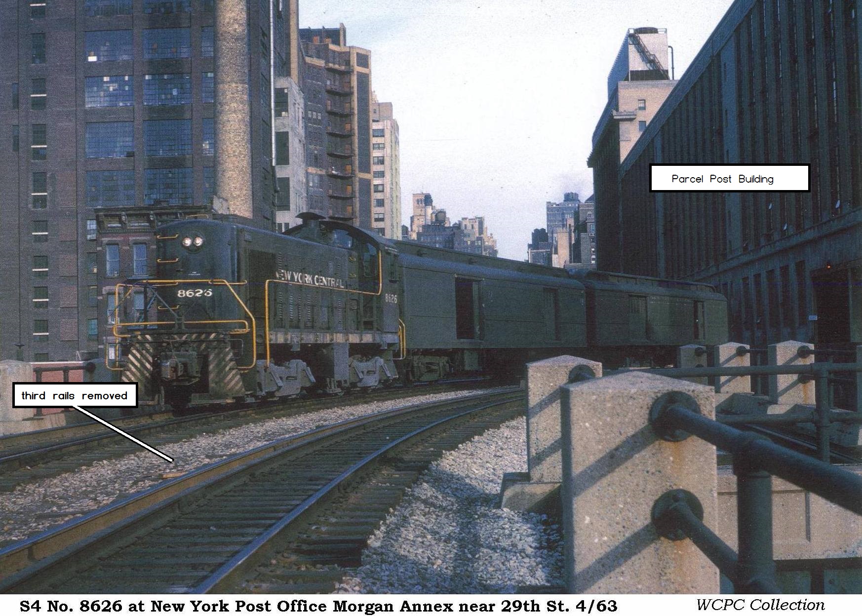
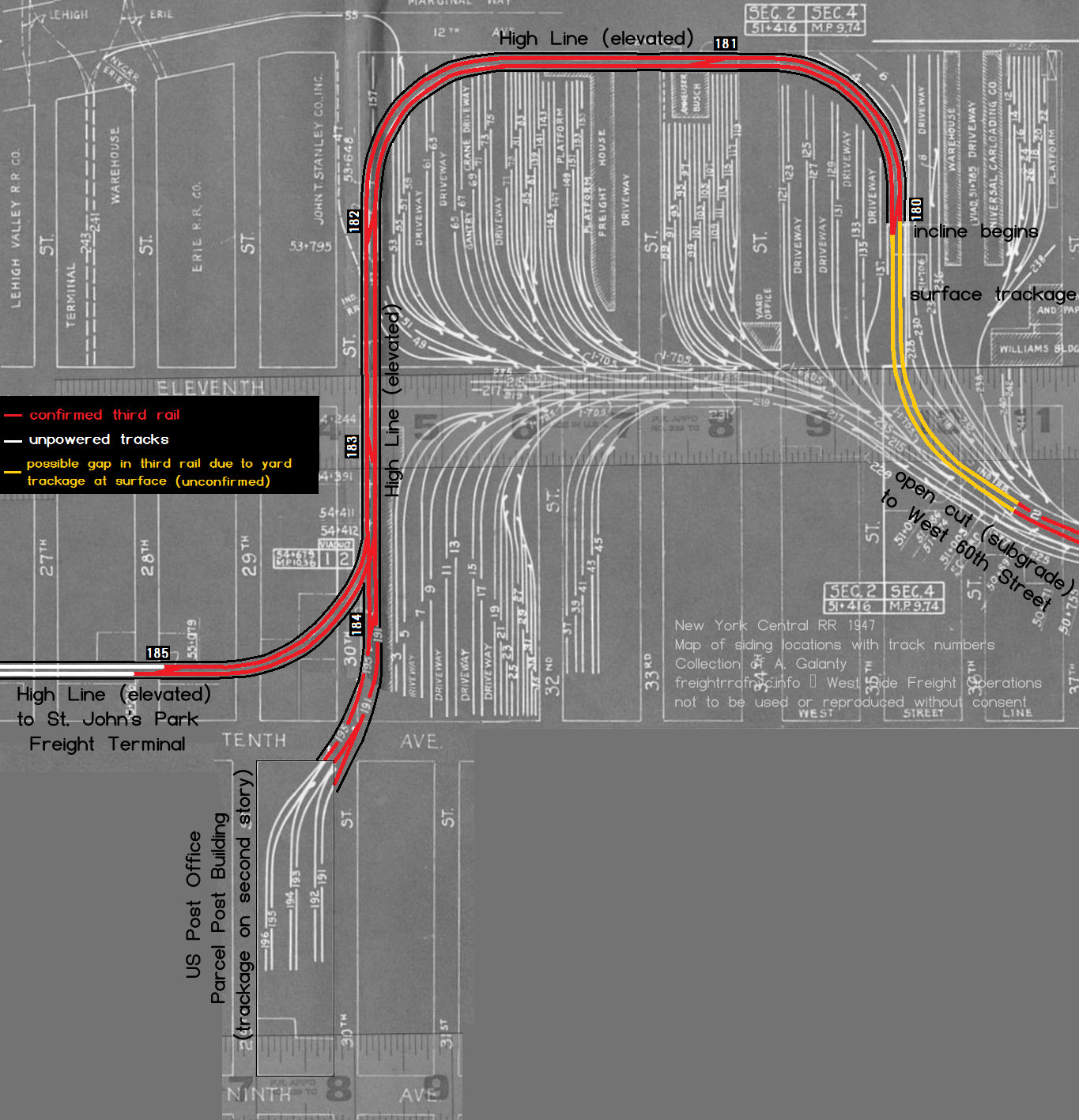
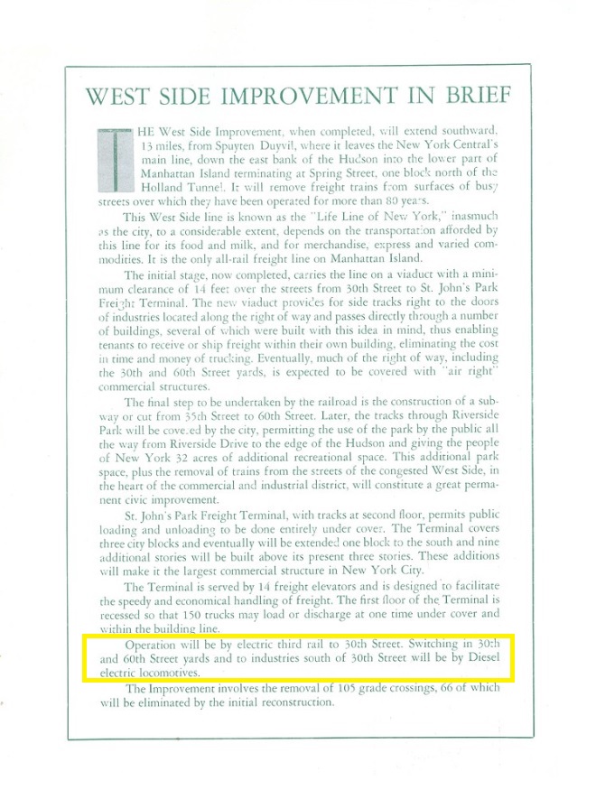
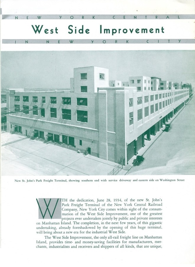
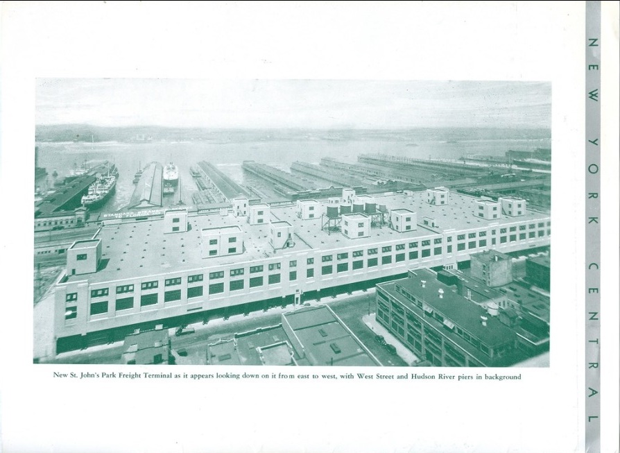 ..
..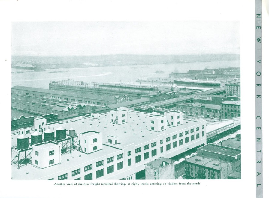
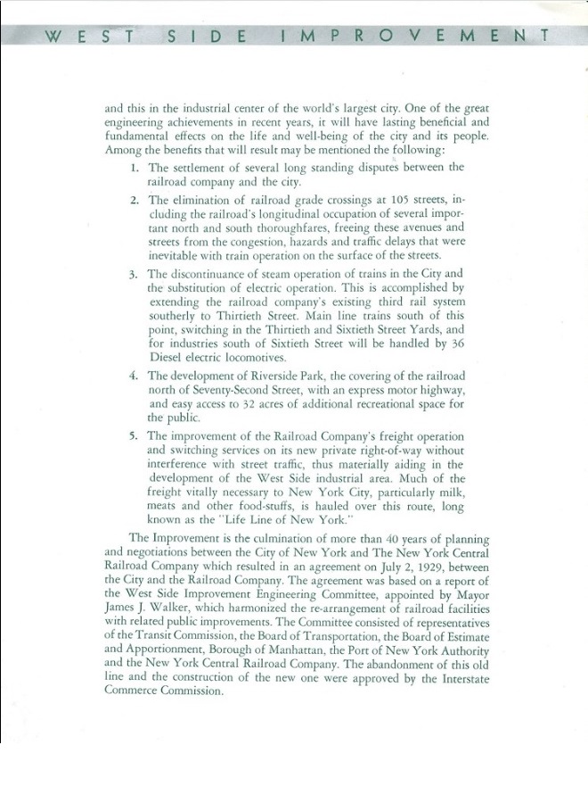
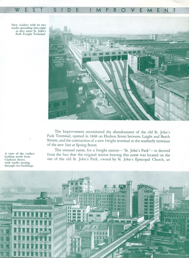
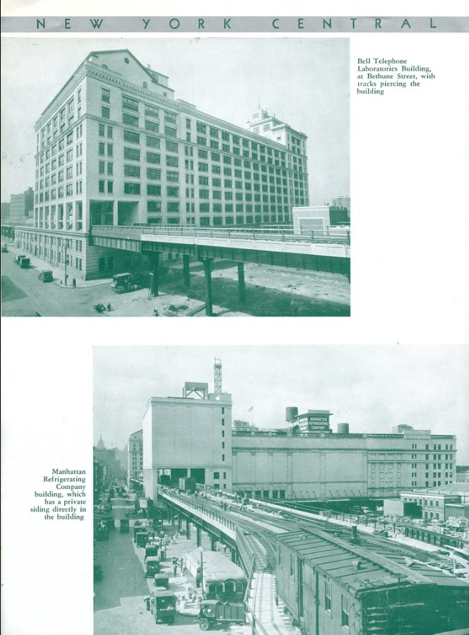
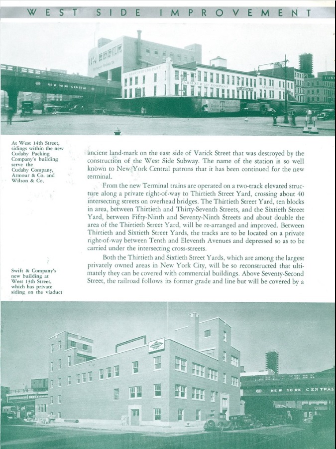
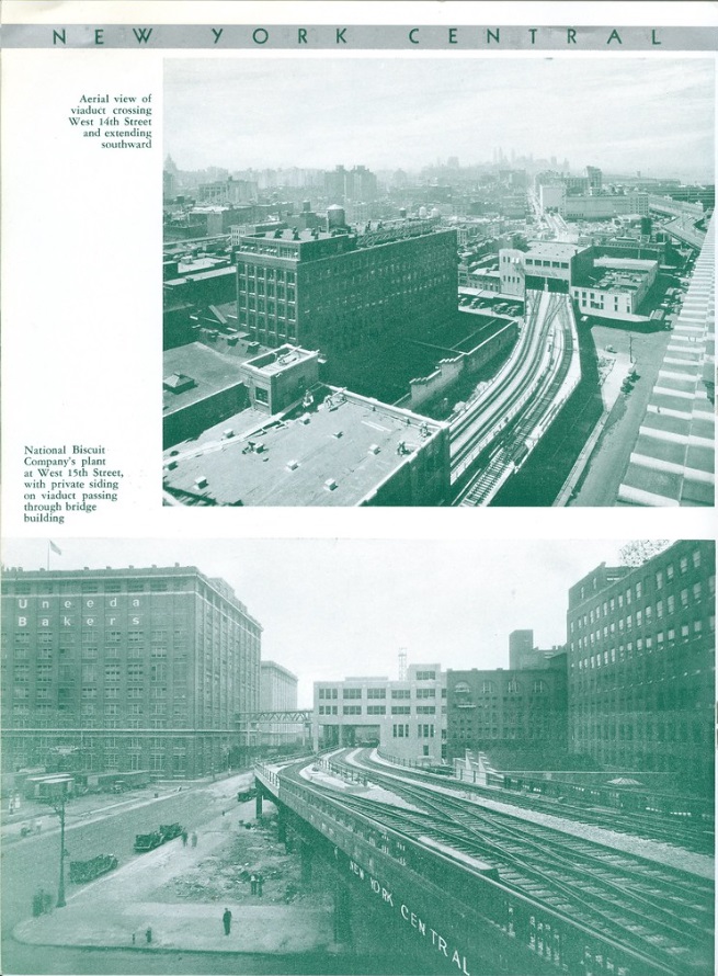
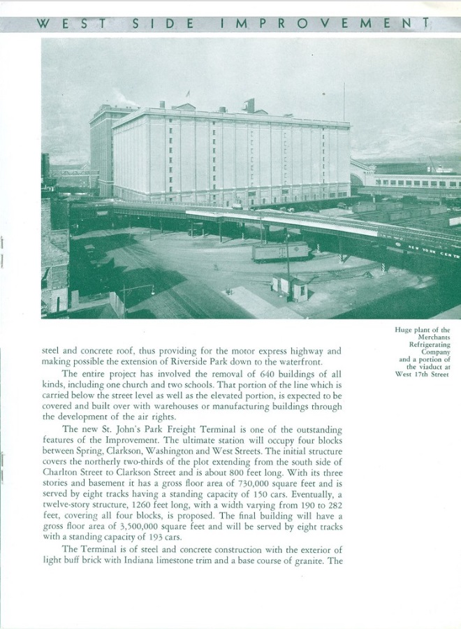
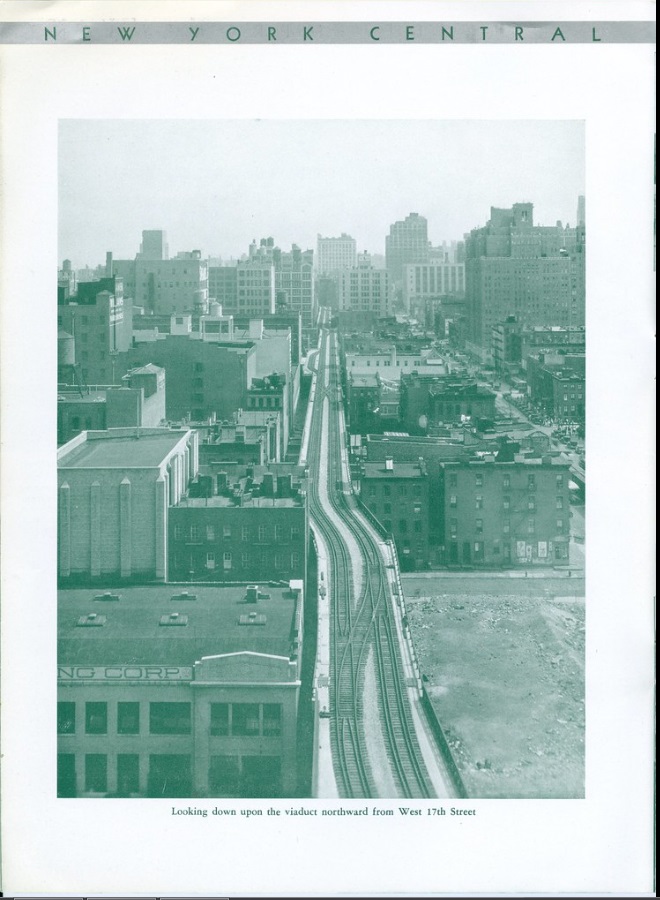
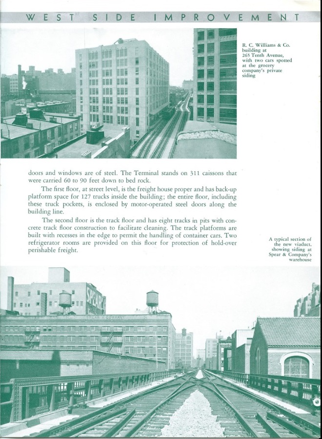
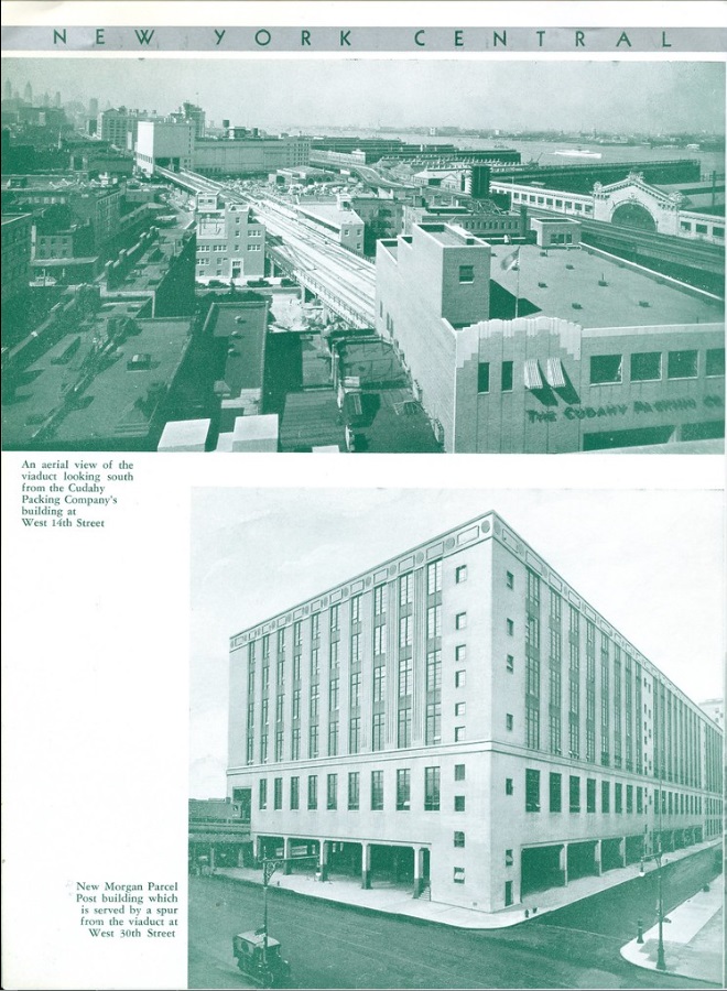
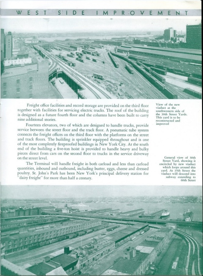
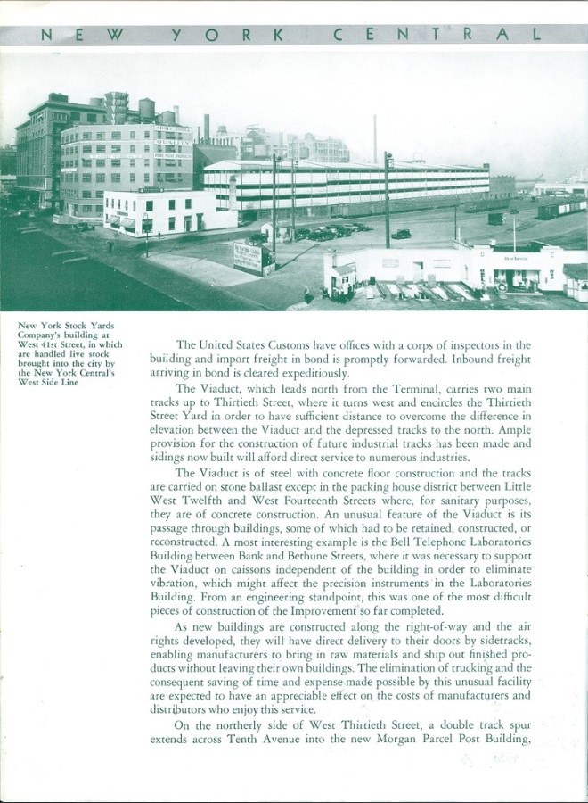
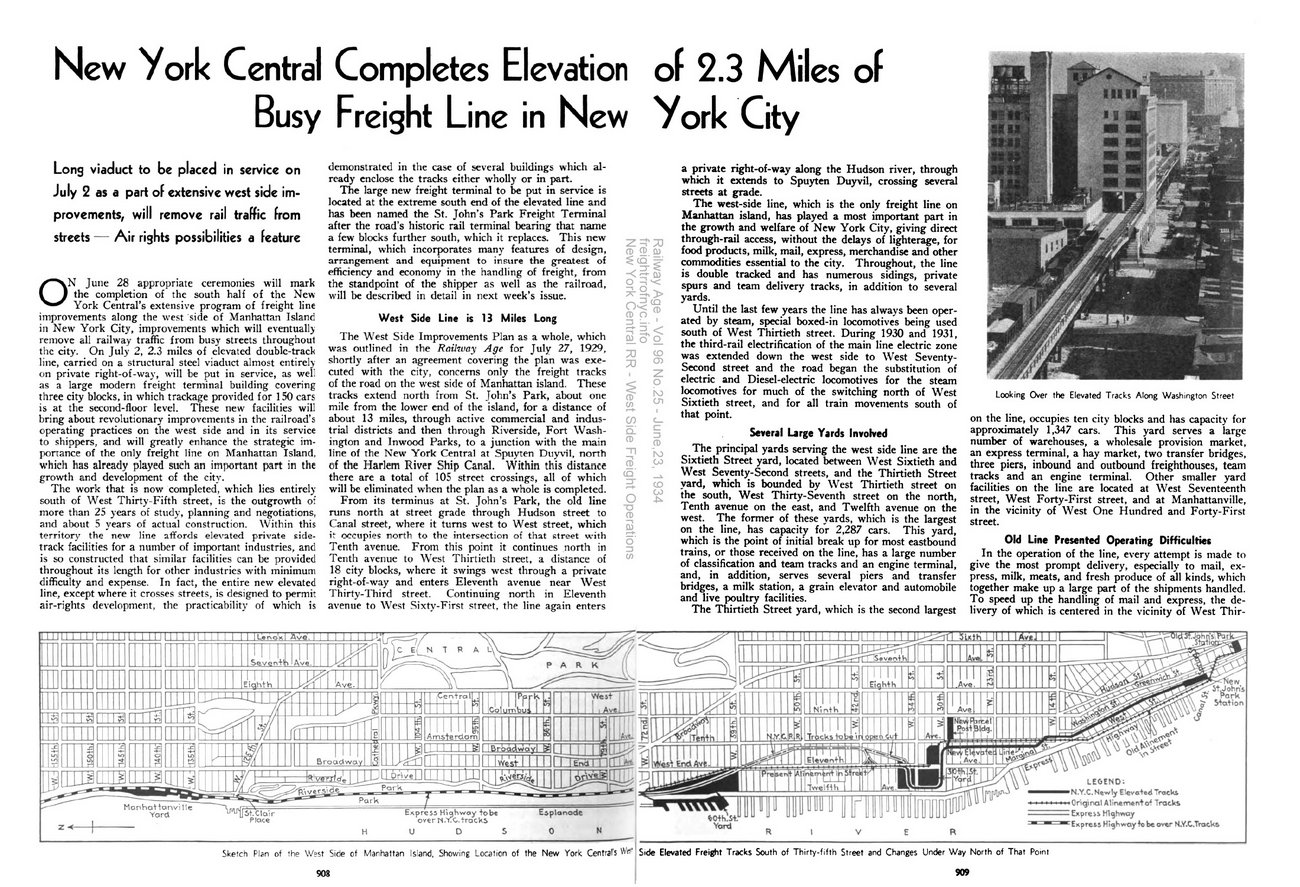
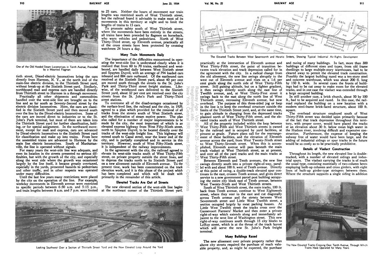
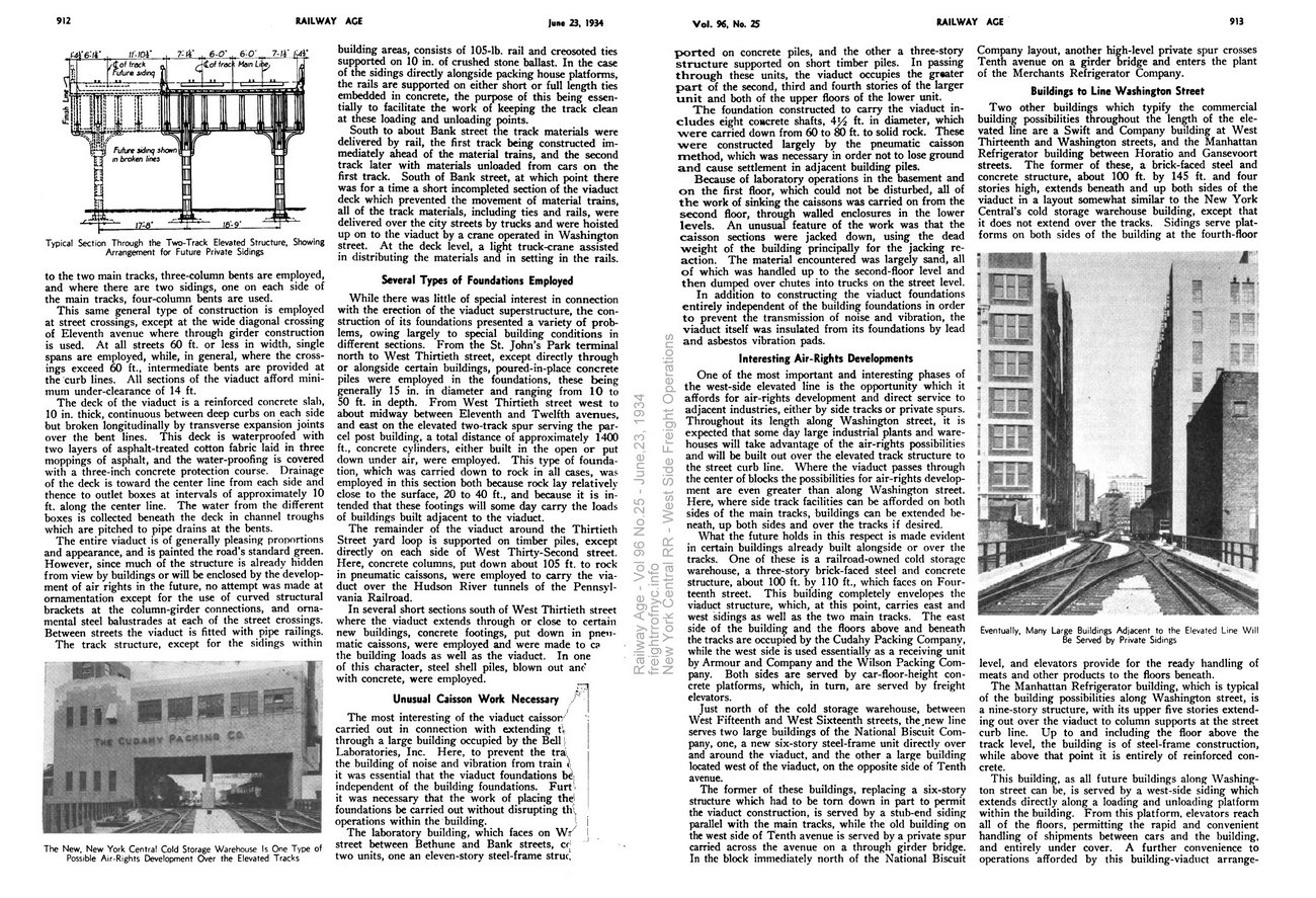
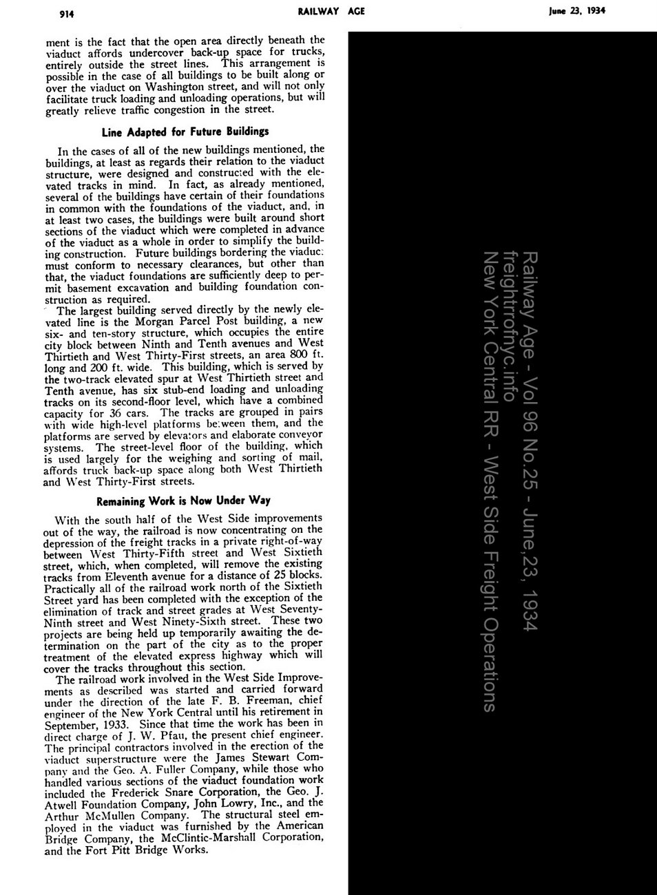
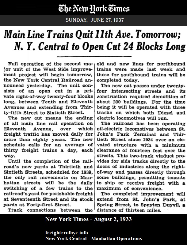
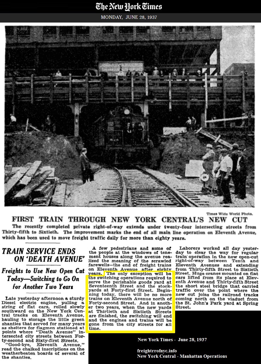
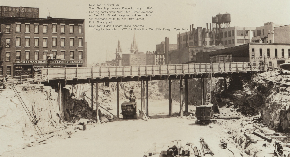
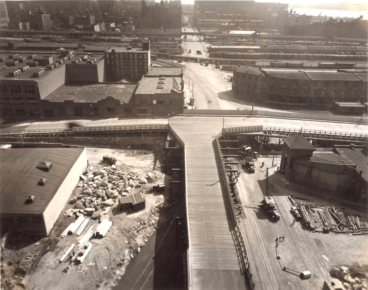
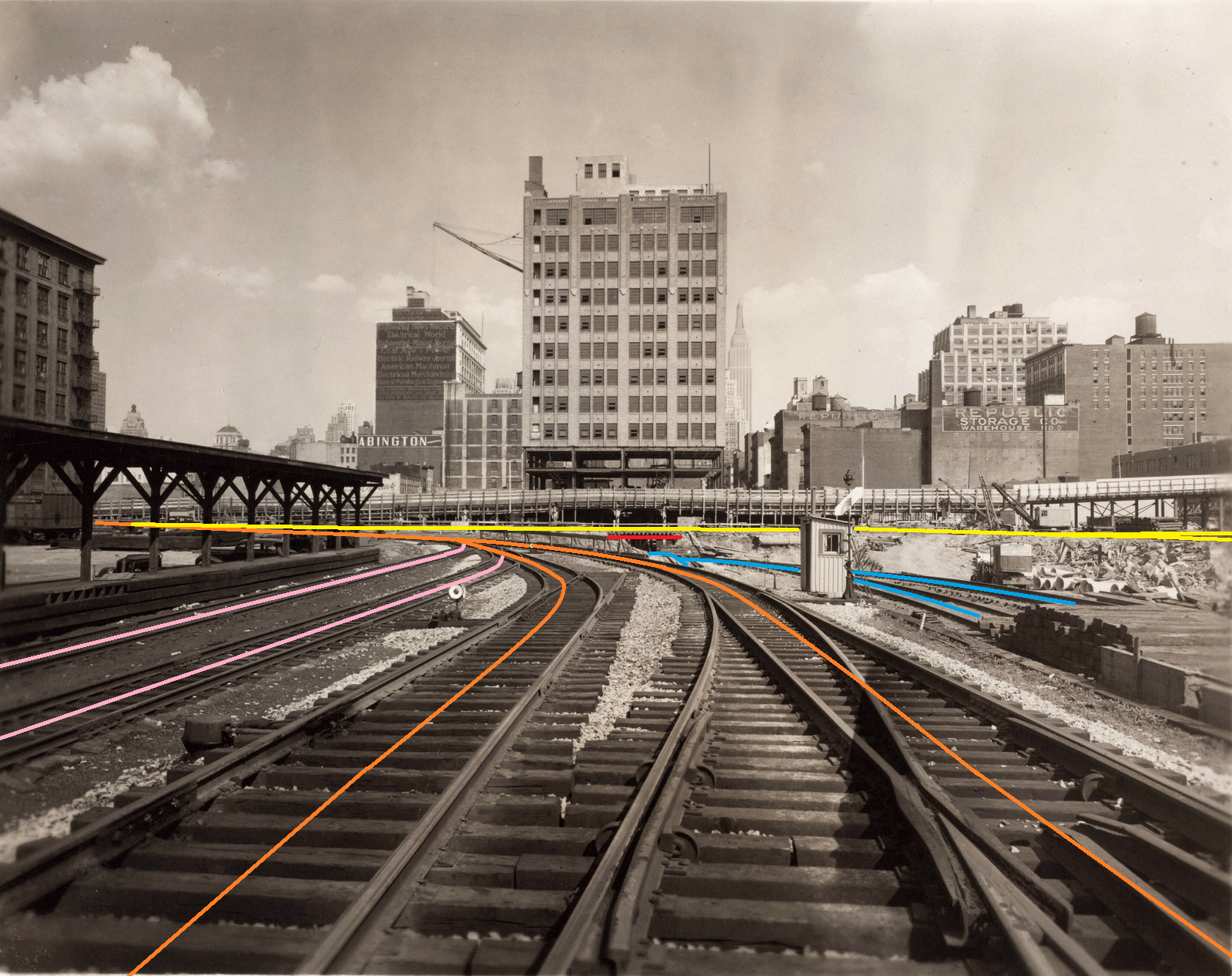
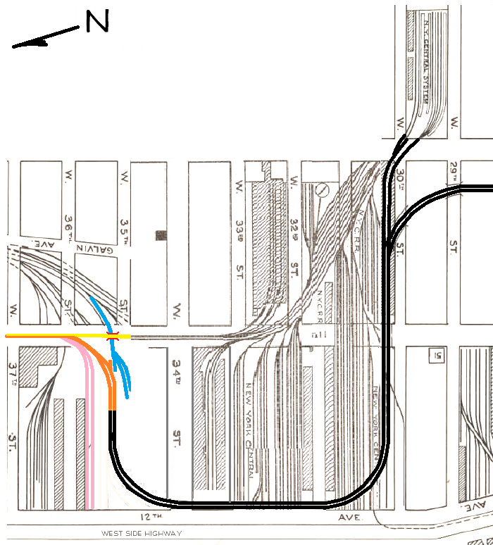
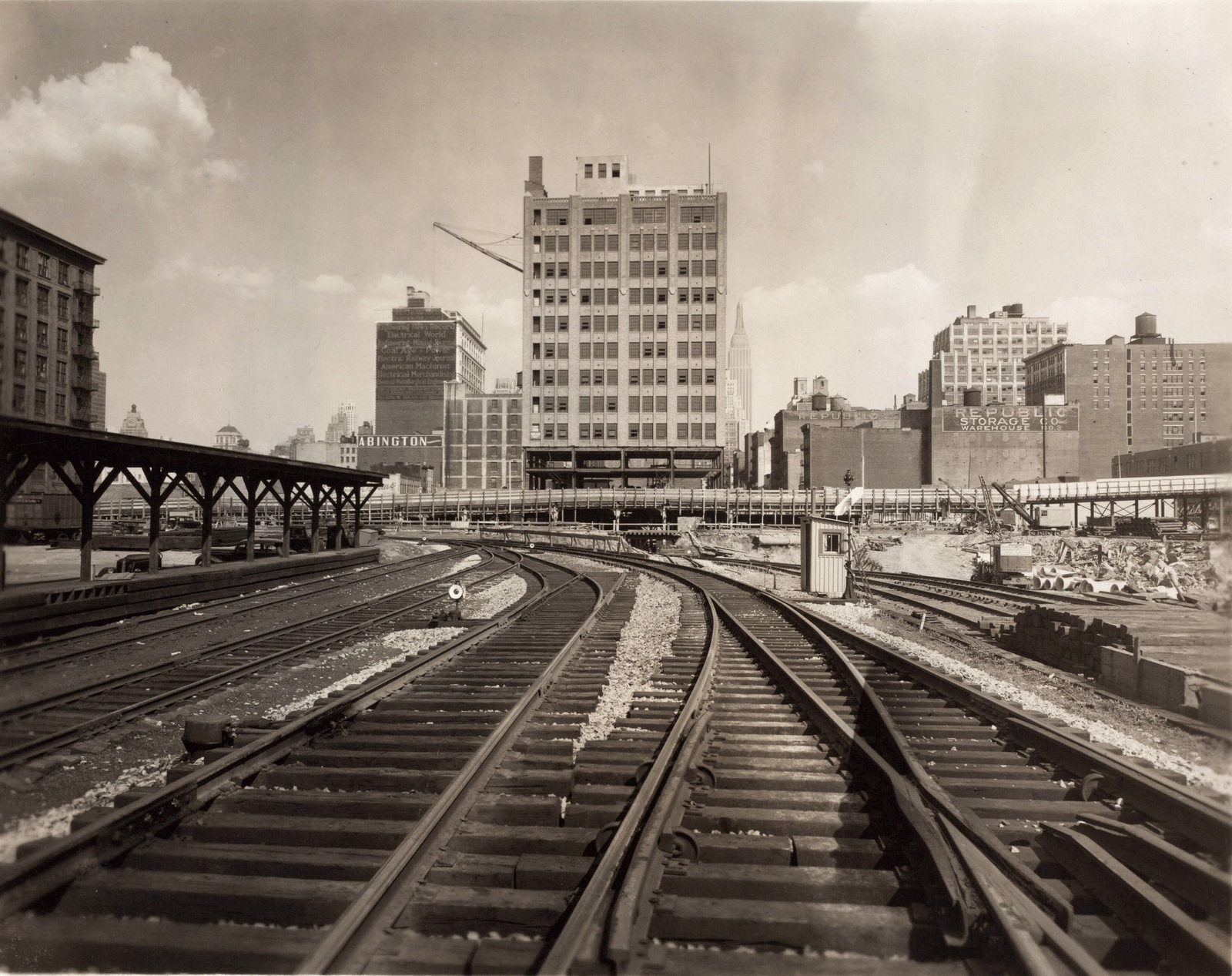
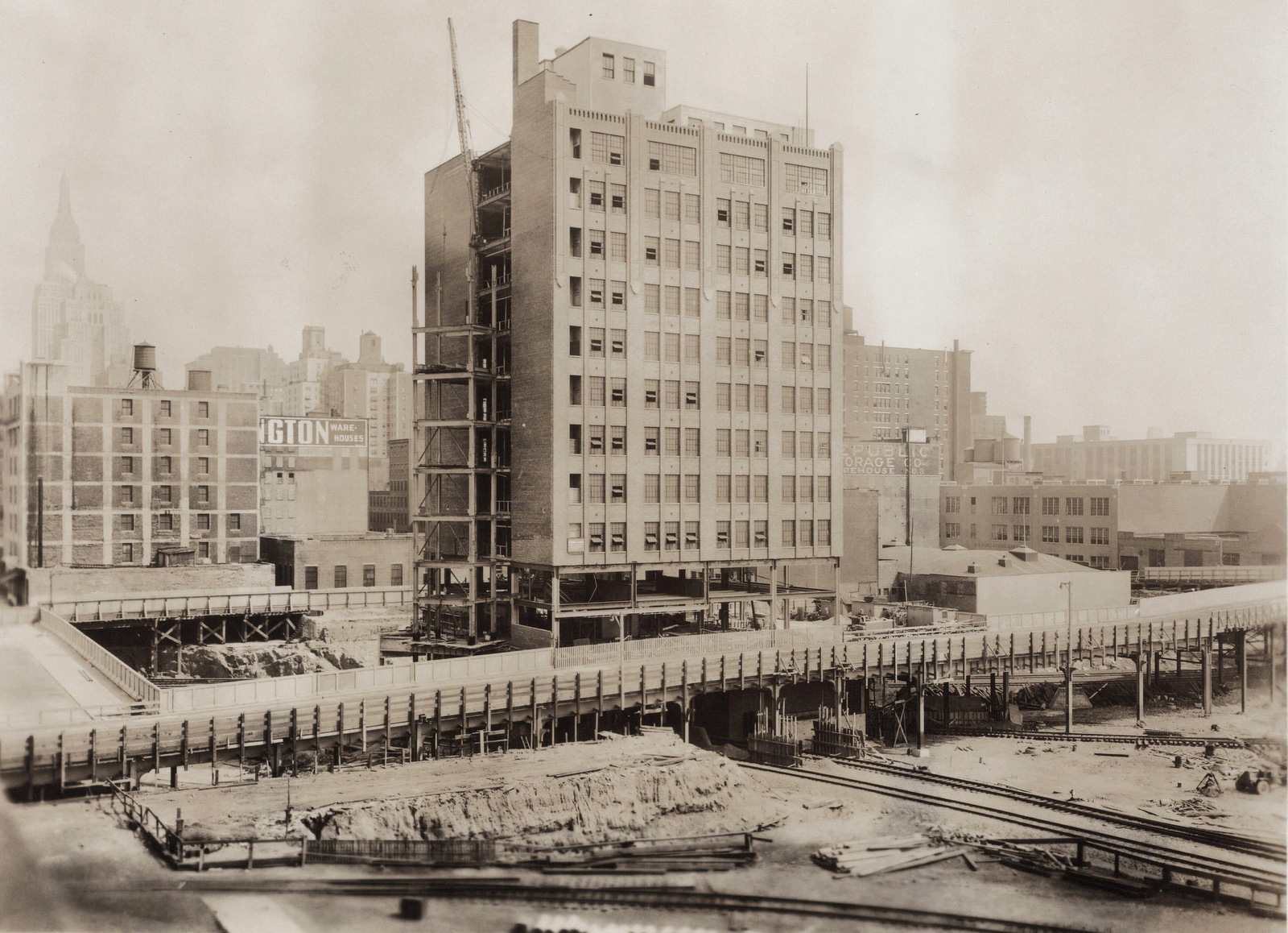
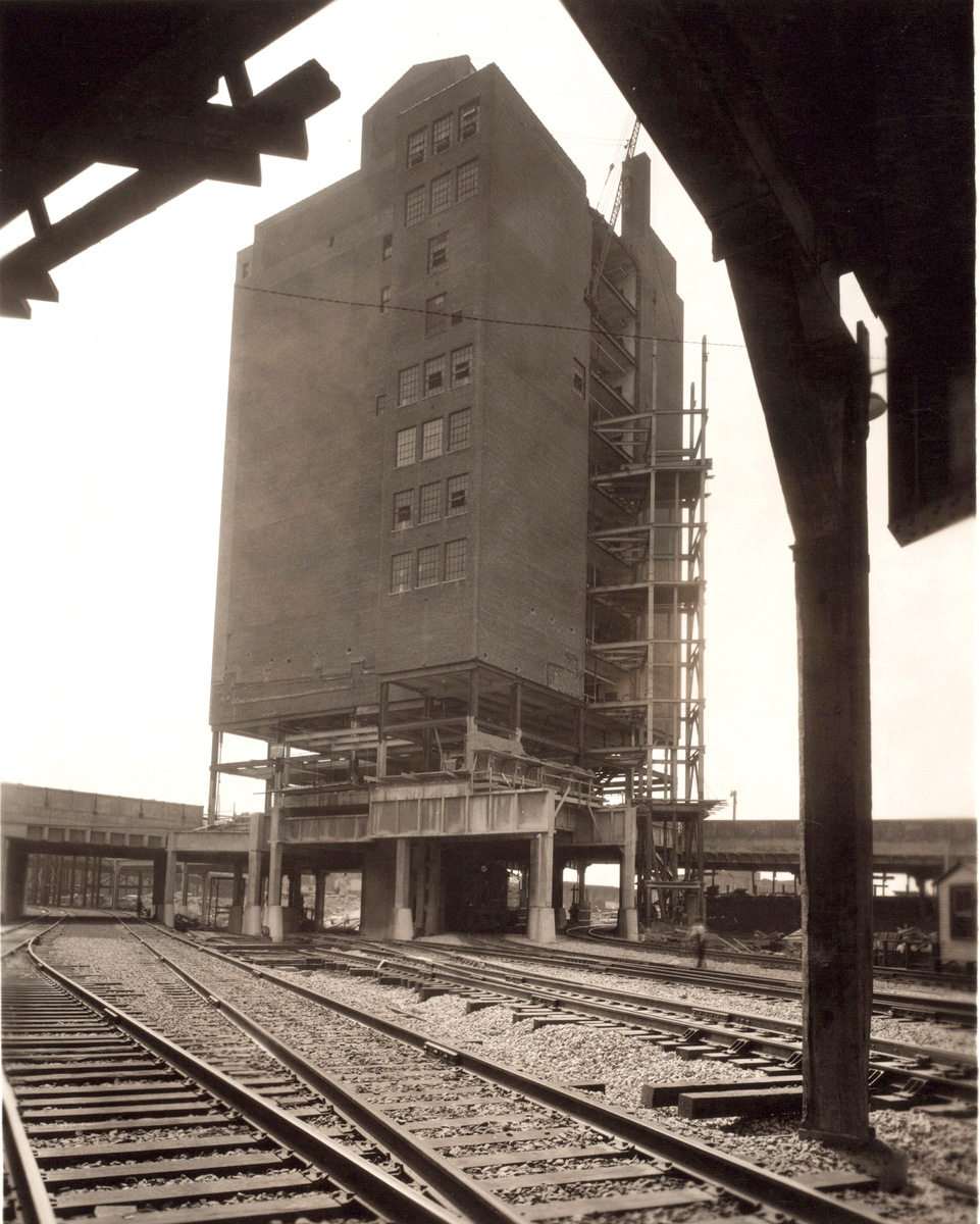
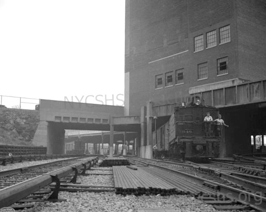
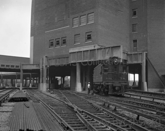
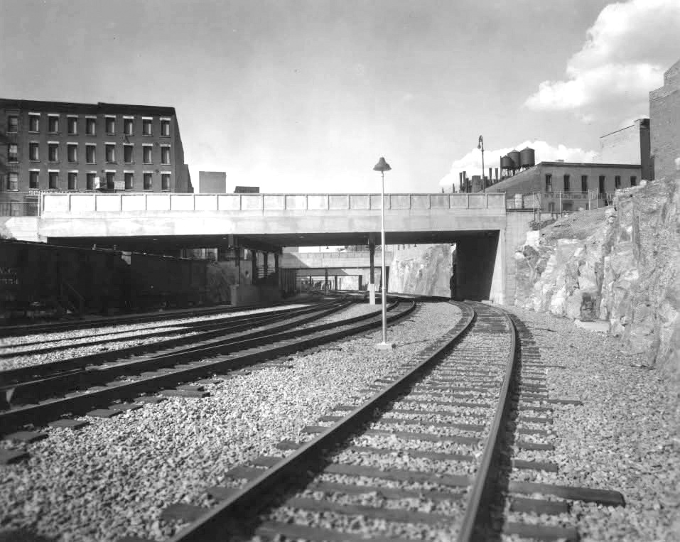
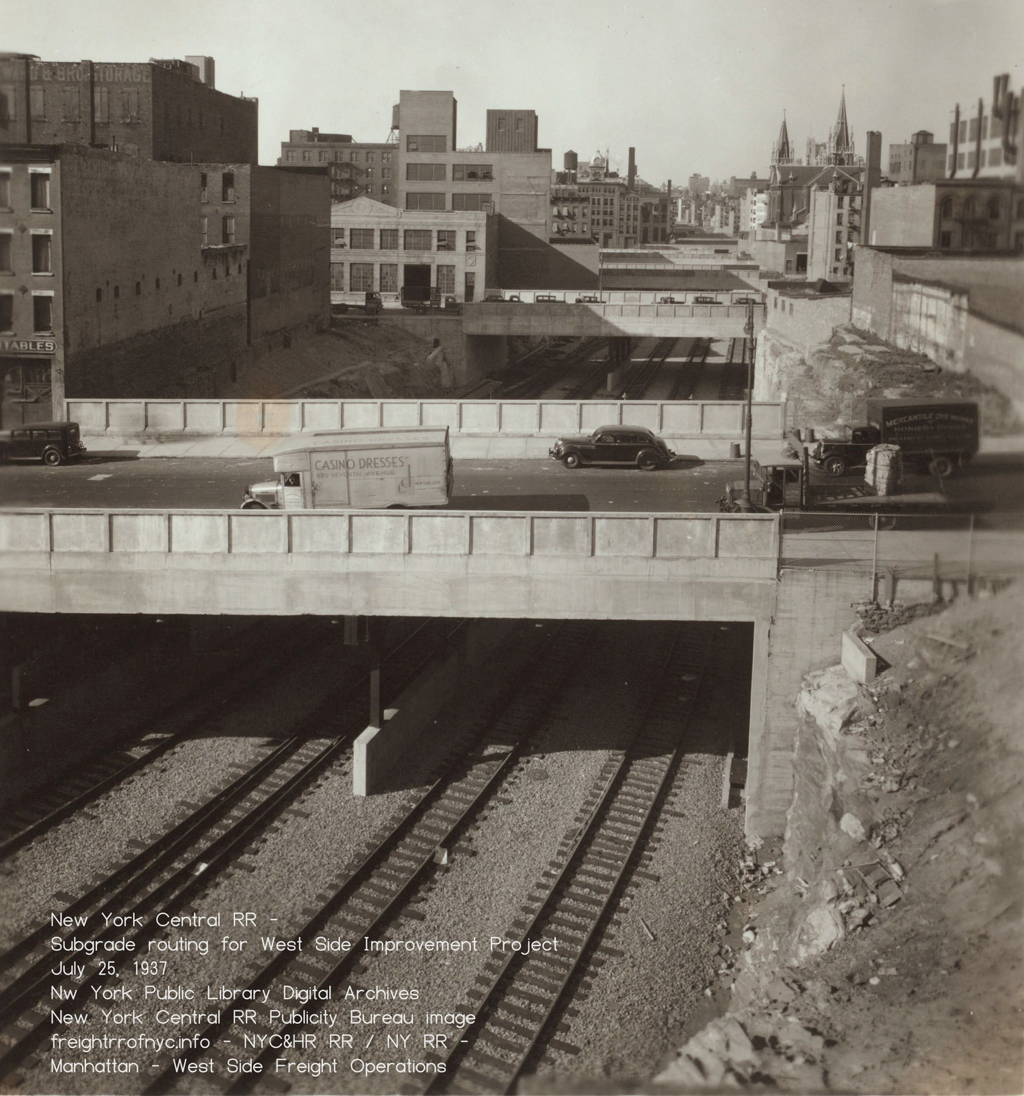
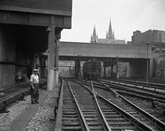
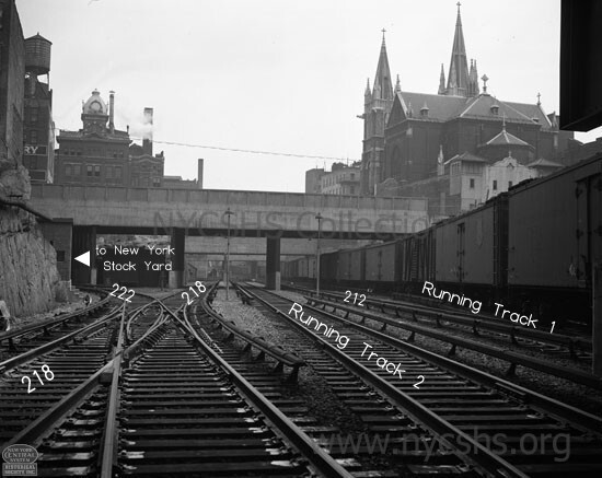
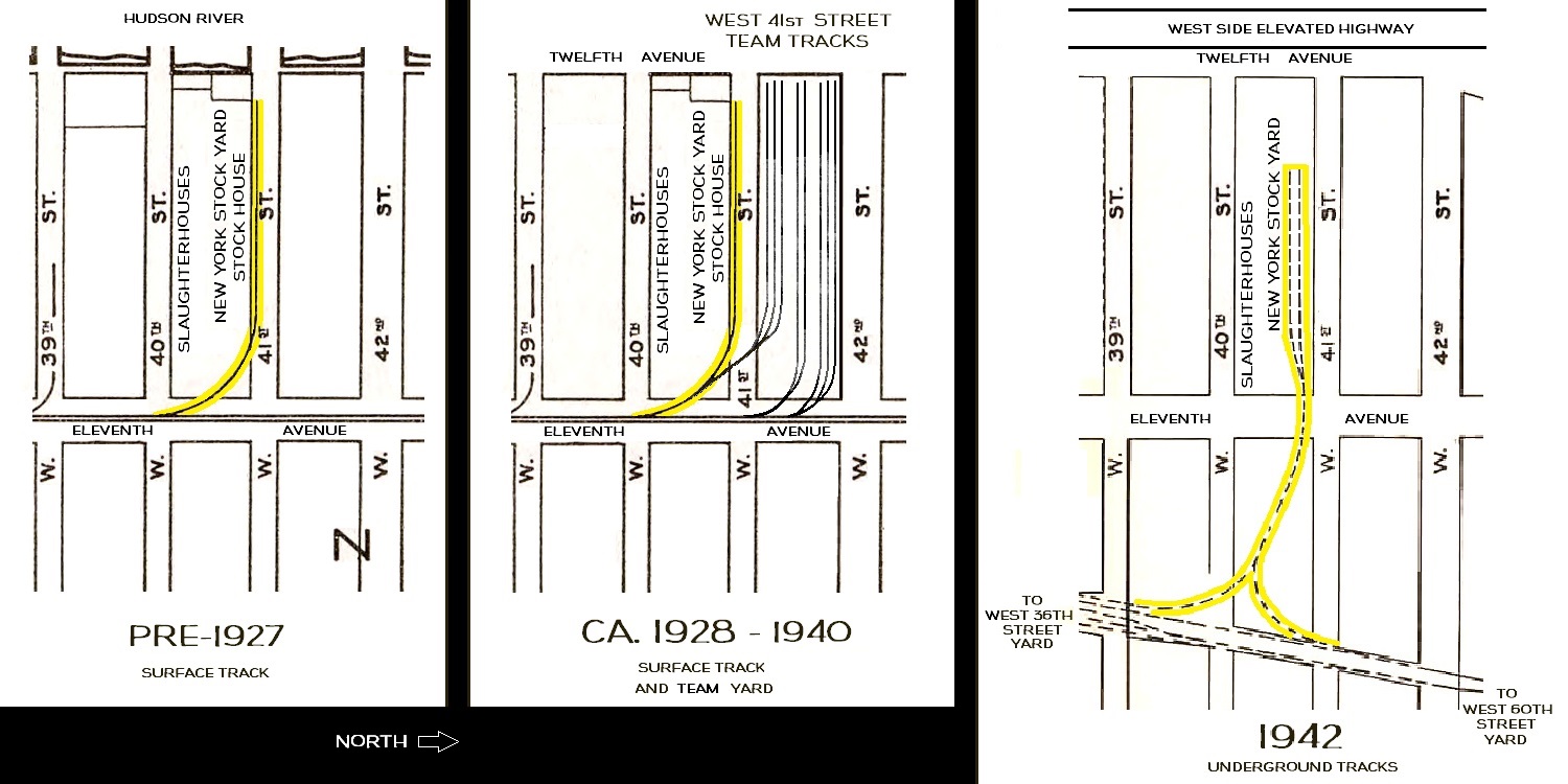
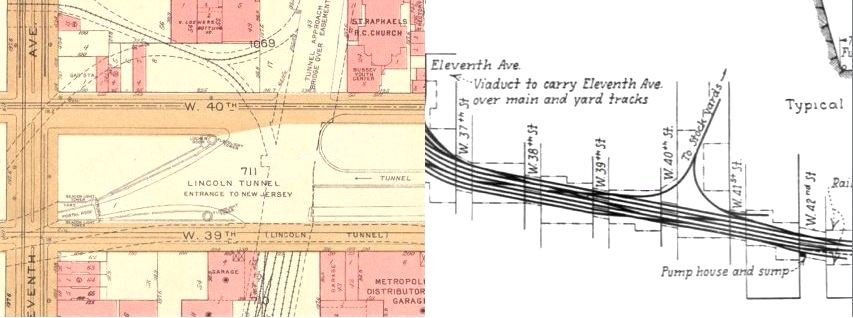
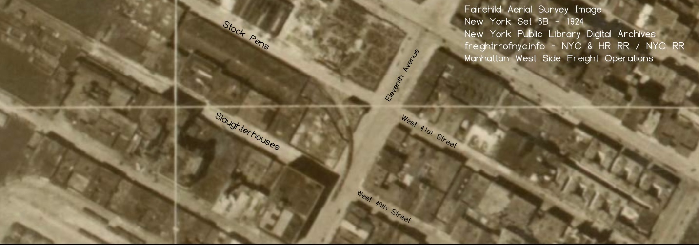
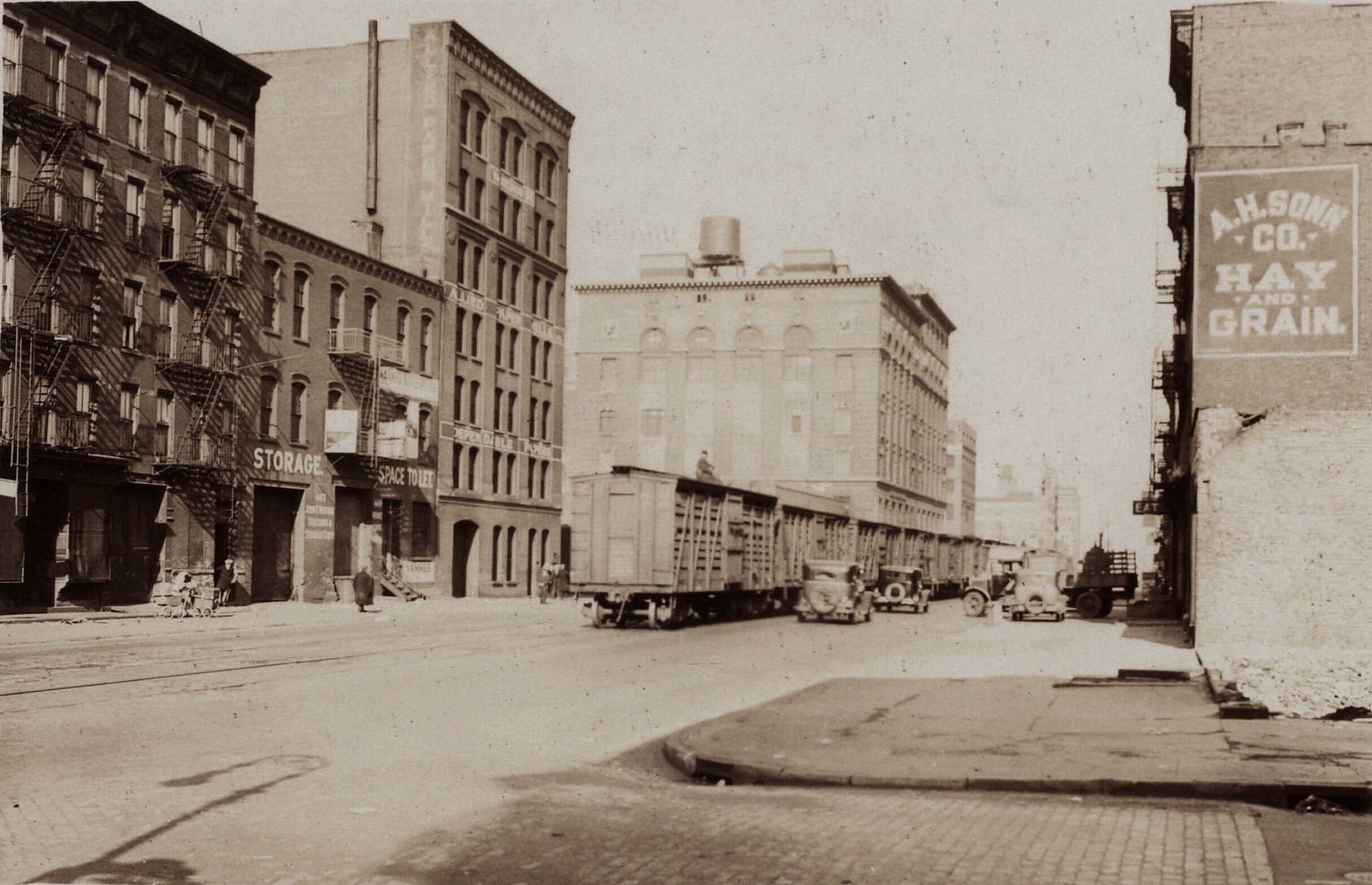
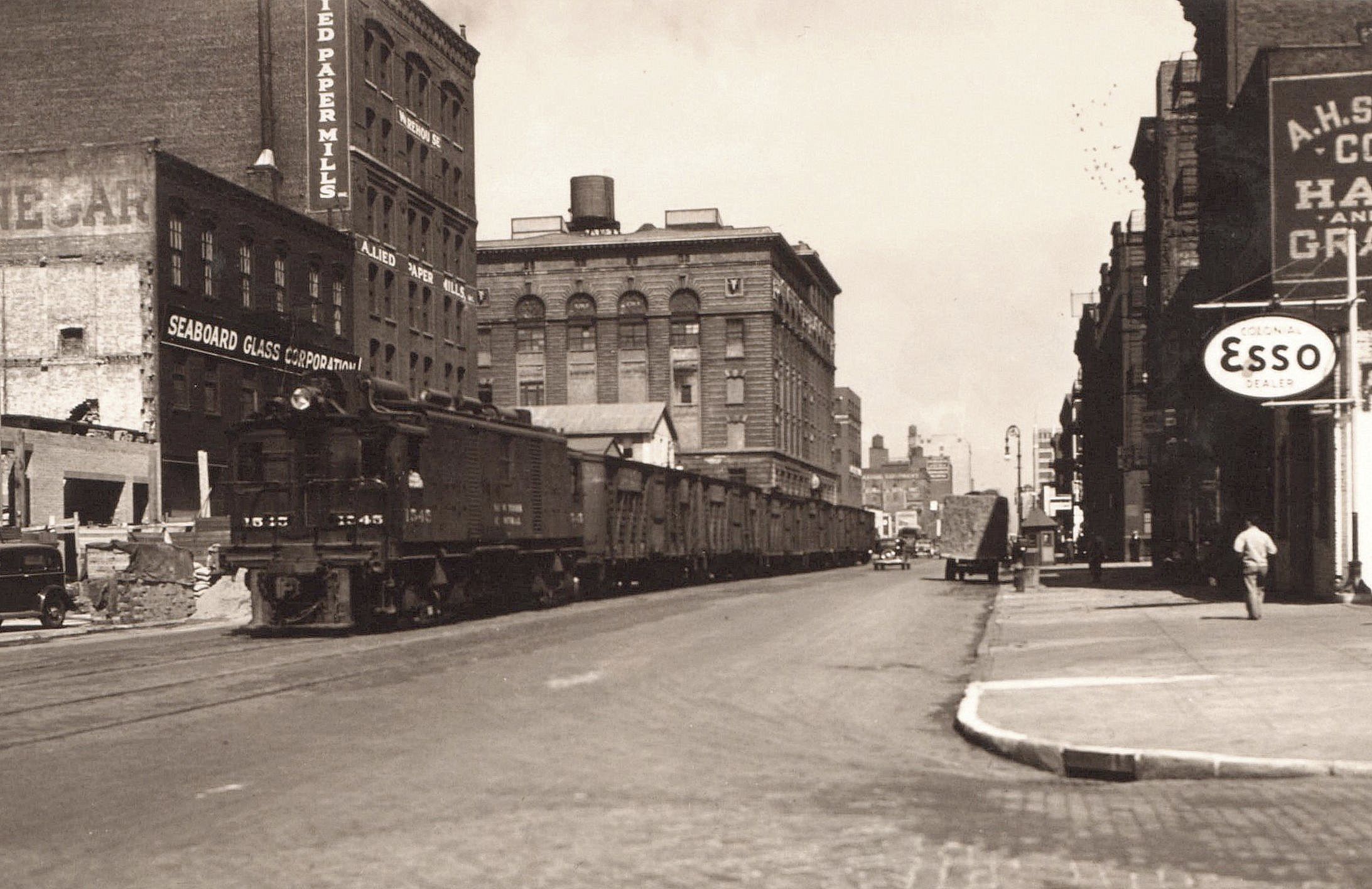
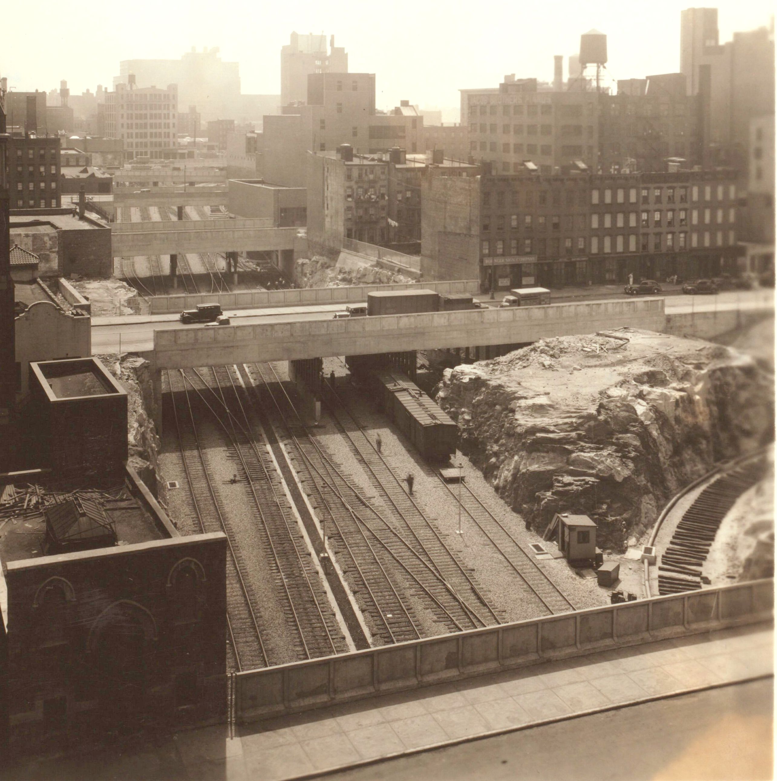
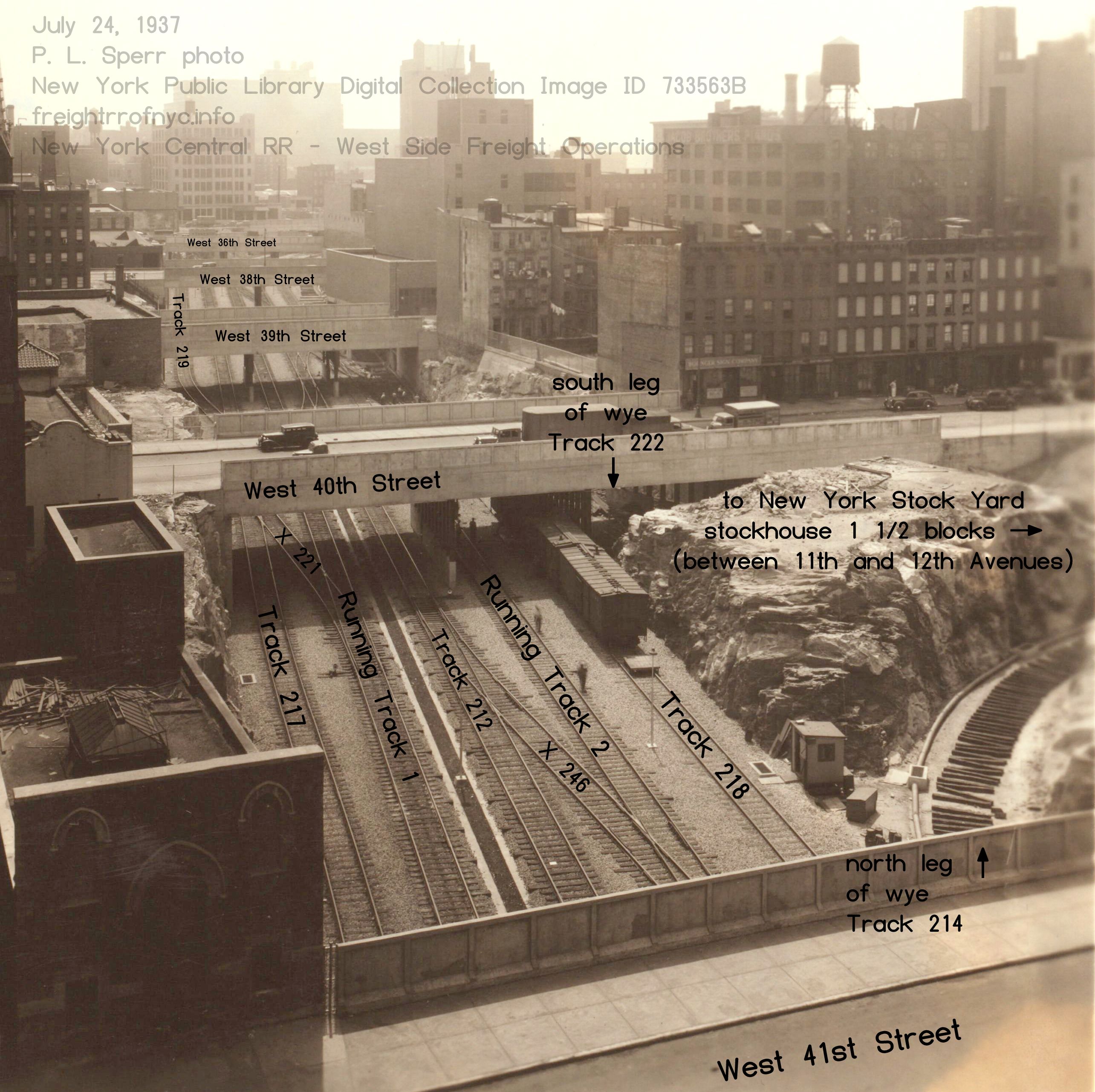
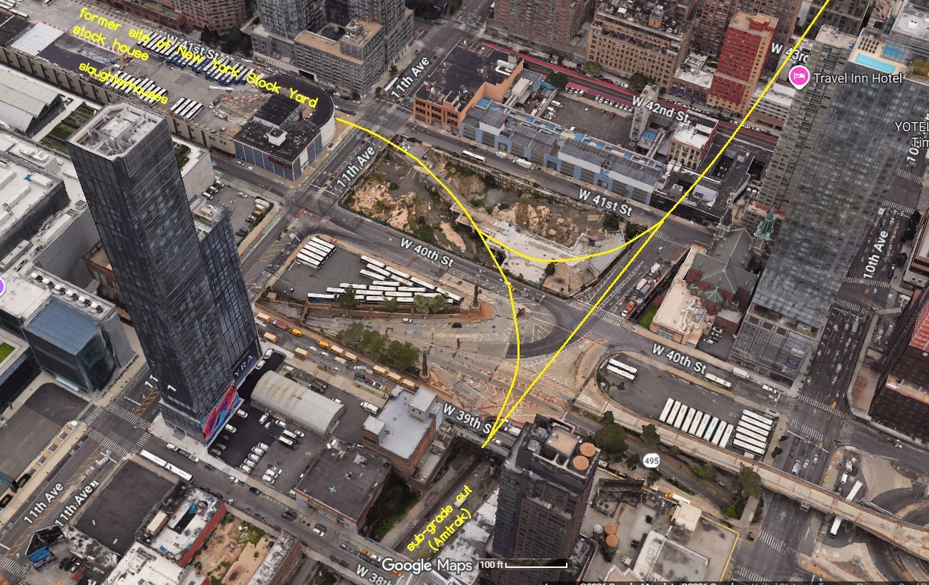
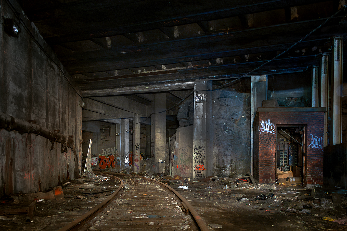
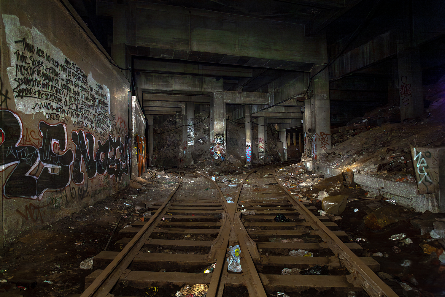
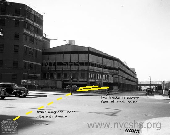
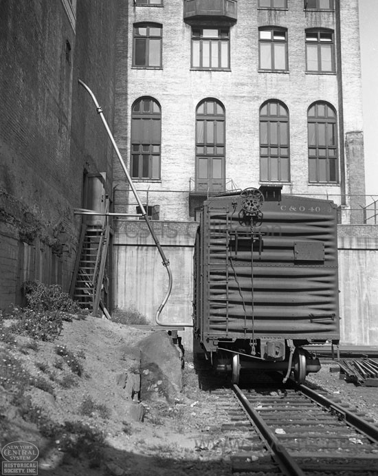
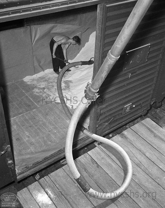
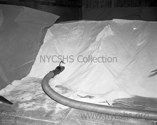
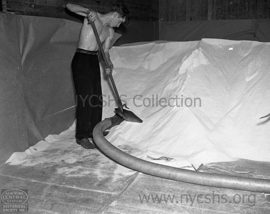
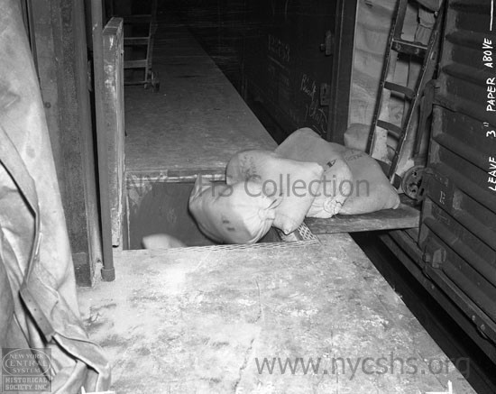
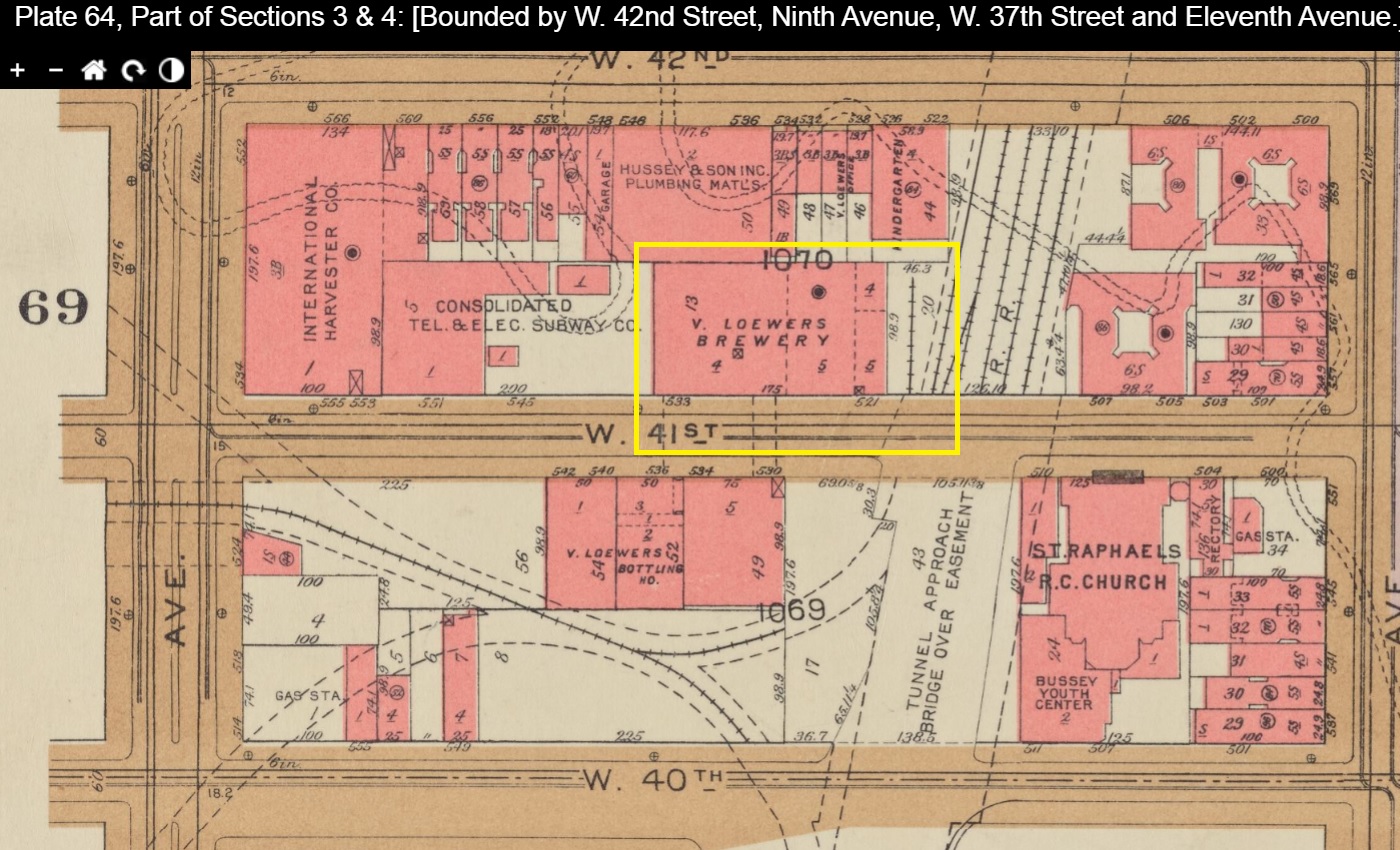
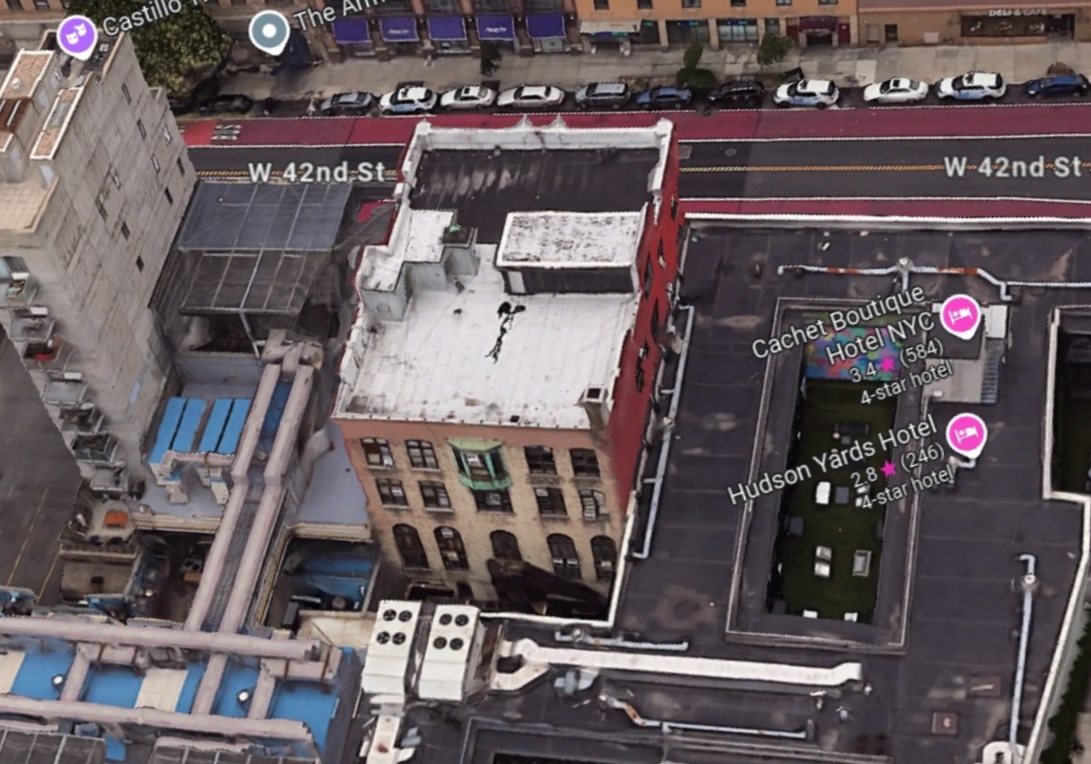
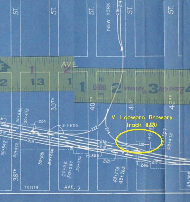
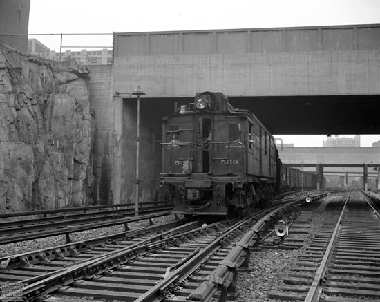
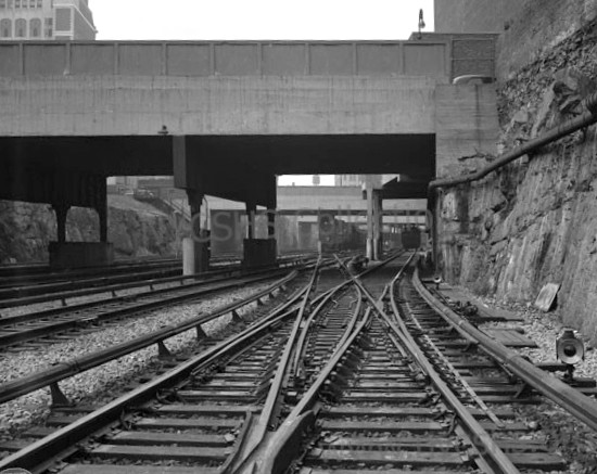
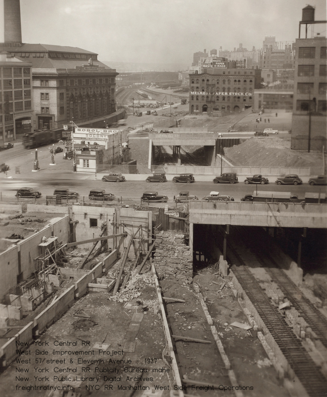
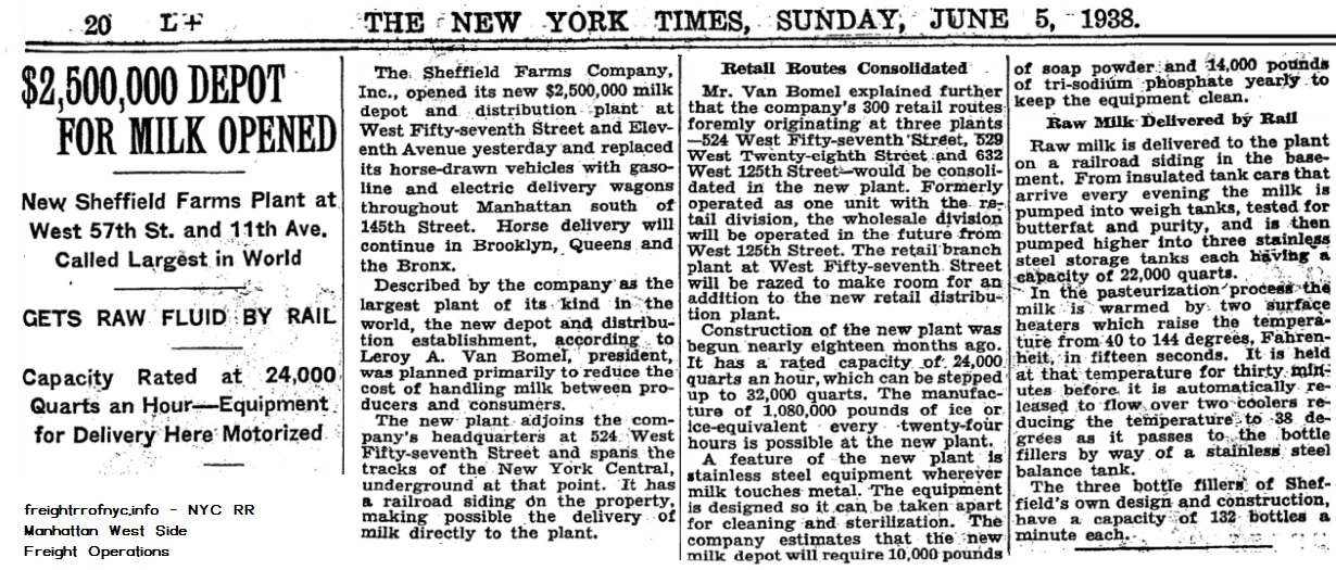
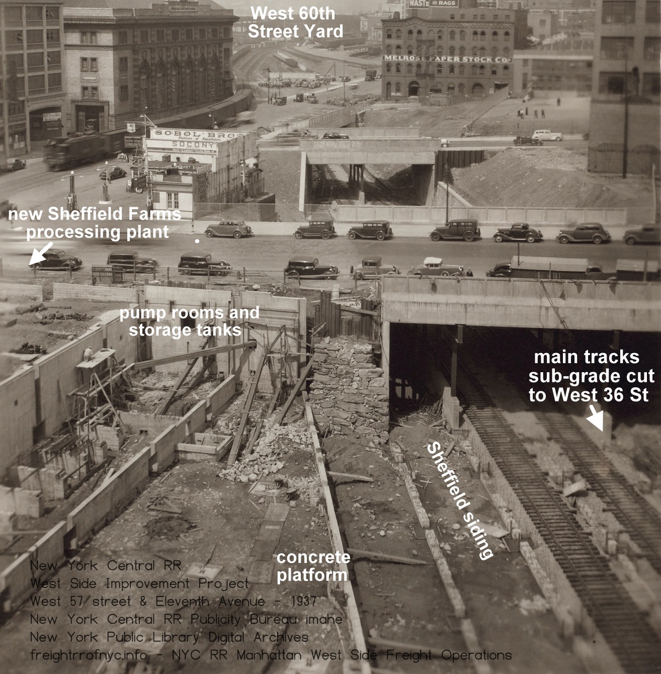
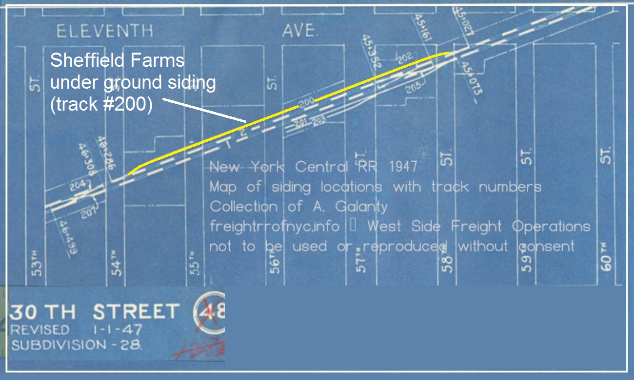
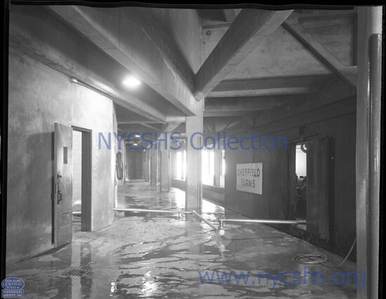
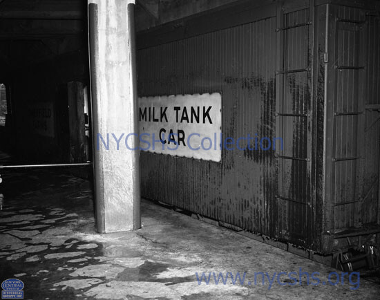
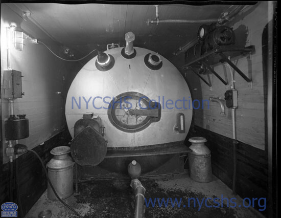
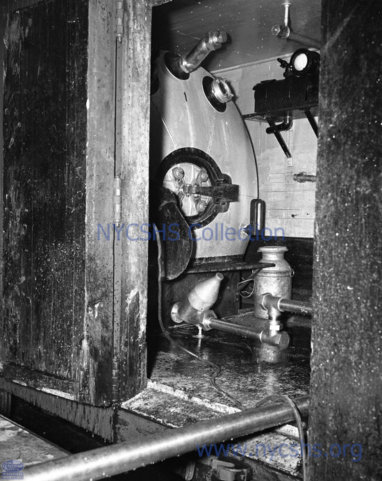
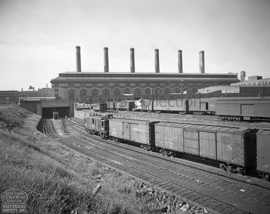
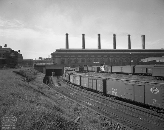
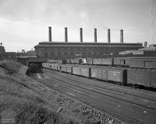
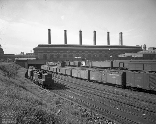
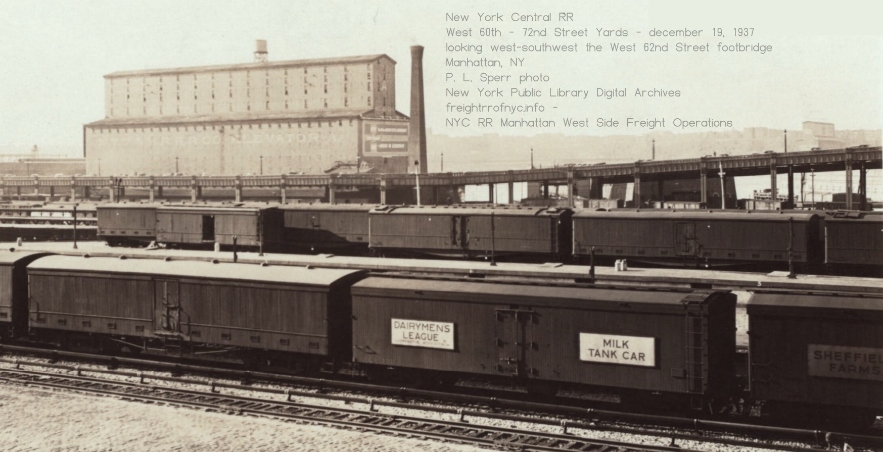
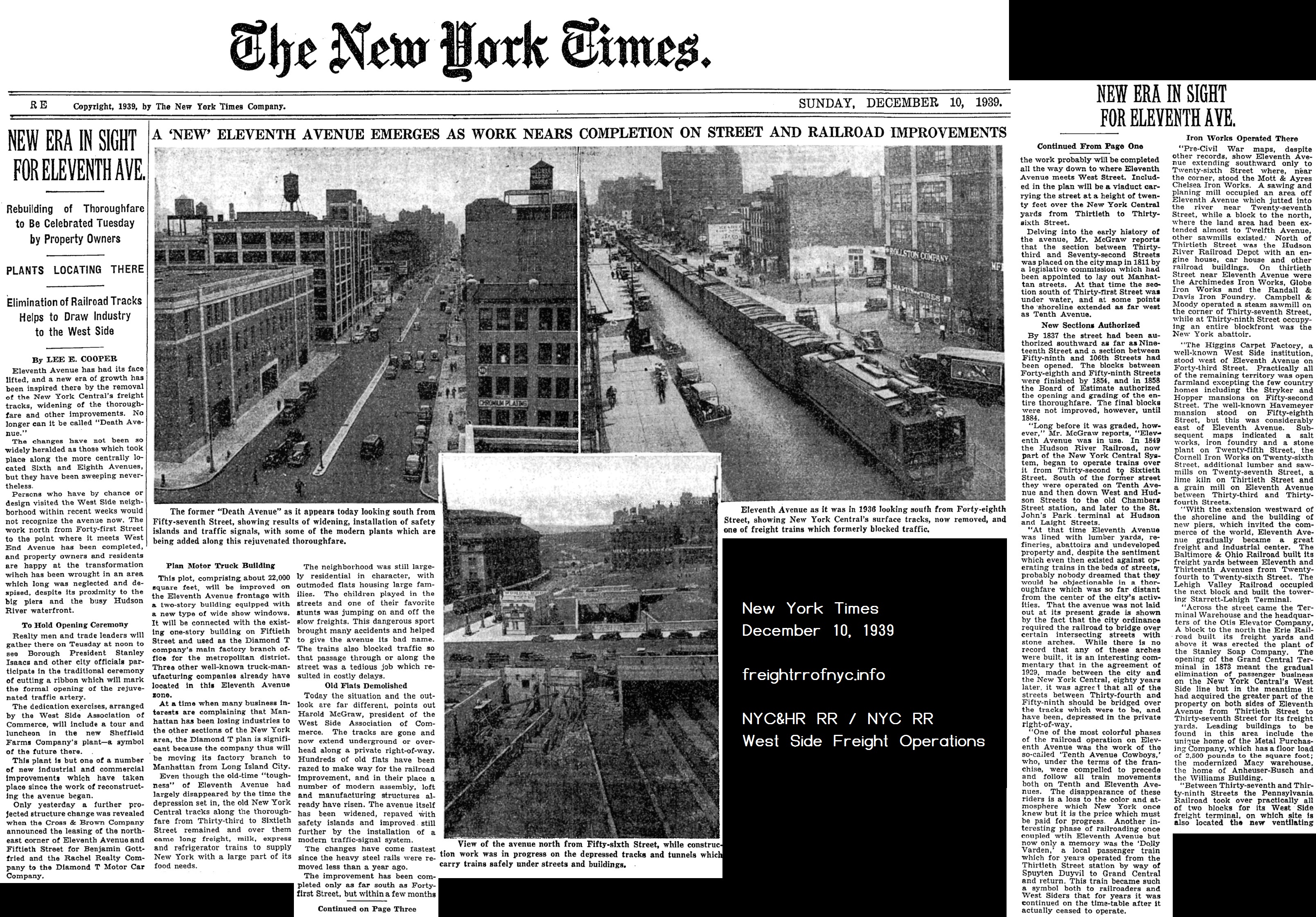
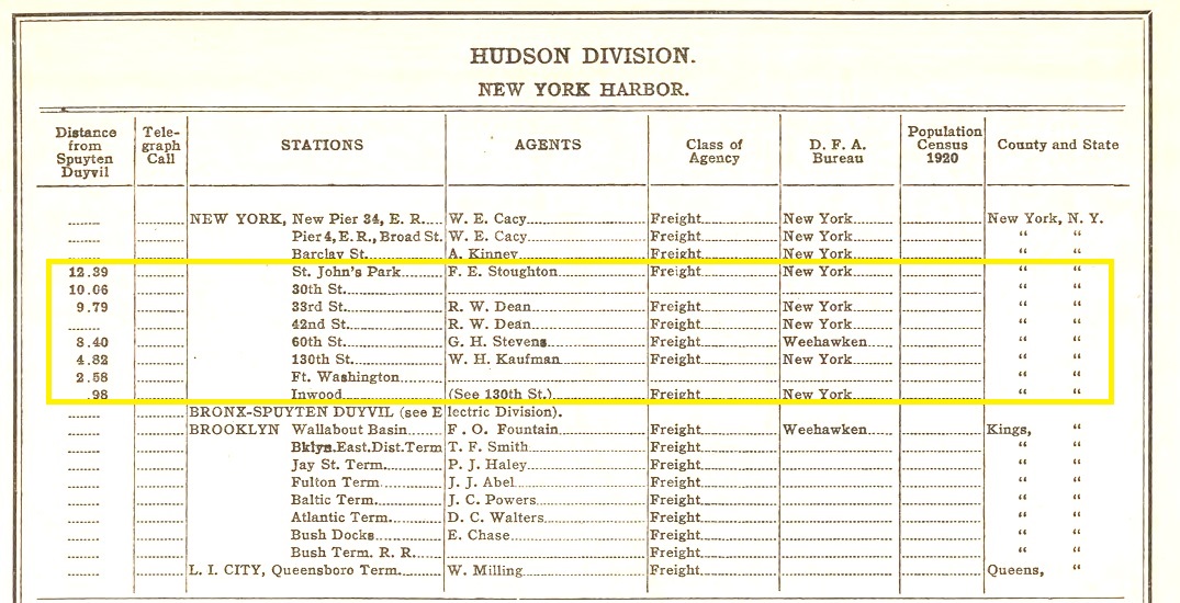
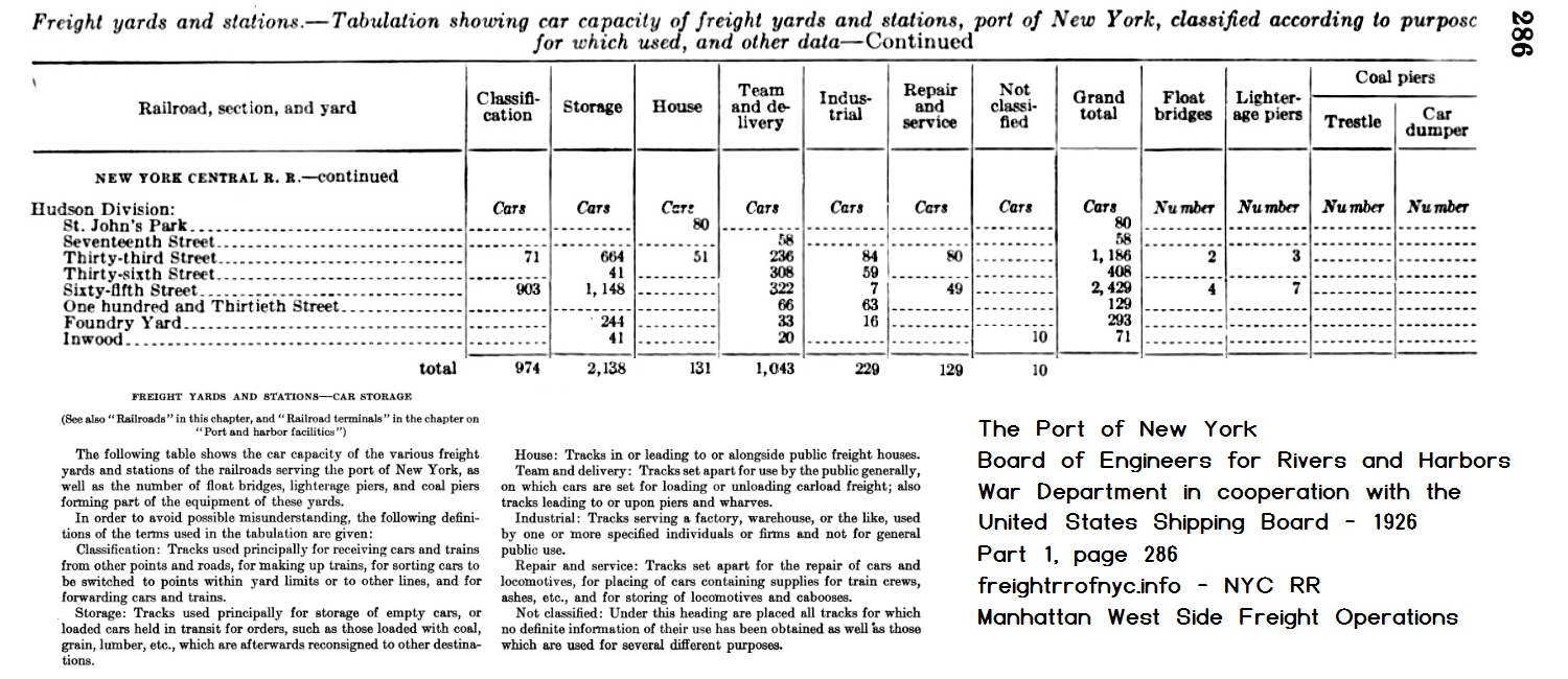
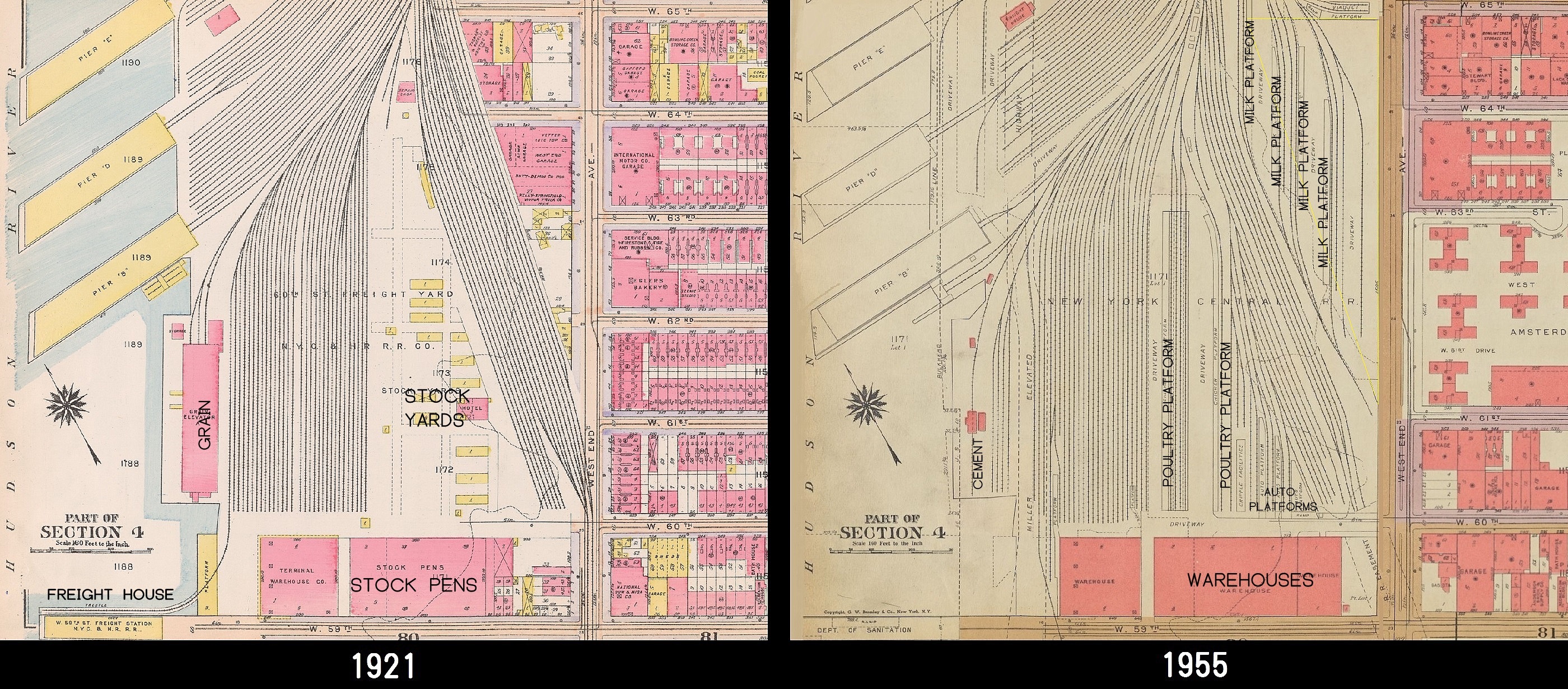

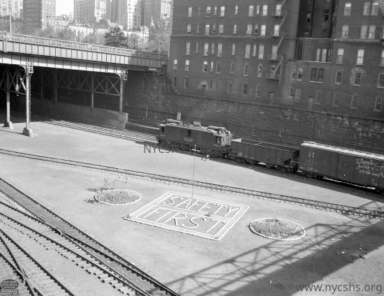
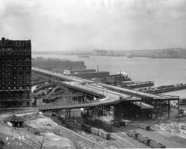
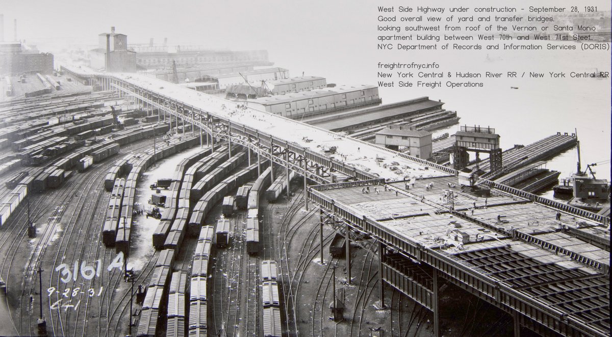
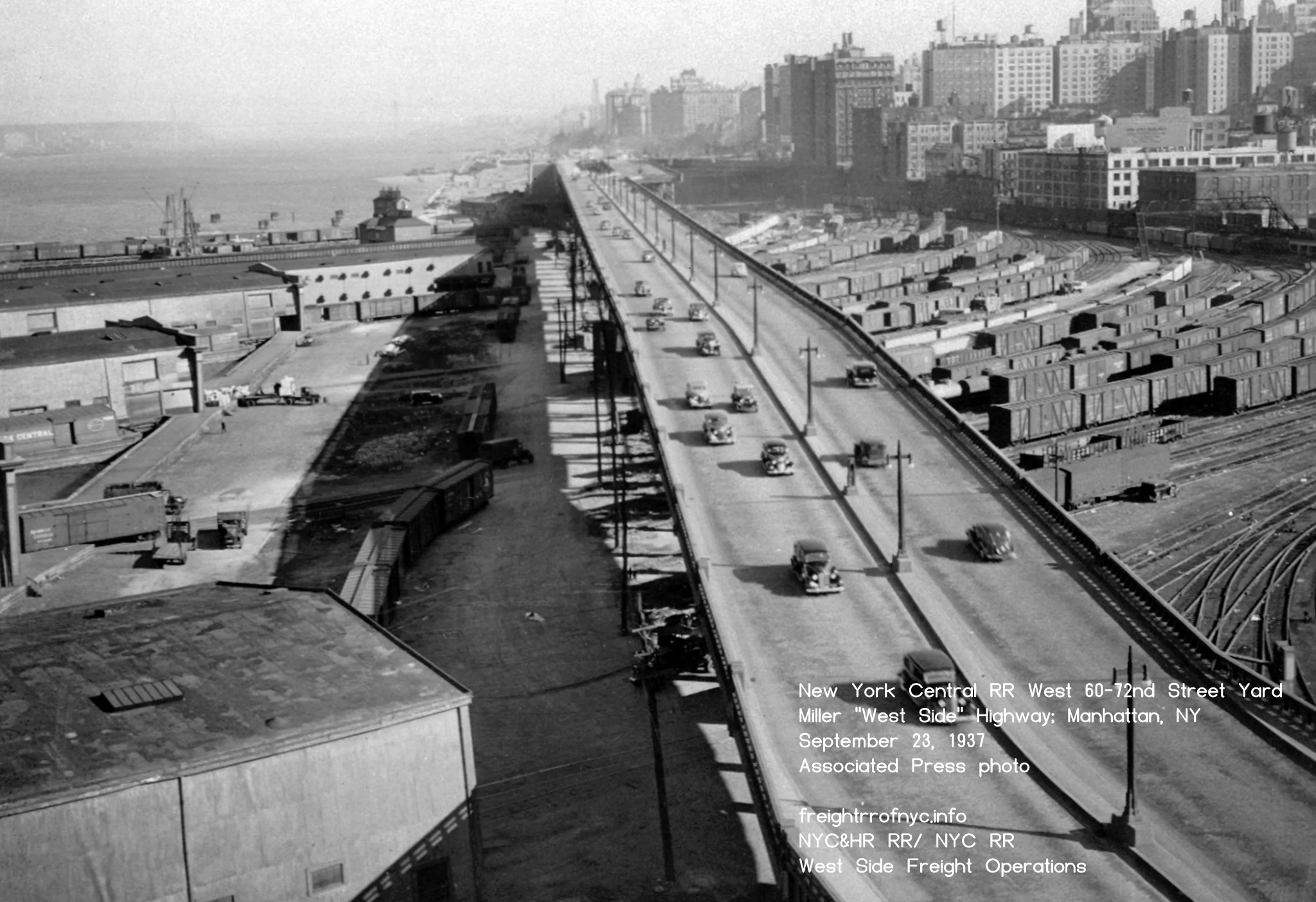
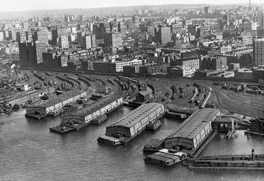
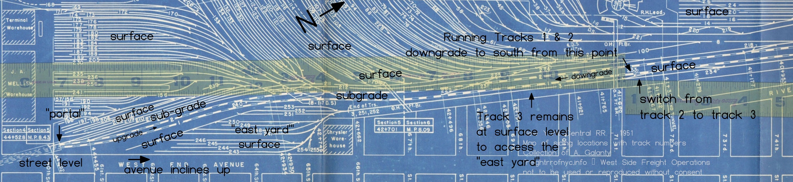
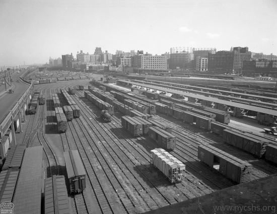
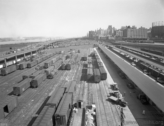
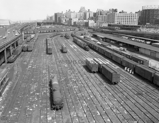
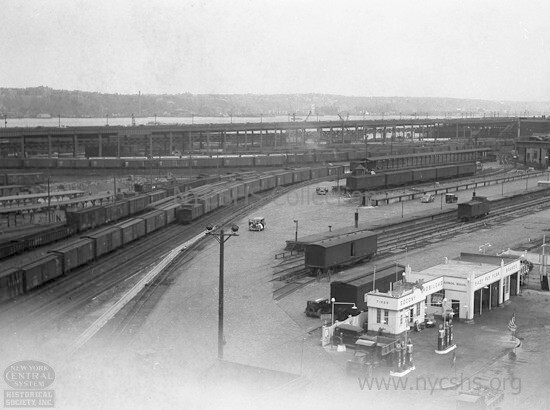
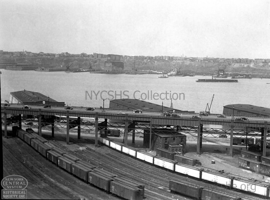
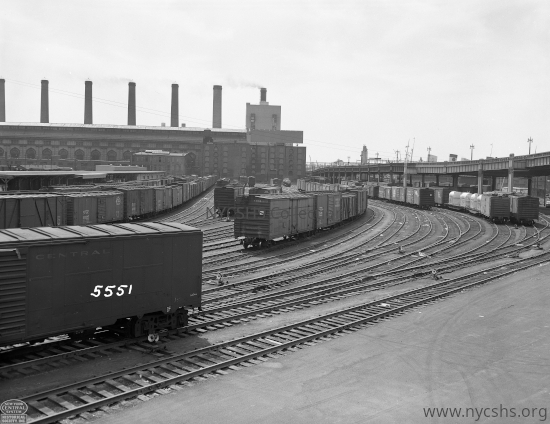
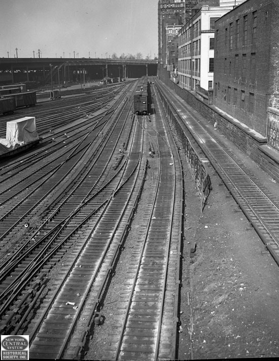
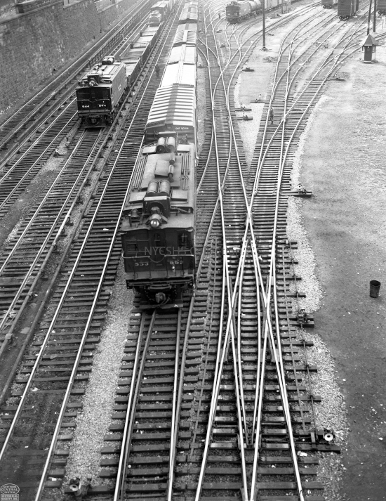
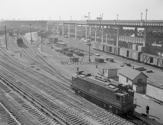
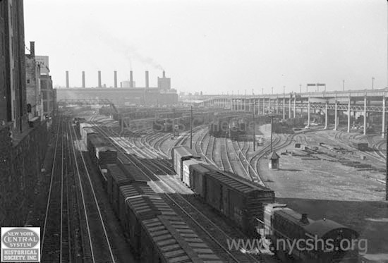
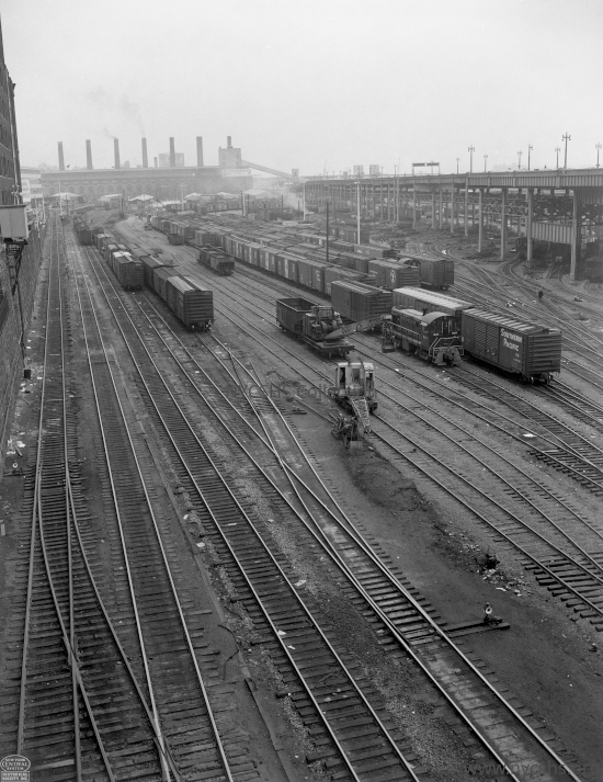
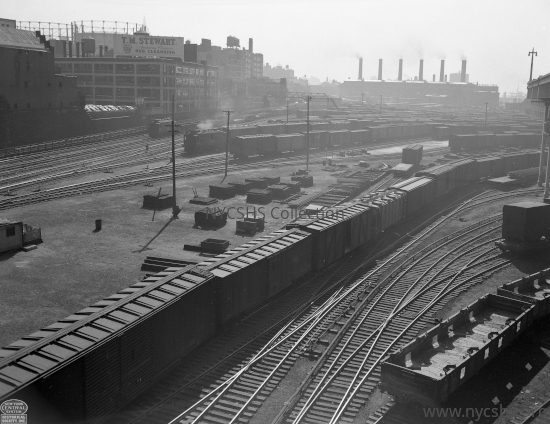
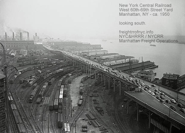
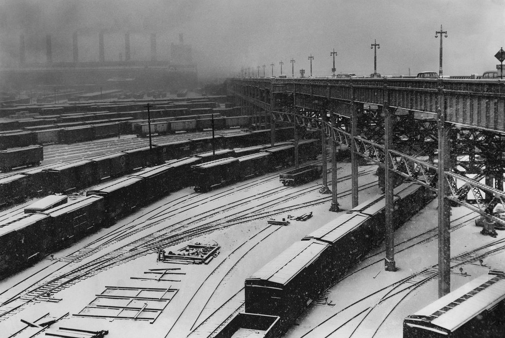
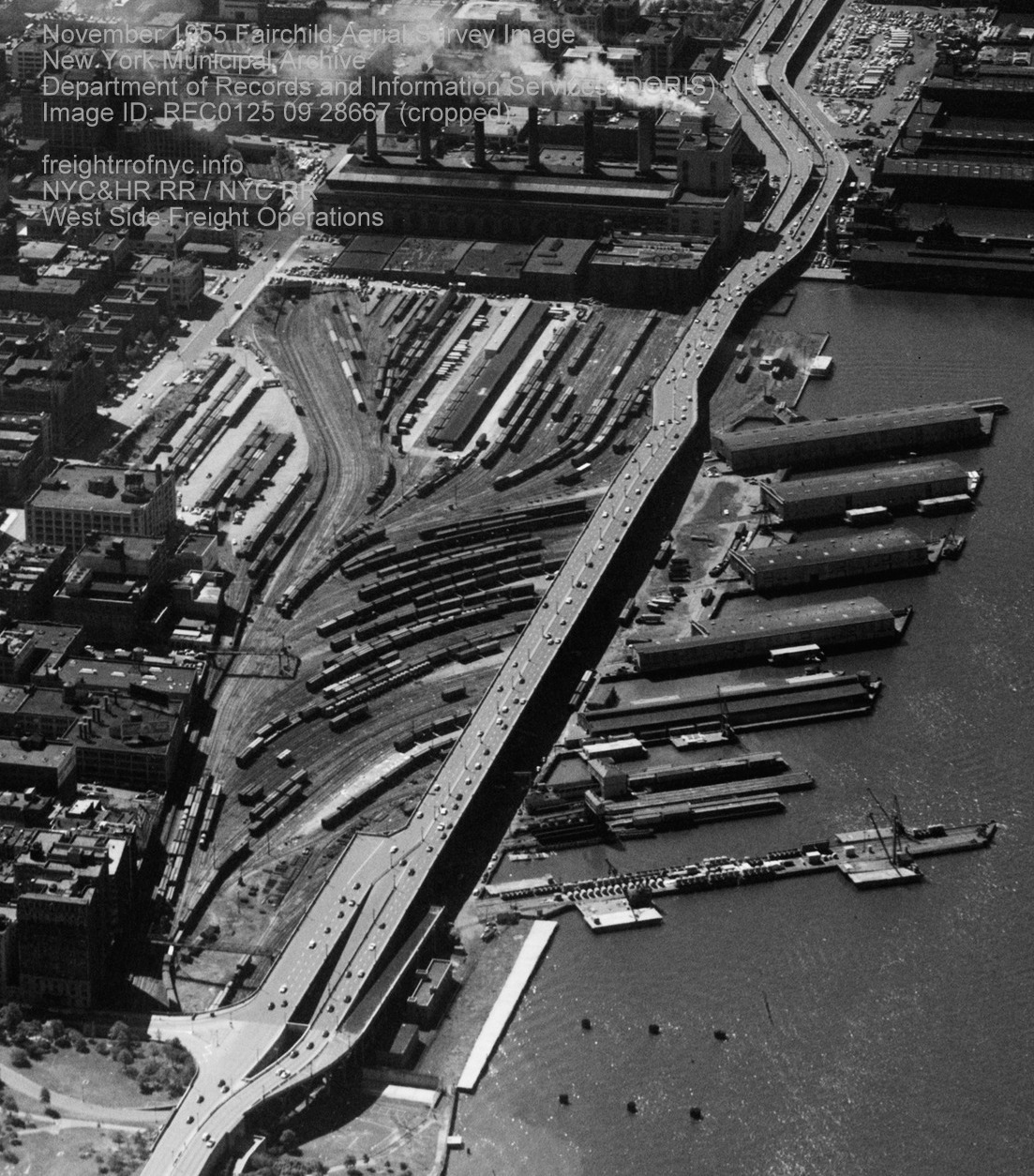
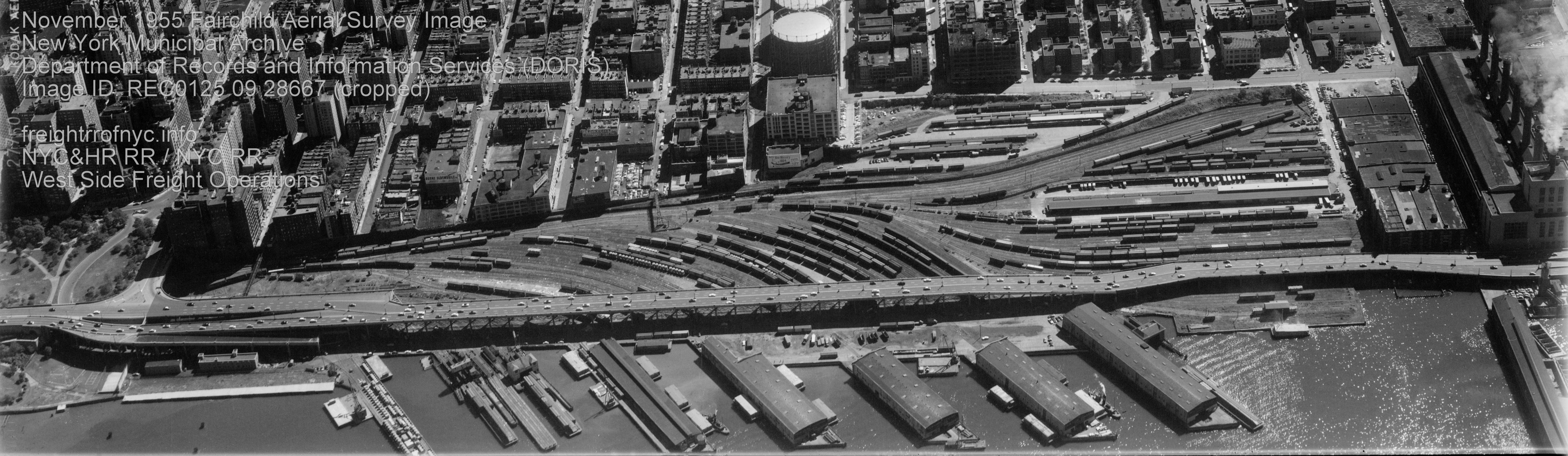
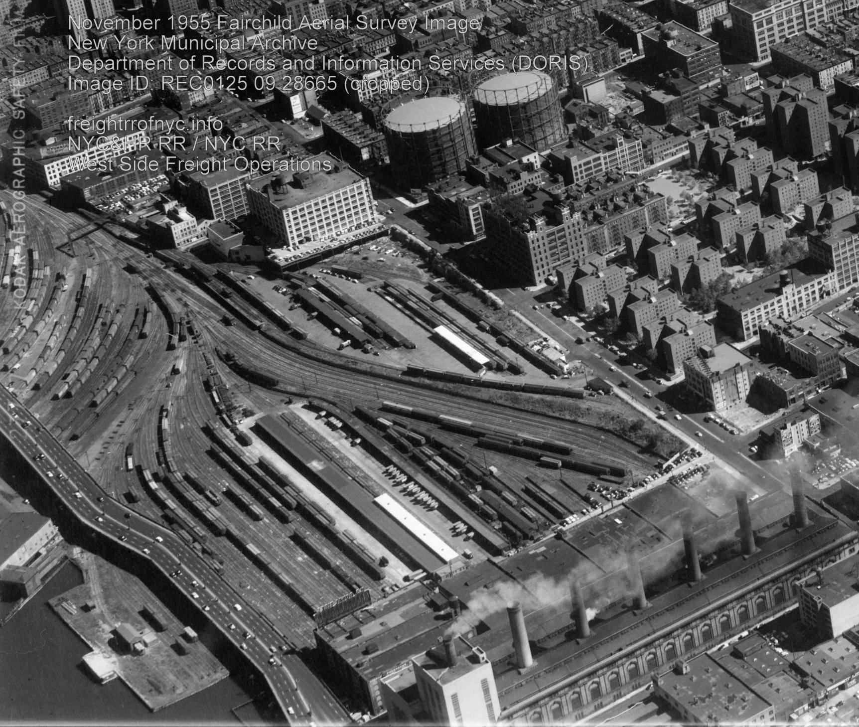
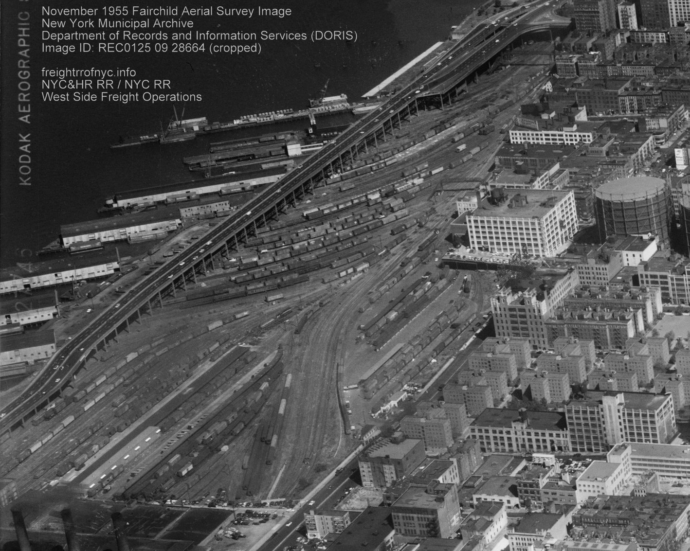
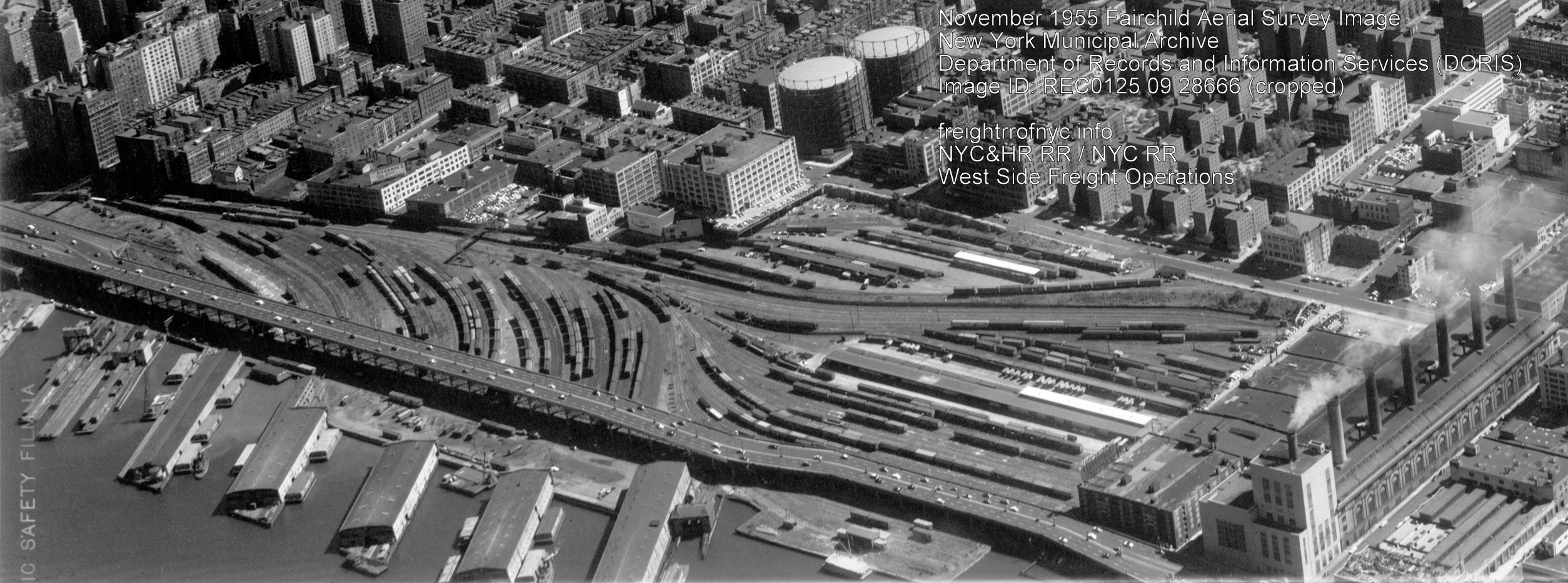
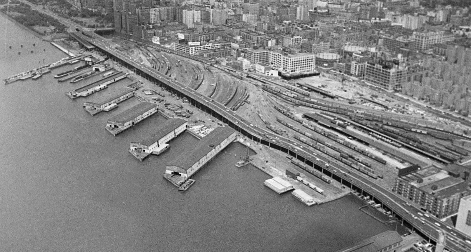
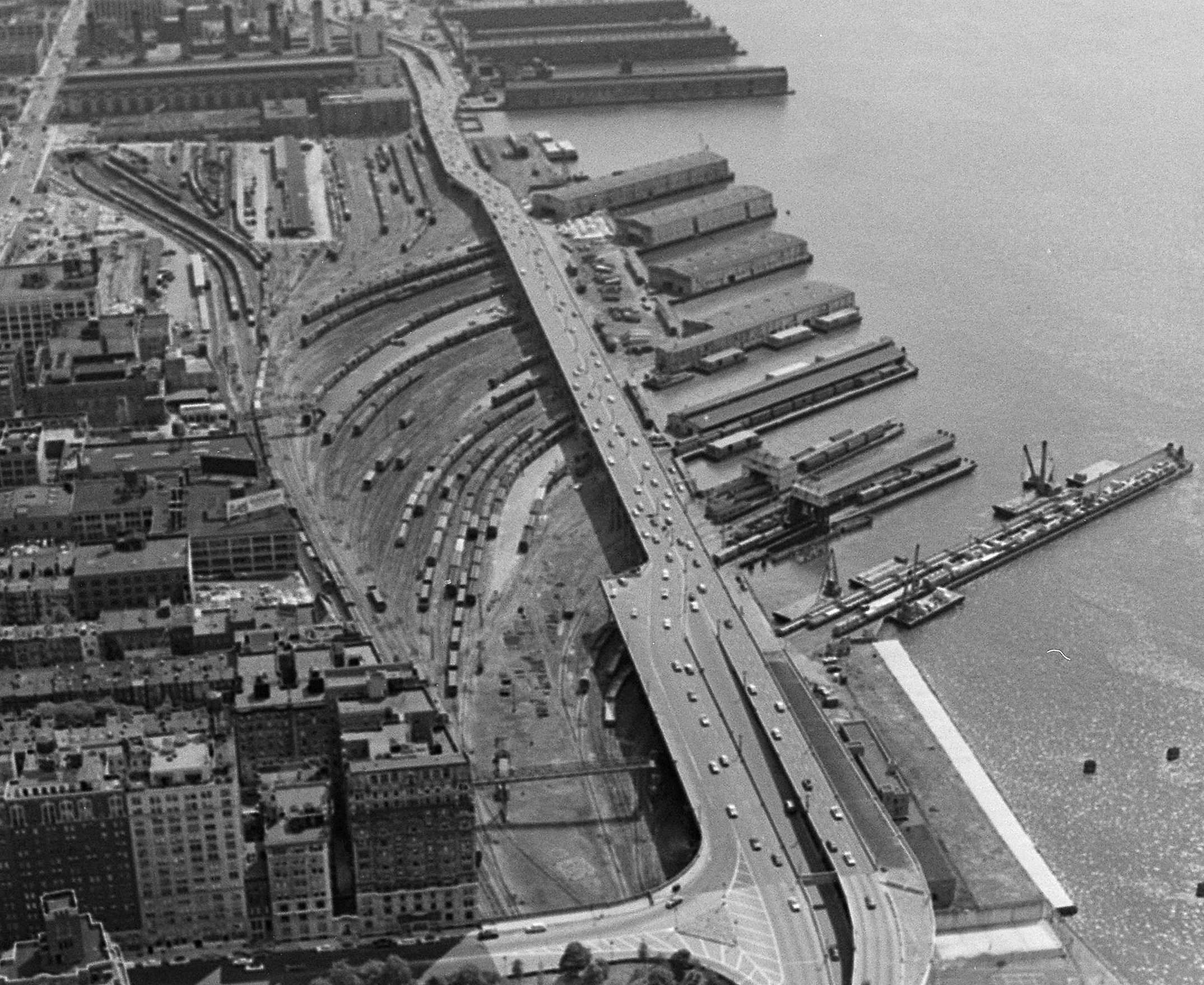
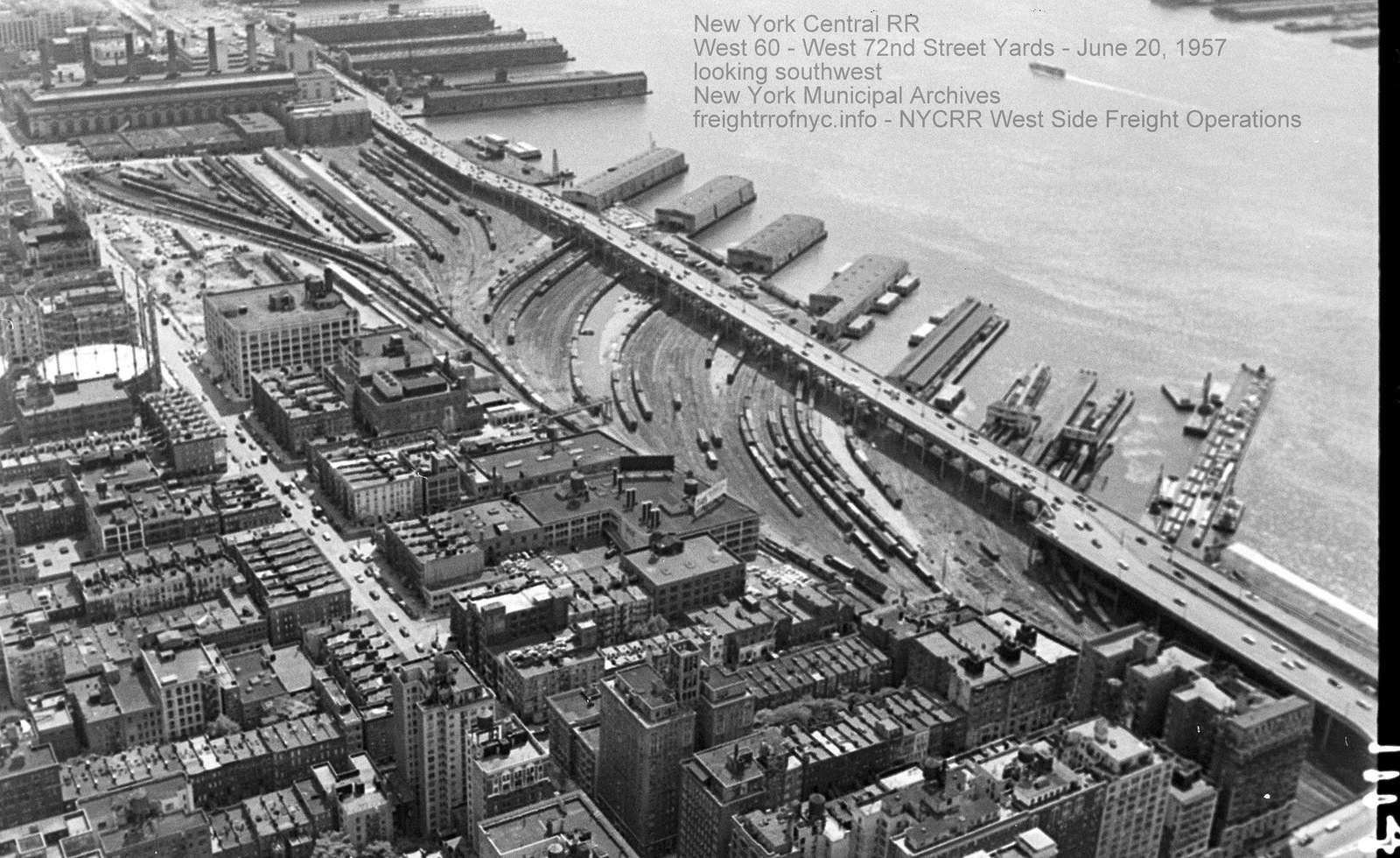
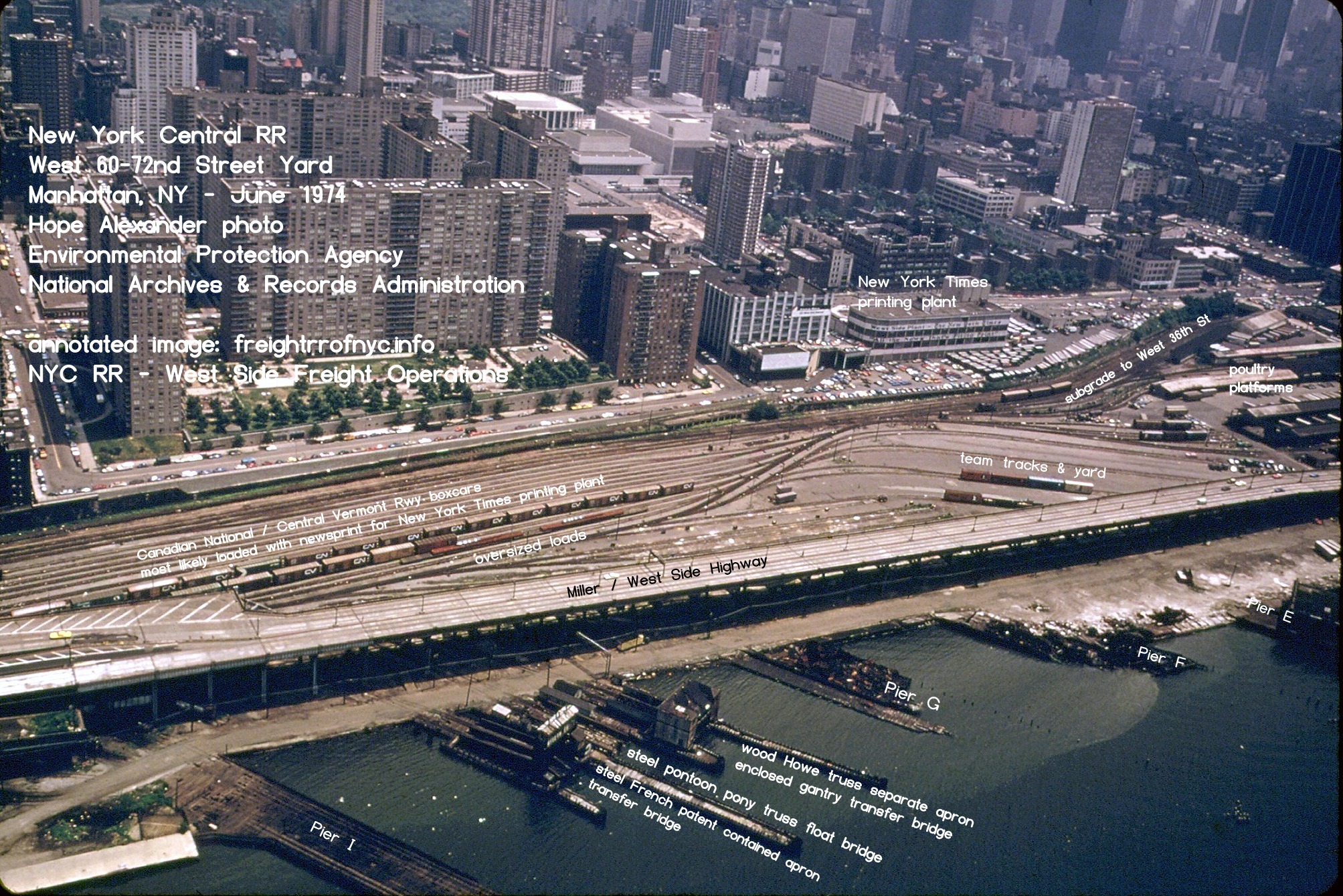
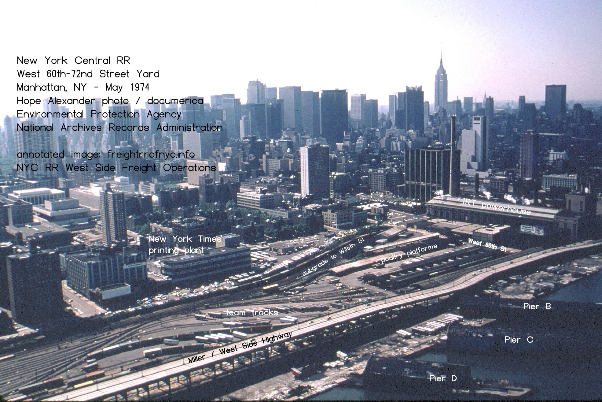
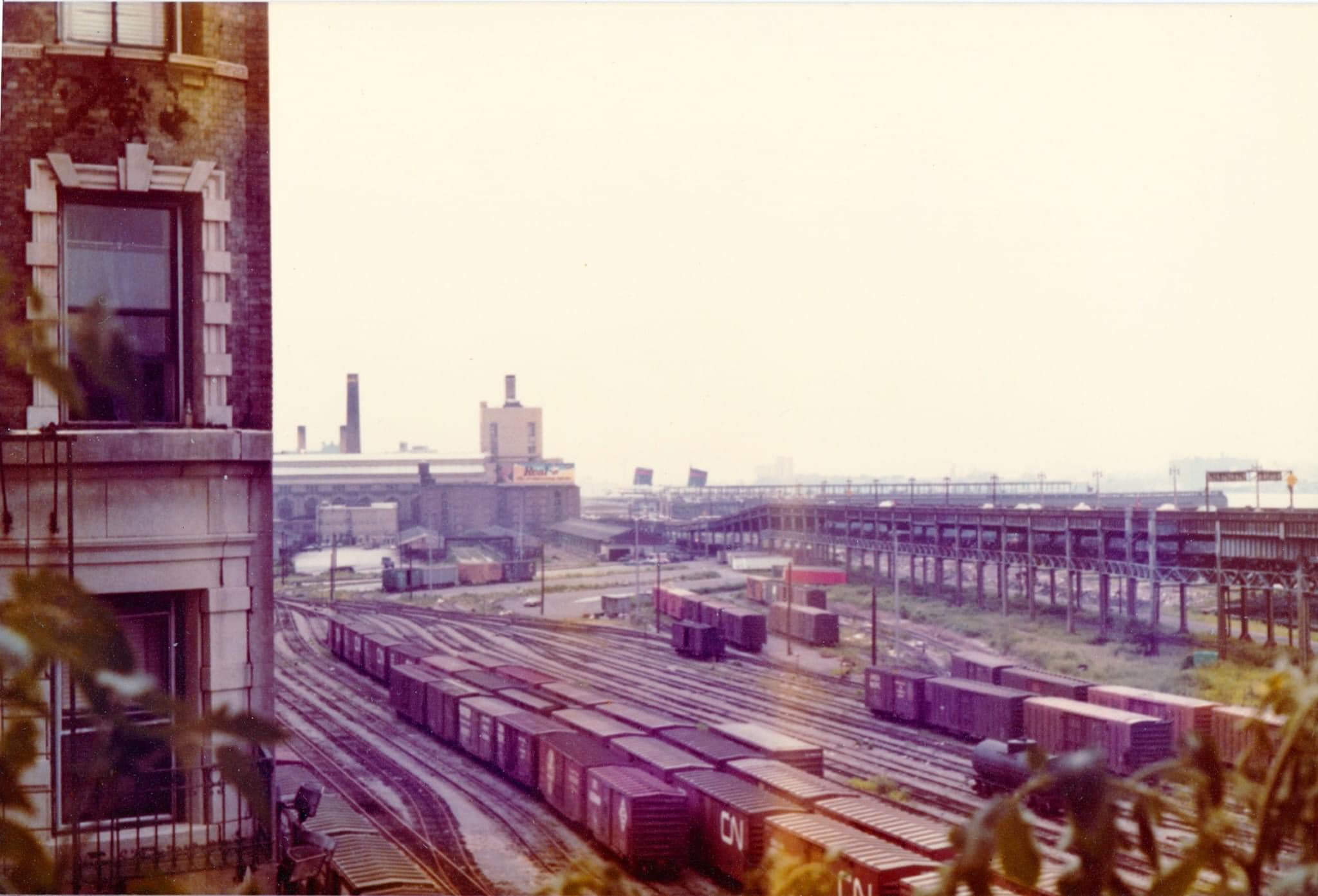
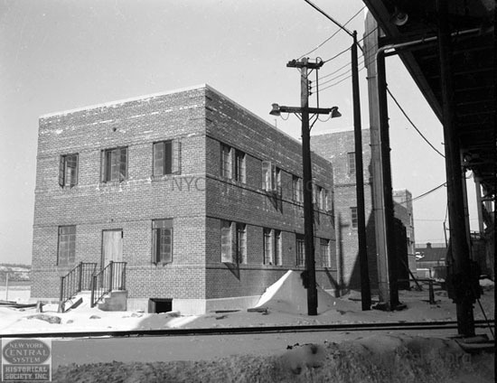
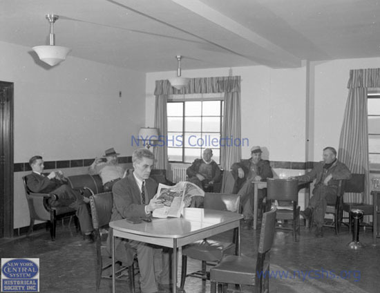
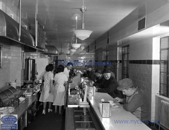
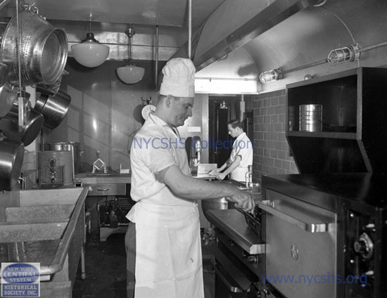
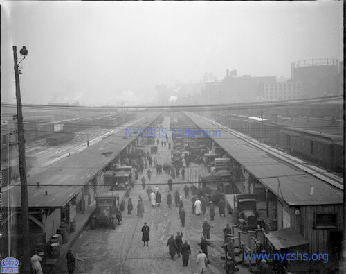
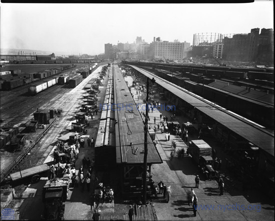
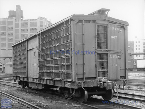
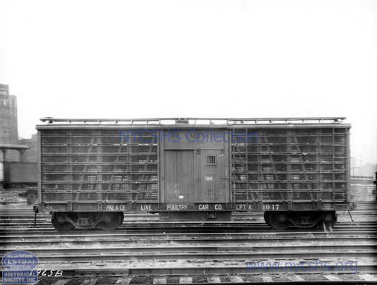
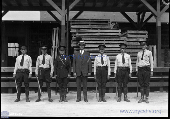
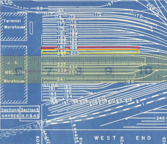
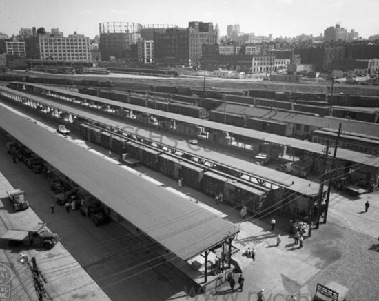
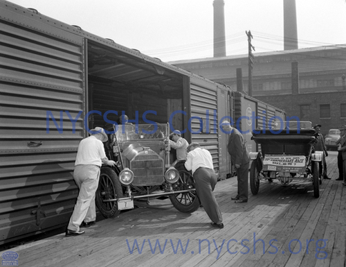
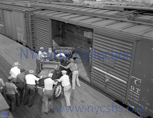
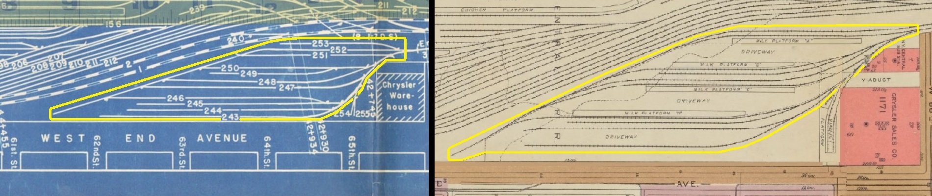
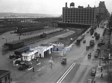
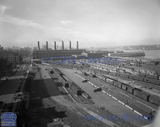
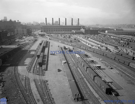
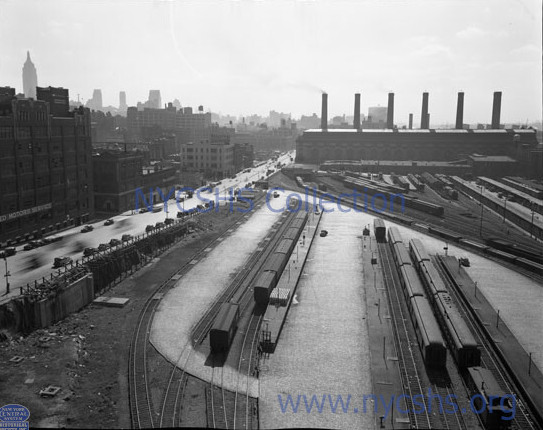
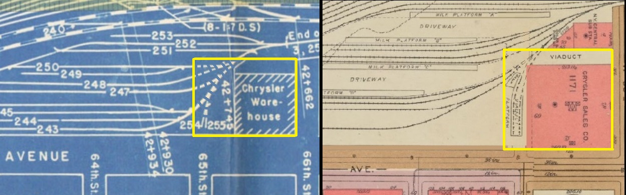
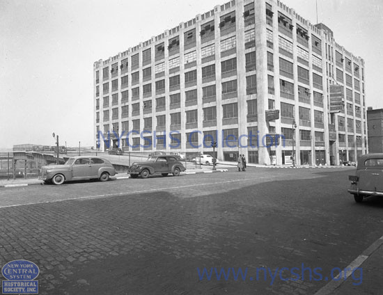
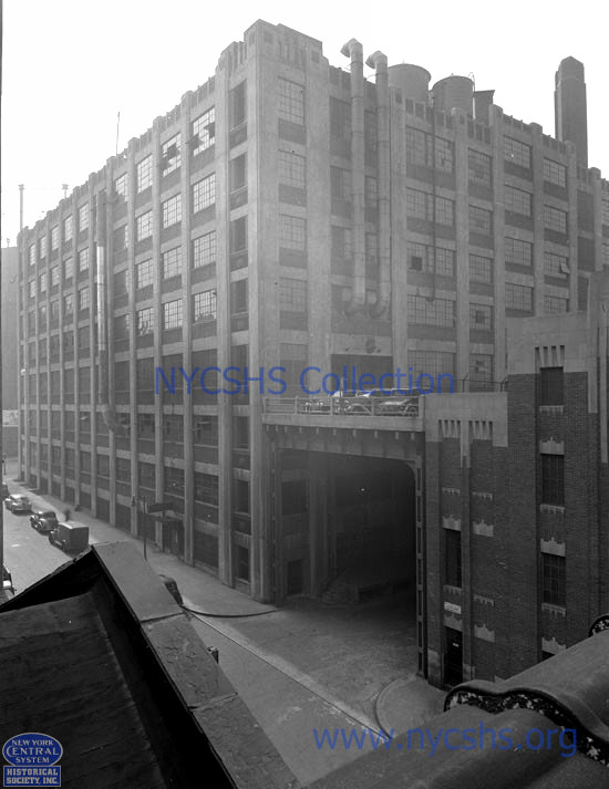
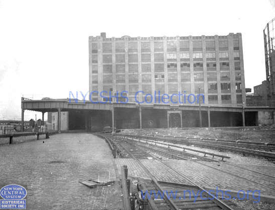
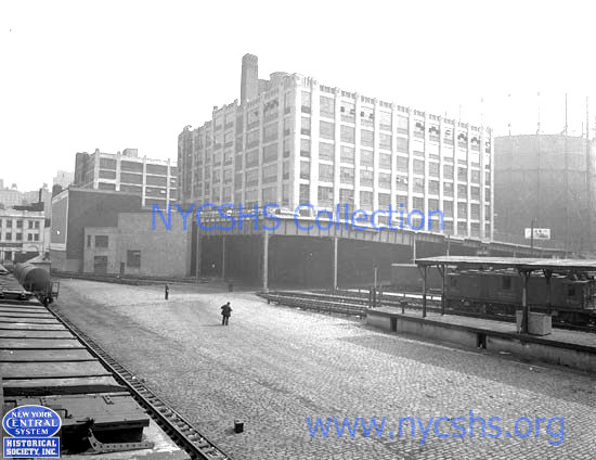
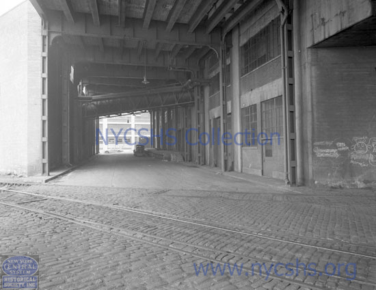
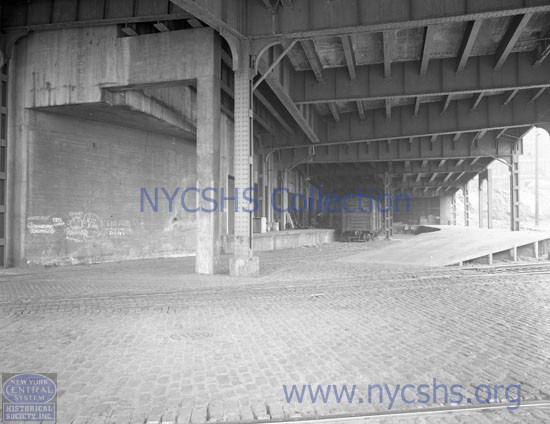
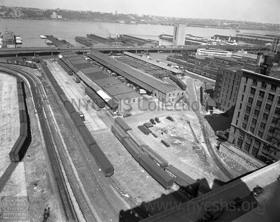
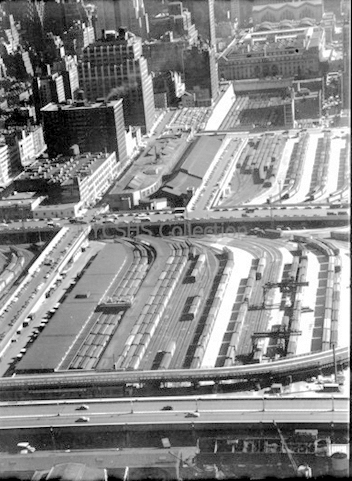
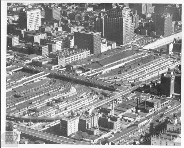
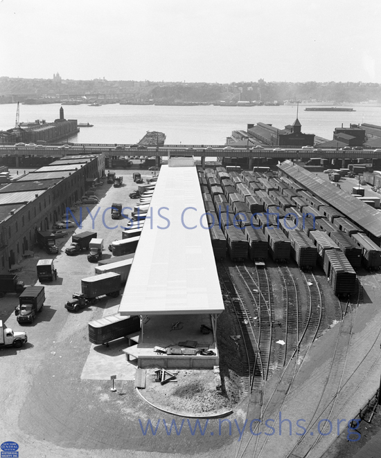
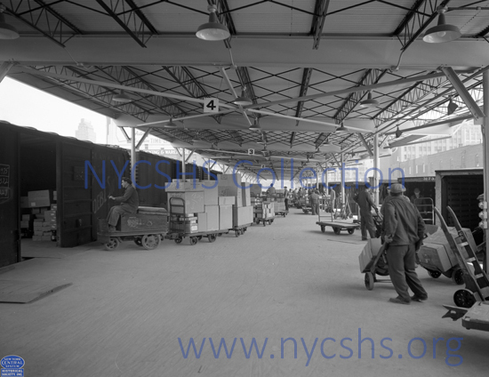
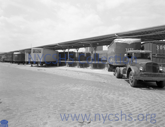
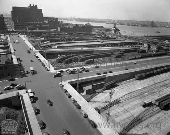
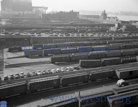
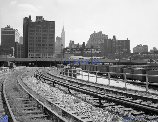
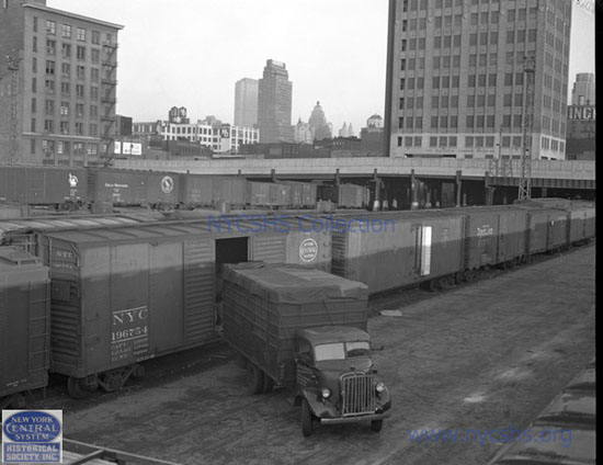
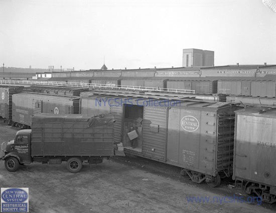
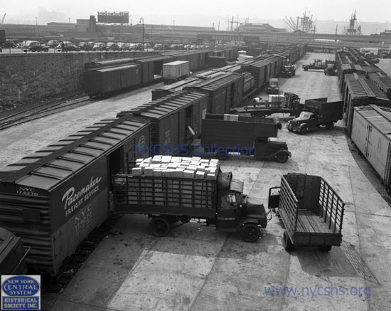
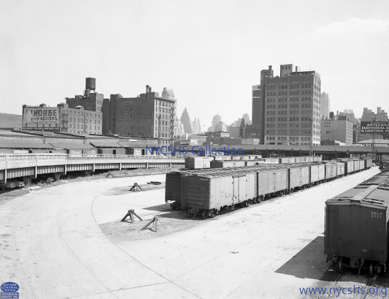
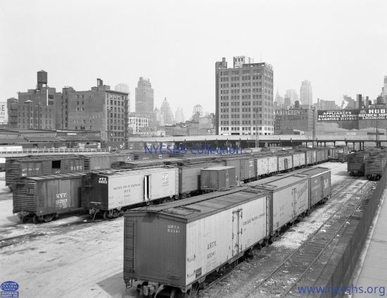
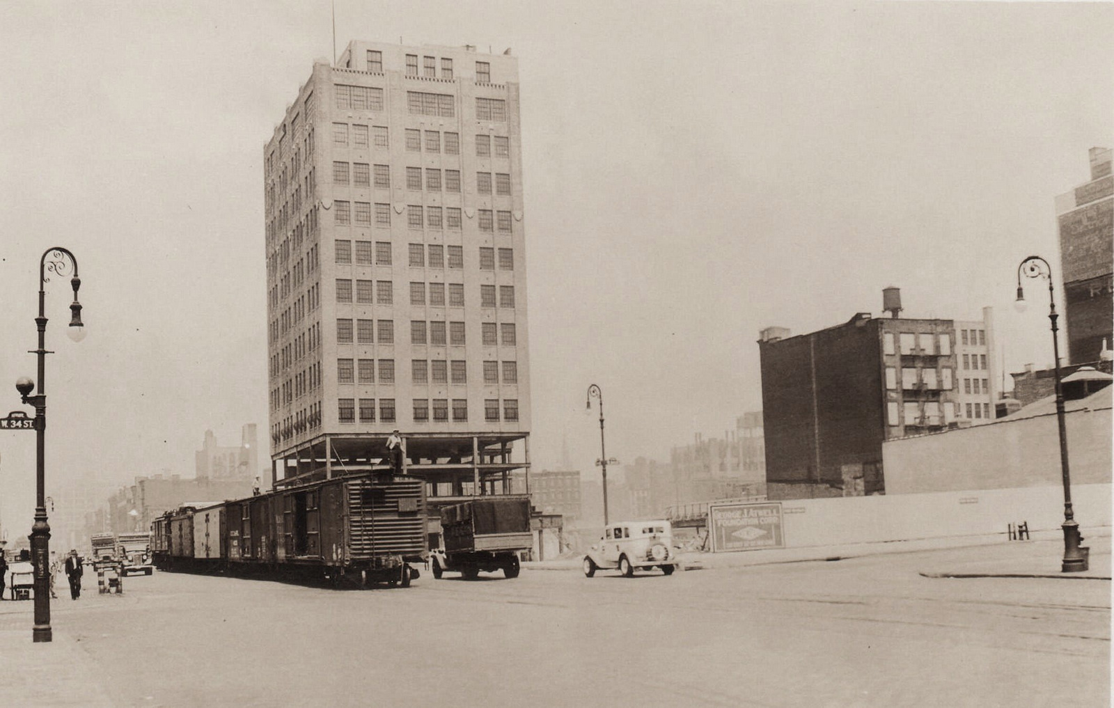
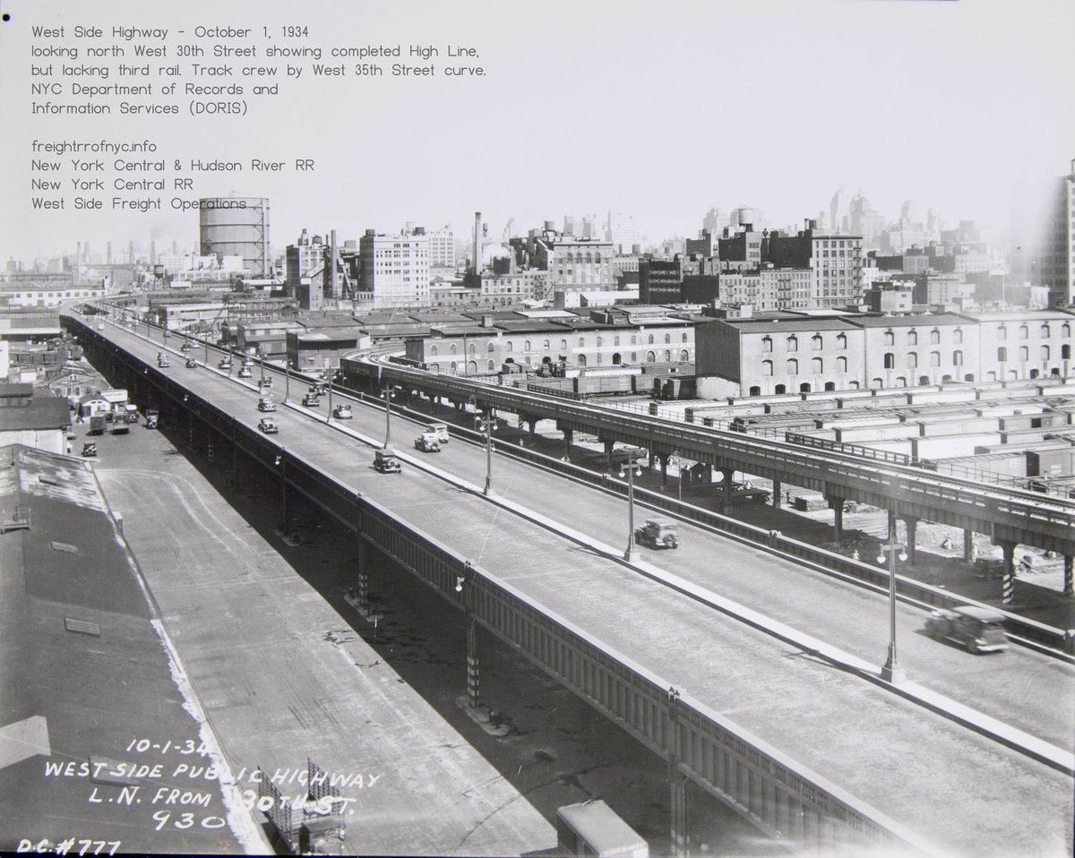
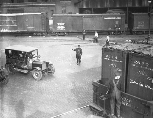
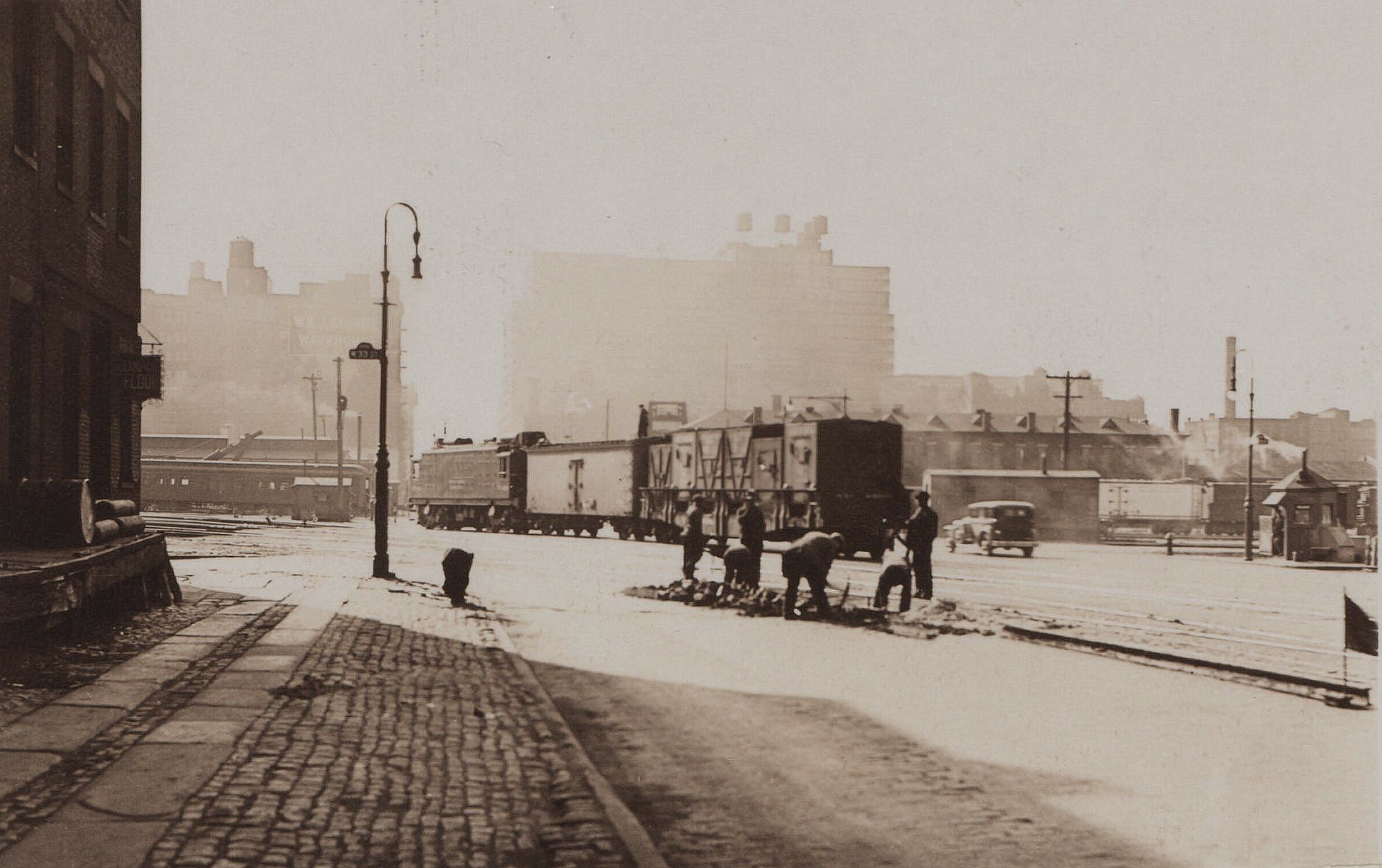
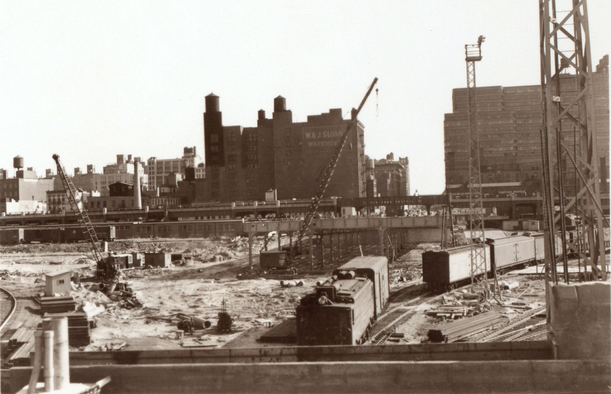
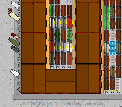
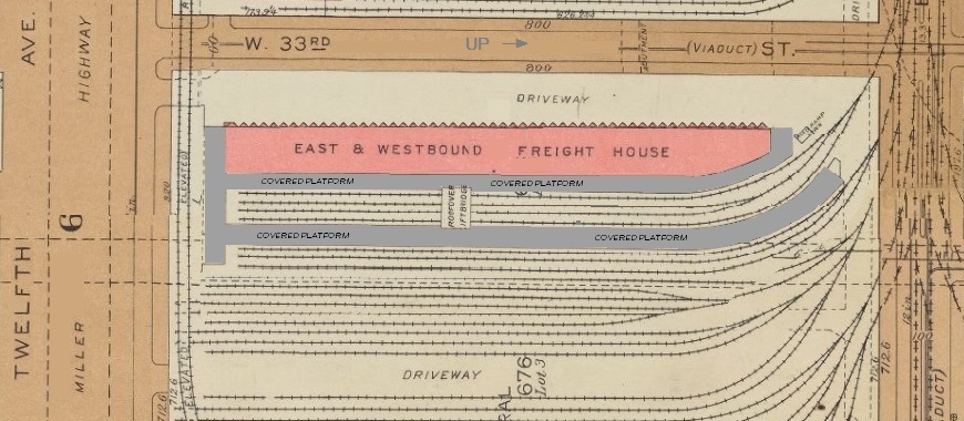
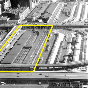
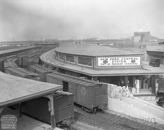
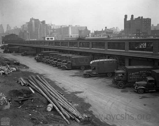
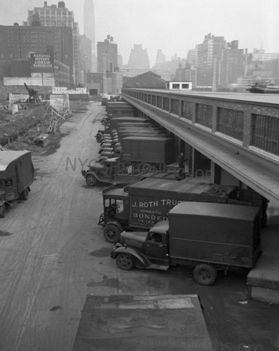
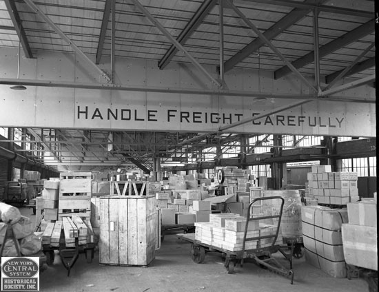
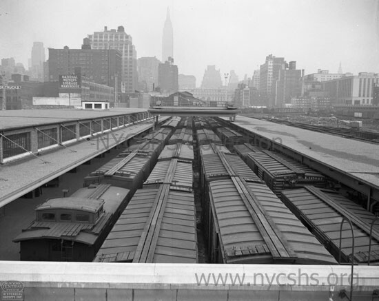
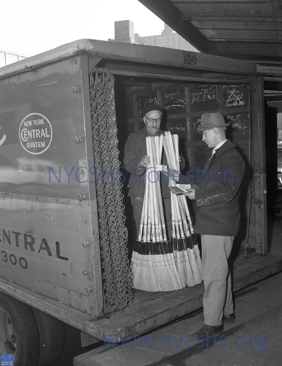
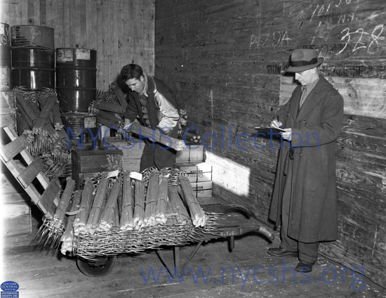
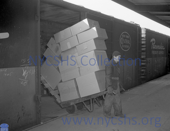
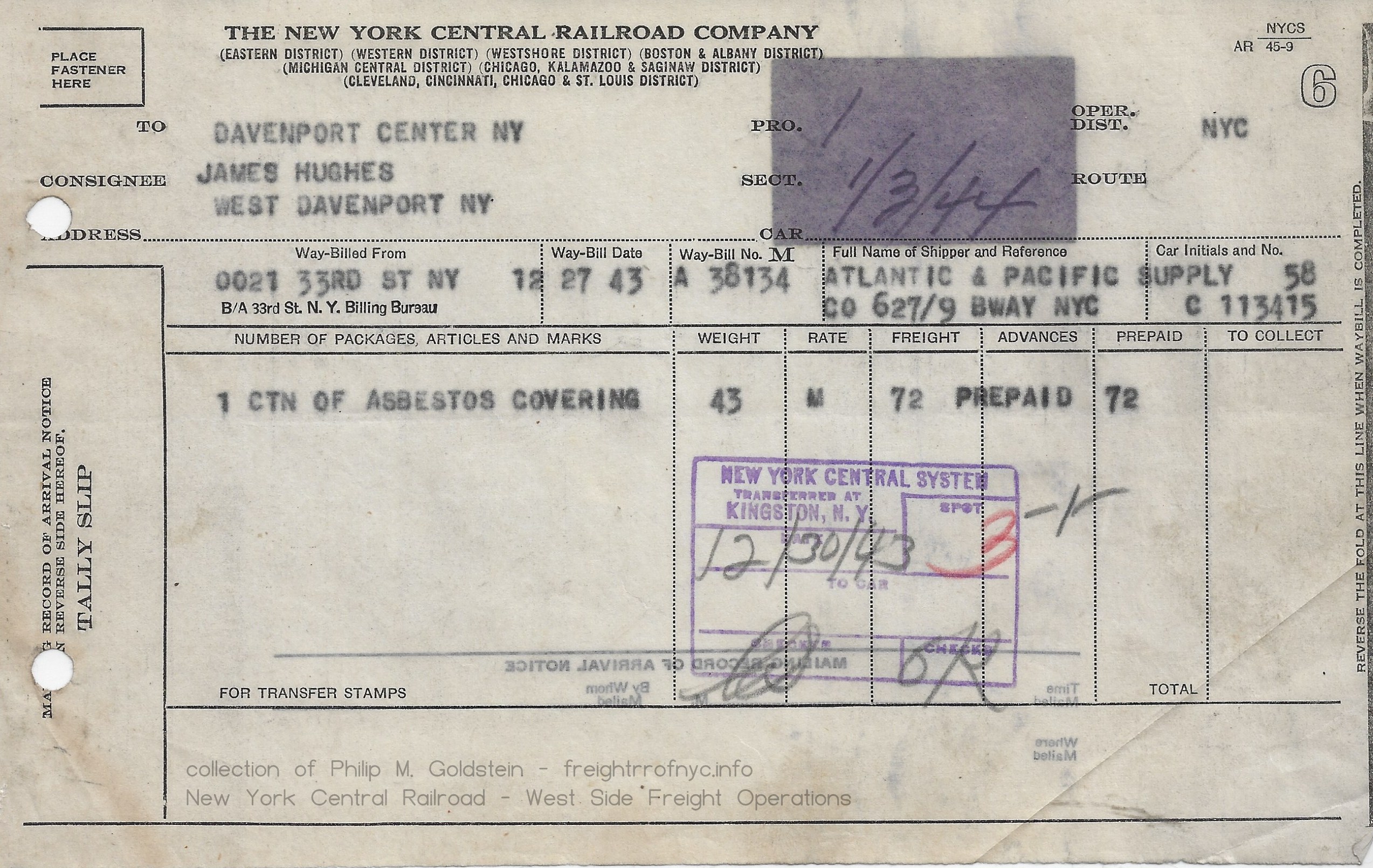
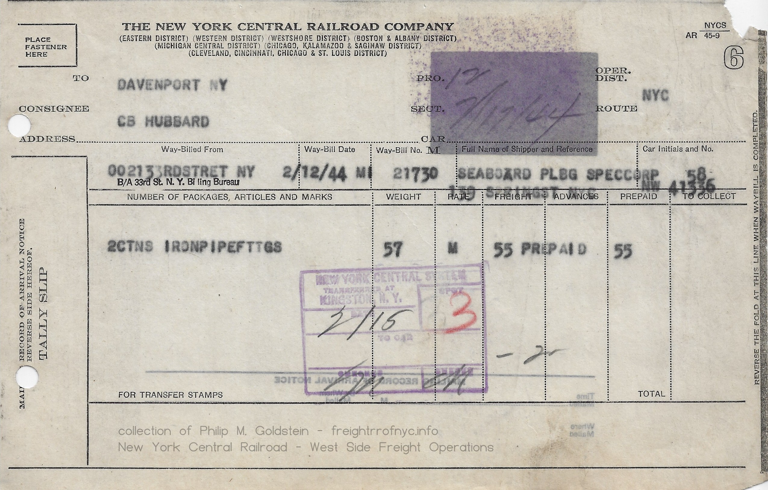
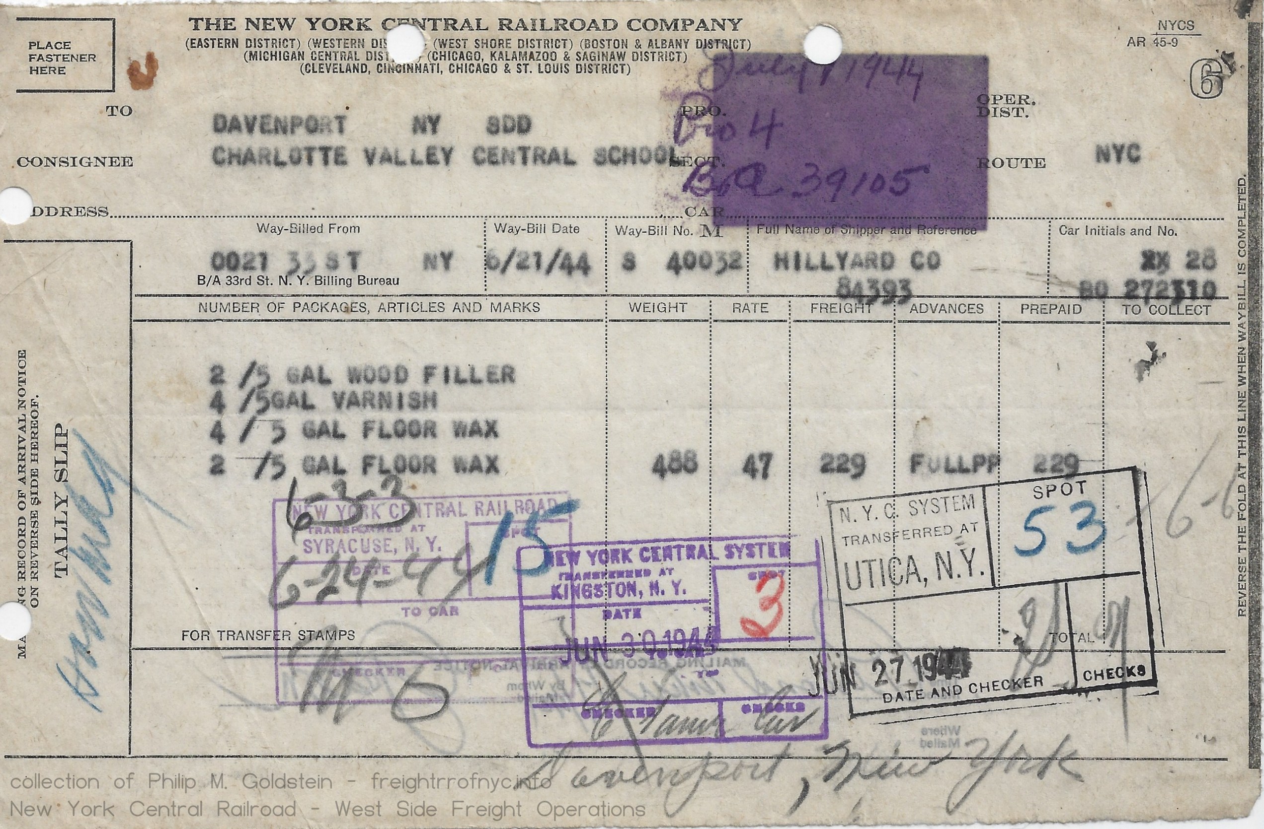
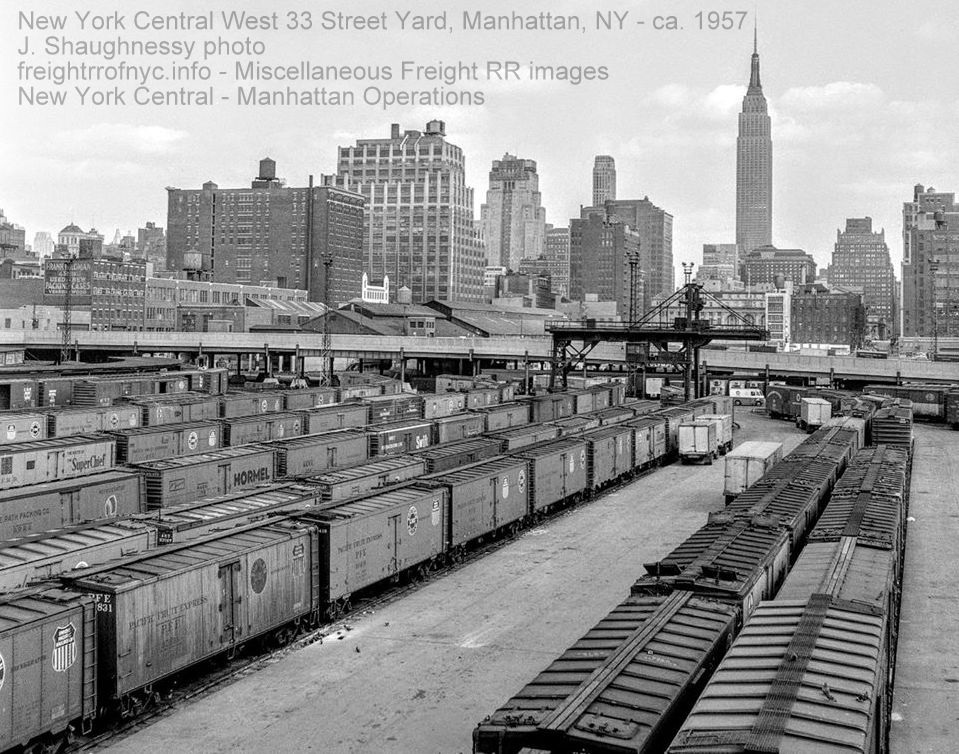
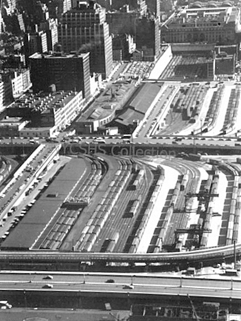
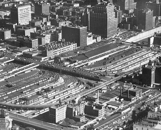
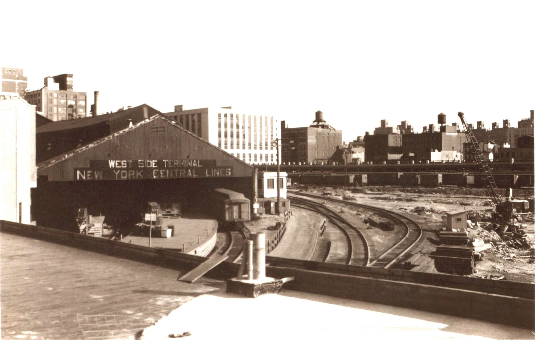
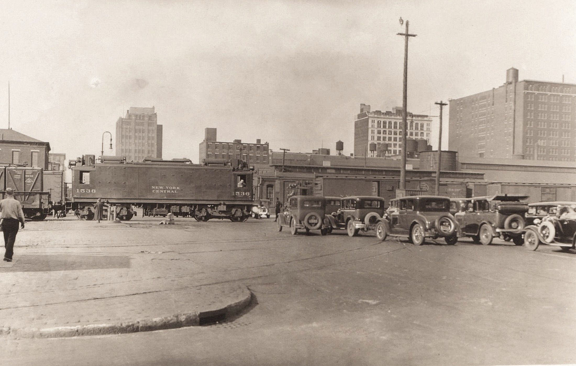
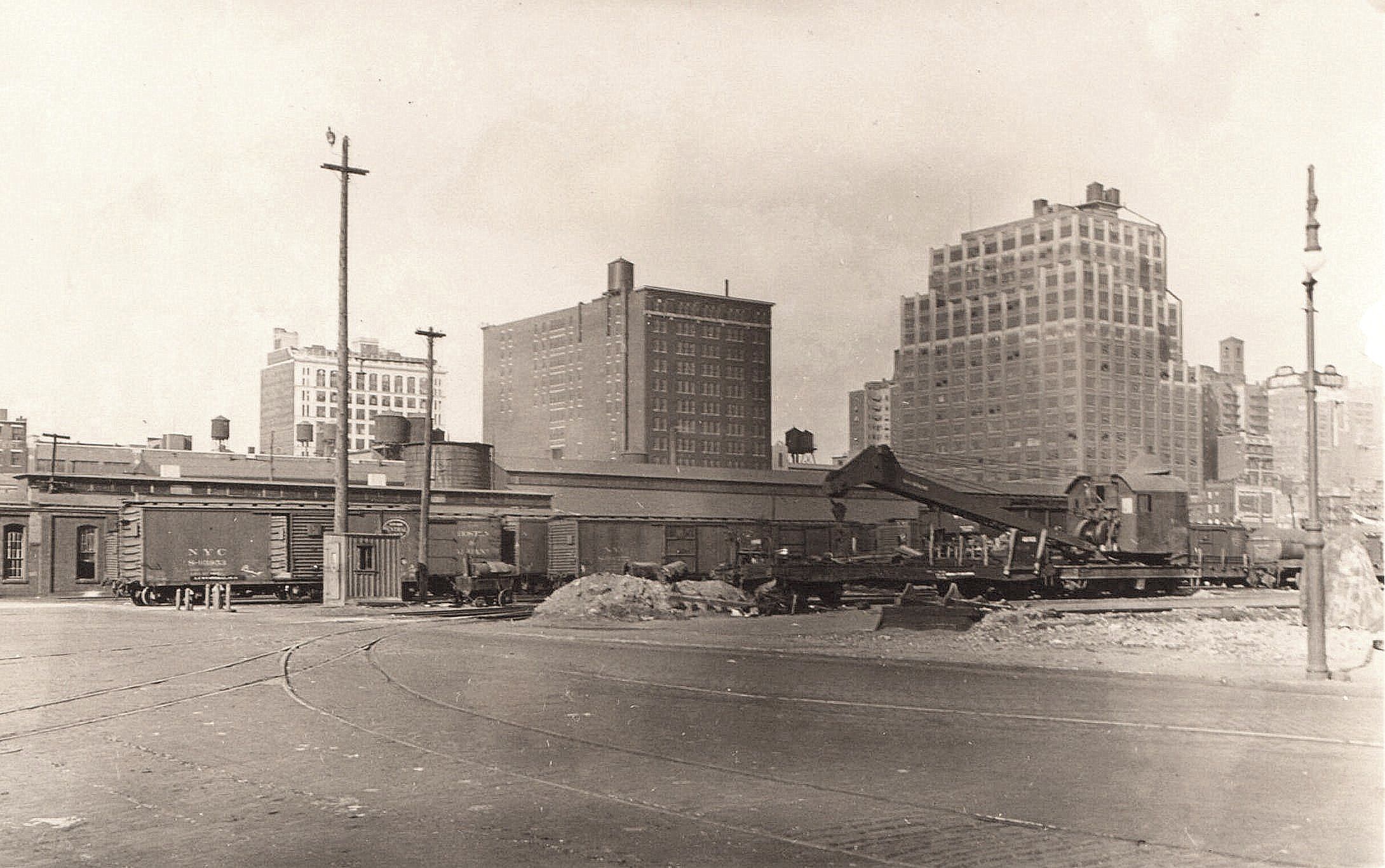
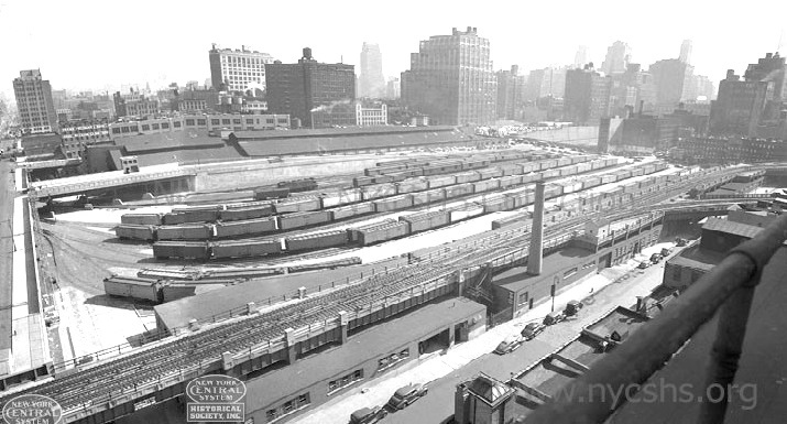
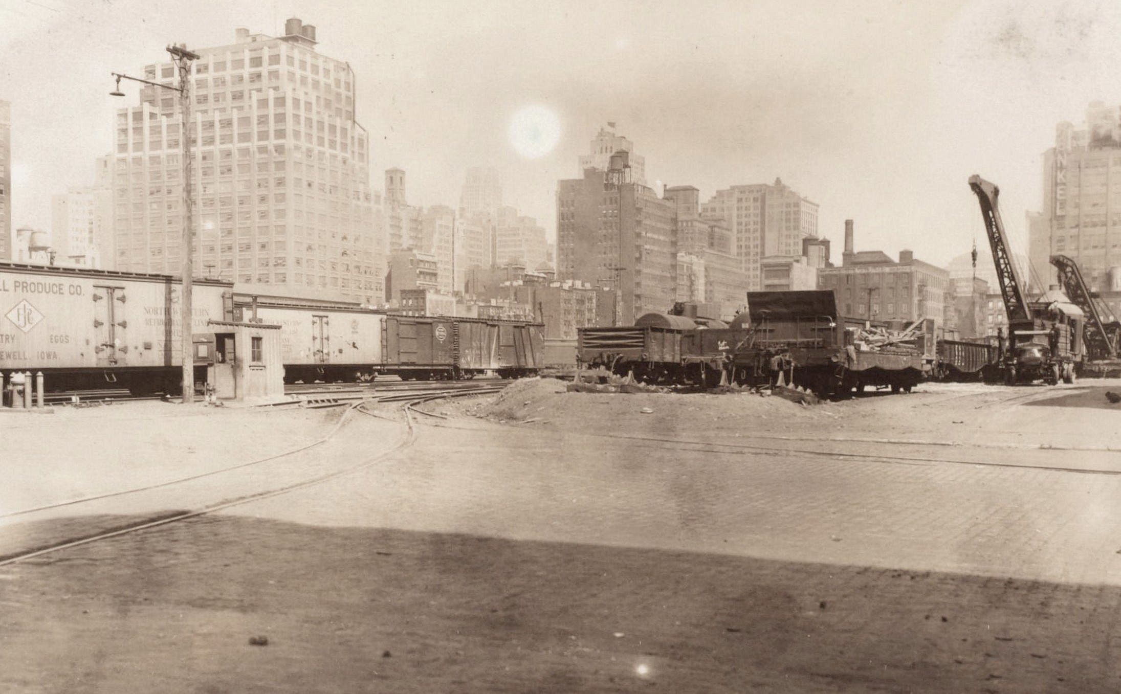
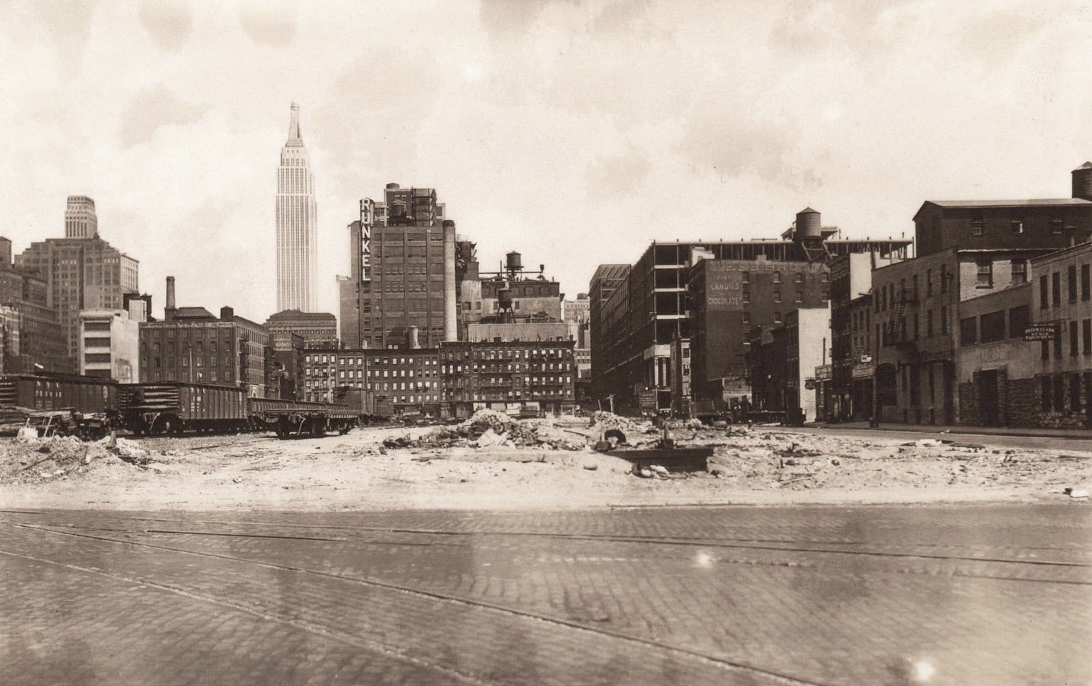
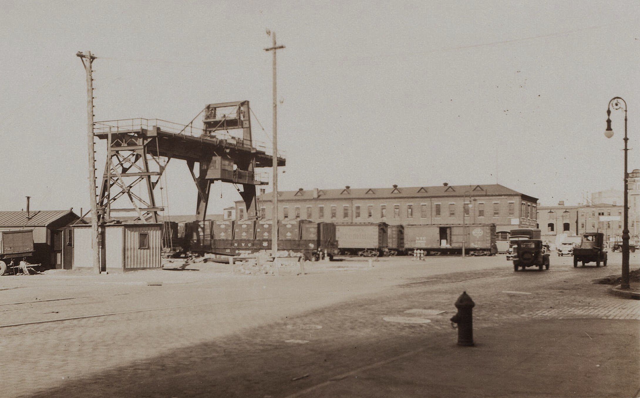
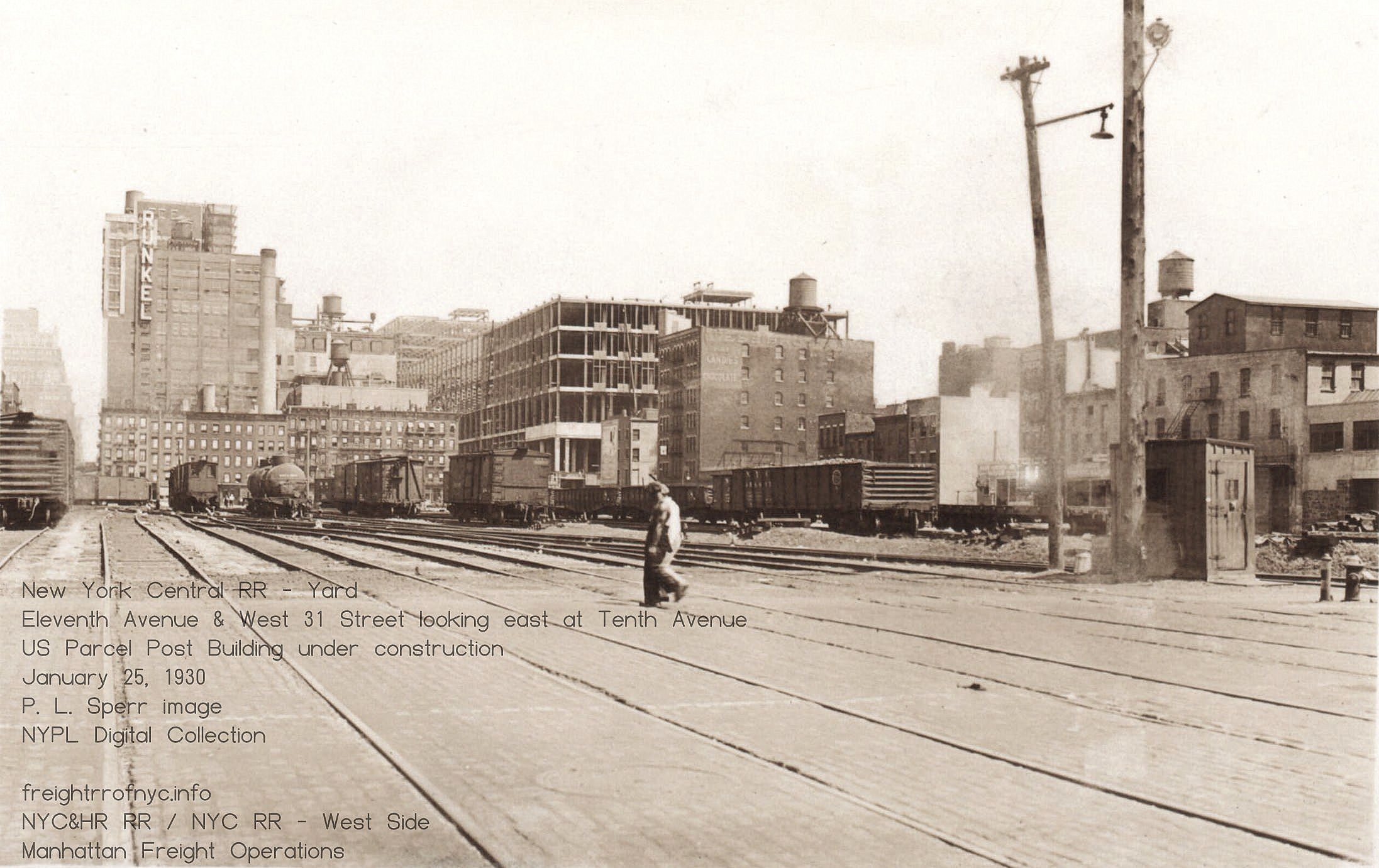
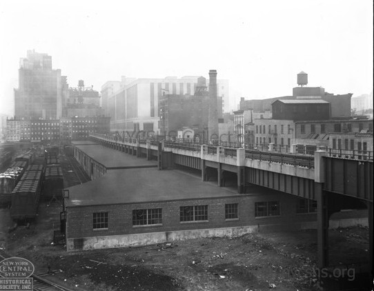
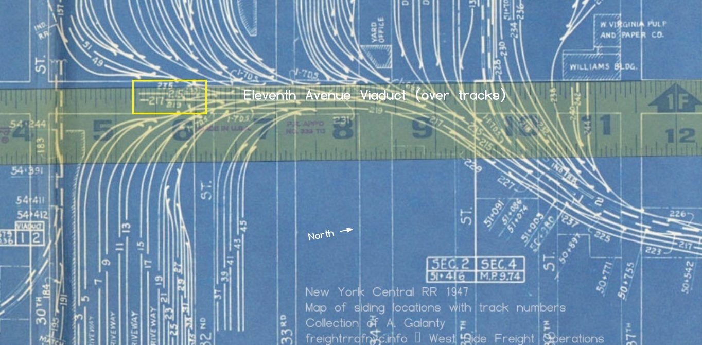
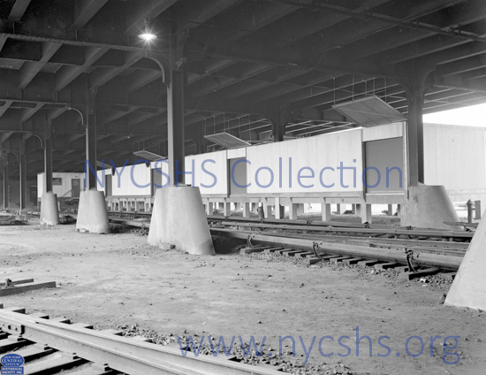
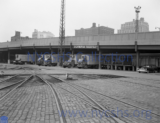
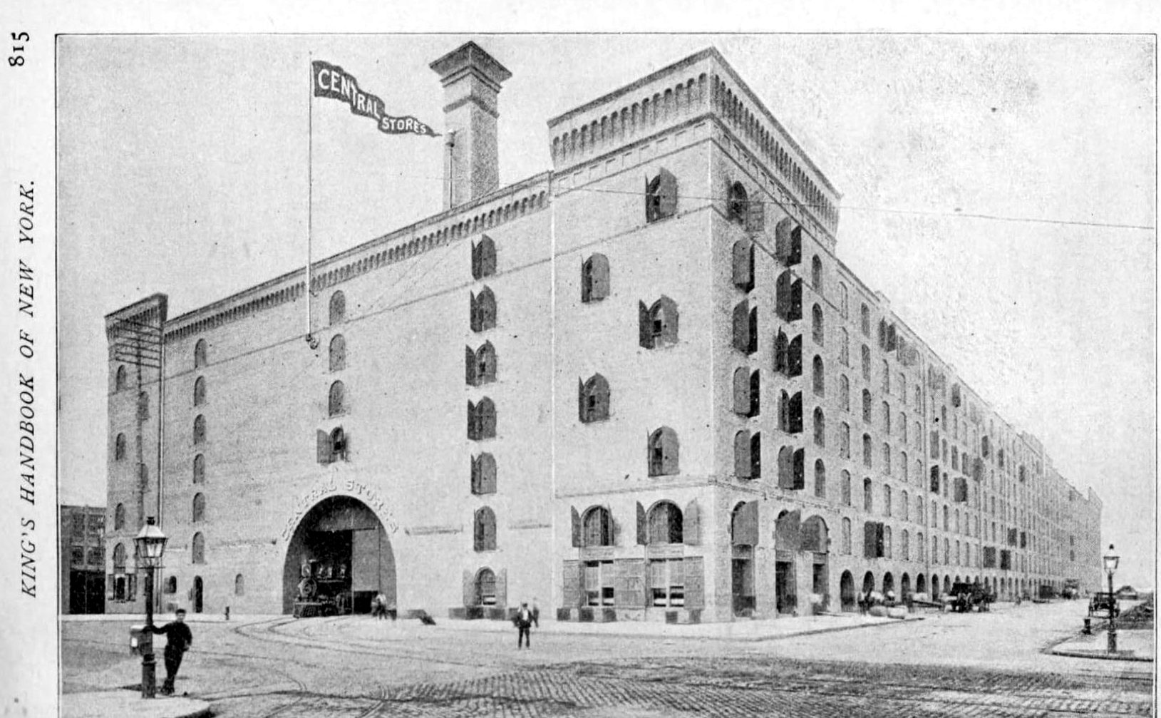
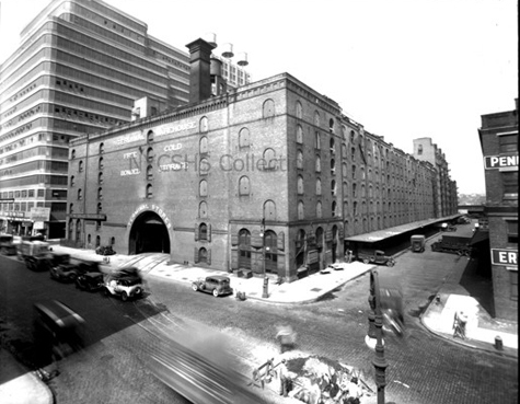
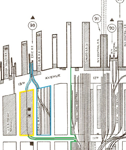
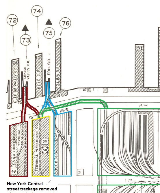
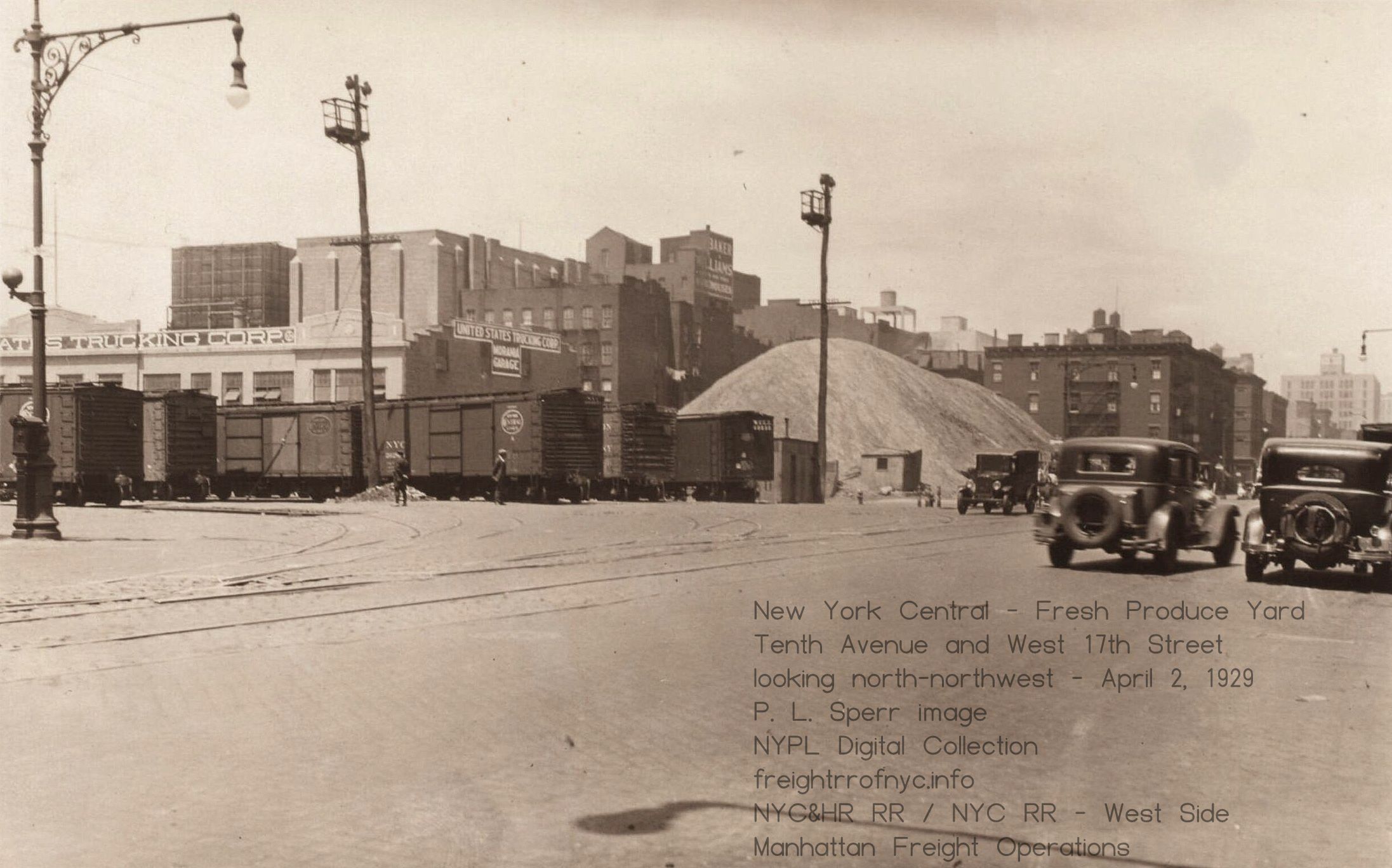
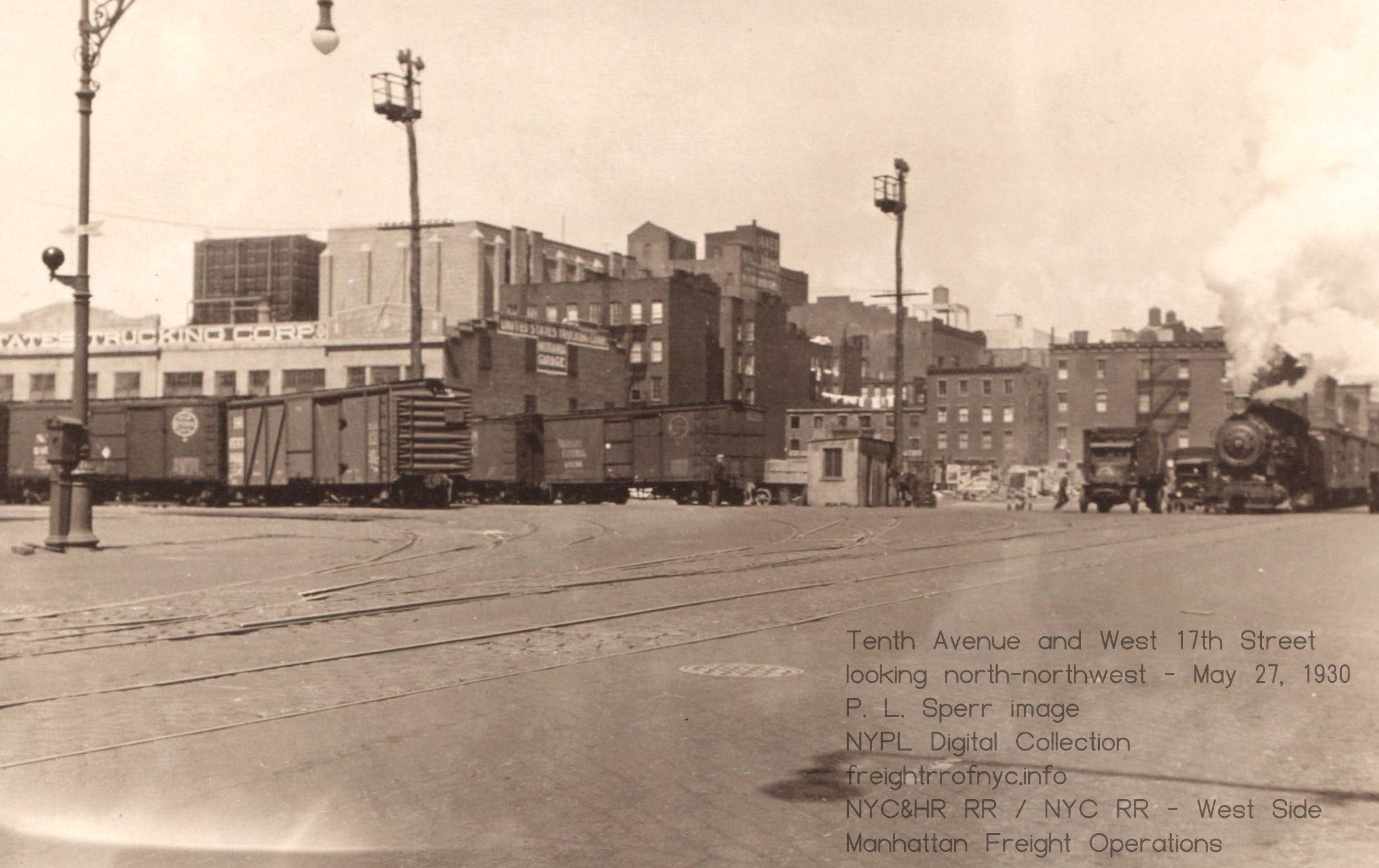
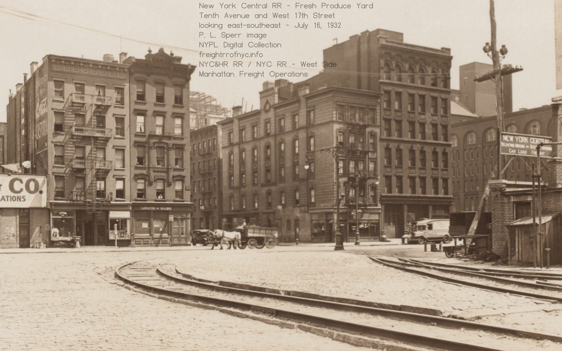
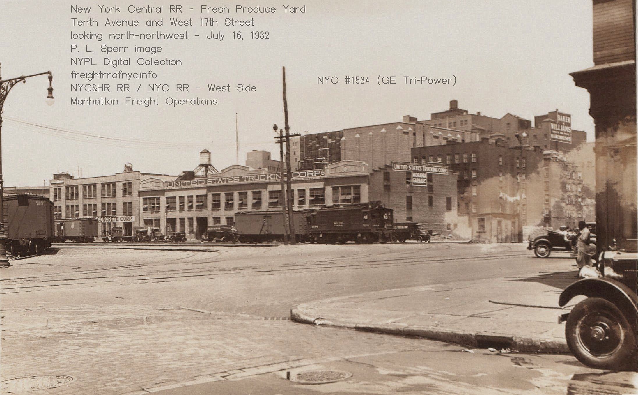
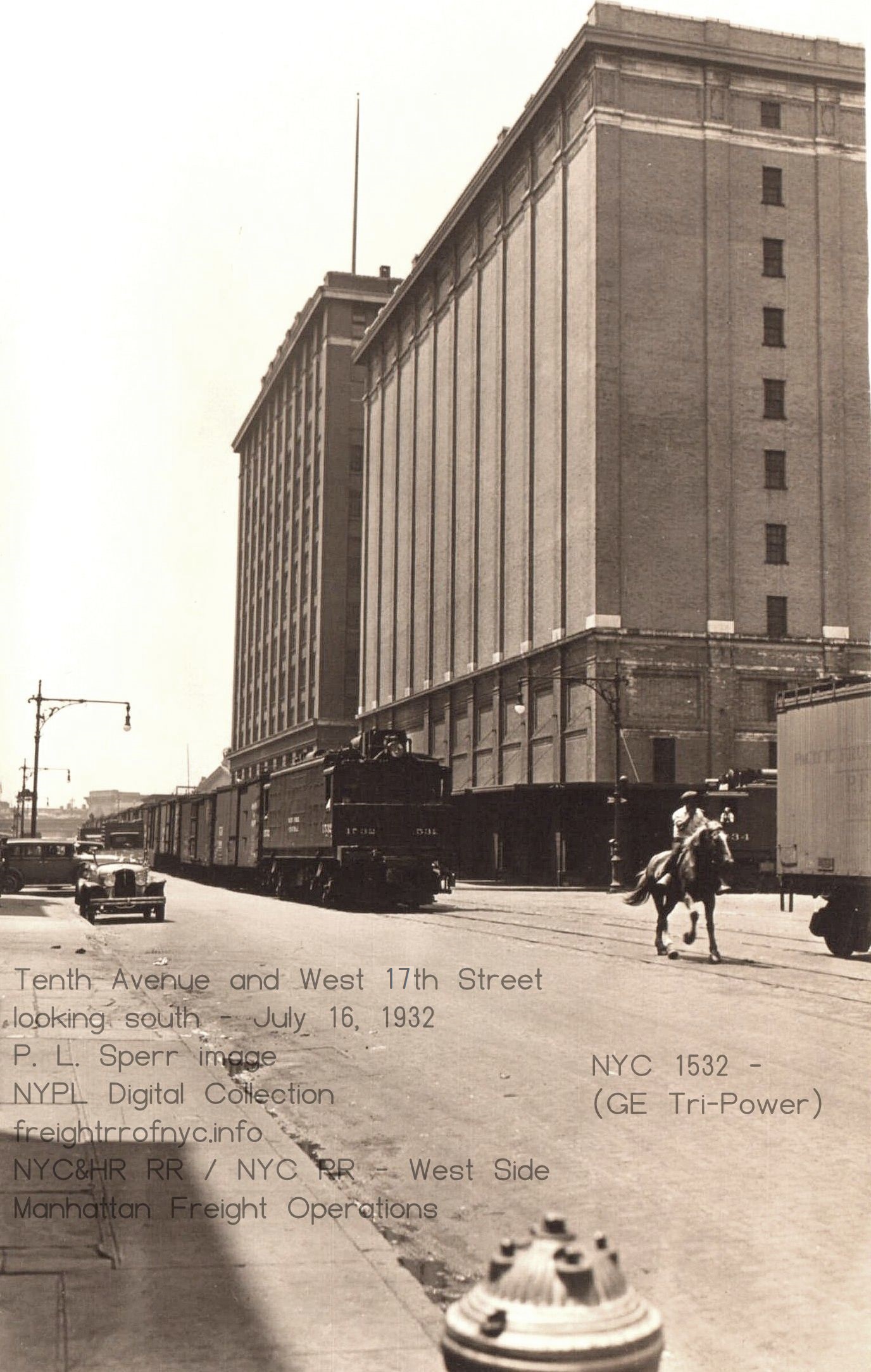
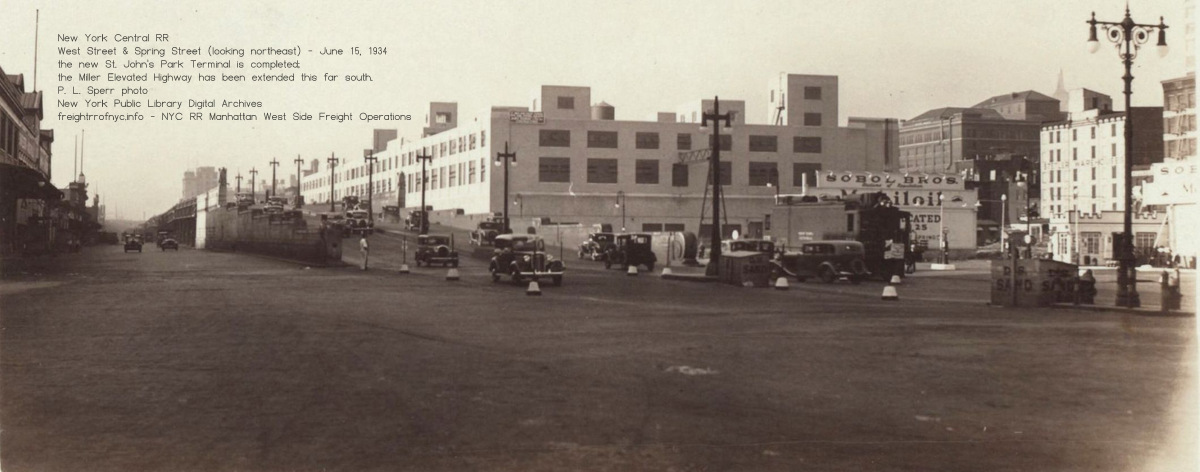
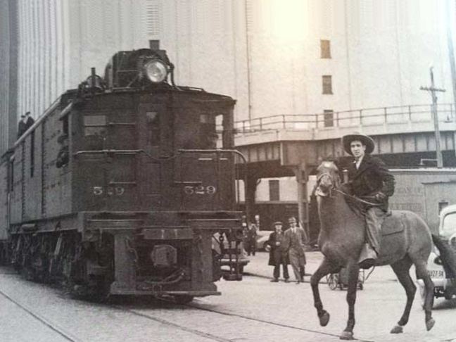
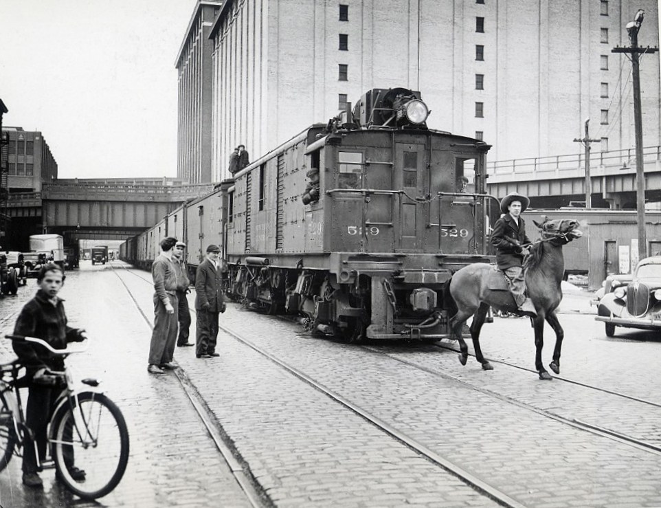
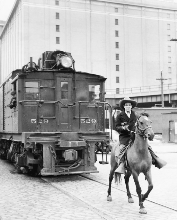
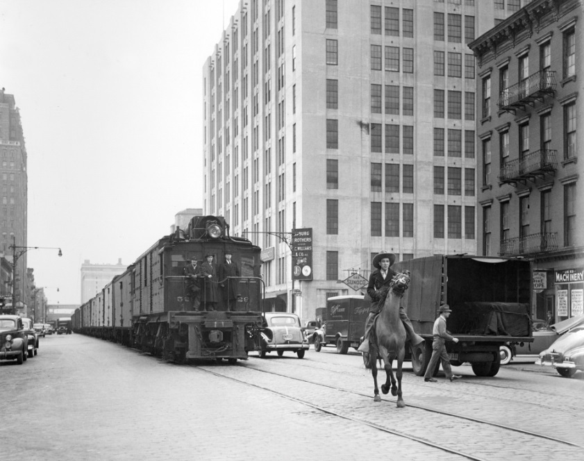
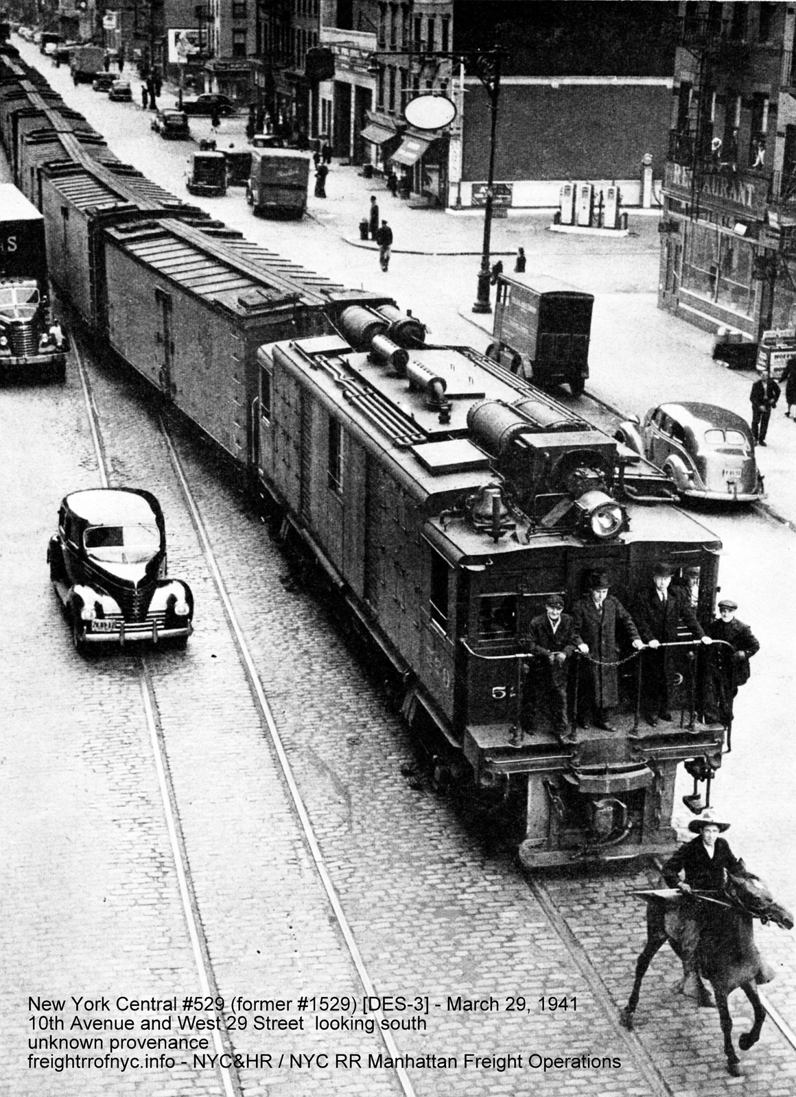
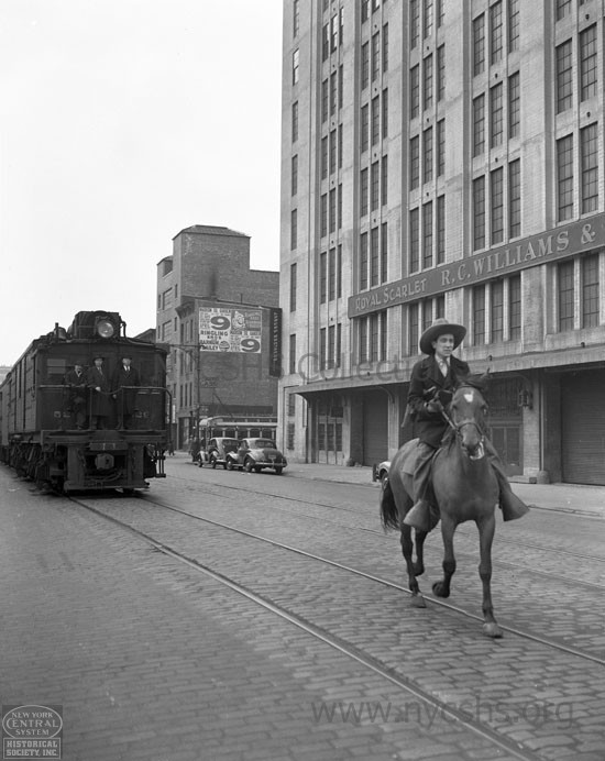
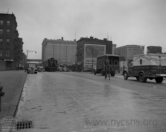
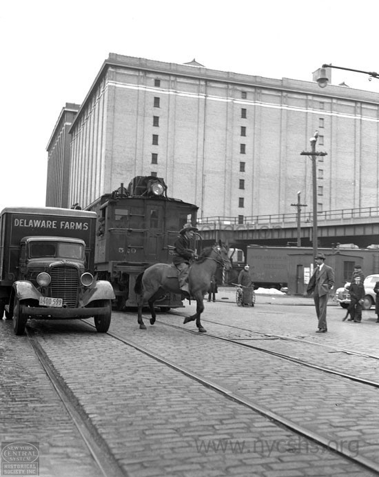
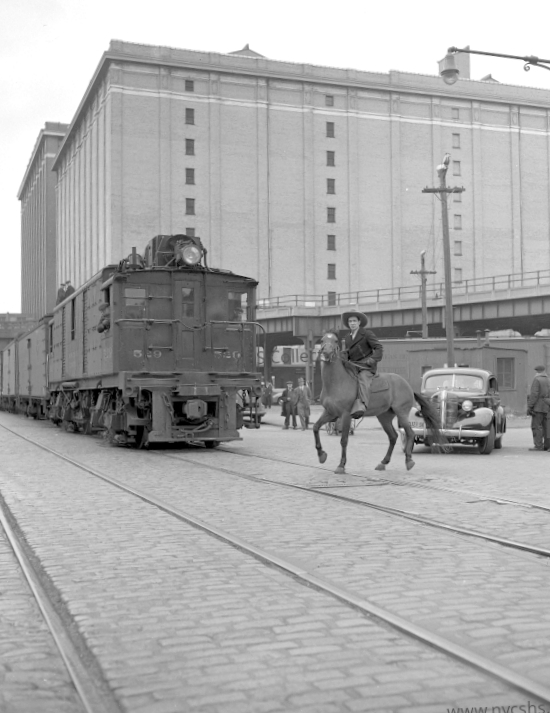
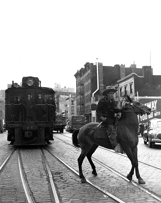
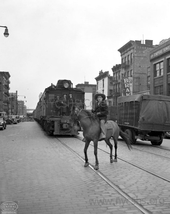
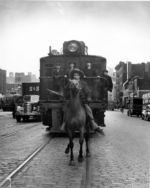
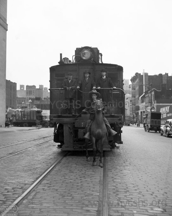
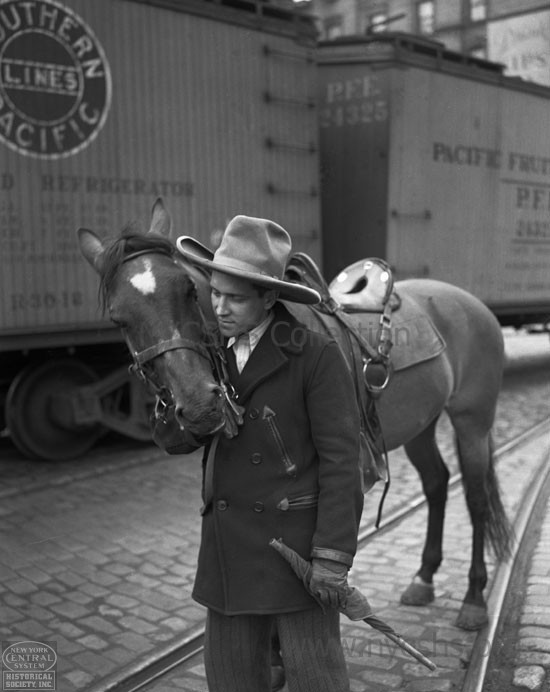
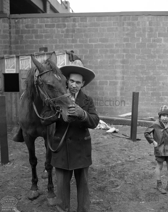
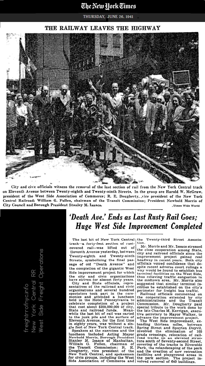
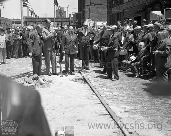
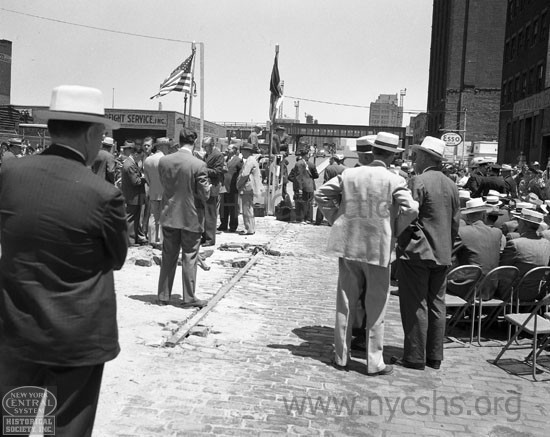
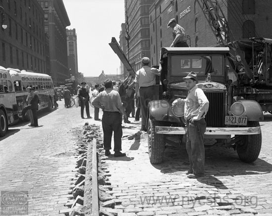
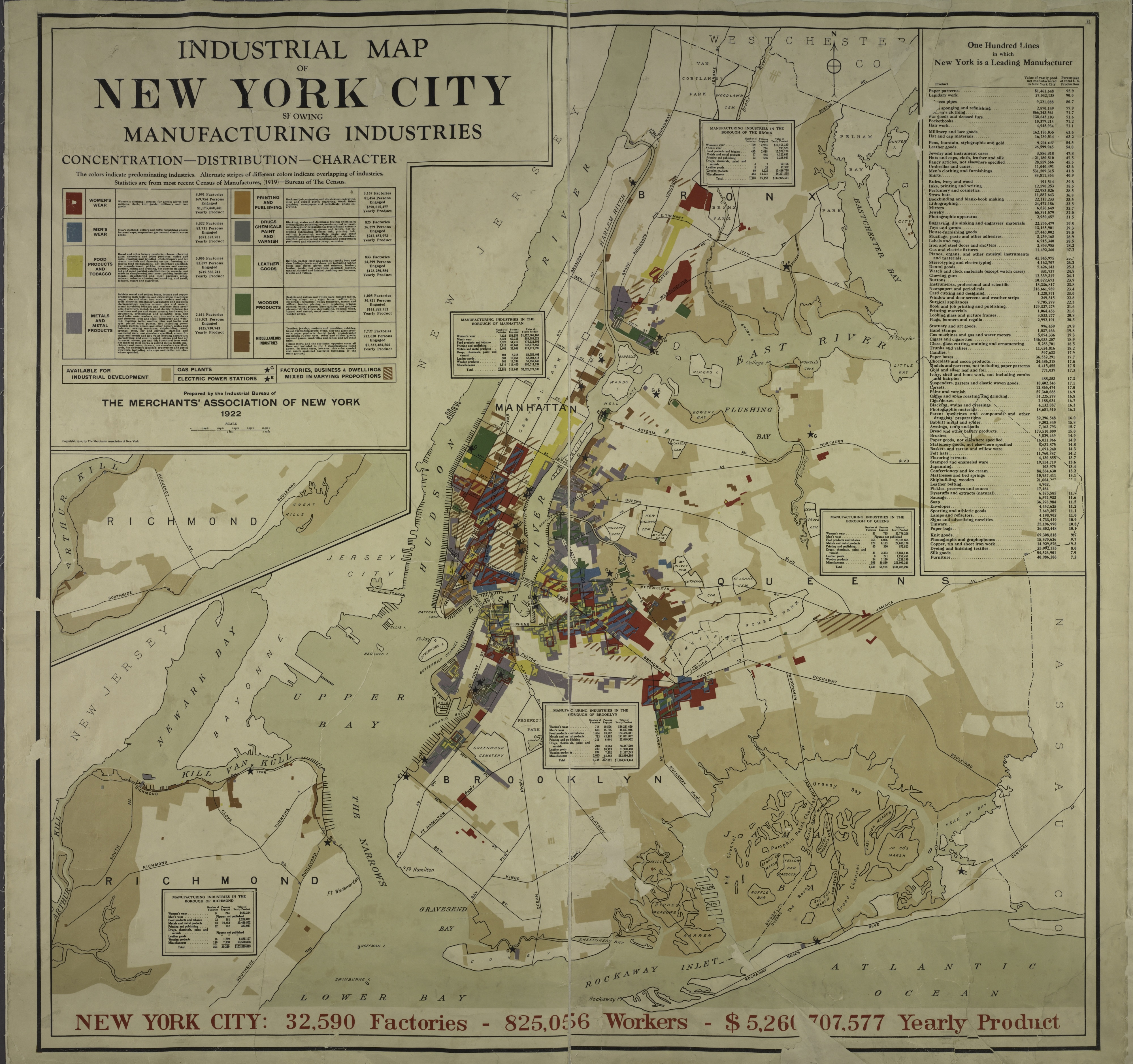
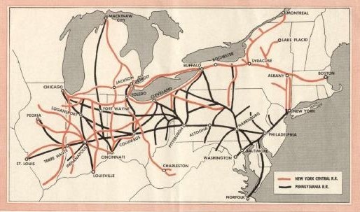
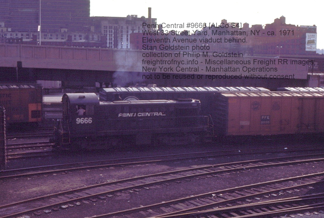
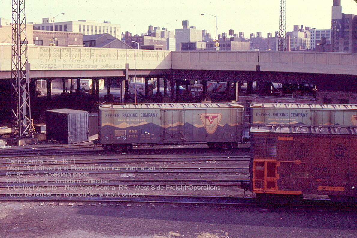
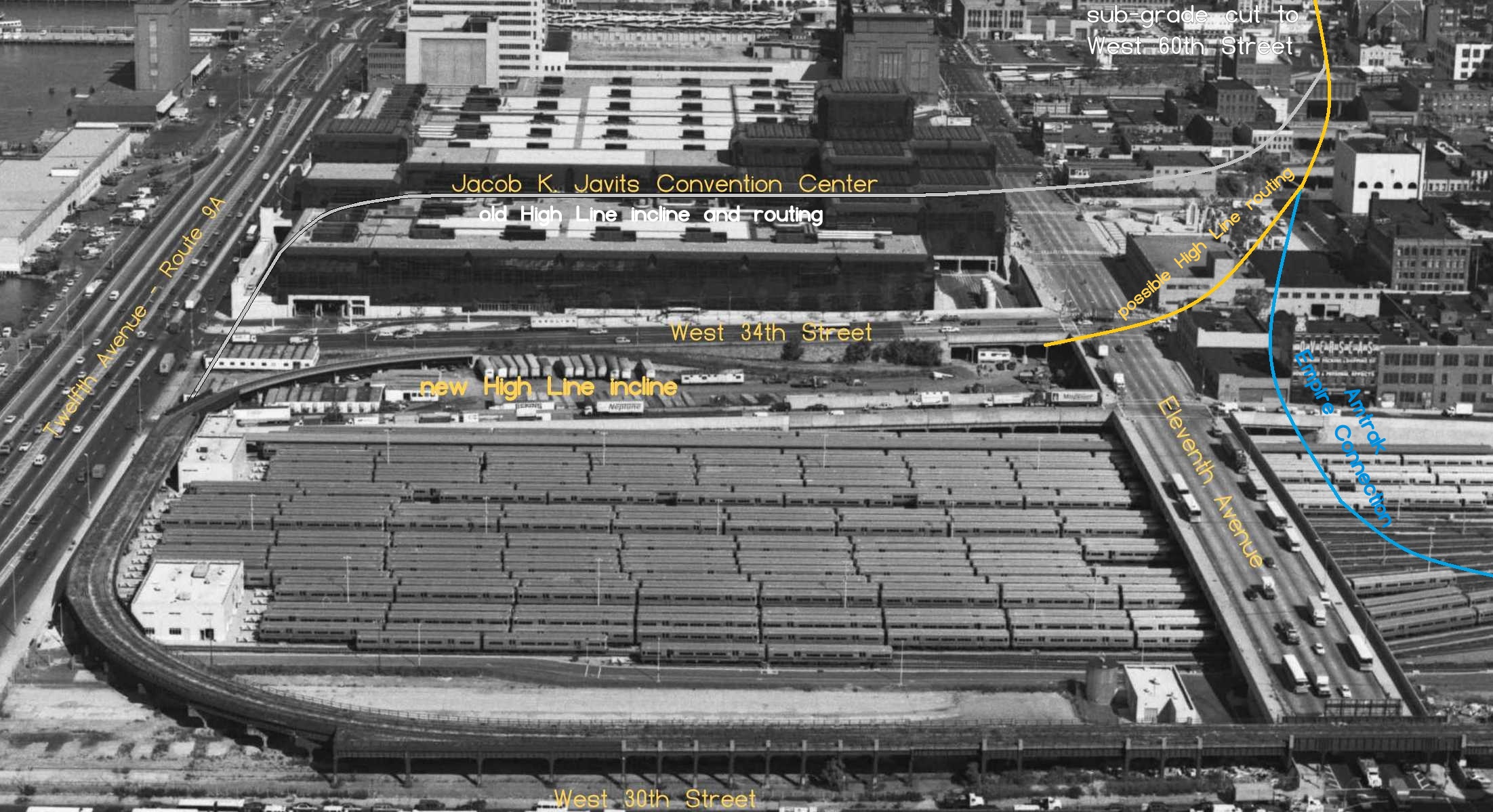
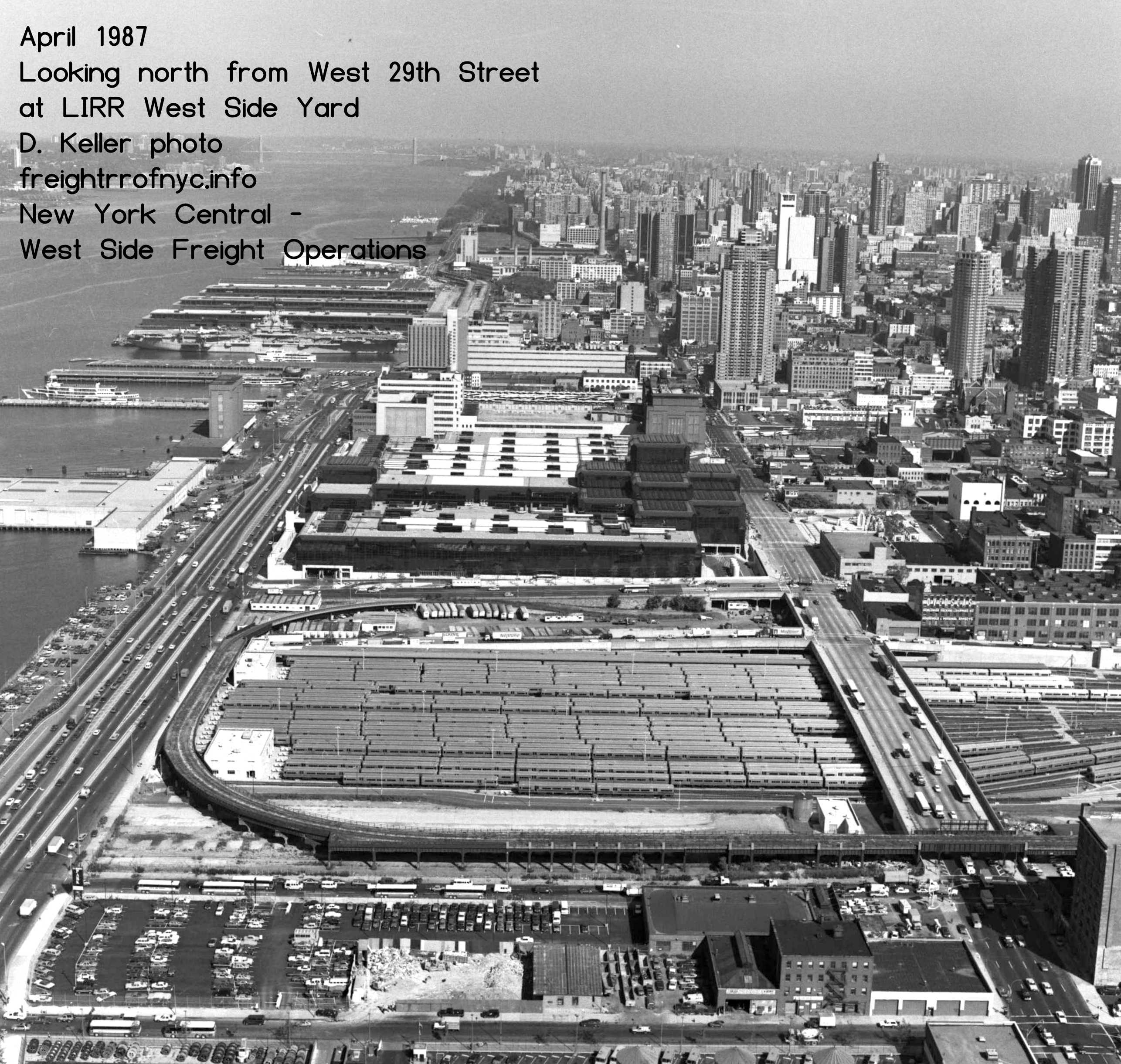
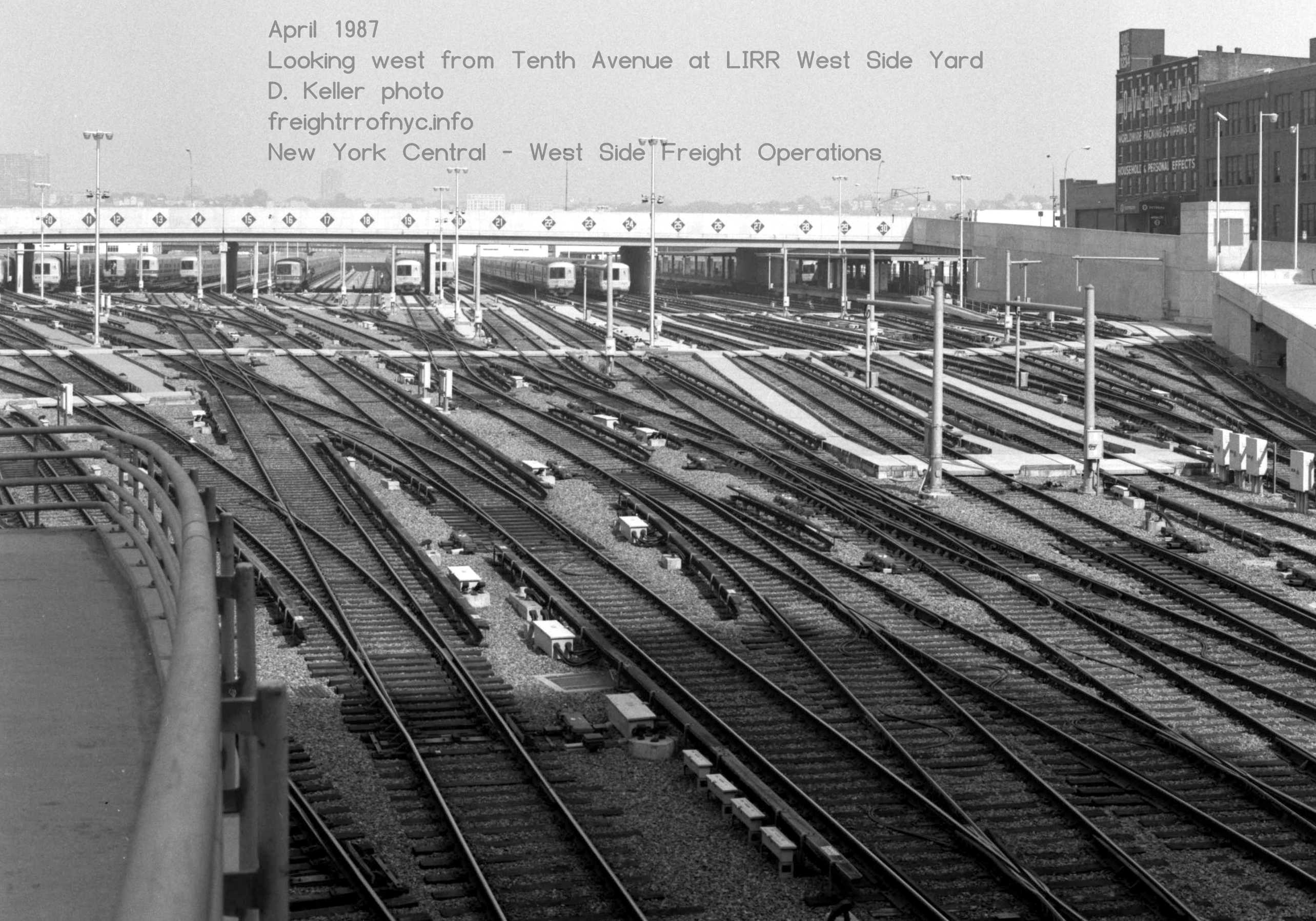
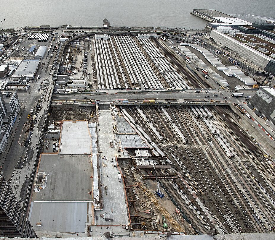

 or
or  train to
Times Square-42nd St (one stop). Here, transfer to the 42nd Street
Shuttle
train to
Times Square-42nd St (one stop). Here, transfer to the 42nd Street
Shuttle  train directly to Grand
Central. It was "only" an 8 minute
trip if everything was operating on schedule; but
if hauling baggage,
it was not convenient. There were no baggage cart rentals (i.e. Smarte
Carte®) like you
might find at airport terminals.
train directly to Grand
Central. It was "only" an 8 minute
trip if everything was operating on schedule; but
if hauling baggage,
it was not convenient. There were no baggage cart rentals (i.e. Smarte
Carte®) like you
might find at airport terminals.